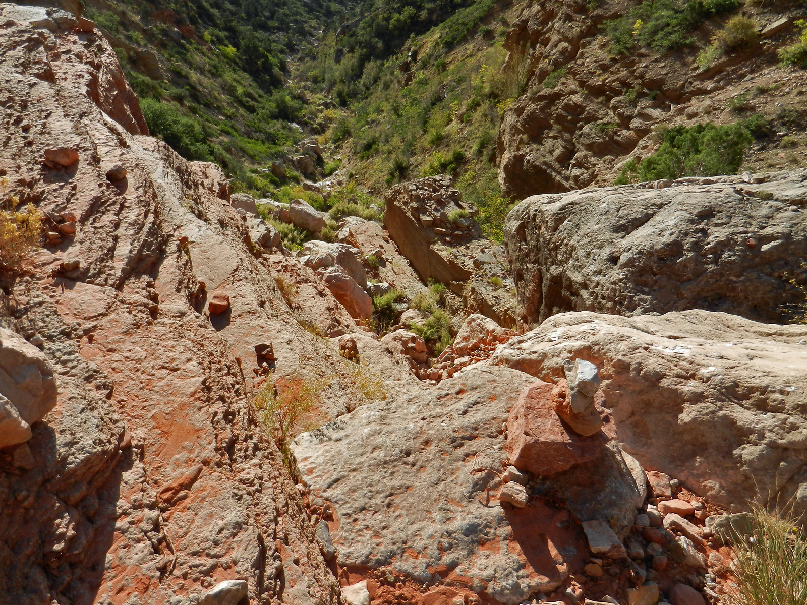
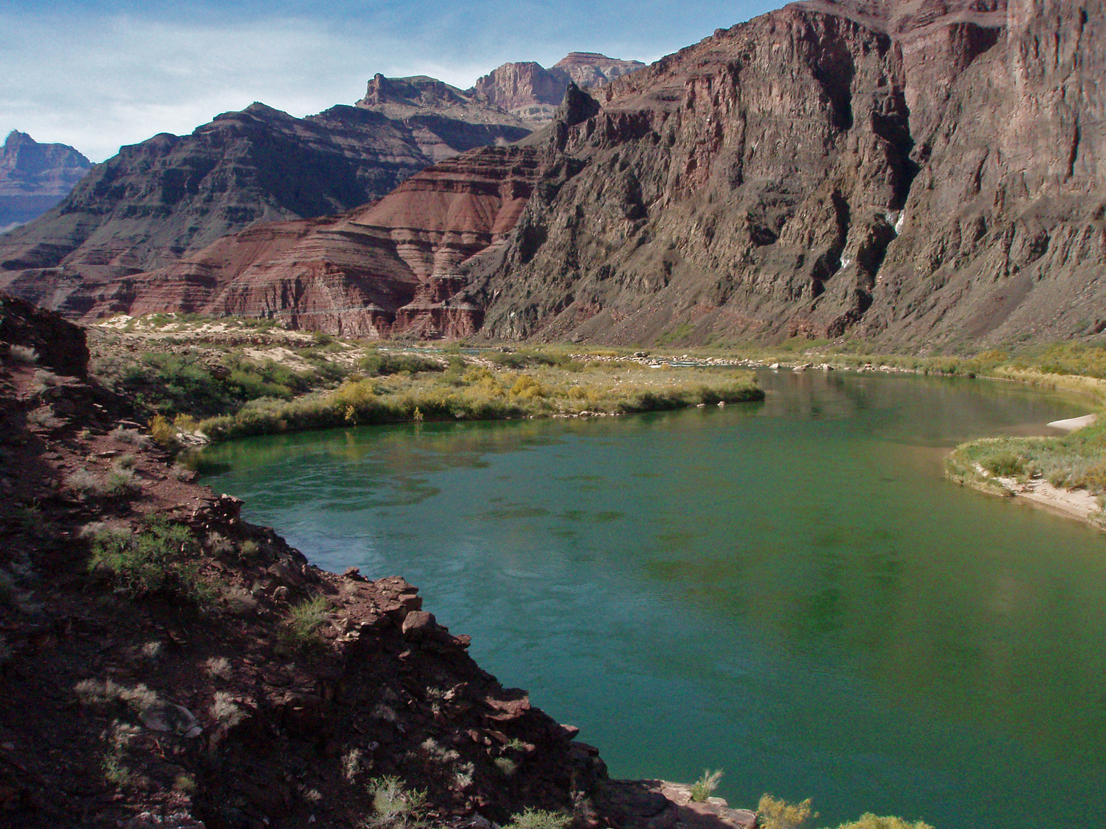
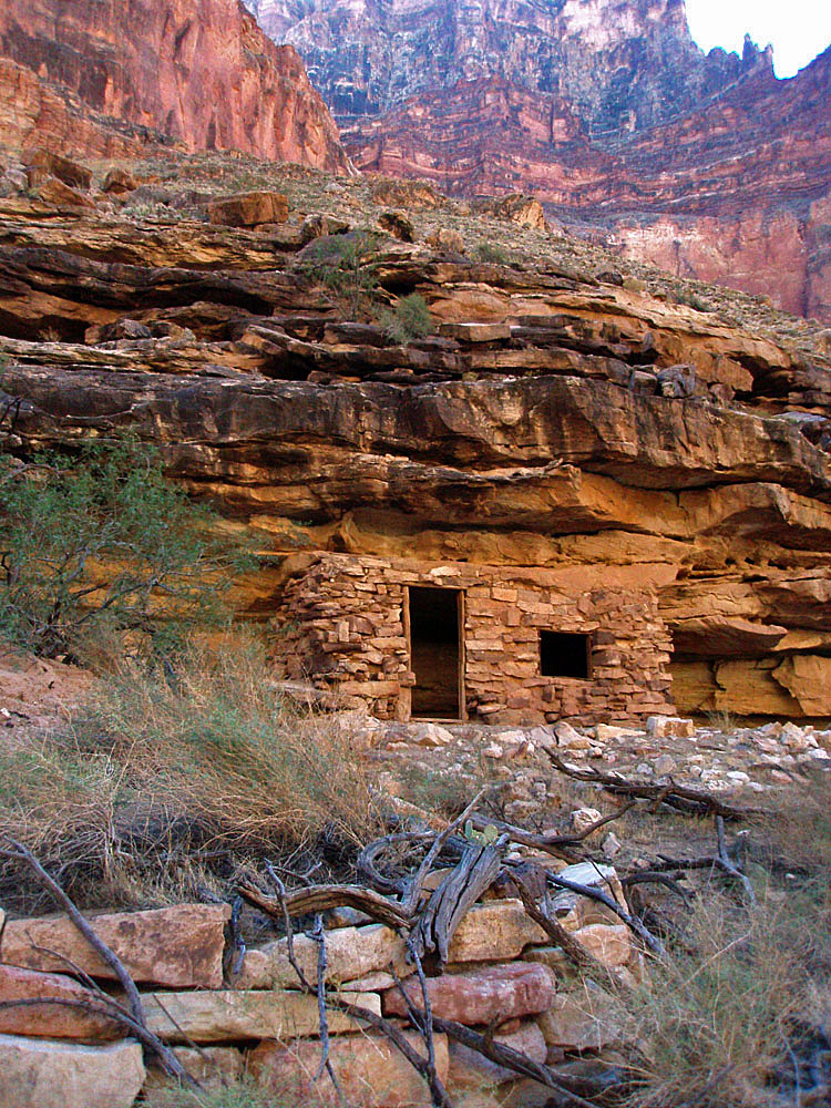
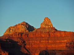
|
October 1 |
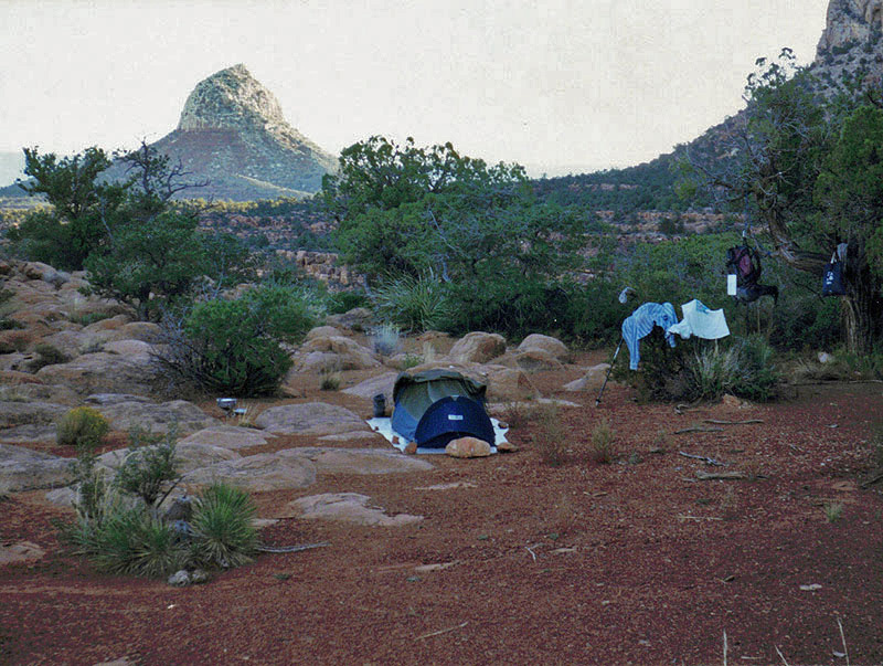
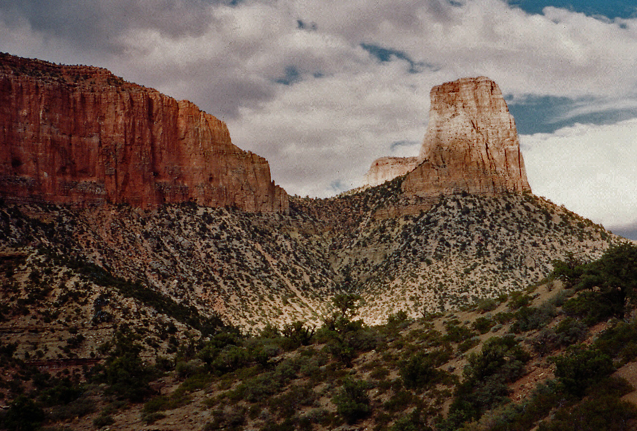
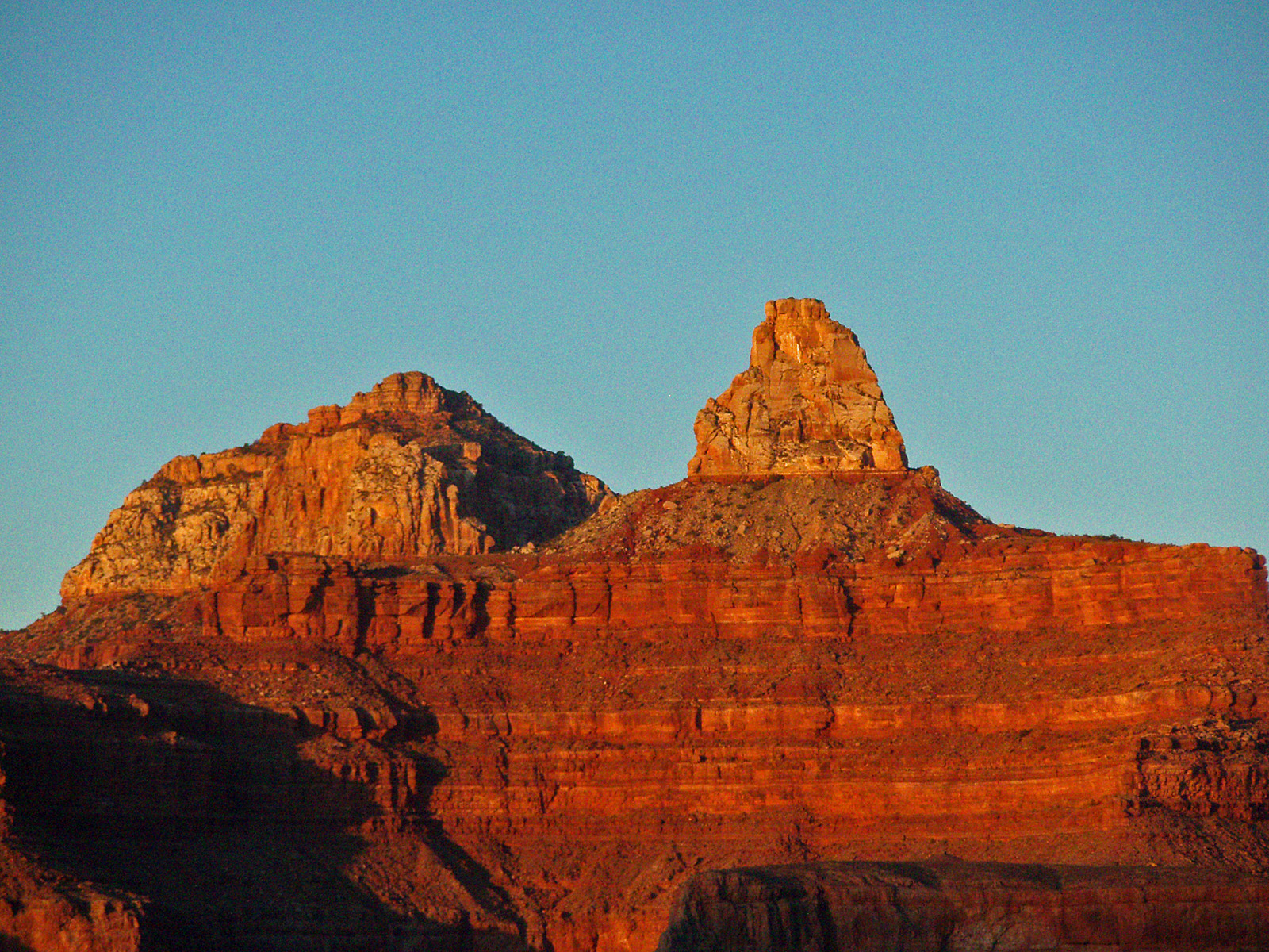
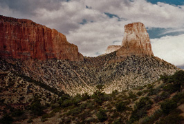
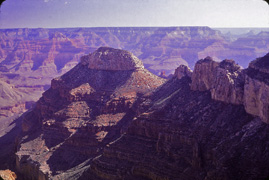
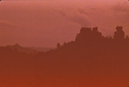
1995 - Mt. Huethawali as backdrop to my campsite. |

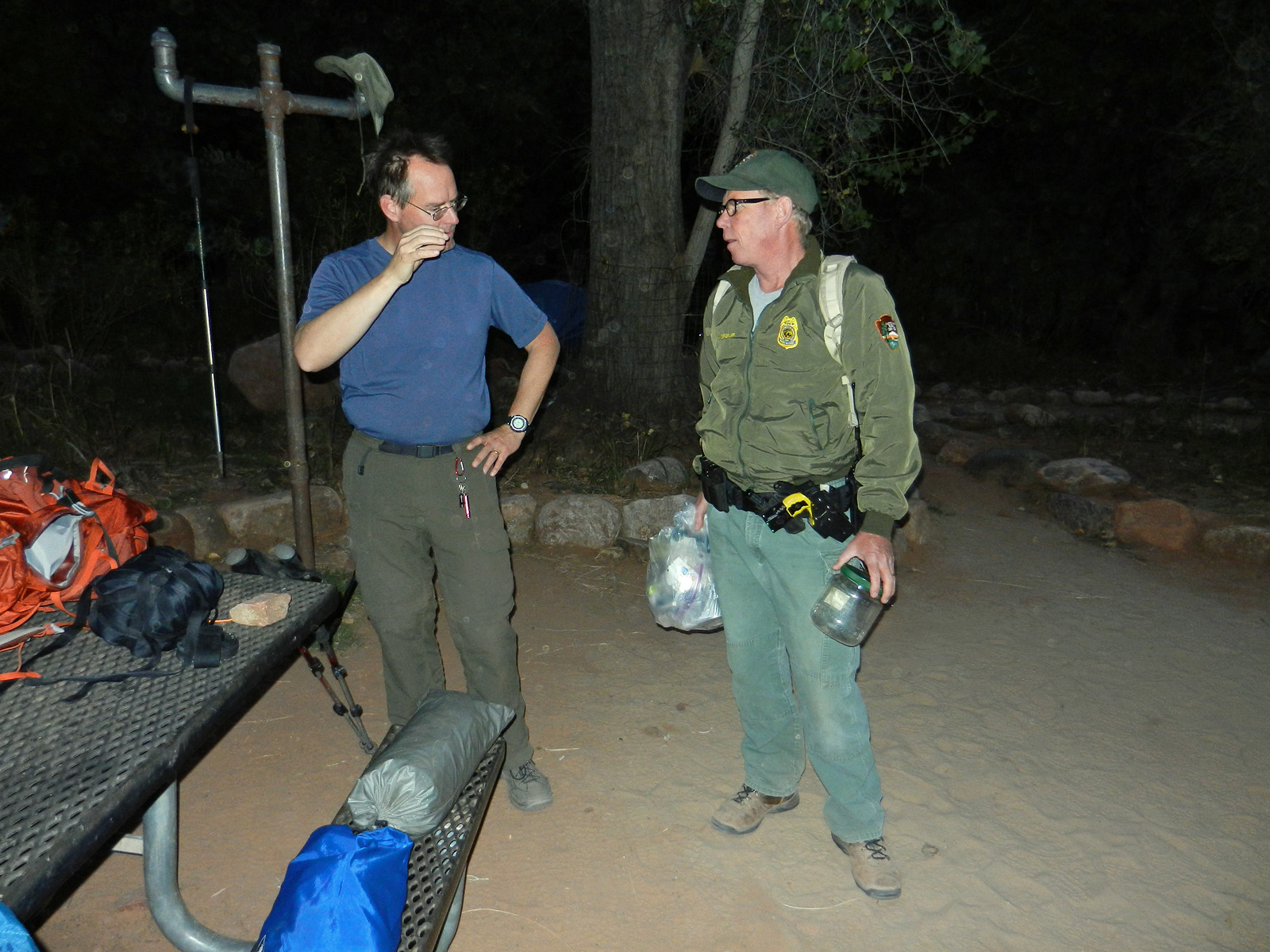
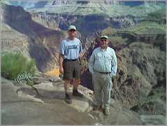
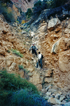
2006 - Key swap on the
North Kaibab Trail. |
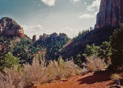
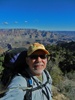
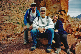
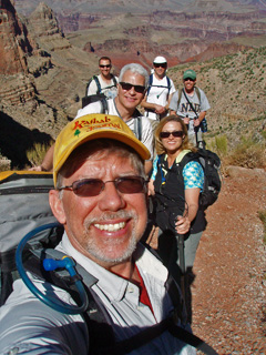
2016 - John, Bev, Geoff
and TS at Cave of the Domes below Horseshoe Mesa. |
|
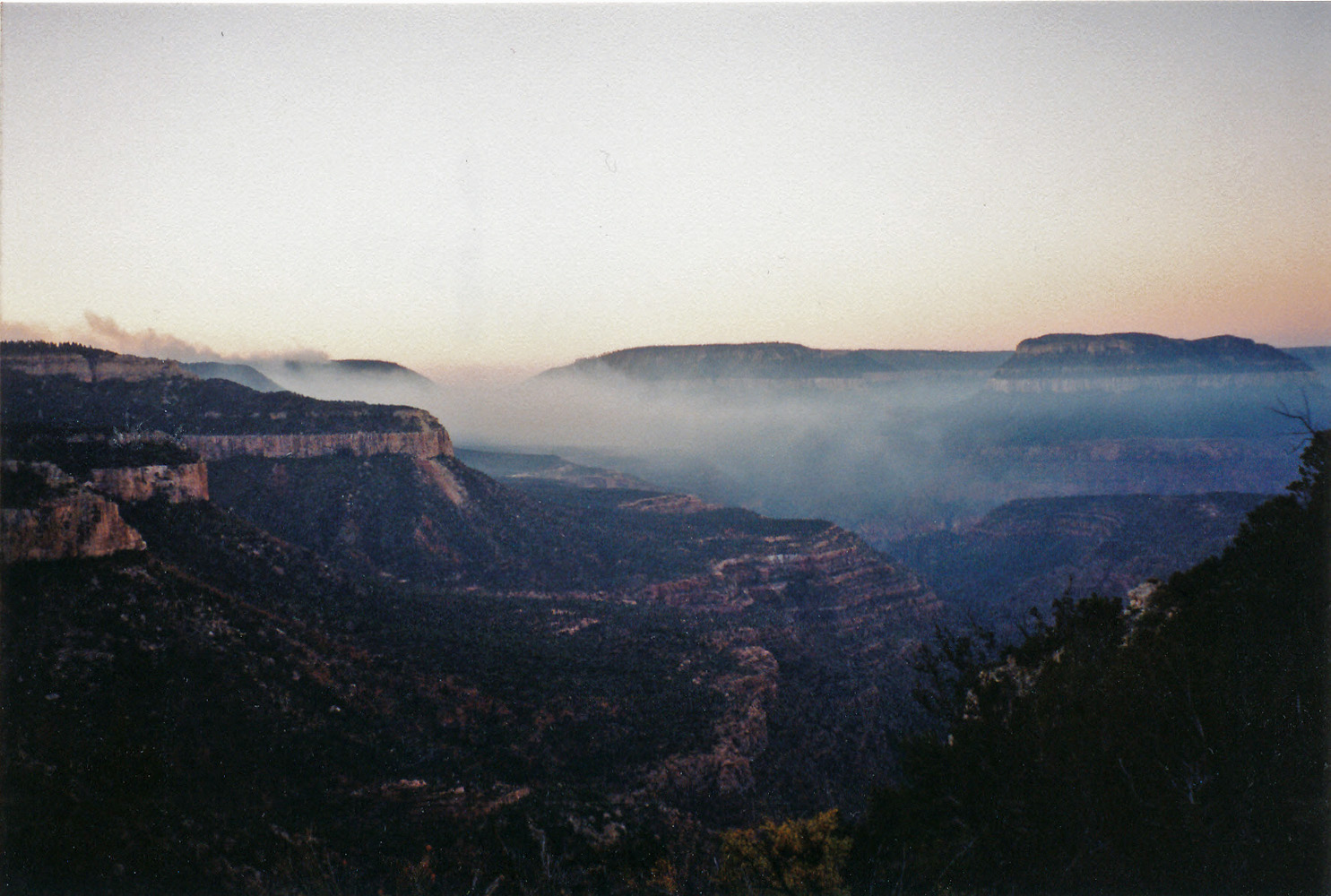
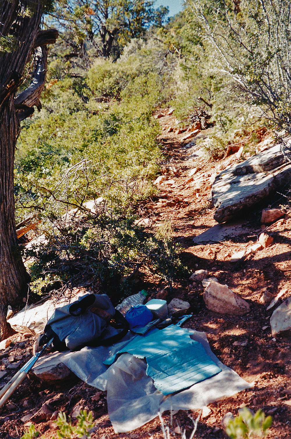
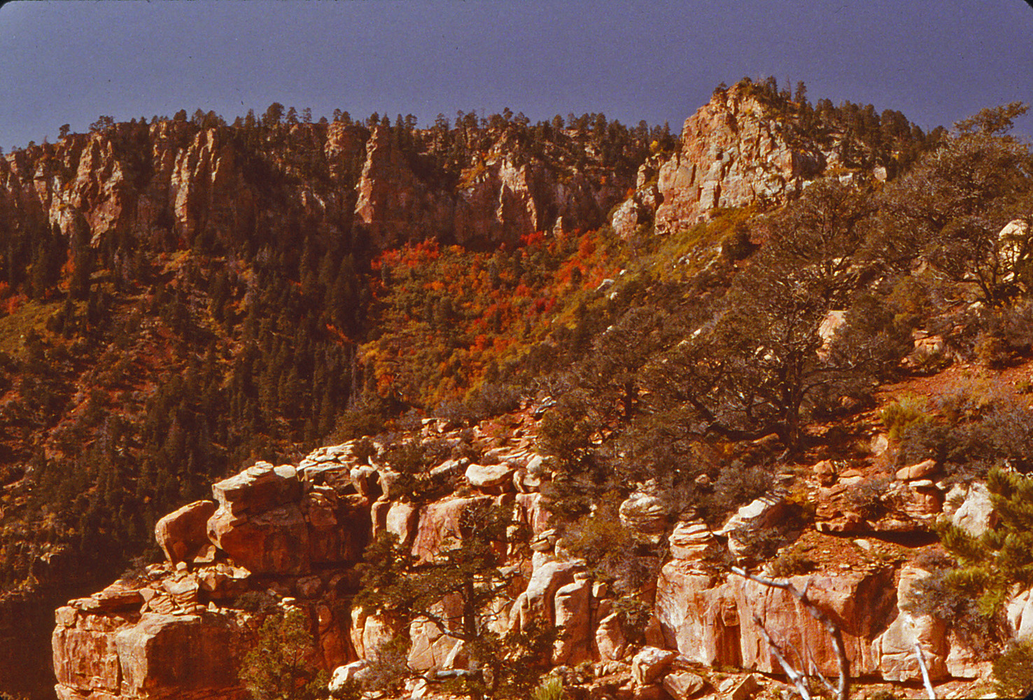
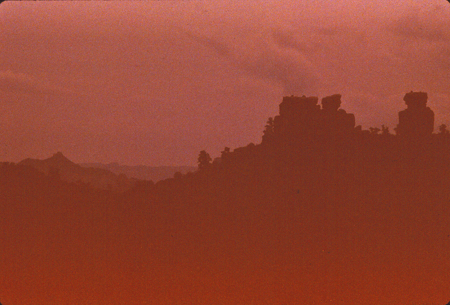
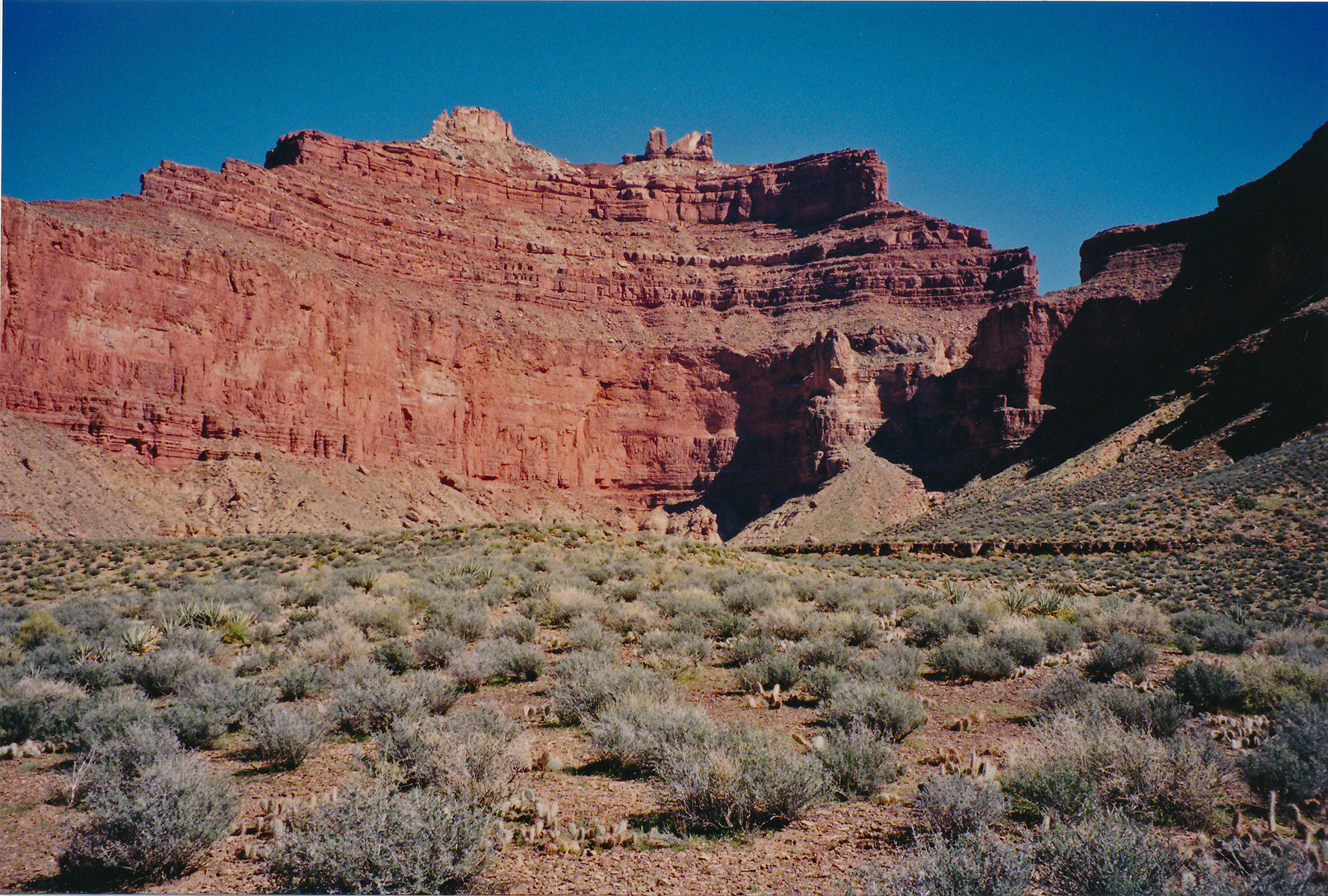
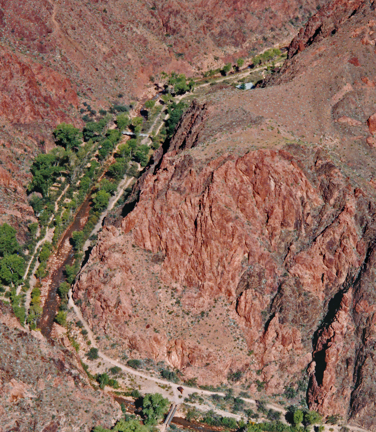
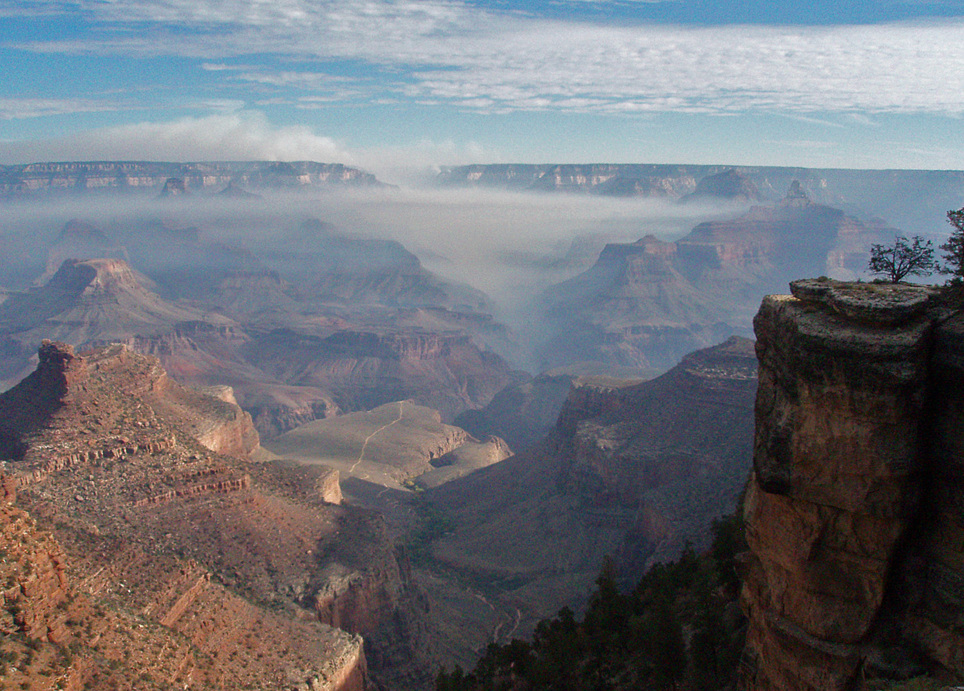
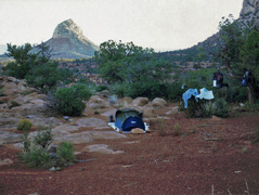
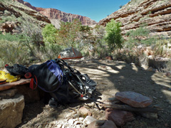
In 1995, I did backpacking trip down the South Bass
as far as the Esplanade with a few objectives in mind. I camped
for two nights on the Esplanade. This was my last day and I got
this shot of my campsite with Mt. Huethawali in the background.
Nice spot, although my first night I made a water run to the Chemehuevi
spring and got enough to last me for my two days here. I wrote up a fuller account on this
trip
here.
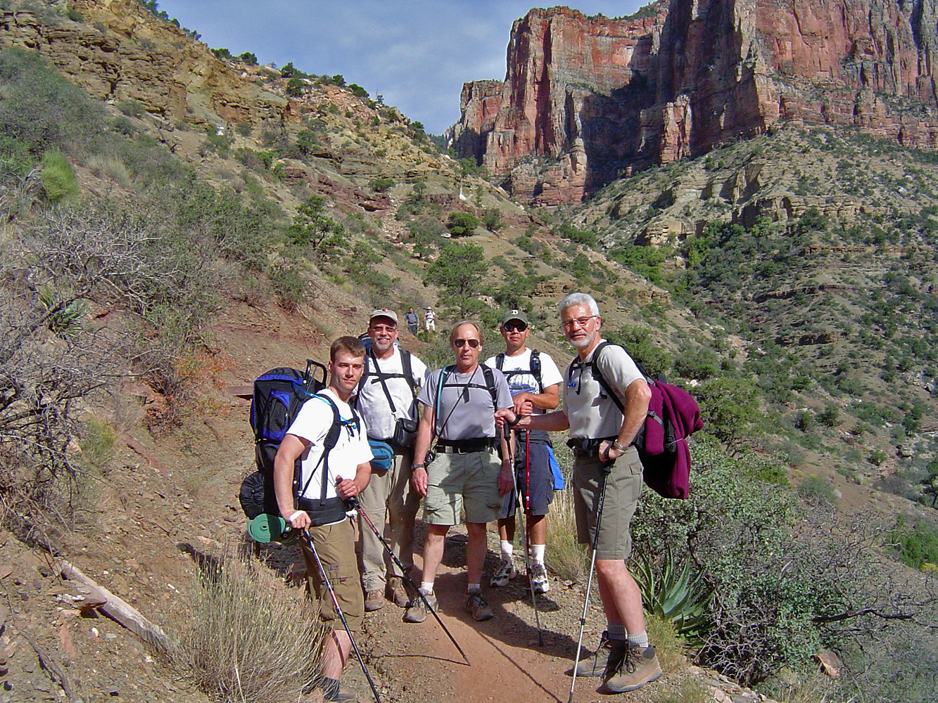
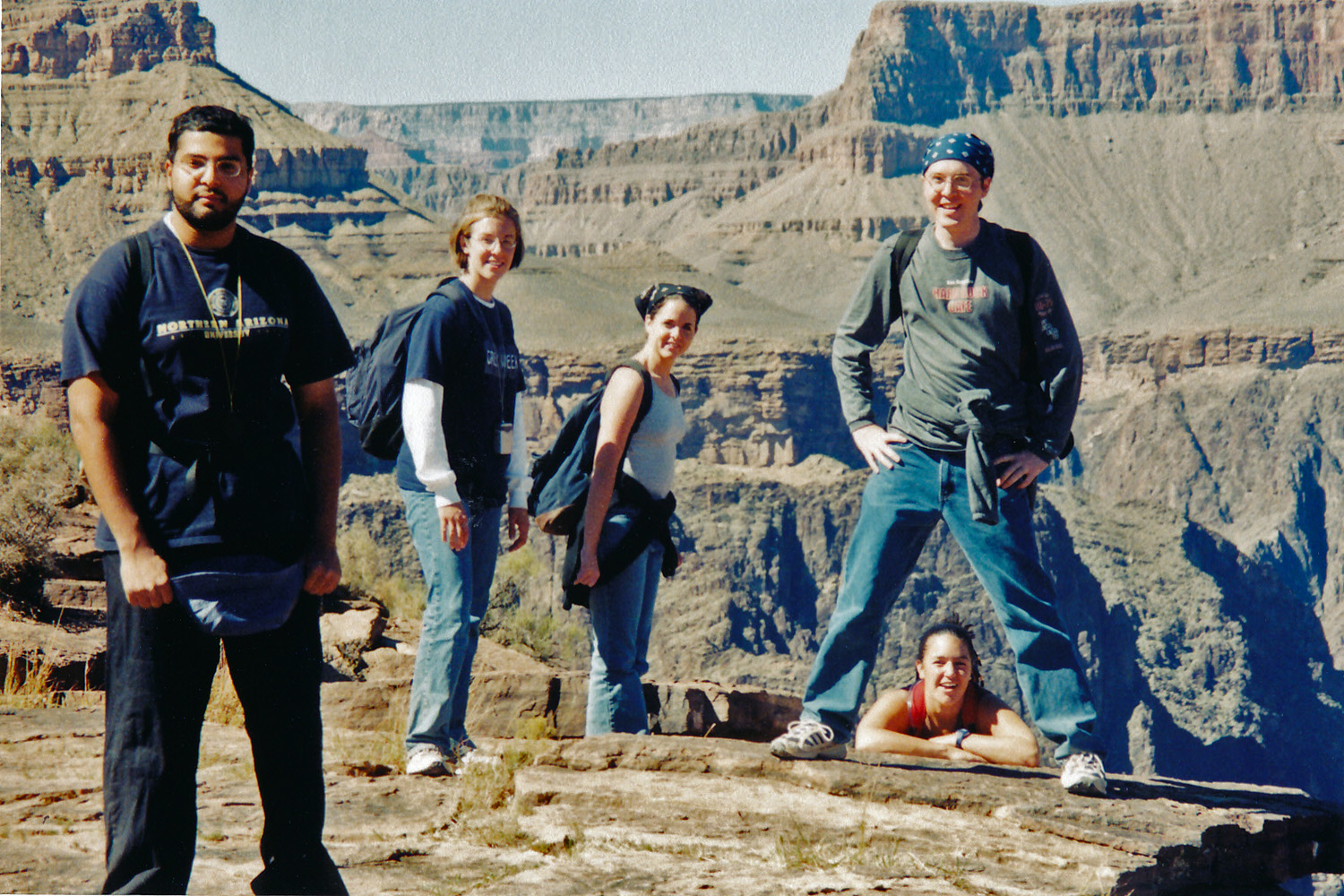
In 2006, Erik Drake and I did a rim-to-rim hike, down the
So. Kaibab and up the North Kaibab, with a night at Cottonwood
Campground. We were facilitating a key exchange for a group that
was going to day hike north to south on October 1st. This is our
second day when we did the key swap as we were just about to turn the
corner into Roaring Springs Canyon. Left to right - Erik, me, John
Haney, John's friend, and T.S. Amer.
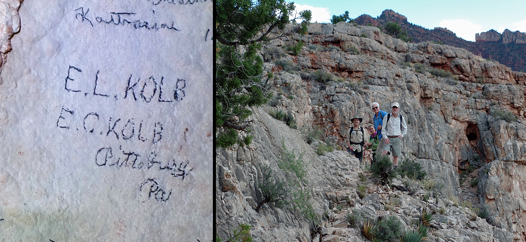
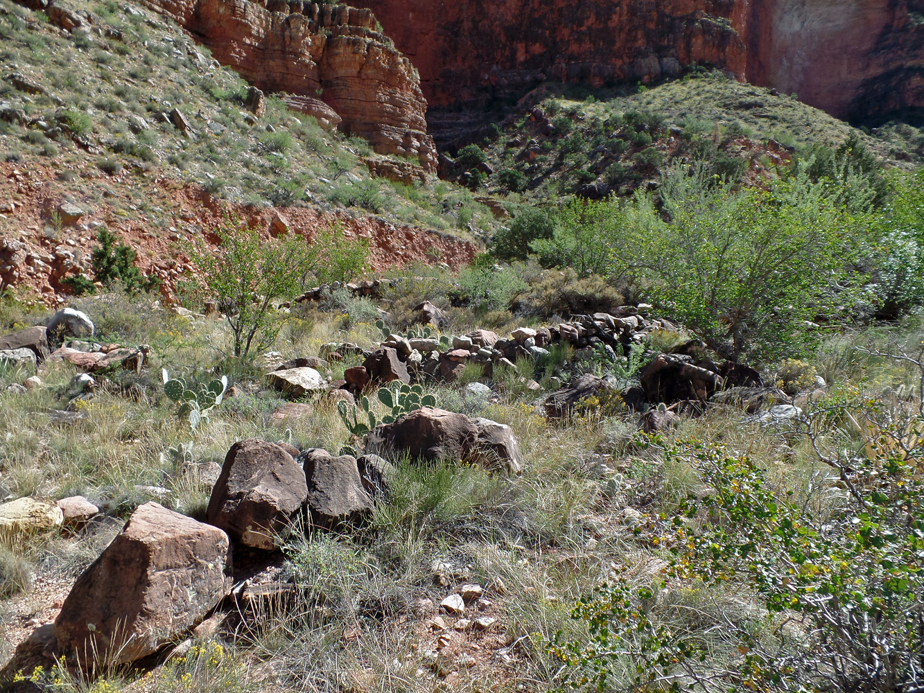
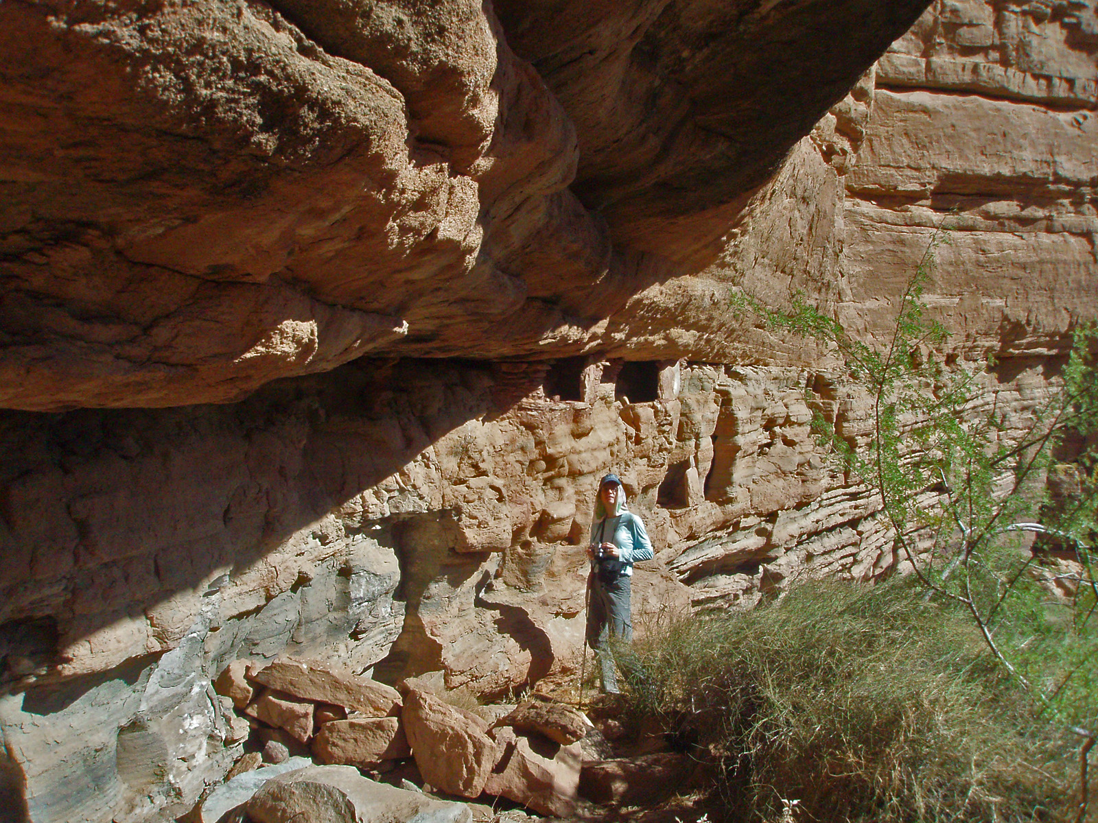
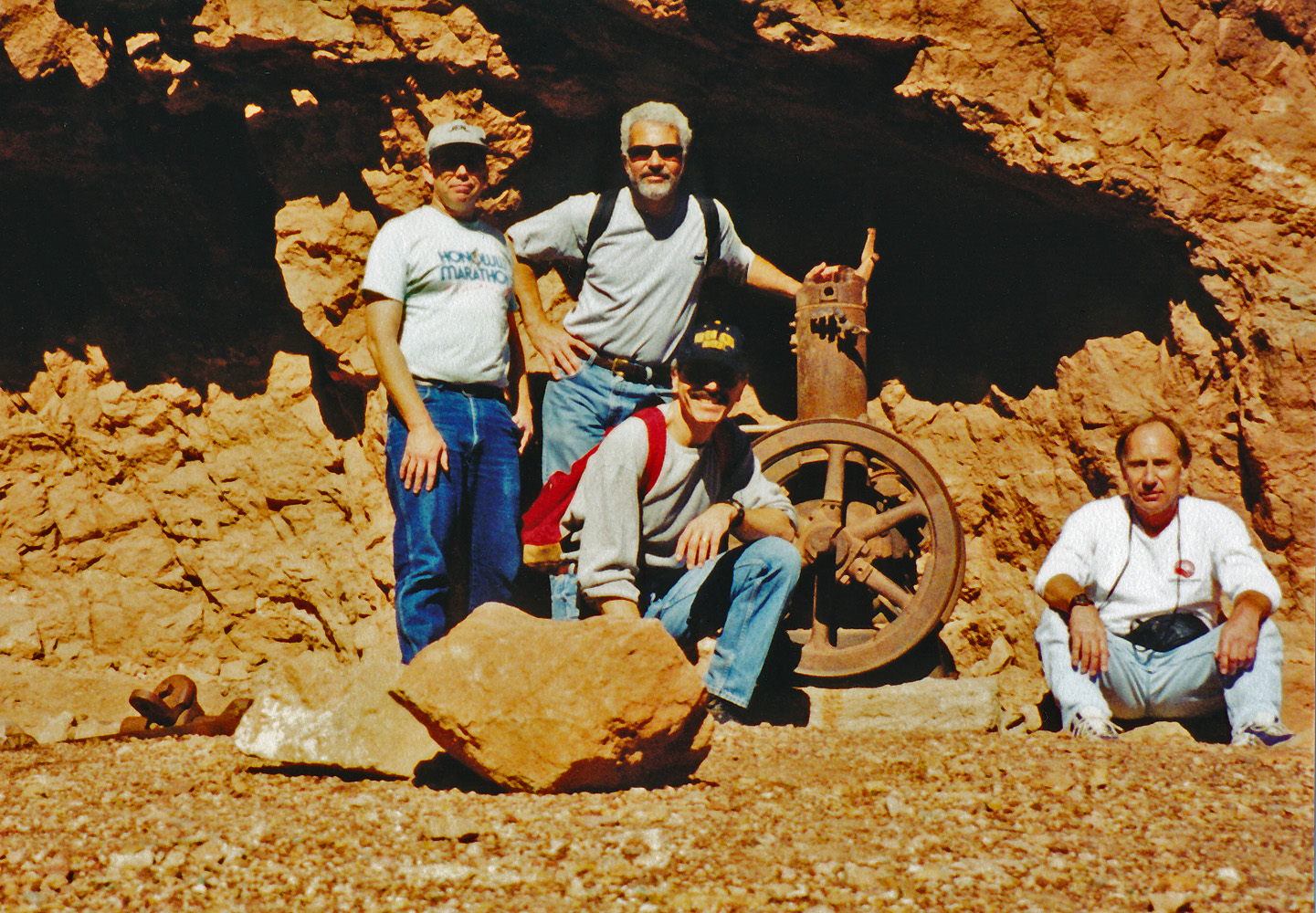
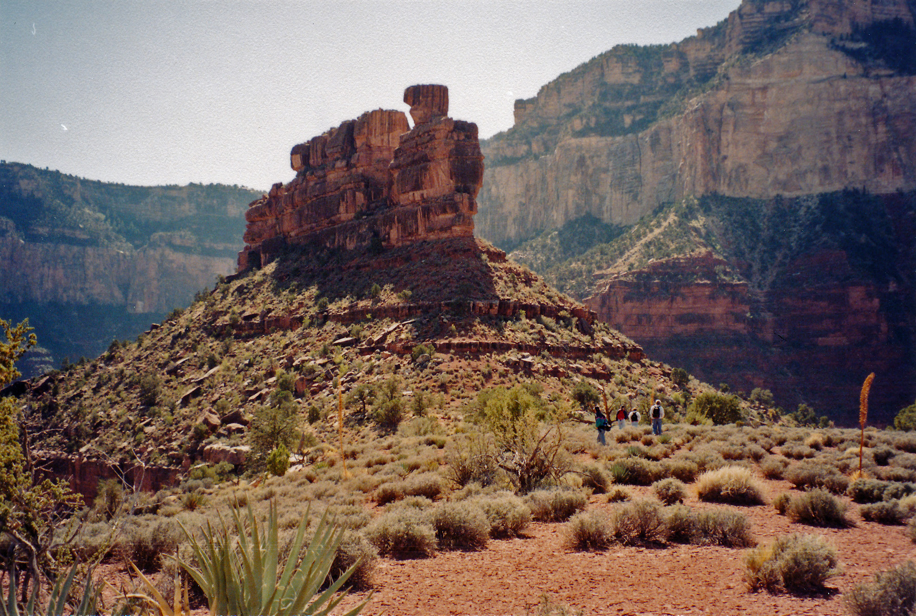
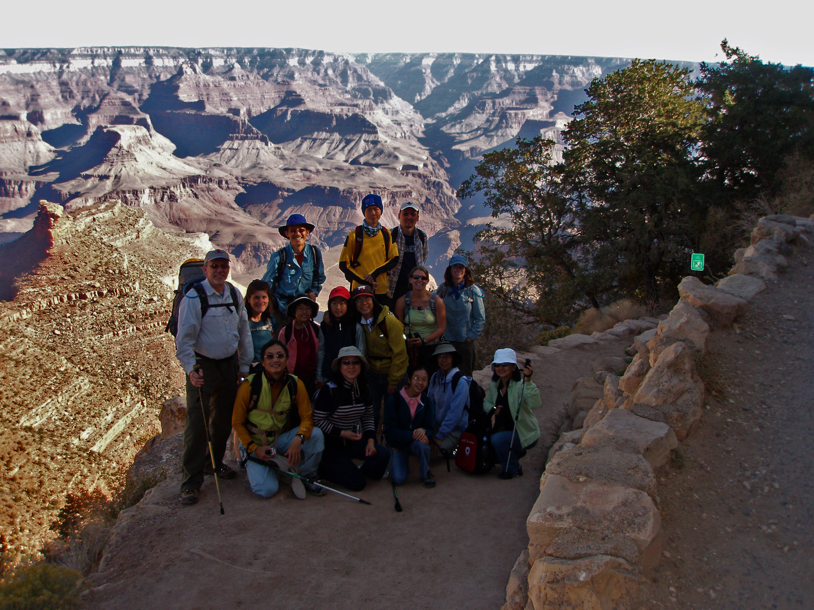
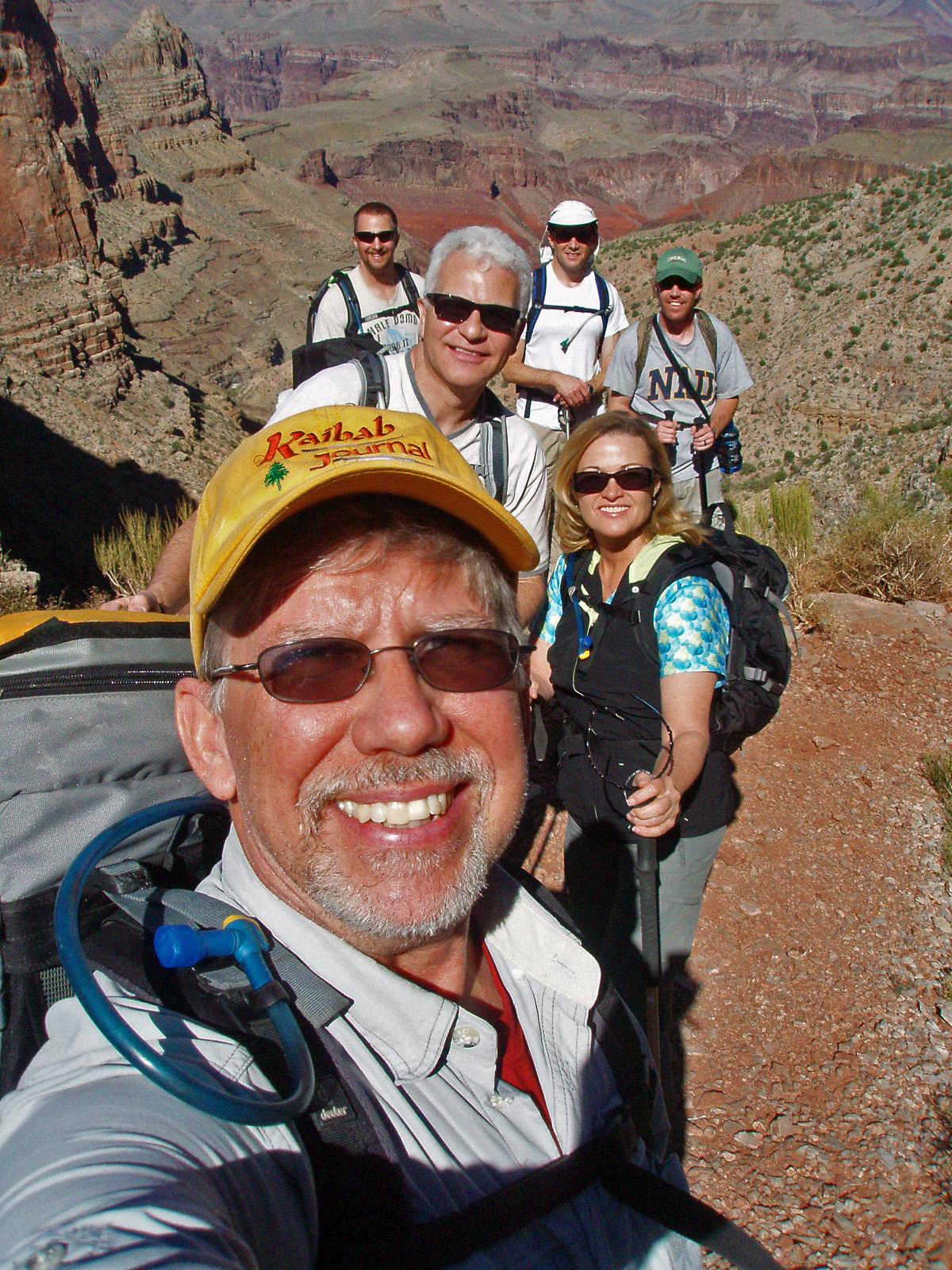
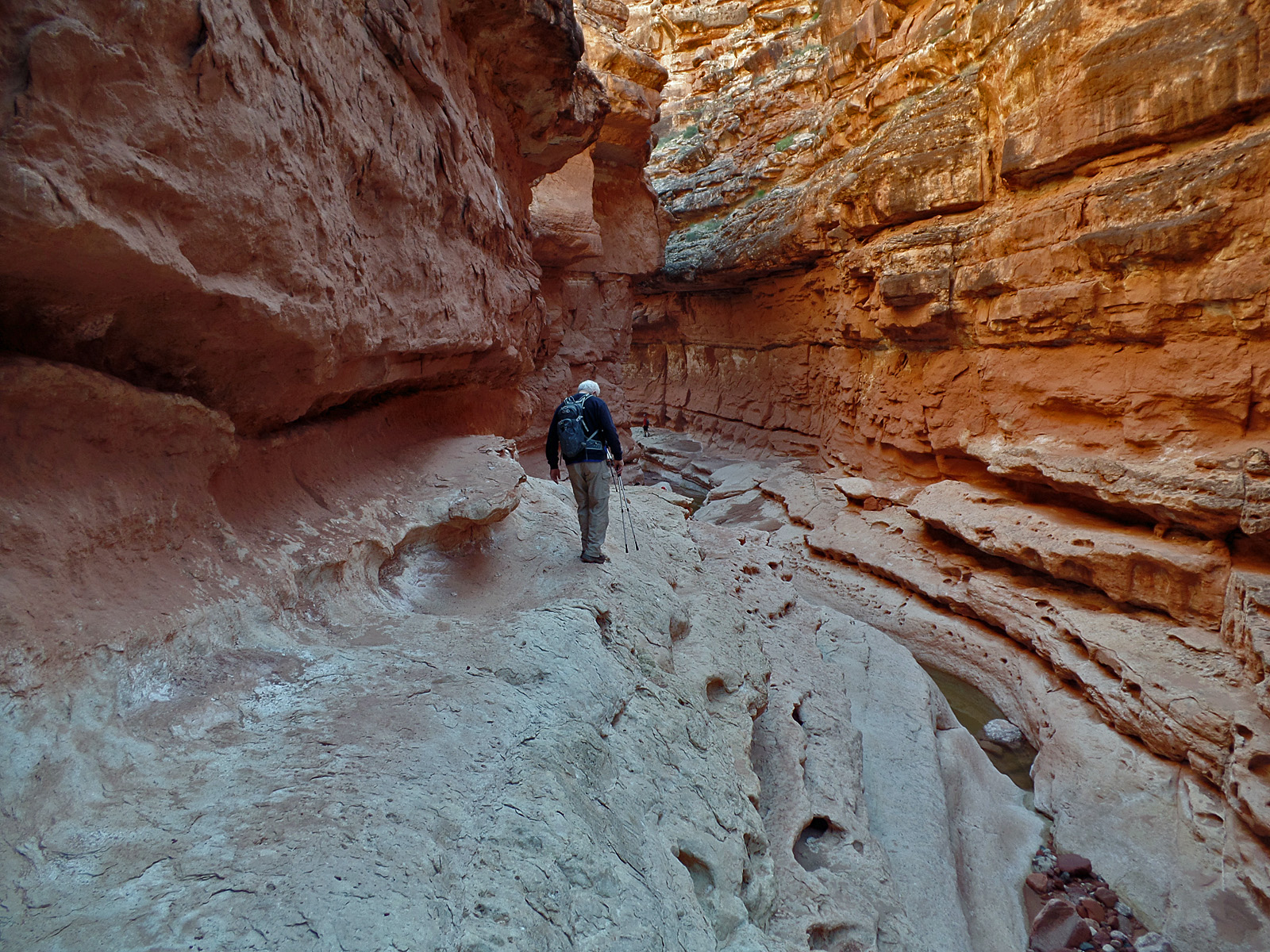
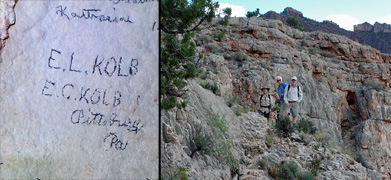
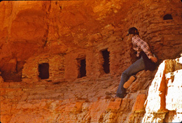
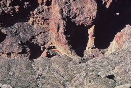
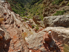
In 2016, with other faculty members from school, I did a day
hike down Grandview with a visit to the Cave of the Domes. [We had
intended to go to the So. Bass area, but muddy roads seemed a certainty
and would have been a stopper.] Along for the hike were John
Eastwood, Bev Amer, Geoff Dick, TS Amer (all pictured) and Kathy
Eastwood (not pictures - she opted out of the trek to the cave).
Here we are just a couple of minutes after leaving the cave and heading
back up. In the cave are old signatures written on the walls of
one of the domes, including this one from the Kolb's.
In 1999, I camped near the Big Saddle Trail, just
north of Crazy Jug Pt. for a couple of nights. I got to my camping
spot very late at night on this date. From my camp I could see the
glow of a wildfire burning over at Swamp Pt. [No photos for this
day.] |
 |
|
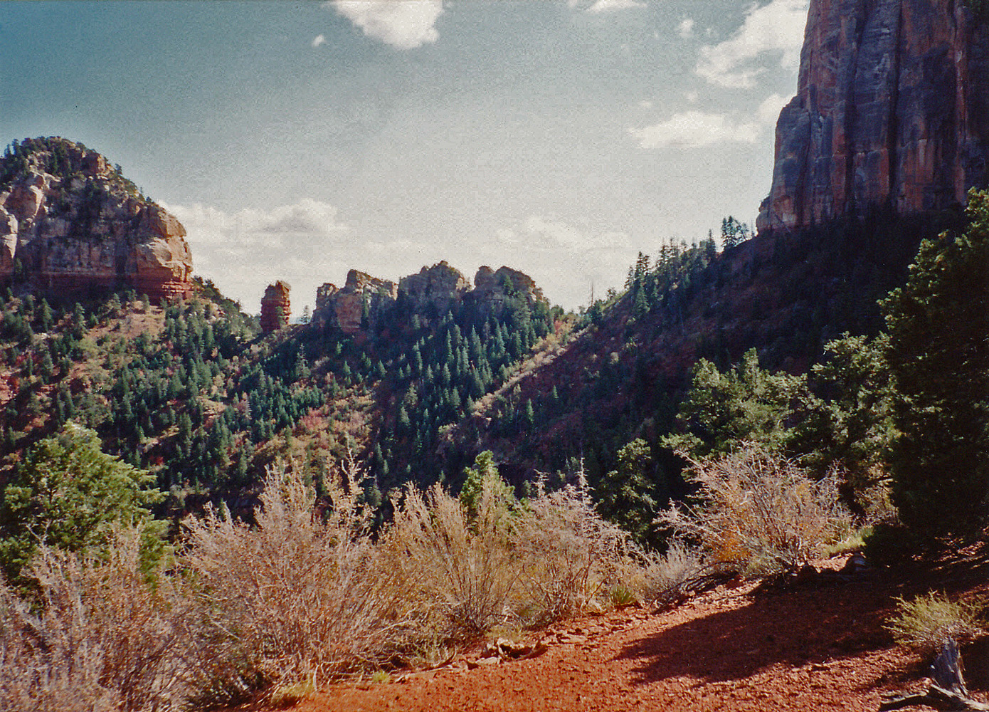
October 2 |
1999 - Smoke fills Saddle Canyon. |
2015 - Camp site at Hance Creek. |
|
In 1999, I camped near the Big Saddle Trail, just
north of Crazy Jug Pt. for a couple of nights. I got to my camping
spot very late at night on the 1st and was greeted with a hazy canyon
the next morning due to fires over at the Swamp Pt. area. The
night before I could actually see the glow of the fires.
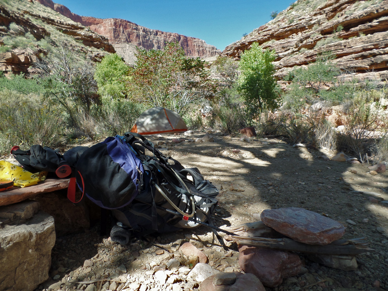
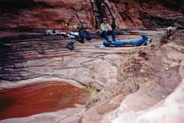
In 2015, I did a backpacking trip down the Grandview to
Hance Creek, where I spent a couple of days and then around to
Cottonwood before heading back out. On this first day I got to
Hance Creek by noon and got this camp site. |
|
|
|
October 3 |

1994 - Upper stretches of Nankoweap Trail. |

1998 - John at "Old Miner's Trail" cairn. |

2015 - Wall of Hance Camp along Hance Creek. |
|
In 1994, I started a six day trek into Nankoweap, to
eventually return to the rim via the Atoko Point route. This was
my first day and the trees were changing on the rim, presenting a
brilliant backdrop to my descent on the trail (from the rim trailhead).
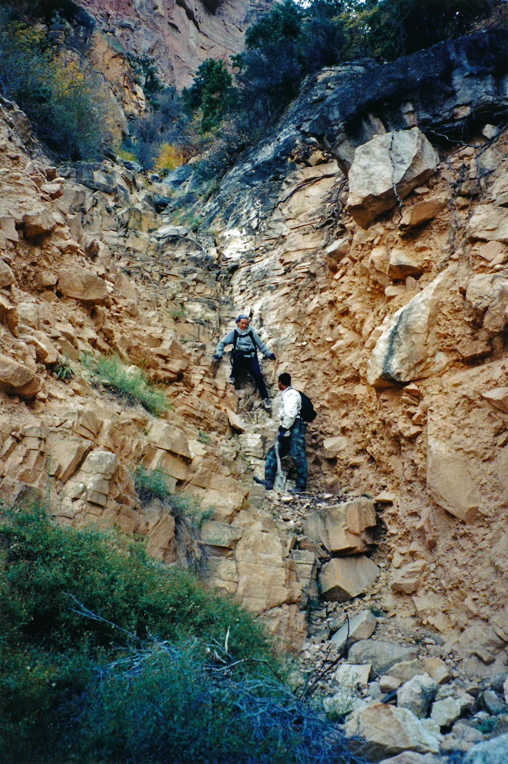
In 1998, I did a day hike down to Phantom Ranch with
colleagues from the business college at NAU - John Eastwood, Ken Lorek
and Allen Atkins. John and I opted to come back up to the Tonto
via the Old Miner's Trail and here he is at the cairn that marks the
descent.
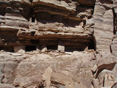
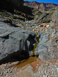
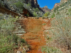
In 2015, I did a backpacking trip down the Grandview to
Hance Creek, where I spent a couple of days and then around to
Cottonwood before heading back out. On this second day I was able
to find the spring that Hance used for his camp down here (it is in the
shaded canyon in the middle of the picture). Up on the terrace
beside the creekbed I found some low walls that must have marked out his
operation here, as shown in the photo.
In 1999, I camped near the Big Saddle Trail, just
north of Crazy Jug Pt. for a couple of nights. This was my last
day and I pretty much just packed up and headed home. [No photos for this
day.] |
|
|
|
October 4 |
1994 - Mystic Falls in Nankoweap Canyon. |

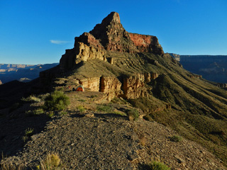
2014 - With Ty Ewing at "East Plateau Pt." |
2015 - Angel's Gate and rain from Cottonwood Canyon. |
|
In 1994, I did a six day trek into Nankoweap, to
eventually return to the rim via the Atoko Point route. This was
my second day and I did a day hike up to Mystic Falls, with a visit to
the ruins here near the falls as well as the ones on the other side of
this side canyon.
In 2014, I took one of my former students, Ty Ewing, on a day hike
down the So. Kaibab to what I call East Plateau Point, with great views
of the river, the Phantom area and the Bright Angel Trail. I ran
into Ty while he was working at REI and we arranged to do a hike
together. He had only been down into the canyon once, yet was
graduating this fall! We would do another trip together, in
January of 2015, to Phantom Ranch where we stayed over in the dorms.
In 2015, I did a backpacking trip down the Grandview to
Hance Creek, where I spent a couple of days and then around to
Cottonwood before heading back out. On this third day I packed up
and moved my camp to Cottonwood Creek. It was a pleasant morning
with lots of blue sky. But, in the mid afternoon, it rained and at
times it was heavy. That persisted well into the night and the
early morning hours. |
|
|
|
October 5 |
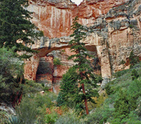
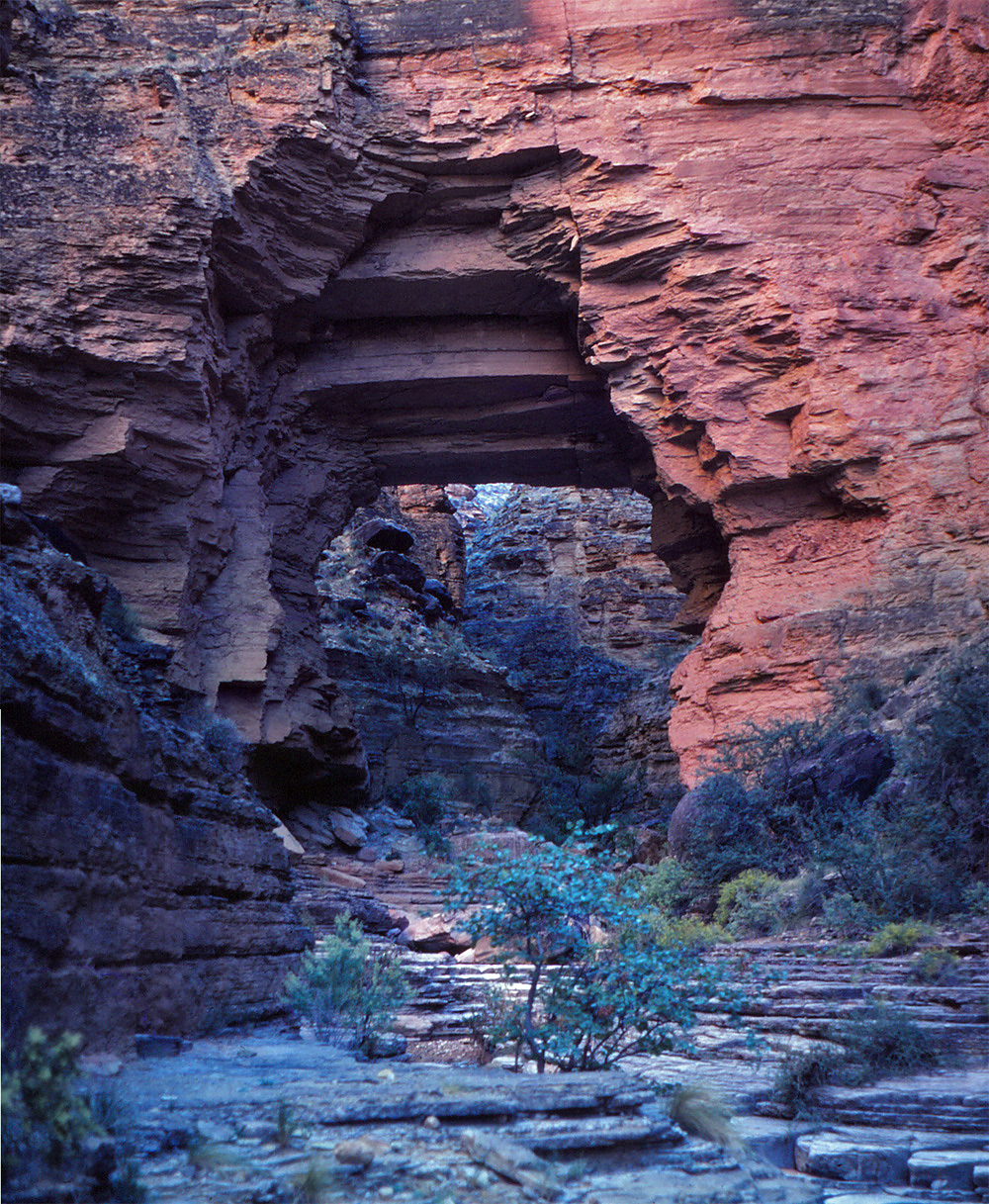
1994 - At Kolb Natural Bridge. |

2015 - Angels Gate in early morning. |
|
In 1994, I did a six day trek into Nankoweap, to
eventually return to the rim via the Atoko Point route. This was
my third day and I did a day hike up to Kolb Natural Bridge.
Discovered in modern times by Barry Goldwater, I wrote up a fuller
account of this day's hike and included Goldwater's story (and some
photos)
here.
In 2015, I did a backpacking trip down the Grandview to
Hance Creek, where I spent a couple of days and then around to
Cottonwood before heading back out. This was my final day.
The rain let up enough to pack under dry conditions and while it
threatened the rest of the morning I was able to reach the rim in good
weather. Here's a picture of Angels Gate from the area of my
campsite along Cottonwood Creek. |
|
|
|
October 6 |
1994 - Swilling-Duppa-Hutton Buttes. |
2006 - At Plateau Point w/Bill Ferris. |
|
In 1994, I did a six day trek into Nankoweap, to
eventually return to the rim via the Atoko Point route. This was
my fourth day. I packed up from my Nankoweap camp and hiked up
into a bowl surrounded by Swilling, Duppa and Hutton Buttes before
descending into Kwagunt Canyon. I exited up the arm west of Banta
Point. I got hung up in the lower Redwall and had to make camp on
a little ledge where I could barely lay out my sleeping bag. It
wasn't dangerous, as this area was heavily forested, which made the
hiking very difficult.
In 2006, I did my first hike with Bill Ferris! We
did the BA Trail to Plateau Point and back. We started off with
clouds at, and below, the rim, but the day brightened up for us.
You can see that the river was quite muddy, indicating that we had been
having some rain recently. |
|
|
|
October 7 |
1994 - Exiting via Atoko Pt. route. |
2004 - Atop Cardenas Butte. |
|
In 1994, I did a six day trek into Nankoweap, to
eventually return to the rim via the Atoko Point route. This was
my fifth day, and probably the hardest hiking day I've ever had in the
canyon. I started from somewhere in the Redwall and by 1:30 I had
finally reached the top of the Supai, which is where I took this photo -
I am near the saddle between the rim (to the right) and an unnamed butte
(to the left) west of Siegfried Pyre. Then began the grueling
contour of Atoko Pt. I barely got up through the Coconino before
night befell me.
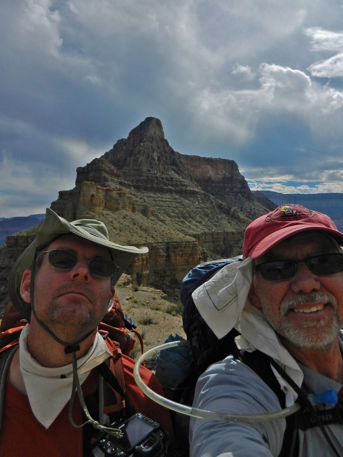
In 2004, I did a nice day hike down the Tanner to climb up
to the top of Cardenas Butte. Great day with great views.
The timed selfie could have been redone so it doesn't look like I'm
making secret hand signals :-) . |
|
|
|
October 8 |
1981 - Pollux Temple. |

1994 - My "camp" in the Kaibab. |
|
In 1981, I did a day hike to the top of Pollux
Temple, via the Jicarilla Point route. I got through the Coconino
on the other side of the cliffs shown and easily got to the saddle and
then the top of Pollux.
In 1994, I did a six day trek into Nankoweap, to
eventually return to the rim via the Atoko Point route. This was
my last day, and an unintended one. I was unable to top out the
previous night and found a spot barely suitable to sleep on overnight.
In fact both my head and my feet were slightly pointed down! One
problem I had was that I was pretty much out of water and I had to walk
back to my truck at the high Nankoweap Trailhead on the rim. I
fill up with the most awful water I've ever had to use from Greenland
Lake, which was just a bog that the deer like to use. Well, it was
enough to keep my mouth wet until I reached my truck. |
|
|
|
October 9 |

1999 - On the Big Saddle Trail. |
2009 - Sunset on Brahma and Zoroaster Temples. |
|
In 1999, I did a quick day trip up to the Crazy Jug
area to spend some time continuing my efforts to clear what I call the
Big Saddle Trail. This section went through a patch of manzanita,
which was relatively easy to deal with.
In 2009, Cara Lynn and I started a three day trip
where we spent two nights at the Bright Angel campground. On our
way down, the sunset lit up Brahma and Zoroaster Temples. |
|
|
|
October 10 |

2009 - Buddha Temple from Utah Flats. |
2014 - Getting started down the Grandview. |
|
In 2009, Cara Lynn and I started a three day trip
where we spent two nights at the Bright Angel campground. On this
second day I did a solo hike up to the Cheops/Isis saddle to leave a
small cache of food and water for a trip I had planned for November.
The Utah Flats area has a sort of Esplanade feel to it. Here Is a
view to the north with Buddha Temple dominating the background.
In 2014, I began a four day hike to spend time
in Grapevine Canyon. Here I am getting started down the Grandview
Trail. My first night would be spent at Cottonwood Creek. |
|
|
|
October 11 |

2009 - Cara Lynn at Garden Creek ruins. |
2014 - Moon over the Redwall. |
|
In 2009, Cara Lynn and I did a three day trip
where we spent two nights at the Bright Angel campground. This was
our last day and we hiked out via the Bright Angel Trail. On the
way, we made a stop at some of the ruins in Garden Creek that used to be
more often visited a hundred years ago but, today, are unknown to
practically all of the hikers that pass by on the trail.
In 2014, I did a four day hike to spend time
in Grapevine Canyon. On my second day I hiked from my camp at
Cottonwood Creek to Grapevine. In the morning I had this great
view of the nearly full moon floating over the Redwall as I started off. |
|
|
|
October 12 |
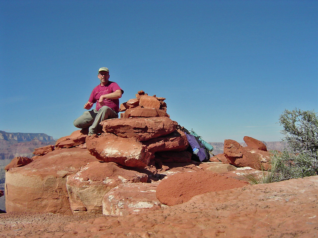
2002 - With TS & Bev at 75 Mile Saddle. |
2014 - In upper Grapevine Canyon. |
|
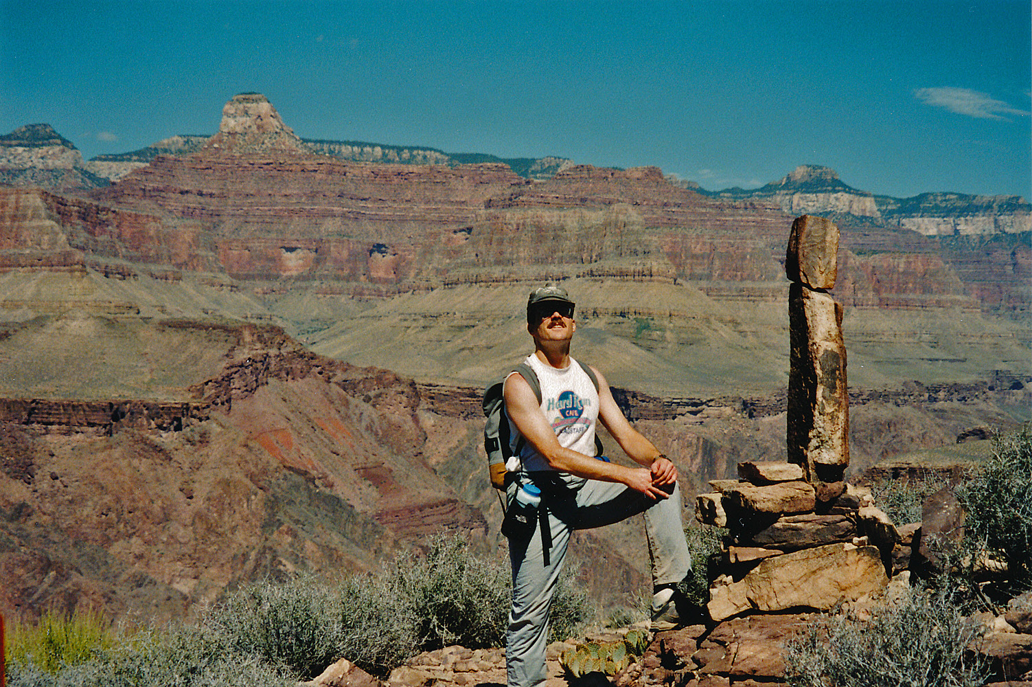
In 2002, I did a day hike with colleagues TS and Bev
Amer down the Tanner Trail to the Redwall Overlook. Here we are at
the saddle with 75 Mile Canyon.
In 2014, I did a four day hike to spend time
in Grapevine Canyon. On my third day I had started off trying to
go downstream, but the break through the Tapeats to the east spooked me.
So, instead I hiked way up the canyon and very much enjoyed the many
idyllic pools and waterfalls. This bighorn didn't fare as well. |
|
|
|
October 13 |

2001 - With the MBAs at Plateau Point. |
2004 - Pipe Creek. |

2014 - Taking notes between Grapevine and Cottonwood. |
|
In 2001, I did a day hike with some of my MBA
students down to Plateau Pt. and back. As one might expect, the
girls beat the boys back up to the rim!
In 2004, I did a day hike loop from South Kaibab to
the Tonto to the Bright Angel. Here is a shot looking up Pipe
Creek, which is my usual halfway stop, as there is both water and shade.
In 2014, I did a four day hike to spend time
in Grapevine Canyon. This was my last day and I hiked back up to
the Grandview Trailhead from my camp in Grapevine. I was assisted
by a waning gibbous (?) moon that helped me pack up well before sunrise.
Here I am writing down some notes as I rounded the bend out of Grapevine
and started to parallel the river before starting my trek into
Cottonwood Canyon. |
|
|
|
October 14 |

1983 - Fall colors on the Nankoweap Trail. |
2000 - At the Grandview mines. |
|
In 1983, I did my first real hike down into
Nankoweap Canyon on a trip lasting five days. I went with Karen
Herrera following the end of the work season on the North Rim.
While I brought along my Pentax K1000, cost considerations kept the
number of pictures I took to just fifteen! Gorgeous fall colors
greeted us for this hike, which began from the upper trailhead.
In 2000, I did a day hike with colleagues from the
business college at NAU down the Grandview to visit the mines and cave.
We lost one member of the group who would not hike down through the
switchbacks in the Kaibab, so it was just the four of us - me, TS Amer,
Ken Lorek and John Haney - for the rest of the trek. |
|
|
|
October 15 |
1983 - Karen at the cliff granaries above Nankoweap Rapids. |
|
In 1983, I did my first real hike down into
Nankoweap Canyon on a trip lasting five days. I went with Karen
Herrera following the end of the work season on the North Rim.
On our first night we camped at a spot in the lower Redwall (or, the
Muav, I guess) I call "Camp-on-a-ledge." This was our second day
and we soon got to the river and set up camp there. Then we
climbed up to visit the cliff granaries - here she is perched alongside
them. |
|
|
|
October 16 |
1983 - The gate at Nankoweap. |
2009 - Water pockets in Lonetree Canyon. |

1997 - Early dawn over Wotans & Vishnu. |
|
In 1983, I did my first real hike down into
Nankoweap Canyon on a trip lasting five days. I went with Karen
Herrera following the end of the work season on the North Rim. On
our third day we broke camp at Nankoweap Rapids and began a grueling
three day ascent to the rim. Here is a formation along the creek I
call the "Nankoweap Gate." Our camp this night would be up above
the Tapeats.
In 1997, I wanted to do a speed hike from Phantom
Ranch to Nankoweap, aiming for four days. This was the first day
and I got a nice early start, with dawn breaking over Wotans Throne and
Vishnu Temple. This first night would see me camped on the Tonto
below Howlands Butte, east of Clear Creek.
In 2009, I did a three day hike to spend time
in Lonetree Canyon, especially to check out some ruins here that Harvey
mentions. Cara Lynn and I had passed through here earlier in the
month and didn't have time to do this. I took the shortcut across
Cremation from the South Kaibab Trail at the bottom of the Redwall and
arrived in Lonetree by 1 pm. I had seen a young bighorn drinking
from some water pockets at the Tonto crossing and so that's where I got
water for my first overnight. Although I did filter this water, it
looked and tasted awful. The next day I was glad to get to the
spring further down this canyon. I wrote up a fuller account
here. |
|
|
|
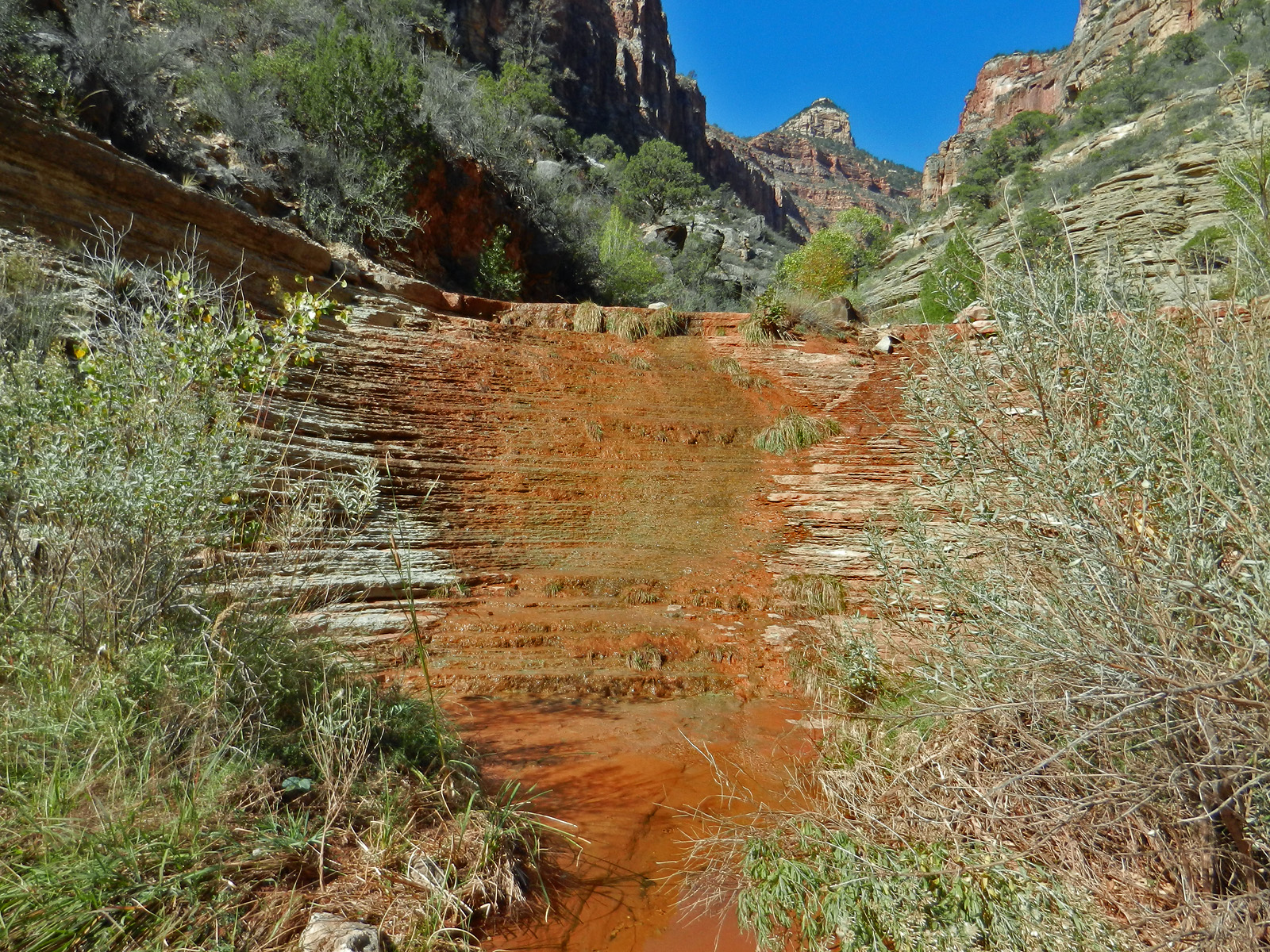
October 17 |
1981 - Montezuma Pt. with red lens. |
1983 - Marion Pt. at dusk. |
1997 - Holed up in Vishnu. |

1999 - Day hiking the Battleship. |
2009 - Ruins in Lonetree Canyon. |

2014 - The Marion-Seiber route. |
|
In 1981, I did a hike down the South Bass and across
the Esplanade to see/visit the many area attractions. This was my
first day down the trail and I camped in front of Montezuma Pt. and
snapped this photo using a red lens I had for my camera.
In 1983, I did my first real hike down into
Nankoweap Canyon on a trip lasting five days. I went with Karen
Herrera following the end of the work season on the North Rim. On
our fourth day we broke camp from above the Tapeats and barely made it
to the saddle before packing it in for the night. I got this shot
as we passed by Marion Pt. in the increasing darkness. I don't
have notes for this hike, so while I have the distinct impression that
we were really running low on water, I can't be sure what the
exact circumstances were.
In 1997, I wanted to do a speed hike from Phantom
Ranch to Nankoweap, aiming for four days. This was my second day
and all my plans came unraveled. I ran out of water while
traversing the dry (and hot) Tonto Plateau and barely made it to this
pool in a little side canyon of Vishnu. I had been counting on
getting to Lava this day, so had to reassess the whole venture.
The next day I turned around and headed back the way I came.
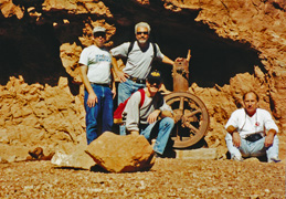
In 1999, I did a day hike out to the terrace in
front of the Battleship with colleagues from NAU. In the photo,
you can see Allen Atkins, Ken Lorek, John Haney and TS Amer, as we were
headed back. Although I did a day hike the previous year with Ken and Allen (and
John Eastwood) to Phantom Ranch, this hike, more or less, kicked off an
annual fall hike with my colleagues.
In 2009, I did a three day hike to spend time in
Lonetree Canyon, especially to check out some ruins here that Harvey
mentions. This was my day hiking day. I walked down the bed
to the good spring and then up to the ruins at the base of the Tapeats.
Very extensive, as this photo attests. I wrote up a fuller account
here.
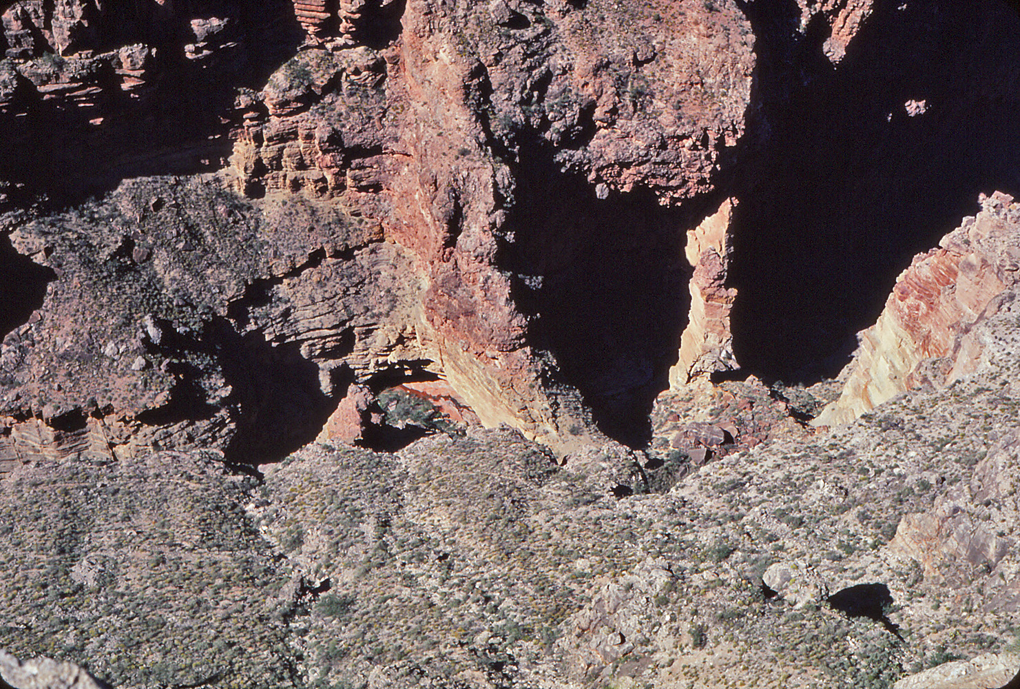
In 2014, I did a three day hike into Nankoweap in
search of the Marion-Seiber route that Doug Nering rediscovered. I
took the regular trail down and kept a close watch on what the canyon
looked like below. It was only after I came up that I was able to
piece together what I was looking at. This annotated picture shows
that the route comes up behind an exposed jagged ridge of Redwall and
then behind this low forest before coming out somewhere on the right
hand side - maybe it is where I drew the yellow line and maybe it is
where I drew the rose colored one. |
|
|
|
October 18 |

1981 - The Royal Arch. |

1997 - Angels Gate. |

2008 - FCB hike to Plateau Pt. |
2009 - Cremation Use Area cairns. |

2014 - Inscription at Seiber junction. |
|
In 1981, I did a hike down the South Bass and across
the Esplanade to see/visit the many area attractions. This was my
first day hiking day and I went down the bed, first following the sheep
trail out above the arch and then backtracking to visit Royal Arch up
close and personal. It's hard to get a good photo of the whole
thing and even the one posted here has been stitched together from two
pictures.
In 1997, I wanted to do a speed hike from Phantom
Ranch to Nankoweap, aiming for four days. This was my third day
and the first on my return journey. It wasn't hard hiking once I
was well-hydrated, but I couldn't continue to Nankoweap because John
Eastwood was supposed to meet me there but would have had the time to
stick around if I was a couple of days late.
In 2008, I did a day hike out to Plateau Pt. with
some of my NAU colleagues and their families. Here we are near the
trailhead. [I must admit that I Photoshopped out the mule
biscuits!] Included in the photo (left ot right) are me, Jennie,
George (in front; visiting faculty from Singapore as I recall), Pin (in
back) then over to Talai, and in front of him are Julie and Cara Lynn.
In 2009, I did a three day hike to spend time in
Lonetree Canyon, especially to check out some ruins here that Harvey
mentions. This was my last day, spent hiking back out the South
Kaibab. I followed the trail all the way so I could compare times
with my shortcut through Cremation the first day - surprisingly, not
much difference. Here are the two big cairns that mark the
boundary of the Cremation Use Area. I wrote up a fuller account
here.
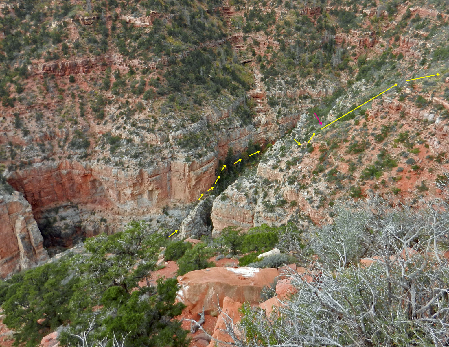
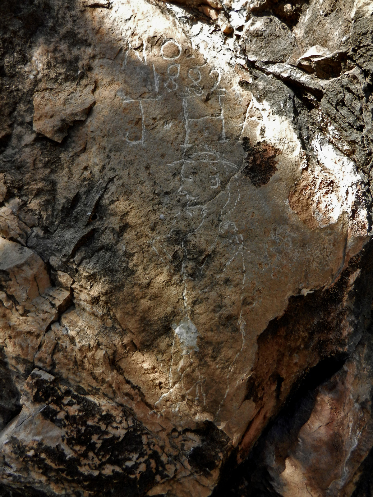
In 2014, I did a three day hike into Nankoweap in
search of the Marion-Seiber route that Doug Nering rediscovered. I
had camped at the creek and this day moved my camp up to the junction
below Seiber Pt. I got there quickly and actually gave some
thought to hiking up to Mystic Falls, which I could kind of see from
this spot. But, the thick brush discouraged me. I did look
for, and find, an inscription that Bil Vandergraff told me about.
I can't say that I buy into the idea that this is really from 1882.
The initials JHA don't ring a bell to me, even though I am a close
student of the Walcott expedition that was here in the early months of
1882. [So, if it is legit, perhaps from someone coming later in
the year while the trail was still passable.]
In 1983, I did my first real hike down into
Nankoweap Canyon on a trip lasting five days. I went with Karen
Herrera following the end of the work season on the North Rim. On
our fifth day we broke camp from the saddle and hiked up to the rim and
then along the fire road to Pt. Imperial. I left Karen here while
I tried to hoof it back to the lodge to pick up her car. Lucky for
me there was someone driving down the road and they gave me a lift.
[No photos.] |
|
|
|
October 19 |
1981 - Looking down on Royal Arch. |

1997 - Panorama of the Bright Angel
Campground area. |
2014 - Cairn marks top of Muav ledges. |
|
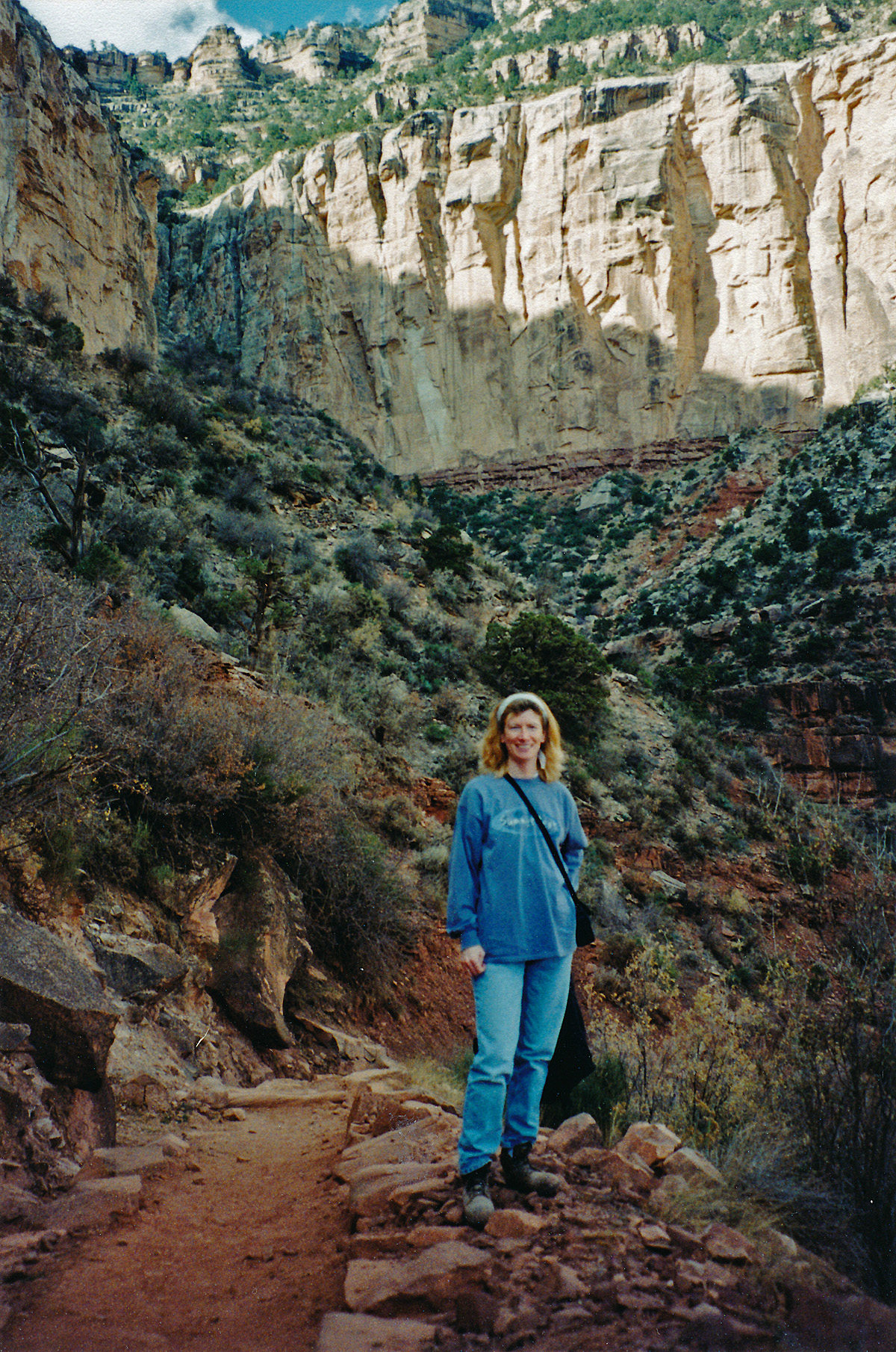
In 1981, I did a hike down the South Bass and across
the Esplanade to see/visit the many area attractions. This was my
second day-hiking day from my camp on the Esplanade. I decided to
go out to the edge of the plateau and look down onto Royal Arch - the
trickle of water is going through it. Also note the "sheep trail"
that one follows to get past the arch, where I had been the day before.
In 1997, I wanted to do a speed hike from Phantom
Ranch to Nankoweap, aiming for four days. Alas, it was not to be.
While this was my fourth, and
final, day, it marked my return to the South Rim. On my way up the
South Kaibab I had this nice view of the Bright Angel Campground.
In 2014, I did a three day hike into Nankoweap in
search of the Marion-Seiber route that Doug Nering rediscovered. I
had camped at the creek junction
below Seiber Pt. the previous night and felt well-rested for this
hike/climb. I had poured over the notes I brought and everything
pretty much unfolded according to them! An early obstacle is
referred to as the "Muav Steps" which you have to side step up past
some giant boulders. A cairn at the top validated my choice here
and others were generally very helpful all the way out. I reached the
saddle by noon, well ahead of what I was expecting. |
|
|
|
October 20 |
1981 - The view from atop Mt. Huethawali. |
2013 - Sunset from the South Kaibab Trail. |
|
In 1981, I did a hike down the South Bass and across
the Esplanade to see/visit the many area attractions. This was my
third day-hiking day from my camp on the Esplanade and I decided to
go and climb Mt. Huethawali. Here's the one picture I took from
the top! [It was the last exposure on my one roll of film I
brought for this hike.]
In 2013, Bill Ferris and I did a backpacking trip to
Trinity Canyon. We left the rim late in the day and hiked through
the sunset, to camp at the Tonto level later in the evening. I
wrote up a full account of this hike
here. |
|
|
|
October 21 |
2001 - On the Old Hance route. |
2013 - Camping on the Cheops-Isis saddle. |
|
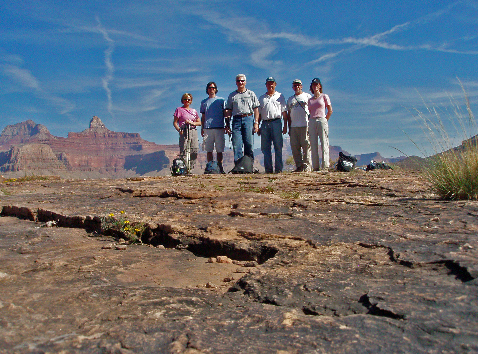
In 2001, I took some colleagues (TS Amer & Craig
Bain) and MBA students (Lena & Omar, pictured) down the Old Hance route.
Bad judgment on my part as this hike was way too challenging for the
group. I still have a vivid memory of Craig stranded on a narrow
ledge holding onto a sapling while Omar lowered his belt down to help
Craig climb back up to safety.
In 2013, Bill Ferris and I did a backpacking trip to
Trinity Canyon. On our second night we camped on the Cheops-Isis
saddle (you can see my tent up in the photo). Getting all the way
to Trinity seemed iffy and we didn't want to pass up the sure water of
Phantom Creek, so Bill hoofed it down to the bed from here and hauled up
water. I
wrote up a full account of this hike
here. |
|
|
|
October 22 |
2013 - A trickle in Trinity. |
|
In 2013, Bill Ferris and I did a backpacking trip to
Trinity Canyon. We reached the bed of Trinity and camped at the
junction with the side canyon we came in down. Here we found a
slight trickle of water and I got this photo looking up Trinity towards
Horus Temple. Years ago Harvey Butchart wrote that the water here
had "a slightly salty taste and had a laxative effect." It turns out he
was right on both counts, the latter of which would plague me for the
next couple of days! I
wrote up a full account of this hike
here. |
|
|
|
October 23 |
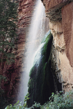
2005 - At Dripping Spring. |
2011 - On the New Hance Trail. |

2013 - Morning clouds in Trinity. |
|
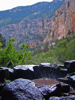
In 2005, I did a hike with my colleagues and family
from NAU down the Hermit Trail to Dripping Spring. [TS, Russell, John &
Kathy, Lena, John H., Erik, Cara Lynn and me.] Here's a great shot
looking across the falling water to the rim. On our way back we
made a stop to visit Sweetheart Spring. I wrote up a full account
here.
In 2011, yet another faculty hike. This time
down the New Hance to the top of the Redwall and back. Along for
this hike, as shown in the picture, are Paul Wagner, John Eastwood and
Tom Downen, in the back, TS & Bev Amer in the middle and me in front for
this selfie. I wrote up a mini-report
here.
In 2013, Bill Ferris and I did a backpacking trip to
Trinity Canyon. On our third morning we started a day hike to find
some of the old remains from a survey crew that had been here in 1919.
Some glorious clouds caught my attention as we began our trek. I
wrote up a full account of this hike
here. |
|
|
|
October 24 |

2013 - Back on the Cheops-Isis saddle. |

2014 - Smoky Shinumo Amphitheater. |
|
In 2013, Bill Ferris and I did a backpacking trip to
Trinity Canyon. We had camped in the bed of Trinity for a couple
of nights. We had another night available, but the water was
really wreaking havoc with my system so this day we hiked up to the
saddle (shown in the photo) and down to Phantom Creek. Ah, much
better water! I
wrote up a full account of this hike
here.
In 2014, I made my way to Lancelot Pt. and down to
the Elaine saddle for a couple of nights so I could try a day hike to
Abyss Cave. This was my first day and on reaching the rim I was
met with a canyon full of smoke from prescribed burns on the north rim.
[See this
link.] The formation in the center of the picture is the Holy
Grail Temple. |
|
|
|
October 25 |

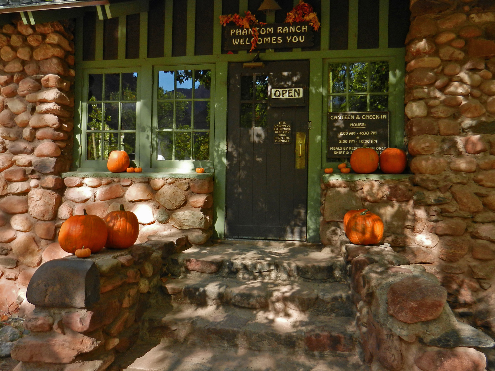
2013 - Almost Halloween at Phantom. |
2014 - Looking up to Elaine Castle. |
|
In 2013, Bill Ferris and I did a backpacking trip to
Trinity Canyon. This day was an easy one as all we had to do was
hike from Phantom Creek to Phantom Ranch. The canteen was all
decked out and ready for Halloween! I
wrote up a full account of this hike
here.
In 2014, I made my way to Lancelot Pt. and down to
the Elaine saddle to camp for a couple of nights. This day I hoped
to be able to day hike down to Modred and the Abyss Cave, but I just
didn't have enough time. Or, I might say that there were lessons
for me to learn about this route that just ate up too much time for me
to seal the deal on the cave. I did make it to the creek, though.
Here is a great shot in the descent canyon, near to the bottom where a
spring appears and provides a nice contrast with Elaine Castle in the
background. |
|
|
|
October 26 |
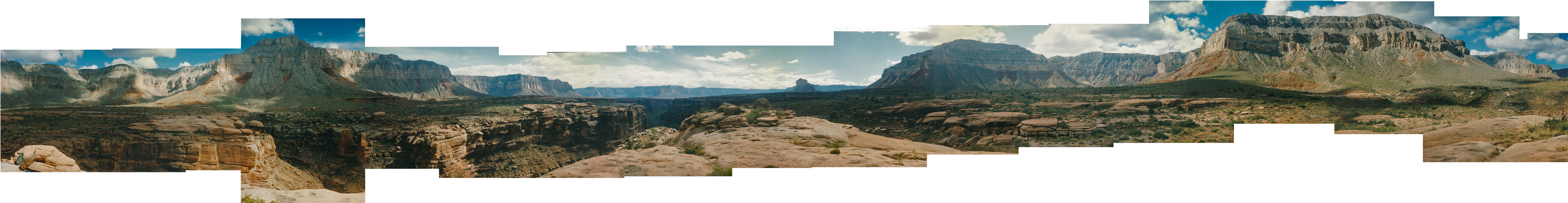
1996 - Panorama at Tuckup Canyon. |

2003 - On the way to East PP. |
2013 - Bill & Bil at the BA Camp. |
2014 - Kaibab squirrel at Lancelot Pt. |
|
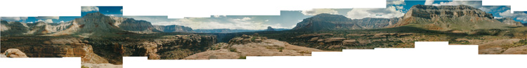
In 1996, Mathieu Brown and I camped above Tuckup so
we could find Shaman's Gallery, a fantastic pictographic panel. I
had been able to pull together clues on its whereabouts, but we came up
empty on this trip (we looked too far downstream). Two months
later I would return and find them. While out on the Esplanade, I
took this series of shots as a panorama of Tuckup. I took one set
of photos and literally did tape them together, and framed them.
This pano was done in Photoshop, but it's not quite 360 degrees as PS
dropped off a few pictures.
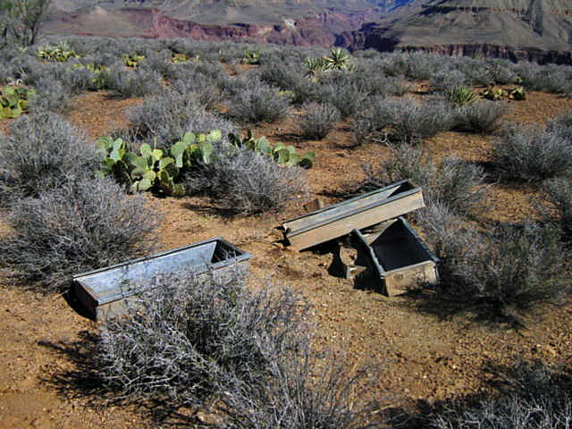
In 2003, I did a day hike to what I call "East
Plateau Pt." with colleagues John Haney, Ken Lorek and TS Amer. We
hiked down the South Kaibab, west a bit on the Tonto and then across the
plateau to the point overlooking the river. Along the way we found
these old troughs. On the side was the faded printing that read,
"Poison Grain." I surmise it was a park service attempt to get rid
of the wild burros back in the day.
In 2013, Bill Ferris and I did a backpacking trip to
Trinity Canyon. This was our final day, with a hike up from the BA
Campground to the rim via the South Kaibab. We were glad to have
had the chance to chat with Ranger Bil Vandergraff the night before and
were pleasantly surprised by an early morning visit from Bil before we
left - he graciously offered to take some of our trash! I
wrote up a full account of this hike
here.
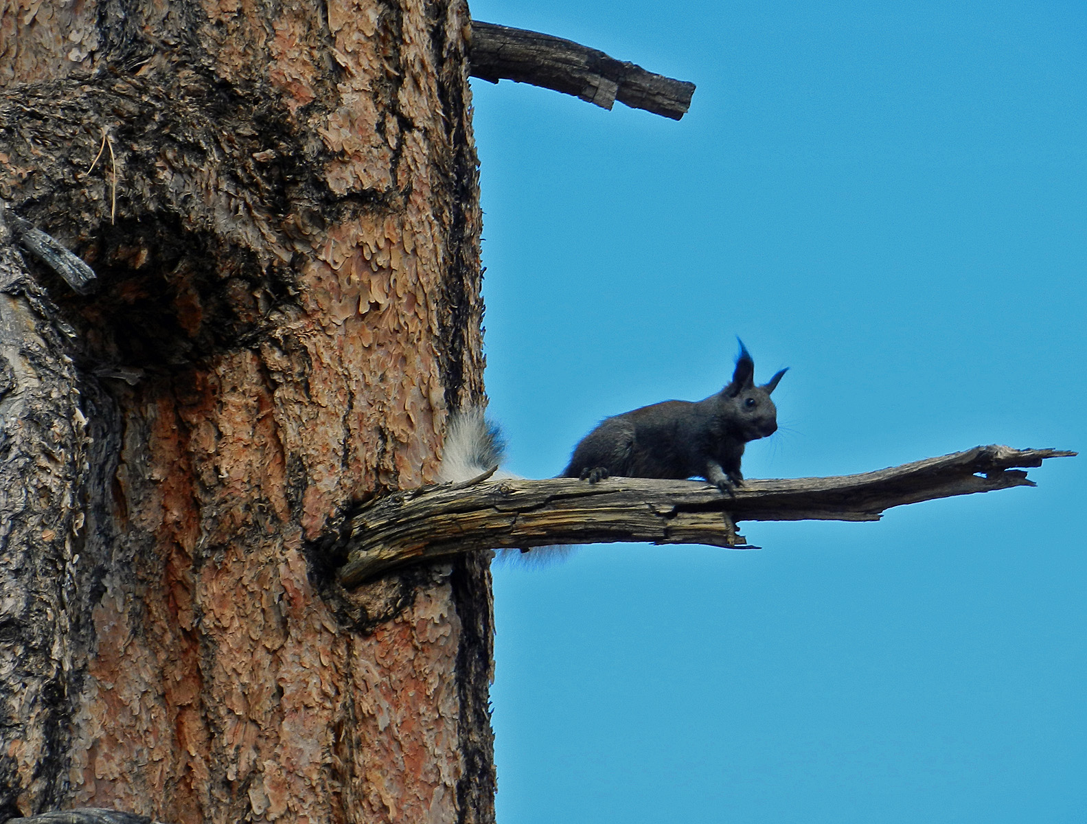
In 2014, I made my way to Lancelot Pt. and down to
the Elaine saddle to camp for a couple of nights. This was my last
day and I hiked back up from my camp on the saddle to the rim and back
to the road. I had a bit of trouble finding the path right away,
but made it up to the Coconino break in good time. Up in the
Toroweap and Kaibab I wasn't sure if I was on the same route as coming
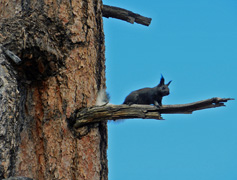
down but I topped out where I came down. There I took a long break
and was treated to the chirping of this Kaibab squirrel.
Amazingly, I was able to cross the north rim back to the road with only
a minimum of trouble - thickets of aspen and/or locust - reaching the
road within eyeshot of my truck. |
|
|
|
October 27 |
2012 - At Sweetheart Spring. |
|
In 2012, with colleagues John Eastwood, Tim Clark
and TS Amer from the business college at NAU on our annual hike.
This year we drove up to a gate in the forest that allowed us to hike
down the Waldron Trail, over to Dripping Spring and up the Silver Bell
(aka Boucher) Trail to the rim and back along the roads to our vehicle.
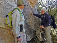
Along the way we made a stop to visit Sweetheart Spring. Here,
John and TS look at an old inscription on the wall - "Harry Kislingbury
'89." |
|
|
|
October 28 |

2001 - After breakfast hike down the BA. |
2007 - Out on Plateau Point. |
|
 In 2001,
Cara Lynn and I did a quick drive up to the South Rim to have breakfast
at the El Tovar followed by a short hike down the Bright Angel Trail to
2 Mile Corner. A nice way to work off breakfast! In 2001,
Cara Lynn and I did a quick drive up to the South Rim to have breakfast
at the El Tovar followed by a short hike down the Bright Angel Trail to
2 Mile Corner. A nice way to work off breakfast!
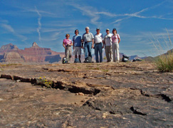
In 2007, our annual faculty hike took us to Plateau
Point and back. On the trip this year were Bev Amer, Brian
Gregory, TS Amer, Allen Atkins, me and Cara Lynn. The canyon was
especially smoky with some burns the park service was doing on the North
Rim. See
here. And, here's a photo I took at the start of the trip
(click for a larger image) ... |
|
|
|
October 29 |
|
|
|
October 30 |

2009 - Above Tanner Rapids. |
|
In 2009 I hiked down the Tanner Trail on a four day
hike with the intent to finally be able to hike up to the Little
Colorado River. I started down at 7:30 am and five hours later I
was at this spot above the river enjoying the view and eating my lunch
before pushing on to camp at Palisades. I wrote up a full account
here. |
|
|
|
October 31 |

2009 - Beamer Cabin at LC. |
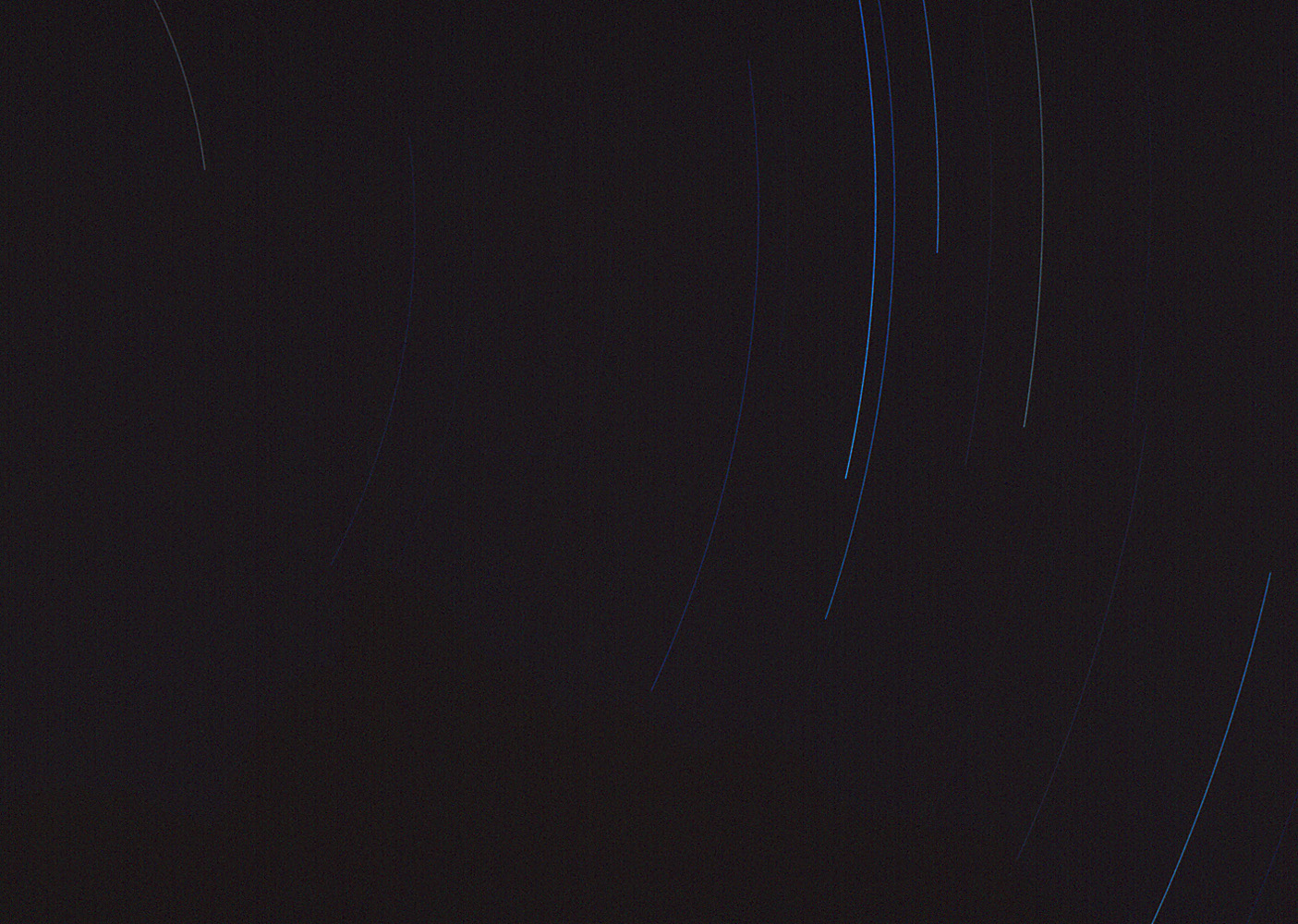
1981 - Star trails from Royal Arch Creek. |

2015 - In Cathedral Wash. |
|
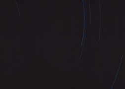
In 1981 I made a hike to Royal Arch after having
been here just ten days earlier. This hike lasted four days. I camped
all three nights in Royal Arch Creek and made day hikes from here.
This was my first day and I took this long exposure at night showing the
star trails across the sky.
In 2009 I hiked down the Tanner Trail on a four day
hike with the intent to finally be able to hike up to the Little
Colorado River. This was my second day and I had a great day hike
to the LC and back. I didn't have time to really go up the LC, but
so it goes. Here is Beamer's old cabin right at the confluence.
Somehow I missed seeing this when Cara Lynn and I were here on our river
trip in 2002! I wrote up a full account
here.
In 2015 I led our annual faculty hike up to the Lees
Ferry area to do two short hikes - one down Cathedral Wash and the other
up the Spencer Trail. It was a fantastic day for these hikes with
TS Amer, Bev Amer, Tim Clark and me. Here is TS making his way
along one of the ledges in Cathedral Wash, and Tim can be seen further
down on the other side. |
|
|