 |
|
|
A Visit
to Mystic Spring; Friday-Sunday, Sept. 29 to Oct. 1, 1995 by Dennis Foster |
|
|
|
|
|
|
|
A Visit
to Mystic Spring; Friday-Sunday, Sept. 29 to Oct. 1, 1995 by Dennis Foster |
|
|
|
|
|
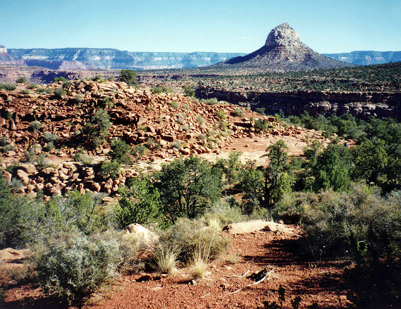
With picture perfect weather and a three day weekend, I decided to make
a quick trip up to the South Bass trail and check out a couple of points
of interest. First and foremost on my list was to search for the lower end of the "Point Huitzil" route,
which connects the South Rim with the Esplanade level. I had read
through the trail logs of Harvey Butchart on this score. He made
many attempts before finding the exact route. Based on his
description, I
thought that it might be easier to locate this route from the bottom
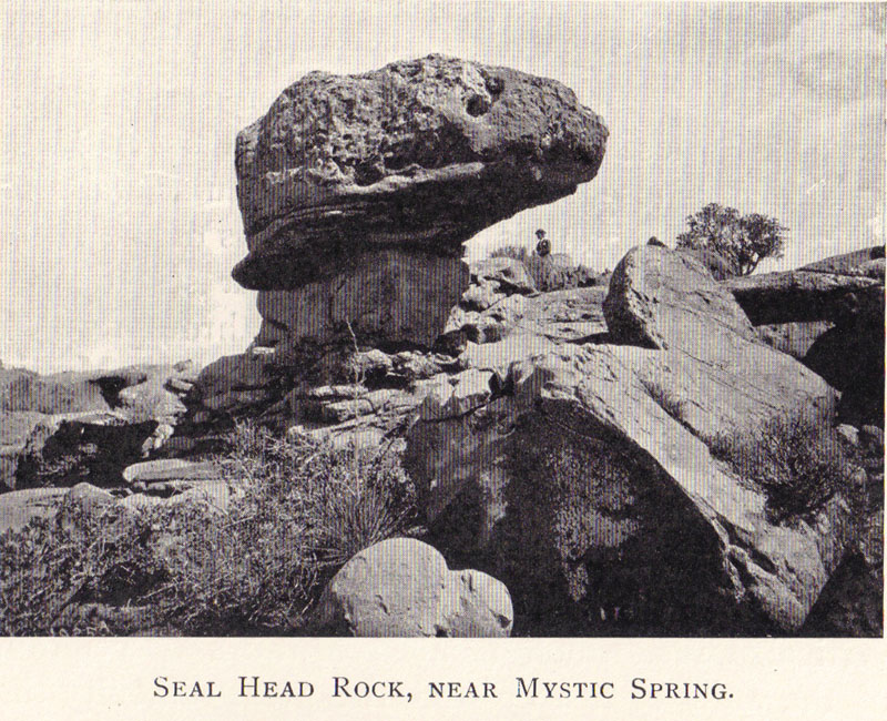
(i.e., the Esplanade) than from the top. Secondly, I wanted to search for Mystic Spring, which had been used by W. W. Bass back in the day. The spring is assumed to be dry today, but may have been rather unreliable even a hundred years ago. In George Wharton James' book, In and Around the Grand Canyon, he wrote (page 154), "Now and again it disappears entirely." James' book, published in 1900, is one of my absolute favorites. [Well, his later book, Grand Canyon of Arizona, is also pretty good.] Harvey Butchart also made a number of attempts to find this spring before success. Eventually, he took along an old photo to help fix the spot. I did the same, copying a couple out of James' book. Day
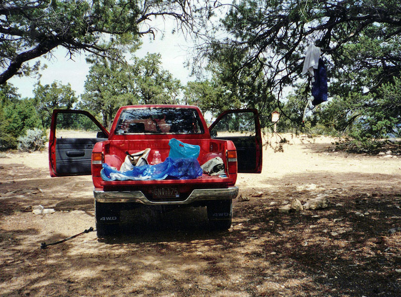
1 (Friday, September 29, 1995): I left my home in Flagstaff at about 7 a.m. and
was on the South Bass trail four hours later. The 30
miles of dirt road got progressively worse and worse as I neared the
rim. The last 5-10
miles were especially slow. I brought along my microcassette
recorder for trail notes and a complete transcription appears below,
although parts were obscured by the wind. |
|
|
||
 |
 |
 |
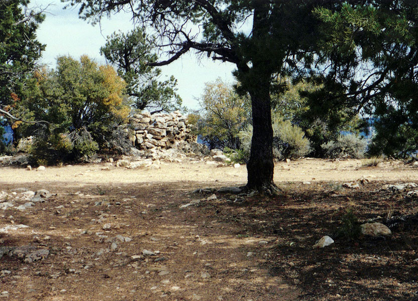
| Stone house remains at Bass. | Indian ruins above Coconino. | Note ruins on ledge to the right. |
|
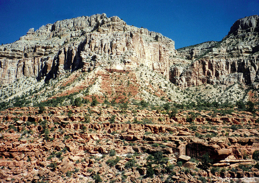
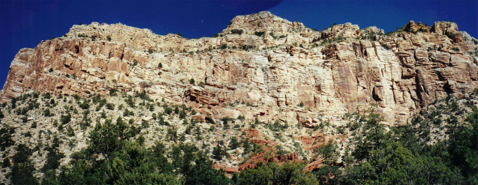
There is a trail along the Esplanade and the junction was
well-marked. I have followed it many times and it does get fainter
and fainter as you get further away from the the South Bass. I
decided to hike along here for just about ten minutes and stop for
lunch. Then, I packed up my fanny bag and left everything else here as I
went looking for Mystic Spring. It is located on the other side of
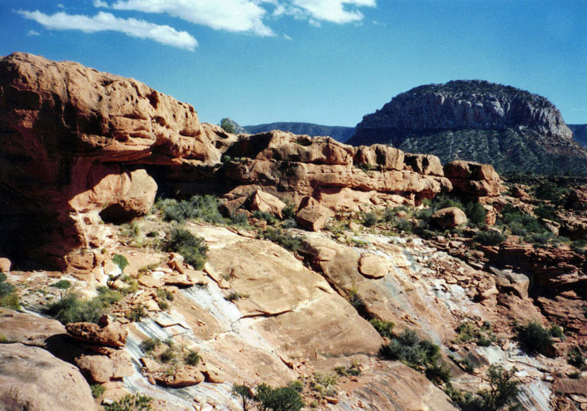
Mount Huethawali and I will have to return to this spot to continue on
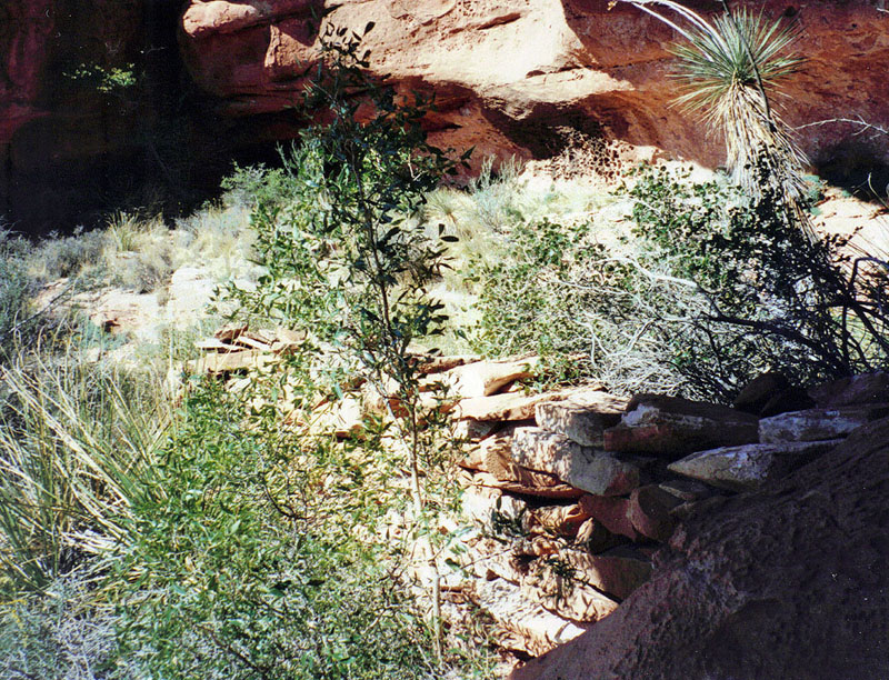
to find a camping spot closer to the Pt. Huitzil route. I decided to contour around Huethawali along the east side, even though the spring more properly is on the west side. But, I wanted to follow the trail for as long as possible. That worked out pretty well, although I had to backtrack when the trail started down the cliff, in order to continue along on a more suitable level. While Mt. Huethawali seems like a big scoop of ice cream (well, to me, anyway), that is actually an illusion. It it quite narrow, making this contour go pretty quickly. As I crossed Huxley Terrace, I got a glimpse of Spencer Terrace, where Mystic Spring is located. As I got to the area of the spring, I was afraid that I would have to climb down quite a ways. But, the spring is very near to the Esplanade level. No wonder it is dry now! It's hard to imagine what is going on geologically to have created a spring out here on this rather isolated terrace. But, I spotted the famous "Seal Head Rock," that appears in James' book. I can't say it really looks like a seal, but it does look like a head with an eye. It only took me an hour to get here from my lunch spot. It didn't take me too much longer to locate the spring area. I matched up photos with James' and poked around a bit. There was a bit of a retaining wall that looked like it would create a floor, perhaps for a tent structure. There is also a little tunnel here, although I didn't bother to poke through it. I found a pick axe and few old cans laying around. But, the spring was bone dry. I got to wondering why Bass used this site - it is certainly not on the way to anywhere! I did notice that you can see a piece of the river from here. I suspected that it would serve as a good place to bring tourists - a short trip from the rim, water at the site and views of the river. So, when I returned, I decided to review the story James tells in his book and the following passage speaks to the fact that this site was used by Bass before he had a trail all the way down to the bottom of the canyon. I gather that Mystic Spring was, for some time, the destination of Bass' forays into the canyon:
One of the unusual things I found here were some droppings that appeared to me to be from wild burros. There was a huge effort to remove these burros from the canyon in the early 1980s (see this article, and if you have the time peruse this collection at NAU). So, are there still some out here? I am pretty sure I saw some in this area in the late fall of 1981, which was after the roundup was over. |
|
|
||
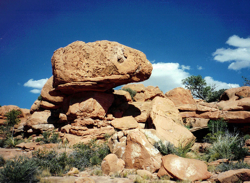 |
My
picture of Seal Head Rock, taken in 1995, and the photo that appears in G. W. James' In and Around the Grand Canyon, published in 1900 and appearing on page 153. Note that in his photo there is someone standing in the background! |
 |
|
Click on the composite photo below (or, any photo) to see a larger image. |
|
|
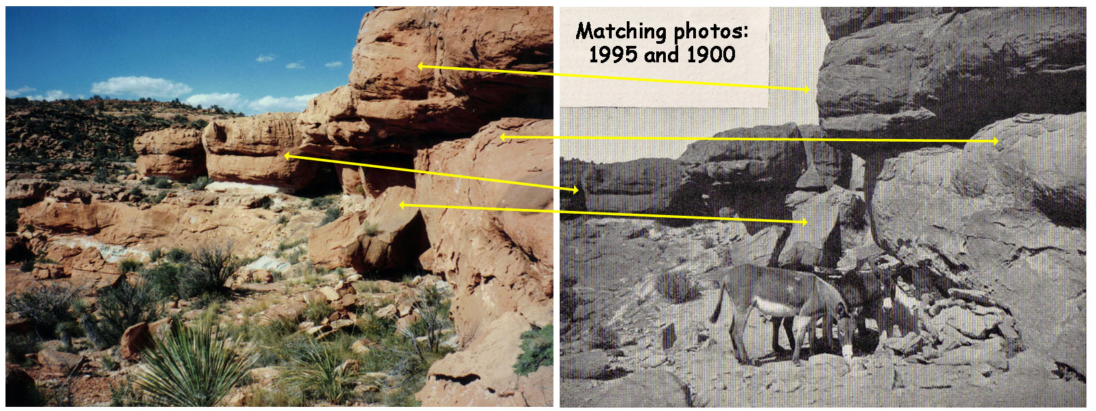 |
| My
photo from 1995 and a copy of the one from G. W. James' book (In and
Around the Grand Canyon, 1900, p. 155). The shadows are so similar that it appears that by coincidence I happened to take my picture at the same time of day as did James! The caption on James' photo reads, "Burros drinking at Mystic Spring." |
 |
 |
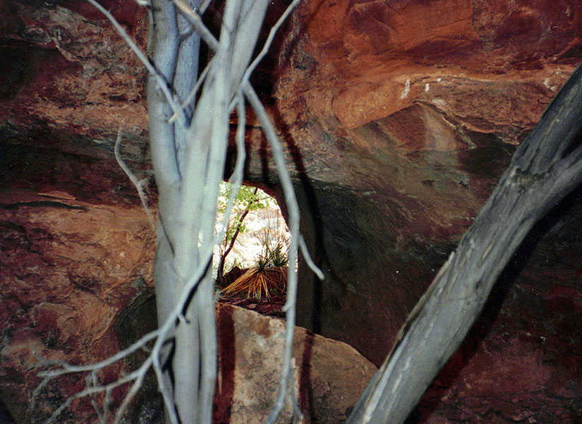 |
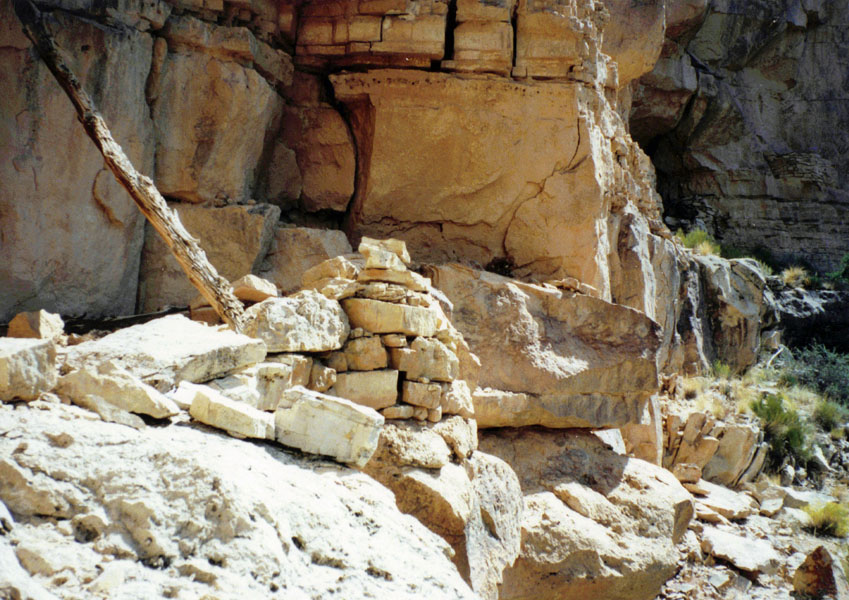
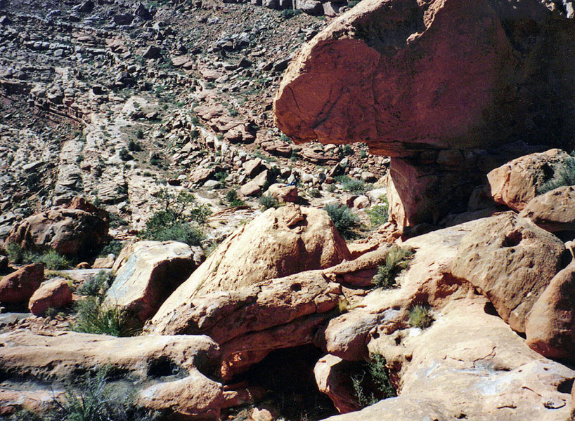
| From behind Seal Head Rock. | Wall that creates a floor of sorts. | The tunnel. |
 |
 |
 |
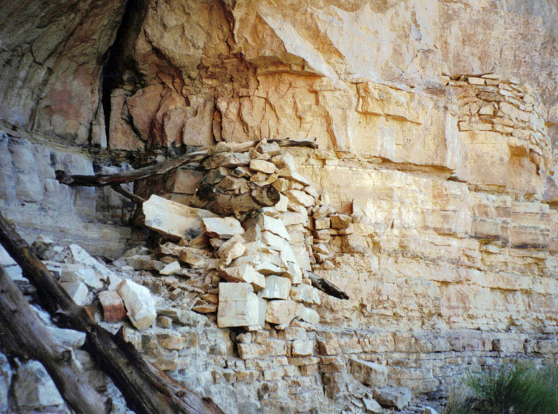
| Mystic Spring & Mt. Huethawali ... | ... matches the photo Butchart used. | Mt. Huethawali from the trail. |
I
poked around the spring area for about a half hour and, at 3 p.m.,
headed on my way back to the trail and my pack. I decided to
continue contouring around Huethawali, so this little excursion took me
all the way around it. It took about fifteen minutes to hike back
along Spencer Terrace to a point where I could begin to contour in
earnest. 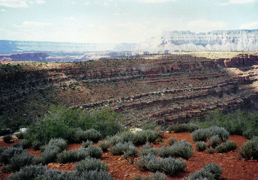 Along the way I passed two mescal pits, side by side with
one another, which seems unusual. By 4 p.m. I was back on the Bass
trail. The going was straightforward, if not as easy as coming
around the east side. Ten minutes later I reached my pack and was
soon ready to push on to a camping spot. Along the way I passed two mescal pits, side by side with
one another, which seems unusual. By 4 p.m. I was back on the Bass
trail. The going was straightforward, if not as easy as coming
around the east side. Ten minutes later I reached my pack and was
soon ready to push on to a camping spot.It took me an hour and a half to reach a suitable place to stop, below Toltec Point. I chose this because I needed to get water and the only sure source I knew of was the Chemehuevi Spring, located in the canyon just to the east of Toltec. It was almost 6 p.m. and I rushed to assemble my empty pack and some water containers so I could be on my way to make this water run. It only took me ten minutes to hike back to a spot where I could start up this side canyon. The seep spring is at the base of the Coconino at the very end of this little bay. I picked a route and climbed up to the cliff. I wasn't sure which way to go, so I went right. That was wrong, so I came back left and found the seep and a small pool of water. There was a pipe here, but I thought I had once seen a metal trough here as well (back in the 1980s). While I had thought to collect a lot of water and bring it back to camp for processing, because of the small amount in the pool, I decided to pump it directly into my water containers. I started at about 6:40 p.m. and finished up 25 minutes later. My trek back down was pretty miserable, with me fighting through the brush all the way back to the trail. I didn't get back to camp until almost 8 p.m., weary and ready to finally make dinner. Day
2 (Saturday, September 30, 1995): I missed my alarm
and didn't get up until 7 a.m. It was cold enough to be wearing my
coats, but once the sun reached me, it was quite pleasant. The
skies were blue and it looked like it was going to be a good day. By 9:30 a.m. I
was on
my way. I carried my regular pack with food and water. Then,
when I reach a place to leave the trail and head up to find the Huitzil
route, I'll break it down into just what I need to carry in my fanny
bag. |
|
|
|
|
|
|
| Day 3 (Sunday, October 1, 1995): I was up at 5:30 a.m. and on my way a bit past 7:30 a.m. I was able to start back with two liters of water, which was my intent. So, the water I was able to get at Chemehuevi turned out to be all I needed. In two hours I reached the South Bass trail and at about 10:30 a.m. I reached the rim and the parking area. A half hour later I was ready to head home. When I got to the boundary road, I decided it might be worthwhile taking it back to the Village, to avoid the badly rutted route I had come in on. It still took an hour and a half to reach the dirt road near Rowe Well. At times I had to get into 4WD to get through some spots. I noted that the road to Eremita Mesa was now blocked off. |
|
|
||
 Chemehuevi Spring. |
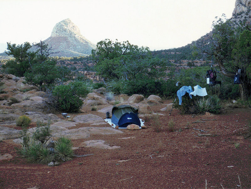 My campsite & Mt. Huethawali. |
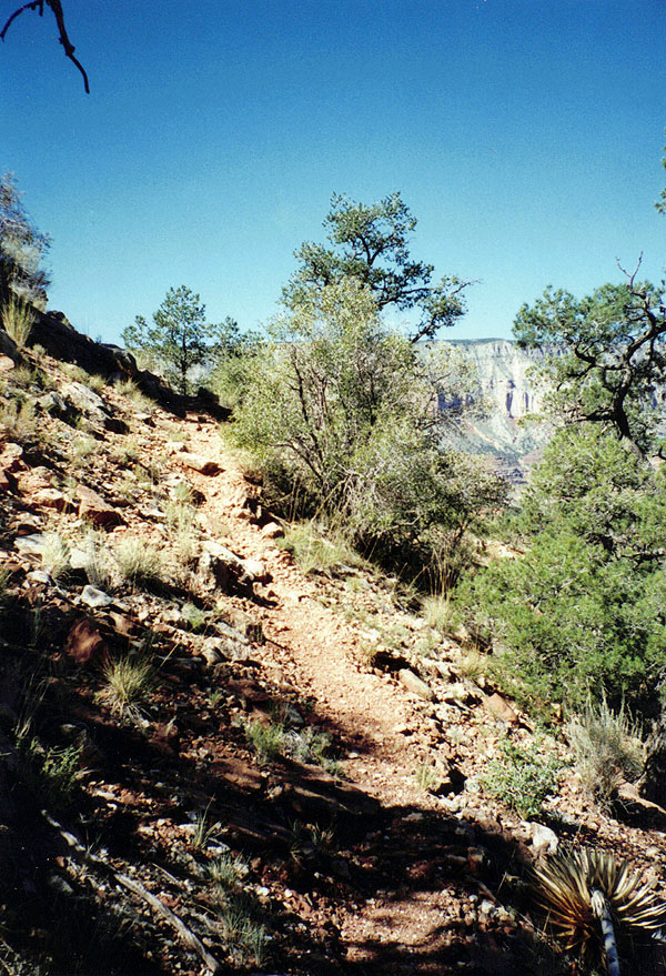 The trail along the Esplanade is in pretty good shape through this section of the canyon. |
 Looking across the Esplanade. |
 Packing up to leave. |
|
| Postscript - I did (as noted above) finally find the Point Huitzil route and have been through it a few times. One of those hikes has already been posted up as Pt. Huitzil to the South Bass Trail Day Hike, which I did more than ten years after this hike! |
|
|
|
Appendix
- Micro-cassette Transcript [Tapes 7b & 8a] Point Huitzil route.
It is Friday September 29th, [1995] and the weight of my pack is 44 pounds. It's 7 o’clock and
I’m just about to leave the house. My mileage reads 26,057.2. It’s 8:59, and I am
on the road to the Bass trailhead. It is about five miles along
the road from Moqui to the road that leads to Pasture Wash. And, I have
just reached that point right now. I left there at about 8:48. It is 10:17, and I’m
at the trailhead. The mileage reads 26,175.4 and it has been about
thirty miles since I left Moqui lodge and also that would be about an (hour and twenty minutes or) hour and a half. So quite a while.
The last 10-15 miles is pretty slow out here. There isn’t
anybody else out here. There was a vehicle parked right at the
boundary gate, but on the other side. So, it may be that I won’t
see anybody for this whole trip. It is 11:04, and I am
all set to head on down the trail. It is a very nice day.
Very pleasant. It was perfectly blue skies when I came here and
still to the south that’s true; and overhead. There are some
clouds, however, over the canyon and the weather forecast was for some
possible afternoon thunder storms. So, those may be building up. It’s 11:35, and I
have stopped just above the break through the Coconino to check out some
of these Indian ruins here in this spot. Maybe get a couple of
photographs. So I’ll be here for a little while. It is 11:57. The ruins
that are here are up above the trail, to the left of a point which is
pretty easy to identify, because there’s some barbwire and it’s still
hooked up to some of the trees and some old poles - here it’s to
fence off this spot from keeping the stock from wandering up or down.
And there are three sites there that I got a close look at and got some
photos of. The ridges up above me, (before the) up above where I
am, that’s before this point, turned out to be just places where the
deer wander but no flat enough spots for some sites to have been built.
And so I am on my way. It is 12:35. I am
at the trail junction on the Esplanade. The rock cairn with the
tree root that Harvey talks about is no longer here, but the junction is
well marked with rocks lining the path going in each direction here for
a piece. So, real easy spot to figure out. It’s still
pretty nice. The breeze has kicked up a bit. The clouds have
been rolling in, but still a lot of blue sky, so very pleasant.
Pleasant going so far. I did hear some hoots from up above when I
was coming down through the Coconino so somebody has reached the
trailhead and perhaps will be hiking down. I do want to take a day
hike out to Mystic Springs and it sure seems that I’m going to have to
come back to this junction to stay atop of these Supai Cliffs so I’m
just planning to hike back along here for about ten or fifteen minutes
and stop and have lunch, pack up some water, and then head on back for a
day hike. It’s 12:41, and
I’ve reached the spot that I think is nice enough for lunch and so
I’ll think over my options here. It is 1:17, and I’m
all through with my lunch and have packed up my fanny bag to go look for
Mystic Springs. I will allot a little bit of time here to do this
so that I can get back and get back on the trail here and get a campsite
and get some water tonight. So, it’s not definite that I’ll
make it. So, on my way. It is 1:37, and I have
just reached the part where the trail descends down into the canyon,
here over the edge of the Supai cliffs. So, I am backtracking a
little bit because I am somewhat below where I would like to be as I
contour around Mount Huethawali and it looks like I can pretty much just
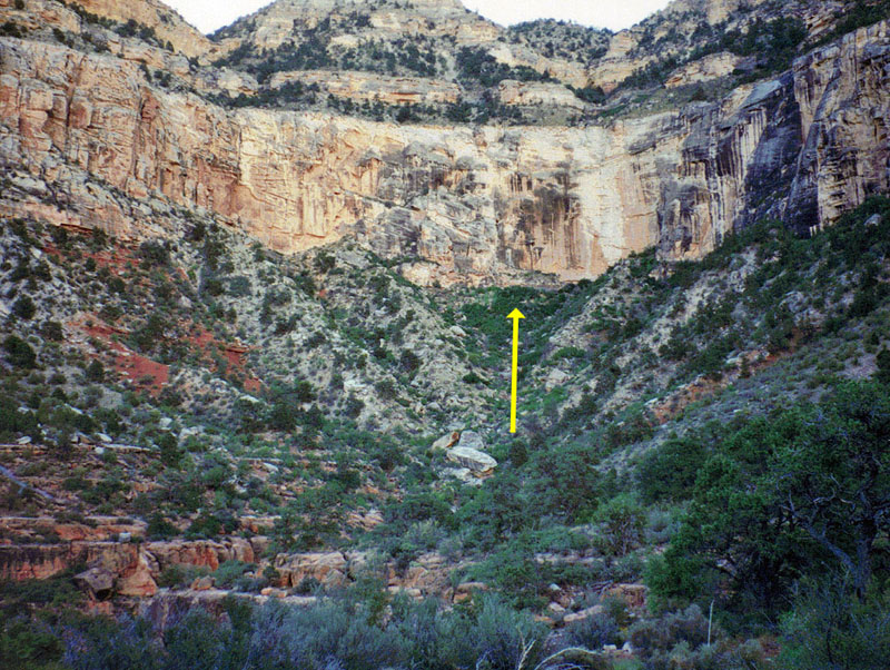
pick a spot head on up and then start contouring around. I’ve
decided to follow the trail as far as I could, as Harvey mentions coming
around the east side and then the north side of Mount Huethawali.
And, so, that it what I’ll do to try to get to Mystic Springs and then
I’ll decided about whether I want to just keep coming around when I
come back. It is 1:51. I
have just contoured around to the north side of Mount Huethawali and it
is (very nice trip, it is) a very nice trip. While it looks like a
big round mountain from the Bass trailhead, it’s actually a very
narrow one. So while it seems that it’s going to take quite a
while to contour around it, it actually goes very quickly. I got
up through the cliffs easily enough. I was able to keep an angle
and pick and chose some spots to keep working my way up here to really
the bottom of the Hermit shale. It is reasonably level – hilly -
but easy enough to walk along. And the vegetation is rather sparse
so the going is really very quick and very easy. I have just passed the
part that leads out to Huxley Terrace and have Spencer Terrace in my
sights and I’m heading over for that. It is 2:36, and I am at
the Seal Head Rock. I slowed down as I got closer to where I
thought this would be and stopped even and reread Harvey’s notes and
managed to work my way down. It is very close to the Esplanade
level. It seems that you might have to go through many, many cliff
levels to get to a seep spring but this is mighty, mighty close.
So anyway I have reached the Seal Head Rock. I recognized the tell
tale eye in it from James’ picture and right behind it is the little
bridge that Harvey mentions that is hardly more than just a few feet off
the ground. It is 3 o’clock, and
I’m heading back. I am just near the Seal Head Rock on my way
out of here. And I can see a piece of the river from here.
It is a piece that is just having gone around the bend, around
(monument) Explorers Monument. It is a little breezy and very
pleasant. The sky is mostly clear. A few clouds off on the
sides but nothing impinging on me, and it has been very comfortable
hiking. I found a pick axe at the campsite but I didn’t see any
the [pails?] Harvey mentions. I also found a couple of old tin
cans laying around and there were a couple of walls that did appear to
be forming some kind of a [level/elevated?] floor system there under
that overhang to make that a more reasonable kind of campsite.
There was absolutely no water at the seep. The ground was bone
dry. The little tunnel was very amazing that lead to an opening
that these three or four trees were growing out through. Quite an
interesting place, all things considered. I am still puzzled
though, as [wind obscures words] as a place as a campsite that you
can’t get anywhere from here. You have to turn around and go
back unless it was to bring people to the one site where you can
actually see the river, although [wind obscures words] a little bit out
of the way, considering as how you can go down [wind obscures words]
Now, back to find a campsite. It is 3:18, and I have
reached pretty much the beginning here of Spencer Terrace. And
I’m going to start contouring around to the west. It looks
like it should be pretty easy going. Right here at this spot, at
the base of some rather large Supai boulders, that form the vestige of a
higher level (as they) as that level disappears heading down to the
terrace, there are two very large mescal pits that I passed on the way
in. Very interesting kind of site. These two pits are side
by side which makes them even more interesting. It is 3:58. I am
back on the trail. Contouring around the west side of Mount
Huethawali was pretty easy. The walking [quat?] wasn’t as open
as it was going along the east side, but I didn’t have to do any of
the contouring along narrower sections as I did between Huxley and
Spencer Terraces. The key to contouring that side is to hop the
saddle between Mount Huethawali and a small hill to the west, that is
pretty visible. And that will make that a pretty short trip.
As I was coming back here towards the trail, I saw a rock cairn and
headed for it, but ended up at the top of a cliff. It may be that
there was a break somewhere in there. I continued along the cliff
for a piece until I hit a rather big ravine and I used it to work my way
down through the first couple of cliff levels and then I continued to
contour over towards the saddle here between Garnet and Bass. And
so I have caught the trail once again. The trail is a little bit
below the high point on the west side of this saddle. So it seems
that I could have found another break here where I could have come down
that ravine and headed more or less straight across here and then
climbed up to the trail as well. So on to my pack. It is
still a very pleasant day. Just a little warm when the breeze
isn’t blowing, since the sun is shining quite bright. But, all
in all still very nice. And the sky is blue. I can see a
small crescent moon overhead that will be kind of nice to deal with for
a couple of days. It is 4:08 and I am
just passing through the “Y” junction. Just a short ways down
the trail before reaching the “Y” there’s a mescal pit that the
trail goes right through the edge of, so very easy to spot. It is 4:11 and I am
back at my pack. So what a nice afternoon trip. I’ll be
here for a few minutes repacking and having a little bit to drink before
heading on. It is 4:28 and I’m on
my way. It’s 5:50, and I’ve
reached a campsite at the point here - Toltec Point - on a little saddle
between the trail and a rocky hill. I’m going to try to get
things set up and organized in the next ten minutes and then make a run
back to get some water. It’s 7:56 and I’m
back at my campsite. It seems like every night I get home late.
I left at 6:05 and got over there pretty quickly - in eleven minutes -
then started climbing. I picked a ridge that looked like I couldn’t be too
far wrong from the seep. And, the going was pretty slow in some
places, in climbing and things like that, and I pretty much gave up the
idea of bringing down a big bucket of water. I just didn’t think
it would work out. And I got up to near the bottom of the Coconino
and I couldn’t tell which way to go, so I went to the east since that
was rather close. There was nothing there, under that overhang.
So then I went to the west which really is the very heart of the ravine
here. So it isn’t off to the side it’s really right there.
And I got up to the seep and there was just a little bit of water in the
pool. I didn’t see the trough, I thought I had seen one once
before. The pipe is still there and the pools seem to only have an
inch of water in it so rather than try and scoop it out, I decided to go
ahead and pump directly into my water bag and my water bottles.
So, I did that and left. I got there at about 6:40 and I left at
7:05. It was dark. Coming down was just awful. A lot
of brush to fight with at first. Eventually, of course, got down
to the bottom and coming along the trail back to camp turned out to be
pretty easy. So quite a trip to get some water. I hope I
have enough for the rest of my trip. It is a little breezy, but it
feels pretty nice. The moon is out, but the stars are very bright
too because the moon is only about a quarter, or so, and shining on the
Coconino walls of Chemehuevi Point makes for quite a nice view, quite a
nice vista here tonight. [Crickets in the background.] *
* * * * * * * * * * * * * * * * * * * * * * * Saturday, September
30th. It is 9:25. Last night I got to bed about 9:30.
I didn’t feel too much like eating, but I did fix my noodles and
managed to eat about half of them before giving in to sacking out.
At about 12:30 I woke up and decided to finish my now very cold noodles.
Still it was quite tasty at that time. I was a little bit restless
sleeping. I had this strange kind of continuing dream that I was
teaching people how to backpack in a Microsoft Windows environment.
It was all very confusing. Still the night was cool. A
little breeze occasionally, and the stars were out so that was very nice
viewing over the course of the night. In the morning I didn’t
hear my alarm go off and I woke up when the sky was getting kind of
bright at about 7 o’clock. The spot I have here gets the sun
very late in the morning. In fact, just about as late as you can
out here without being deep inside one of these ravines. The sun
comes up over the highest point on the rim here from where I’m camped,
so it wasn’t until some time after about 8/8:30, that the sun really
started to hit the campsite. It was quite cool in the morning.
I was wearing both of my coats, although once the sun did poke out, it
has warmed up to be very pleasant. It is a clear blue sky. I
don’t see a single cloud anywhere. It is cool and pleasant.
No breezes yet and so now I’m on my way over to the Point Huitzil
route. I have decided to pack up quite a few things in my regular
pack, including about four liters of water and will hike to as far as I
need to go along the Supai and then break that down into my fanny bag
for hiking up through that route. This way I can decide to eat
lunch either on the Supai or up higher and I can bring plenty of water
so that I’m not going to have to worry about trying to carry all that
water just on my fanny bag. I seem to have plenty of water.
I’m sure I have enough for today and as long as tomorrow morning I got
a couple of quarts when I leave then I’ll have just enough (to)
retrieved at Chemehuevi seep for this particular trip. So now
it’s on to along the Supai here to see what I can see. This
morning I read through Harvey’s notes on this particular route and I
am hopeful that I’ll be able to catch some of these breaks that he was
writing about. It is 11:32. I am
in the bed of the drainage here that runs between Montezuma and Point
Huitzil. And it has taken quite a while to get here. I was
thinking it might be just an hour but after an hour I was just barely
beginning to start contouring around Montezuma Point, which is quite a
big point to contour around. I thought I had lost the trail for a
bit, but I picked up some trail, maybe it was a different trail, but it
was cairned. And it lead along kind of a narrow ledge here into
this ravine where I found that I could drop down and then it looks
pretty easy to climb back up to the other side rather than continuing to
contour back into this area. So I stayed at that level for a bit
as I saw a couple of overhangs that looked like they might be the ones
Harvey mentions but they didn’t pan out. And from down here I
can’t tell what overhang he was looking at so perhaps as I get up I
will be able to better judge that. I saw what looked like his
route down through the Coconino. It seems that it was kind of easy
to identify a spot where the rappel would be but that has gone out of
sight as well and I’ll be able to see that as I get up to the top of
these cliffs. It is 12:27. I
had a rather pleasant lunch here and rested for a bit and am now headed
up. I have decided to pack up my fanny bag and just take that from
here on and I’ve hung my pack up in a tree. It should be a
pretty easy spot to catch coming back since the overhang that I was
checking out is rather prominent right here and there are some rock
cairns right in the bed here to either indicate a way to cross or a way
to go down the creek bed. So on to check out this route. It is 12:58 and I’ve
climbed up to the sort of flat high part here in the Esplanade in front
of Point Huitzil and am crossing a big mescal pit so the first signs
here that I’ve got of the Indian usage. Now I’ll continue
around the point and look for the route. It is 1:47. I am
at the base of the Coconino at what appears to be the right spot to
catch the bench that Harvey mentions that comes up above a little Supai
drop or rather a Hermit shale drop off. I have been along the base
of the Coconino her for a little bit, checking out (four different)
three different (sites) possible routes on my way to this spot.
And each one had some kind of a drop in it that looked impassible.
From further away I could see this route and it looks like there’s a
tricky spot part way up here but that may be where Harvey talks about
the Moki steps being located so hopefully that will work out pretty
well. So I’m stopped in the shade of a tree here, have a little
water for a moment, and then head on up. It’s 2:23, and I’m
on my way back to camp. I climbed up a little bit in the Coconino.
I followed this shelf here for a bit, climbed up pretty nicely, but then
I reached a spot that was rather exposed, was kind of a drop about three
or four feet drop down to a little ledge and then a five or six foot
drop below that to another bench. And I just didn’t like the way
it looked. So I looked at it for a while, but then I came back and
picked up my bag and am now headed back. It may be that those
ledges are what Harvey refers to as the Moki steps although they were in
the side of the wall not along a smooth sloping surface. I did
check out two or three other possibilities for getting through that spot
- nothing really went. The spot where I was there was a little
detached rock, or a big detached rock, with an opening behind it that
you could pass through to the other side right above this drop and
that’s as far up as I got. It is 3:35, and I’m
back in the creek bed where my pack is hanging up. I rested for a
few minutes at the top of the cliff here before coming down in.
The rock cairn I left on protruding rock is a quite noticeable landmark
for the walk up through that last part. And I reread Harvey’s
notes about the overhang and took a little closer look around here.
I’m going to try to walk up the creek a bit to see if I can see
anything and if not then I’m going to head back out at this level and
there’s a big flat area in the next side ravine that might be where
the mescal pits he mentions are located. If so, then that would be
the site of the overhang. It is 4:20, and I am
all set to leave. I spent about a half hour walking up the creek
bed here and then coming back along a ledge to check out this one
overhang that I could see a bit from where my pack was. But
nothing doing, so now on around this level into this next big ravine.
Maybe we’ll see something there. It’s 4:52. I am
back on the trail. I followed that level I was on into the next
bay and didn’t really see anything there. I also went up and
contoured around a bit over into the next area too, but that really
seems too far from where Harvey (thought he, where Harvey) saw the
(ruins, or) the mescal pits and the overhang. So I’m thinking
maybe it was really further up the creek or at a little bit higher level
than where I was on the creek bed. So perhaps at another time.
I came up a ravine at a spot that looked kind of familiar. I kept
coming up it until I was able to see the trail and then catch that.
So now I’m headed back to camp. It’s 6:14, and I am
back at the camp. The sun set on me about 6 o’clock. The
Kaibab cliffs at the very tip top here are still getting just a little
bit of sun. The moon is about a half moon. And looks like it
will be a little bit bright here for a while. But it’s nice to
be back. It was clear all day long. Not a single cloud to be
seen and still not a cloud to be seen. It has been very still as
well and actually very warm during the day in the sun. So I
don’t know if that means it’s going to be cold at night but at least
if it’s still, it should be pleasant that way. Well now to
relax, unwind, have some water, fix some dinner, and go to bed. *
* * * * * * * * * * * * * * * * * * * * * * * Sunday, October 1.
It is 7:36 and as soon as I put on my pack I will be leaving this very
nice campsite. I got up at about 5:30 so it has been two hours.
It was very still last night, very pleasant. Not as cool, I
don’t think, as the night before. I got up at twilight and fixed
breakfast, got all packed up and so everything is going along pretty
well. It’s a little cool. The sun still, of course,
hasn’t come up here. But I am anticipating a very nice hike out. It is 9:23, and I’m
at the “Y” junction. I had to make a stop for about 12 minutes
along the way, but otherwise time has been pretty good. I left my
camp this morning with exactly two liters of water - just what I wanted
to have. So that worked out well. I had to husband my water
a bit, in terms of washing dishes and brushing teeth, but still I ended
up drinking more than half a liter before I set out, to leave me with
the two I have left. Well, it has been a wispy, cloudy, kind of
day. Looks like it might be building up a bit, but very pleasant.
I’ve only been in the sun here for the last 20-30 minutes and that
hasn’t been bad either. It is 9:57, and I’m
at the top of the Coconino. It’s 10:28 and I’m
back at the top. I counted the switchbacks coming up. Once
you come up above the little cliff, up above the Coconino, there’s
only one set of switchbacks and they occur rather quickly.
Otherwise the trail just angles up and up and up and up and up to the
top. It is 11:10, and I am
all set to go. The cloudiness has thickened up quite a bit.
So much so that it actually looks rather threatening. There is a
van here. I think it’s a sort of a VW type and I had heard a
noise I thought coming from the rim on the way up, a hoot or something.
So, it may be that it’s somebody here just for the day. Although
they haven’t been around since I’ve been here. Anyway, it’s
been a pleasant hike. My shower went really well. It’s
cool but very still, so that helps a lot. And so I feel pretty
good. Now on to the highway and off to visit Sue on the way home. It is 11:37. My
mileage reads 26,179.1 and I am at the boundary road and I have decided
that I’m going to take it. At least right here it isn’t rutted
like the regular road is and even though I remember it being rocky
further on I think this will probably be a better way to get back to the road.
Of course this way I'll end up on Rowe Well Road and end up driving
through the Village rather than cutting across over to Moqui. It is 12:13 and I am at
the spot I believe where the road goes off to Jicarilla Point, since
there is a road here. And I have come about five miles along here,
so about half way. I picked up the boundary fence here not too
long ago. And the road has improved noticeably since then.
So, my travel time here has picked up quite a bit. Anyway onwards. It’s 1:08, and I’m
back on the Rowe Well Road. Quite a trip there along the boundary
road. Many places where I had to get in the four wheel drive and
use the low transmission speed to get up over places. A couple
places I even had to put it into four wheel drive. And after I
passed the Eremita Mesa turn off, which is now blocked off, I ended up
having to drive through three rather large puddles. So, I got some
mud splattered on me. Going from here should be pretty easy. It’s 1:32, and I have
just have left Moqui after filling up with five gallons of gas. |
|
|
||
|
|
Return to Hiking Grand Canyon home page |
|