|
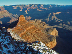
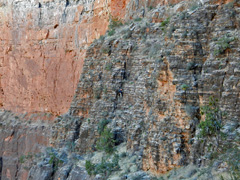
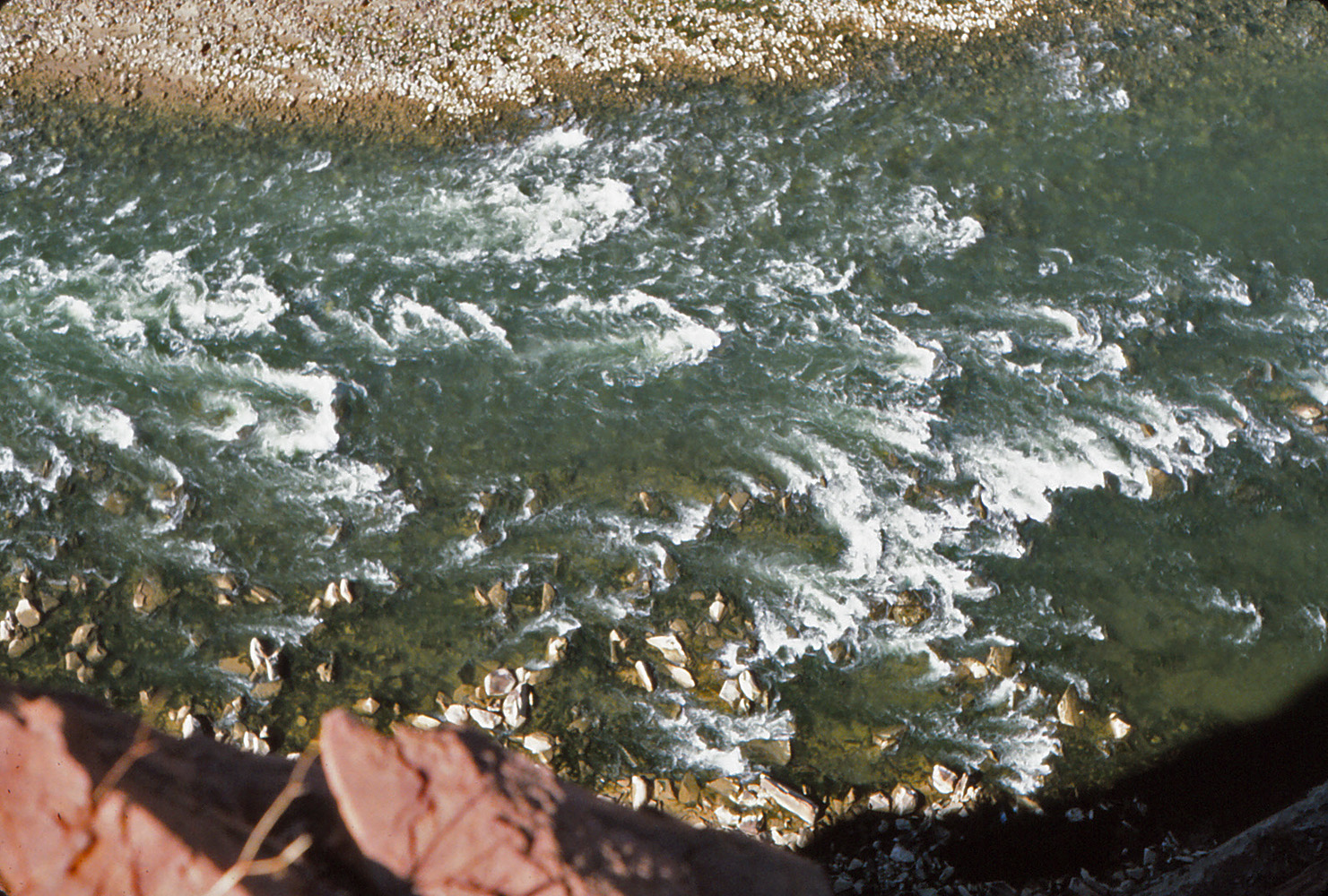
February 1 |
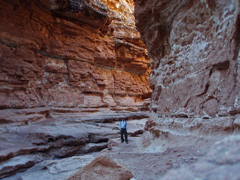
2009 - In the narrows of Cathedral Wash. |
|
In 2009 I decided to scoot up to Marble Canyon and do a hike
I had only read about down Cathedral Wash to the river. Not a soul
around and the fact that you start on the plateau and wend your way into
this narrow canyon rather quickly is very cool. On this day it was
actually cold! And, I made it back home in plenty of time to watch
the Super Bowl. [The one the Cardinals lost :-( unfortunately.]
I wrote up a fuller account of this hike
here. |
 |
|
February 2 |
|
|
|
February 3 |
|
|
|
February 4 |

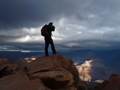
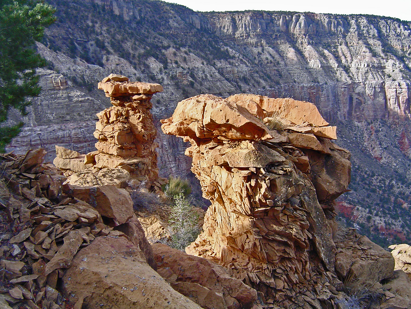
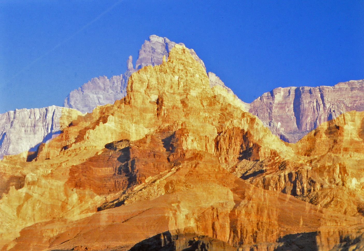
2006 - Toroweap towers on Pt. Huitzil route. |
|
In 2006 I went up the to South Bass area with John & Kathy
Eastwood, Mark Pebler and one of Kathy's astronomy students, Keith.
John, Mark and I got dropped off at the abandoned Pasture Wash Ranger
Station to do a looping hike to the South Bass trailhead via the Pt.
Huitzil route, spending most of our time trekking along the Esplanade.
Great fun. One of the landmarks for navigating this route are
these two squat towers in the Toroweap layer. It was an all day
affair and the three of us had on our headlamps for the final push up
the South Bass. There we found that Mark's vehicle had gotten a
flat and no amount of effort could free one of the lug nuts. So,
the five of us returned to Flagstaff in my Toyota Xtra Cab - talk about
being packed in like sardines! The next day - Super Bowl Sunday -
I drove Mark back up to get his truck (he had to use a patch kit as a
temporary fix). I got back home just in time to see only the very
last play of the big game :-(, between the Steelers and the Seahawks. I wrote up a fuller account of this hike
here. |
|
|
|
February 5 |
|
|
|
February 6 |
2009 - Bill Ferris on the South Kaibab. |
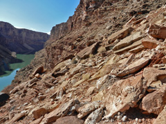
2013 - Sketchy slopes in 6 Mile Draw. |
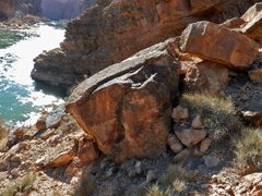
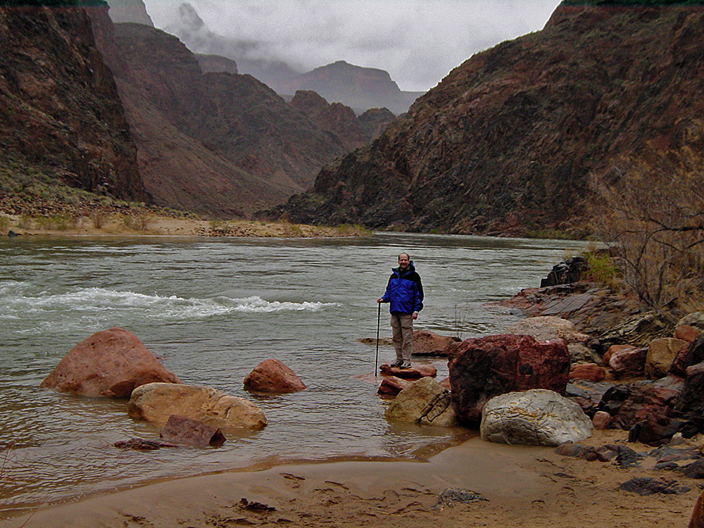
2013 - Downriver from Cathedral. |
|
In 2009 Bill Ferris and I did a day hike down the South
Kaibab to the Colorado River and back the same way. We stopped at
the picnic table near Bright Angel Creek for our turnaround point, not
going all the way to the ranch. It was really dark in the early
morning as you can tell from this photo of Bill snapping some pictures
from Ooh Aah Pt.
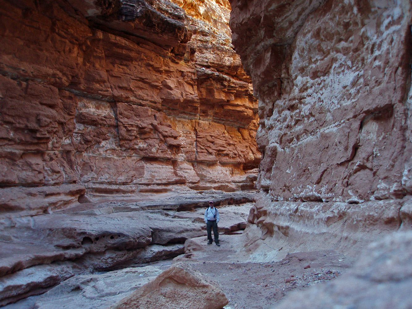
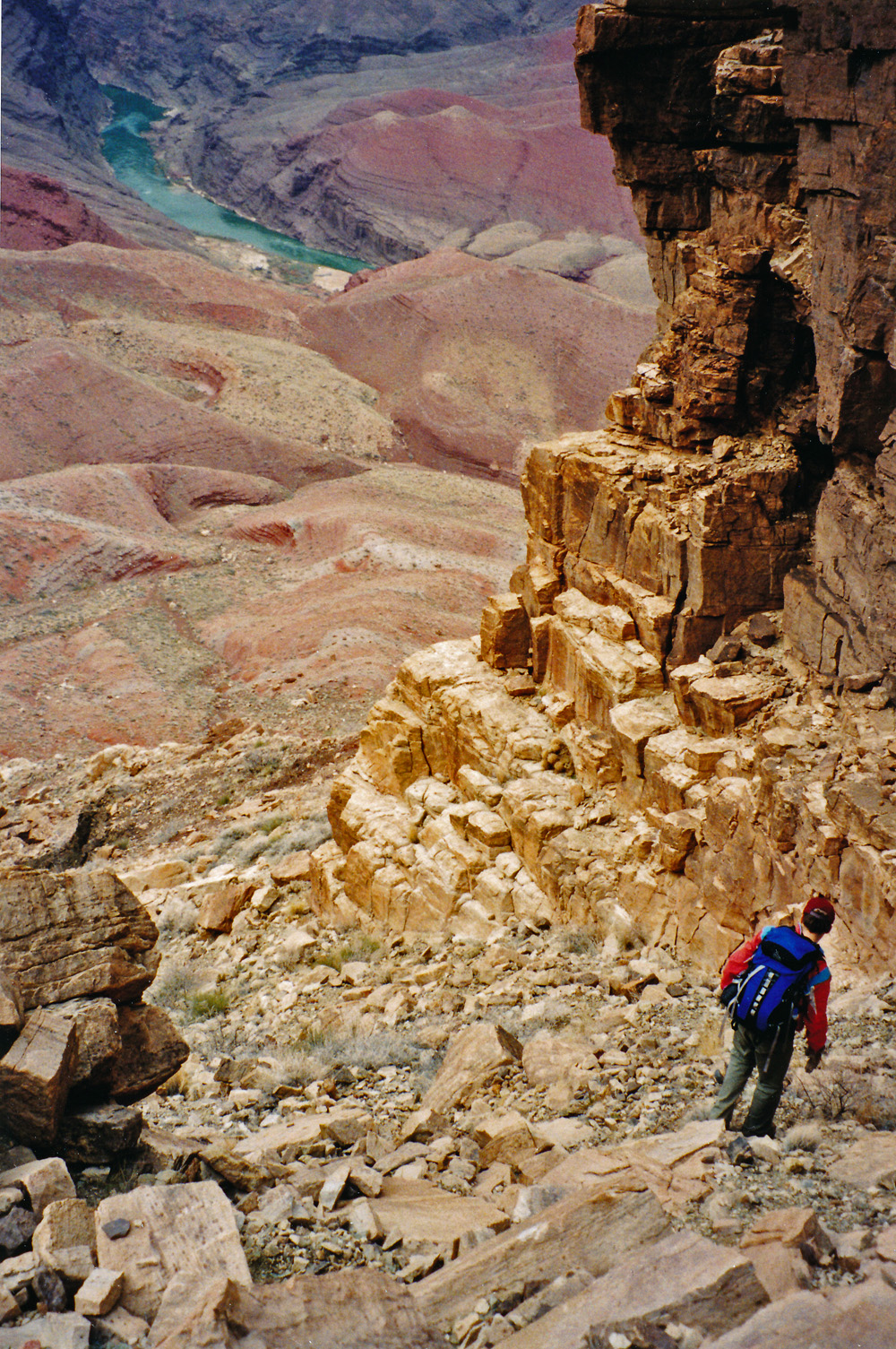
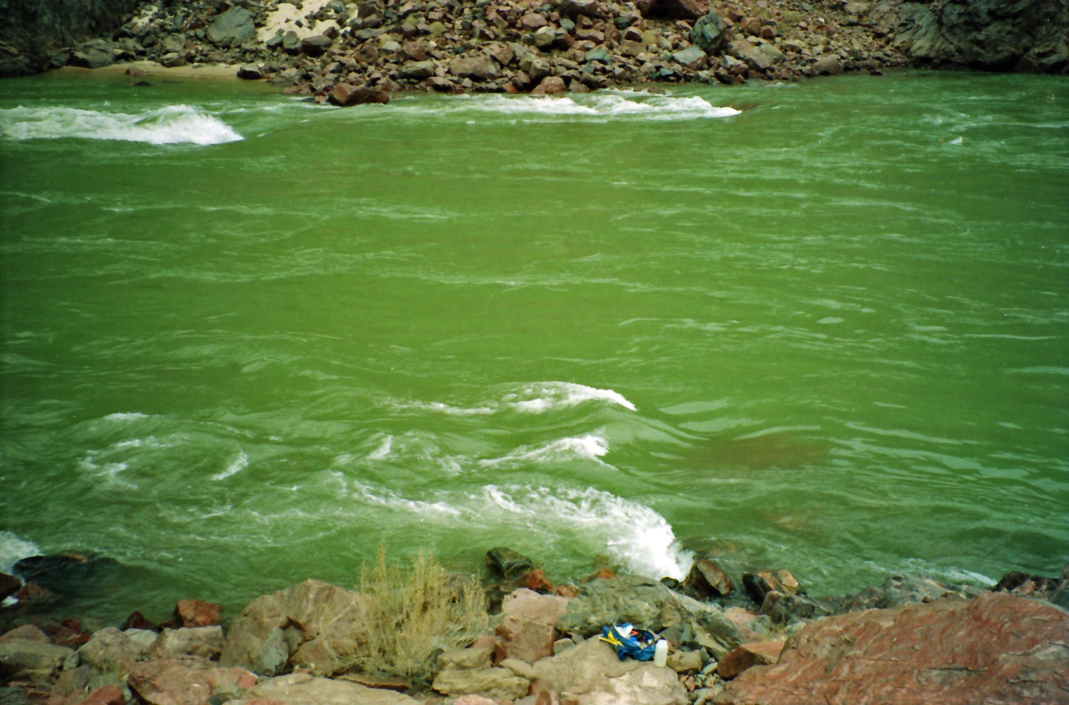
In 2013 I was trying to do some loop segments in Marble
Canyon. This day I started down the so-called 6 Mile Draw which
comes out to a sheer cliff over the river. I started following a
steep route on the upriver side, heading for a slope that would take me
to the river. But, I soon gave up over this precarious slope; the
photo is looking back to the draw, to which I returned. A fuller
account is written up
here.
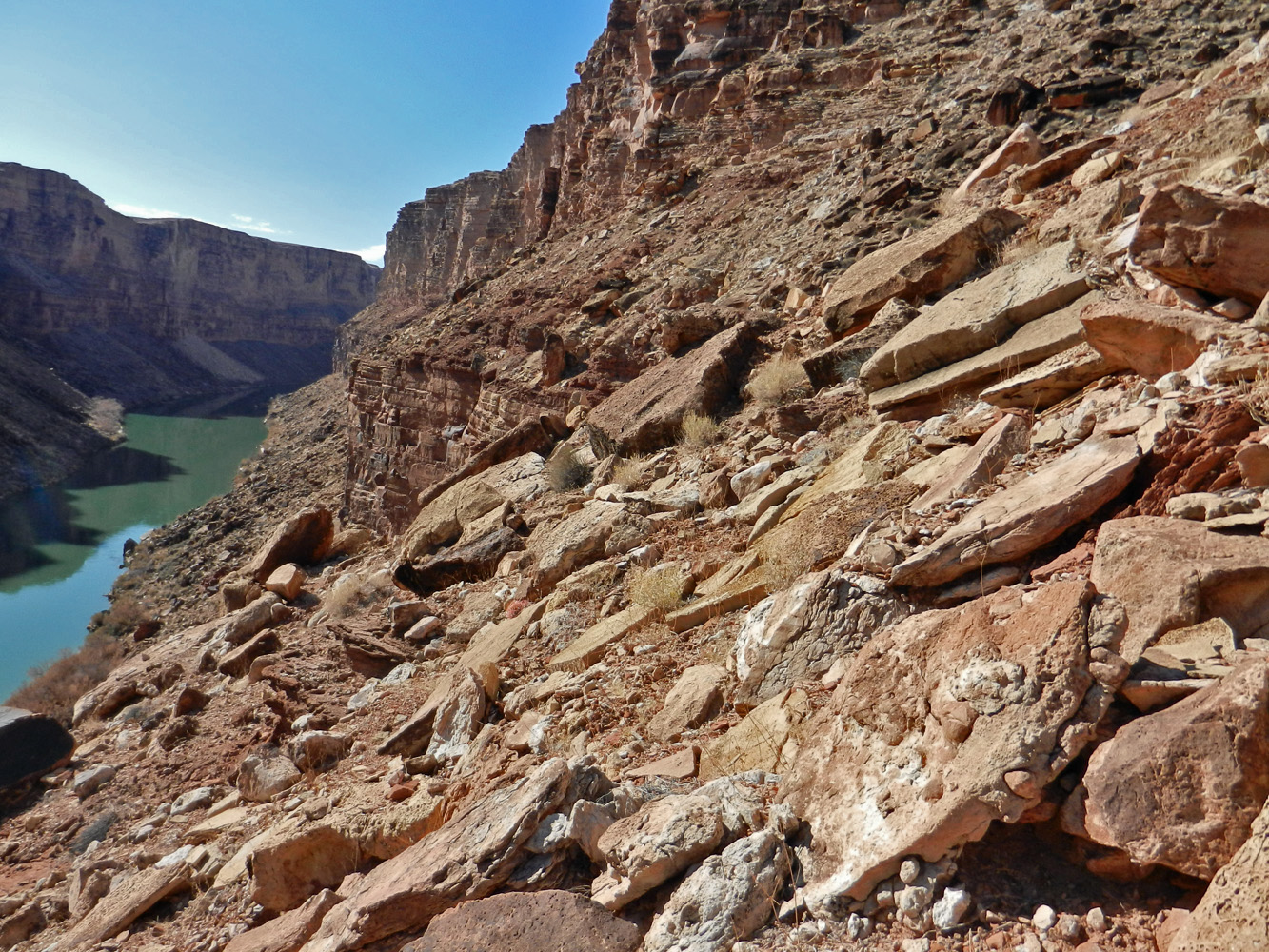
In 2013 I was trying to do some loop segments in Marble
Canyon. In the morning I was stymied in 6 Mile Draw, so in
the afternoon I drove up the road and hiked down Cathedral Wash. I
followed down alongside the river to find a spot referred to as a
"wall." This photo shows my furthest progress. I did not get
past the knob that sticks out into the river and I think the wall is
just beyond this. A fuller account is written up
here. |
|
|
|
February 7 |
|
In 1981 I hiked down to the Bright
Angel Campground where I would spend a couple of nights. [No photos.] |
|
|
|
February 8 |
|
In 1981 I had hiked down to the Bright
Angel Campground where I would spend a couple of nights. This was my
second day and I hiked up to Utah Flats and over into Phantom Creek.
From there I continued north until I could follow a talus slope down to
the creek and cross over to the North Kaibab Trail and return to my
camp. [No photos.] |
|
|
|
February 9 |
2008 - O'Neill Butte along the South Kaibab Trail. |
|
In 2008 I did a day hike down the South Kaibab Trail to the
river. I literally only crossed the Black Bridge and after a short
rest turned around and came back up to the rim. I was on the trail
at 7:30 am, reached the other side of the bridge at 10:15, took a
fifteen minute break and was back on the rim at 2 p.m. Six and a
half hours for this round trip to the river - not bad!
In 1981 I hiked down to the Bright
Angel Campground where I spent a couple of nights. This was my
last day and I hiked back up to the rim. [No photos.] |
|
|
|
February 10 |
|
|
|
February 11 |
|
|
|
February 12 |
|
In 1984 I hiked down the Grandview Trail with Karen Herrera.
We spent two nights camped on Horseshoe Mesa. This was our first
day and we hiked down to a camp site. [For some reason I have no
photos for this day nor do I have any journal notes.] |
|
|
|
February 13 |
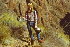
1984 - Karen Herrera with coffee pot on the Old Grandview Trail. |
|
In 1984 I hiked down the Grandview Trail with Karen Herrera and we
camped for two nights on Horseshoe Mesa. This was our second day
and we did a day hike down to Cottonwood Creek and then out on the Tonto
and down the Old Grandview Trail to the river. In the old, but
well-constructed, section through the Tapeats we came across this old
coffee pot. Below this, the "trail" became a barely discernible
route and for years I wasn't sure we had actually followed the right
route to the river. I don't know how we did this trek to the river
and back in a day, in the middle of winter, but, alas, I did not keep
any journal notes to remind me! |
|
|
|
February 14 |
1998 - John Eastwood on route to Cardenas Creek. |
|
In 1998 John Eastwood and I did a day hike down the Tanner
Trail. The rim was snowpacked and it took us quite a bit of time
to locate the trailhead! While above the Redwall we left the trail
and hiked up to the Escalante-Cardenas saddle and then headed north to
an easy route down through the Redwall. From here we had to find a
narrow break in the Tapeats - the photo shows John after we got through
that spot. We got to the river and ate a late lunch as the weather
took a turn. From here we bushwhacked our way over to the lower
stretches of the Tanner Trail and hiked up in the rain which soon turned
to snow, reaching the rim late at night. We were in the midst of a
big storm and the drive back to Flagstaff took many hours.
In 1984 I hiked down the Grandview Trail with Karen Herrera and we
camped for two nights on Horseshoe Mesa. This was our last day and
we hiked back up to the rim. I recall that it had snowed
overnight, but I have no photos for this day. |
|
|
|
February 15 |

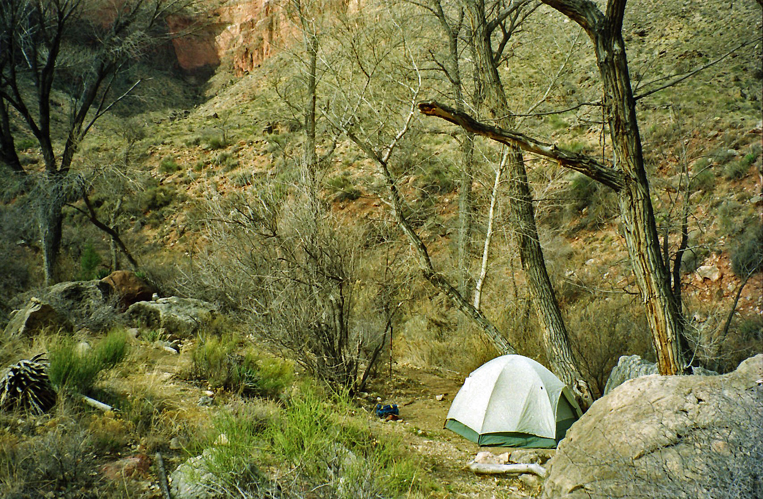
1991 - Camp at Cottonwood Spring. |
|
In 1991 I did a three day trek down the Grandview Trail.
I camped for two nights at the little spring in the side canyon to
Cottonwood, as seen in the photo. I used to camp at this spot
quite often - it is all by itself, next to water (at least, back then)
and away from the trail. As you can see, this is my roomy 3-man
tent; quite the luxury for a solo hike! |
|
|
|
February 16 |
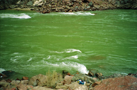
1991 - At the foot of Sockdolager Rapids. |
|
In 1991 I did a three day trek down the Grandview Trail.
I camped for two nights at the little spring in the side canyon to
Cottonwood. This was my second day and I did a day hike down to
the foot of Sockdolager Rapids, shown here with my fanny pack sitting on
a rock. There is an old trail that goes beneath the Tapeats and a
steep rock-filled ravine that leads to this spot north of Horseshoe
Mesa. |
|
|
|
February 17 |
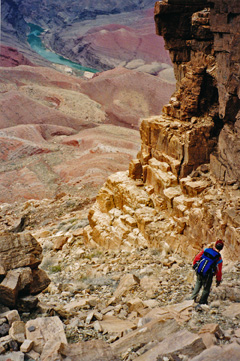
2013 - Chris Atwood climbing down from Tse-An-Kaetan. |
|
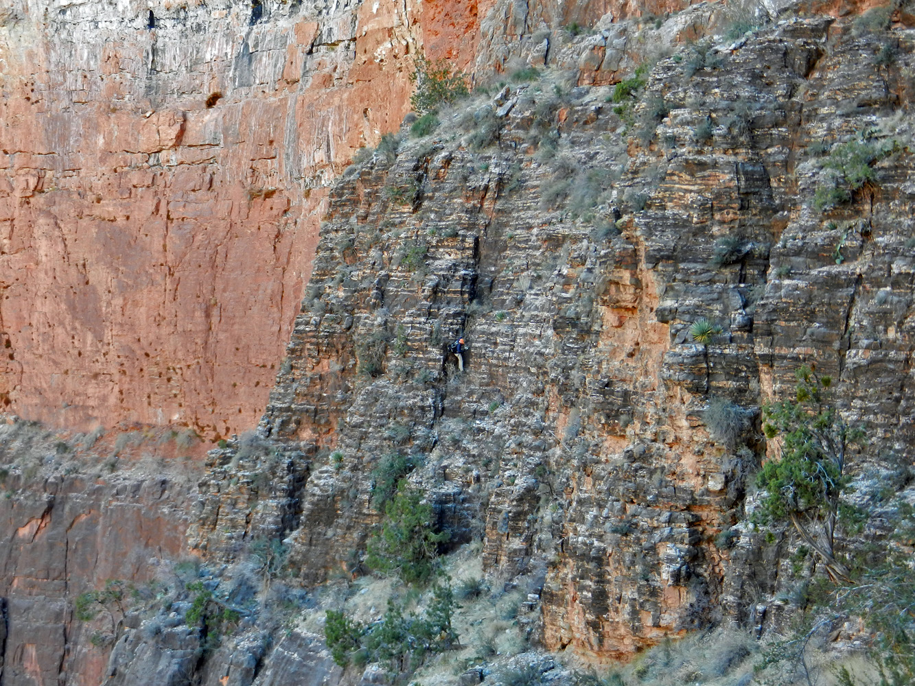
In 2013 Chris Atwood and I did a day hike down the South
Kaibab Trail. We were headed into Cremation Canyon and decided to
try for Tse-an-Kaetan, a cave where some ancient split-twig figurines
had been found. We located the cave and I was sure I'd never get
into it. But, after climbing up to it, Chris tied in a long piece
of webbing to an anchor spot and came back down (as shown in the photo)
to borrow my pen so he could sign into the register. With the
webbing as security I made the climb too and got the chance to poke
around in this fantastic cave.
In 1991 I did a three day trek down the Grandview Trail.
I camped for two nights at the little spring in the side canyon to
Cottonwood. This was my last day and I hiked back up the Grandview
Trail. [No photos.] |
|
|
|
February 18 |
|
|
|
February 19 |
|
|
|
February 20 |
|
|
|
February 21 |
|
|
|
February 22 |

1981 - Comanche Pt. ... beside itself. |

2004 - John at Pipe Creek Rapids. |
|
In 1981 I did a hike down the Tanner Trail, camping for two
nights at the river. This was my first day down. By accident
my film jammed, yet I got this cool picture that is double exposure of
Comanche Pt.
In 2004 John Eastwood and I did a day hike down the Bright
Angel Trail - here is John at the river. It was a cool day, lots
of clouds and with some occasional light rain. We were in search
of the lower portion of a route that would lead up to the Tonto west of
Pipe Creek. On an earlier hike we had come down that route but got
cliffed out a hundred feet above the BA Trail. We came up empty on
this trip, but on the way back we did hike the original Devil's
Corkscrew as we ascended back to Indian Garden. [A few months
later I was able to do this interesting route - see
here.] |
|
|
|
February 23 |

1981 - Unkar Rapids ... from 400 feet above! |
|
In 1981 I did a hike down the Tanner Trail, camping for two
nights at the river. This was my second day and I hiked over to
the tall cliff above Unkar Rapids. At about 400 above the river, I
had to literally crawl out to the edge to take this picture looking down
on the rapids. From here I hiked up the Cardenas drainage and
somehow managed to get to the base of the Redwall and follow a route to
the Escalante-Cardenas saddle and return to camp down the Tanner Trail. |
|
|
|
February 24 |

1981 - On the Tanner Trail. |
|
In 1981 I did a hike down the Tanner Trail, camping for two
nights at the river. This was my last day and I hiked back up to
the rim. This photo is from a spot looking back at a section of
trail below the Redwall with the river in the background. |
|
|
|
February 25 |
|
|
|
February 26 |
|
|
|
February 27 |

2000 - Hmm... the view from Plateau Pt. |

2009 - The Vermilion Cliffs. |
|
In 2000 I did a day hike down the Bright Angel Trail to
Plateau Point just to enjoy the weather. I was the only one at the
point while there and I took some photos like this that I think made for
a nice contrast.
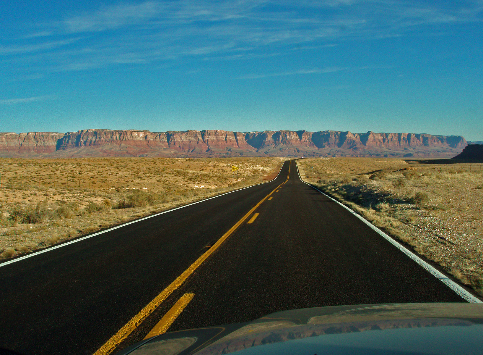
In 2009 I drove up to the North Rim to get to Crazy Jug.
The snow on those roads stymied me from getting any closer than about
five miles from the rim. But, I got this nice shot of the
Vermilion Cliffs while I was on my way up. |
|
|
|
February 28 |
|


