|
December 1 |
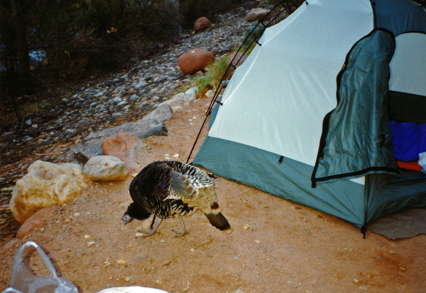
1990 - Bright Angel turkey at my camp. |
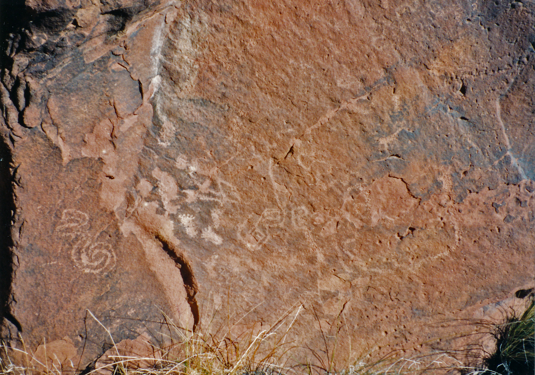
1994 - Petroglyph rock in Nankoweap. |
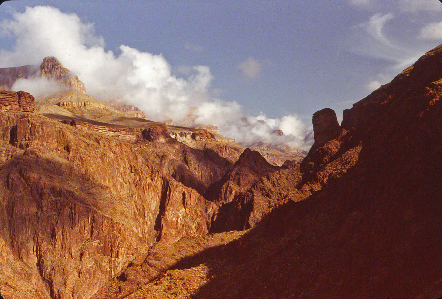
2012 - Near the river on the South Kaibab Trail. |
|
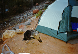
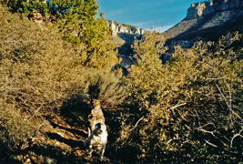
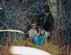
In 1990 I hiked down to the Bright Angel Campground
to spend two nights. This was my second day and I day hiked up to
Utah Flats and around to the Cheops-Isis saddle where I climbed part way
up Cheops. It got spooky for me and I turned back. I didn't
take many pictures, but here is one from the morning at my camp site
when this turkey was scrounging around for food. Note the big tent
- back then I would often bring my 3 person tent on solo hikes just
because I liked having all that space!
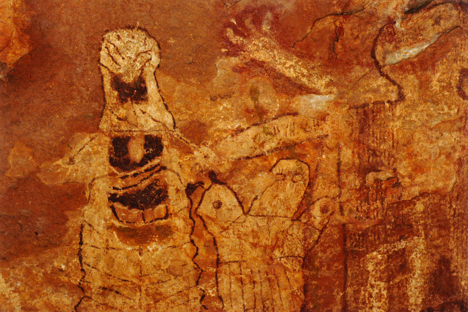
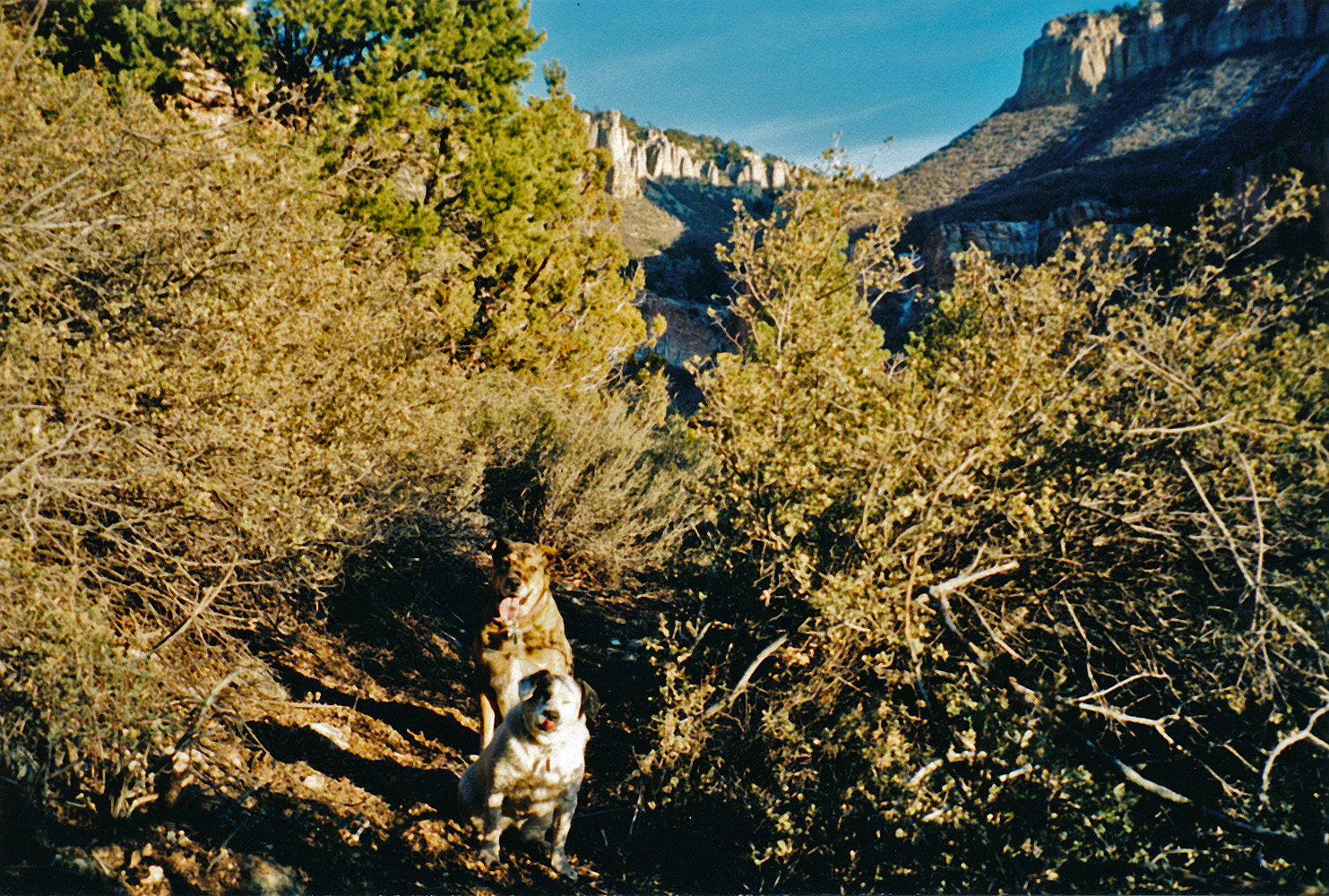
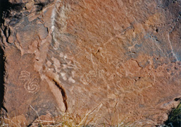
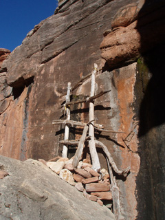
In 1994 I hiked down the Nankoweap Trail to spend
four days in the canyon. This was my second day and the first day
of day hikes from my base camp where the trail meets the creek.
One of my objectives was to find this petroglyph rock which is nearby a
multi-room ruin on a terrace in the middle of this area. I
continued up towards Mystic Falls but turned back just past the junction
with the Marion-Seiber arm. Very little water in the bed and
mostly frozen!
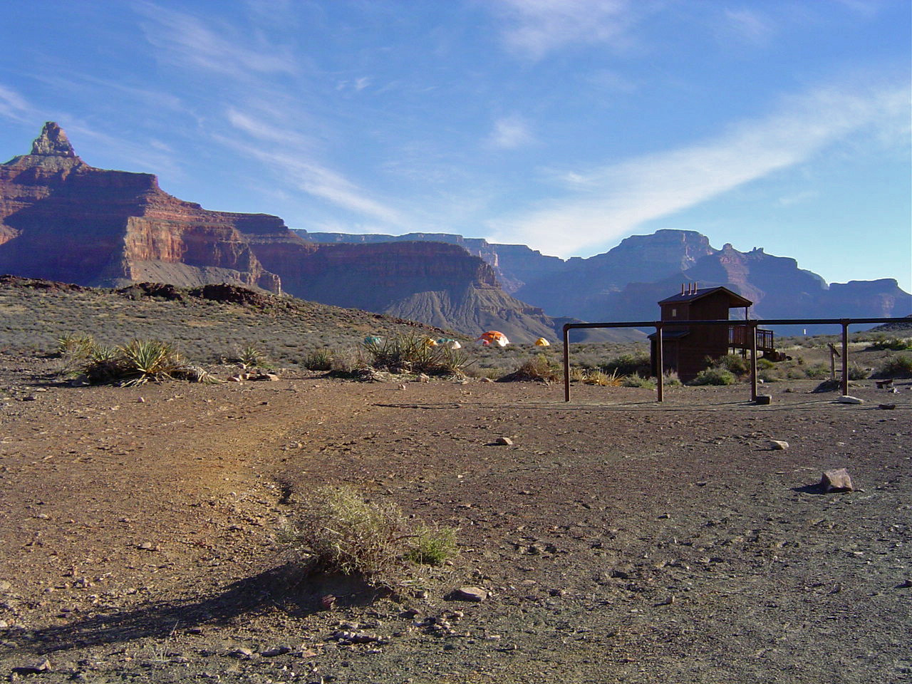
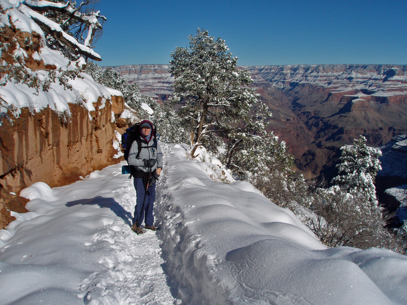
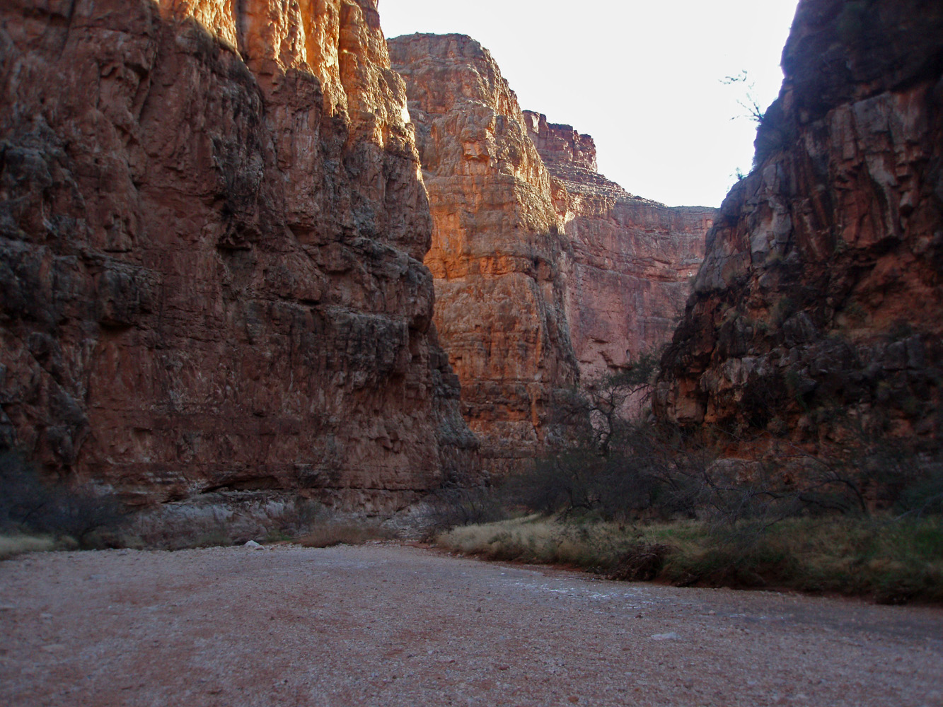
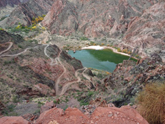
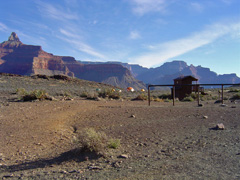
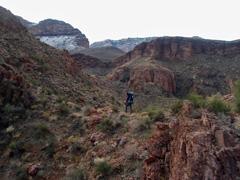
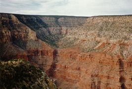
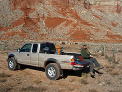
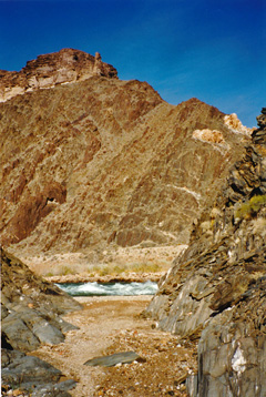
In 2012 I did a
day hike down to Phantom with a visiting speaker to the college, Russ
Wermers, and my colleague Pin Ng. It was a pretty nice day, but we
did have to use our headlamps as we returned to the rim on the South
Kaibab Trail. This photo is from the lower section of the trail as
we descended, showing some river users, the bridge we cross over on and
the Bright Angel Campground area.
In 1983 I did a three day hike down to Phantom Ranch with Karen
Herrera. This was supposed to be the end of my 30 day trek from
Tuckup, which I had abandoned after ten days earlier in November.
[No photos for this day.] |
 |
|
December 2 |

1983 - Clouds around Johnson Pt. in BA Canyon. |
1990 - Sumner Butte from the South Kaibab Trail. |
1994 - Cliff granaries at Nankoweap. |
1995 - Peppyr as we make our way to Pt. Huitzil. |
2004 - Trail crew camp on the Tonto near South Kaibab. |
|
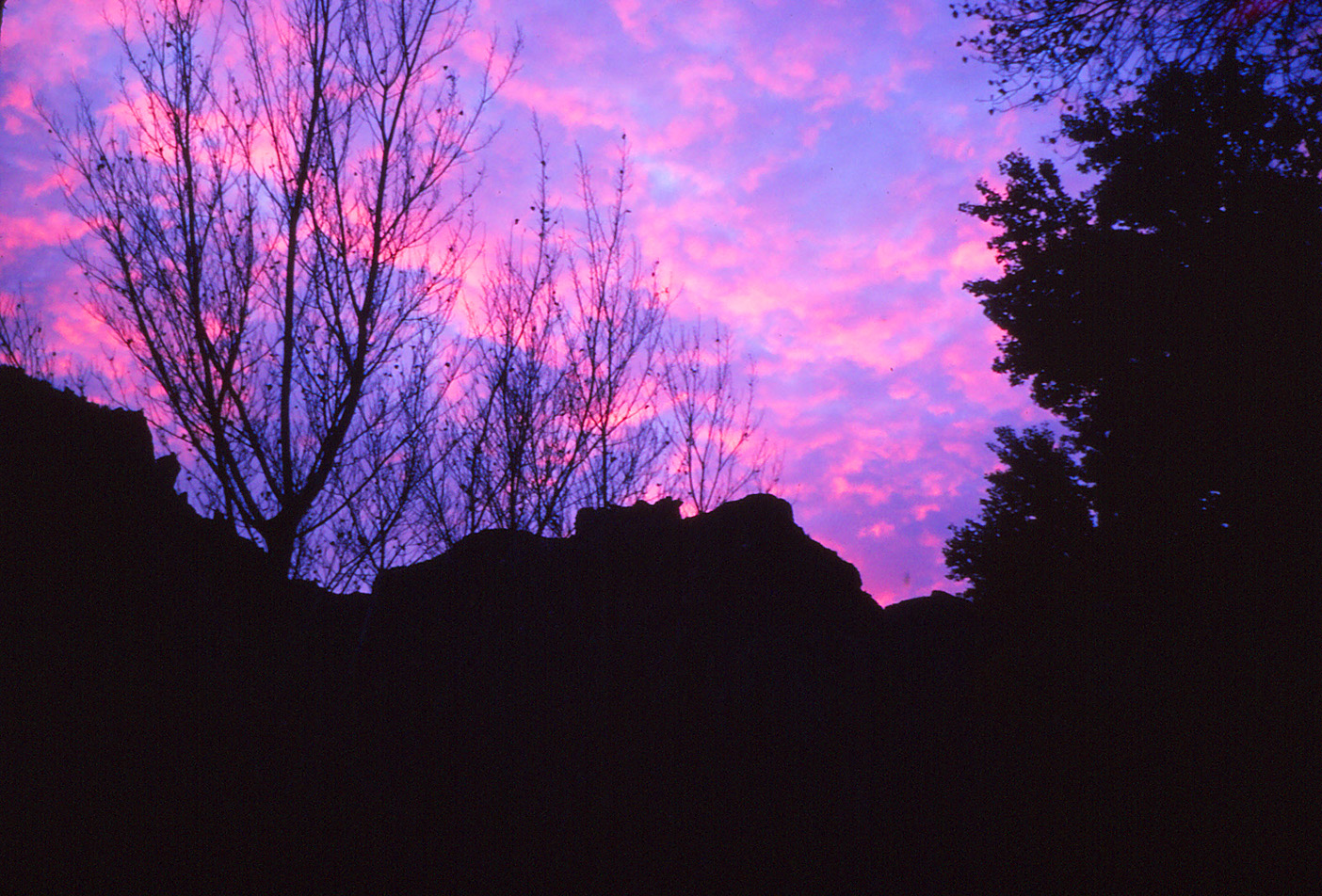
In 1983 I did a three day hike down to Phantom Ranch
with Karen Herrera. This was supposed to be the end of my 30 day
trek from Tuckup, which I had abandoned after ten days earlier in
November. This was our second day and we just hiked a bit around
the ranch area. This view of Bright Angel Canyon, with clouds
swirling around Johnson Pt. was taken from the bench area on the Clear
Creek Trail.
In 1990 I hiked down to the Bright Angel Campground
to spend two nights. This was my last day and I hiked back up the
South Kaibab Trail. Along the way I snapped this photo of Sumner
Butte, on the other side of the river from me.
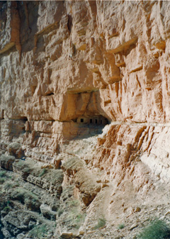
In 1994 I hiked down the Nankoweap Trail to spend
four days in the canyon. This was my third day and I day hiked
down to the river to get some early morning shots of the famous granary
ruins there with some sunlight on them. I was there before the sun
rose on this area and stayed until after all was in shadow and it is a
very narrow window of opportunity.
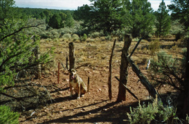
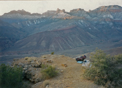
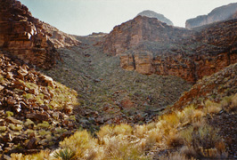
In 1995 I made my first foray out to the South Bass area to
check out the Pt. Huitzil route from the rim. At the Havasupai
gate (which was then down at the bottom of the ravine) I followed an old
road along the fence line until it gave out. Then my dog Peppyr
and I hiked along it until we came to the park boundary fence, luckily
at a gate, where I took this photo. We got to the rim and I
scouted out the route for about an hour, coming up empty, before
returning. More on this story
here.
In 2004 I did a
day hike down to Phantom and back on the South Kaibab Trail. There
was a camp set up on the Tonto a bit east of the restroom. Since
there was lots of work being done on the trail, I presume this was a
temporary camp for the trail crew. |
|
|
|
December 3 |
1994 - "Camp-on-a-Ledge" on the Nankoweap Trail. |
|
In 1994 I hiked down the Nankoweap Trail to spend
four days in the canyon. This was my last day and I had been
camped at a little flat spot at the bottom of the Redwall that I call
"Camp-on-a-Ledge." I have camped here far too many times!
The photo shows that I'm all packed up and ready to hike out.
In 1983 I did a three day hike down to Phantom Ranch
with Karen Herrera. This was supposed to be the end of my 30 day
trek from Tuckup, which I had abandoned after ten days earlier in
November. This was our last day and we hiked out. [No
photos.] |
|
|
|
December 4 |
|
|
|
December 5 |
|
|
|
December 6 |
|
|
|
December 7 |
|
|
|
December 8 |
|
|
|
December 9 |
|
|
|
December 10 |

1997 - Supai ledges in Royal Arch. |
|
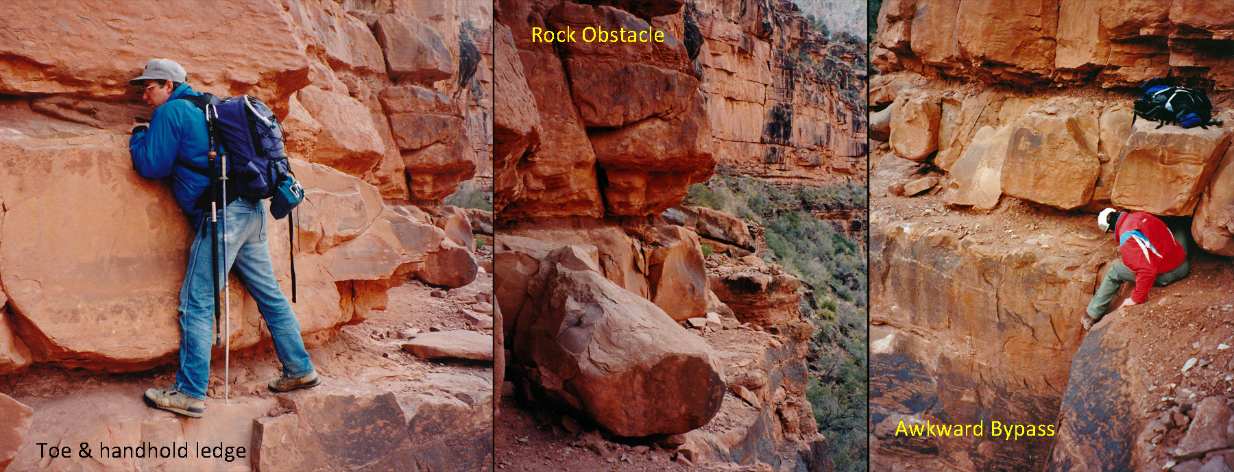
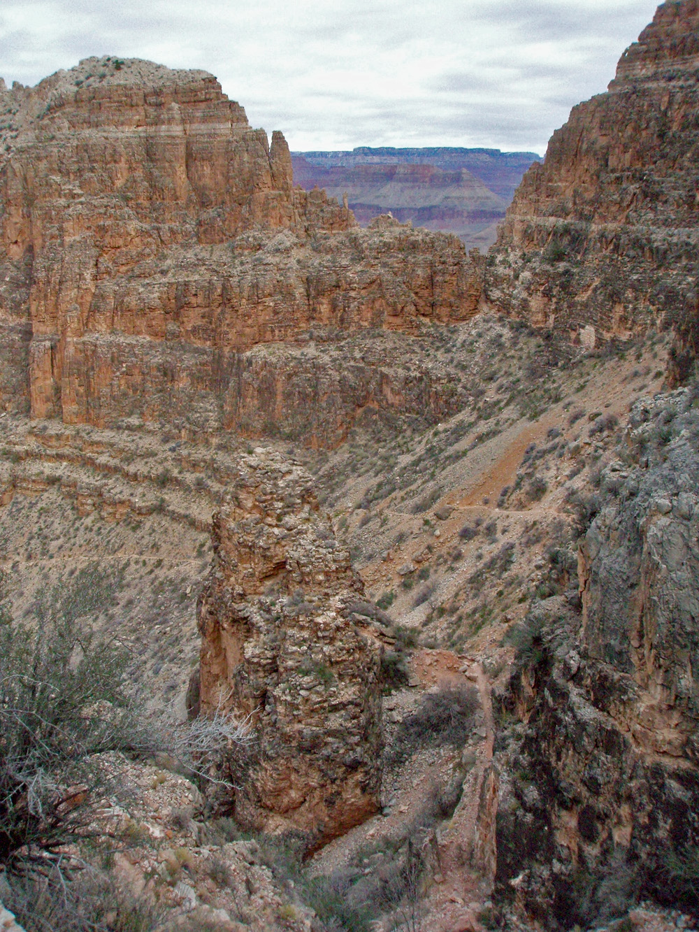
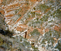
In 1997 John Eastwood and I returned to the Point
Huitzil route to see how far we could get into Royal Arch on a day hike.
It had been almost two years since we had been able to piece together
this route down to the bottom of the Coconino. It was a cold day,
but not bitterly so. There were potholes of frozen water in the
bed and flowing icicles that made it a rather unique little hike.
We got as far as the main junction via this narrow ledge in the Supai.
I think today that hikers stay on the other side of this side canyon to
bypass these. I only took pictures of our hike back up through
them, but have placed them into this collage in their correct order when
going down into the canyon. |
|
|
|
December 11 |
|
|
|
December 12 |
|
|
|
December 13 |
|
|
|
December 14 |
|
In 1981 I had finished my year working on the South Rim and
preparing to return to Hawaii, where I was in graduate school. I
planned to do one final long hike - across the canyon on the Kaibab
Trail, across the North Rim to the Nankoweap Trail and then down into
the canyon and back around to Phantom Ranch and out. Alas it was
not to be. This was my first day and with a heavy pack I got to
Cottonwood where I camped for my first night. [No photos.] |
|
|
|
December 15 |
1981 - Aiken's residence from across Bright Angel Creek. |
|
In 1981 I had finished my year working on the South
Rim and preparing to return to Hawaii, where I was in graduate school.
I planned to do one final long hike - across the canyon on the Kaibab
Trail, across the North Rim to the Nankoweap Trail and then down into
the canyon and back around to Phantom Ranch and out. Alas it was
not to be. This was my second day and I was only able to hike from
Cottonwood to somewhere in the Supai along the Old Kaibab Trail. I
had never been on this old trail and have a very vivid memory of
crossing the icy creek with the water up to my knees. Here's the
one photo I took this day of the Aiken residence as I passed by on the
east side of Bright Angel Creek. |
|
|
|
December 16 |
|
In 1981 I had finished my year working on the South Rim and
preparing to return to Hawaii, where I was in graduate school. I
planned to do one final long hike - across the canyon on the Kaibab
Trail, across the North Rim to the Nankoweap Trail and then down into
the canyon and back around to Phantom Ranch and out. Alas it was
not to be. This was my third day and from my camp along the Old
Kaibab in the Supai I got to the rim and then angled cross-country
toward the Pt. Imperial/Cape Royal Road. There was quite a bit of
snow on the rim and it was a slog, not to mention the difficulty of
crossing the rim off trail with trees down everywhere. I camped
somewhere short of the road where there is a pull-off and picnic table
(Fuller hill?). It was a very cold night and I remember that the
fire I made would shoot embers out and burn small holes in my sleeping
bag. [No photos.] |
|
|
|
December 17 |
|
In 2005 I did a day hike to Plateau Pt. but have no photos
of this hike.
In 1981 I had finished my year working on the South Rim and
preparing to return to Hawaii, where I was in graduate school. I
planned to do one final long hike - across the canyon on the Kaibab
Trail, across the North Rim to the Nankoweap Trail and then down into
the canyon and back around to Phantom Ranch and out. Alas it was
not to be. This was my fourth day and I slogged across the rim to
the Pt. Imperial/Cape Royal Road and then followed it to the Pt.
Imperial junction. I thought it would be easy, but there was wet
slushy snow on the road and my boots were soaked. From here I
headed back into the woods thinking I could make a beeline for the
Nankoweap trailhead. It was sometime in the early afternoon that I
reassess my plans and decided to turn around. Not only was I
already two days behind schedule, I had never been on the Nankoweap
Trail and I wondered if I would be able to even find it! I
returned to the picnic table and camped nearby. [No photos.] |
|
|
|
December 18 |
1996 - At the Tuckup Trailhead; Peaks in background. |
|
In 1996 I returned to
the Tuckup Trail to look again for Shaman's Gallery. This was my
first day and I spent most of it driving around to the the North Rim,
finally reaching the trailhead at about 3 p.m. only to see the
snow-capped San Francisco Peaks on the horizon, from where I had started
(shown in the photo). I got down to the Esplanade before dark and
used the light of the moon all the way to my objective of Cottonwood
Spring.
In 1981 I had finished my year working on the South Rim and
preparing to return to Hawaii, where I was in graduate school. I
planned to do one final long hike - across the canyon on the Kaibab
Trail, across the North Rim to the Nankoweap Trail and then down into
the canyon and back around to Phantom Ranch and out. Alas it was
not to be. This was my fifth day and I was able to retrace my
track back to the Old BA and head back into the canyon. I camped
somewhere along the trail. [No photos.] |
|
|
|
December 19 |
1996 - Old copper mine at Cottonwood Spring. |

2008 - Cara Lynn on a snowy Bright Angel Trail. |
|
In 1996 I returned to the Tuckup Trail to look again
for Shaman's Gallery. This was my second day and I mostly stayed
close to my camp at Cottonwood Spring, although I did move to a spot
that would get earlier sun in the morning. On my forays around the
area I visited this old copper mining site with the steel skeletal
remains of a bucket (I presume that the rest was wooden) and a big chunk
of copper.
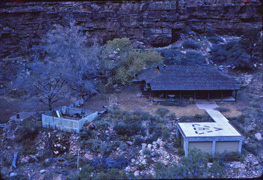
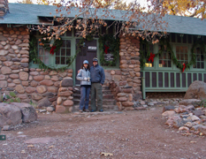
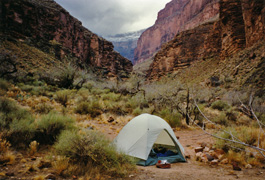
In 2008 Cara Lynn and I did a hike down to Phantom Ranch for
a couple of days of camping at Bright Angel. There had been a big
snowstorm in the days prior and the mules were kept off the trail for
six days (I think). So, little traffic on the trail, and we wore
our traction devices all the way to Indian Garden! Here is Cara
Lynn near the top of the Bright Angel Trail, which was the featured
photo that was used in the local paper when they ran my story about this
hike a little later.
In 1981 I had finished my year working on the South Rim and
preparing to return to Hawaii, where I was in graduate school. I
planned to do one final long hike - across the canyon on the Kaibab
Trail, across the North Rim to the Nankoweap Trail and then down into
the canyon and back around to Phantom Ranch and out. Alas it was
not to be. This was my sixth day and I hiked from the Old BA to
the Bright Angel Campground. I checked in with a ranger there and
told him of my aborted hike. Lots of space in the campground and I
camped there. [No photos.] |
|
|
|
December 20 |

1981 - Sunrise from the Bright Angel Campground. |

1996 - At Shaman's Gallery. |
2008 - Phantom canteen decked out for Christmas. |
|
In 1981 I had finished my year working on the South
Rim and preparing to return to Hawaii, where I was in graduate school.
I planned to do one final long hike - across the canyon on the Kaibab
Trail, across the North Rim to the Nankoweap Trail and then down into
the canyon and back around to Phantom Ranch and out. Alas it was
not to be. This was my seventh (and final) day. I hiked back
up the Bright Angel to the South Rim. Before leaving the
campground I got my second (and final) picture, of the sunrise from the
campground.
In 1996 I returned to the Tuckup Trail to look again
for Shaman's Gallery. This was my third day and I was able to find
this pictograph site in the main bed by a bit past noon. Across
the bed I saw a relatively easy exit back up to the Esplanade which I
used to more quickly return to my camp.
In 2008 Cara Lynn and I did a hike down to Phantom Ranch for
a couple of days of camping at Bright Angel. This was our second
day and we took it easy, hanging out at the canteen (all decorated for
the holidays) and an afternoon hike up the Clear Creek trail to the
stone bench. |
|
|
|
December 21 |
2008 - Cara Lynn on the "Old Miner's Trail." |
|
In 2008 Cara Lynn and I did a hike down to Phantom Ranch for
a couple of days of camping at Bright Angel. This was our last
day and we took the "Old Miner's Trail" up to the Tonto Plateau and then
met up with the South Kaibab for the rest of the hike. I took this
photo as Cara Lynn was crossing a little saddle on the way to the
switchbacks up through the Tapeats. We put our traction footwear
back on at Skeleton Point!
In 1996 I returned to the Tuckup Trail to look again
for Shaman's Gallery. This was my last day although that hadn't
been my intent. But the previous night I was wracked with stomach
cramps that kept me up most of the night. Instead of staying for
another day of local hiking, I packed up and hiked out. What took
me about three hours coming down took about eight going back out and up,
as the cramping continued all day and on the long drive back home.
[No photos.] |
|
|
|
December 22 |
1999 - O'Neil Butte during solstice moon. |
|
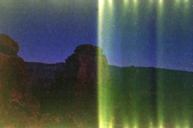
In 1999 I did a quick evening hike down the South Kaibab for
the solstice
super moon. I drove up late in the afternoon and got started
down the trail at about dusk. There was a guy laying in his
sleeping bag at Ooh Ahh Point but three people were just coming up the
trail they were going to look after him. I didn't see anyone else
the rest of the evening. [The guy in the sleeping bag was gone
when I returned.] Hiking in the canyon under a full moon is quite
special and to do this on the solstice was even better. I brought
my Pentax K1000 and a tripod, but no additional film and I was only able
to take two pictures and neither turned out very well. This one is
looking away from the moon and towards O'Neill Butte and has some light
exposure over half the frame. I did go down as far as Skeleton
Point. Once down on the so-called Mormon Flats I hiked up to the
small hill west of the trail and followed it to the end, descending back
to the trail near the point. I had never done that before and yet
there are excellent views of Phantom from that hill. I was back to
the rim by 11 p.m. for a late night drive back home. |
|
|
|
December 23 |
|
|
|
December 24 |
|
|
|
December 25 |
1999 - Peppyr & Rocket near Crazy Jug. |
|
In 1999 I drove up to the North Rim to do some car camping
by the Big Saddle Trail near Crazy Jug Point. I got to my favorite
camping spot on the rim by noon and then took my dogs, Peppyr and
Rocket, down the trail to the spring in the main bed on the Esplanade
level, near where this photo was taken. |
|
|
|
December 26 |
1987 - Snow covered Tonto Plateau. |
1999 - Peppyr & Rocket near Crazy Jug. |
|
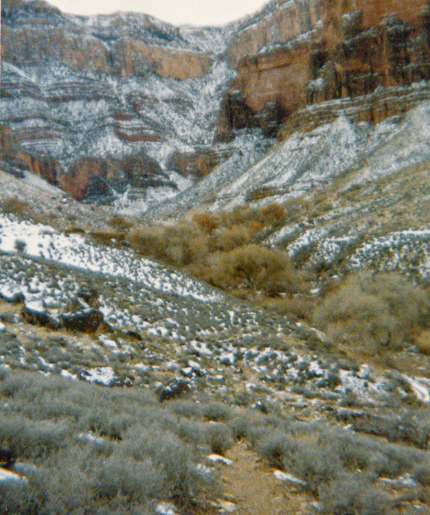
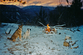
In 1987 I traveled to AZ during my winter break and thought
to do an ambitious hike - across to the North Rim, over to Pt. Sublime,
down to the Tonto, back to Phantom and out to the South Rim. Too
ambitious as it turned out. This was my first day and I hiked down
the Bright Angel and stayed in the Phantom Ranch dorm. Lots of
snow in the canyon as this photo looking down on Indian Garden can
attest.
In 1999 I drove up to the North Rim to do some car camping
by the Big Saddle Trail near Crazy Jug Point. This was my second
day and it had snowed a bit overnight and so in the morning, with my
dogs Peppyr and Rocket, I got a fire started. In the background is
Muav Saddle with Powell Plateau to the right and the North Rim to the
left. We spent most of the day clearing the trail segment that
goes into a ravine on the western side of the canyon and into a bed that
is dominated by a large breccia pinnacle. |
|
|
|
December 27 |

1987 - Snowy Cottonwood campground. |
1989 - View of Dripping Spring Canyon from Hermit Trail. |
1999 - With Peppyr & Rocket at Lower Crazy Jug Spring. |

2001 - With Erik Drake on the black bridge. |
2008 - With Bill Ferris at Hack Canyon Trailhead. |
|
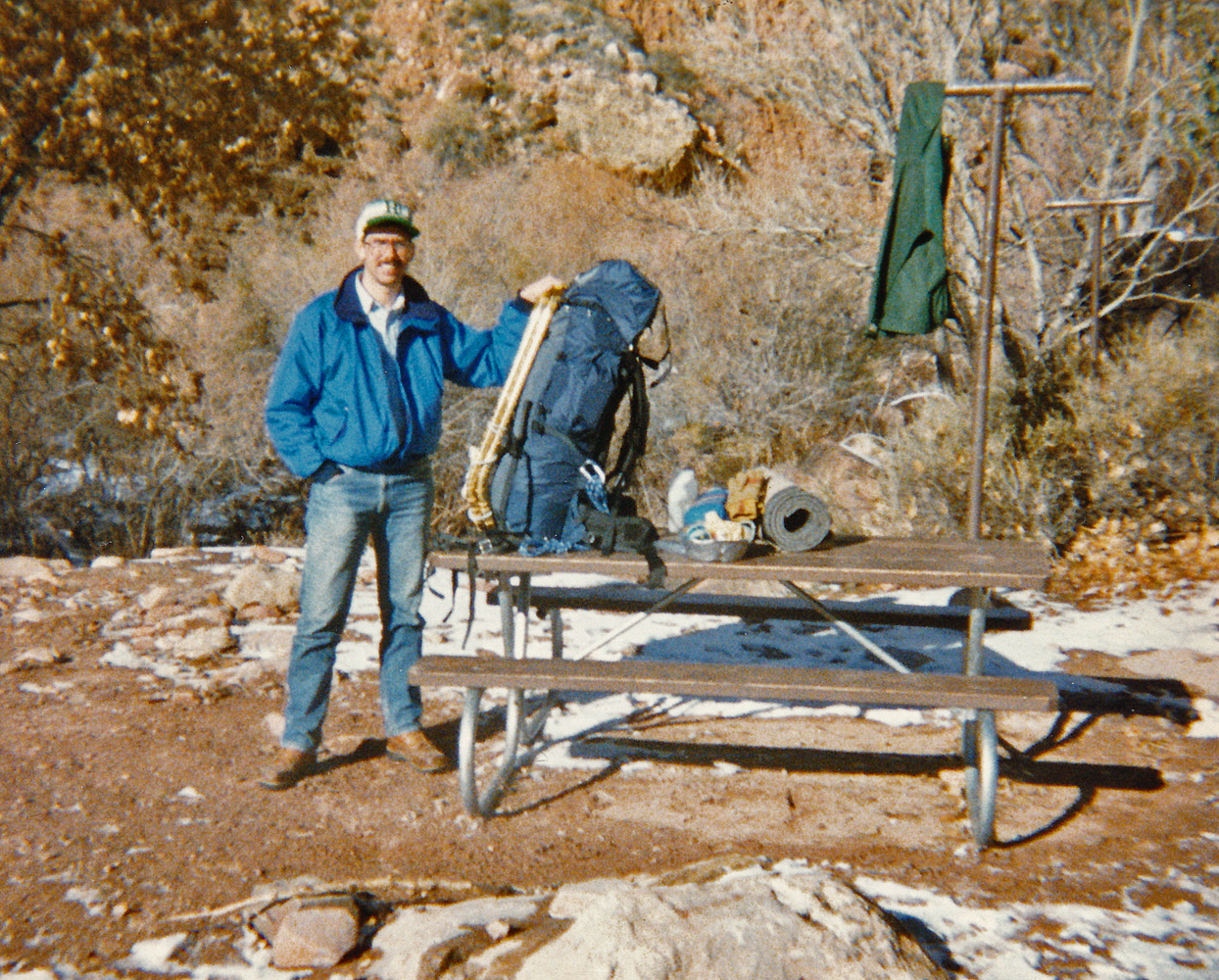
In 1987 I traveled to AZ during my winter break and thought
to do an ambitious hike - across to the North Rim, over to Pt. Sublime,
down to the Tonto, back to Phantom and out to the South Rim. Too
ambitious as it turned out. This was my second day and I hiked
from Phantom to Cottonwood campground, where there was plenty of snow on
the ground. I picked a spot that was mostly in the sun. Note
the snowshoes on my pack - I was planning on using them to hike to Pt.
Sublime.
In 1989 I did a hike down the Hermit/Boucher to visit at
Slate Creek. This was my first day and I got this nice picture of
the Dripping Spring Canyon from the Hermit Trail.
In 1999 I drove up to the North Rim to do some car camping
by the Big Saddle Trail near Crazy Jug Point. This was my third
day and with my two dogs, Peppyr and Rocket, we hiked down to what I
call "Lower Crazy Jug Spring," which is below the upper part of the
Supai. Part of the old Big Saddle Trail goes here and you can
still see some signs of switchbacks in the Supai and alongside the trail
some leftover barbed
wire.
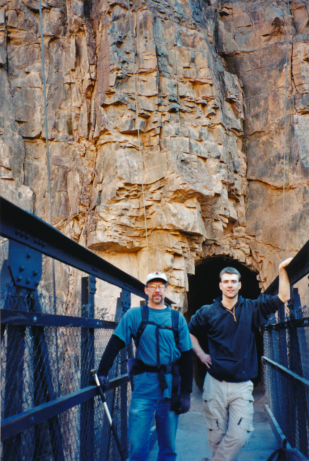
In 2001 Erik Drake and I did a day hike down the South
Kaibab to Phantom Ranch and then back up the Bright Angel. We were
accompanied by a retired geologist who would tell us the most
interesting stories about the rocks all the way down. Over the
last few miles at the top of the BA it was bitterly cold and the hiking
was quite a grind. Here we are on the black bridge at the bottom
of the South Kaibab Trail.
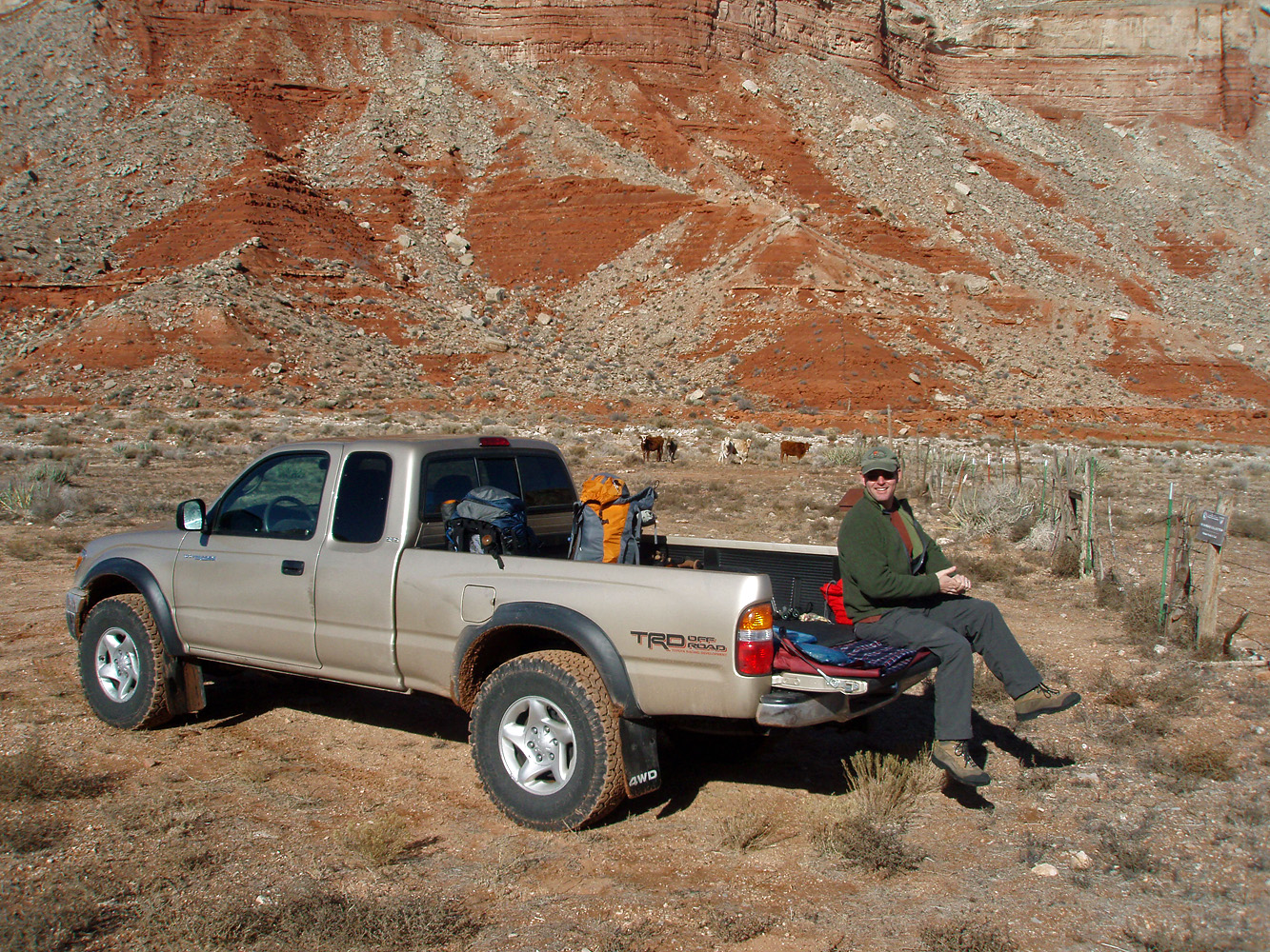
In 2008 Bill Ferris and I did a multi-day hike in the Kanab
Creek area. I had a permit to do a hike around Fishtail Mesa, but
there was too much snow on roads for us to get to Indian Hollow.
So, we went down Hack Canyon and did a hike mostly in the wilderness
area. This was our first day and here is Bill getting ready to
start our trek down the canyon to camp at the junction with Kanab
Canyon. |
|
|
|
December 28 |
1987 - The Redwall Bridge on the North Kaibab Trail. |
1989 - Camp in Boucher Canyon. |
1999 - Annotated Big Saddle Trail. |
2008 - The Esplanade, Racetrack Knoll & Fishtail Mesa. |
|
In 1987 I traveled to AZ during my winter break and thought
to do an ambitious hike - across to the North Rim, over to Pt. Sublime,
down to the Tonto, back to Phantom and out to the South Rim. Too
ambitious as it turned out. This was my third day and I day-hiked
from my camp at Cottonwood campground up the North Kaibab Trail to about
where I took this picture of the snow-covered Redwall Bridge. It
was so cold that I brought along my stove so that I could fix a hot
lunch before returning to my camp.
In 1989 I did a hike down the Hermit/Boucher to visit at
Slate Creek. This was my second day and I hiked from a campsite by
White Butte to Boucher Creek where I set up this camp. Back in
those days I would often carry my roomy three-man tent on my solo hikes.
In 1999 I drove up to the North Rim to do some car camping
by the Big Saddle Trail near Crazy Jug Point. This was my last
day and mostly we just packed up and headed home. But, I drove to
Crazy Jug Point to take some
photos that show the general route of the Big Saddle Trail. In
this photo I've indicated where the trail is located. On the right
hand side is the main, Crazy Jug, spring. But you can find another
piece of trail from a nearby saddle that goes to the left and then
descends below the upper Supai to another spring.
In 2008 Bill Ferris and I did a multi-day hike in the Kanab
Creek area. On our second day we hiked from our camp at the
Hack-Kanab junction up to the Esplanade on the east side of Kanab and
then hiked along it until we camped up above Jumpup Canyon. Along
the way I got this nice view of the Esplanade (and we did get water from
pockets like those in the photo) with the very red Racetrack Knoll and
snowy Fishtail Mesa in the background. |
|
|
|
December 29 |
1987 - The Phantom in Bright Angel Canyon. |
1989 - On the Tonto between Boucher and Slate. |

2007 - Atop the Cathedral Stairs on the Hermit Trail. |
2008 - Ladder in Jumpup Canyon. |
|
In 1987 I traveled to AZ during my winter break and thought
to do an ambitious hike - across to the North Rim, over to Pt. Sublime,
down to the Tonto, back to Phantom and out to the South Rim. Too
ambitious as it turned out. This was my fourth day and I hiked
back to the Bright Angel Campground from my camp at Cottonwood
campground. Along the way I got a picture of the so-called
"Phantom" namesake of the ranch (with "brush stroke" stylization).
In 1989 I did a hike down the Hermit/Boucher to visit at
Slate Creek. This was my third day and I hiked from my campsite at Boucher Creek
to Slate Canyon. While contouring along the Tonto I had many great
views of the river.
In 2007 Cara Lynn and I did a quick overnight trip to Hermit
Creek. This was our first day and this photo is taken from the top
of the descent through the Redwall, referred to as the "Cathedral
Stairs."
In 2008 Bill Ferris and I did a multi-day hike in the Kanab
Creek area. On our third day we hiked from our camp on the Esplanade
above Jumpup Canyon down into Jumpup and camped below where Indian
Hollow comes in. To get down into Jumpup one must trust this crude
ladder atop a rock pile! |
|
|
|
December 30 |

1987 - Snowy Indian Garden. |
1989 - Looking down Slate at Crystal Rapids. |
2007 - Early morning moon at Hermit Campground. |

2008 - Kanab Canyon. |
|
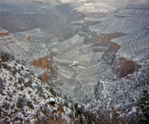
In 1987 I traveled to AZ during my winter break and thought
to do an ambitious hike - across to the North Rim, over to Pt. Sublime,
down to the Tonto, back to Phantom and out to the South Rim. Too
ambitious as it turned out. This was my fifth, and final, day as I hiked
back up to the South Rim via the Bright Angel Trail from the Bright Angel Campground.
Cold and still lots of snow down relatively low in the canyon as this
view of Indian Garden attests.
In 1989 I did a hike down the Hermit/Boucher to visit at
Slate Creek. This was my fourth day and I had the opportunity to
do some day-hiking from my campsite on the Tonto in Slate Canyon.
I backtracked down the trail to a spot where I could descend to the bed
of Slate and easily follow it to the river. Here is Crystal
Rapids, one of the biggest in the canyon, and the approach to it down
the narrow bed was quite awesome.
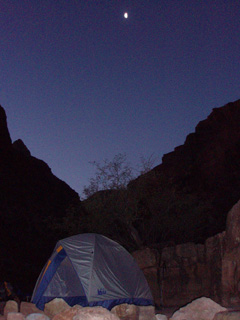
In 2007 Cara Lynn and I did a quick overnight trip to Hermit
Creek. This was our second day and time to return to the rim back
up the Hermit Trail. I remember that it was a very cold and very
long night in the tent. Still I got this nice shot in the early
morning of the tent with the moon up above it.
In 2008 Bill Ferris and I did a multi-day hike in the Kanab
Creek area. On our fourth and final day we hiked from our camp in Jumpup Canyon down
to Kanab Canyon, where we practically bumped into three bighorns.
Then up the canyon, with its many ice-covered pools to Hack Canyon and
back to the trailhead. Here is a view looking up a little stretch
of Kanab where the walking was pretty easy. |
|
|
|
December 31 |
1989 - Looking at an alternate route down into Slate from the Tonto. |

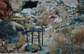
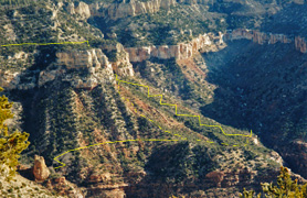
2011 - Annotated panorama of the ruins in Bright Angel Wash. |
|
In 1989 I did a hike down the Hermit/Boucher to visit at
Slate Creek. This was my fifth day and I packed up and moved my
camp from Slate back to Boucher. Along the way I looked for an
alternate descent down to the bed of Slate (on the east side) that
Harvey Butchart wrote about and which I spied out the previous day.
No problem. I was able to easily get down right where there was a
big cairn in the bed and I took this picture looking up at this route.
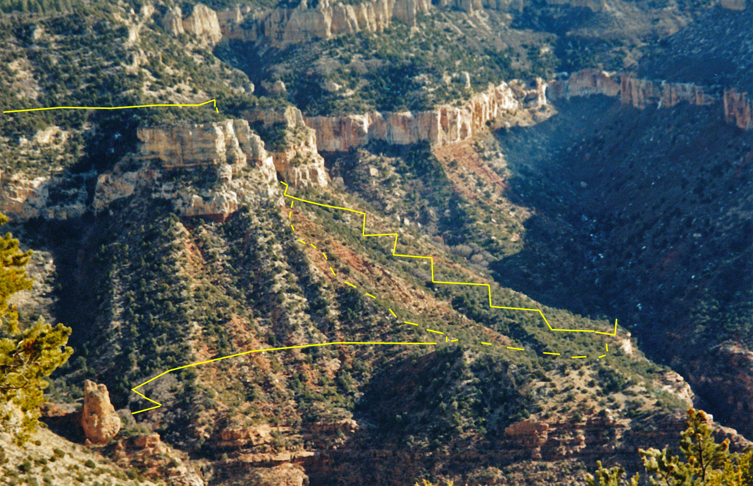
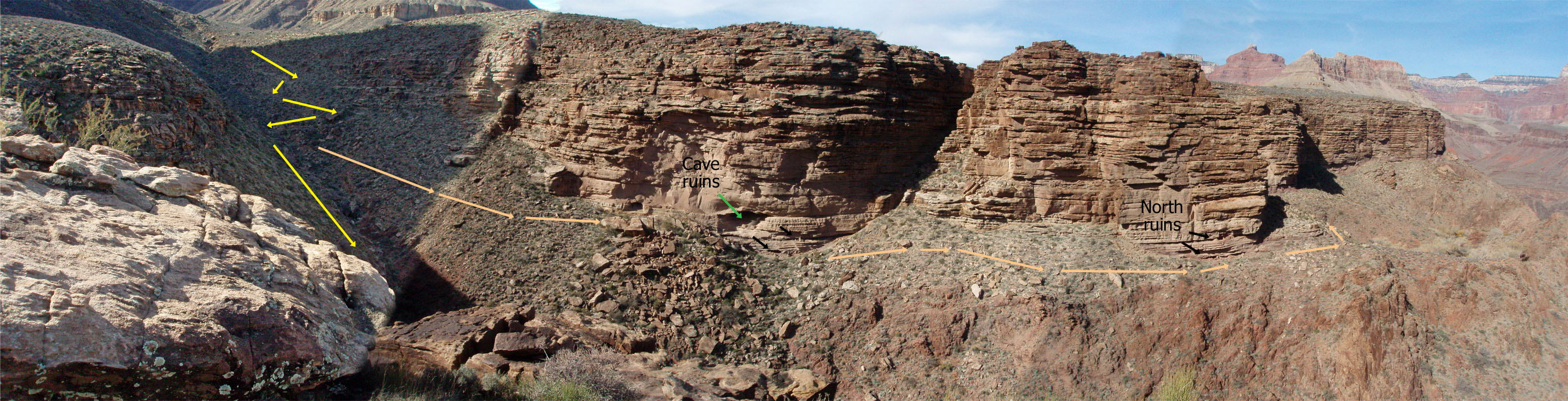
In 2011 I did a day hike down the Bright Angel to do a more
thorough visit of the ruins that lie above the original trail, which
went up onto the Tonto after coming through Indian Garden and then down
a ravine that leads to Pipe Creek. The old trail follows some old
telephone lines which are readily visible and the trail is in remarkably
good shape and easy to follow. But, before the trail crosses this
ravine a fainter trail continues to these ruins at the base of the
Tapeats. It passes two major groups of ruins before going around a
corner and meeting up with the (new) Bright Angel Trail. I took
this panorama after climbing back up out of this ravine on an easy slope
to the east. A fuller account of this hike (with photos) is
here. |
|
|