 |
|
|
The Lonetree Canyon Ruins Friday-Sunday, October 16-18, 2009 by Dennis Foster |
|
|
|
|
|
|
|
The Lonetree Canyon Ruins Friday-Sunday, October 16-18, 2009 by Dennis Foster |
|
|
|
|
|
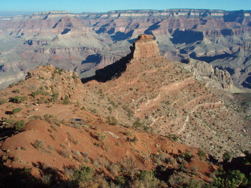
In late September, Cara Lynn and I did a three day hike from Grandview
to the South Kaibab and out. Along the way, I had some hope that
we would have time to scout out some ruins in Lonetree canyon.
Harvey Butchart described them in his journals (March, 1969), and I had
copied the relevant portions. Alas, the temperatures were way too
high during this trip and we spent many hours resting up during the
middle of each day. Consequently, our progress was less than I
hoped, and we had to hike through Lonetree without looking for these
ruins.
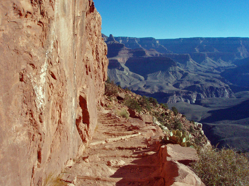
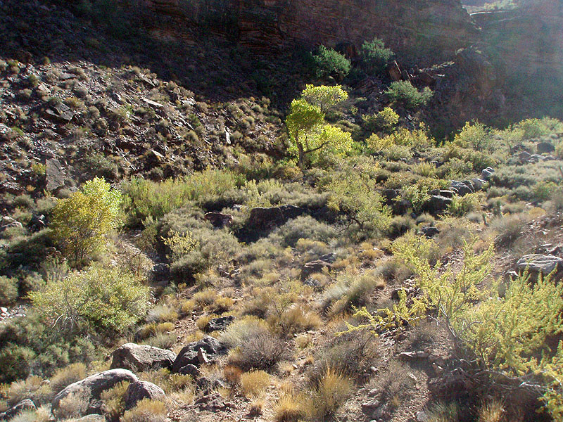
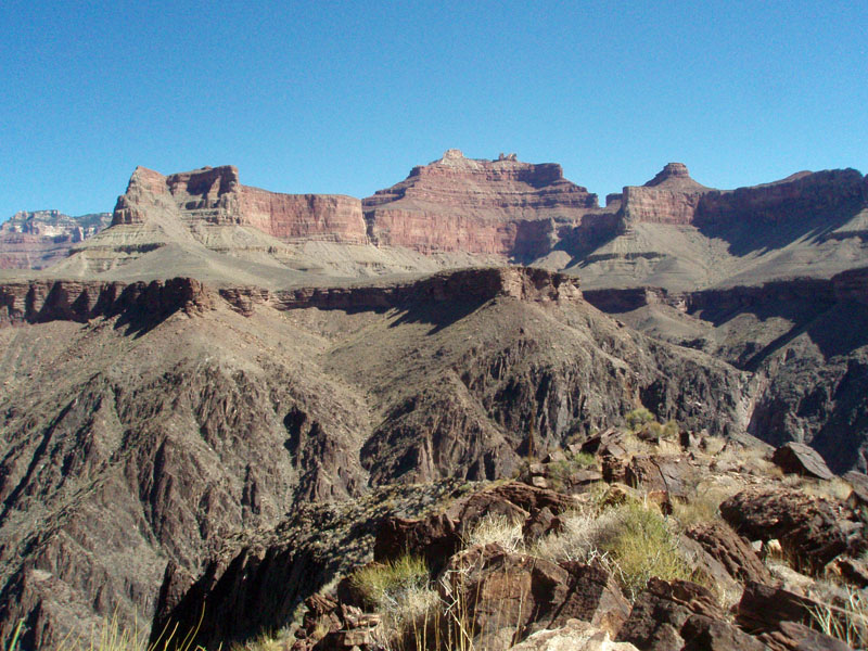
But, I had a chance to go back just a few weeks later. We had planned for a hike down Hermit, but that had to be scrubbed. So, I changed the permit to three days in Lonetree. I left early Friday morning, with much better weather than we had at the end of September. It was clear and pleasant the whole trip. I started down the South Kaibab trail at 7:30 a.m. I was only planning on following the trail to the bottom of the Redwall. Here, you can leave the trail and follow a ridge down to the Tonto plateau, to the east. From here, you can stay above the rugged canyons that the Tonto trail passes through, and cut across the plateau to the main bed of Cremation. That's what I did, and along the way I passed a couple of water pockets in one ravine, which made me feel good about finding water in Lonetree. I cached a liter of water at the top of the Redwall, on the South Kaibab trail. I cached another liter in the main bed of Cremation, where I picked up the Tonto trail for the rest of the hike to Lonetree. I figured that if I left Lonetree dry, I would be able to reach my water caches and get out in fine shape. Since I was dropping water along the way, my pack started out on the heavy side - 43 pounds. I reached the main bed of Cremation at 11:00 a.m. and decided to eat an early lunch. It wouldn't take long to reach Lonetree from here. |
|
|
||
 |
 |
 |
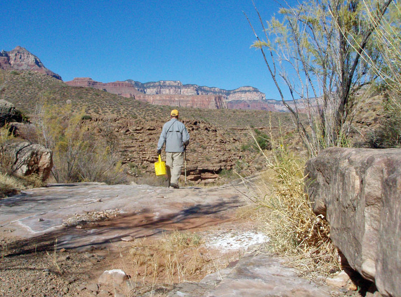
| Scenic O'Neill Butte along the trail. | On the South Kaibab trail. | Along the Tonto trail. |
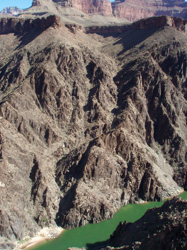
It took me about an hour and a half to reach Lonetree canyon from
Cremation. As I rounded the last ridge and was heading into the
canyon, I 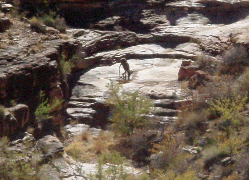 could
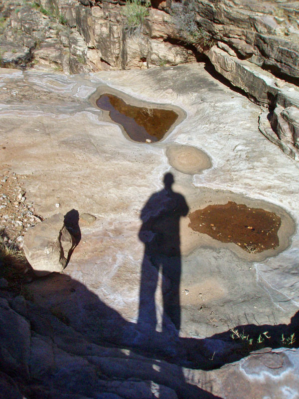
see where the Tonto crosses. There I could see something shiny
that I took to be a water pocket. I stopped and looked for a
moment, and spotted something heading down a nearby ledge. It was
a bighorn sheep. It walked up to the shiny spot and started
drinking from it! So, I knew there was water! could
see where the Tonto crosses. There I could see something shiny
that I took to be a water pocket. I stopped and looked for a
moment, and spotted something heading down a nearby ledge. It was
a bighorn sheep. It walked up to the shiny spot and started
drinking from it! So, I knew there was water!
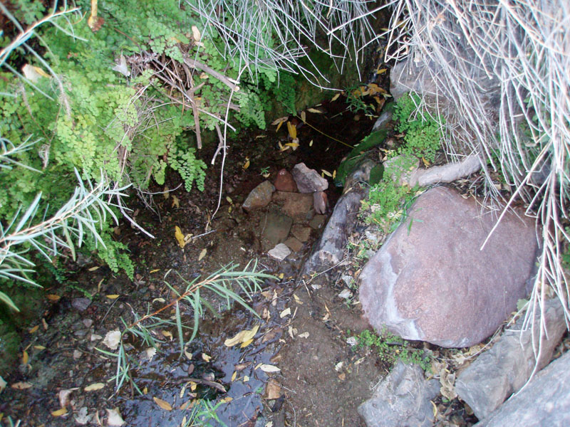
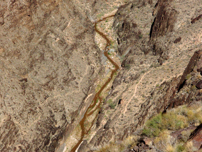
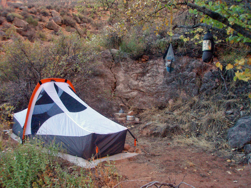
Once at Lonetree, I dropped my pack and scouted around for a place to camp. I found a pretty good spot just a few minutes up the bed. It was a small terrace, about eight feet above the bed. It was flat and level and had a tree that provided shade during the day, and a place to hang up my pack and food sack at night. It was quite a lazy afternoon. I didn't feel pressed to do any serious exploring, so I just took my time fixing up my camp site. At 3 p.m., I headed down to the water pockets with my yellow bucket, to filter some water. It had a distinctive color to it, and wasn't really very tasty. So, I mostly drank water I still had with me, and used this water for cooking purposes. The next day, I would look for the spring that is supposed to be down the canyon, at the site of the "lone tree." |
| On Saturday, I was up and out a bit past eight o'clock. I figured it would be an easy day, so I wasn't rushed. I was able to walk down the bed without any problems, right through some major cliffs. Quite scenic. Within a half hour, I found the lone Cottonwood, and sure enough there was water there. It wasn't a huge flow, and it didn't last very long in the bed. But, there is a nice big rock surface right here, making the process of collecting and filtering water easy and convenient. I did have to dig a slightly deeper depression in the bed, and line it with some flat rocks, so that I could dip my cup into the water and fill up my yellow bucket. From there, I filtered out 6.5 liters, most of which I left here, to pick up on my return upstream later in the day. |
|
|
||
 |
 |
 |
| Lonetree spring, with improvements. | The "lone" tree marking spring. | The lower creek was flowing. |
|
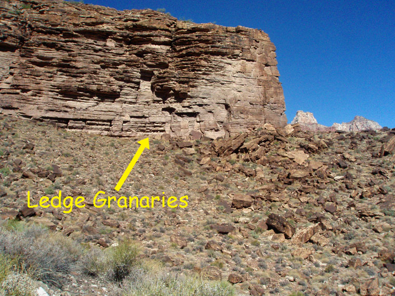
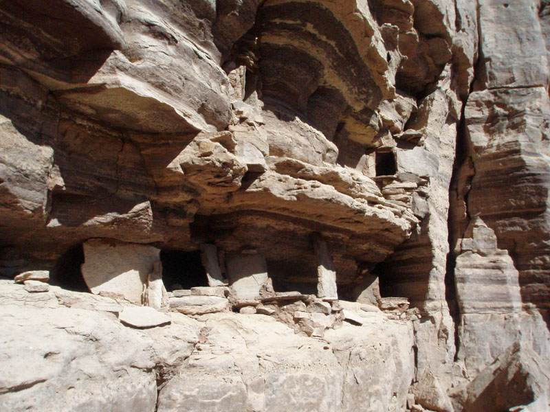
From the spring, it only took me fifteen minutes to find and hike up to
the ruins. They are at the base of the Tapeats cliffs. I
could spot some of the holes marking granaries from well down the
slope. I did a quick pass by the ruins and continued on along a
projecting peninsula that overlooked the river. The views from
here were fantastic.
I was looking almost straight down at the Colorado River, and was nearly directly across from Clear Creek. I saw eight hikers heading up Clear Creek - they had light packs, so I presume that they had day hiked down the creek from their camp. I could discern a faint trail that went both upstream and downstream, to nearby beaches, which are popular camp sites. |
|
|
||
 Ruin location. Click for annotation. |
Following out past the ruins to the "end" of the peninsula, I was looking down at where Clear Creek flows into the Colorado River. |
From the peninsula, there is an excellent view of the route from the river beach above Clear Creek to the Tonto level, as described by Butchart. |
 Peninsula sticks out towards river. |
||
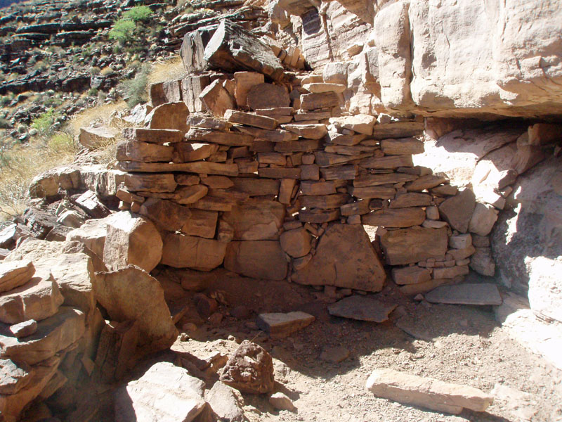
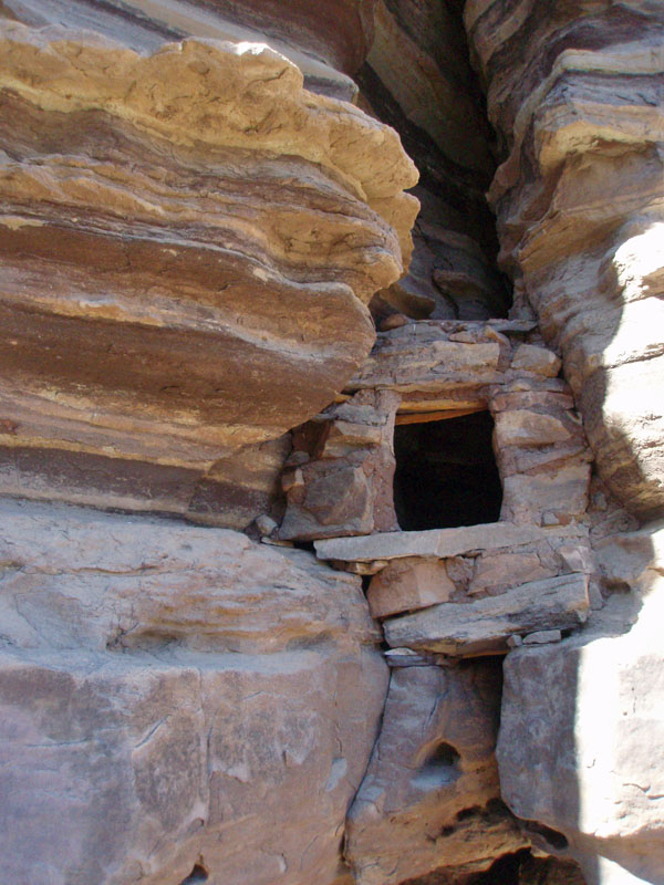
| I
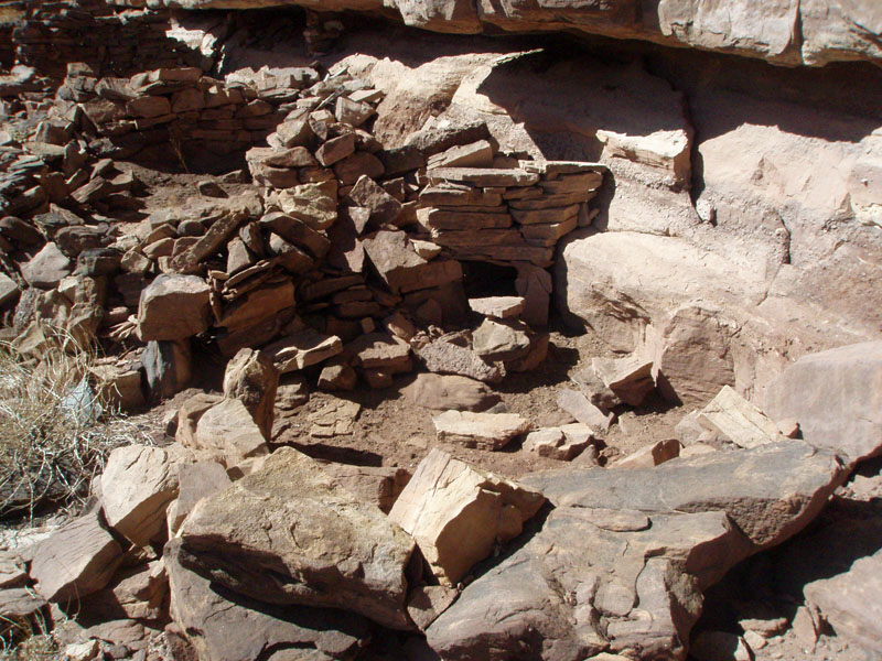
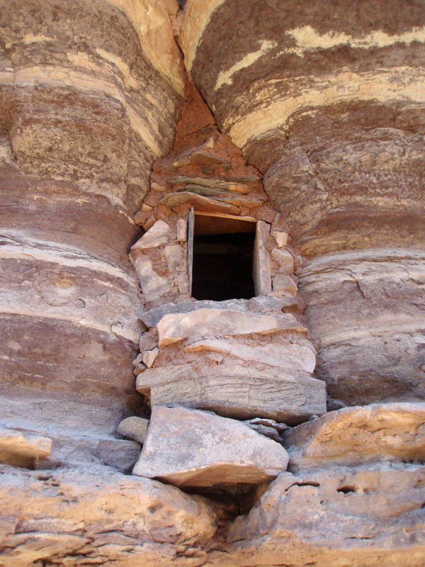
returned to the ruins and took a close look at them. There are
quite a few granaries here, and many are in excellent condition.
The dwelling units are in rougher shape, but still have walls
standing. There were probably a half dozen here. While the
ruins are in very good shape, I began to notice something very odd - no
pottery shards. None. Anywhere. Usually, people find
them and set them on rocks. Even so, there was absolutely no sign
of pottery here that I could see. That is especially unusual when
you consider the history of this ruin.
As I noted, Harvey Butchart visited this ruin in 1969. At the time, he had heard of these ruins from Bob Euler, who was an archeologist at Grand Canyon for many years. Euler had seen these ruins from the air - apparently, he did a lot of investigating by helicopter! So, it seems that these ruins were not known, at least not widely, before the late 1960s. It is practically unfathomable that anyone - even a park service research group - could totally clean out an old Indian site of pottery remains. Yet, I found nothing. Granted, I didn't dig around for any samples, but I did keep my eyes open. In fact, I left the site by heading down the slope directly below them, thinking I might find small caches washed up in little gullies. Nothing. So, that leads me to an especially provocative question, which may just show off how little I know about these things: Is it possible that the inhabitants of this ruin did not possess pottery? I have never heard of any such thing. You figure that if people can build these structures, they probably can make pottery. I just don't know. |
|
|
||
|
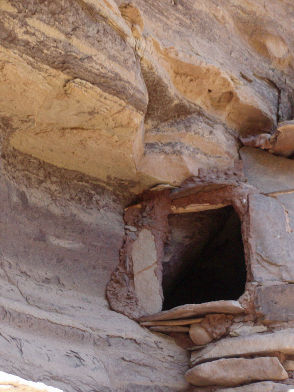
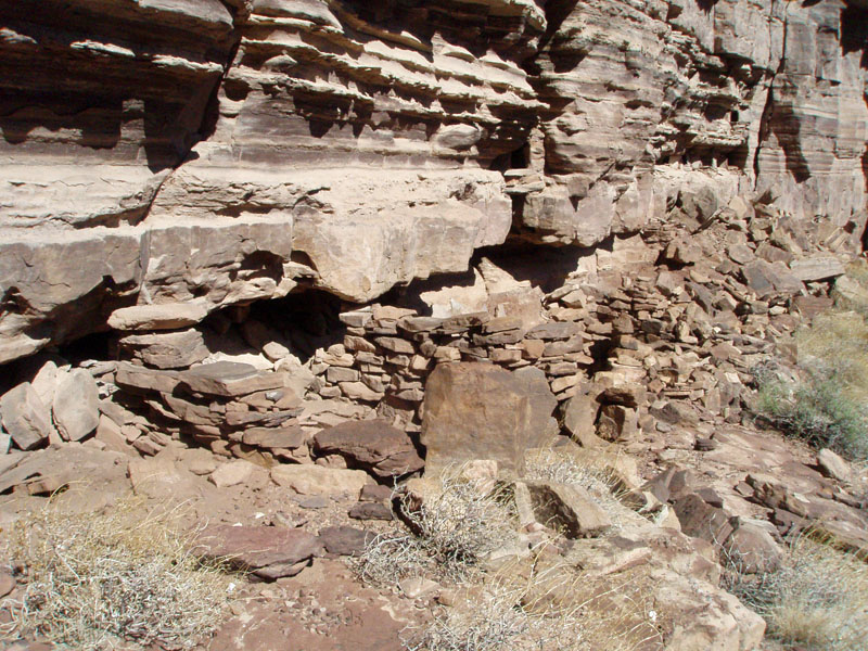
Most remarkable among the ruins were the number and condition of the many granaries squeezed into the cracks of the cliffs. |
The
mortar was holding up well for these granaries. In this case, it completely
fills in the crack above |
|
|
|
||
 |
 |
 |
| Wall construction for dwelling. | Ledge granaries, on two levels. | Dwelling with fire pit (?) in back. |
|
While visiting these ruins, I saw that there was a real easy exit to the
Tonto level, to the west. Harvey Butchart came down this route, in
1970, on a day hike to the river. I thought about spending some
time looking for this route, but once at the overview, I was
dissuaded. It seems that any route would have to be quite steep,
although Butchart's trek went east of the main drainage and then
followed a sloping ramp back to the west.
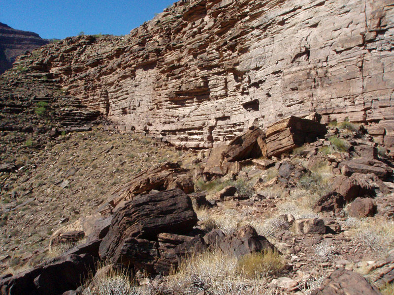
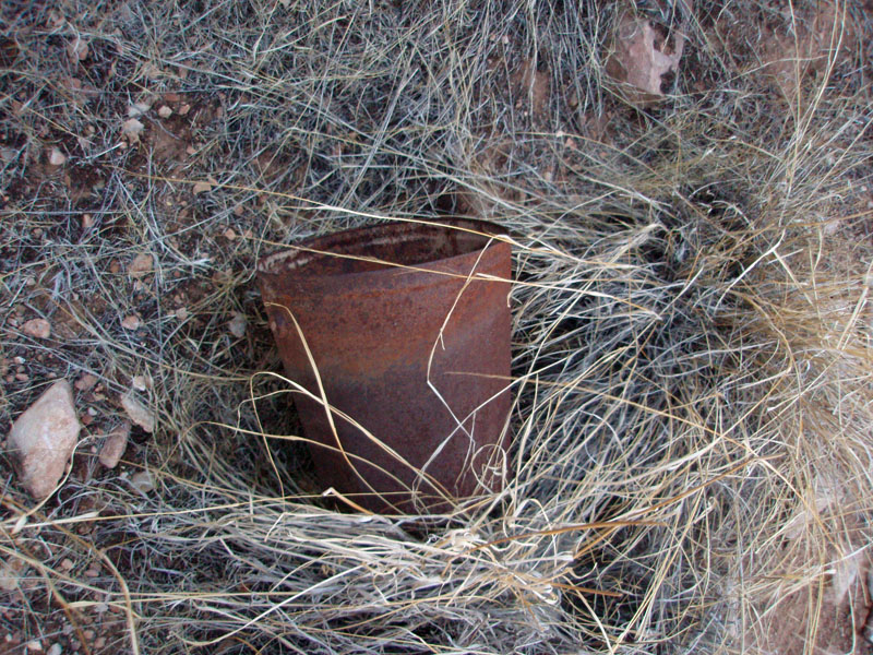
So, instead of exploring a way to the river, I headed down to the bed. I saw that there was water flowing down through this section. Once there, I found a nice flow, and large pools. I followed the bed upstream and found that the water started up just a short distance below the Cottonwood tree - probably less than 50 yards below the spot where I had seen the water disappear into the bed. So it goes! I picked up my water supplies and continued up the canyon. I also wanted to look for some trail signs to the east, which I had read about. I found a bit of a trail, and an old bucket. This led up to the cliffs and followed along at their base to a ravine, which I was able to climb out, and find myself on the Tonto trail. Nice little shortcut, if one is coming from the east, so I marked it with a couple of cairns. Also, there were a couple of nice camping spots at the base of these cliffs, not too far from the spring. |
|
|
||
|
|
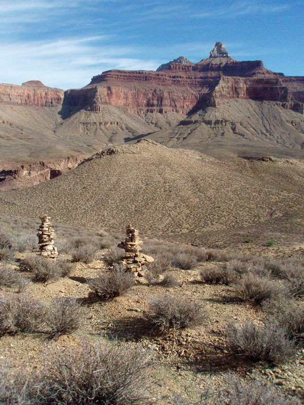
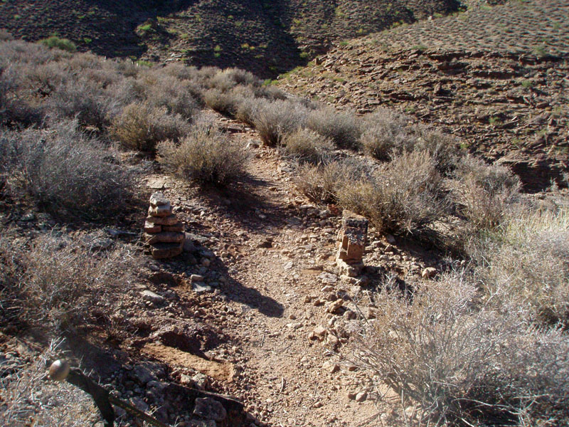
When hiking out the Tonto trail to the South Kaibab trail, you pass these cairns, marking the boundary of the Cremation Use Area. |
|
|
|
||
| On Sunday morning, I was up and out by 7:15 a.m. I didn't have any sun until I reached Cremation canyon, at about 8:30 a.m. I picked up my water (drinking most of it right away) and headed on my way. I decided to follow the Tonto trail to the South Kaibab, so I could judge whether my "shortcut" route, from the bottom of the Redwall, really saved any time. Well, I reached that spot at 10:30 a.m. So, it took me one hour and forty minutes to cover this stretch (Cremation to bottom of Redwall on the So. Kaibab). Coming down, it took me one hour and twenty minutes. Hmm... The rest of the hike out went well - I reached the rim by 1:30 p.m. and made it home before dark! |
|
|
||
|
|
Return to Hiking Grand Canyon home page |
|