|
January 1 |
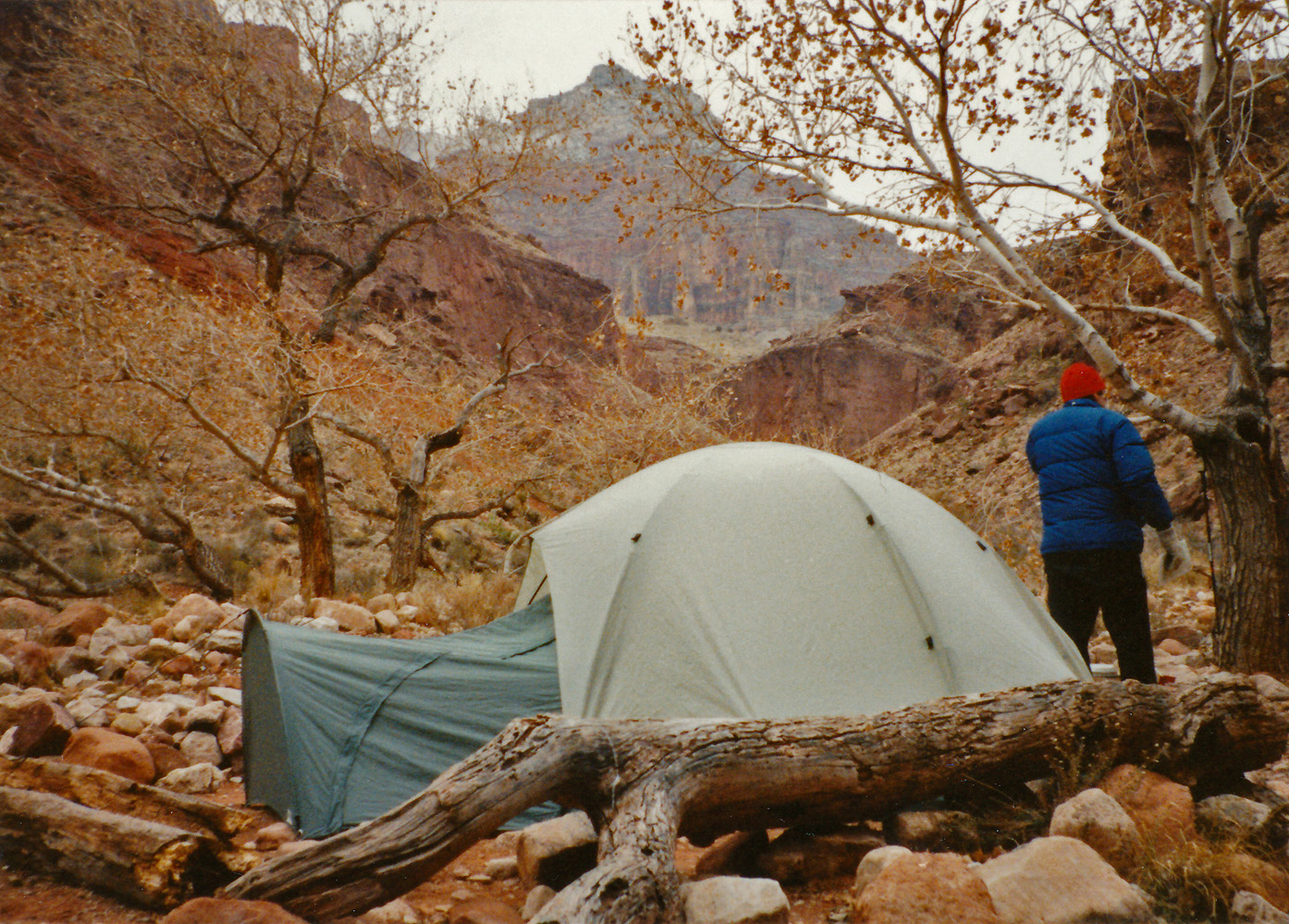
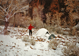
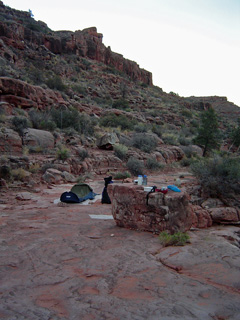
1989 - Empty Hermit Creek Campground. |

1992 - Clouds wrap around Zoroaster and Brahma. |
|
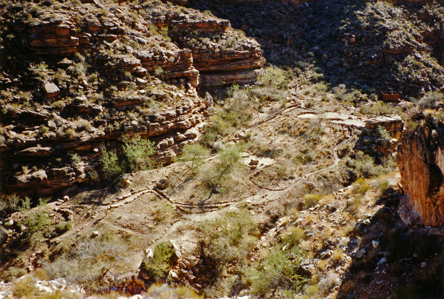
In 1989 I did a hike down the Hermit/Boucher to visit at
Slate Creek. This was my sixth day and I hiked from my camp in
Boucher to the Hermit Creek Campground, which, not surprisingly, was
absolutely empty. A solo hiker did arrive after me, just before I
did an afternoon hike down to Hermit Rapids.
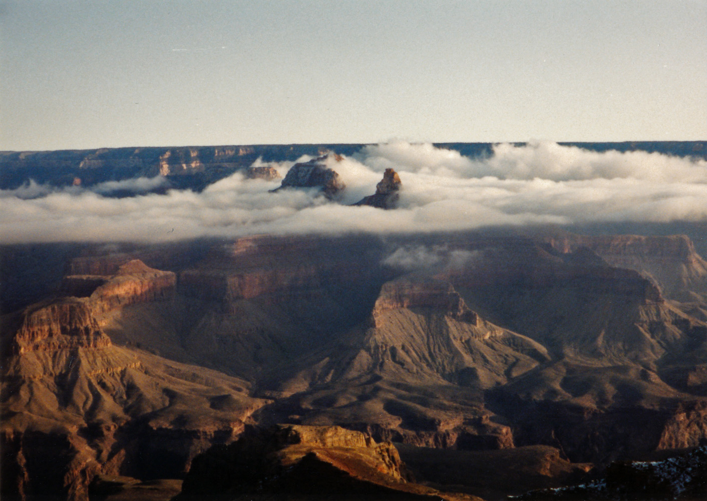
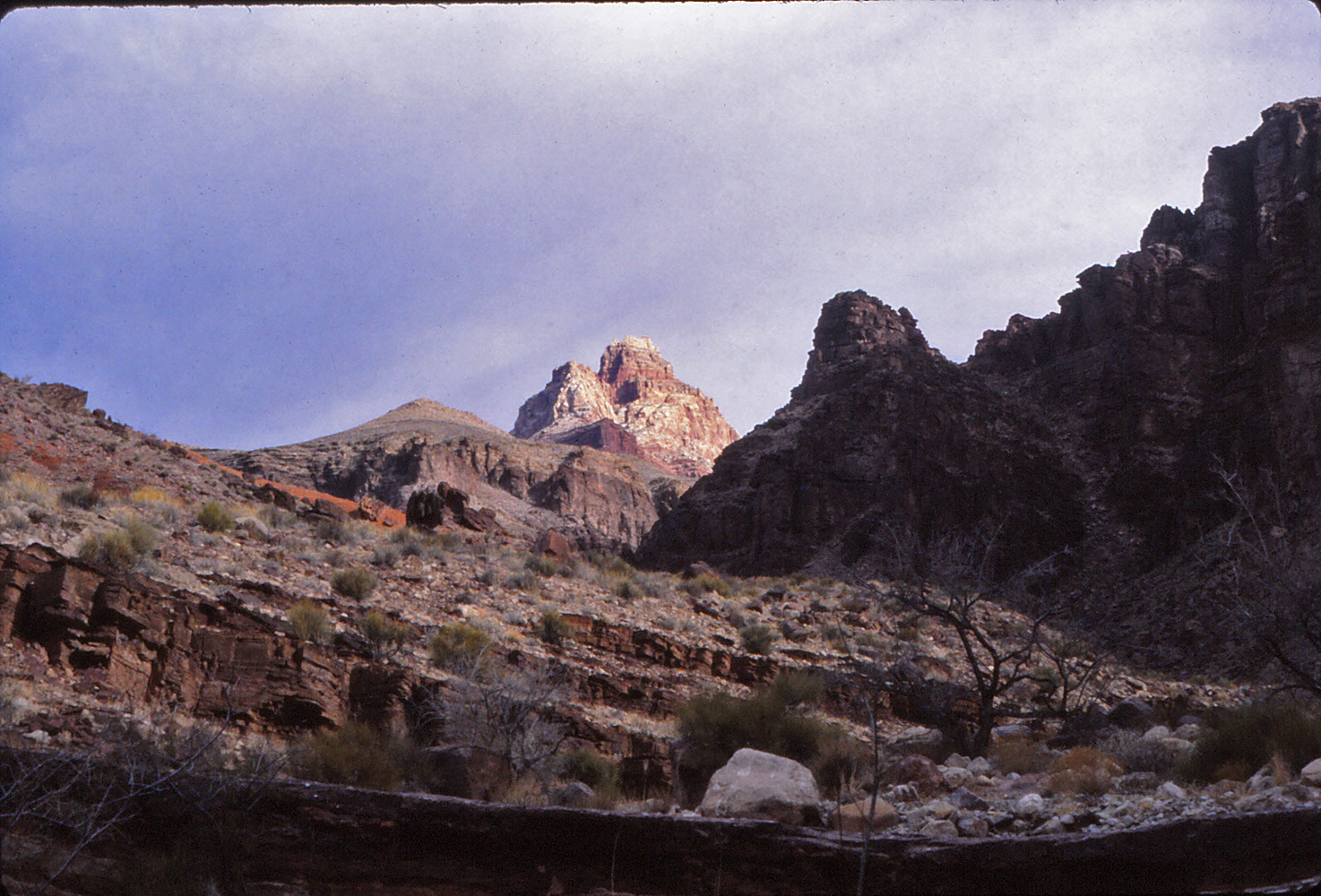
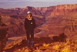
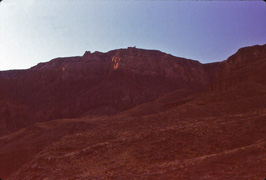
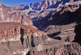
In 1992 Neil Jacobs and I did a hike over to Clear Creek.
This was our first day. We went down on the South Kaibab, passed
through Phantom Ranch and then up the Clear Creek Trail to camp on the
Tonto level for the night. Very cold day but the early morning
clouds were quite spectacular as they surrounded high peaks on the north
side of the river. |
 |
|
January 2 |

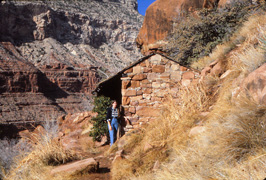
1989 - Santa Maria Rest House. |

1992 - Camp at Clear Creek. |
|
In 1989 I did a hike down the Hermit/Boucher to visit at
Slate Creek. This was my seventh, and final, day as I hiked back
up to the rim on the Hermit Trail. Along the way I took this photo
of the rest house at Santa Maria Spring.
In 1992 Neil Jacobs and I did a hike over to Clear Creek.
This was our second day and pretty much all we did was hike from our
camp on the Tonto the rest of the way to Clear Creek where we set up our
camp for the next two nights. I brought along the vestibule add-on
which served us well when the weather turned. But I think my main
reason was that the zippered door on that side of the tent was busted. |
|
|
|
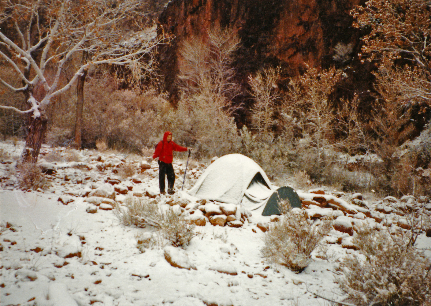
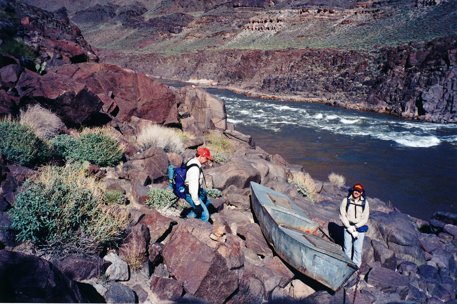
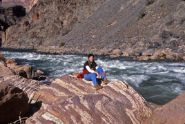
January 3 |
1992 - Snow in Clear Creek! |

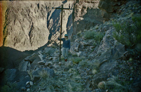
1999 - John and I at the Ross Wheeler. |
|
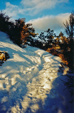
In 1992 Neil Jacobs and I did a hike over to Clear Creek.
This was our third day and we did a day hike down the creek with the
intent of reaching the river. But, the weather turned on us and we
probably only got about half way. It snowed quite heavily in the
afternoon and when we returned to our camp, the tent was covered in
snow. Not a very usual sight this deep in the canyon!
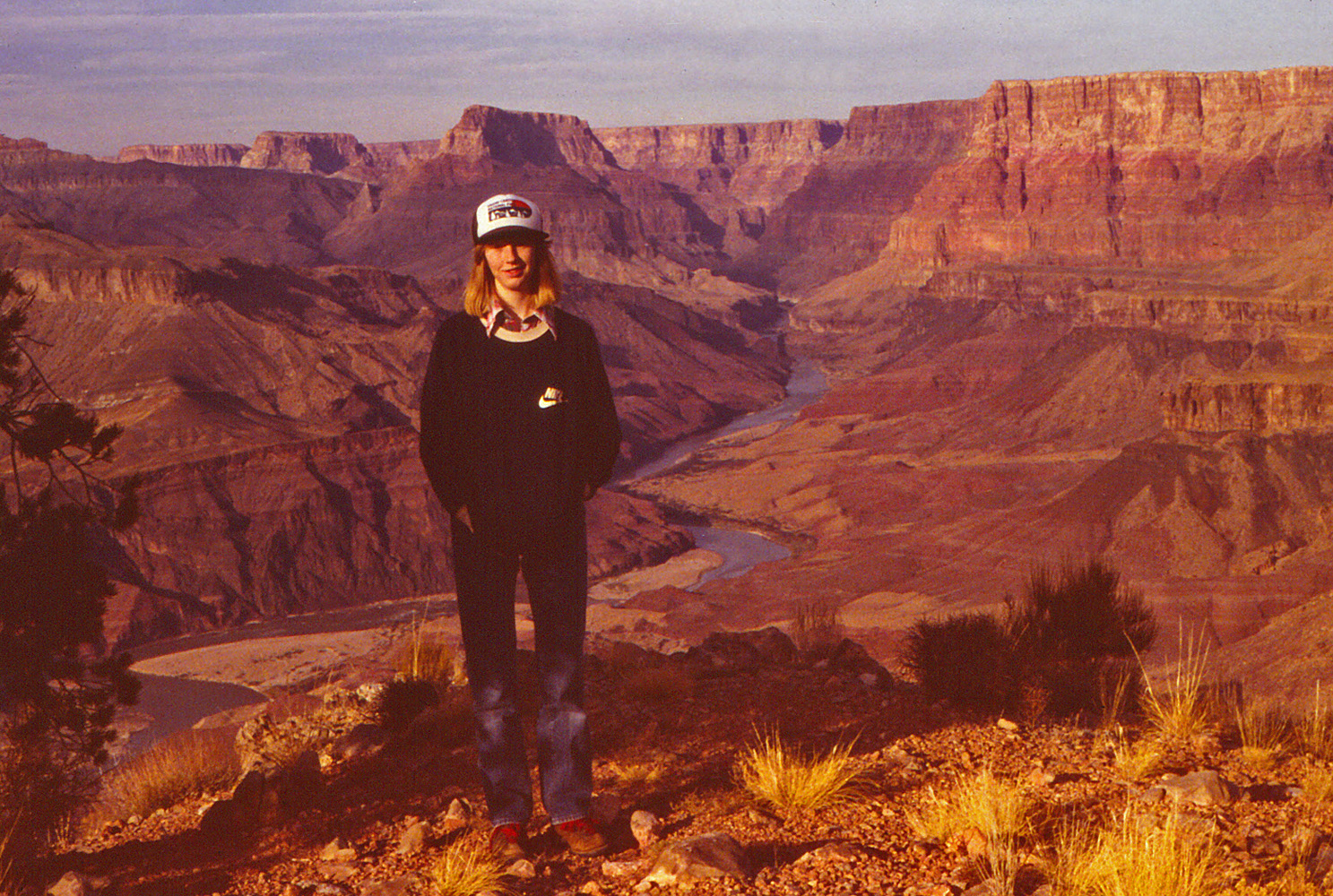
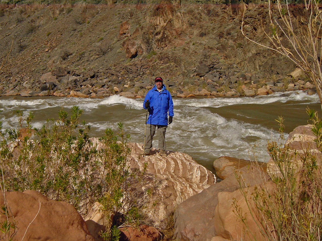
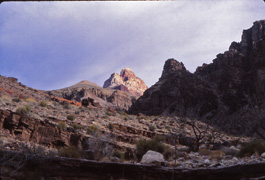
In 1999 John Eastwood and I did a day hike down the South
Bass to the river and back. It had been a very mild winter and we
were able to get to the trailhead on roads that would otherwise be
impassible. Here's a timed photo of me and John (I didn't quite
make it to my spot!) at the abandoned Ross Wheeler just above Bass
Rapids.
In 1981 I did a day hike down the South Kaibab to Phantom Ranch and
back up the Bright Angel Trail. [No photos.] |
|
|
|
January 4 |
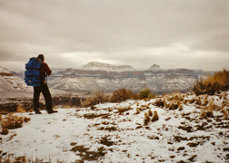
1992 - Snow on the Tonto coming out of Clear Creek. |
2003 - At the end of the Redwall below Lipan Pt. |
2006 - Looking west from the Thunder River Trail. |
|
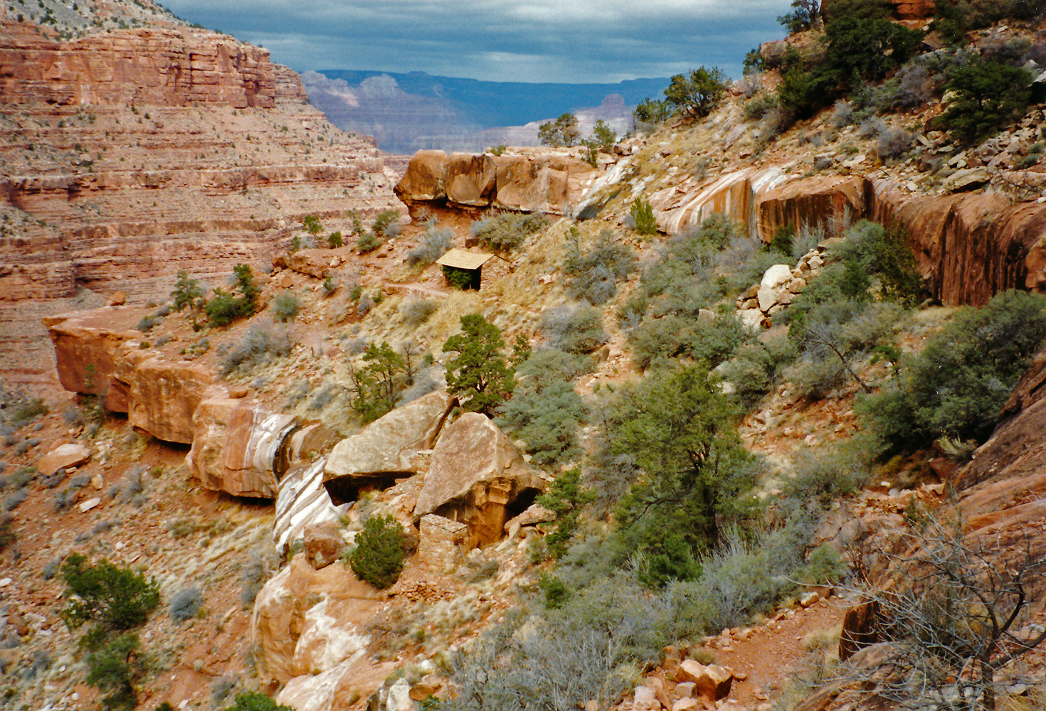
In 1992 Neil Jacobs and I did a hike over to Clear Creek.
This was our fourth day and we packed up our camp in Clear Creek and
headed back towards Phantom Ranch. This night we camped along the
Tonto, which was still plenty snowy, as you can tell by this morning
photo of Neil on the trail.
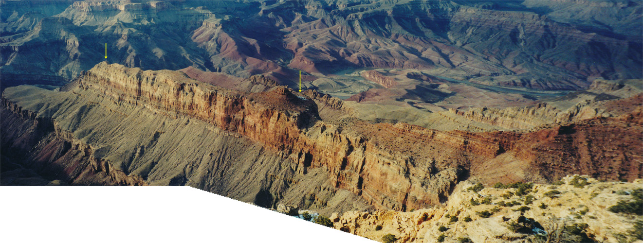
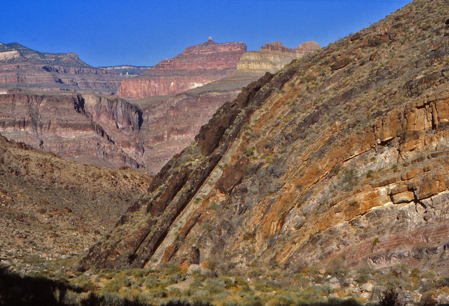
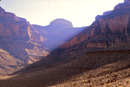
In 2003 I did a quick day hike on the Tanner Trail. I
had been looking at a long formation in the Redwall that defines the
east side of 75 Mile Canyon for some time and this day was the day to
see if I could hike out to the end. I could, and did the timed
shot shown. This feature is quite visible from Lipan Pt. although
the photo below shows what it looks like from the trail before reaching
the saddle with 75 Mile. The arrow on the left shows the point I
reached (and in the photo above) while the arrow in the center shows a
bit of snow in the shadow of the little unnamed butte. [Click to
see a larger image.]

In 2006 I headed down the Old Thunder River Trail (from
Indian Hollow) with the intent of doing a hike around Fishtail Mesa.
This was the first day and I hiked down the trail, with its sweeping
views of the canyon, as shown in the photo (including Fishtail Mesa in
the center and Mt. Sinyala to the left). That night I camped near
to Fishtail Spring down low in the Supai layer. |
|
|
|
January 5 |
2006 - Camp above Fishtail Spring. |
|
In 2006 I headed down the Old Thunder River Trail (from
Indian Hollow) with the intent of doing a hike around Fishtail Mesa.
This was the second day and I decided to change my itinerary due to the
rather dry conditions, so I packed up my camp above Fishtail Spring
(shown in the photo) and hiked up and over the saddle into Indian Hollow
where I set up camp for the next few days.
In 1992 Neil Jacobs and I did a hike over to Clear Creek.
This was our fifth, and final, day as we packed up our camp in along the
Tonto and headed back to Phantom and out the South Kaibab. [No photos.] |
|
|
|
January 6 |

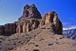
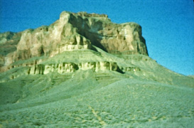
1981 - Wheeler Fold in Bass Canyon. |

2006 - Looking along Fishtail from atop the mesa. |
|
In 1981 I did my first hike down the South Bass Trail.
I left the trailhead at 11 am and reached the river by 5 pm. I
missed seeing a lot of the historical stuff in the area but not
something as awesome as the Wheeler Fold, shown in the photo.
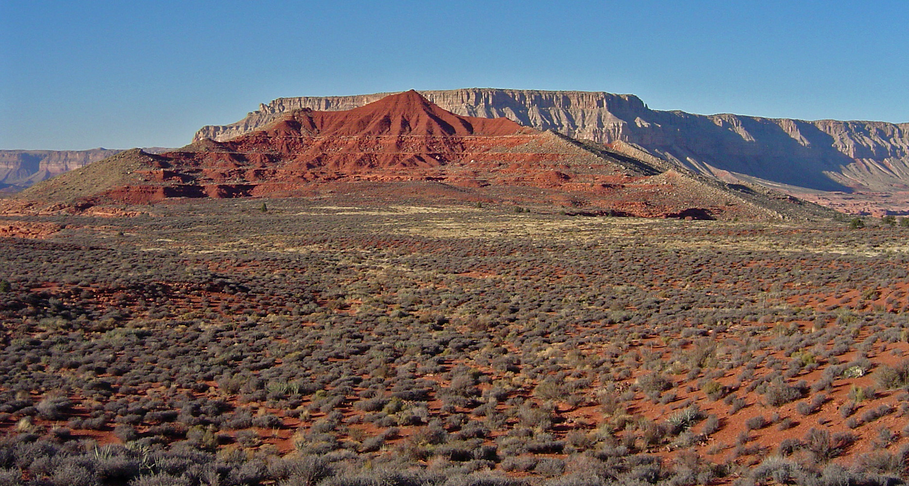
In 2006 I headed down the Old Thunder River Trail (from
Indian Hollow) with the intent of doing a hike around Fishtail Mesa but
instead spent three nights in Indian Hollow. This was my third day and I
day hiked up to the top of Fishtail Mesa and got a chance to look around
a bit, but not enough time to go all the way to the end. Still, I
did find a register in a cairn along the west rim. |
|
|
|
January 7 |
1981 - Packed up from my camp at Bass Rapids. |

1996 - Roundabout route at Pt. Huitzil. |

2001 - With Liz Scott on the New Hance Trail. |

2006 - Racetrack Knoll in Kanab Canyon. |
2012 - With John Eastwood & Duncan Orr in Hance Canyon. |
|
In 1981 I did my first hike down the South Bass Trail.
This was the second day and I got this photo of the beach where I had
been camped the night before, all packed up and ready to head for the
Tonto level, where I camped short of Garnet Canyon this night.
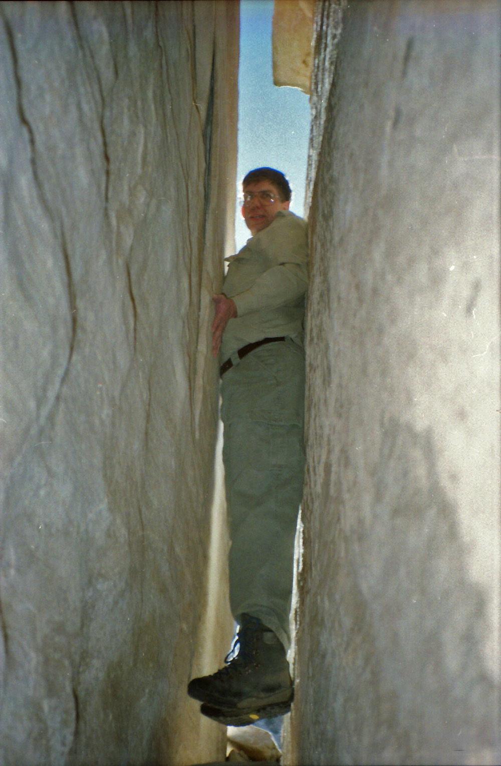
In 1996 with John Eastwood, we were able to finally crack
the secret of the Pt. Huitzil route. I was able to work my way
along this crack, suspended above the ground a bit, to a corner where I
could get to the "ladder" that leads up to the hole in the Coconino.
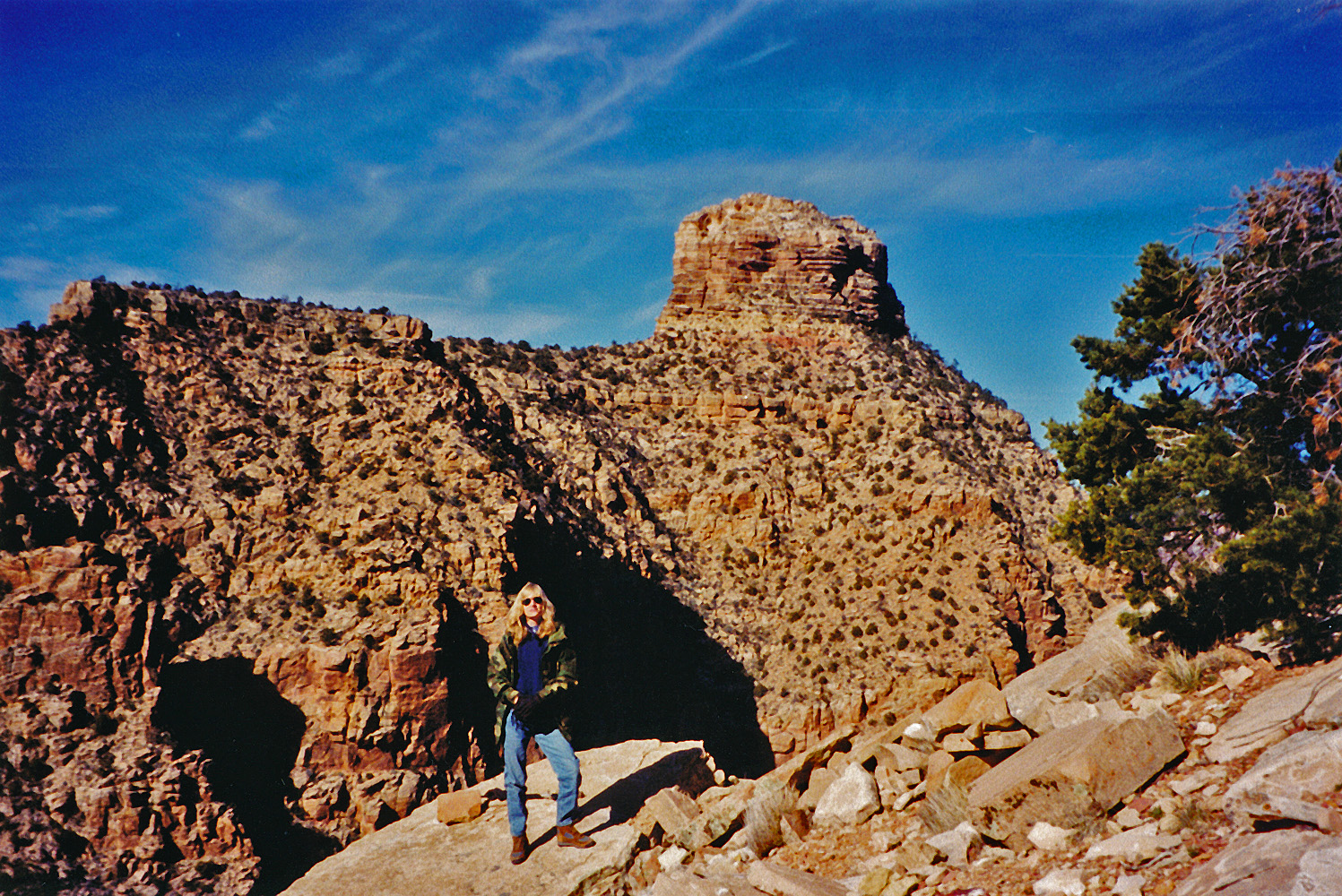
In 2001 I did a couple of short hikes with Liz Scott - down
the South Kaibab to Cedar Ridge and, as shown here, down the New Hance
to the lower part of the Coconino (with Coronado Butte in the
background).
In 2006 I headed down the Old Thunder River Trail (from
Indian Hollow) with the intent of doing a hike around Fishtail Mesa but
instead spent three nights in Indian Hollow. This was my fourth day and I
day hiked over to a good flowing creek in the next canyon to the north
(Kwagunt Hollow) and then I had hopes of hiking out to, and up to the
top of Racetrack Knoll. I ran out of time for that but did get
this nice shot of the knoll.
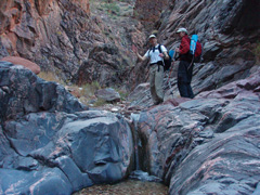
In 2012 I was joined by John Eastwood and Duncan Orr for a
day hike down into Hance Creek. We had thought to be able to get
all the way to the river, but there just wasn't enough time - we made it
to the first of three major bypasses. But, we also got to use a
definite trail down into Hance from the Tonto on the west side of the
creek that was a cool score for us. Here is John and Duncan at one
of the many idyllic pools in Hance. |
|
|
|
January 8 |
1981 - Elves Chasm. |
1984 - Karen on the Tanner Trail. |
2006 - Middle cliff in Indian Hollow. |
|
In 1981 I did my first hike down the South Bass Trail.
This was the third day and I was able to get to a beach a bit downstream
from Garnet where I set up camp. Then it was time for a day hike
to Elves Chasm, shown in the photo.
In 1984 I did a hike with Karen Herrera down the Tanner
Trail for a few days. Here she is at the Redwall Overlook on our
way down on this first day.
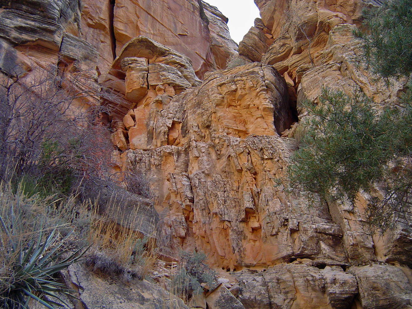
In 2006 I headed down the Old Thunder River Trail (from
Indian Hollow) with the intent of doing a hike around Fishtail Mesa but
instead spent three nights in Indian Hollow. This was my last day and I
packed up and returned to the rim directly up Indian Hollow. There
are three places that require some consideration and I recall taking off
my pack at all three. At this spot - the middle cliff - I hoisted
up my pack and shoved it onto the high ledge and then climbed up over
it. |
|
|
|
January 9 |
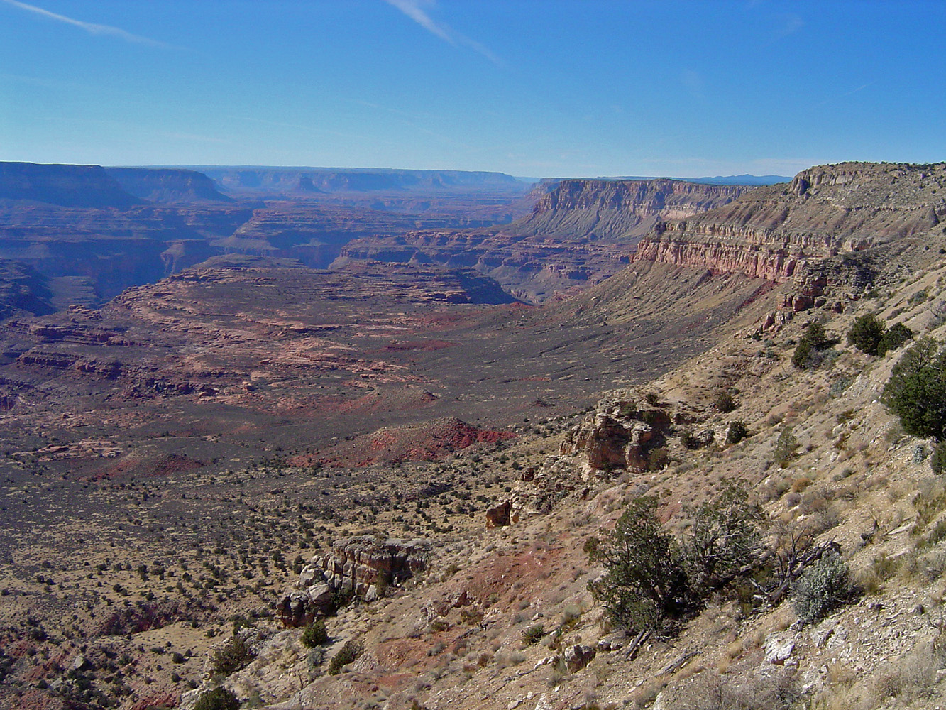
1981 - View of Mt. Huethawali up Copper Canyon. |
1984 - "Eat at Mom's" on Tanner beach. |
|
In 1981 I did my first hike down the South Bass Trail.
This was the fourth day and I moved my camp from below Garnet to the
Tonto above Bass Canyon. On the way I got this view of Mt.
Huethawali in the afternoon while looking up Copper Canyon.
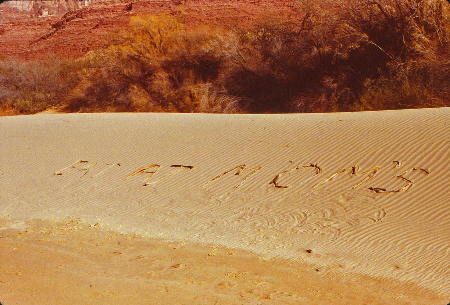
In 1984 I did a hike with Karen Herrera down the Tanner
Trail for a few days. This was our second day and we spent the
morning enjoying the beach environment. With some driftwood we made
this sign that I though passing river runners would notice - Eat At
Mom's. |
|
|
|
January 10 |

1981 - Ruins near the top of the South Bass Trail.. |
1984 - Desert View Watchtower from the Tanner Trail. |
|
In 1981 I did my first hike down the South Bass Trail.
This was the fifth, and final, day and I hiked back up to the rim from
my camp on the Tonto. Up above the Coconino I spotted these ruins
(which I think pretty much everyone sees, but I missed them on the way
down).
In 1984 I did a hike with Karen Herrera down the Tanner
Trail for a few days. This was our last day as we hiked back up to
the rim from out camp higher up the trail from the river. In the
morning the Desert View Watchtower was barely visible on the rim. |
|
|
|
January 11 |
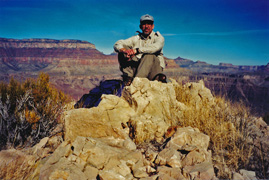
2003 - Snowpacked Grandview Trail. |
2015 - With Ty Ewing at Indian Garden. |
|
In 2003 I did one of my favorite looping day hikes - down
the Grandview to Horseshoe Mesa, off to the east to the Tonto, and
follow it around to an overview of the river above Sockdolager Rapids,
then back up to the mesa from the trail on the west prong and back to
the rim. This hike was made even more interesting by the
snowpacked conditions on the upper portion of the trail as seen in the
photo.
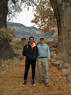
In 2015 I did an overnight hike to Phantom with a former
student of mine, Ty Ewing. He had graduated the previous month and
was still in town before leaving for his new job. Here we are at
Indian Garden on our way down. |
|
|
|
January 12 |
2015 - Misty conditions on the South Kaibab. |
|
In 2015 I did an overnight hike to Phantom with a former
student of mine, Ty Ewing. He had graduated the previous month and
was still in town before leaving for his new job. This was our
second, and final, day and we hiked up the South Kaibab after having the
early breakfast at the Phantom Canteen. The clouds were low lying
in the morning and I got this shot of a misty O'Neil Butte from the
so-called "Mormon Flats" section. Not surprisingly, Ty got to the
rim about an hour ahead of me. |
|
|
|
January 13 |
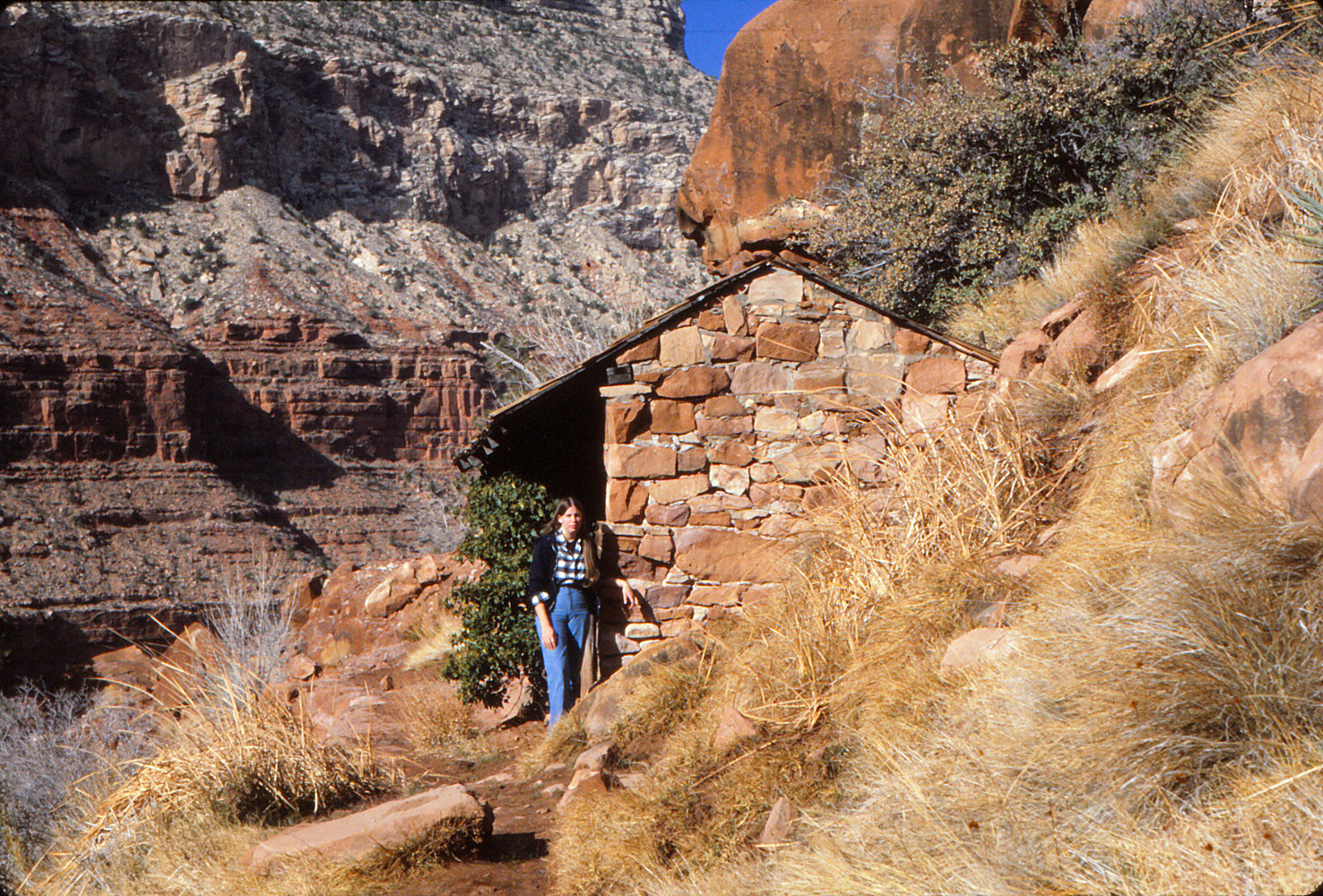
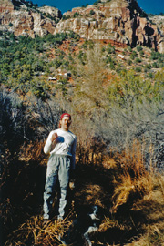
1981 - Sue Foster at Santa Maria Spring Rest House. |
|
In 1981 I did a three day trip with my sister, Sue Foster,
who, like me (and my other sister, Gayle) was working on the South Rim
at this time (all for Fred Harvey). We hiked down the Hermit Trail
and camped at the creek for two nights. This was our first day and
I took this picture of Sue at the rest house be Santa Maria Spring.
If memory serves, I don't think we saw anyone else during this trip. |
|
|
|
January 14 |
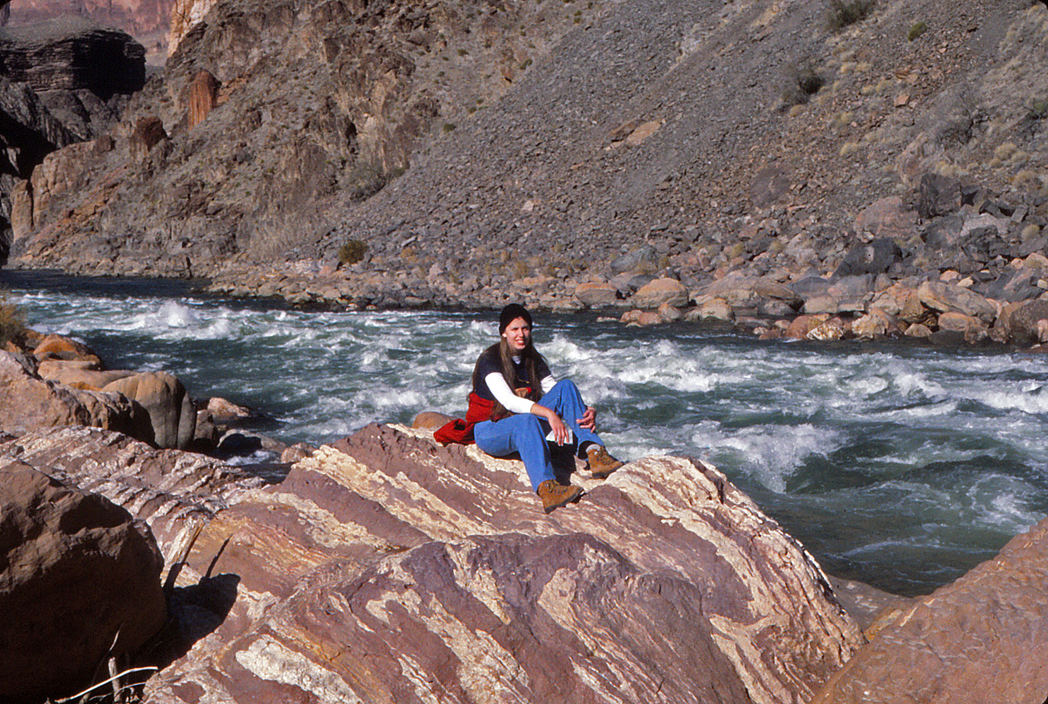
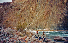
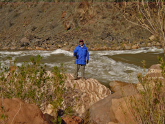
1981 - Sue Foster at Hermit Rapids. |
|
In 1981 I did a three day trip with my sister, Sue Foster,
who, like me (and my other sister, Gayle) was working on the South Rim
at this time (all for Fred Harvey). We hiked down the Hermit Trail
and camped at the creek for two nights. This was our second day and
we did a day hike down to the river. Here is Sue at Hermit Rapids
on a cool, but nice and sunny day. |
|
|
|
January 15 |
|
In 1981 I did three day trip with my sister, Sue Foster,
who, like me (and my other sister, Gayle) was working on the South Rim
at this time (all for Fred Harvey). We hiked down the Hermit Trail
and camped at the creek for two nights. This was our last day and
we hiked back up to the rim on the Hermit Trail. [No photos.] |
|
|
|
January 16 |
1999 - With John Eastwood at Boucher Rapids. |
|
In 1999, John Eastwood and I "day-hiked" down the Boucher
Trail (from the Silver Bell trailhead) to the river and back. It
had been a very mild winter and lent itself to this kind of hike.
Still, we reached the creek in the mid afternoon and despite our better
judgment (OK, despite John's better judgment!) we put in the time to get
to the river, where this photo was taken. It turned out to be a
grueling hike back up as we didn't reach the trailhead until after
sunrise the next morning. Occasional napping along the way during
a bitterly cold night was less than pleasant. John has since
become skeptical when I suggest a "day hike," wondering if that means 24
hours! |
|
|
|
January 17 |
2004 - On Horseshoe Mesa. |
|
In 2004 with John Eastwood and one of my MBA students,
Peter, I did a day hike down the Grandview to Horseshoe Mesa, then down
to Cottonwood Creek and around to the trail that leads up the west prong
of the horseshoe, with a side trip to the Cave of the Domes. Here
is a photo of me on the mesa - I think that the cairn marks the route to the cave.
In 1999, John Eastwood and I "day-hiked" down the Boucher Trail
(from the Silver Bell trailhead) to the river and back. It had
been a very mild winter and lent itself to this kind of hike. We
reached the river very late in the afternoon (on the 16th) and had to
hike up mostly in the dark, not reaching the rim until after sunrise on
this day. [No photos.] |
|
|
|
January 18 |
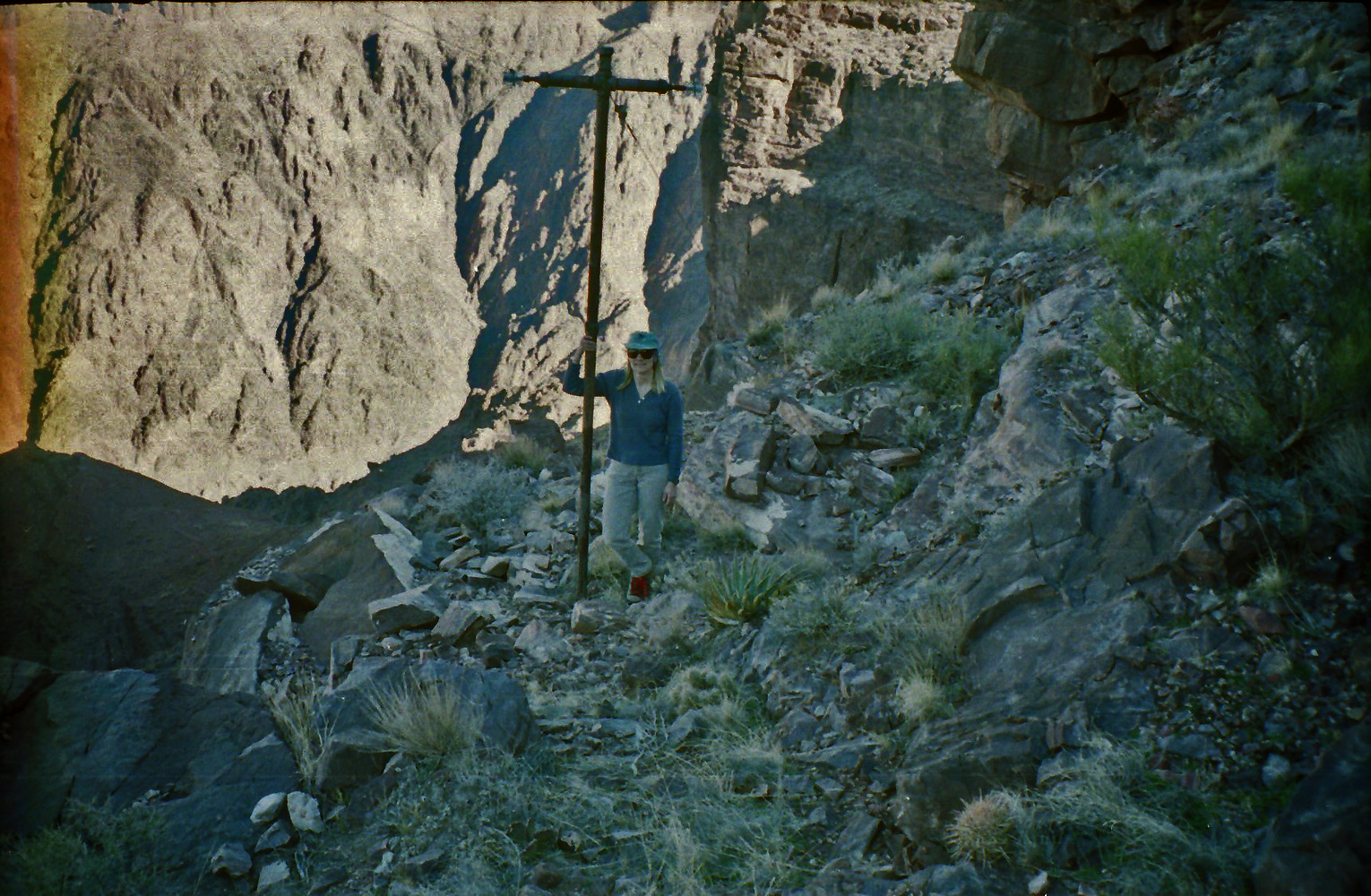
2003 - Vicki Wallis on Telephone Trail. |
|
In 2003 Vicki Wallis and I did a day hike down the South
Kaibab, across the Tonto and up the BA. I wanted to use this
opportunity to check out the route that the telephone line takes from
"The Tipoff" on the South Kaibab Trail at the Tonto level. We
followed the line to the edge of the Tapeats and there was a rough trail
through the cliff that led down to a ridge that the regular trail
passes by. Here she is at one of the better spots on this route
next to one of the telephone poles. |
|
|
|
January 19 |
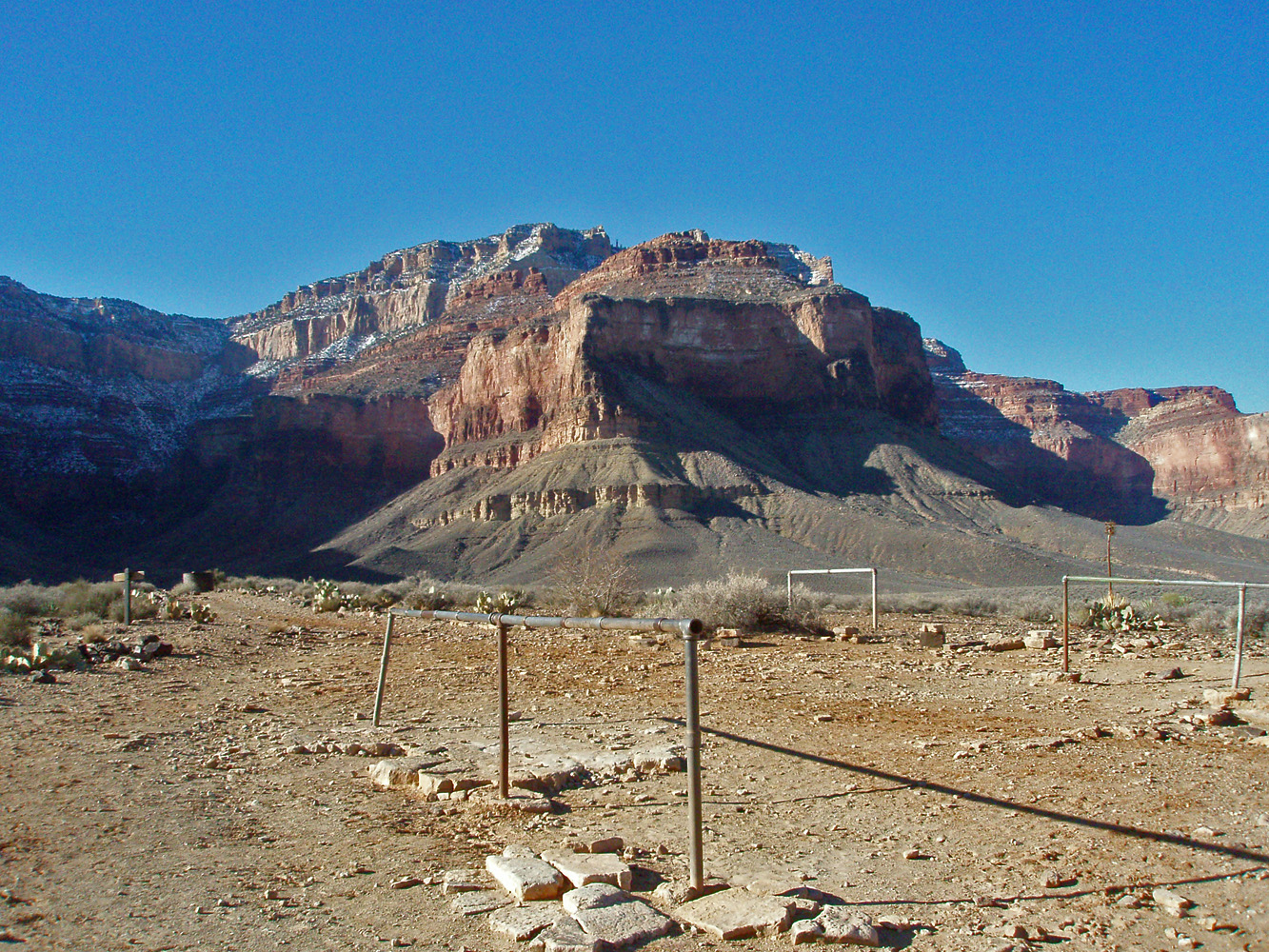
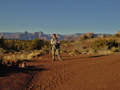
2008 - The South Rim from Plateau Point. |
|
In 2008 I went up to the South Rim to do a quick day hike to
Plateau Point. Not many on the trail and absolutely deserted out
at the point. Here's the view looking back to the rim. If
you look closely, you'll see the old headframe from the Orphan Mine.
In 1981 I started a nine day trek to Asbestos Canyon. This
first day I hiked down the South Kaibab and then on toward Clear Creek.
Did I make it all the way there? I don't know as I didn't keep a
record. Also, no photos for this first day. |
|
|
|
January 20 |

1981 - Angel's Gate (aka Snoopy Rock). |
|
In 1981 I did a nine day trek that took me to Asbestos Canyon. This
was the second day (and the first picture!!), of Angel's Gate as I was
contouring without a trail along the Tonto Plateau. |
|
|
|
January 21 |
1981 - Newberry Butte. |

2006 - In South Canyon. |
|
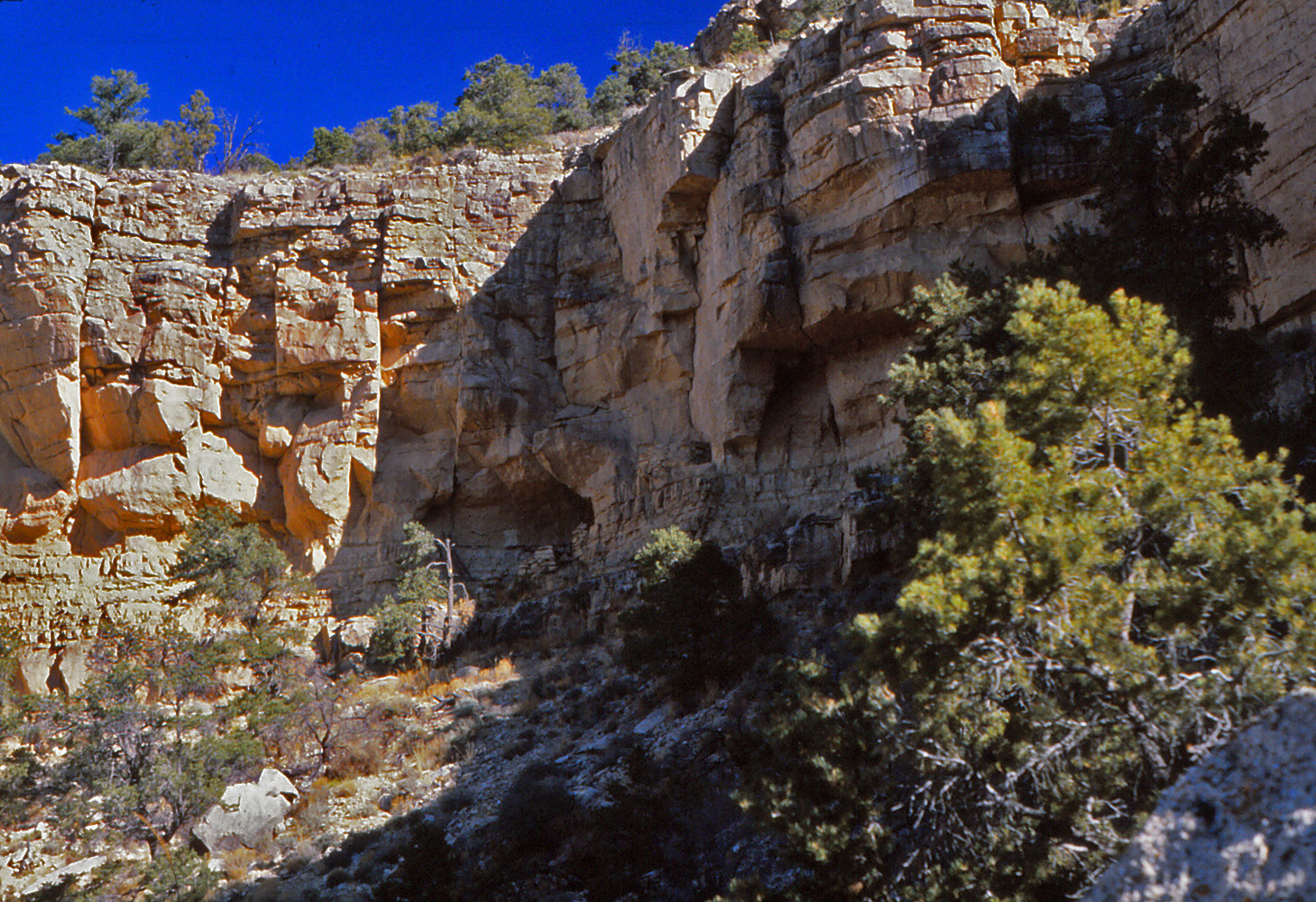
In 1981 I did a nine day trek that took me to Asbestos Canyon. This
was the third day when I hiked from the Tonto near Hall Butte to
Asbestos via the saddle at Newberry Butte, shown here in the photo, as
viewed from the saddle. Note my pack laying on the ground about
thirty feet away. I had followed a route through Vishnu Canyon
that another hiker (Doug Romer; another Fred Harvey employee) told me
about that came across the bed below the fall. That required a
very sketchy few steps across a spot about fifteen feet above the bed
that nearly made be turn back. After about an hour of
contemplation I made the crossing. But, as I climbed up the other
side, to the Newberry saddle, I saw that it would have been much easier
to cross further up the bed, above the fall, and that is the way I
returned a few days later.
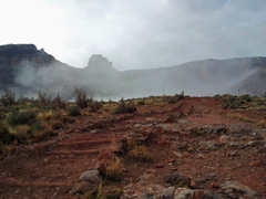
In 2006 Erik Drake and I went up to Marble Canyon to do a
day hike down South Canyon. We checked into the Cliff Dwellers
Lodge on the way in so we wouldn't have to drive all the way back to
Flagstaff after what we expected to be a long day. Great weather,
although cold. Frozen water pockets and dripping icicles in the
bed of South. We got as far as the overlook of the river atop the
Redwall before we had to turn back. Here is Erik on the long
bypass of a cliff near the Bedrock Canyon junction. We had to
ascend from the bed in the dark. Thankfully the numerous cairns
showed up well in our headlamps and kept us on the right route to the
rim. We were both anxious to get to the lodge and enjoy some hot
chocolate! I wrote up a fuller account
here. |
|
|
|
January 22 |
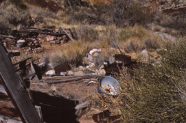
1981 - Remains of Hance's camp in Asbestos. |
2000 - John Eastwood in Crazy Jug. |
|
In 1981 I did a nine day trek that took me to Asbestos Canyon. This
was the fourth day and I got to do some day hiking in the Asbestos area.
Here is a photo of the camp remains here, which were mostly gone when I
returned to this area in 1993. Note the alarm clock (facing away)
sitting on the cast iron stove, along with a big pot. At the 2016
Grand Canyon Historical Society
Symposium
presenter Shane Murphy argued that most of the mining in the canyon that
we associate with Hance was, in fact, being directed and done by William
Ashurst, who was a partner with Hance.
In 2000 John Eastwood and I (and our dogs - Annie, Peppyr
and Rocket) went up to spend the day on the Big Saddle Trail in Crazy
Jug Canyon. Here is John down near the spring with Peppyr beside
him and Annie out in front. |
|
|
|
January 23 |
1981 - Mine/tunnel in Asbestos. |
|
In 1981 I did a nine day trek that took me to Asbestos Canyon. This
was the fifth day and I got to do some more day hiking in the Asbestos area.
I followed the wide bench to the west and got this photo looking back
east with a bit of Hance Rapids showing on the river and, barely
visible, the Watchtower at Desert View on the rim. Circled on the
image is the outlet of a mine from the other side of this point that is
really a tunnel that ends on this cliff face. |
|
|
|
January 24 |
1981 - An unusual view of Vishnu Temple. |
|
In 1981 I did a nine day trek that took me to Asbestos Canyon. This
was my sixth day and time to start my return. I packed up and
hiked back to camp on the Tonto out in front of The Howlands Butte.
Along the way I took this photo looking up at Vishnu, seemingly from my
route across Vishnu Canyon. On this hike I only took 16 pictures
and this was the last one! Back then paying for film, carrying
film, and paying to develop film, seemed prudent. Today
(2017) that seems rather appalling. |
|
|
|
January 25 |
2003 - Looking back south from Plateau Pt. |
2004 - At Hermit Rapids. |
|
In 2003 I did a quick day hike down the Bright Angel Trail
to Plateau Pt. and back. All of my photos turned out fuzzy, and
this the best of the lot with some stylization courtesy of Photoshop.
This is also the very last roll of film I have used!
In 2004 Erik Drake and I went down the Hermit Trail to the
river and back on a day hike. Here is a photo Eric took of me at
the rapids. [If you look back to my photo for Jan. 14 you'll see
the same rock but with the river running much lower.]
In 1981 I did a nine day trek that took me to Asbestos Canyon. This
was my seventh day and I hiked from my camp out in front of The Howlands
Butte and into Clear Creek. While there I actually had time to do
a quick hike up the creek to some ruins, although I took no photos this
day. |
|
|
|
January 26 |
|
In 1981 I did a nine day trek that took me to Asbestos Canyon. This
was my eighth day and I hiked from my camp out in Clear Creek to Phantom
Ranch. While there I did a hike up to Utah Flats and down Phantom
Creek back to camp. [No photos.] |
|
|
|
January 27 |
|
In 1981 I did a nine day trek that took me to Asbestos Canyon. This
was my ninth, and final, day and I hiked from my camp at the Bright
Angel Campground back to the South Rim. [No photos.] |
|
|
|
January 28 |
|
|
|
January 29 |
|
|
|
January 30 |
|
|
|
January 31 |
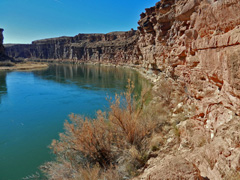
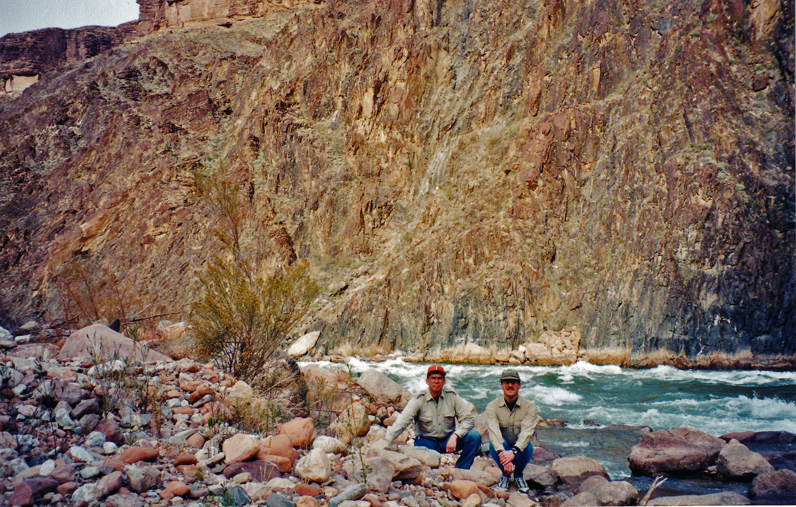
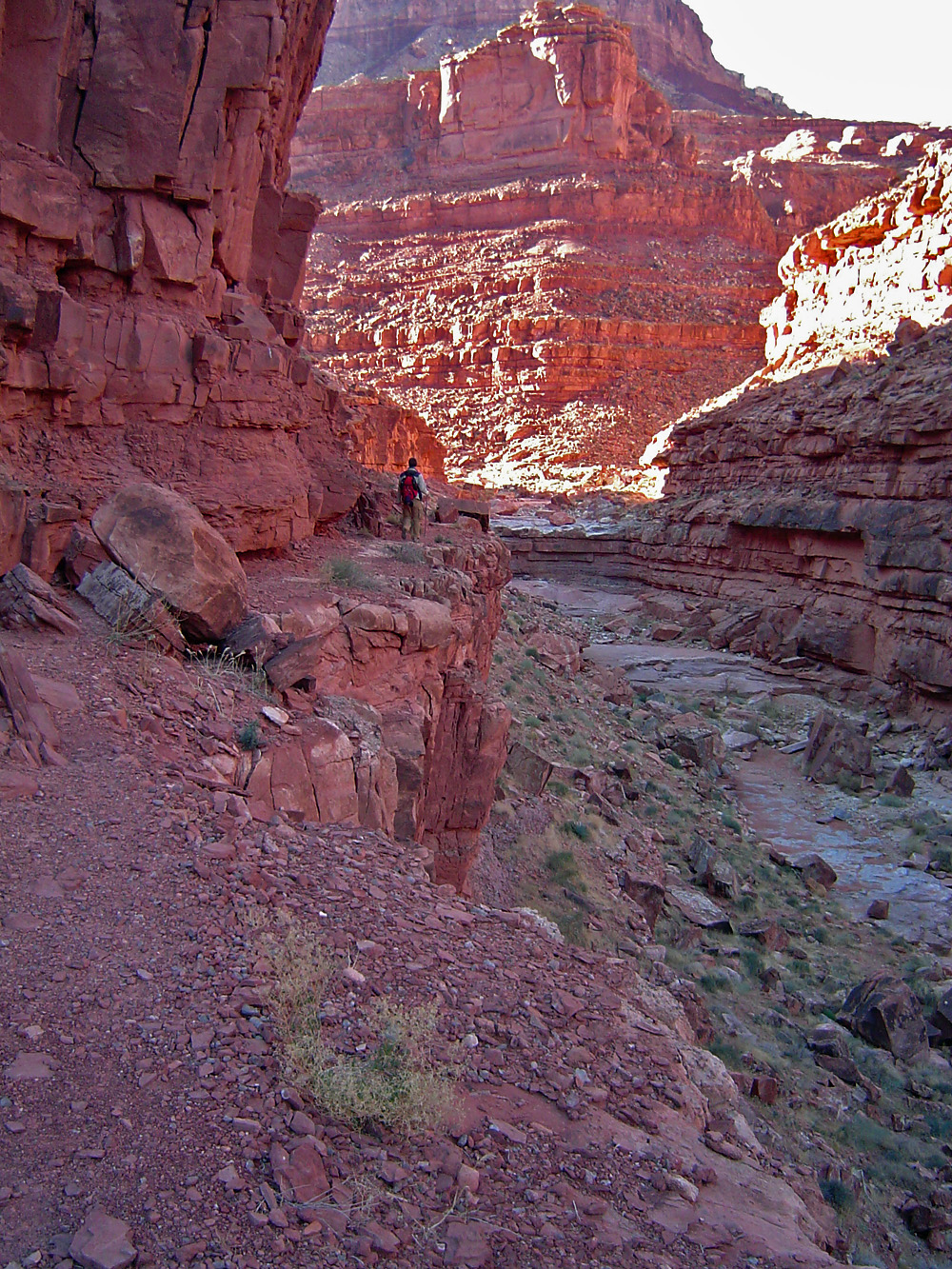
2013 - Hiking along the Colorado River. |
|
In 2013 I did a loop hike from Lee's Ferry to Cathedral
Wash, hiking down along the river, shown in the photo, and back across
the plateau. I had this notion that I could hike through Marble
Canyon on a series of (mostly) day hikes. That turned out much
harder than I thought and this is the only segment I actually did.
I wrote up a fuller account of this hike
here. |
|