 |
|
|
A Week in
Basalt & Lava Friday-Saturday, March 9-17, 2012 by Dennis Foster
Part I: Getting to Lava Rapids (Pre-hike through Day 4) |
|
|
|
|
|
|
|
A Week in
Basalt & Lava Friday-Saturday, March 9-17, 2012 by Dennis Foster
Part I: Getting to Lava Rapids (Pre-hike through Day 4) |
|
|
|
|
|
|
|
|
See Bill Ferris' trip report at his website - Grand Canyon Adventure
|
|
|
The preliminaries - getting
the kayak to the river; March 2-3 Fast forward four years and the pain and suffering of
the logistics involving the kayak are fading, while the opportunities of
what such a crossing can provide are becoming more and more attractive.
So I talked my hiking buddy Bill Ferris into a similar trip, where we
would
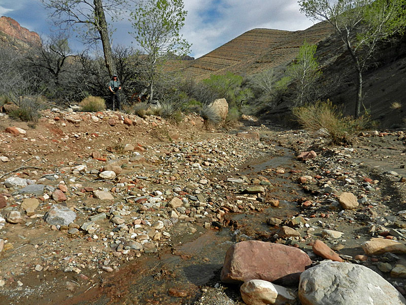
The trip would take place during my spring break. We decided to hike together the weekend before and cache the kayak. Although we had permit for one night, we had thought to make this a day hike. To lighten our load for next week's hike we also brought along extra gear to cache. Well, that kind of worked. We brought our tents and the stove and some food. Since it was mid-March there was still quite a bit of snow below the rim where the sun rarely shines. We used our Kahtoolas, caching them in the Coconino for our return. Although we were on the trail at 7 a.m. we only reached the Tanner delta area at about 4 p.m. without having figured out where to cache the kayak and supplies. So we decided to camp overnight which did use up a meal. And we didn't have our sleeping bags so the night was a bit brisk (we used space blankets!!). It was a good decision. The next morning we hauled everything out to the end of the delta near to the spot where Chris and I had launched from (and, where Harvey did his air mattress crossings!) and set up the cache. Then it was time to hoof it back to the rim which we reached a bit after 6 p.m. While our desire to do this as a day hike went by the boards at least we had more than just the kayak cached for the next week. |
|
|
||
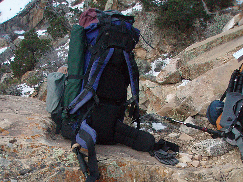 The kayak pack with overnight gear. |
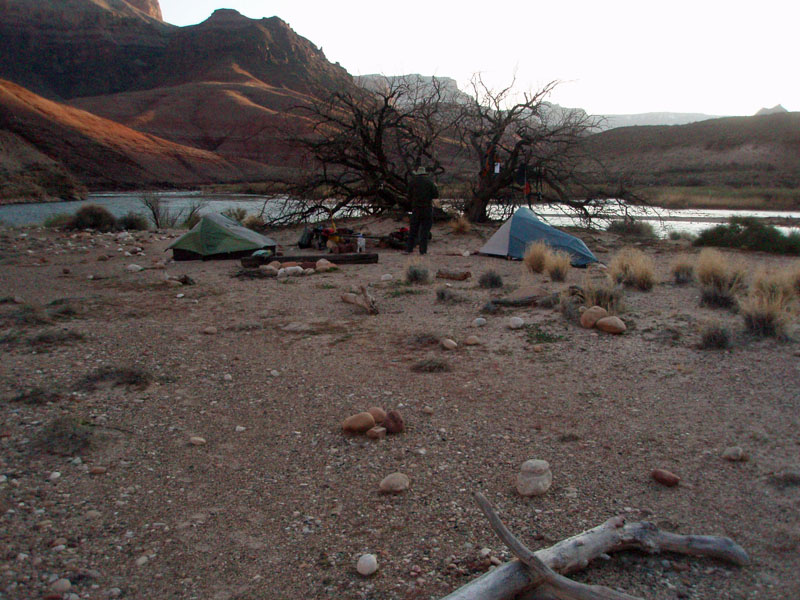 Camp at Tanner Delta. |
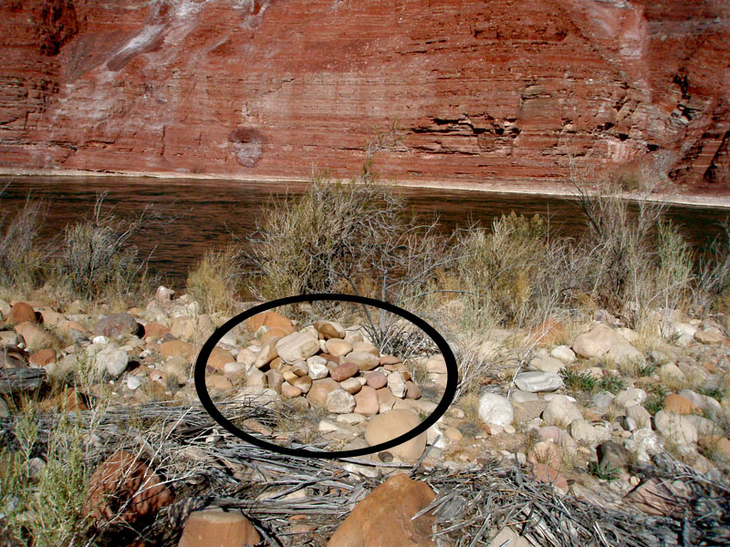 Kayak cache under "cairn." |
 Bill heads up through the Dox. |
 Trail climbs into BA shale. |
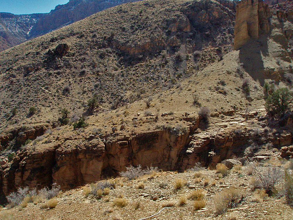
 Looking back at proposed route. |
|
Day 1 - Down the Tanner Trail
and a mishap on the river (Friday, March 9) -
At the start of the hike my pack weighed
37 pounds. That wasn't bad, but I had 15 pounds cached at the
river that would have to be added in. Partially offsetting this
was a cache I would leave at
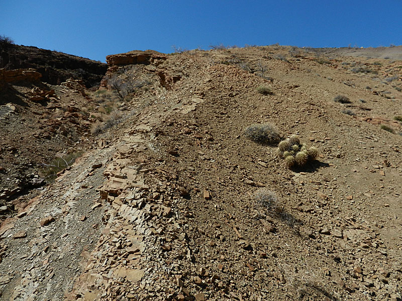
We are also bringing our Kahtoolas as there is still snow of the top sections of this trail. We only hiked for about an hour before we cached these just a bit above the 75 Mile saddle. Our coats stayed on for a few more minutes, until we got into the sun. It was just past 9 a.m. when we passed the giant rock where I often cache water. We had beautifully clear blue skies and the temperature was quite pleasant. We reached the top of the Redwall descent at 10 a.m. and took a twenty minute break. A half hour later we were down below the Redwall on the small saddle. The trail does some contouring and descending until you are on a ridge in the Bright Angel shale, atop the Tapeats. I refer to this stretch as "Tanner's backbone," as a reference to the one named for John D. Lee at Lee's Ferry. We took a short break here and then continued on our way. At, or near, the bottom of the descent through the Tapeats there is a wide bend in the trail where we stopped at noon for lunch. Someone's cache a bit downhill from here had been totally pulled apart and ripped up. Probably the ravens. Bill and I call this the "World's Smallest Cairn" site because that's exactly what we made here (I think that was on the previous trip). We only spent a half hour on lunch and were on our way by 12:30 p.m. At 1 p.m. we were on a saddle where we left the trail and descended to the west, down to the river level. As we got near we found ourselves on a short segment of the Escalante route. I've done this shortcut now five times and it never goes the same way twice! It was only another half hour to our kayak cache and thirty minutes after that, at 2 p.m., we were ready to launch our way across the river. We decided that it would take two trips to get all our stuff across the river. Bill left his camera set up on its tripod, poised to automatically snap some photos as we crossed. Besides the two of us we had our packs and I had an additional dry bag, which contained my phone, camera, wallet and other items. That was a good thing, as about two-thirds of the way across we hit an eddy (so we came to find out later) that rolled us right over!! I can still remember splashing into the river and being able to see a light green aura to the water. As I surfaced I looked briefly around, mostly in a state of panic, although both of us were wearing PFDs. Bill was holding onto the overturned kayak and was some ten feet away from me (as best I can judge these things). And, he was further out into the river while I was closer to the shore. So, I started to make my way to the shore, although with the paddle corded to my wrist that was not easy. As I got out I saw Bill heading the same way, but holding onto the kayak. I walked into the water and extended my paddle out so he could grab it and I could pull him in the last few feet. We were on some nice flat rocky ledges. By some miracle Bill's pack was floating in the water under the kayak!! My pack was also floating in the water but a ways away. But it was caught in the eddy and making a looping arc towards our position. I was able to get out just far enough into the river to snag the pack and drag it onto the rocks. Was it heavy! The thing was quite waterlogged and it may have only been a couple of more minutes before it sank. During this time I saw my dry bag. It too was caught up into the eddy, but unlike the pack it got into the slower channel that went behind an island. We were right next to this channel and I raced down alongside the cliff here, where there was just the hint of a route in an attempt to intercept the bag. I kept my paddle, thinking I might need to use it to hook the bag. Well, miracle #2 occurred as that's exactly what happened. I reached a spot where I knew I was ahead of the bag, found a spot to get to the water and partly waded out until the bag came by and snagged it. I returned to where Bill was and promptly plopped down, exhausted. Taking stock of our situation we only lost three things in this mishap - Bill's hat, his notes and map, and one of the inflatable seats for the kayak. [Bill snagged the other seat while I was down trying to get my dry bag.] So, I guess that's why I brought two hats on this hike!! Well, I hardly knew what to do except to take stuff out of my pack and try and dry it out. We still had stuff on the other side of the river, but my confidence level for using the kayak was pretty much at zero. But, it was only about ten or fifteen minutes later that a river party came by. We flagged them down for assistance. It was this guide that explained the situation with the eddy and schooled us on what we should have done. I was quite willing to hang it up on this hike and ask them to ferry us, and our stuff, back across the river. But, one of the people in this group was a park service ranger and seemed quite unwilling to do anything that involved giving us a lift. The best they would do is go across the river, gather up all the rest of our stuff (tents, boots, food caches and Bill's camera) and then bring it over to us. Well, that was OK with me, as I mentally started calculating how long it would take to hike the north side of the river to Phantom Ranch where we could cross on over the bridge and hike up to the South Rim. The sun had already set on our little spot, making it impossible to dry anything out fully. We decided to load up the kayak and cruise down the slow channel to the end and find a spot to unload our gear and find a place to camp. That went well, although Bill had to paddle back up the channel for the rest of our gear while I improved our little landing spot. We found some great camping spots atop a small bluff here overlooking the river and with more pot shards laying around than I have seen anywhere else in the canyon. We tied up the kayak at our "port" and busied ourselves setting up camp. The sun had set on us and we were eating dinner as it got dark. At 8:50 p.m. I turned in and was quite pleased that there were only a couple of damp spots remaining on my sleeping bag. |
|
|
||
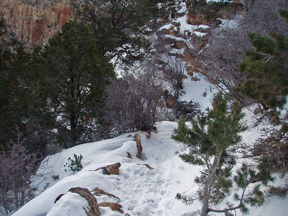
 Near Tanner trailhead in snow. |
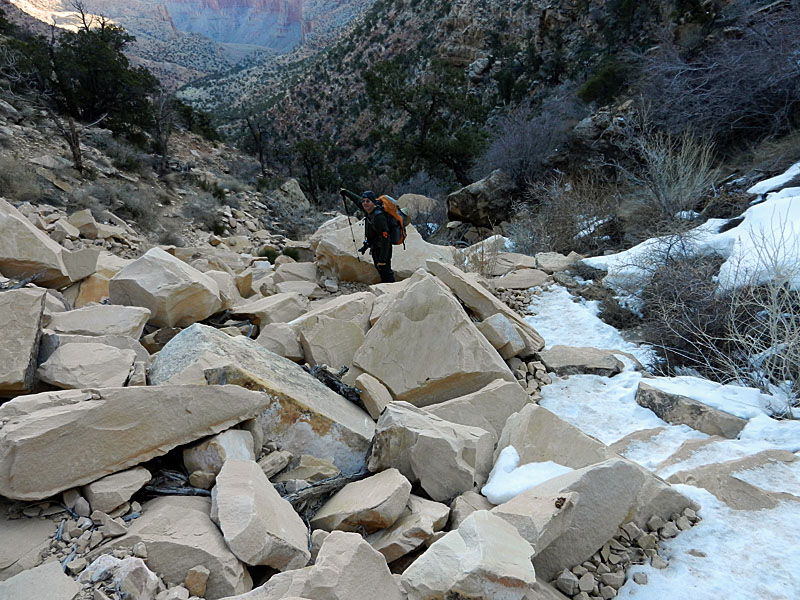 Route through Coconino blocks. |
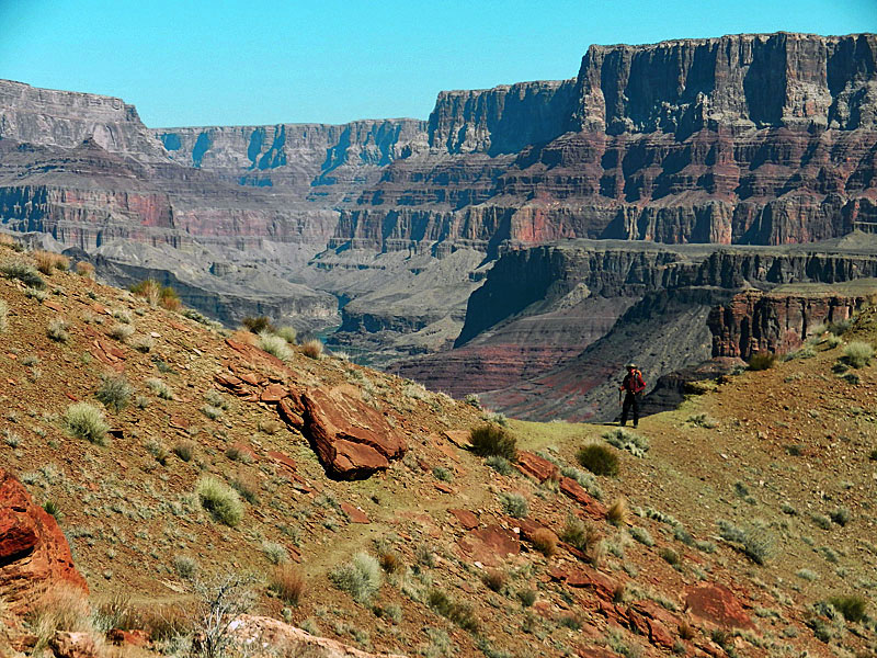 Bill on saddle overlooking river. |
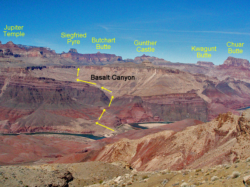
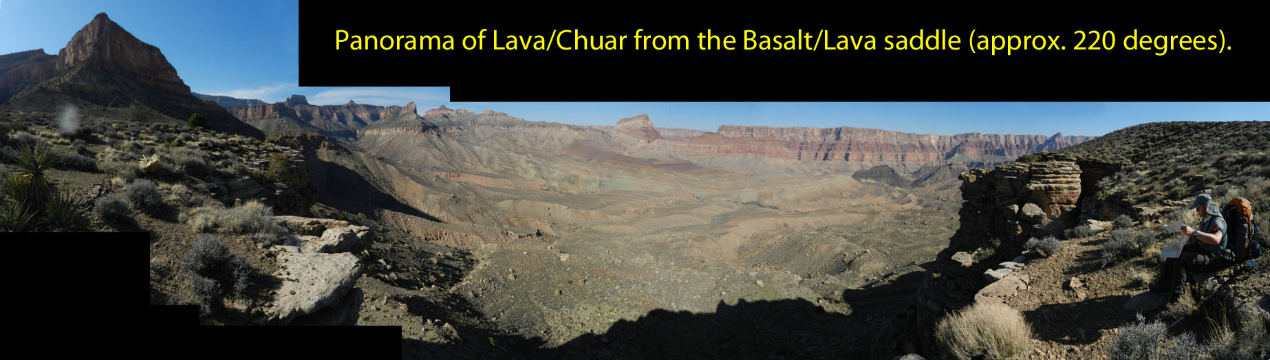
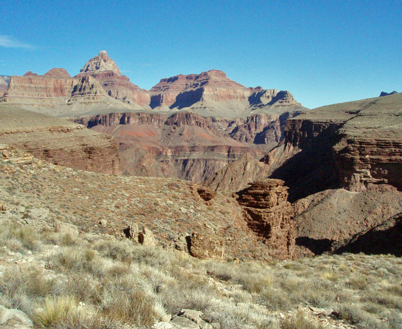
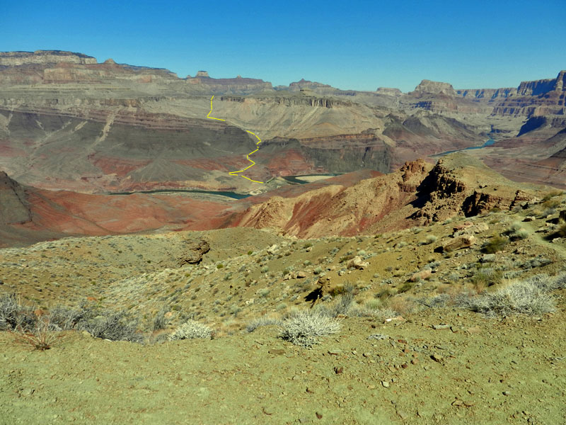 From Tanner, looking into Basalt. |
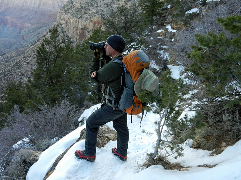
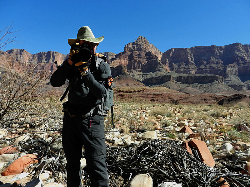
 Bill sets up for a shot along BA shale. |
 Lower section of trail on steep slope. |
 Segment of Escalante Route. |
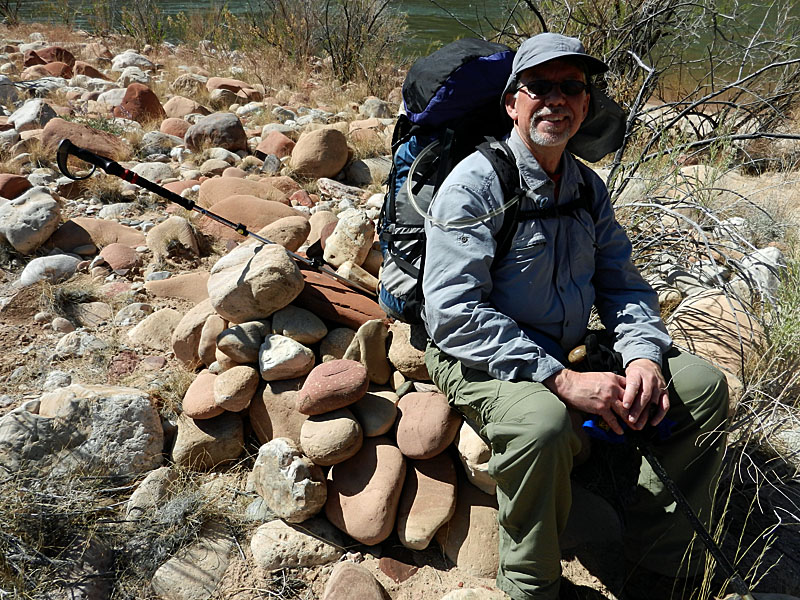 Sitting atop kayak cache. |
 Bill "armed" and ready. |
|
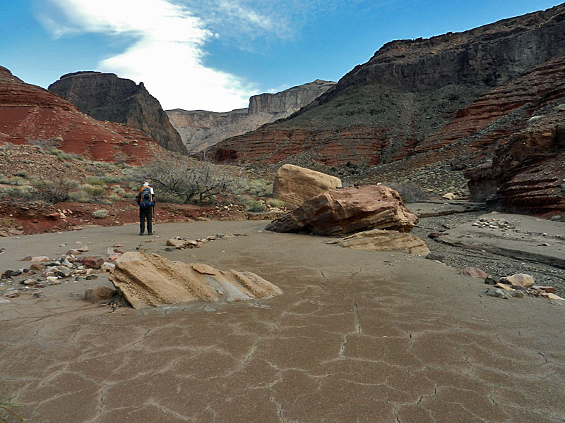
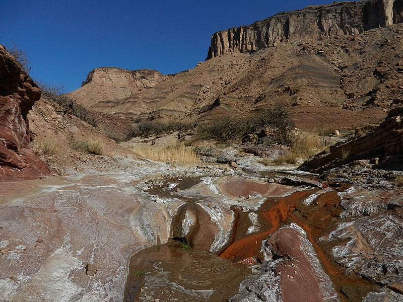
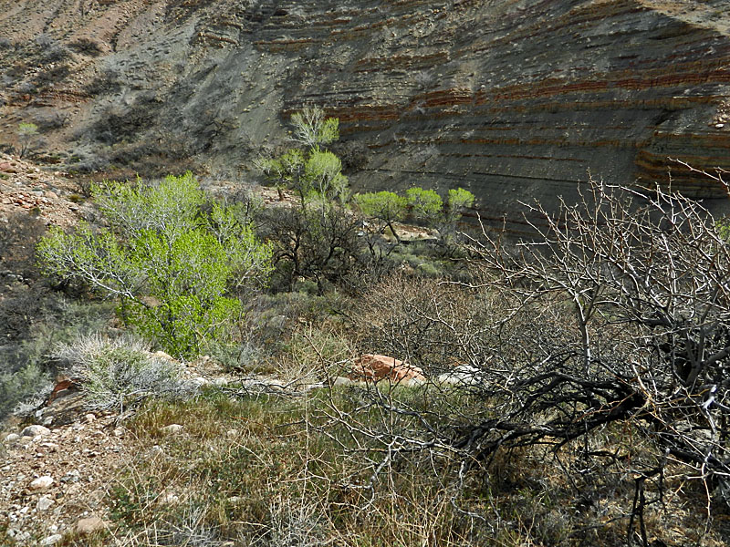
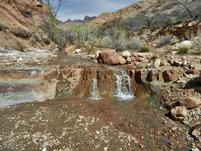
Day 2 - A Day at Basalt (Saturday, March 10) - I slept very well and got up rather late - at about 8 a.m. Since we decided to spend another night here, there wasn't any real rush to get up and get going. We got a chance to continue drying out our stuff while we poked around the Basalt delta area. We found the old miner's camp and there is is still quite a bit there. We also looked over the hillside we are camped above where pot shards are exposed. I don't think I've been to a site that had more bits and pieces than I have seen here. We also found an old nail sticking into the ground on the hill leading down to where we had tied up the kayak. At a bit past noon we were ready to take the kayak back across the river to convince ourselves that we could do this without calamity. We went along the shore up above the eddy and the beginning of this calm channel behind the island for our launch. Success! We maneuvered ourselves to the south side of the river, landing at our camping spot downriver a bit. Then we picked up the kayak and carried it back to the spot where we had launched the day before. This time we stayed in the river and below the eddy, landing on the island just below the calm channel. We got out and looked around this area for a while hoping we might find either Bill's hat or the other kayak seat, but we came up empty on that score. We crossed the calm channel and cached the kayak near to where we would use it to cross back over the river at the end of our trip. When we got back to camp the ravens were attacking our gear. We carry a couple of ratsacks to keep our food safe but the ravens were able to pick through the wire mesh and get into a couple of my meals. All in all it was only minor damage, so the ratsacks did do their job. We just kicked around the rest of this warm day, prepping for tomorrow's hike to Chuar Valley. |
|
|
||
 Old miners' camp at Basalt. |
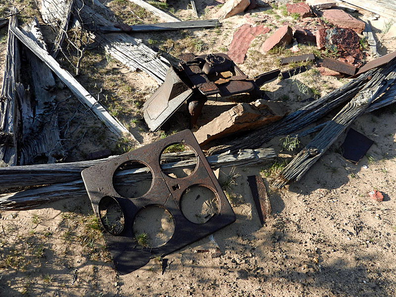 Stove at old camp. |
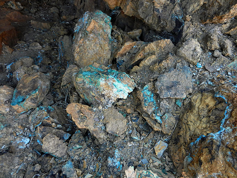
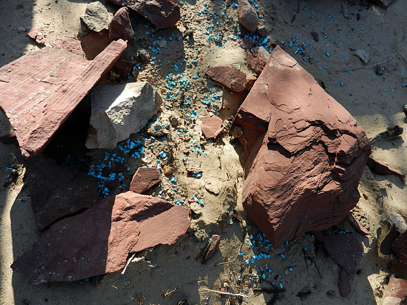 Odd looking blue pellets. |
 Lip fragment of old pot. |
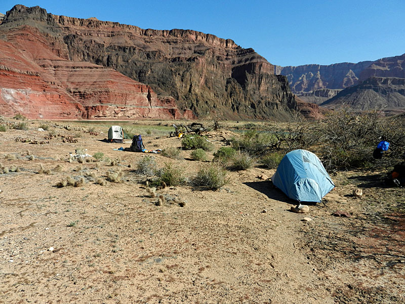 Our camp at Basalt. |
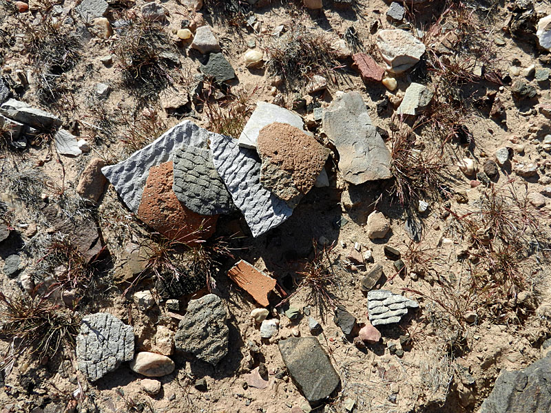 Pot shards near our campsite. |
 Old nail. |
 Backwater channel at Basalt. |
 Terrace at Basalt (see our camp). |
|
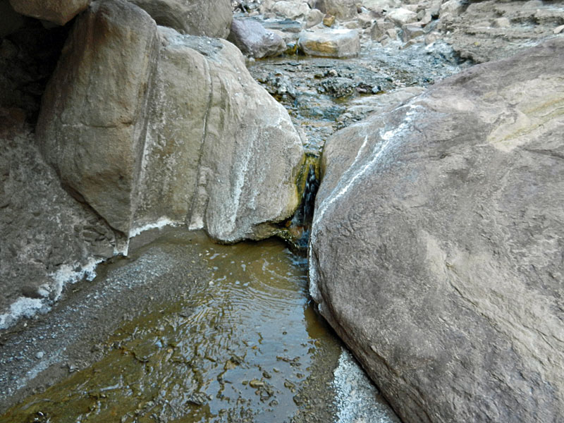
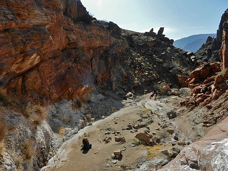
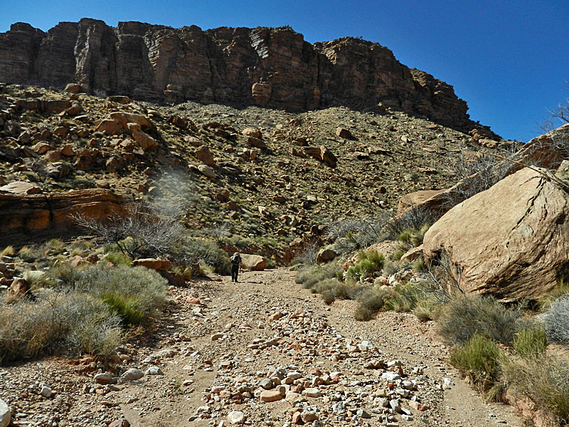
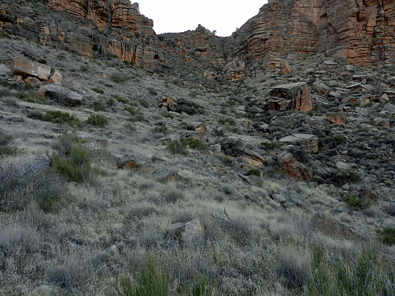
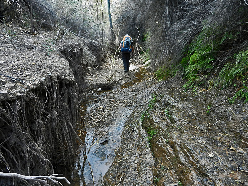
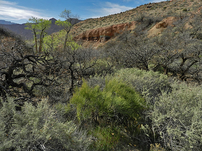
Day 3 - Trekking to Lava (Sunday, March 11) - Although it was windy during the night, I was up at 1:30 a.m. to open up the rainfly to deal with the condensation. We were up at 6 a.m. and ready to go two hours later. It was still windy so I mostly packed up while inside my tent, which was a bit of a challenge. It is easy going up the creek bed - wide and level.
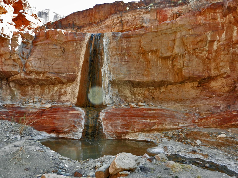
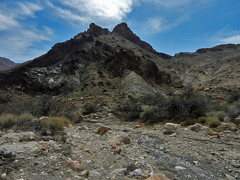
At about 8:30 a.m. we reached a large lava butte that defines the two
branches of Basalt we dubbed as the "Anti-Matterhorn" because it kind of
looks like that peak but it's all black. There is a final small
fall in the bed that gets you up past the narrows (such as they are).
We hauled up our
|
|
|
||
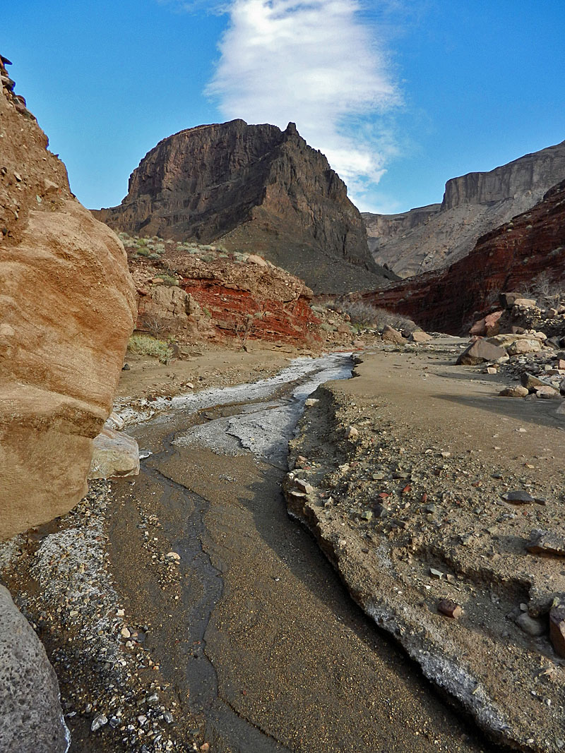 The hike up Basalt quickly starts to resemble some trek on an alien world with the salty deposits lining the small creek and the looming basalt mountain that splits this canyon. Go east (right). |
 Bill heads up the "bowling alley." |
 Small falls in Basalt Creek. |
 Larger falls. Mine site is above this. |
 Looking back down Basalt atop falls. |
|
|
|
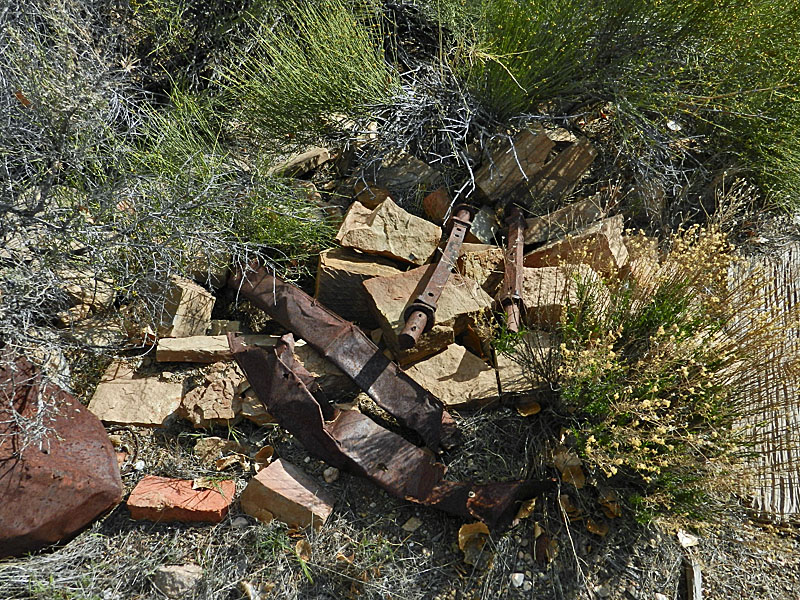
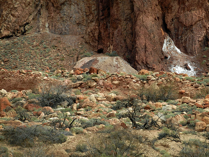
||
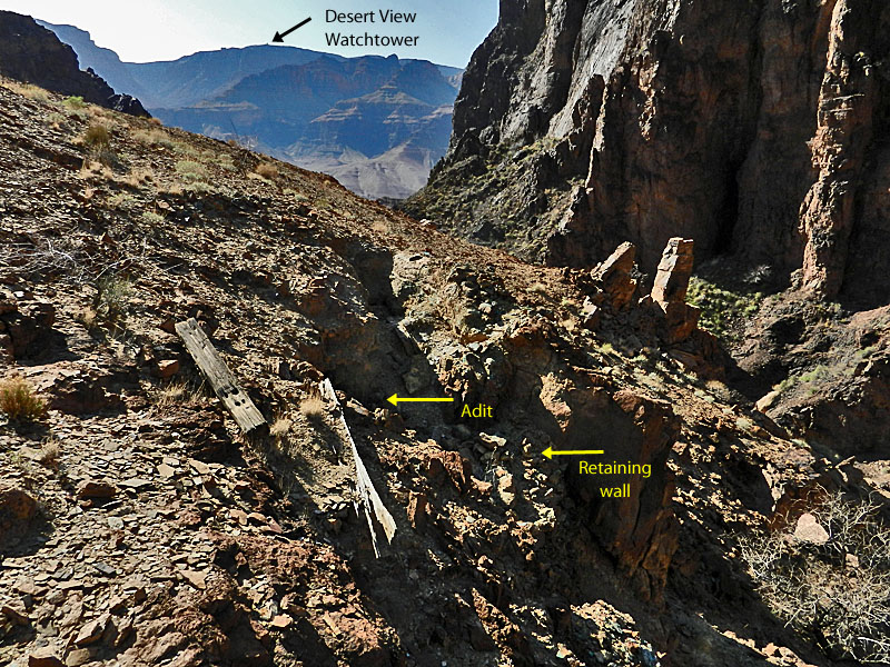
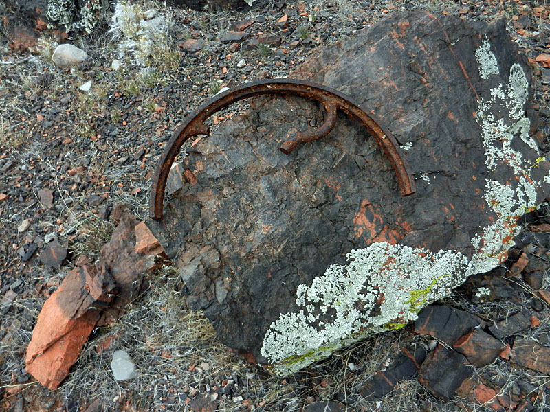
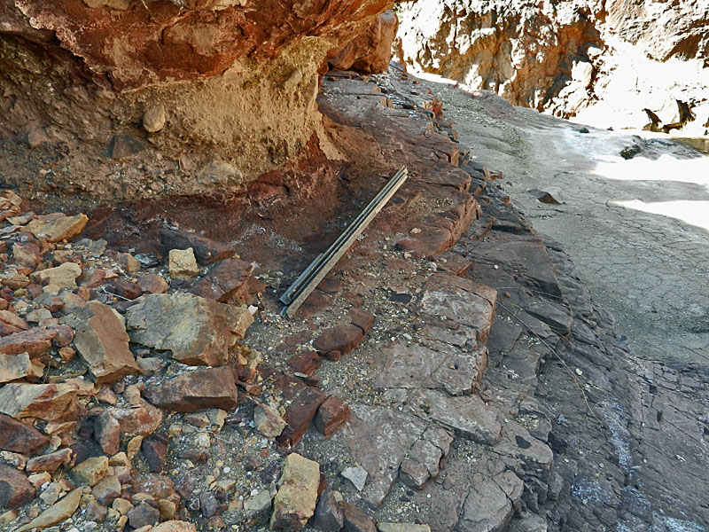 Metal posts - will NPS close mine? |
 Retaining wall meant I was there! |
 An old wheelbarrow remains. |
 Shallow (caved in?) adit. |
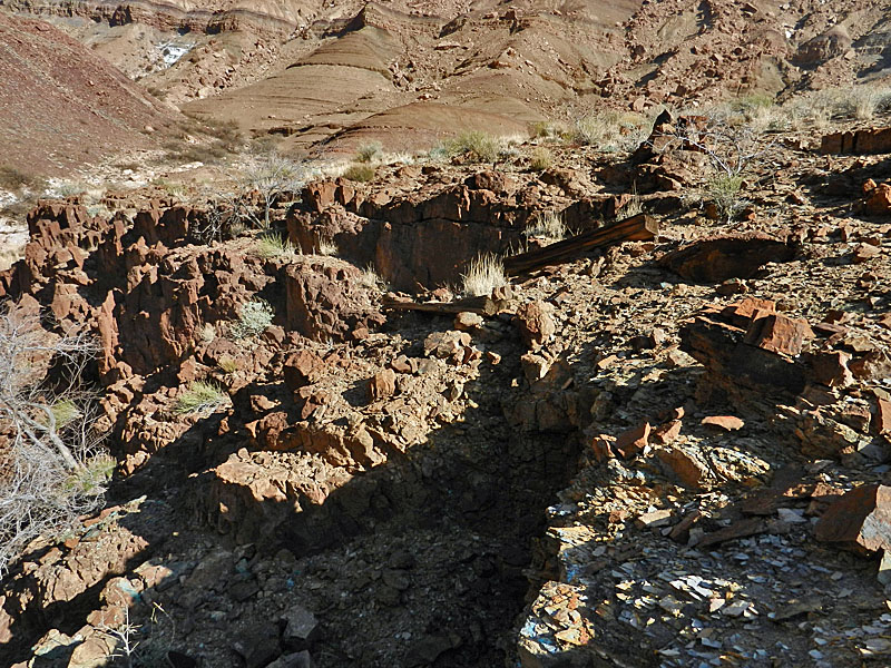 Cairn and timbers (looking north). |
 Mine site from bed (annotated). |
|
*See
Quest for the Pillar of Gold (Billingsley, Spamer, Menkes), p. 77. |
||
|
Up above the falls/mine the bed widens out into a valley. Walking along the trickle of water gets more difficult as it both narrows down and get brushy. We left the bed and paralleled it to the sloping Supergroup that provides a flat, if steep, ascent to the upper valley, above the two branches of Basalt. We only got part way up this route before we decided (at about 11:30 a.m.) to break for lunch in the shade of some cottonwood trees. That was a welcome break from what was turning out to be a rather hot day. We were on our way by 12:15 p.m. and to the top of the sloping rock a half hour later. On the map, this trek up through Basalt doesn't look very hard, but it was a grind for us. We mostly followed the bed in the upper valley although some detouring around boulder fields is necessary. As we neared the top we were in some really cool little narrows. We reached the saddle at about 3:30 p.m. I had twice hiked from Chuar/Lava to Basalt, but never via this route. Bill scouted around and found a spot that looked best for getting through the upper cliff layer. There were a few times where we had to step down through some steep places, but we were soon seeing signs of a game trail. And, of ancient use, when Bill spotted a large pottery piece that still had part of the lip intact. The route down was not only steep, but we were being eaten alive by the bugs. It was quite a challenge to swing my arms to keep them out of my ears, nose, mouth and eyes and yet pay attention to my footing! It took us exactly two hours to reach the creek at the so-called "Still Spring." We picked the right lines of descent and ended up in that ravine which we followed to the creek. [Later we would discover an easier route along the hilltops beside this ravine.] In my notes, I wrote, "Tired! Tired! Tired!" I guess I was tired. The bugs were mostly gone, but had been replaced by mosquitoes. And, giant ones at that! I decided to eat my dinner in my tent to keep them at bay. As it got dark and cooled down they disappeared. I thought that I finally turned in for the night at 9:30 p.m. but found out the next day that my phone and camera were giving me daylight savings times, which is not observed in most of Arizona. [So, it was actually 8:30 p.m. and mostly I was keeping track of the time from my watch.] |
 Into the middle valley of Basalt. |
 Exit along tilted layers ahead. |
 The ascent to the upper valley. |
 Bill heads up dry bed in upper valley. |
 Narrows and trees appear!! |
 Final stretch is gentle slope to ridge. |
|
|
||
 |
||
 Our route down from left side of break. |
 Yes, this is an ancient route. |
 Nearing Lava Creek. |
|
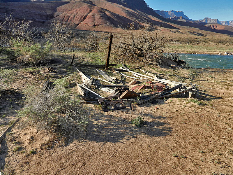
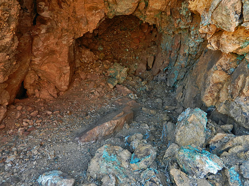
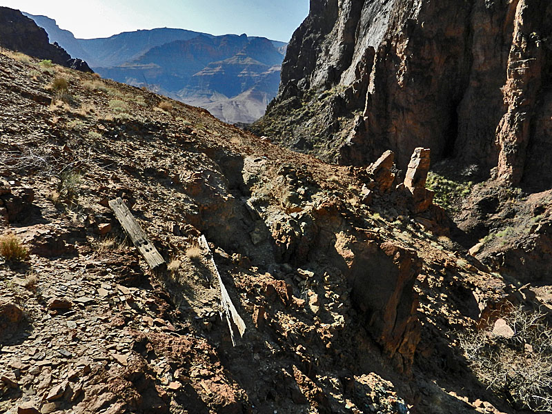
Day 4 - Down to the Colorado River at Lava (Monday, March 12) - We were up and about a bit late. The first order of business was to find the remains of the old still. At 9 a.m. we poked around just downstream of our camp and found it right off the bat - wood planks, barrel hoops and miscellaneous scrap. Bill found the old coffee grinder right next to the creek and being consumed by a tree. This was one of the places I especially wanted to see. I had been in this area in 1984 (on my way to Phantom), in 1994 (just to visit in the Lava area) and 1996 (also on my way to Phantom) and completely missed this. I am quite sure that I must have walked right by the old coffee grinder on each occasion!! [Actually, I was also here in 1993, on my way to Phantom, but never got up this far in Lava.] Why would miners have a coffee grinder? Well, here's what a group of park rangers thought when they visited here in 1928:
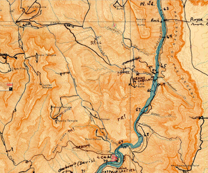
The "small branch stream" must have been the same one that Bill and I came down to the creek. Is the ranger speculation right about the grinder? I think so, but I have also found a piece of a similar grinder, as best I can tell, above Bedrock Tanks on the South Bass Trail (see here for the picture and here for that trip report). Perhaps it is worth a note about the naming conventions here. The whole canyon here is called "Chuar Valley". There is a "Chuar Creek", but it is just a branch (and, dry I think) of the main creek which flows from the head of the canyon and all the way to the river and which is called "Lava Creek." The narrow section over the last mile to the river is called "Lava Canyon." At the river are two buttes - to the north is "Chuar Lava Hill" and to the south is "Lava Butte." The rapids at the river are called "Lava Canyon Rapids." There is also a "Chuar Butte" that defines the northeast corner of this valley and sits opposite the Little Colorado River. Even my head is spinning trying to keep track of all this. Right behind the old miner's camp we also found a faint trail that headed up to the higher terrace/plateau that is a dominant feature in this area. I went up a ways and could see that I would have clear sailing to the routes I was interested in checking out tomorrow that lead up to the top of the cliff between Lava and Basalt. At about 10:30 a.m. Bill headed down the creek to the river. I left a half hour later and met up with him there at 12:40 p.m. It was nice and relaxing hanging out at the river and so we whiled away the afternoon, not heading back until 3 p.m. We were back in camp at 4:45 p.m. I had set out a water bag to warm up in the sun all day and took a shower, which felt great. I had lasagna for dinner and we split a package of Bananas Foster for dessert. Ah, life is good! By the time I turned in I was pretty well packed up for the day hike I had planned for Tuesday. |
|
|
||
 Miners' camp remains. |
 Miners' camp. |
 Area near miners' camp. |
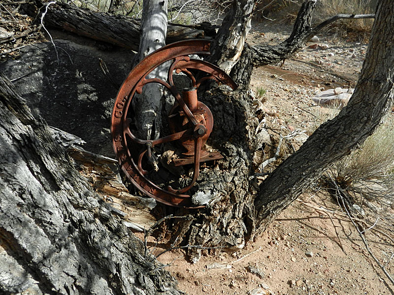 Grinder nearby. |
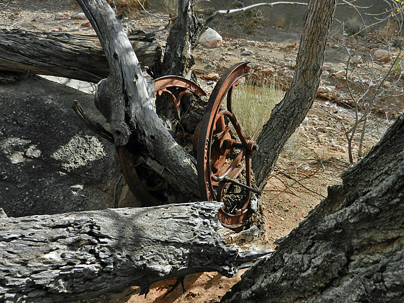 Grinder. [Really for coffee???] |
 Bill at grinder beside Lava Creek. |
 View of our camp from higher terrace. |
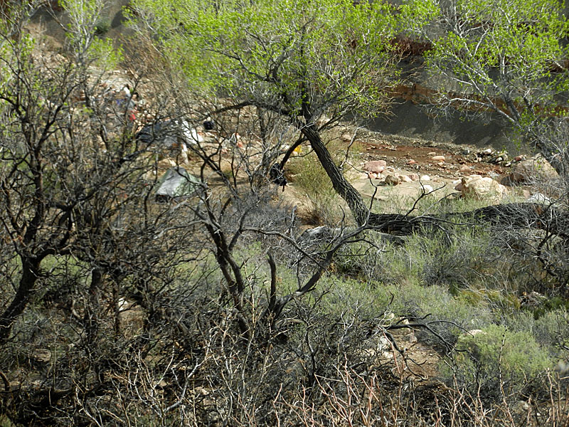 Close up of camp (note tents). |
 Looking to ridge towards Basalt. |
 Lava Creek. |
 Chuar Lava Hill near river. |
 Mine tailings on Lava Butte. |
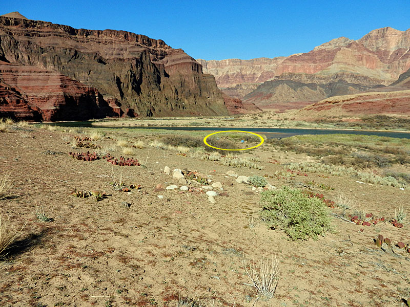
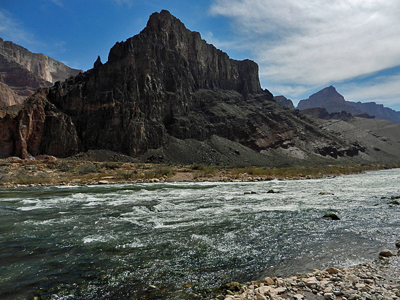 Colorado River at Palisades. |
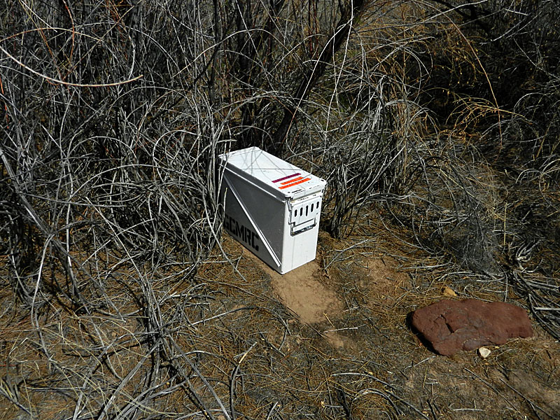 Hiker cache for river pick-up. |
 Mine tailings in Palisades. |
Go to Basalt & Lava - Part II: In Lava and Back Again |
||
|
|
||
|
|
Return to Hiking Grand Canyon home page |
|