 |
|
|
In the
Empire of Bass Sunday, Nov. 10 - Monday, Nov. 18, 2013 by Dennis Foster |
|
|
|
|
|
|
|
In the
Empire of Bass Sunday, Nov. 10 - Monday, Nov. 18, 2013 by Dennis Foster |
|
|
|
|
|
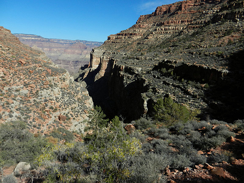
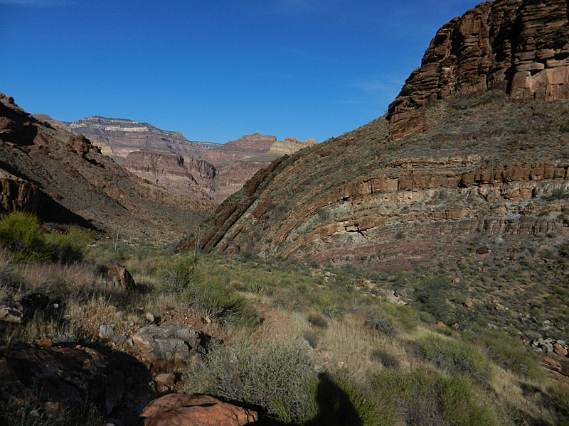
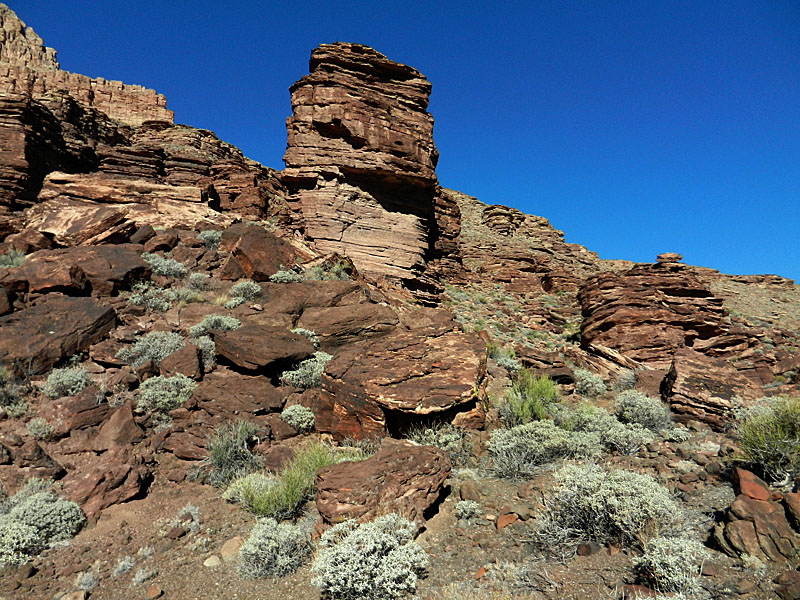
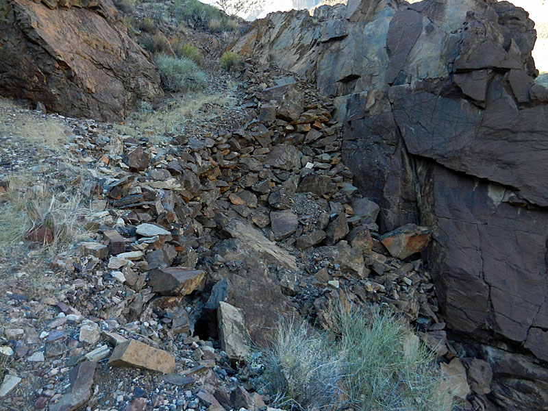
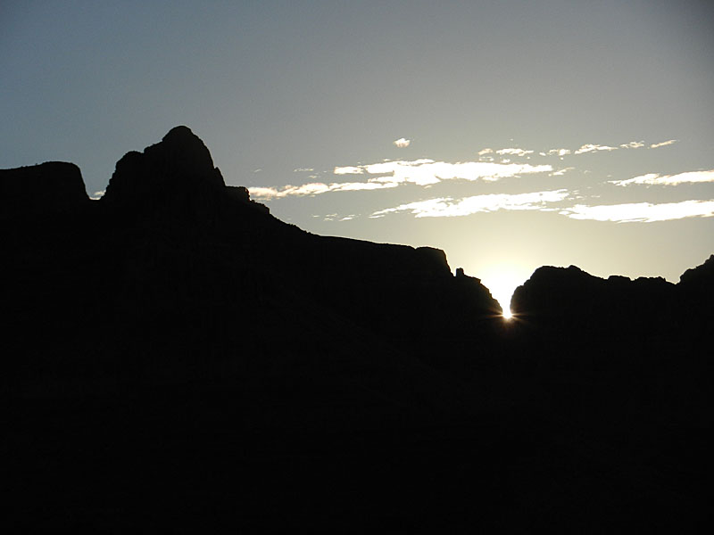
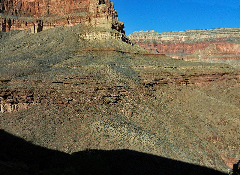
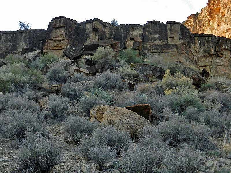
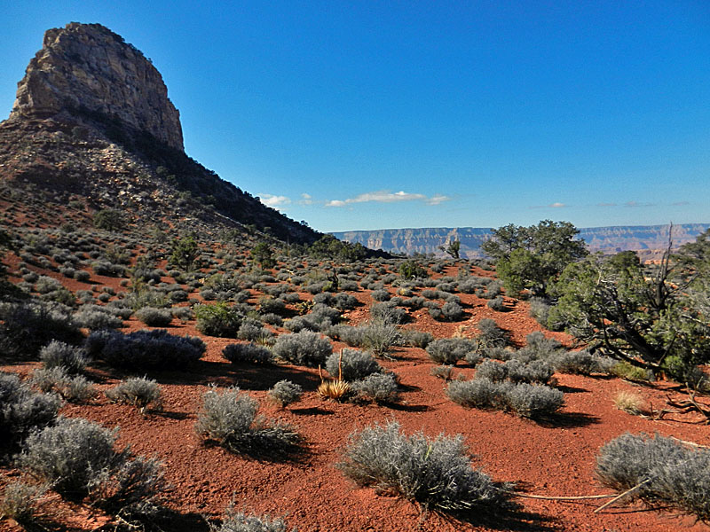
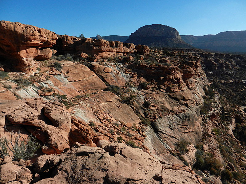
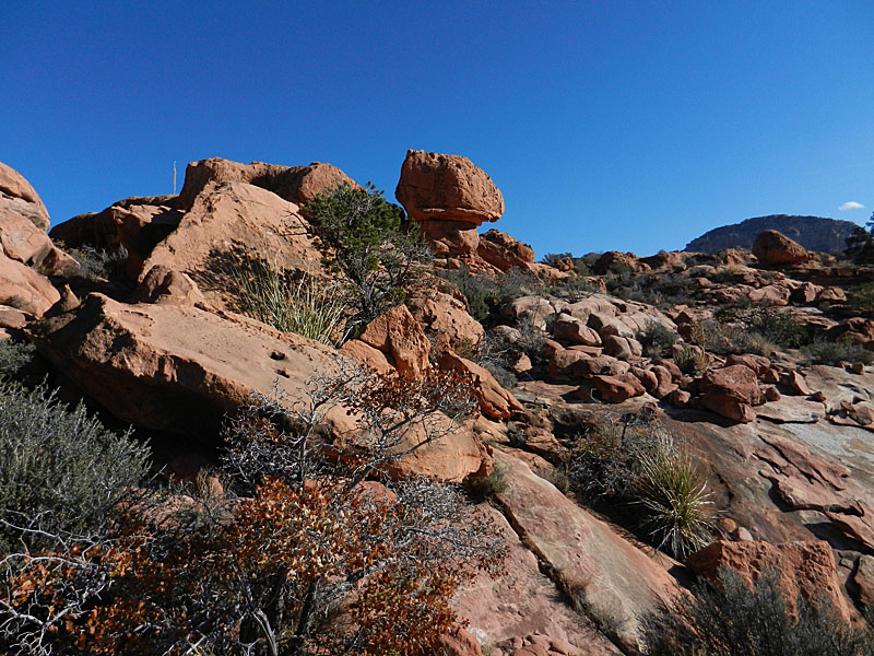
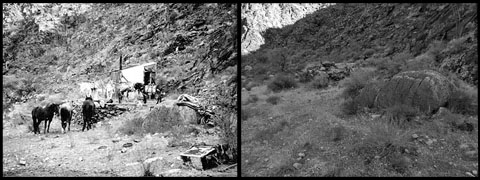
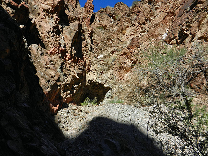
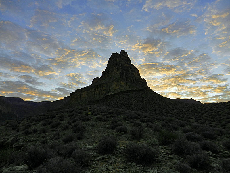
My sabbatical year at NAU was fast coming to an end and I had one more fall hike scheduled. As a general rule, I don't get to do fall hikes, because there just isn't enough time off, except for Thanksgiving. So, my big hikes each year typically come during our spring break. This hike would be down the South Bass trail and would afford me the opportunity to visit a lot of historic sites. Since 1981 I have camped below the Esplanade here only once and that was on the first day of a hike through the Gems to Hermit in 2011. This hike would be challenging in that it was scheduled for nine days, which would require a heavy pack. As the date neared I decided to tweak my itinerary to keep the days with the pack on my back short. I had two nights in the Bass use area, three in Garnet, two in Ruby and one more in Bass. In looking over my map, I decided to camp barely into the Garnet and Ruby use areas. That would lighten one burden, but would create another - water management. I decided to start the hike with 6 liters of water and cache two (with food) where the trail drops off the Esplanade, since that would be near my last night's camp. Two more liters were cached at the Tonto east trail junction, for pick-up on my way to the Ruby use area. There was no water at this Tonto junction, although we found some here in 2011. I did see a couple of potholes lower down, at Bedrock Tank, where Bass had a camp that he used especially in the winter. Mostly I would rely on getting water from the Colorado River. I ended up hauling a total of three gallons from the river to the Garnet use area and that sufficed for my stay there. I did pick up a gallon at Bedrock Tank on my way to the Ruby use area and I got one last liter at Serpentine Rapids. That may not seem like much, but with the cool weather I actually ended up with a gallon still in my pack at the end of my trip! Over the years I have learned of many interesting sites here, mostly related to William Wallace Bass' tenure as a guide, miner and all-around entrepreneur, from the early 1880s until the 1920s. There are his many trails, leading to camp sites on the Esplanade (Mystic Spring), below the Tonto (Bedrock Tank), at the river and in Copper Canyon. He had a mine in Copper Canyon and there are two places where he strung up cables across the river. At the bottom of the South Bass Trail he also used a beach to row a boat back and forth across the river. Doug Nering refers to this as the "Bass empire." I like it! So, that's the way I'm going to reference this area. There is a great site at NAU with old Bass photos and I have linked to individual ones below. To see the whole collection, go here. I left Flagstaff at 5:30 a.m. and reached the trailhead at 9:00 a.m. It may be hard to believe, but this was my first trip across the Havasupai gate when someone was actually there to collect my $25 fee. They seem to be more committed to keeping someone there 24/7/365. Figuring this was the case, I brought along a pumpkin pie for the tribal ranger at the gate. He seemed appreciative and told me that they put in ten day shifts. As usual, the road deteriorates steadily the closer you get to the trailhead. It took me just as long to drive the highway from Flagstaff to Tusayan (92 miles) as it did to drive the dirt road from Tusayan to the South Bass trailhead (28 miles). The day was nice and clear. The weather forecast looked good for the next ten days, so I was feeling quite optimistic about this hike. At the trailhead, mine was the only vehicle and I didn't see any other hikers until my eighth day. I suspect that for those days I had this whole area to myself. |
|
|
||
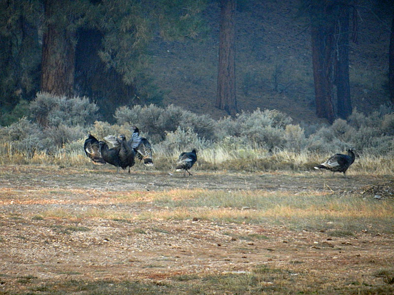 Turkeys along the road to the trailhead. |
 Signage, as it is, on Havasupai land. |
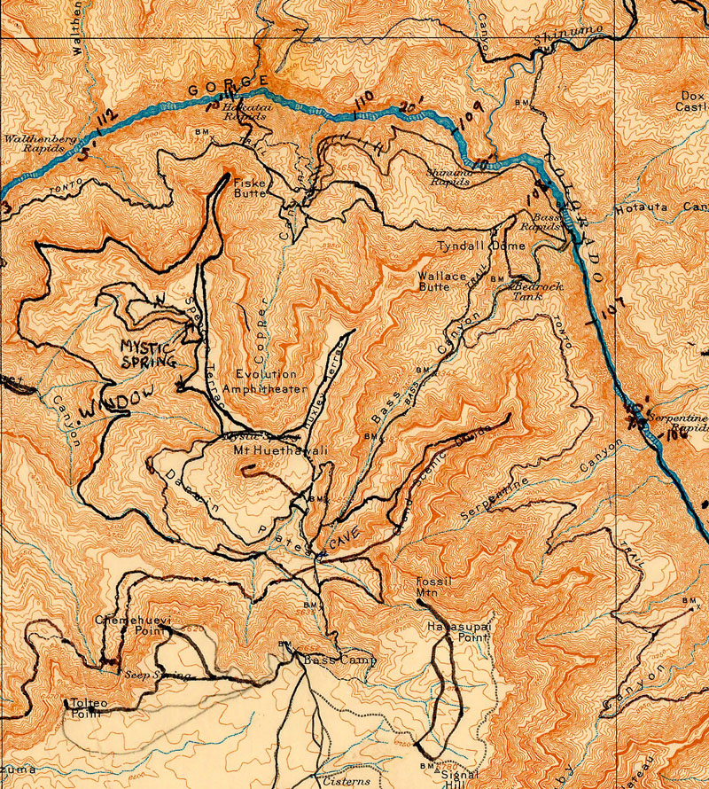 Harvey Butchart's map, accessible on-line from NAU's Cline Library. Close inspection of the map will show the South Bass Trail down past Bedrock Tank and to the river at Bass Rapids. The Tonto Trail goes east to Serpentine and west to Copper Canyon and to Hakatai Rapids. |
 The parking was wide open. |
 An old cistern of Bass' at the trailhead. |
|
|
Day 1 - Down the So. Bass to the
river (Sunday, Nov. 10) - I was on my way at 9:30 a.m.
Or, so I thought until I reached the big ravine that comes in from the
east at the top of the Coconino. Here, Bass built some check dams to collect water.
But, before I could scope this out I realized that I had forgotten my
Spot device. Aargh!
I had left it on the hood of my truck after sending out the "check in"
signal. So, I spent a half hour
retrieving it. It turned
out
to be a fortuitous lapse on my part as I saw a structure built into a ledge up
above the trail near the rim. I
recognized it as the old
"darkroom" facility that Bass built for visiting photographers. I
had come across a
photo of it on-line and wondered where it was since I
had no recollection of having seen it before. I would take a
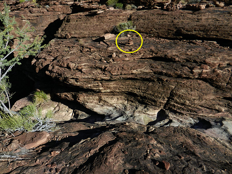
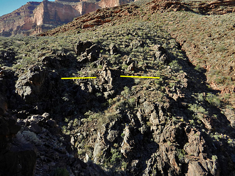
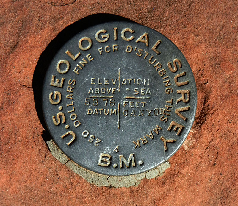
closer look on my way out in nine days. Crossing the big ravine I looked for an old benchmark that is shown on the map. It was partly obscured by a bush, but was right beside the trail. It is pictured with other photos below. I tried to find other old benchmarks along the trail, but my record was 3 for 7. So it goes. Crossing the
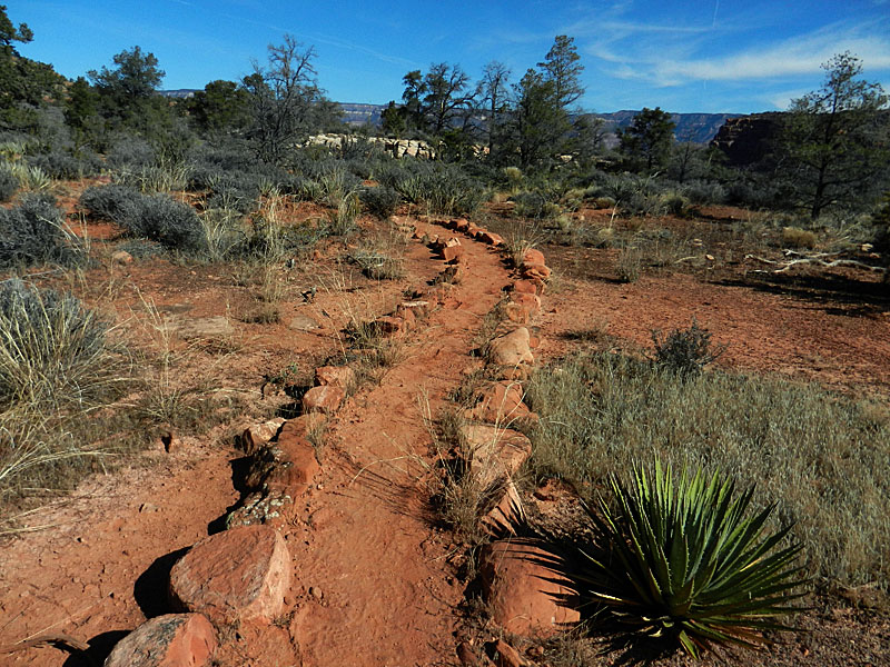
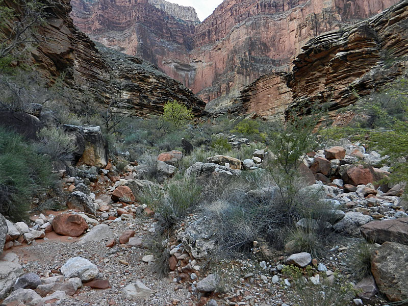
Esplanade was nice. Most of the way the trail is easy to follow
and part of it is nicely lined with big rocks. But, part isn't and
I strayed here. It didn't cost me much time, but it is always
disconcerting to lose such a well-defined trail like this. By
11:30 a.m. I was at the point where the trail drops off the
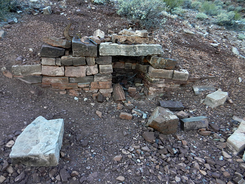
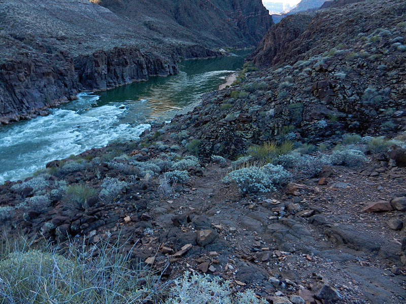
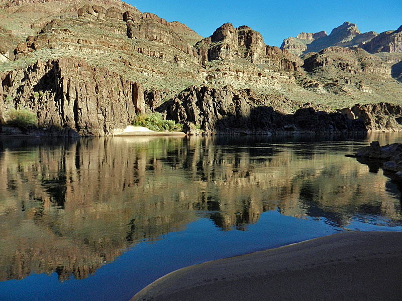
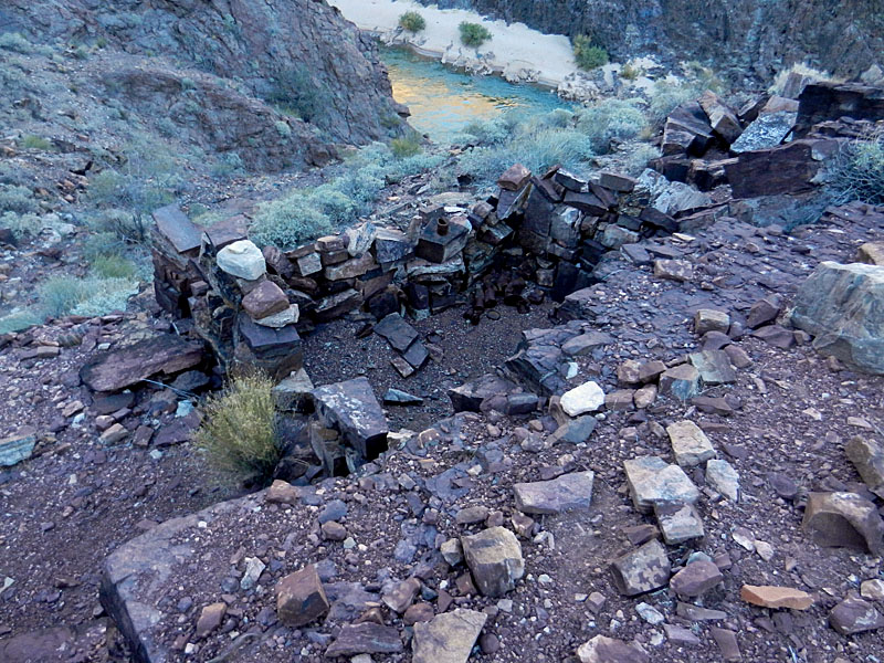
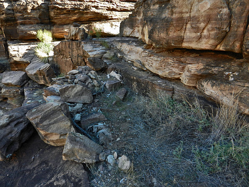
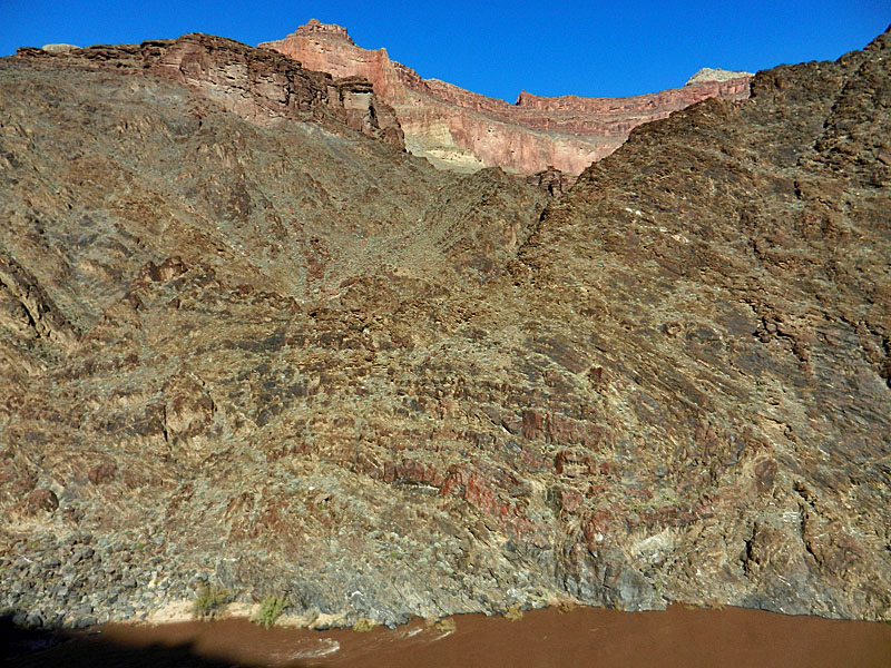
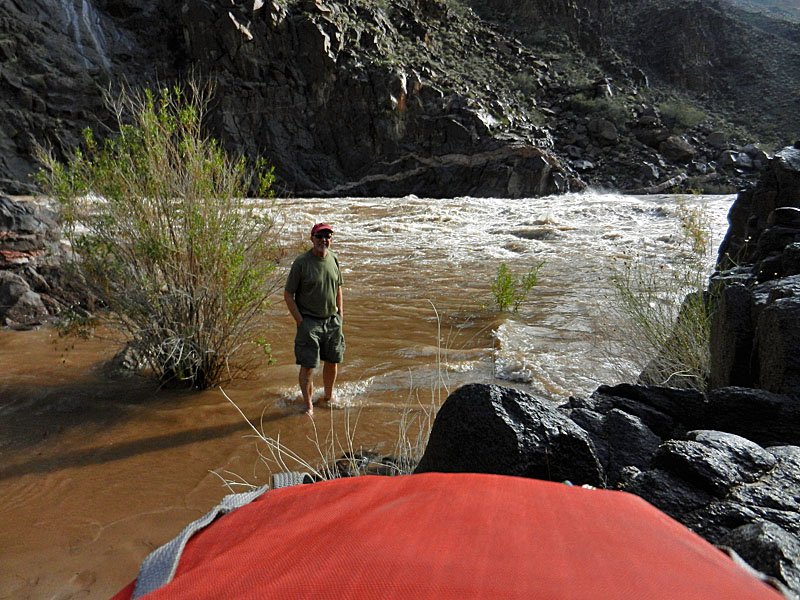
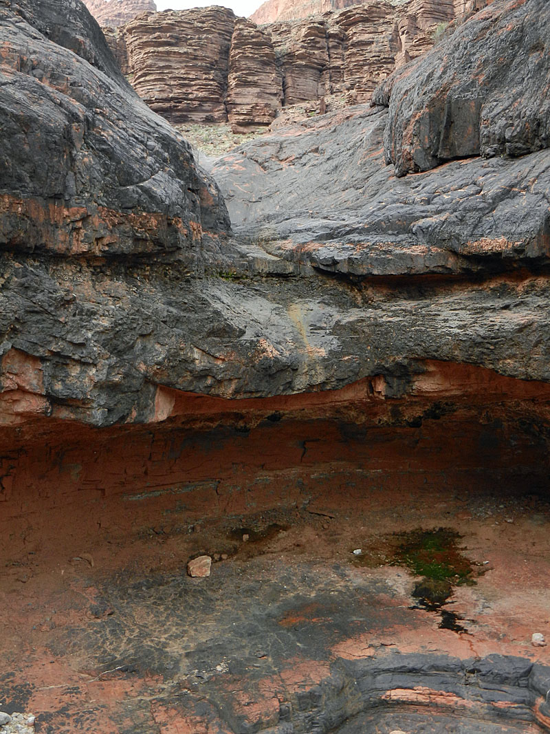
At 3:15 p.m. I reached Bedrock Tank, where Bass had a camp and stored supplies. I found a large water pocket here which I would use later. Also, I saw cairns heading up to the west and decided this must be where the so-called "shortcut" trail is that goes up to the Tonto. Almost certainly it is something Bass built to facilitate his movement throughout this area. I had been on that trail, but it was more than 30 years ago and I had no discernable memory of it. By 4 o'clock I had reached a junction where the trail heads down to the beach above the rapids. There is a large stone fireplace here that Bass built for his visitors. I am pretty sure I have never been to this site, even though I have been down this trail to the river on a few occasions. That's reasonable, since the Park Service improved this trail (and on the north side as well) back in 2005, after it had been neglected for the better part of eighty years. I am quite sure that on my previous trips I followed a cairned route more directly down to the beach rather than this trail. Fifteen minutes later I was at the beach. No one else here so plenty of space for me. I took the first spot behind a screen of bushes and scrambled to get my camp set up before dark. I had carried two more liters of water for the hike and was down to just a cup left, so I planned that pretty well. While my dinner was cooking I filtered water for the next day. It was dark when I ate and getting cold. Yet another item I failed to bring was my balaclava. But, I realized that on my drive up and was able to buy a fleece cap in the gateway community of Tusayan just before leaving the highway and starting along the dirt road. By 7:30 p.m. I was in my sleeping bag for the duration. |
|
|
||
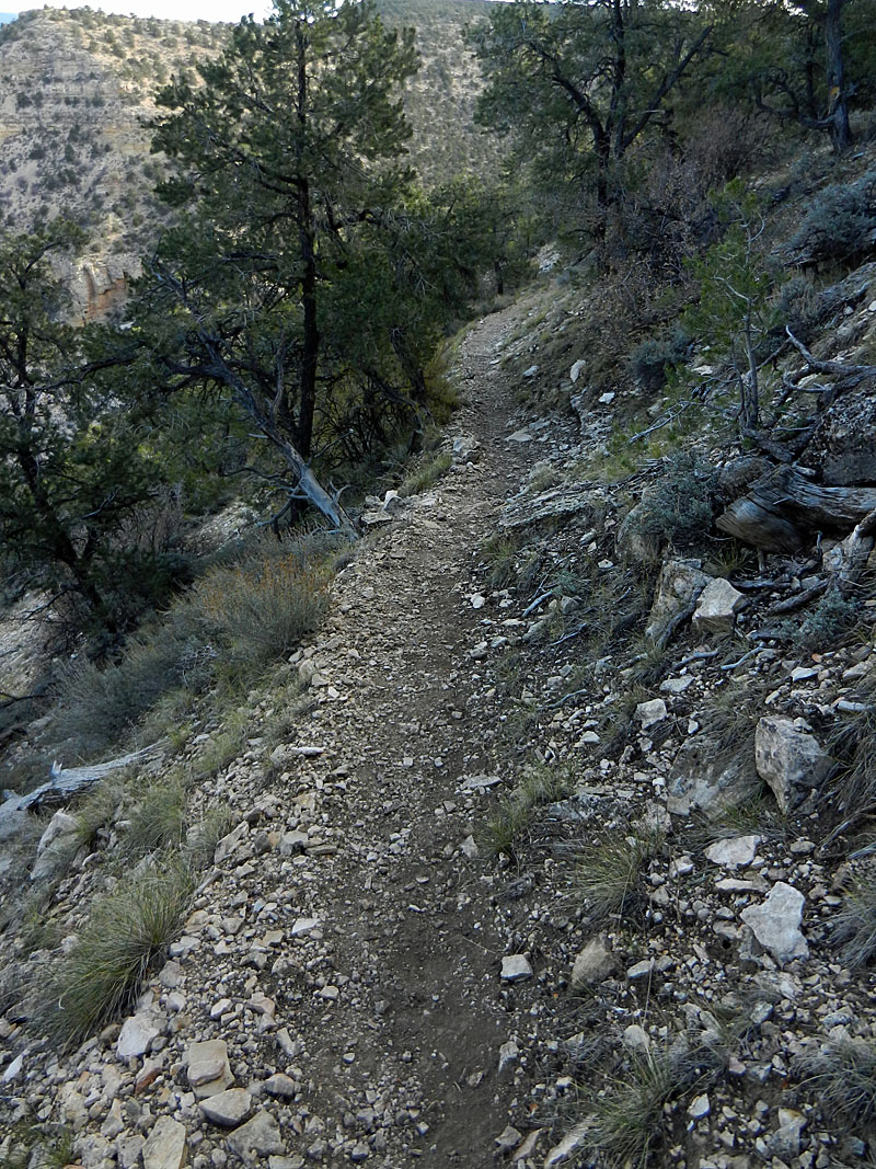 The upper stretch of trail. In the winter this can be covered in ice (see here). It still shows the improvements made by the Park Service in 2005. |
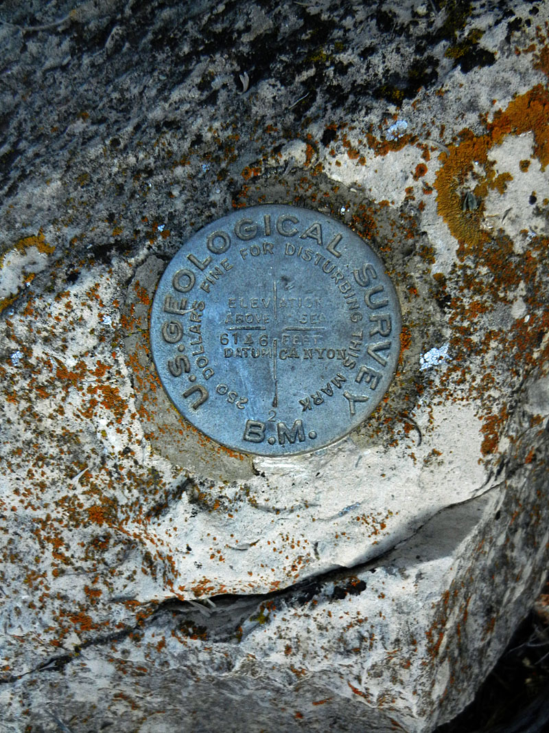 Benchmark 6146 at ravine. |
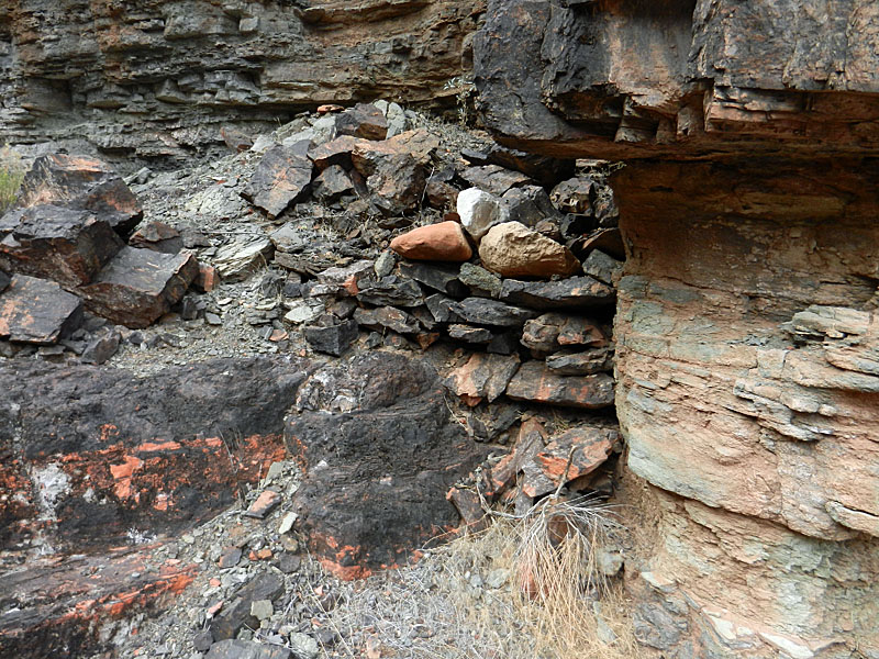
 Ruins just past ravine above the trail. |
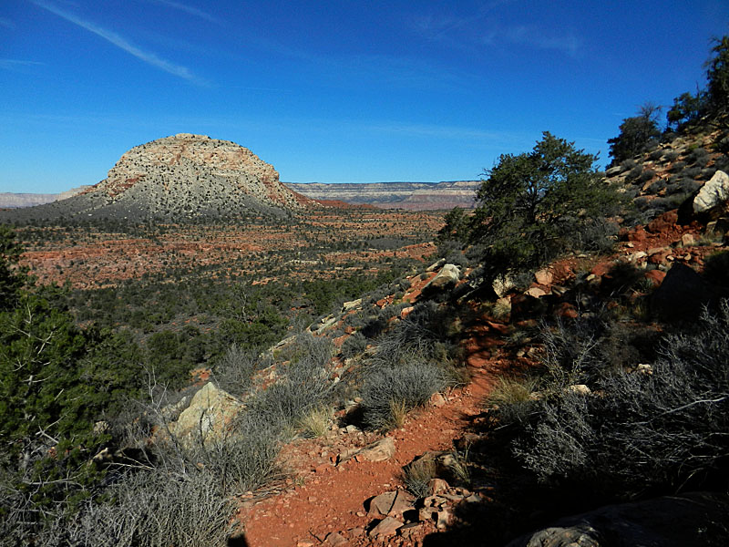 Mt. Huethawali from the Esplanade. |
 Well-lined trail across the Esplanade. |
|
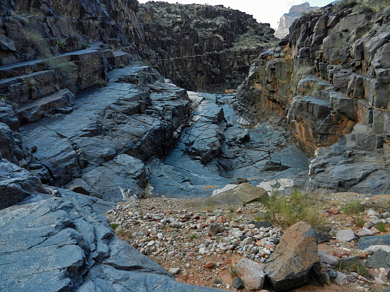
 Looking down Bass Canyon. |
 The Redwall Narrows begin. |
 Wheeler Fold up close. |
 Fireplace at trail junction to river. |
 Bass Rapids and camping beach. |
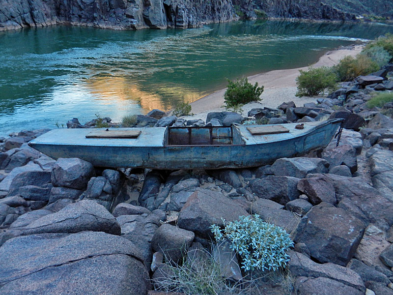 The Ross Wheeler above beach camp. |
|
Day 2 - Hauling a water cache
and checking out Bass ferry & cable site (Monday, Nov. 11)
- I slept pretty well overnight. I did wear my coat for the last
couple of hours, but felt comfortable. I wasn't in a hurry, which
was kind of a theme for this whole trip, so I didn't get up and out for
good until 6:30 a.m. Although I was anxious to visit the cable
site, I decided to start the day by hiking two gallons of water up to
the Tonto where I would set up my next camp. So, at 9:00 a.m. I
was on my way. An hour and a half later I was on the Tonto.
The shortcut trail is great and was fun to hike, especially with a
relatively light pack. I saw a nice big camping spot above Bedrock
Tank, where this trail starts, along with some old tools and a piece of
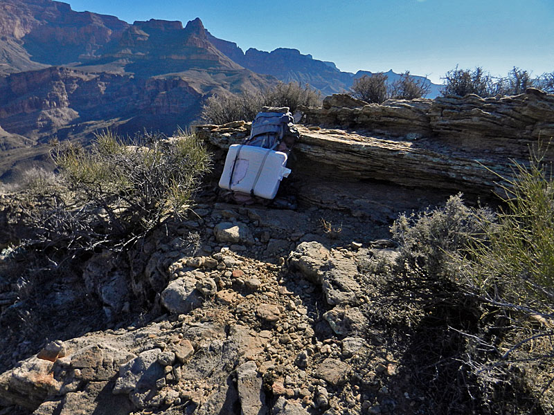
a bighorn skull. And, at the Tonto level I found an abandoned pack.
It was lying in some bushes, next to some ledges that I used for my water
cache. A note with it was fading but appeared to have been written
this past March. The pack was quite light and I presumed that it
had clothes and maybe a sleeping bag inside. I didn't feel
compelled to see what was inside, even though I would spend three nights
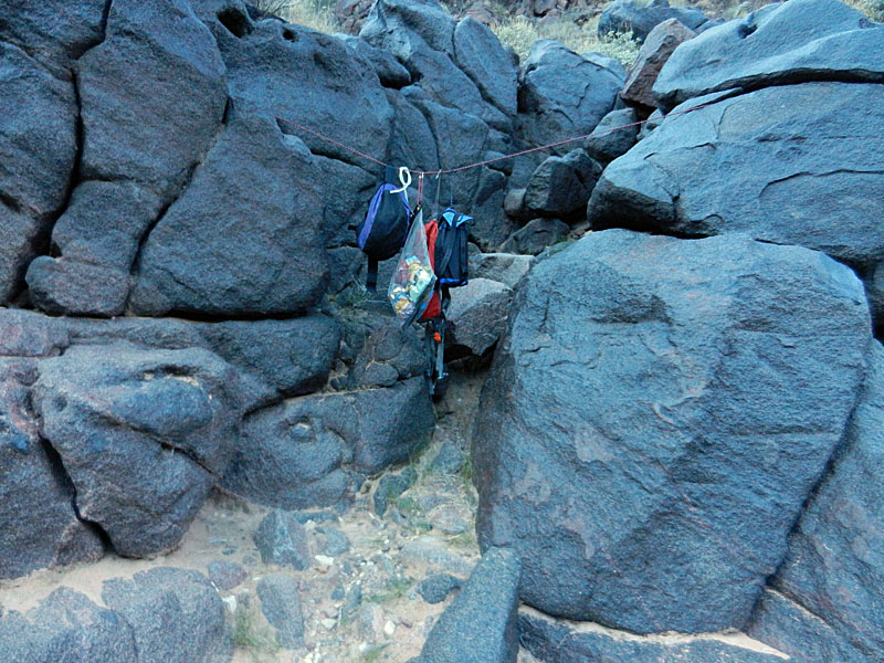
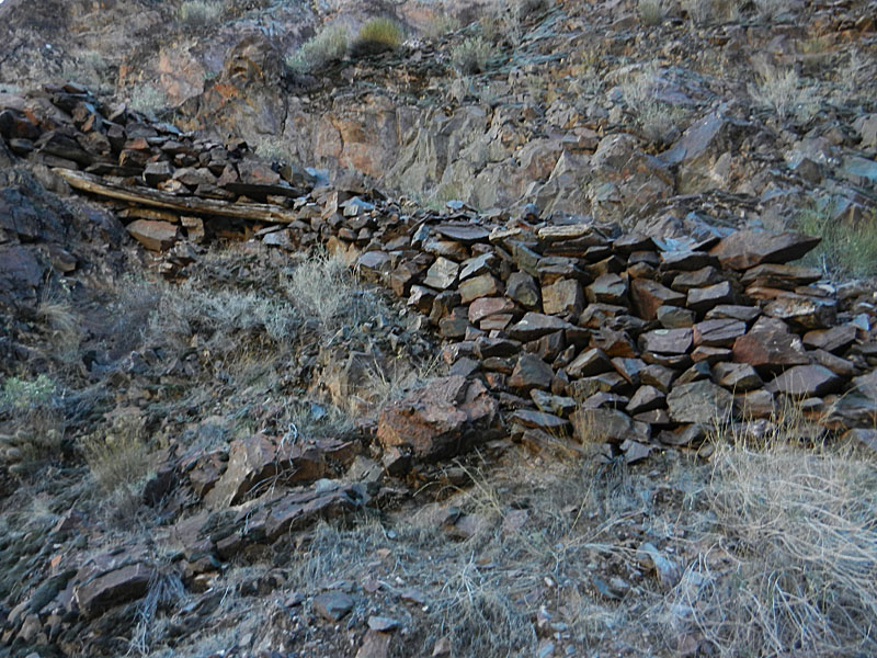
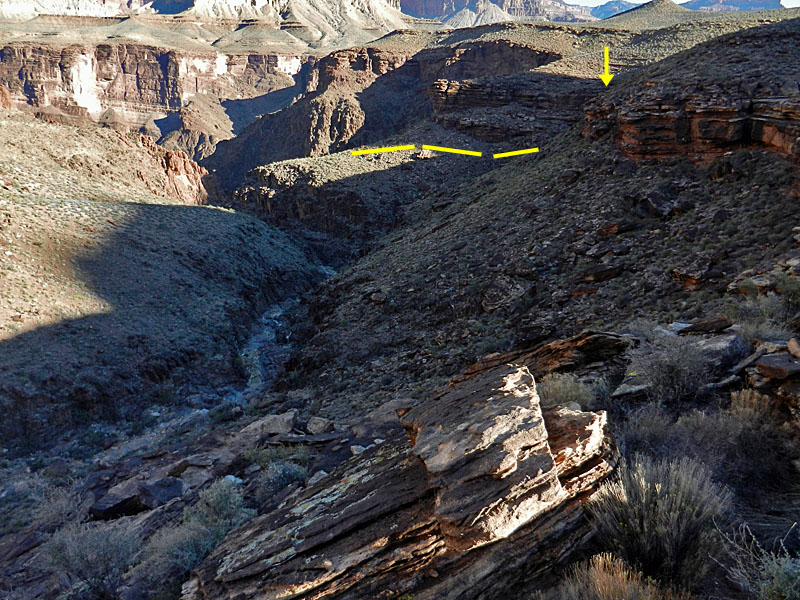
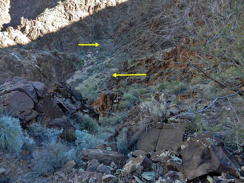
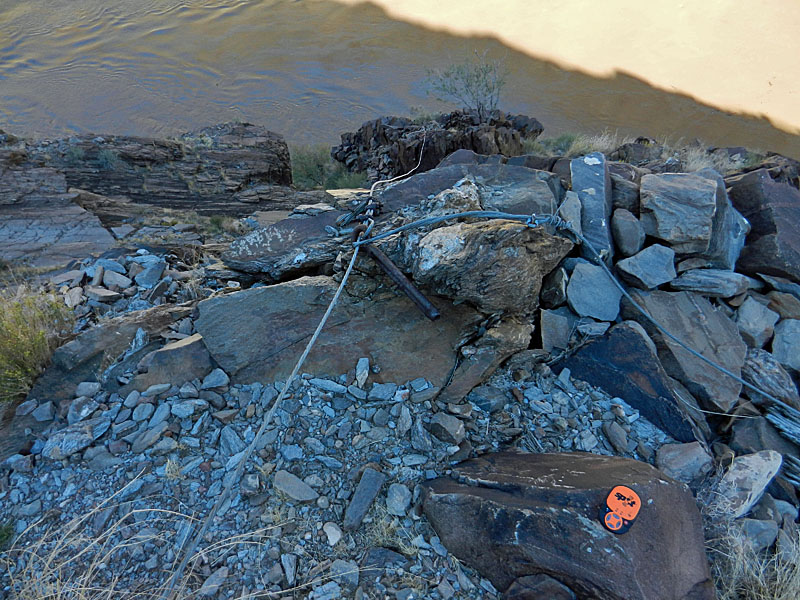
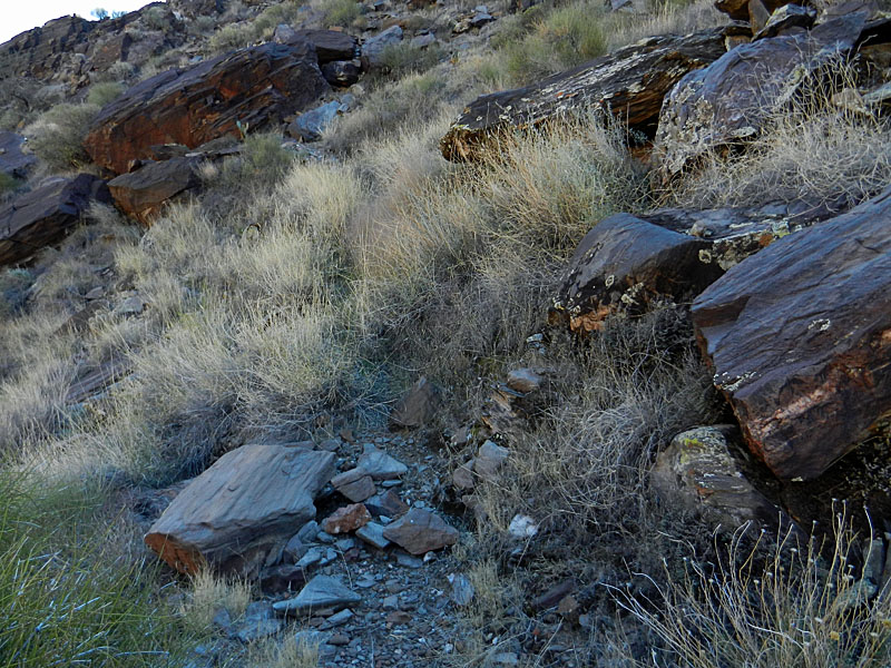
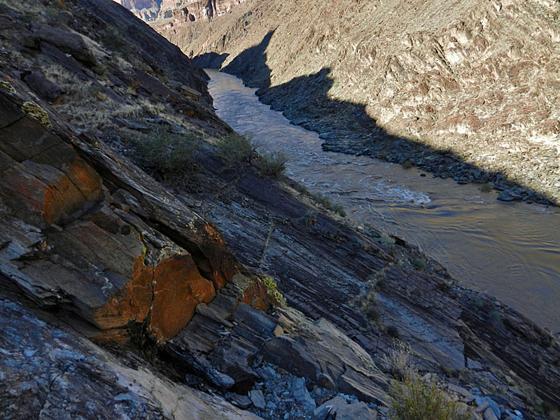
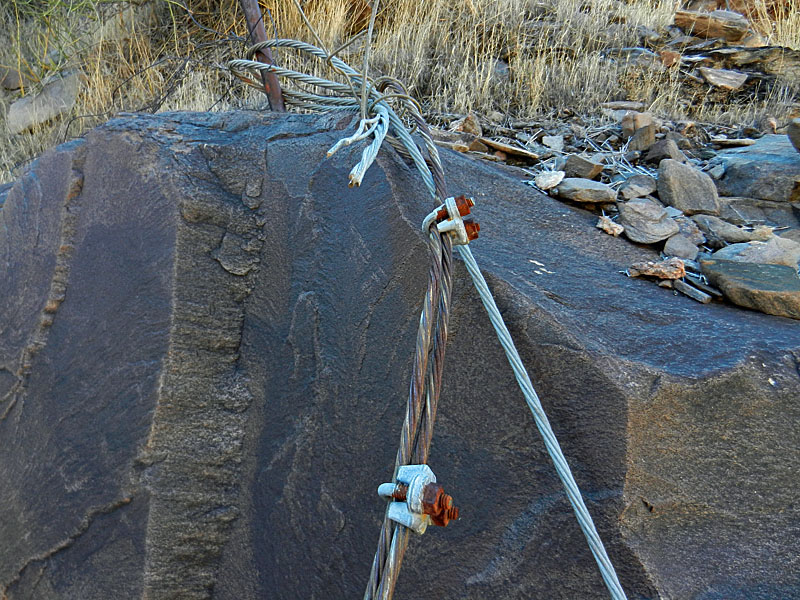
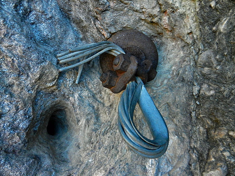
nearby. There is a true shortcut route here and I decided to check it out on the way down. I went down the ravine that the trail comes up to where there is a gap in the Tapeats that you can get down. I worked my way nearly to the bottom but then would have to contour to my left to finish the deal. From there I couldn't tell where to go but later I decided that you can just head for the river and maybe end up at the fireplace without having to worry about obstacles. Instead, I turned back and came back down on the shortcut trail. By 12:30 p.m. I was back at my camp and an hour and a half later I was on my way to visit the ferry and cable sites. They didn't take long to reach. The trail down to the boat ferry beach is only about fifteen minutes past the fireplace. It is in great shape and easy to follow. Like the beach on the north side, it is small and not suitable for camping. [See an old photo here of Bass rowing tourists across.] Finding the cable site was more challenging. I knew where the site was across the river and figured that the one on this side had to be, more or less, directly opposite and at about the same level. I made a couple of false starts to the east of the boat beach trail. Near the top of the ravine I finally stumbled onto the old trail. It lead right down to the remains of the old cable tram, as well as the cables and other pieces of equipment. [Here's a great old photo of the cable tram.] Coming back up I found that it turns very obscure just before meeting up with the regular trail - perhaps on purpose. On my way back I found a camp site near to the fireplace. There is a faint trail here that loops around to this site. It looks like there were a couple of rooms. Lots of old cans here. I was back at my camp by 4 o'clock and eating dinner in the deepening shadows at around 5 o'clock. I heard a noise and poked my head out through the bushes and saw a boat had beached. So, I came out to welcome my new neighbors. One guy had scampered out of the boat and was standing on the beach. I recognized him immediately as Mathieu Brown, a former student of mine and whom I had just seen on the South Rim Village a few weeks earlier. Small world. He was leading some of his students in the Grand Canyon Semester on a river trip. It seems that they (5 altogether) were able to hook up with a private party running the river. There were another 5-6 boats heading in and it would be more than a little cramped on this small beach so Mathieu decided that they should continue on down to Shinumo beach to camp. We chatted while the others continued downriver (and while his boatman ran up to photograph the Ross Wheeler). He asked if I needed anything or if they could take some of my trash. Since it was only my second day, I really didn't have any needs. Well, except for fuel. I had brought only one canister with me and it had been used for a couple of days in October. I thought it would be enough, but I was already starting to regret not bringing either a full can or at least another partial can. So, starting with the next day, I decided to eat cold breakfasts so as to be sure that I wouldn't run out. Cold dinners did not sound appetizing. |
|
|
||
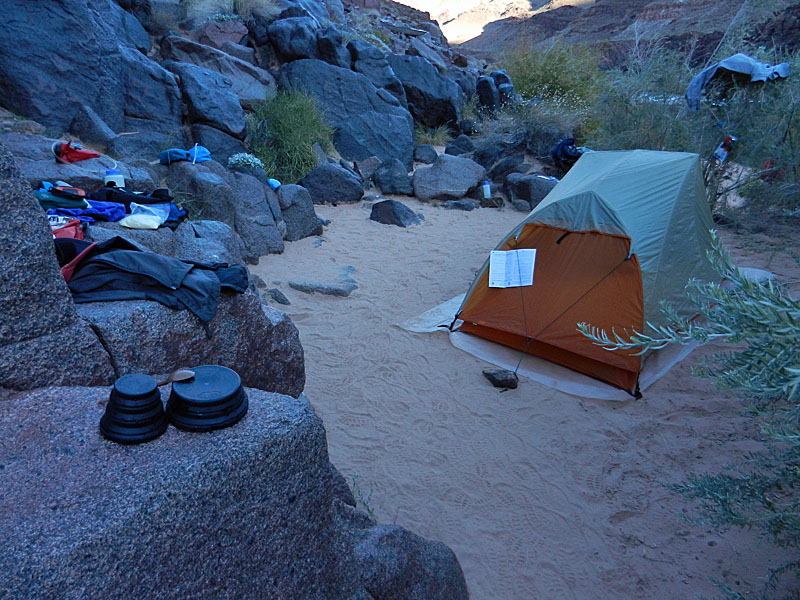 Bass Rapids campsite. |
 Food storage - shady all day. |
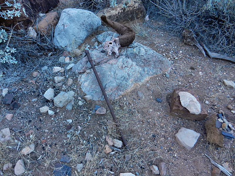 At the camp above Bedrock Tank. |
 Detached cliff along shortcut to Tonto. |
 Abandoned pack on Tonto Plateau. |
 Direct shortcut to river here. |
 On the boat ferry beach. |
 Looking across to north side beach. |
 Trail to the boat ferry beach. |
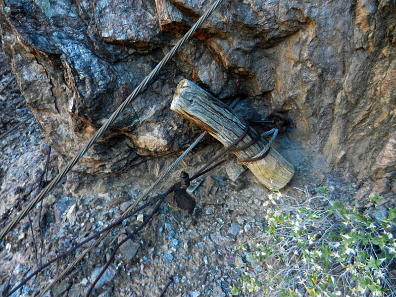 Cable site anchor. |
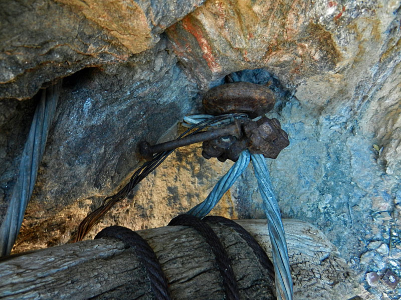 Cable site anchor. |
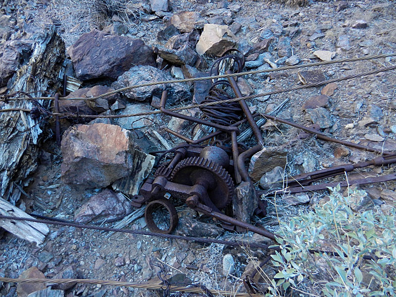 Remains of cable operation. |
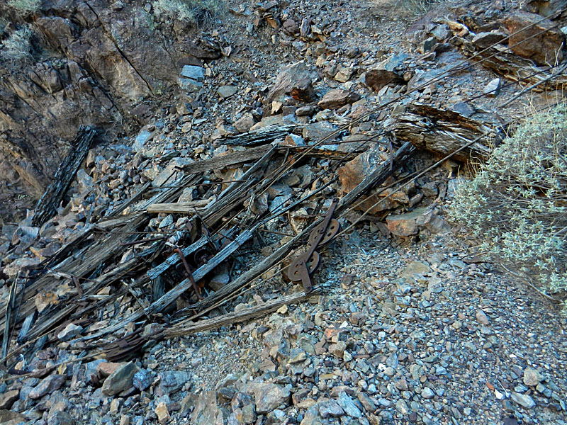 Cable tram remains. |
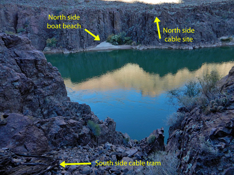 View from tram to north side. |
 Trail to cable site. |
|
|
||
 Camp near fireplace. |
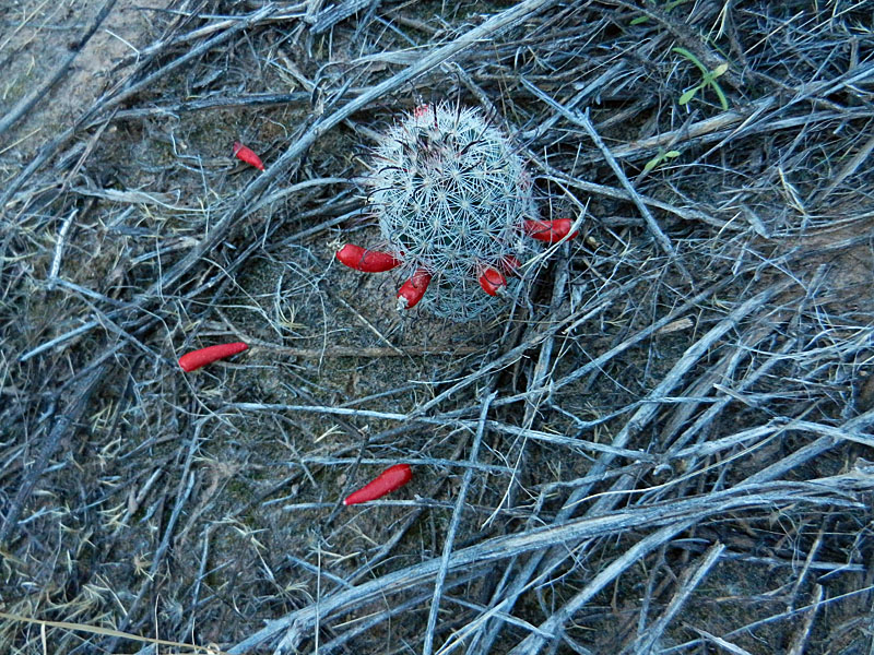 Cactus in bloom. |
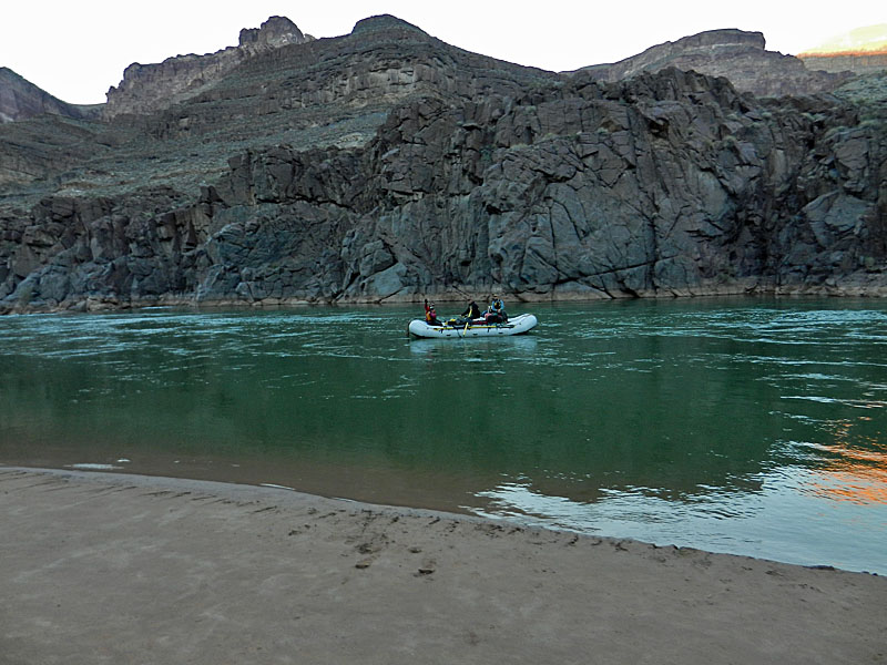 After a short visit, river party departs. |
|
Day 3 - Moving my camp to below
Tyndall Dome (Tuesday, Nov. 12) - I stirred out of my bag
for good at 6:45 a.m. and was all packed up and on my way at half past
nine. I took 5 liters of water with me and that served me well for
the next phase of my hike. On my way up, I poked around Bedrock
Tank. Nothing left but a small wall on the west side that creates
a level spot, probably for living space. I did manage to line up a
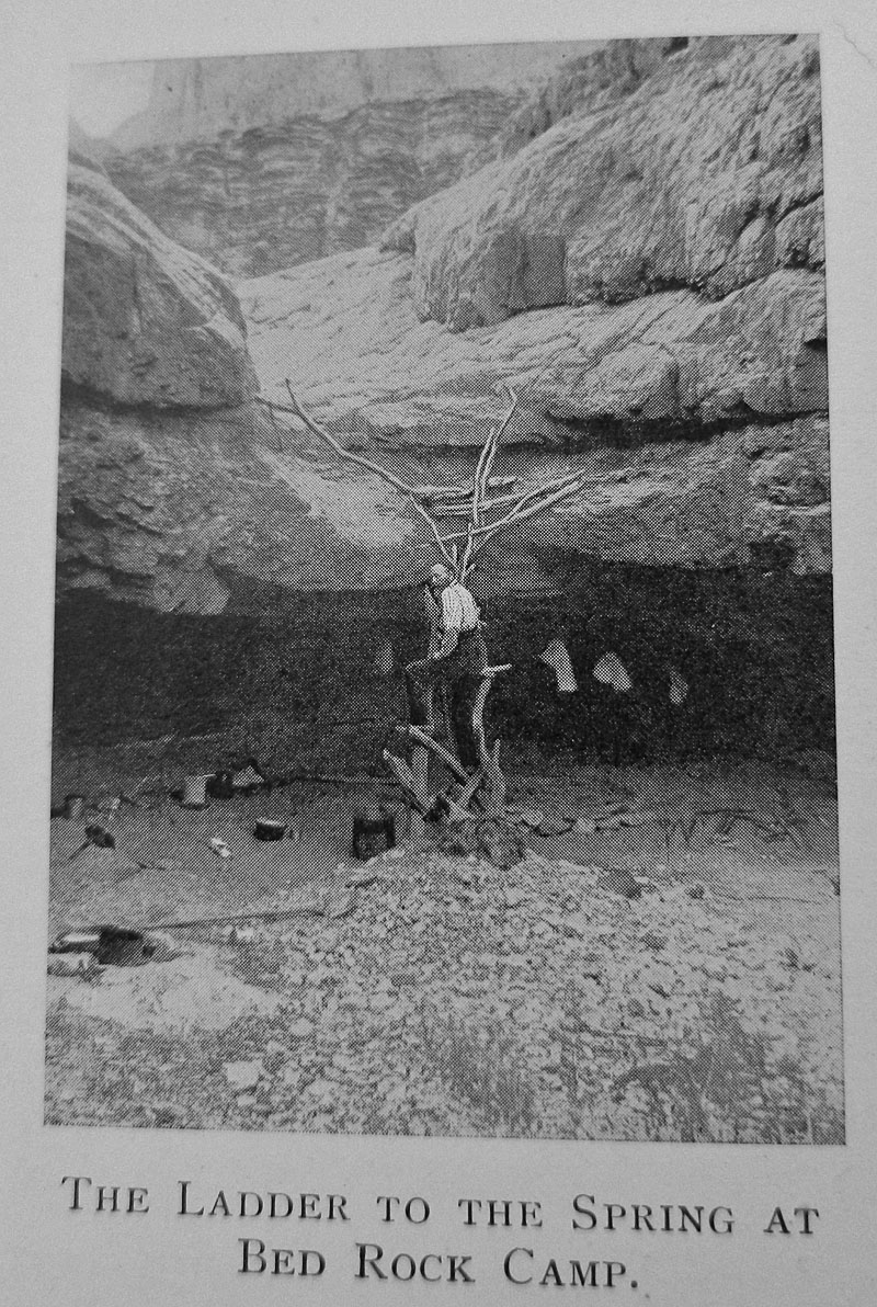
photo that replicates one from James' old book. I remember seeing
this years ago (the photo) and thinking that you had to use the ladder
to reach this spot. But, that isn't the case. The trail is
just 20-30 yards further downstream from here, and on the climb out you
can easily see this area. I also found a piece of a coffee
grinder. I recognized it right away since I have seen another one,
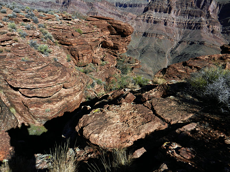
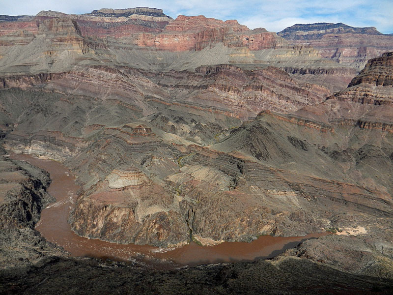
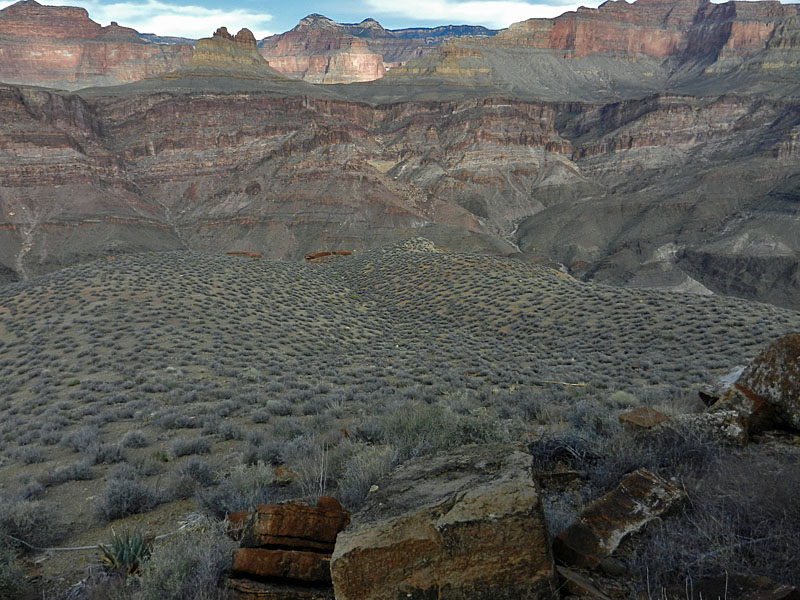
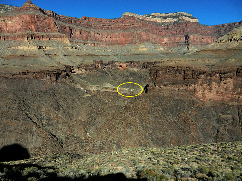
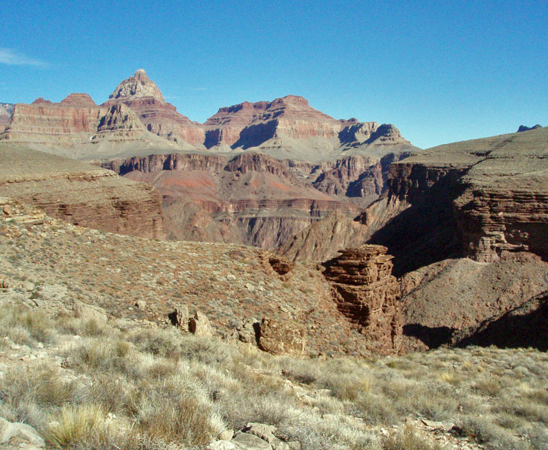
largely intact, in Lava Canyon, in the eastern part of Grand Canyon. At 11:30 a.m. I reached my water cache and decided that this was a suitable site for my camp. It was cloudy this day and I wondered if it might rain. So, I placed a couple of large flat rocks into my vestibule area for my pack and shoes, to keep them dry just in case. Although threatening, nothing materialized for my three nights here. In the mid-afternoon I walked along the nearby Tonto trail to a nice overview of the river. It was flowing a deep dark brown. Quite a difference from the past two days! I wondered if it wasn't raining further east, causing this. Later I found out that it was a massive release of water from the Glen Canyon Dam that was responsible. I was glad to have pumped the water I needed before that happened. The silt would have surely gummed up my Katadyn. I also saw some river runners. Most of them rowed up into Shinumo Creek, out of my view, and they ended up camping on the thinnest of beaches just below that. The next two nights I would see yet another group camped there. The views from this campsite were just fantastic. I could see all of Shinumo Amphitheater as well as a long ways east. And, I had the very scenic and dramatic Tyndall Dome right behind my tent. On my way back to camp I climbed up the slope to get on top of a terrace ringed by a small cliff. Nice and flat here and there was a cairn at the point. Looking over to the east, I thought that my campsite in the Ruby use area might be located on the same terrace there. |
|
|
|
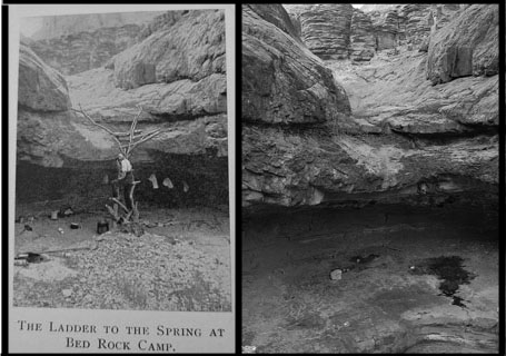 Side-by-side view of Bedrock Tank from George Wharton James' book (page 158) and from my trip, done in black & white. The ladder is sort of a ruse, as a real trail is just down the canyon 25, or 30, yards away. However there is a pothole (spring?) where the bed drops away and it may be easier to access from below as shown in the photo. See larger images here and here. |
 Remains of a wall at Bedrock Tank. |
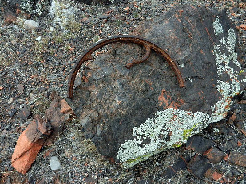 Yet another coffee grinder. |
|
 The river turned dark brown! |
 Grand Scenic Divide from terrace. |
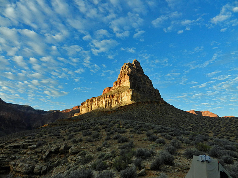
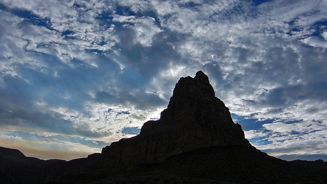 Clouds accent Tyndall Dome. |
 River runners visit Shinumo Creek. |
 Across the Tonto to my tent (close-up). |
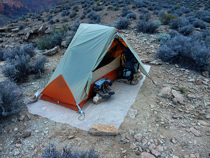 Tent is ready in case of rain. |
|
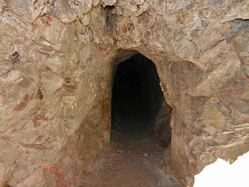
Day 4 - A day hike to Copper
Canyon (Wednesday, Nov. 13) - It was a still night and the
threat of rain never materialized. I was up at 6:40 a.m. to clear
skies and decided that my cold breakfast - oatmeal, cider and a pop tart
- was not bad. An hour later the sun reached me and a large flock
of birds appeared and flew around the base of Tyndall Dome for a few
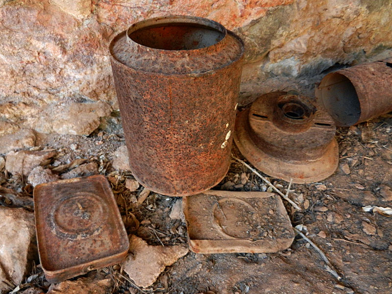
minutes before heading out on their way. Very cool. It took me an hour to reach a hillside saddle where I could look into Copper Canyon. I knew there was a trail into the canyon from the east and I kept looking for signs. Well, cairns. I even tried one route tentatively, but returned to the trail. A bit after 9 o'clock I was in a major side bay and headed down the slope to the top of the Tapeats to check out the area. Further north I was able to recognize a hill where the trail was located as it heads down to the mine site (on the other side of the hill). I wasn't sure where the Tapeats break was, but I zeroed in on the right area so I contoured my way back in that direction. At 9:45 a.m. I found the break. It was one of the coolest "trails" I have ever been on. You go right down this ravine (just past the hillside saddle!) and right at the pouroff (where there was a cairn) you take a sharp left and start down a ramp through the cliffs. Easily traveled by Bass' burros. Once below the cliff the trail crosses over to the ridge of the hill I had seen. From there you can see down to the mine and camp site and easily follow the switchbacks to the bottom. Along the way, if you look to the other side of Copper you can see the trail that leads up and out to the west. It took me less than a half hour to reach the bottom. The mine and camp are really in the only place big enough down here. The wall for the camp site was still intact, with an old cast iron stove still sitting there. The mine has been barred up, so I could only look in. You can see that there is a shaft of light that comes down inside the mine but I didn't look for the opening up above. A few minutes
down the bed, passing a pothole with water, is a short adit. It
may have been another mine, but others have speculated that this might
have been the start of a tunnel to bypass falls in the bed. There
were a few old items here, including a piece with stamped lettering
reading, "Victor Dietz New York U. S. A." After
I
I saw another mine up above the bed, on the east side, but it was all filled in. Then I headed up the canyon and found the trail leading out to the west. It was well-constructed and easy to follow until you reach the flats below the Tapeats. Then it fades out. It most certainly continues at this level to Hakatai as I saw bits and pieces of it later on. But, for now, I just followed the well-worn hiker route up through a break in the Tapeats to the Tonto Trail. Clearly Bass wouldn't have any use for a Tonto Trail here, so staying below the Tapeats makes sense. I took a break for lunch in this area and continued along to the front of Fiske Butte to scout out the route that goes to Hakatai. Since I was purposely keeping to an easy schedule, this was a hike I would do the next day. I used the Bass trails to cross back across Copper and it took me a bit less than an hour. Where this route meets up with the Tonto on the east side there were a couple of small cairns, but I don't think they would attract much attention. I put in a couple more that would point on in the direction of the bed of the ravine. It was less than another hour to get back to my campsite. More checkerboard clouds kicked in at sunset. In addition to fuel worries I can add camera battery power. The indicator was showing this loss so I had to start watching my use. I really wanted to get photos of the "Monte Video" inscription on day 8 and didn't want to jeopardize this. |
|
|
||
 Sunrise on Tyndall Dome. |
 Sunrise on Sagittarius Ridge. |
 West route in/out of Copper Canyon. |
 East route into Copper. |
 Cairn marks east route down pouroff. |
 Level walking from pouroff! |
 Mine and camp from top of hill. |
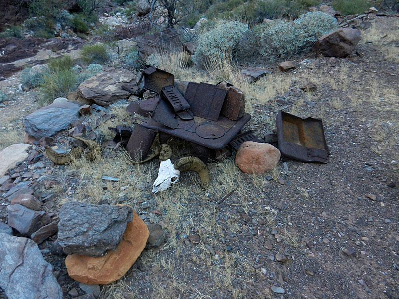 Camp stove and sheep skull at site. |
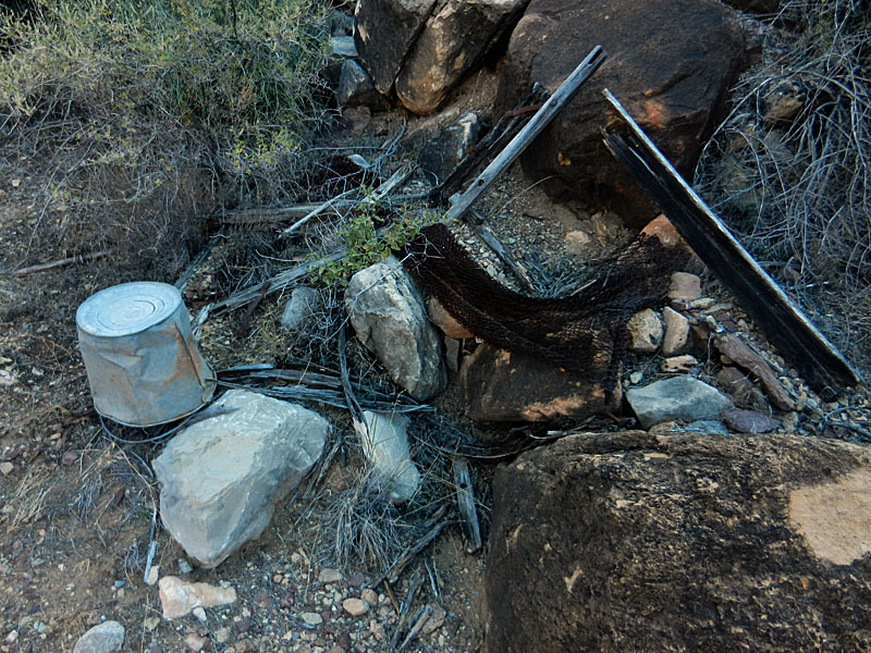 Other camp trash in the area. |
 The trail on the west side is visible. |
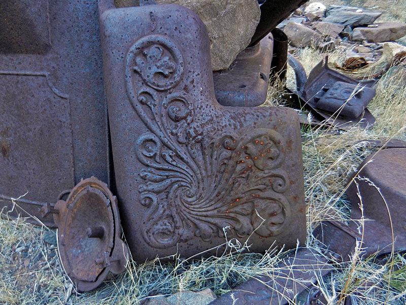 Stove detail. |
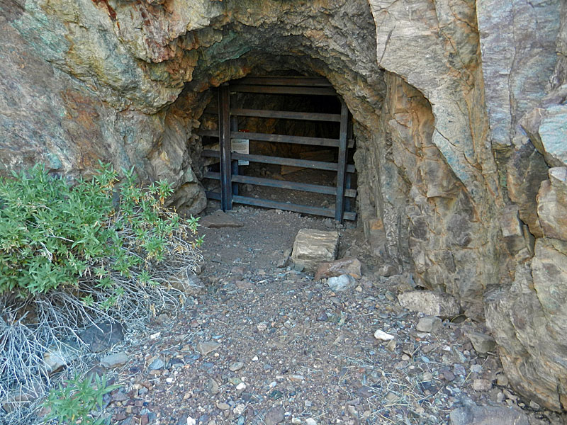 Copper mine closed off. |
|
Day 5 - Day hike to the Hakatai
cable crossing (Thursday, Nov. 14) - Up at 6:10 a.m.
although it was still a bit dark. I was ready to go at 7:25 a.m.
with clear skies. It only took fifty minutes to reach the hilltop
saddle overlooking Copper Canyon. This time I planned to do the
Tonto all the way around to gauge whether the Bass trails across are
faster. They are! But, it is not by much - maybe 10 minutes.
By 9:30 a.m. I was heading down through the Tapeats out in front of
Fiske Butte. Others had written that if you just work your way
down the slope toward the river that you'd eventually find the trail.
But, this slope is covered in knee high grasses and even after finding
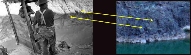
the trail it takes some concentration to stay on it. I actually found the trail at the earliest opportunity, as it was still at the same level as it follows from Copper Canyon. The schist here is all slanted and I was often tempted to head more downriver, but the trail plunges more or less directly down to the river, cutting across these bands of schist. The river didn't look that far away from the top but it took me an hour to reach the cable site. Bass just used this crossing to ship buckets of asbestos ore across the the river. He didn't maintain it over time, deciding it was more economical to have his burros haul the ore to Shinumo and then cross at that cable site. Consequently, there are cables laying around here, but nothing as sophisticated as at the other site. I gave brief thought to going all the way to the river and started following the trail down, but it soon gave out. The sloping rocks really didn't look too inviting and the river was still very muddy, and running high. One of the old photos I found shows Bass in a cable tram and is titled, "Hakatai Cable, Bass and Mr. Waite, undated." But, according to my reading of Billingsley, et al. (Quest for the Pillar of Gold), Bass only had hauled buckets across the river at Hakatai. So, I looked at the photo more closely and it looks to me like it shows the cable below Bass Rapids. Below is my comparison of the old photo with a close up of the north bank of the river shown in my photo above, "View from tram to north side." The two features I've highlighted sure look the same to me. Initially I thought that the old photo showed the bank that looked more like the Hakatai area, but now I am convinced otherwise. And, while this cable tram doesn't look like the other one linked above, Billingsley notes that the cable tram was upgraded once. So, this photo, below, may show the original cable tram, which was not as beefy as the later one.
By noon I was back up at the Tonto and stopping for an hour-long lunch break. I spotted what looked like part of the trail down below me in the next bay. I stuck to the Tonto Trail and crossed Copper again on the Bass trails. This time it took me only about 35 minutes. By 3:30 p.m. I was back at my camp, tired and looking forward to rest and dinner. |
|
|
||
 Cables at Hakatai drape over schist. |
 View to Hakatai side of cable. |
 Grass-covered trail. |
 Hakatai Rapids from cable site. |
 Cable anchor. |
 Asbestos mine in Hakatai. |
|
Day 6 - Moving my camp to the
Tonto in front of Grand Scenic Divide (Friday, Nov. 15) - I
was up at a few minutes past 6 o'clock to the sounds of a hooting owl
somewhere further down this ravine. I heard it hoot a few times in
a rhythmic cadence before I recognized what it was. The cloud
cover was thick and had me concerned, but blue skies broke out before I
left. I encountered the "birds of Tyndall Dome" again, and at the
same time as two days previous - 7:45 a.m. They seemed to be
bluebirds and I wondered if they weren't ground nesting since them
seemed to be flying up from the bushes and I did notice a lot of holes
in the ground - more than could be accounted for by the mice.
[Indeed, I didn't see any mice on this hike.] I was off just a few minutes before 8 o'clock and still carrying a gallon of water. The cool temperatures have sure done a great job keeping my water consumption down. I followed the Tonto Trail back into Bass Canyon, retrieved my water cache, and continued on my way. As I got in front of the point coming down from the Grand Scenic Divide I decided that the ground up above the small cliff band looked more promising than the Tonto level for a camp. I spied a route that looked like it would go so up the slope I went. The cliffs are probably 8-12 feet tall and I did find a spot where I could pull myself up the last little bit. Later I found better spots on both sides of this little peninsula that I used. I set my pack onto a bush and covered it with a pack poncho. I still needed water, so I gathered up my filter and bladders into my day pack and headed back down to Bass Canyon. I reached the Bedrock Tank area at 10:20 a.m. and pumped out one gallon from the pothole there. After a snack I was all packed up and ready to go by 11 o'clock. I decided to leave this water at the cache site on the Tonto Trail I had used before and would retrieve it on the eighth day when I was hiking up to the Esplanade. I was back to my pack by noon. I had lunch and set up my tent. Just in time too, as the wind started kicking up. I had to scurry a bit to get everything inside and gathered up many rocks to tie my lines to. Lucky for me I set it up with the door facing the leeway side so even with the fierce gusts, I could leave the flap open. Still, I ended up putting rocks on every inch along the edge of my ground cloth, to keep the noise down and to keep it from flapping dirt up at me. I also got two very large rocks and tied my rope to them on opposite sides of the tent to keep it from blowing away! I took a little walk around my area but was in the tent by 3 o'clock as the wind kept blowing and raindrops started to fall. I could see that it was raining further to the east, but I only got a few sprinkles. I spent the rest of the afternoon reading a book. At sunset, the wind died down and the night was reasonably pleasant. |
|
|
||
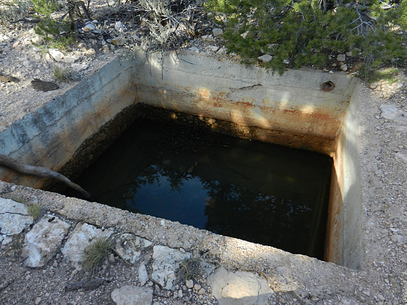
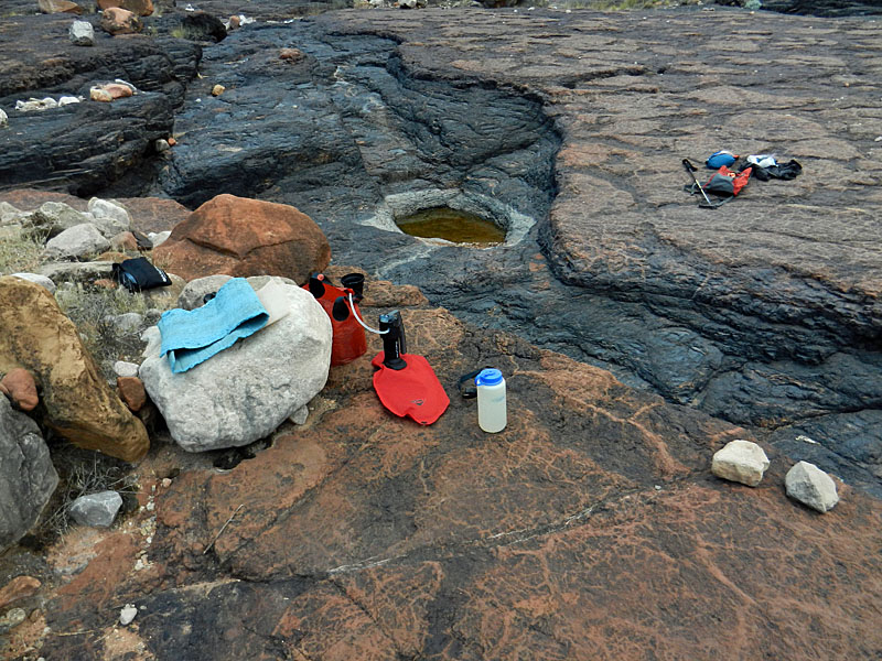 Filling up at Bedrock Tank. |
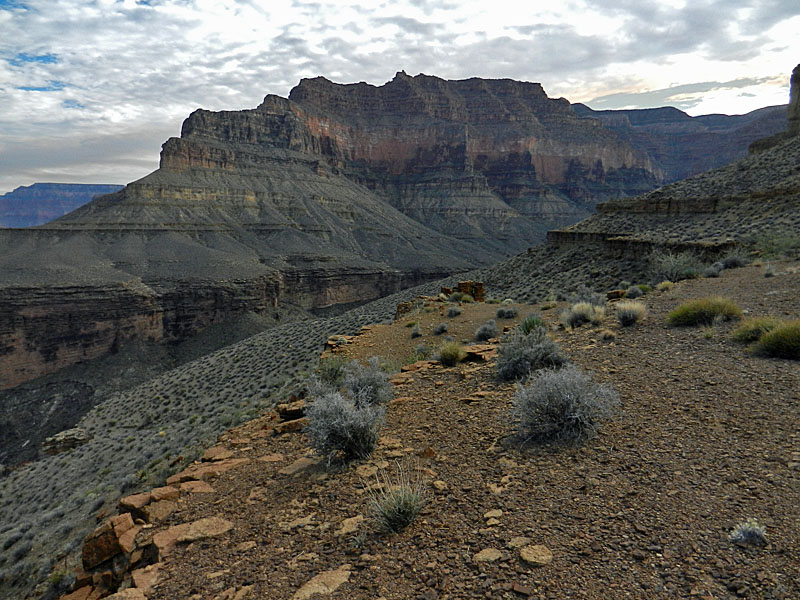
 Camp below Grand Scenic Divide. |
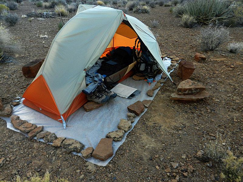 Tent prepped for wind and rain. |
|
Day 7 - Day hike down Serpentine to the
river (Saturday, Nov. 16) - The moon was nearing full and
quite bright all night long. Some clouds in the morning and it was dark
until almost 6:30 a.m. I was up just ten minutes before that and
ready to go in only an hour. I think the cold breakfast is saving
me a lot of time in the morning! It was mostly clear overhead, but
cloudy and it looked like it was raining to the east and the north. It took me less
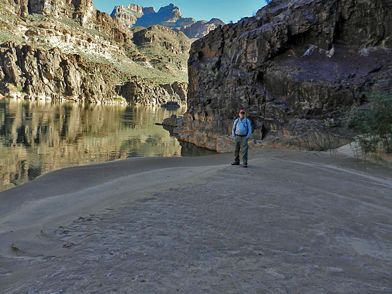
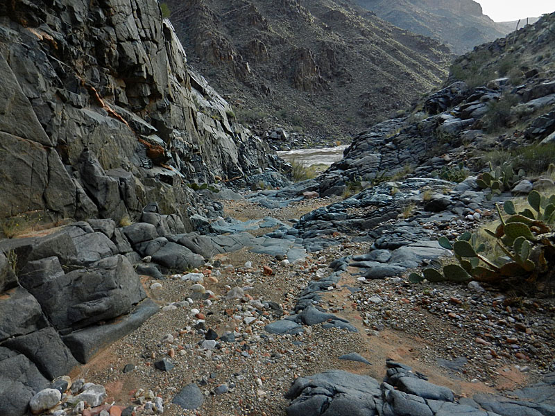
than an hour and a half to reach the bed of Serpentine. It is
pretty much an easy walk from here down to the river. There was no water
here, although there is a nice grassy area just below the Tapeats.
A jumble of boulders in the bed can be bypassed by a cairned route on
the east side. Some bushwhacking was involved but soon enough you are
in the main bed and following it the rest of the way. Lots of
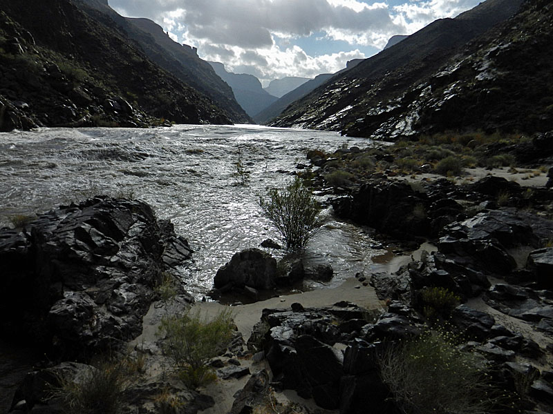
polished schist to cross. If it was wet I would be concerned, but
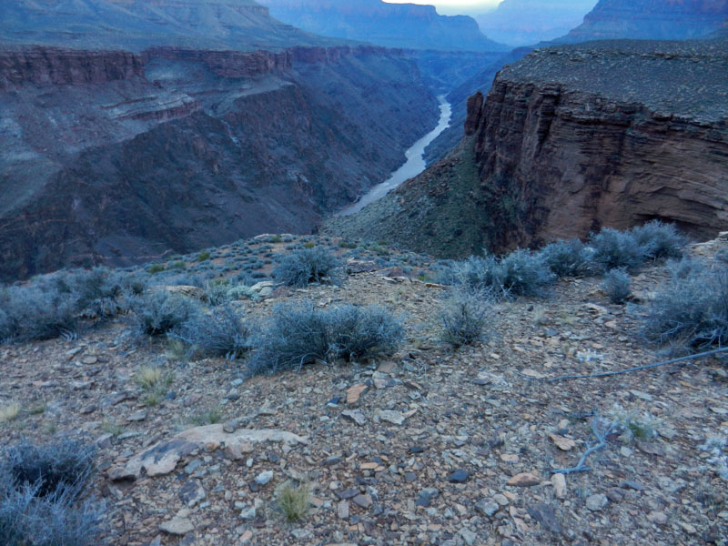
fun when it's dry. From the Tonto it took me less than an hour to reach the river and the sun was shining on that spot which made it quite pleasant. Clouds to the east looked very threatening, as did the river. It was very muddy and running quite high, as I could tell by the bushes that were partly submerged in the water. Although it was cool, I found a nice calm area where I could wade out into the frigid water and even get a chance to splash water over my face and head. I used my Phantom Ranch bandana to filter a liter of water. It caught most of the sediment, but there was quite a lot in this water. I used some iodine tablets for purifying purposes. I hung around here for about one and quarter hours. I was back to the Tonto by noon and took my lunch break there. As I was getting ready to leave I realized that I didn't have my bandana. It was still back at Serpentine Rapids, laid out on a bush to dry! Aargh! Well, I thought that I did have the time to make a trek back to the river to get it, but decided that I would just have to write it off as one more contribution to the canyon. Or, to the next river party that passes by and stops here. I wonder if there is some cosmic bookkeeping entry for things lost, and found, in the canyon? I'm pretty sure my account is still in the black. I was back at my camp by 2 o'clock and with the wind still blowing hard I spent most the rest of the afternoon reading. I am quite sure the wind was largely a function of my location up on this terrace - I didn't experience that much down on the Tonto. |
|
|
||
 Destination - Serpentine Rapids. |
 Below the Tapeats. |
 Polished schist in lower bed. |
 Approaching the river. |
 Looking upriver. |
 The requisite soaking in the river. |
|
Day 8 - Up the So. Bass to the
Esplanade with a day hike to Mystic Spring and Monte Video (Sunday, Nov. 17) - It
was mostly cloudy overnight and in the morning. The threat of rain
was high, but as the day wore on, I saw more and more blue skies.
I was up at 6:25 a.m. and on my way at 7:45 a.m. which must be a record
for me! I still had 1.5 liters of water (with the gallon to pick
up at the Tonto/Bass trail junction and two liters on the Esplanade), so that
didn't seem to be an issue. By a quarter to ten I was at the top
of the Redwall and about an hour later I was on the Esplanade. In the
Supai I met the only hikers I saw on this trip. They were just
starting their hike and heading down to Bass Rapids. They were
able to confirm that the weather forecast was still holding up. I
was thinking that if the weather had turned bad that I might forgo the
Esplanade camp and continue on out to the rim. The afternoon
turned out to be quite spectacular with all the clouds blowing away and
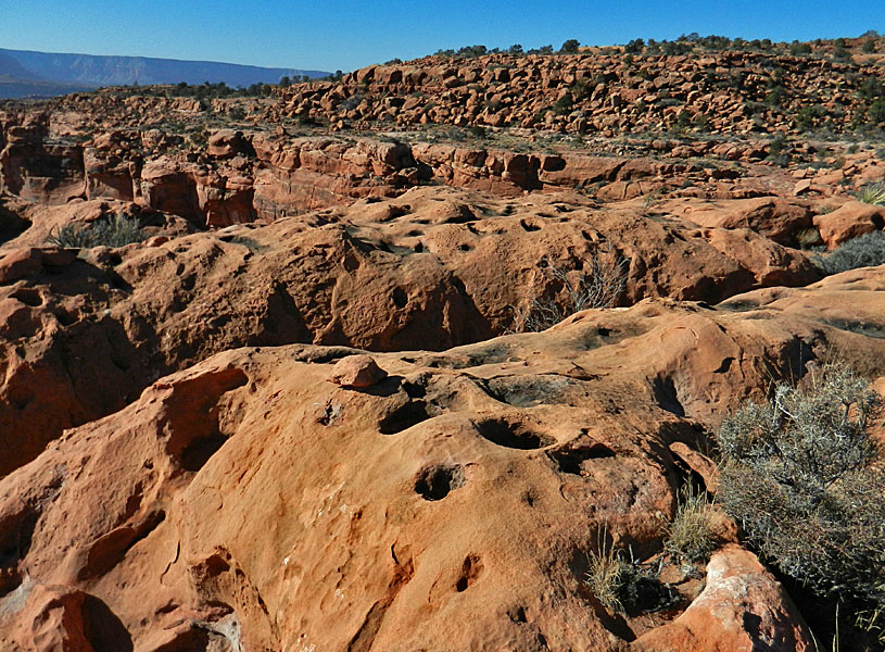
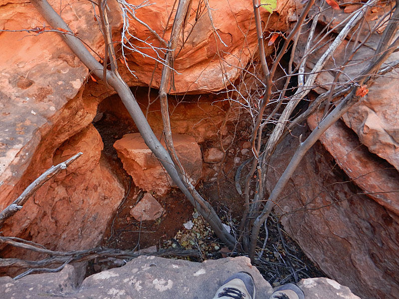
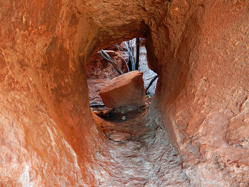
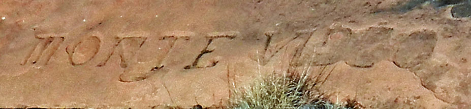
a deep blue sky overhead. I had my camp all set up and had eaten my lunch by noon, when I started off on my day hike to Spencer Terrace. I wanted to see an inscription, "Monte Video," that I had only just heard about in the last couple of years. I also wanted to revisit Mystic Spring, where Bass first set up camp in the canyon, and where he would entertain tourists, until he built the trail to the river and on the north side. Skirting Mt. Huethawali to the east was easy going. No trail here, although I think this was the route that Bass followed back in the day. It took about a half hour to reach the start of Spencer Terrace. You have to work your way down a band of boulders, but it isn't hard. Then, just follow the terrace out to the bitter end. Along the way I passed two very large cairns. They mark a route down to the next level, on the west. There is still one more level to drop down to get to Mystic Spring, but on my way back I ended up coming out right where these cairns are. It took me about 45 minutes to get to the end of the terrace. There is one more piece here, but it is detached. I was afraid that I was going to have to find a way to climb down and back up to that piece, but that wasn't the case. In fact, looking more closely at the Butchart map, you can see that he didn't climb out onto this detached piece either. Just as I was wondering where the inscription might be I saw it was right in front of me. Carved into the sandstone, and facing up, it has perplexed many as to its origins and meaning. Ray Kenny had mused about this being from the mid-1500s when the Spanish first encountered the canyon. Intriguing, but I'm not convinced. [My main objection is that it is too close to Mystic Spring and certainly many/most/all of Bass' tourists would have walked out here to the end of the terrace, if not for the exercise than at least to be able to see, and hear, the river, which you can do from this spot. This spot also has great views into Copper Canyon and I could see the mine site from here.] It took me about thirty minutes to work my way back to Mystic Spring. I found the right shelf (below the wide one), but got cliffed out just before reaching the spring. So, I had to climb back up the 10+ feet to the higher level. This area is quite bizarre, with potholes and crevices everywhere. As I was hopping around through here I came to a hole with a tree growing out of it. Aha! I've seen this tree before. It is in a little courtyard area that one can access from Bass' campsite via a tunnel (all natural insofar as I can tell). I did bring some photos from my 1995 visit and felt pretty confident that this was the right spot, even though I couldn't see the tunnel. Still, I had to think about whether I could get back out if I was wrong. I decided I could, so down I went. And, there was the tunnel and there I was at the Mystic Spring campsite. How cool. I have previously posted up a trip report on this site, "A Visit to Mystic Spring." There are some photos there that compare current views (well, 1995!) with those of a hundred years ago (from James' book). So, I'll not repeat them below. I had thought that the campsite area, with a rock wall creating a level space, was the main spring. There are some ferns growing on the wall here and it looks damp. But, in the old book, there is a photo labeled, "Burros drinking at Mystic Spring." This spot is about 20 yards away, and there is a small wall here as well, leveling out the space, and one can see water streaking down the cliffs below. It isn't much; just barely a seep. But, just before putting this report together I found this old photo showing Bass, and another man, drinking from the same spot as the burros! So, I guess that was the proper place of the spring. It was an easy hike back to my camp, which I reached at almost 4 o'clock. I had plenty of water and both my fuel and camera battery were holding up as well. With a perfectly cloudless sky, I got a chance to photograph something I had been seeing each night - the shadow of Mt. Huethawali being cast on the Redwall on the north side of the river. Yet another cool thing on this hike! |
|
|
||
 My camp was above this cliff. |
 Lumber from the Bass era? |
 Trail switchbacks in the Supai. |
|
|
||
 Route to Spencer Terrace. |
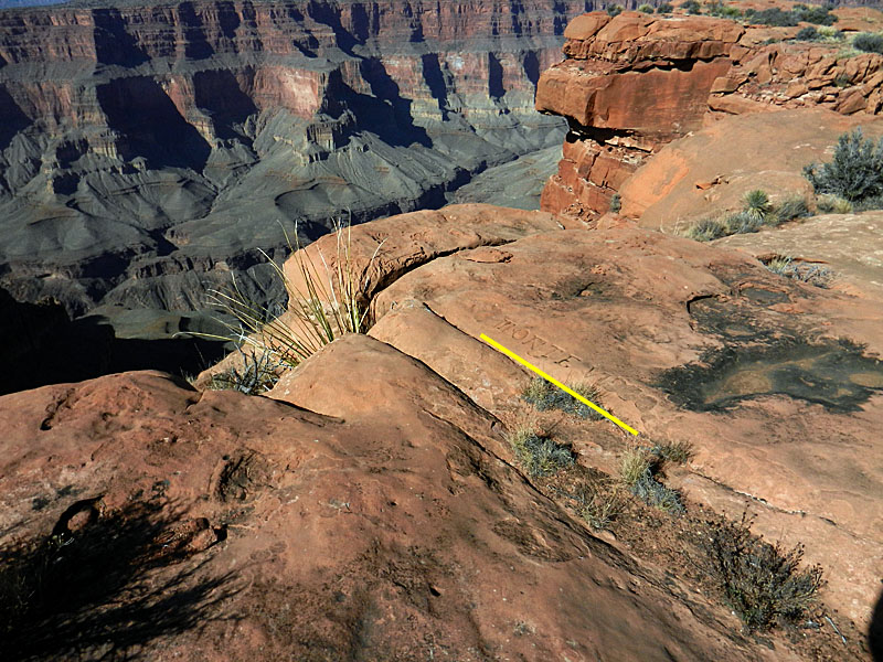 Monte Video inscription (close-up). |
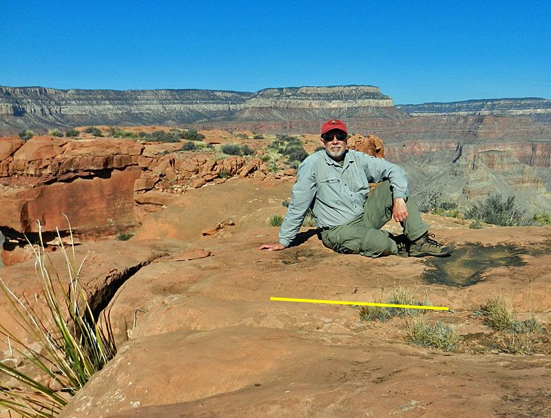 Inscription at the end of the terrace. |
|
|
||
 Up above Mystic Spring. |
 The courtyard at Mystic Spring. |
 Tunnel to courtyard. |
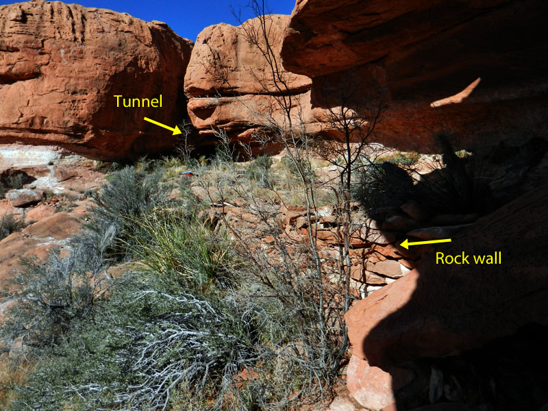 Mystic Springs camp area. |
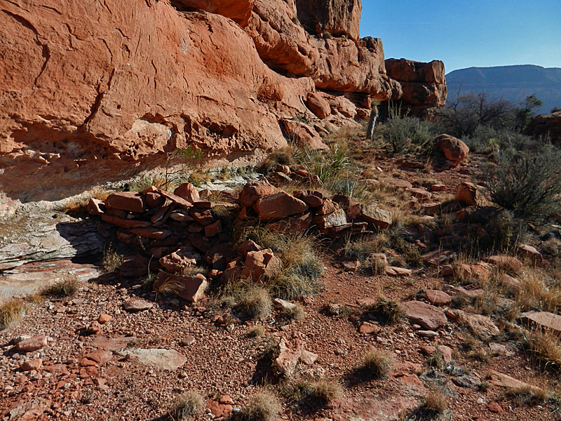 Mystic Springs. |
 Looking to the south from Mystic area. |
 Seal Head rock. |
 Natural arch near Mystic Spring. |
 Huethawali's shadow at sunset. |
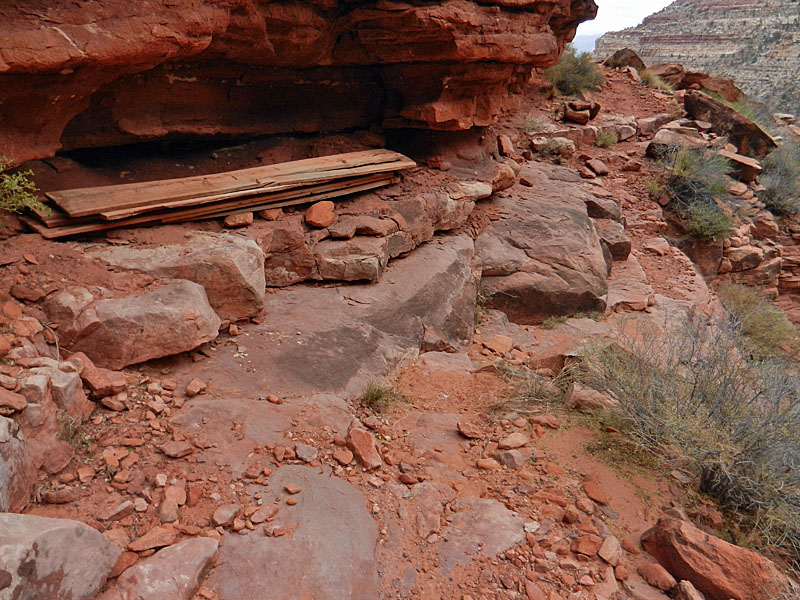
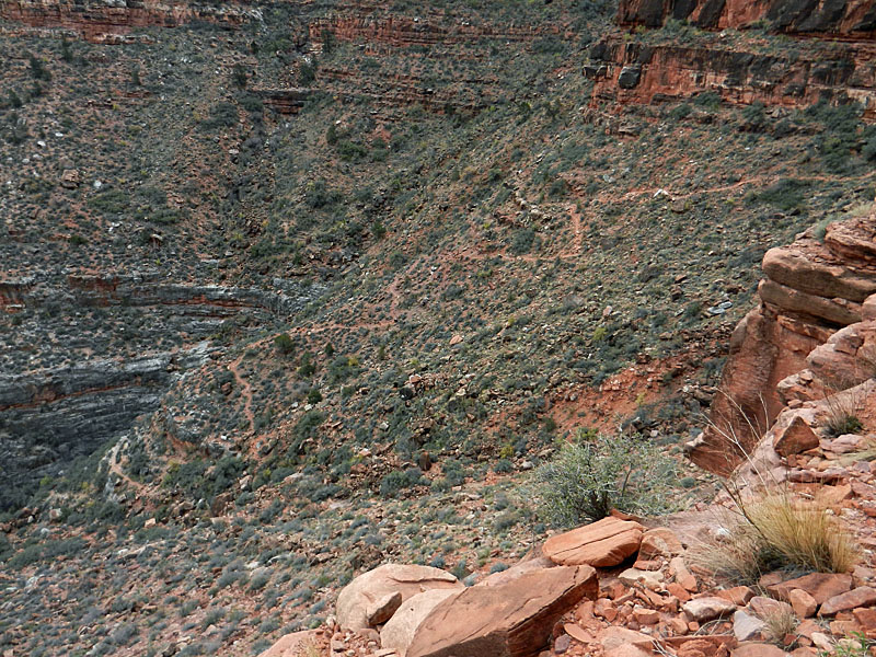
| Day 9 - Up the So. Bass to the rim (Monday, Nov. 18) - It was noticeably colder at this camp, but not uncomfortable. Clearly above freezing and likely close to forty. I got up at 6:40 a.m. to minimize how much time I'd have to spend in the cold before the sun rose and that worked out well. I was just starting my hot (!) breakfast when the sun came up at 7:30 a.m. Perfect. By 8 o'clock I was on my way and in less than two hours I reached the rim. I stopped to see the darkroom facility and found that there is a much easier route to it from the rim. Also I found some big flat areas here that must have served Bass as places for tent cabins. Since it was still early in the day the upper stretches of the trail were quite frosty from the low overnight temperatures. |
|
|
||
 Photo studio for Bass' visitors. |
 Tent cabin site? |
 Grand Scenic Divide. |
| Once on the rim, I was able to clean up, change clothes and be on my way in about forty-five minutes. It took a bit more than two hours to reach the highway and soon make a well-deserved lunch stop in Tusayan. At the end of the hike I was still carrying a gallon of water and I still had fuel left for my stove. My pack weighed 37 pounds when I got home, which includes the water. A great hike under nearly ideal conditions; I couldn't ask for more. |
|
|
||
|
|
Return to Hiking Grand Canyon home page |
|