Hiking the Escalante Route
From Tanner to Grandview

Saturday 3/16/2013 - Friday 3/22/2013

by Dennis Foster


Bill Ferris snaps a pic of his son Matthew in 75 Mile canyon.


Click on any picture to see a larger image.

     My hiking buddy Bill Ferris invited me to join he and his son for a seven day hike during spring break.  It is a bit of an irony for me as I am on a sabbatical this year and have no particular time constraints.  That is, I can hike anytime.  I think that's irony, but I could be wrong.  His plan was to hike down the Tanner Trail and then follow the Escalante Route to Hance Rapids, where you can pick up the beginning of the Tonto Trail, which he would follow until he could hike up and out to Grandview Point.

     I was intrigued because I had once tried to hike the Escalante Route (west to east) and gotten lost somewhere along the way.  I started off from Hance Rapids on the second day of my hike and in some side canyon I missed a turn.  I kept going up the canyon and eventually found a route that took me to the top of the Tapeats.  From there I contoured to a break I knew about in the Redwall that would lead to the saddle between Escalante and Cardenas Buttes.  From there, it would be a quick scramble down the Supai to the Tanner Trail.  While I had a permit for Tanner Rapids that night, I decided instead to just hike up to the trailhead and drive home.  That was in November of 1981.  Now, thirty-two years later I would get a chance to actually do this route!  I accepted!

     Bill had been over this route a couple of times in the last few years, so was very comfortable with its challenges.  His son Matthew had been on a few backpacking trips with him in the canyon over the last couple of years and this would be his most daunting.  At twelve years old, he has started to acquire an impressive resume of Grand Canyon hiking.  To better accommodate Matthew, Bill put together a conservative itinerary, with daily hikes of between 3 and 6 miles, except for our final day hiking out.  I have a tendency to put together itineraries that push me to the limit of my abilities, so I thought this might be a nice and relaxing hike.  To while away the extra time we'd have, I brought cards, a small cribbage board, a book and a notebook.  Matthew and I played cribbage only once (the first night), I never wrote in the notebook and I didn't read a single word in the book I brought.  Note to self: Whenever you have free time, you'll be laying down in the shade of a tree or boulder.

Day 1: To the Redwall Overlook on the Tanner Trail (Saturday, March 16):   We drove up in two cars so we could leave one at each end of the hike.  Bill left his at Grandview and I drove us over to Lipan Point, the start of the Tanner Trail.  We started off just a couple of minutes before 10 am.  At 52 pounds, my pack was the heaviest.  I don't know how Bill keeps his pack weight down, but he does.  We were carrying extra water because we will have a dry camp this night.  Temperatures were nice and there were clouds in the sky.

     We took a lunch break from 12:20 pm to 1:10 pm, at a large rock in the bed of the ravine just short of the saddle to 75 Mile Canyon.  I seem to stop here on every trip, and have even cached water here on occasion.  We had another rest break at a large house-sized rock in the long traverse along the Supai.  I also tend to stop there on hikes and it is another favorite spot to cache water.

     At just a few minutes short of 4:00 pm we reached the camping sites at the so-called "Redwall Overlook."  There was a group already here, although only one person in camp.  The rest were day hiking to the river for water.  [So, maybe they camped here for two nights.]  So, we went over the next ridge to the west and found a huge wide open space where we set up our tents and made our camp.  We had a short-lived threat of rain and it was quite windy, or at least gusty.  Both Bill and I have new tents and they were quite a pain to set up in the wind.

     I taught Matthew how to play cribbage.  He is a quick learner and promptly skunked me (a double victory).  As it got dark, we tried to look for the PANSTARRS comet that has been visible lately.  No luck for us.  We had clear skies after sunset and the stars were shining brightly.  I could see the Big Dipper outside the door of my tent and would use that to judge how well I was sleeping.  [That is, I'd look outside, see that it hadn't rotated very much and think, "I need to sleep."]


Me, Matthew and Bill at the parking
lot at Lipan Point just before heading out.  Our objective was the top of the Redwall and we were on our way at
about 10 o'clock.

The 75 Mile saddle on the Tanner.

Nearing our first camp site.

 My new Big Agnes tent.

The Watchtower from our site.

Day 2: To the Colorado River and a campsite below Tanner Rapids (Sunday, March 17):   We were up at 6 am and ready to go by 8:20.  We crossed the ridge and the other group was all gone - we didn't hear nor see them at all.  While walking through this campsite, I saw a small bag hanging from a branch in a tree.  It was an REI candle lantern.  The bag was black and undoubtedly just got overlooked.  So it goes.

     It was a clear day, but we got our hiking done pretty quickly.  By 1 p.m. we were at the Tanner Rapids campsites.  There were tents or packs set up in a few spots here.  We took the trail going west - really, the start of the Escalante Route - and by 1:40 we were nicely ensconced at a campsite that Bill and I have used before which is closer to Basalt Rapids.  It has great views and is right near the river.  There are a couple of  scraggly trees here that afford some shade, and good spaces to set up our tents.  It was much warmer this day, but also very windy and setting up our tents was a challenge (as was keeping sand from blowing in!).  We lounged around all afternoon, including a long time at the river.  I took off my shoes and waded into the water, but after only 10-15 seconds it was so cold that it actually hurt my feet!


The view from atop the Redwall.

Redwall descent (close-up of B & M)

Tanner trail in the BA shale.

Across the river - Basalt Canyon.

The lower trail.  Walcott Butte?

Comanche Pt. looms over river camp.

Day 3: A short jaunt to Cardenas Beach (Monday, March 18):   We were up at 6 am again, and ready to go by 8:30 am.  This would be our shortest day - a three mile hike (less, actually) to the beach at Cardenas.  We had given some thought to hiking all the way to our target for day 4 (Escalante beach), but it was going to be a warm day, so we deferred on the chance to have a two-night camp at Escalante.

     That turned out to be a good choice for many reasons.  We had overcast skies for the grueling hike the next day, versus the hot sun of this day.  And, we had the spacious Cardenas camp area all to ourselves, versus having to share the much smaller Escalante with other groups.

     On our way we stopped to look for signs of a mine operated by Felix Lantier.  We didn't really see a mine but we did see some of the residual equipment that looked to have been used here.  We reached Cardenas beach camp at 11 a.m. and just enjoyed the environment for the rest of the day.  We did have to share the camp ... with what must have been the world's largest mouse.  I swear it was the size of a small dog!  Could it have been a rat?  I don't know, but someone I know that stayed here on a later river trip confirmed that this critter was huge.  Luckily, not a nuisance.

On the Escalante Route. Hardware from Lantier mine? Bill gets one more of his 800 photos!

Day 4: Following along cliffs above the river and down to Escalante beach (Tuesday, March 19):   We were up at 5 a.m. and on our way by 7:20 a.m.  It was a very overcast day, but that made for more comfortable hiking.  The route ascends to the cliffs overlooking the river and passes by a real neat ruin on a high hilltop.  I had heard about this ruin many years (well, many decades) ago, but wasn't sure where exactly it was.  But, on a high on the north side of the river, while stopped for lunch between Basalt and Unkar I just happened to spot it!  Some years later I got a chance to visit and it was nice to revisit this interesting site.

     On our way to Escalante beach we passed two groups heading the opposite direction - first a group of four guys and then a group of three guys.  The group of three were all carrying enormous amounts of water - some 10 liters each!!  But, they were very friendly and I gave them my photocopied map (we had more).

     We reached the beach at Escalante at 3 p.m.  It was hot here, as it had been over the past couple of hours.  We decided to forgo setting up tents and just sleep out this evening.  There was no wind so it was a pleasant choice.


Wall of the Hilltop Ruin.

Mortar in these ancient walls.

Unusual marker: "Hilltop 1991"

Angel's Window!

Trail with view of Unkar Rapids.

Deteriorating wall of Tapeats.

Rounding the corner to Escalante.

We camped on Escalante beach.

Smoke from the north rim?

Day 5: Down 75 Mile Canyon, up and over the Papago wall & slide to Hance Rapids and beyond (Wednesday, March 20):   We were up at 6 a.m. and on our way at 7:40 a.m. for this rather long day.  It took a bit under two hours to get to back to the river at Nevills Rapids.  Following down the narrows of lower 75 Mile Canyon through Grand Canyon Supergroup rocks was quite cool.  The overcast this day was quite welcome.

     From here we could see the famed "Papago wall," a steep climb out the west side of Papago Canyon that may require some careful planning as perhaps lifting up packs near the top.  After a nice break, it took us about twenty minutes to reach the beginning of the climb.

     But, the climb is only half of this challenging part of the route.  Then you have to maneuver down a steep and loose slope back to the river.  Altogether it took us about two hours to climb the wall, descend the slide and hike over to Hance Rapids (which is, confusingly, at the foot of Red Canyon and not Hance Canyon!).  We stayed at the rapids for a few hours and had our dinner before pushing onwards.  We hiked up the now emerging Tonto Trail for about an hour before setting down roots at 5:30 p.m. at a neat site among very large boulders.


Wooden steps cabled together.

We found this pit above 75 Mile Canyon.  We looked around a bit
as this looks an awful lot like a
mining site, but we saw no tell-tale minerals we could identify.

The eerie narrows of 75 Mile Canyon have walls of the rarely-seen Shinumo quartzite.  In the bed is a group that had shared the Escalante site with us on the previous night.

Looking down on Escalante beach.

Matthew leads the way down 75 Mile.

River runners at Nevills Rapids.

Looking toward the Papago area.

At the top of the route up the "wall" you still need to get through one last cliff layer.  We passed one route and ended up on a thin track that led to this chute, requiring a 160° turn!

Looking down the "slide."

Bill scouts out our route while Matthew takes a short break.  Although it was still quite steep below here, we had passed through the worst of this descent!

Soon, Bill & Matthew would be standing on this rock!

A seagull hangs out at Hance Rapids.

Looking back at Hance Rapids.

Our campsite...the next morning.

Day 6: On the Tonto Trail to Hance Creek (Thursday, March 21):   We had a pleasant night, especially nice in that the clouds gave way to a sky full of stars.  We were up at 5:15 a.m. and on our way at 8 a.m.  We did have one loss - Bill forgot to turn off his Spot device last night, which can be used for sending out an SOS, but which is mostly used to send out tracking data.  [I think later models will go into auto shut off if it isn't moving for an extended period of time.]  Without any extra batteries, we will have to forgo having that data for the last two days of our hike.

     Blue skies and a warming sun were the watchwords for the day as we followed along the Tonto Trail to Hance Creek.  We got there in good time, arriving at the main camping area at about 1 p.m.  We set up under the big cottonwood tree that is here, and relished the shade it provided.  Later in the afternoon I took a walk up the bed, past the names on the wall, to the junction of the two arms of this canyon.  I went to the the terrace that is above the bed at the junction and explored around, but found nothing of interest.  [Some years later I would return here and scout out old stone corrals farther up to the east here.]


On the Tonto trail.

Route into Hance (more here).

Cottonwoods where trail crosses.

Overhang with historic (& not) names.

Main area with names on wall.

View of our campsite as we left.

Day 7: Back to the South Rim via the Grandview Trail (Friday, March 22):   We were up at 5:15 a.m. and on our way at 7:30 a.m.  It took about an hour to reach the spur trail to Page Spring, aka as Miner's Spring.  [Years later, the overhanging rocks here fell and this is now a very difficult spot to get water from.]  I was quite a ways ahead of Bill and Matthew as I wanted to check out O'Neill Spring, on the west side of Horseshoe Mesa, without making them wait around for me.

     I reached the mesa at 9 a.m. and hung up my pack in a tree.  I headed down the trail to the west, into Cottonwood Canyon, and reached the faint spur trail to O'Neill by 9:40 a.m.  It took me less than fifteen minutes to get over to the spring, which, as usual, was dry.  I only hung around for about ten minutes before heading back, reaching my pack at 10:40 a.m.  About an hour and a half later Bill and Matthew showed up and we headed for the rim, reaching it at 4 p.m.


The trail up to Horseshoe Mesa.

A dry O'Neill Spring (more here)

All smiles at Grandview Point.
     We drove back to Lipan Point so I could pick up my truck.  Then we drove out of the park at Desert View and down to Cameron, where we grabbed dinner at the trading post.  Once home, my pack weighed in at 39 pounds, which included 2 liters of water (4 lbs.), 2 lbs. of food (mostly snacks), 1 lb. of trash and 4 lbs. of stuff I didn't use and/or need.  FYI - after getting home, I wrote up our adventure for the local Flagstaff paper, below.

     Startin' em young
DENNIS FOSTER Special to the Daily Sun

My hiking buddy Bill Ferris invited me to join him and his 12-year-old son, Matthew, for a seven-day trek in the Grand Canyon.

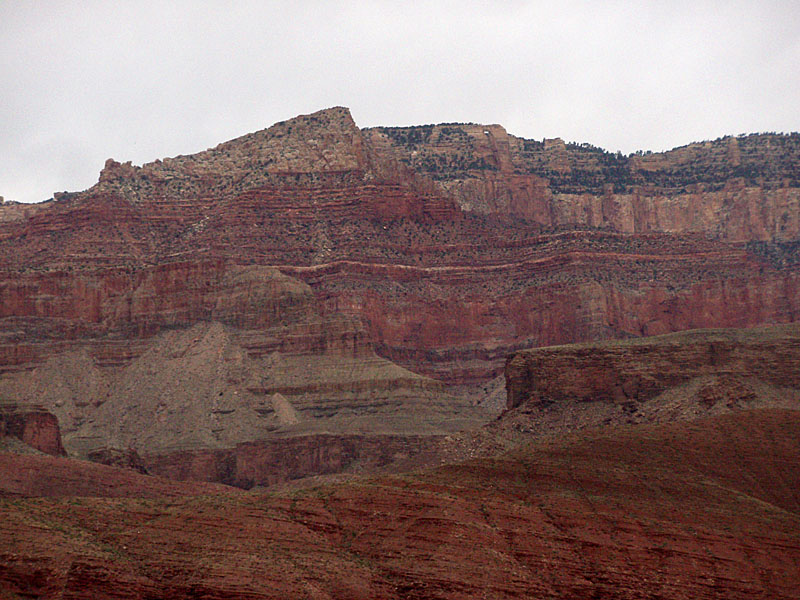
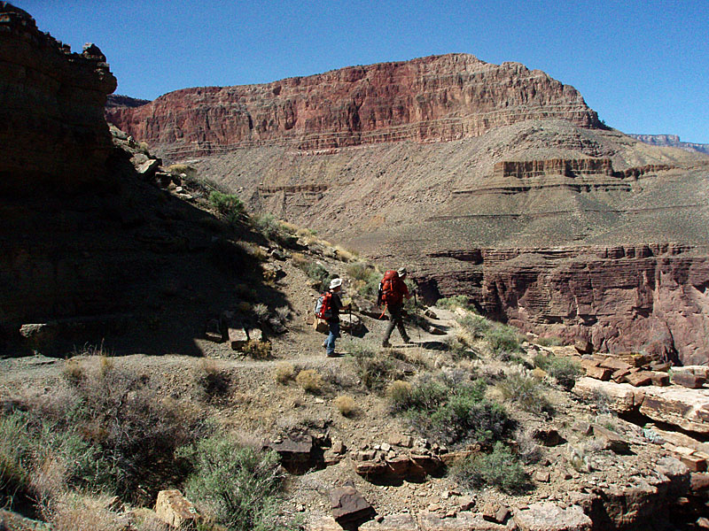
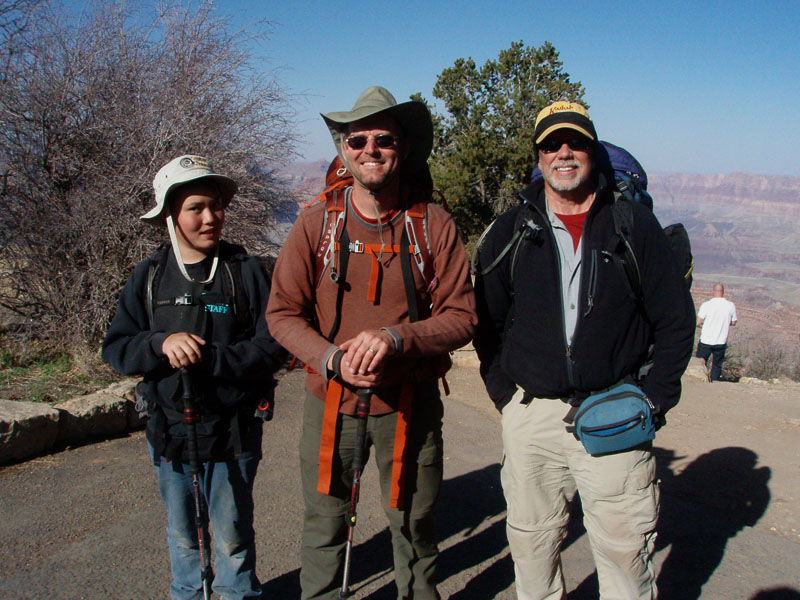
He planned to hike down the Tanner Trail, along the Escalante Route, up the Tonto Trail until we could climb to Horseshoe Mesa and exit via the Grandview Trail. As I had not done this complete route before, I enthusiastically accepted.

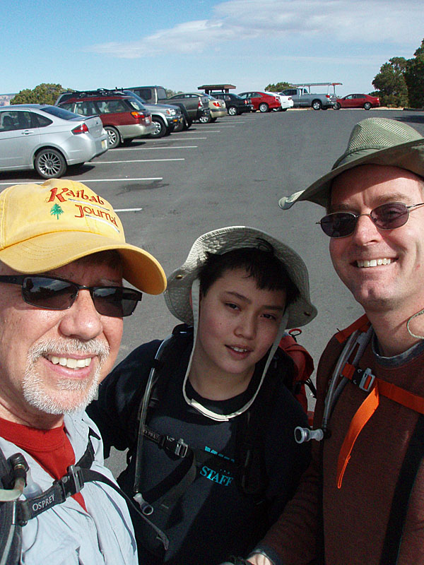
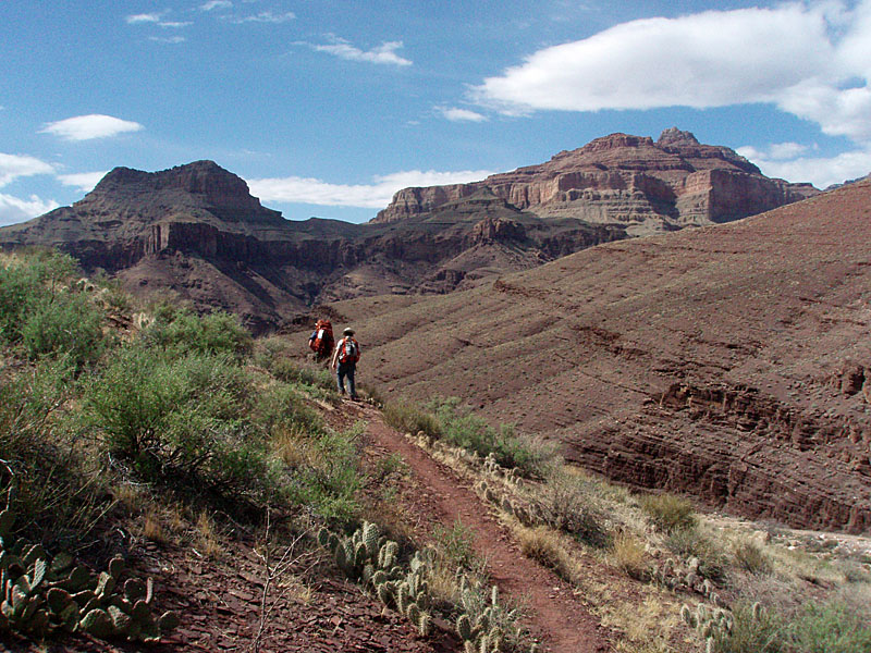
Matthew is becoming quite the backpacking pro, having been on more than a few trips with his dad. Although Bill planned a conservative hiking itinerary, that didn't mean we would take it easy. We were up around 5:30 every morning and usually hiking into the middle of the afternoon each day. That gave us time to set up camp, relax and cook dinner during daylight hours. I like it.

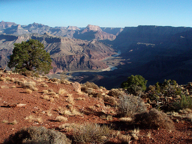
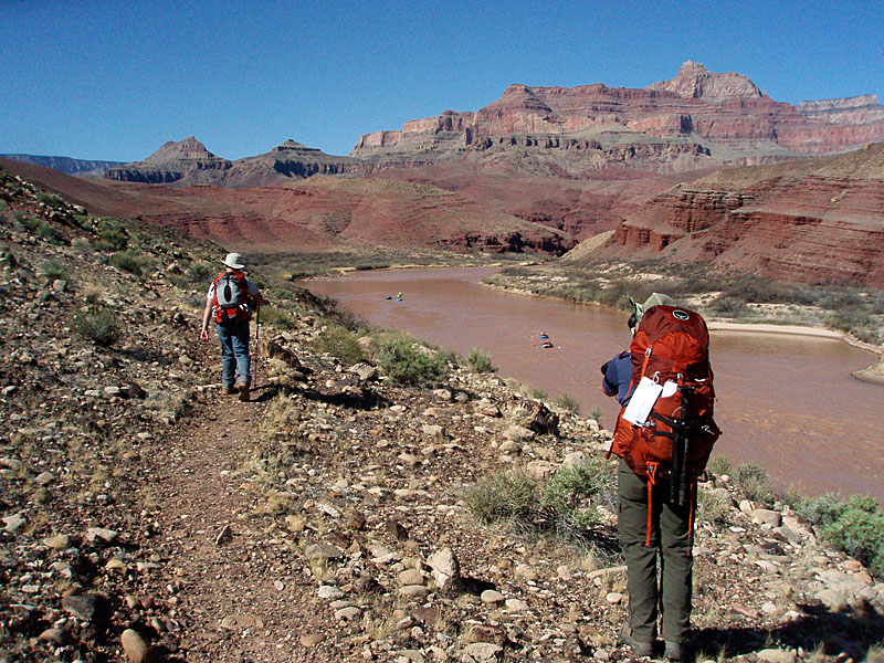
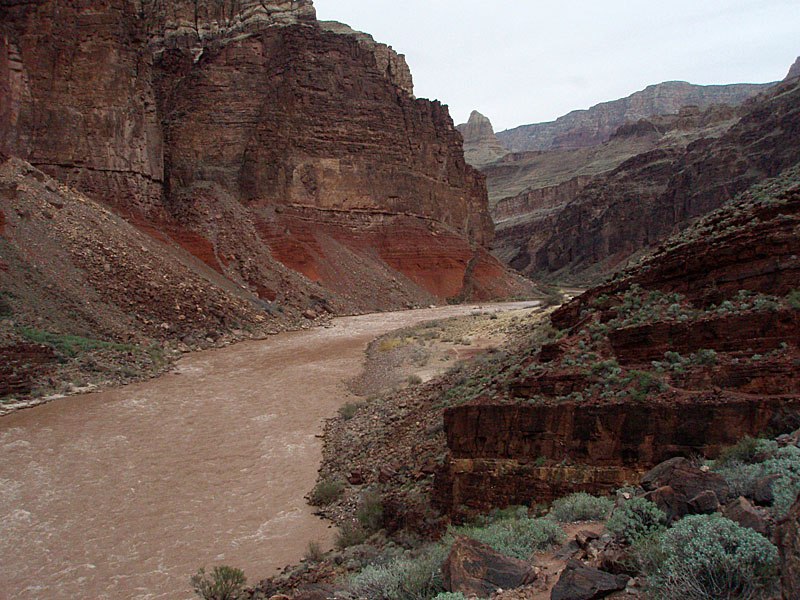
We started with a two-day hike down the Tanner Trail to the river.

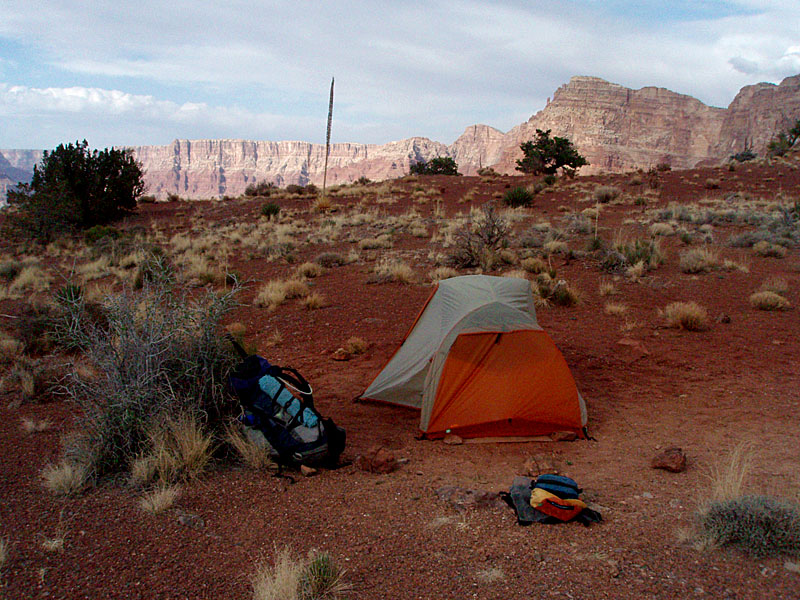
The first night was a dry camp atop the Redwall when our packs were at their heaviest. Matthew pulled his weight, lugging a pack that was proportionally as heavy as ours. The next day we reached the river in the early afternoon. It was quite warm in the sun, with temperatures into the 70s, and we mostly kept to the shade until sunset.

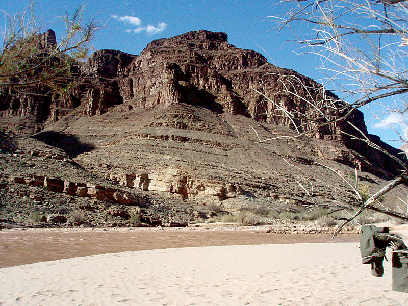
SLEEPING ON THE BEACH

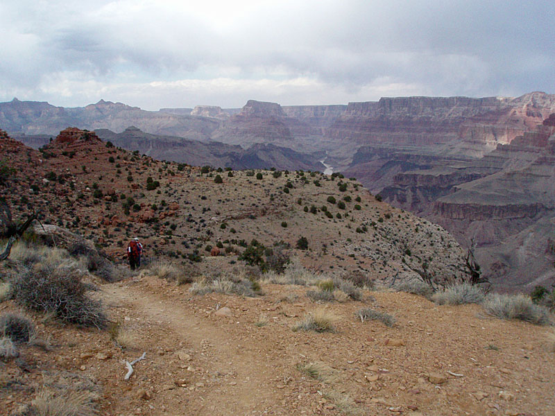
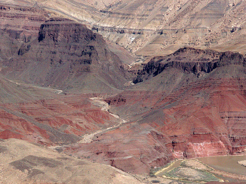
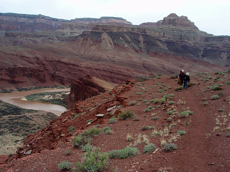
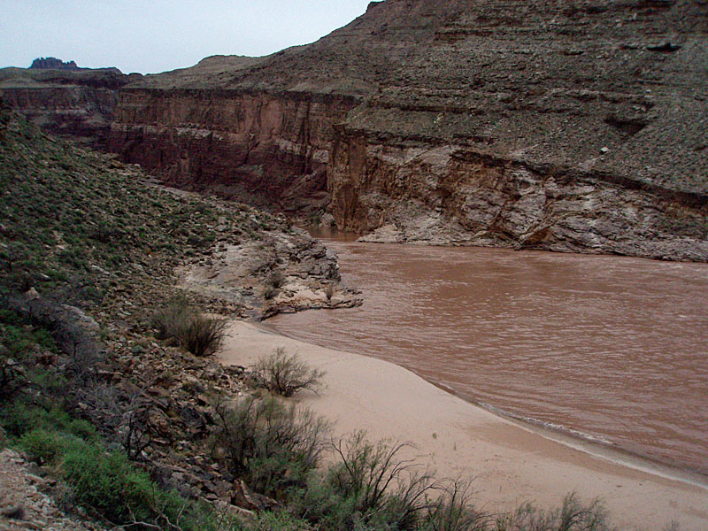
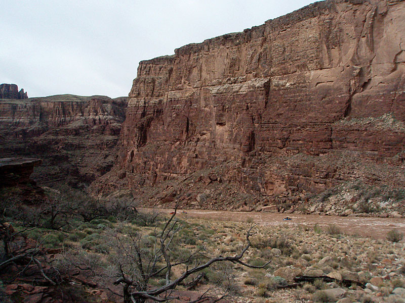
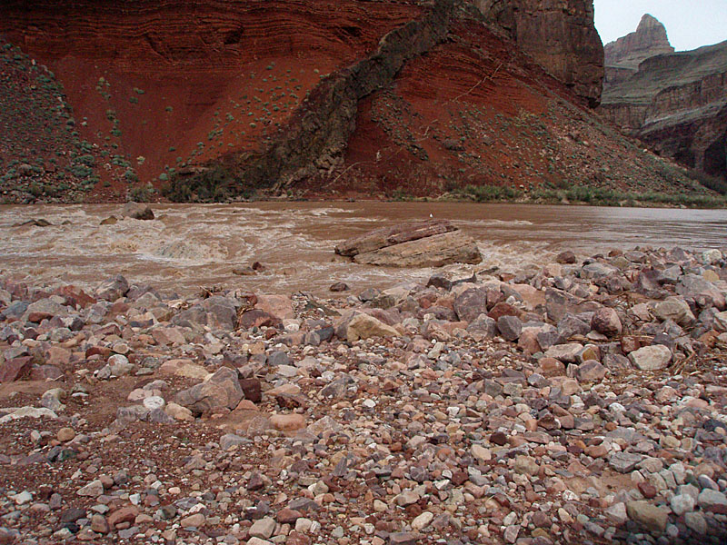
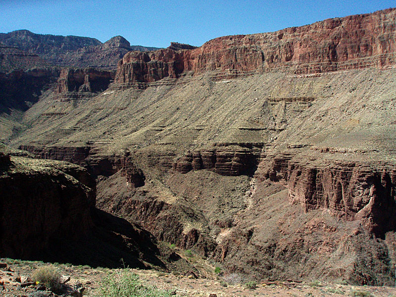
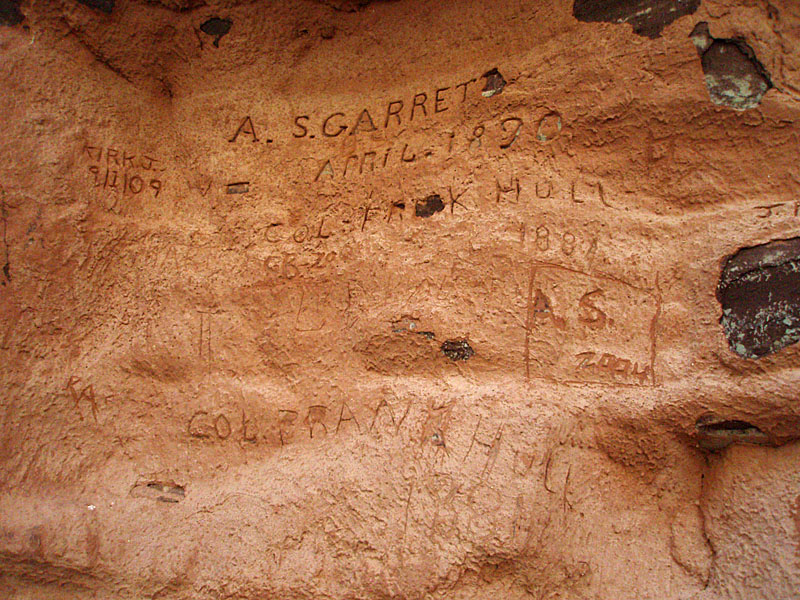
Day three would start us on the "Escalante Route." We only planned to go as far as Cardenas Creek, about three miles away. We reached the well-developed river camp at Cardenas before noon, which we had all to ourselves. Well, to ourselves and to the largest mouse I've ever seen. I swear it was as big as a cat.

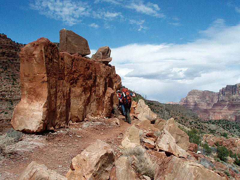
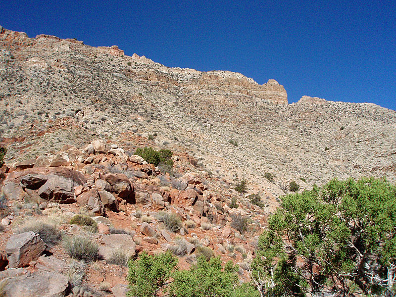
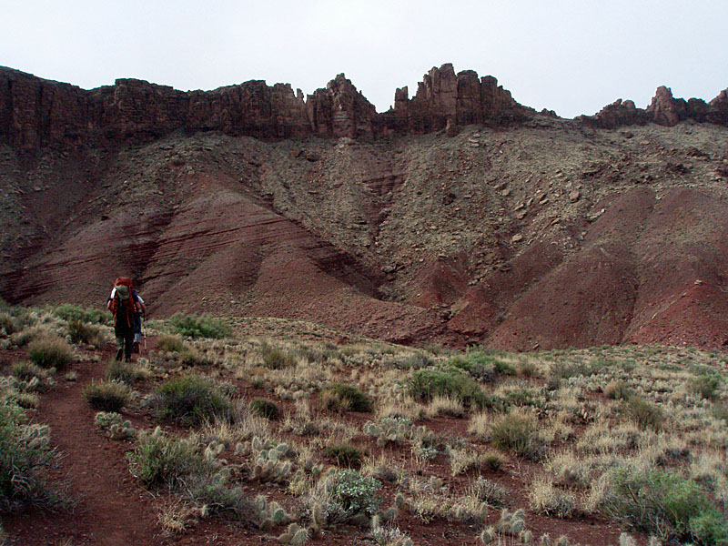
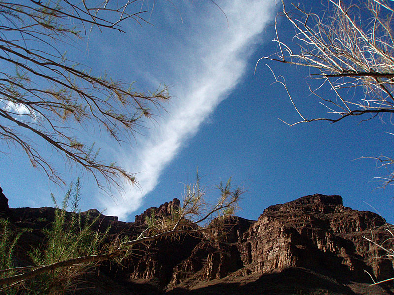
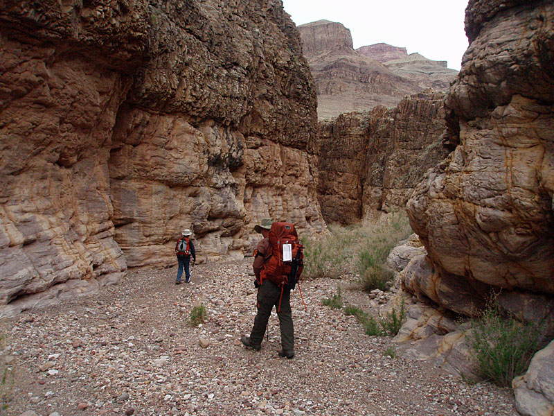
The next day we hiked up a thousand feet in order to wrap our way around and into Escalante Canyon. This would be one of our toughest hiking days and the weather cooperated beautifully with lots of overcast until the early afternoon. Matthew is still building up his hiking skills and relied on his father's coaching when we crossed over a jumbled boulder field. But, once the trail flattened out I was the one calling out for rest breaks.

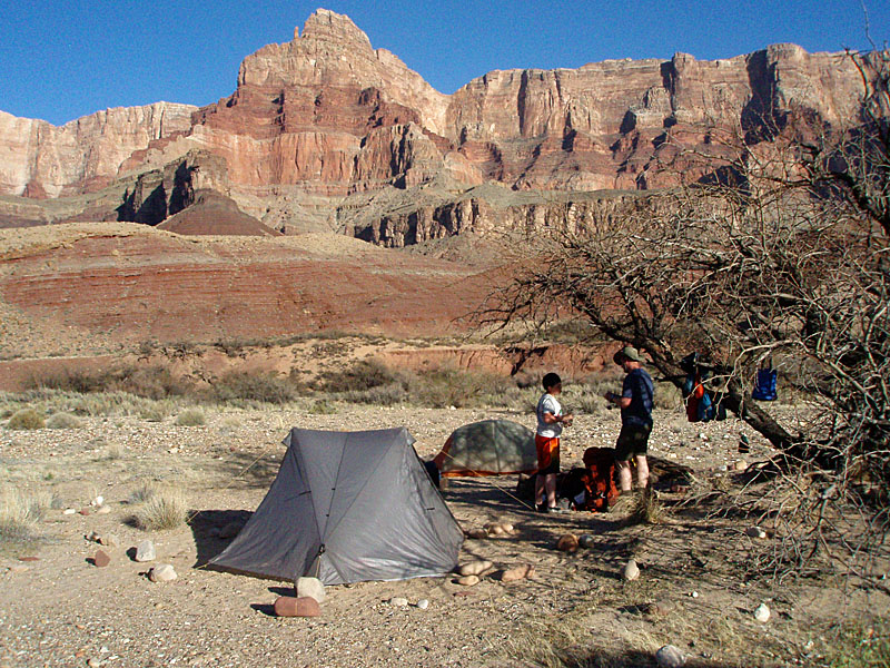
At our camp we decided to leave the tents packed up and just sleep out on the beach. Like all the other nights on our trip, it was pleasant, with the overnight low probably in the mid to upper 40s.

TWO HEART-STOPPERS

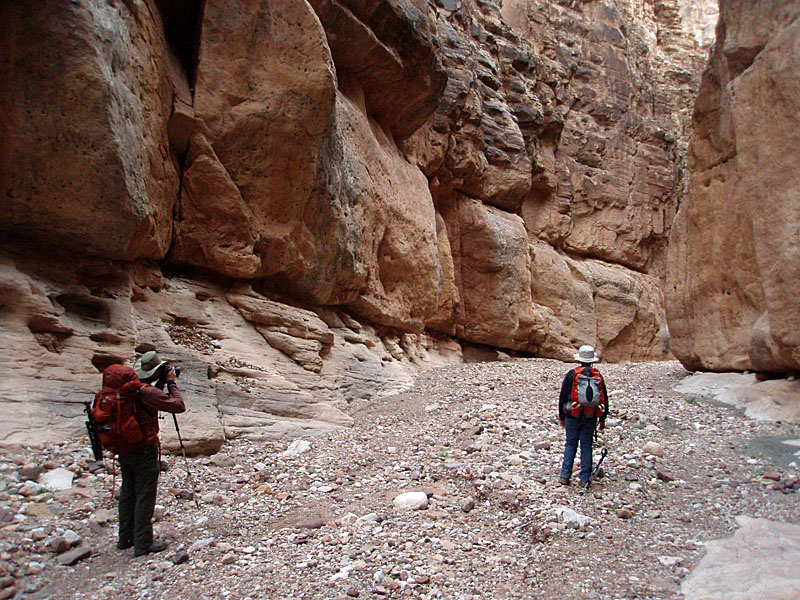
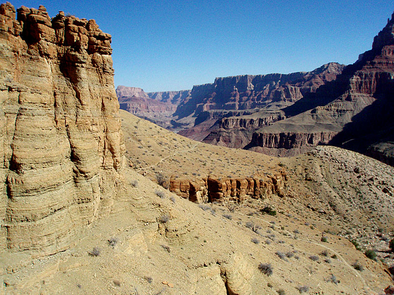
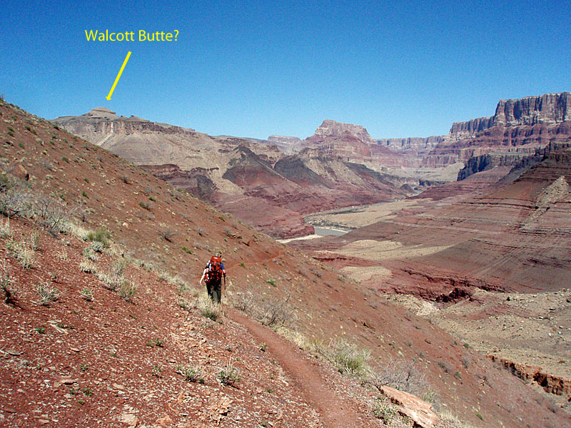
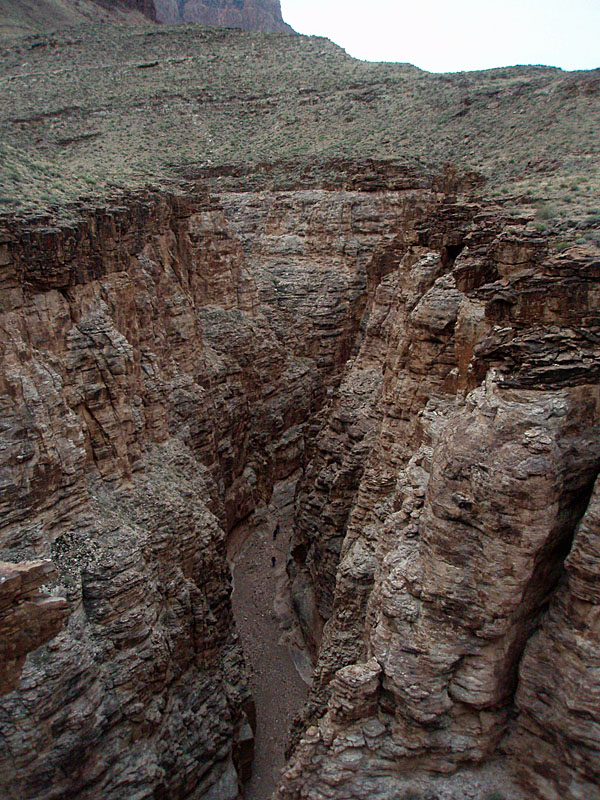
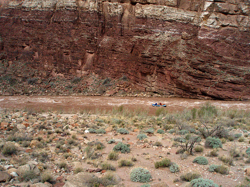
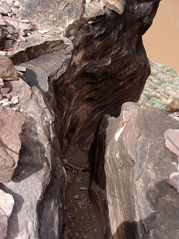
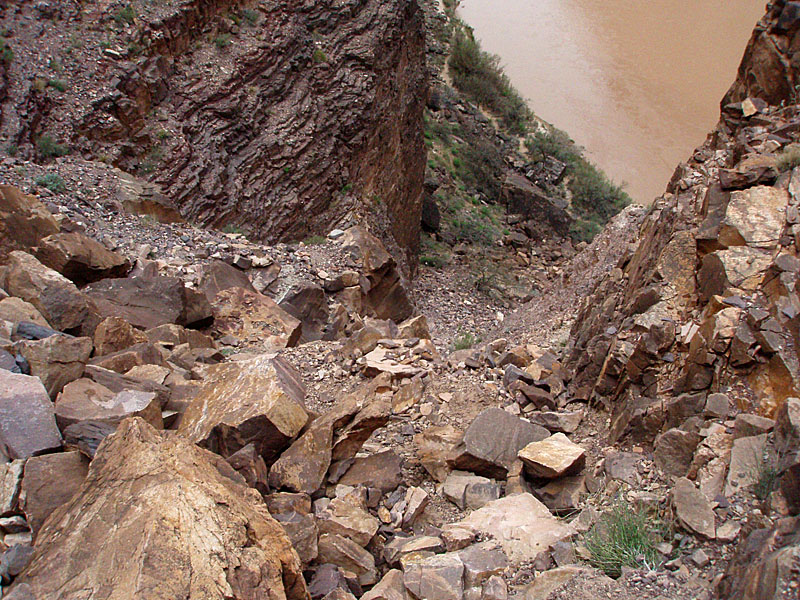
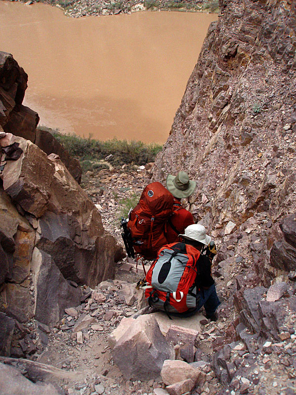
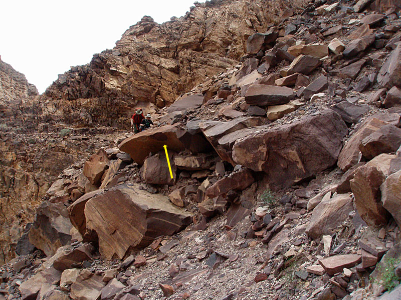
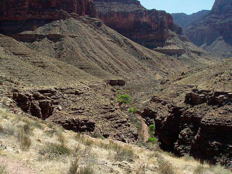
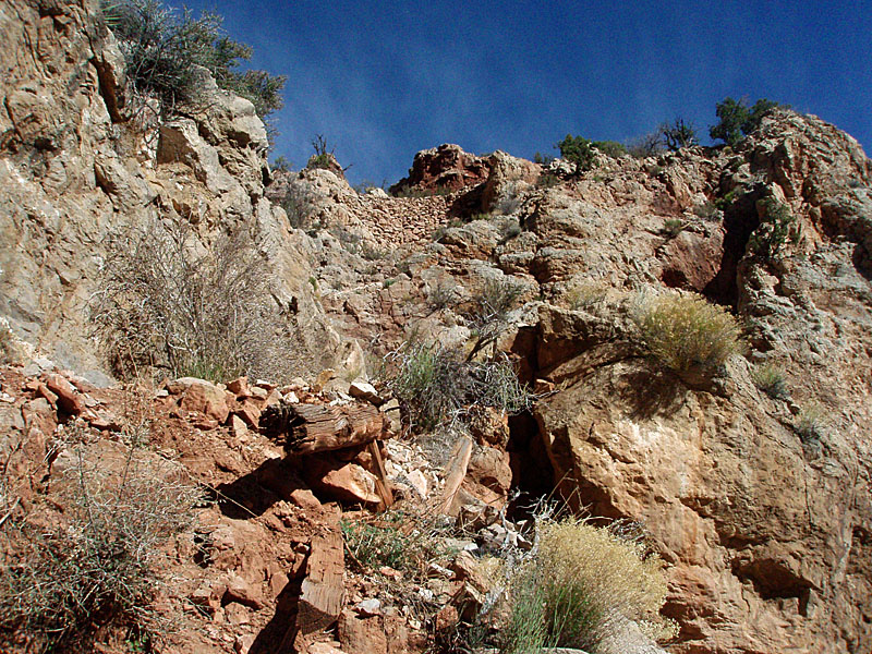
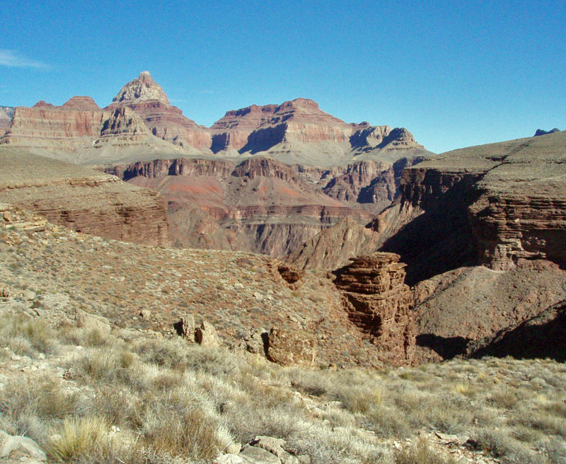
On the fifth day, we hiked over to and then down the impressive slot in 75 Mile Canyon. Once at the river, we spied a river trip and enjoyed watching the boats run the rapids. From here we could see downriver to the first of two heart-stoppers that make this a "route" and not a trail -- the "Papago Wall." The wall most certainly will require a rope for lowering packs, and many will want to do the same to raise them up.

Just past the wall, and out of our view, was the other heart-stopper -- the Papago Slide. The slide not only gives you a case of vertigo but adds a dose of terror as you make your way through precariously perched rocks that look like they could start sliding anew any time.

You may find yourself on your knees in places, perhaps just to say a short prayer. It is only about six-tenths of a mile from the mouth of Papago to Hance Rapids, but it took us two hours to do it.

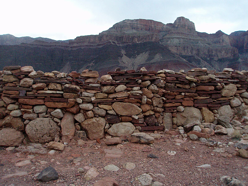
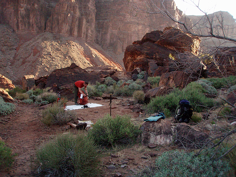
Our sixth day took us to Hance Creek, where we would spend our final night.

We had the camping area among the cottonwoods all to ourselves. The next morning we awoke to yet another beautiful day and began the 3,600-foot climb to reach the rim. We learned from hikers coming down that the snow and ice at the top of the trail was mostly gone and presented no concerns. That was a relief for us to hear.

We three very happy hikers reached the rim at 4 p.m. We talked about food a lot the last day and looked forward to a meal in Cameron. Matthew had a well-deserved cheeseburger and another Grand Canyon adventure under his belt.

Dennis Foster is an avid Grand Canyon backpacker and has recorded more than 300 separate hikes since 1977.

BACKCOUNTRY PERMITS

Getting a backcountry permit at the Grand Canyon is a rather involved process.

You must first review the various use areas in order to determine where you'd like to camp during your trip. You can apply for a permit up to four months in advance of the month your trip begins. For hikes in March, an application will be accepted no earlier than November 1st of the previous year. You must apply in writing by fax, snail mail or in-person. No e-mailed applications are accepted. You can only make an in-person request three months in advance of the month your trip begins.

The most popular backpacking months are March, April, May and October, each getting more than 10,000 user nights. According to data from 2008, 25 percent to 50 percent of permit requests made for these months were denied, due to space limitations imposed by the Park Service. Conversely, January is the lightest month for backpacking with only about 2,000 user nights being permitted.

Visit www.nps.gov/grca for more information for planning a trip and the forms needed to make a permit request.

Return to Hiking Grand Canyon home page

dfoster@kaibabjournal.com