Trying for Sockdolager
Via a route off the Tonto into the middle of Hance Creek.

Saturday, January 7, 2012

by Dennis Foster


A detached knob on the Tonto
signals the route into Hance.


Click on any picture to see a larger image.

     In 2007, Bill Ferris and I hiked down the Grandview trail to see the rock cairn(s) out on the Tonto Plateau above Sockdolager Rapids.  I wrote about that here.  I noted that there looked like a route off the Tonto into the middle of Hance creek.  In 2008 I did a day hike down this route in an attempt to reach Sockdolager on a day hike.  I got all fumbled up on the first bypass and had to turn around and head back.  I had been through these bypasses, but only once and it was in the 1980s.  Now, I have recruited John Eastwood to join me in a second attempt at this as a day hike, with me bringing along notes from Wayne Tomasi's excellent Grand Canyon book.  John recruited Duncan Orr to join us and the three of us left town about 6:30 a.m. and were on the trailhead at 8:40 a.m.

     Seeing as how it was the first week in January, it was cold.  But, we hadn't gotten much snow so far and we felt we would be able to get down the trail with our Kahtoolas.  All went according to plan, except that the days are short in the winter and this hike just turns out to be too long for me to make in one day.

     Still, we were on the Coconino saddle at 9:35 and a half hour later we finally took off the microspikes.  At 10:30 a.m. we were almost to the mesa, at a spot I like to use to cache water, which we did.  When we reached the mesa we found a surprising sign that warned of radiation danger.  I had read that a pencil-lead uranium vein was intermingled with the copper vein that was mined here and I guess this is the outcome.  But, the sign directs hikers away from the old trail that passed right over some tailings by a shallow pit, where I have camped at before and where I used to cache water.  And, now it presents a radiation danger?  Probably not.

John and Duncan tread carefully.  Still some icy patches in the Supai. Radiation alert?
     We descended off the east side of Horseshoe Mesa.  The upper part of this trail is in much better shape than I've ever seen it.  The trail crew has done a great job of smoothing out a steep spot here and shoring up the side.  We soon passed right by an old mine shaft that I used to visit regularly.  In fact, my trip report from 2007 contains many photos from inside this mine.  But, now these tunnels are gated, ostensibly to protect the bats.  Since the hole was man-made it seems quite a stretch to me that it should serve as a bat sanctuary.  Well, so it goes.  To the right is a photo of the gated entrance to this mine opening.  Just below the mine is a spur trail to Page Springs.  The wheelbarrow doesn't always seem to be here, but it was at this junction today!

     We reached the Tonto level at 11:45 and it only took fifteen minutes to reach the spot where we leave the trail and make our way through the break in the Tapeats all the way to Hance creek.  It is pretty easy to find, as there is something of a detached tower forming here.  And, it is easy walking, at least until near the bottom.  In fact we could tell that we were on residual switchbacks through part of this and there were quite a few small cairns to keep us on the right path.  It only took us about 20 minutes to reach the creek and we are well below where you would come down from where the Tonto trail crosses the bed atop the Tapeats.


An old wheelbarrow marks the
junction with the short spur trail to Page (aka Miners') Spring.  With water in Hance, we didn't need to stop.

John descends an improved trail.

Once below the Tonto level, the
route levels out a bit as it follows a ridge to a small ravine, into which it drops just before reaching the creek.

The last little bit to the creek.
A gurgling Hance creek.  Hiking down the creek. Idyllic falls in Hance canyon.
     We had made good time, but the late winter start was catching up with us.  We reached the first bypass in a half hour, but it was 1:00 p.m.  We missed the exit, marked by a rather small cairn (see below), and as we backtracked, and looked over our notes, we saw what we had to do.  Since there were two more bypasses, and one of which is quite a dramatic climb up and down, we decided that we just were going to run out of time.  So, we decided that this is as far as we'd go.  We dropped our packs and did climb up the bypass just to see what it did.  It was very steep and the schist is often loose.  But, the route led to a ridge, with a cairn on it, and a nice sloping hillside that leads down to the creek past a second waterfall.  This is a problem with the route - you can easily find a way over the first waterfall on the west side, but then you get stymied by a second one.  So, this bypass has to knock off both waterfalls.

     We took a look downstream and returned to our packs.  We hadn't yet eaten lunch, and it was quite cool here in the shade.  So, we hiked back up the creek until we were in the sunshine and stopped to eat from 1:45 p.m. to 2:15 p.m.  On our way up the creek I found a rock structure up above the bed on a hillside.  It could be contemporary, but I wondered if it wasn't something used by Hance at one time, when he was showing tourists into the canyon?  Before ascending our exit ravine, we made some water - it is nice to have it readily available so you don't have to carry so much.  [And, we had two liters each cached up above.]  By 3:19 we were back on the Tonto trail.  We soon lost the sun and gained a lot of wind.  Temperatures dropped and we started bundling up.  At 4:40 p.m. we reached our water cache above Horseshoe Mesa, where it was windy and cold.

Cairn marks first bypass in the bed.  At the ridge of first bypass. John descends back to bed.
An old Hance structure?  Autumn comes late in the canyon. Heading up to the Tonto on return.
     Once we started up the Supai, the wind died down, but we started working against the daylight.  It was 6:00 p.m. when we reached the Coconino saddle and an hour more to the top.  We didn't have to use our flashlights as the full moon more than sufficed.  I started the day with three liters of water, got none at the creek, and still had one left when we returned to the top.  That is purely a function of the weather.  When hot, a gallon wouldn't be enough for this trip!  A few days after this trip I sent an e-mail to the editor of the local paper asking if he'd be interested in a story for their "Outdoors" section.  He was.  It ran ten days later and appears below.

Appendix - A grand but slippery view
Arizona Daily Sun
January 17, 2012

Late in the 19th century, John Hance staked some mining claims in the Grand Canyon, accessed by a trail he improved near to present-day Grandview Point.  He soon turned most of his efforts to cultivating the tourist trade, then in its infancy.

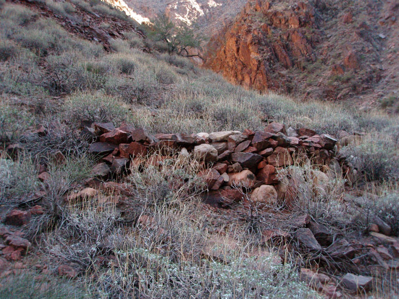
 Later, Pete Berry staked copper claims on Horseshoe Mesa and built the Grandview Trail to access his mines.  Although he didn’t give up on the mining operation, he also promoted the tourist trade and built the aptly named Grandview Hotel, which competed with the growing tourist facilities at today’s South Rim Village.

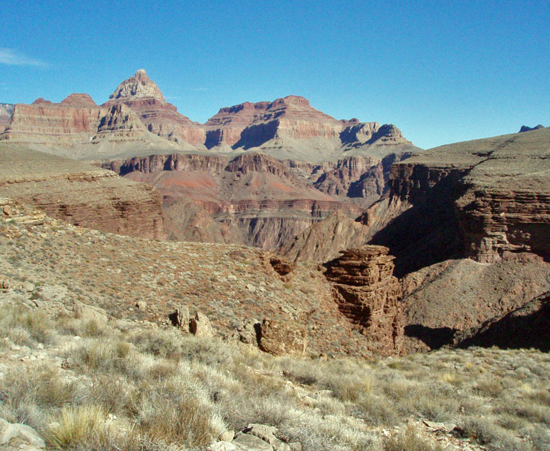
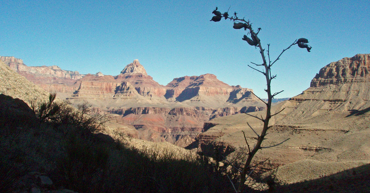
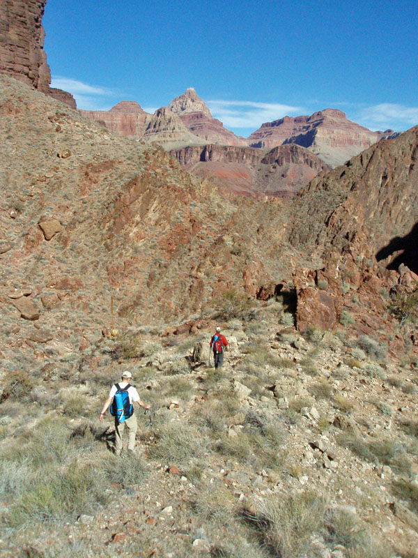
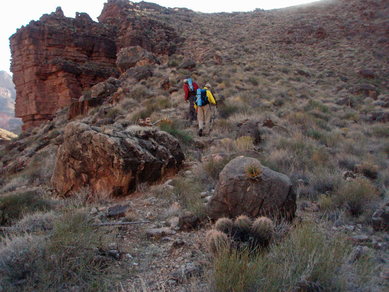
On the first Saturday of 2012, John Eastwood, Duncan Orr and I planned a day hike down the Grandview Trail, past the heart of Berry’s old Last Chance mining operation, then down to Hance Creek.  From there, we’d try to reach the Colorado River at Sockdolager Rapids.

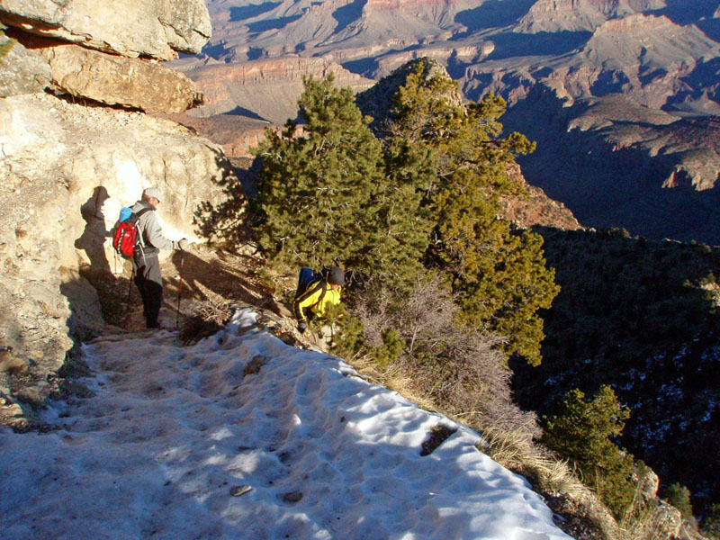
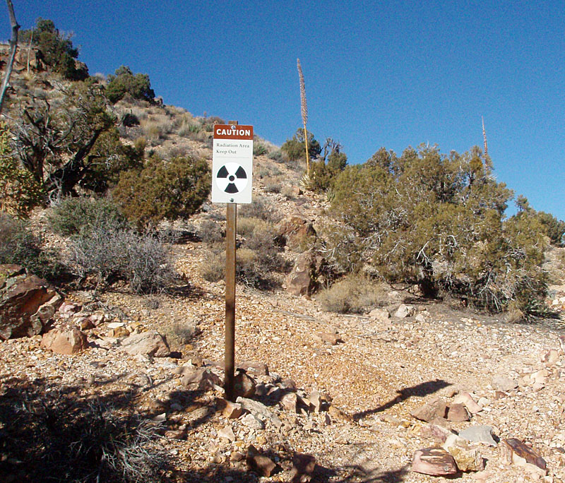
Once the snow falls in winter, Grand Canyon hiking becomes quite treacherous. 

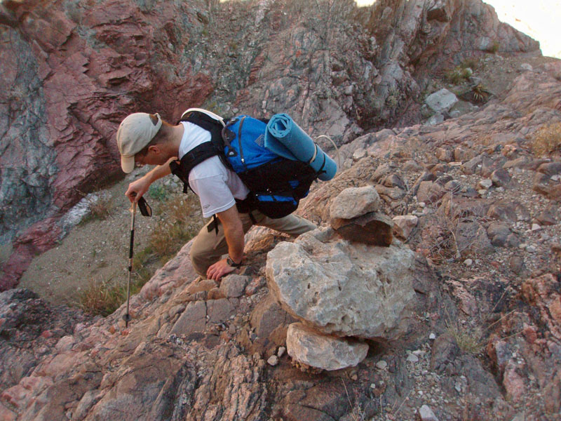
Even on the best of trails, you need to wear some kind of footwear traction device in order to cope with steep icy sections.  All three of us were wearing Kahtoola Microspikes, whose parent company is headquartered in Flagstaff. 

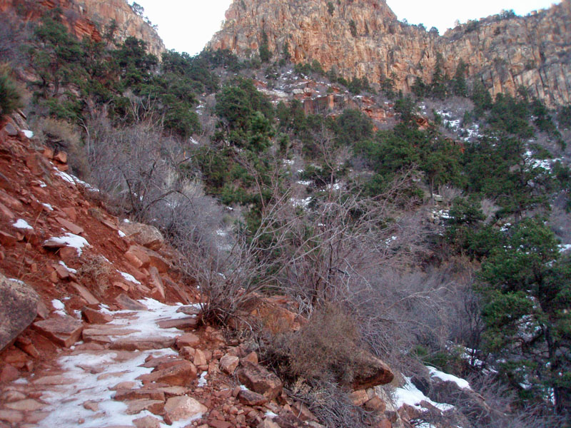
We wore ours for about an hour and a half, covering about two of the three miles from the trailhead to Horseshoe Mesa.  The Park Service has done much to improve the Grandview Trail in recent years, although it is still a rough trail.

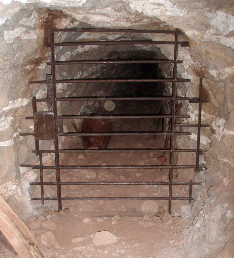
Just before the final drop to Horseshoe Mesa we cached water for our return.  We had left the rim at 8:40 a.m. and had reached this spot two hours later.  From here, we descended east off the mesa to the Tonto Plateau.  Near the base of the Redwall cliffs, the trail passes over the mine tailing of one of the major horizontal entrance shafts for Berry’s mine.  You used to be able to walk quite a ways back in here and see the copper veins in the walls.  But these shafts, called “adits,” are now gated.

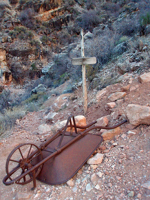
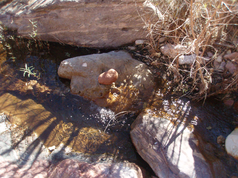
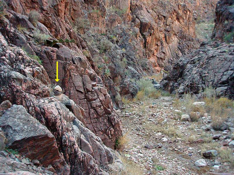
The usual way into Hance Creek is to hike south and east to where the trail crosses the creek bed.  But a few years ago I spied a route that would get you through the Tapeats cliffs and down to the creek much closer to the river.  By noon, we were on this route.  You can tell it is an old trail, as it still has tell-tale zigzags and is marked with many small cairns to keep you on track.

It only took us about 20 minutes to reach the creek, which was flowing quite well.  The advantage of a hike in winter is that inner canyon temperatures are just about perfect.  The disadvantage is that the days are short.

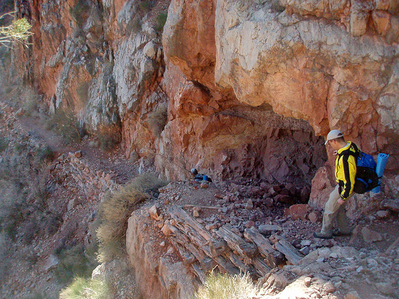
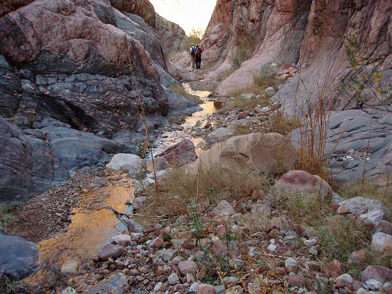
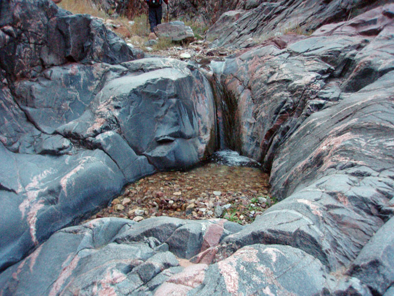
The route down the creek to the river is challenging.  There are three or four, places where the bed is blocked, and one must bypass these obstructions.  These bypasses involve quite a bit of climbing, loose rock and uncertain footing.

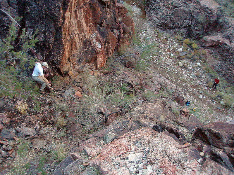
 Thirty minutes after reaching the creek, we came to the first waterfall.  After some searching we located the bypass — a climb up a steep ramp of crumbly schist.  As it was already 1 p.m. we decided that reaching the river was an impossible task.  So we dropped our packs and scrambled up the bypass just to see what it was like. 

We ended up 50 to 75 feet above the creekbed before we were on a more gentle route back down.  From here the river was maybe a mile away. Tantalizingly close but too hard a road for us to complete this day.

After a late lunch that lasted nearly until 2 p.m., we were ready to head back up to the rim.  By 4 p.m. we had seen the last of the sun for this day.  The wind kicked up, causing me to put on my fleece coat to keep warm. 

Soon we were up above Horseshoe Mesa retrieving our water.  By 5 p.m. we were back on the trail, and it took us another two hours to reach the rim.  We wore our spikes over the last two miles, and the last hour was well after sunset.  But a nearly full moon made the last mile quite magical.

Dennis Foster lives in Flagstaff and has been an avid hiker in Grand Canyon since 1977.

Return to Hiking Grand Canyon home page

dfoster@kaibabjournal.com