 |
|
|
Hiking
Proposal: Eremita Mesa humbly submitted by Dennis Foster |
|
|
|
|
|
|
|
Hiking
Proposal: Eremita Mesa humbly submitted by Dennis Foster |
|
|
|
|
|
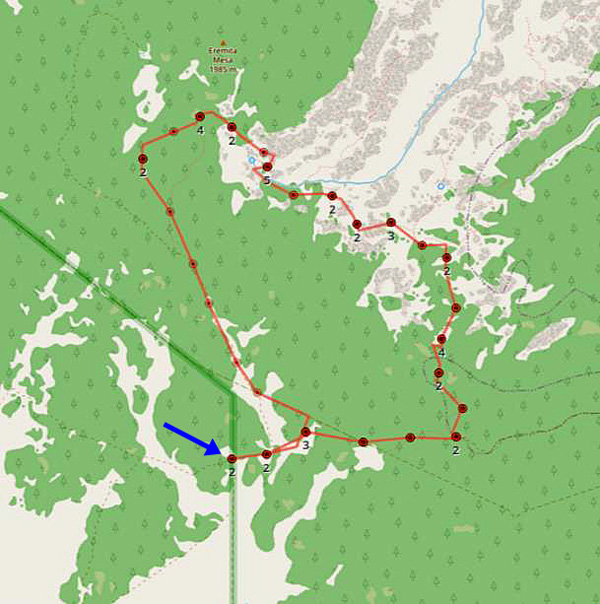
For your consideration, I would propose a summer 2021 GCM hike in the Eremita Mesa Area. Below is a map from a day hike I did in February of 2021. The arrow points to a gate that leads from the forest into the park. I believe there is room for many vehicles here and places to camp. But, about a tenth of a mile south there is even more room.
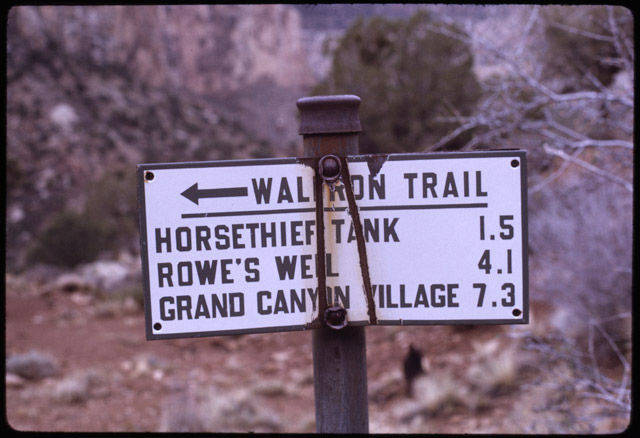
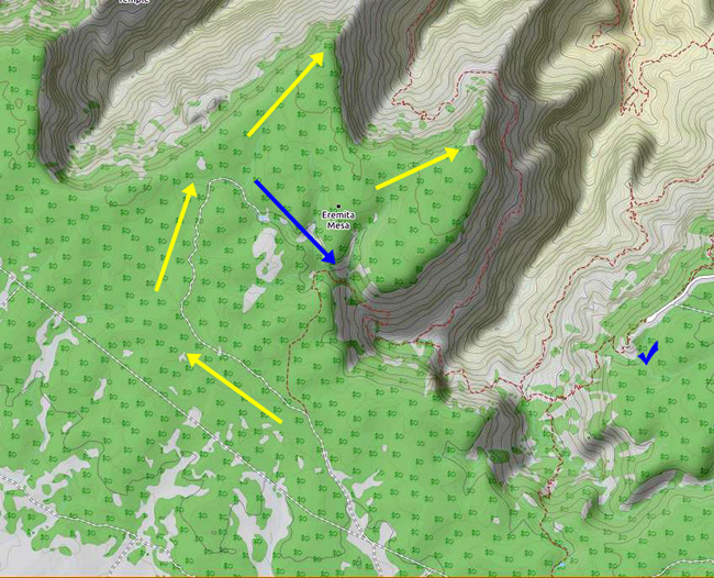
The proposal is to follow along the Eremita Road and possibly visit points on the rim, as shown below by the yellow arrows. Then follow the main ravine, shown with the blue line past Eremita Tank and to the Silver Bell Trail (aka, Boucher). From here we could go down to Dripping Spring and return back to the rim and follow the Silver Bell all the way back, or we can continue on and exit at the Waldron Trail (which is what we did on the map above). FYI, the 4 Sisters are at/near the blue check mark, very much near to the Hermit trailhead.
I don't know if there are any rim ruins in the area, but I'm sure that if there are, Haley knows! |
|
|
||
|
|
Return to Hiking Grand Canyon home page |
|