 |
|
|
Nankoweap
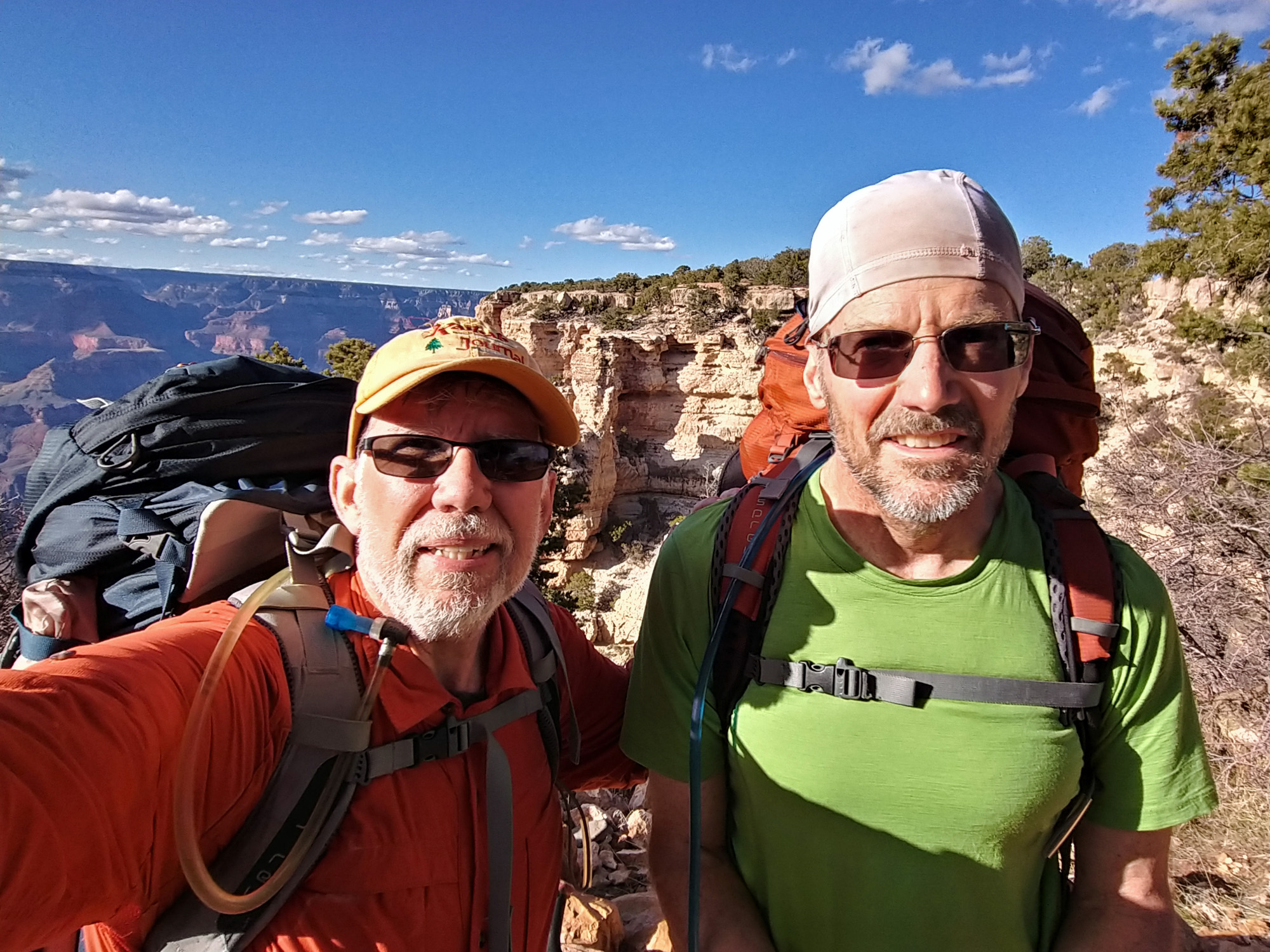
to Phantom Wednesday, March 11 to March 24, 2020 by Dennis Foster |
|
|
|
|
|
|
|
Nankoweap
to Phantom Wednesday, March 11 to March 24, 2020 by Dennis Foster |
|
|
|
|
|
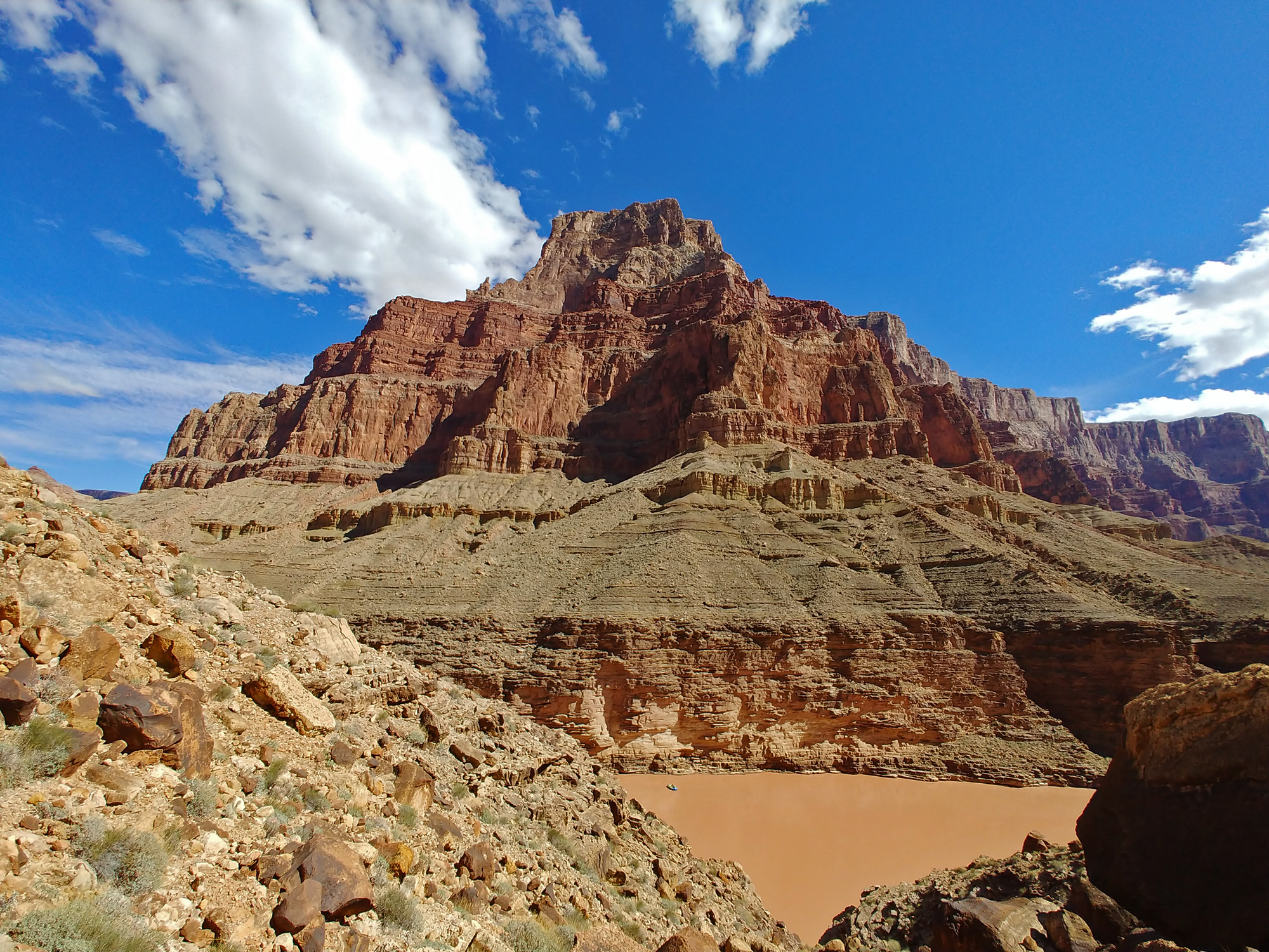
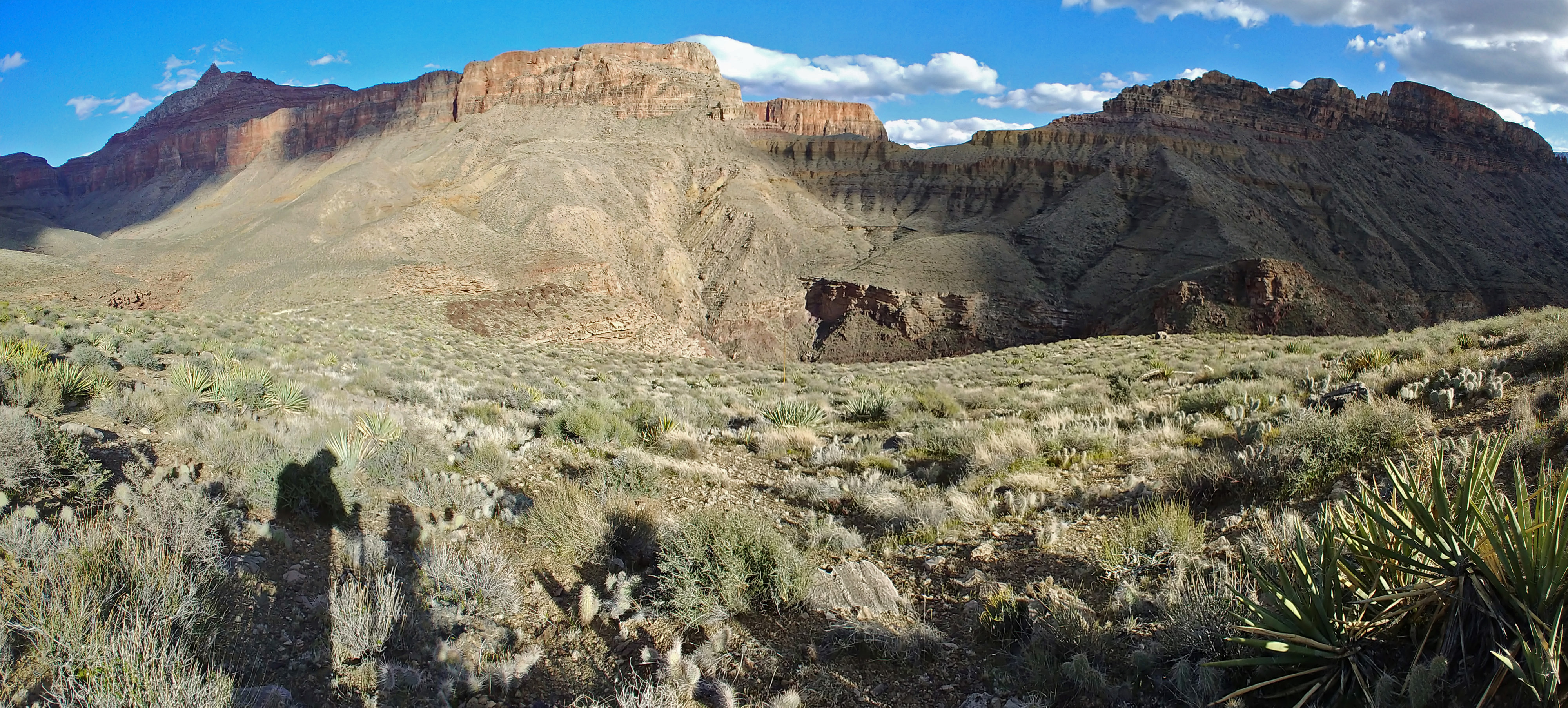
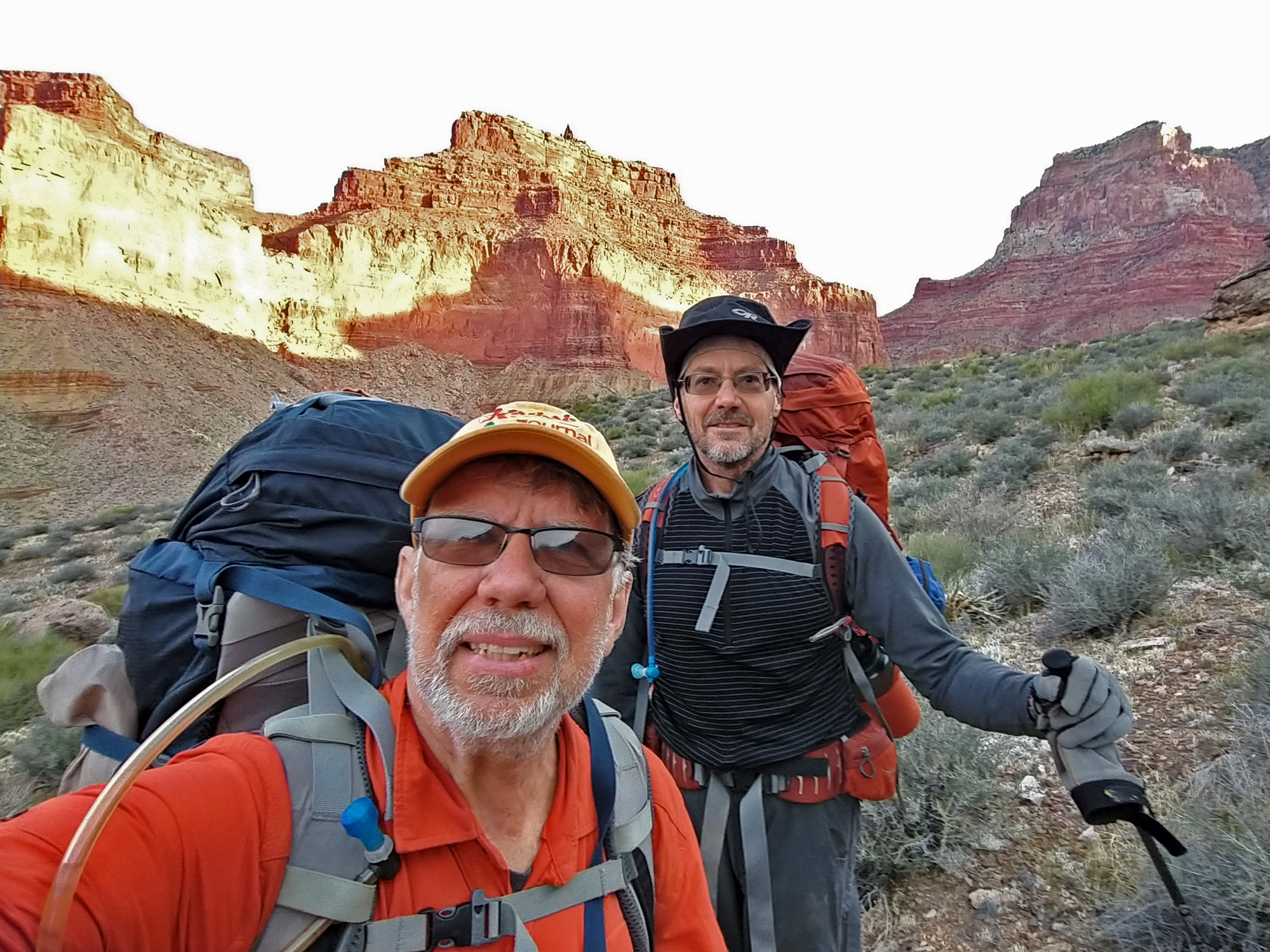
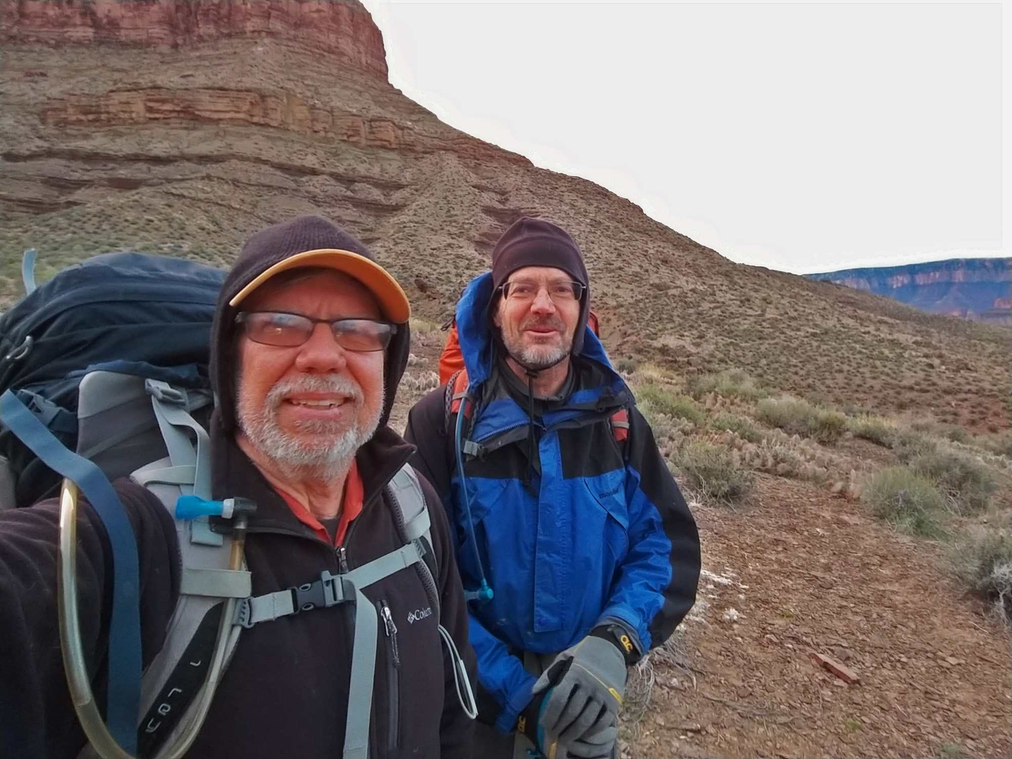
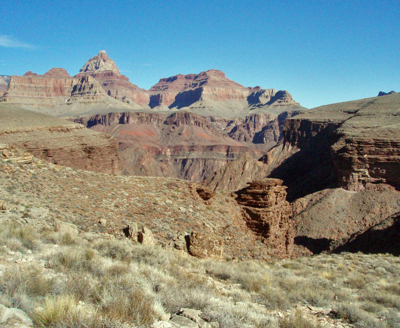
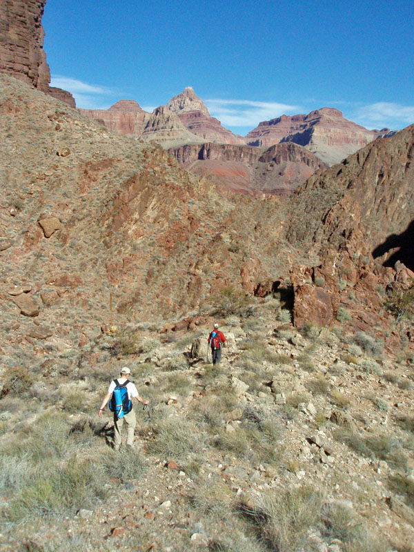
This trip marks the third time I have followed this particular route from Nankoweap to Phantom, with a couple of minor adjustments. The first time was in 1984 with hiking buddy Duane Ott and backcountry ranger Ralph Moore. The second time was in 1993 with colleague and hiking buddy Neil Jacobs. This time I will be with hiking buddy John Eastwood. I thought this would be a good hike for us as he closes in on having a complete hiking line from Nankoweap to Kanab Creek. And, I thought this would be better than using either the Butte Fault route from Nankoweap to Chuar (which I have been over twice) or the so-called "high saddles" route from Chuar to Clear Creek (which I have done once before) as we will be by water the first 3-4 days, lessening the loads we must carry, and because there is less elevation change involved in the climbing required to go from canyon to canyon. The text below comes from what I posted up on Facebook on my timeline, as well as on two public groups (Grand Canyon Hikers & Backpackers and Grand Canyon Hikers). I haven't changed any of that. But, I only posted up five images with each hike - the daily map and four representative photos. Here I have added in more photos to better illustrate this hike. The map comes from a screen grab I made from the tracking done by my Spot. I am unsure how to usefully save this information. So, instead I reviewed the map for each day and saved that image. I then ran them through Photoshop to erase faulty tracks (like when it bounces me back and forth across the river!) and sometimes paste in a different tracking line to capture what we actually did. The map program is interesting in that it aggregates the tracking signals based on how far you have zoomed out/in. Then it shows a number which represents the number of tracks it has aggregated. High numbers, then, mean we took a rest break here or maybe a lunch break. But, I can zoom in and see individual tracks, although with how the signal bounces around, that is rarely more informative.
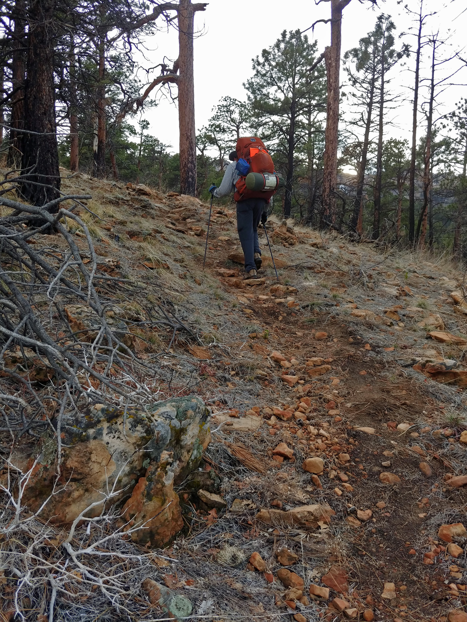
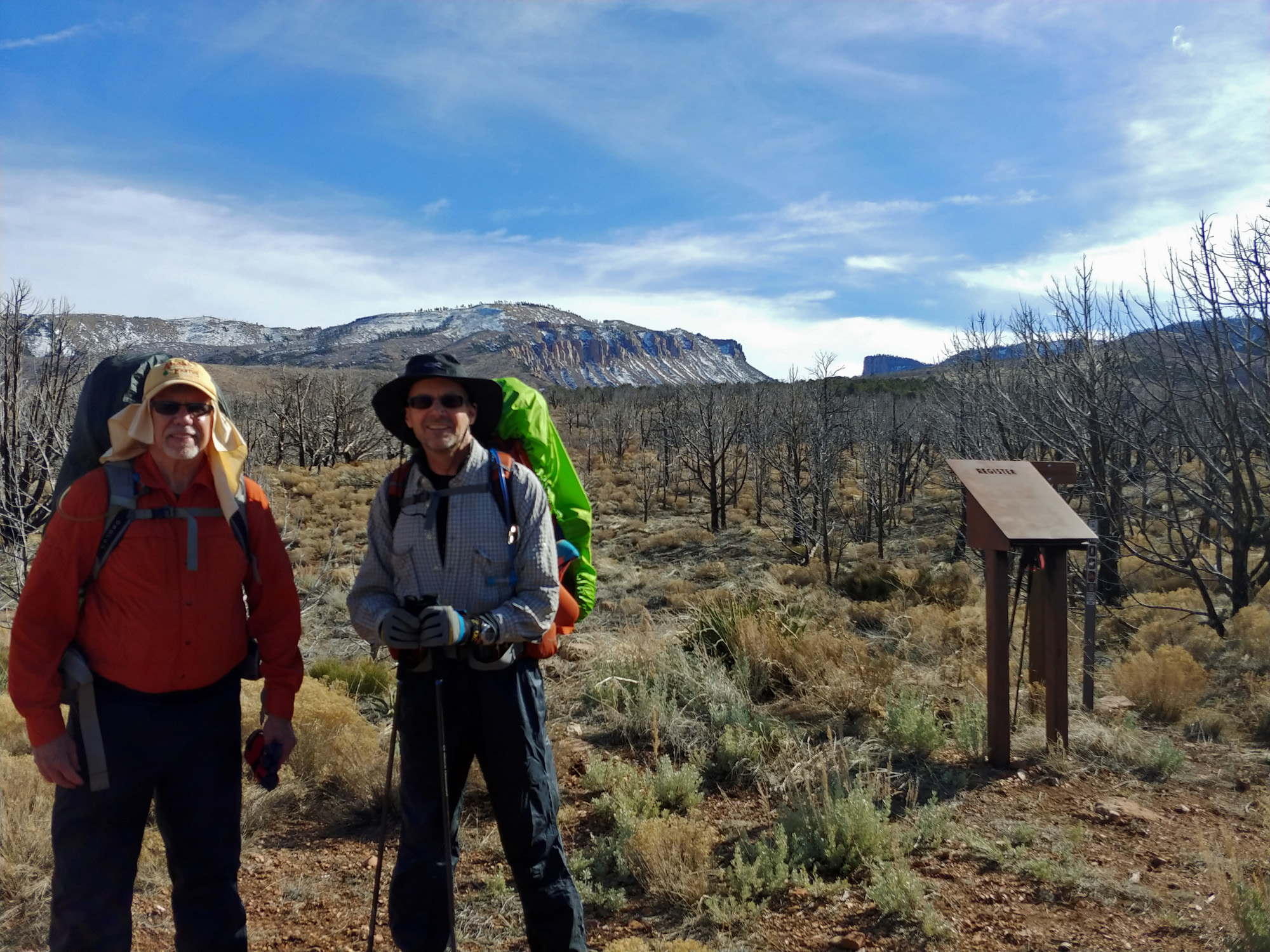
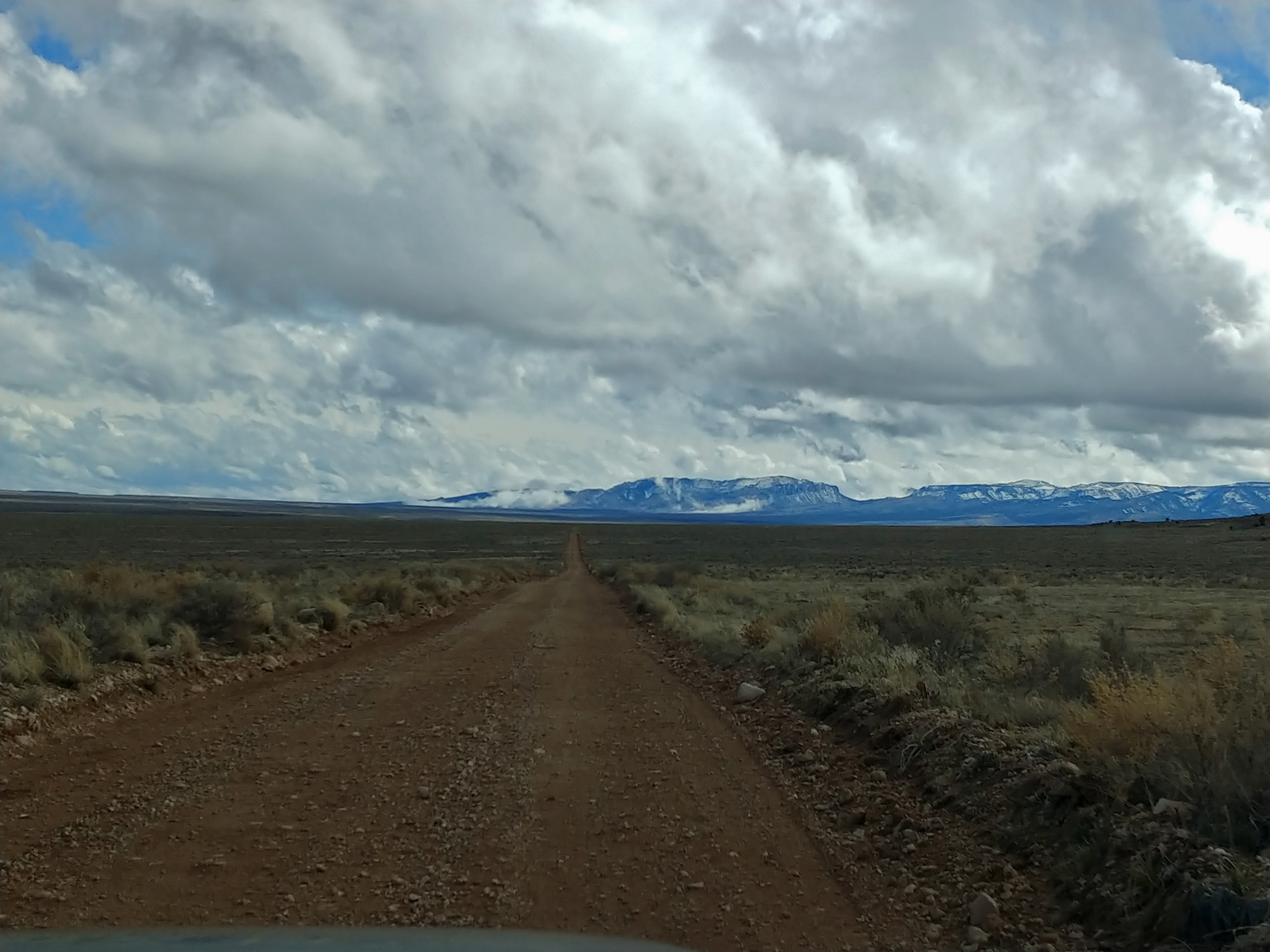
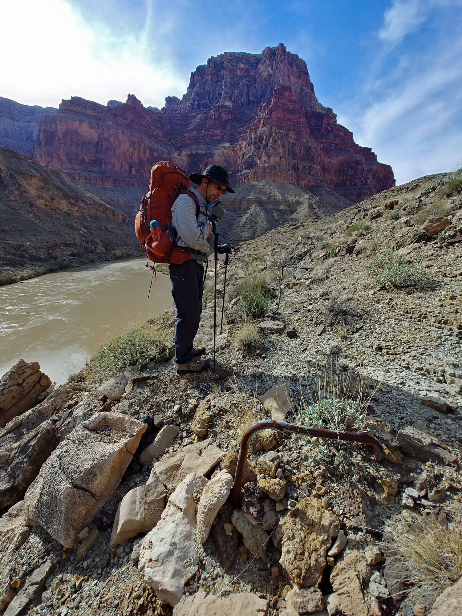
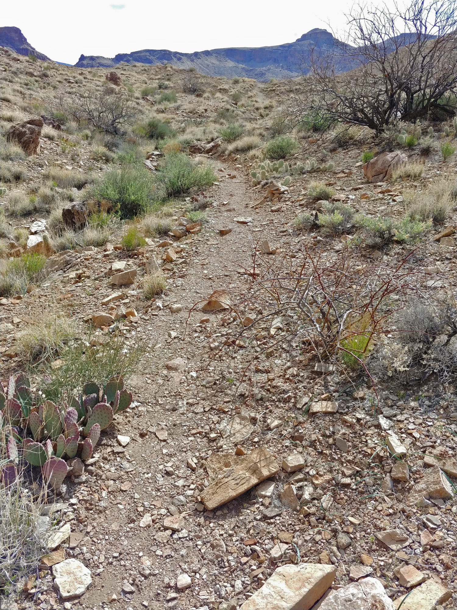
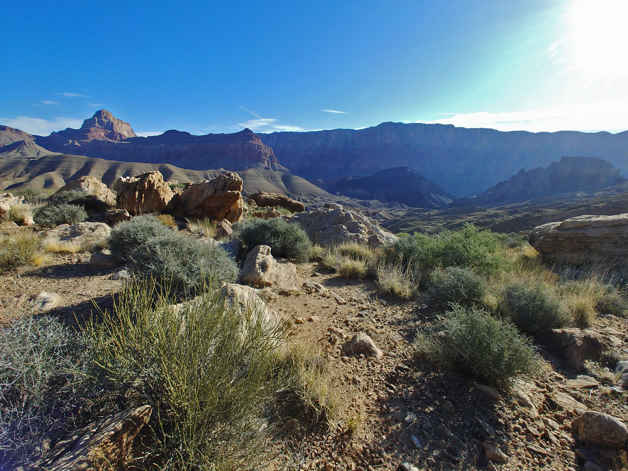
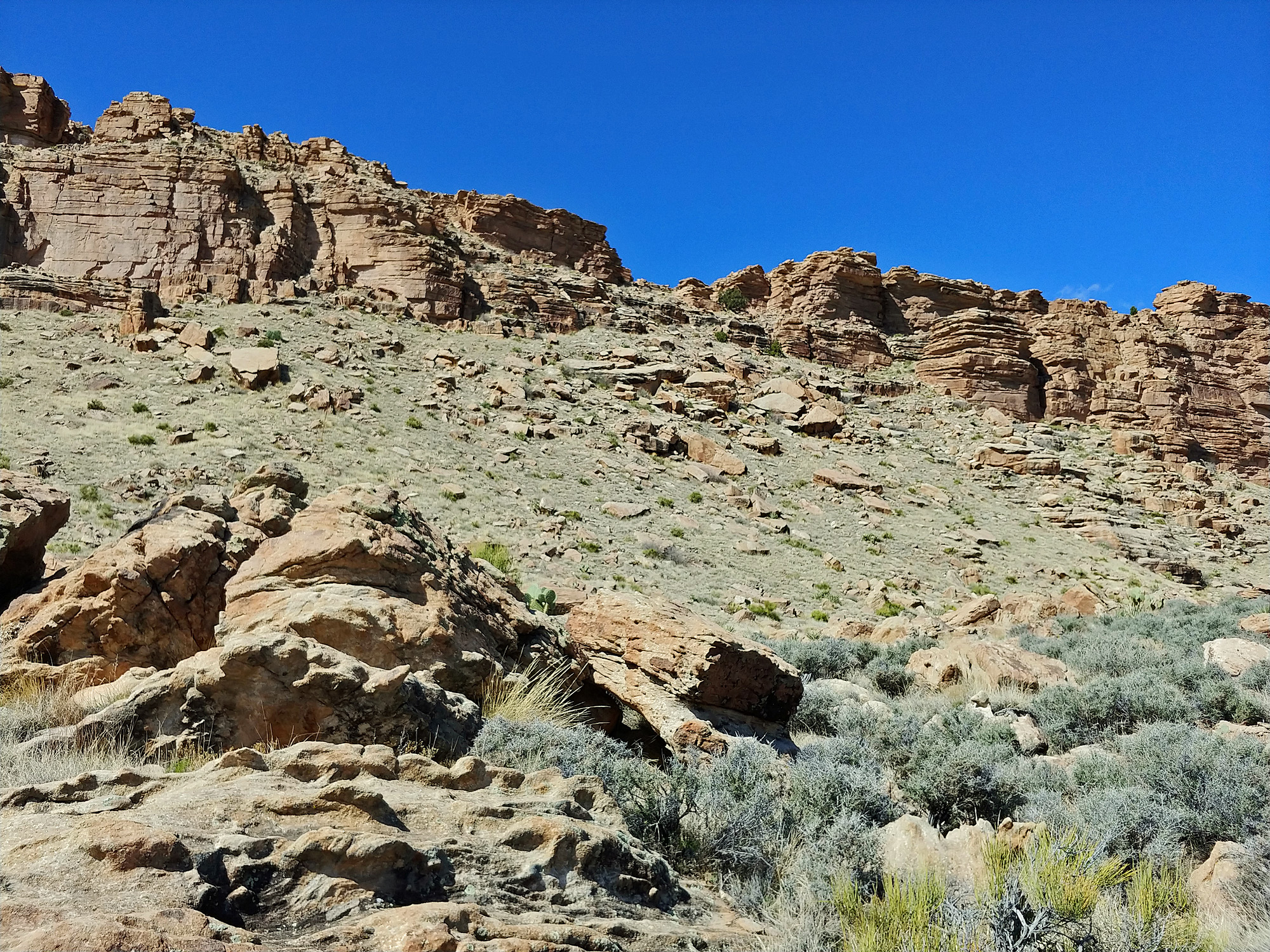
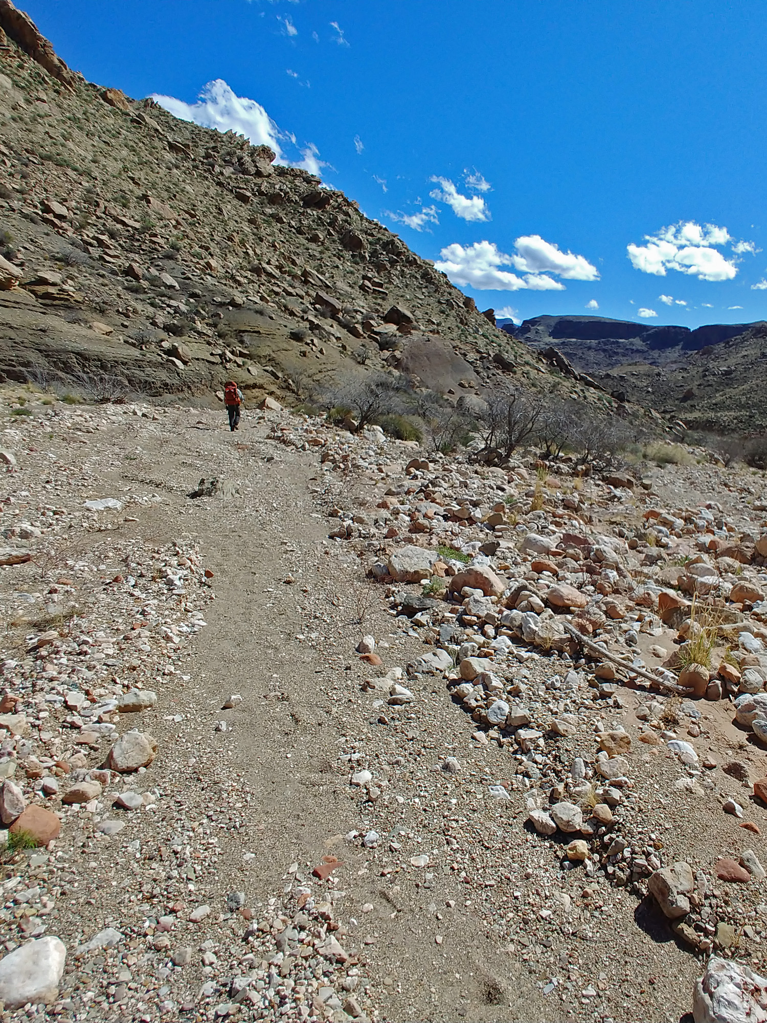
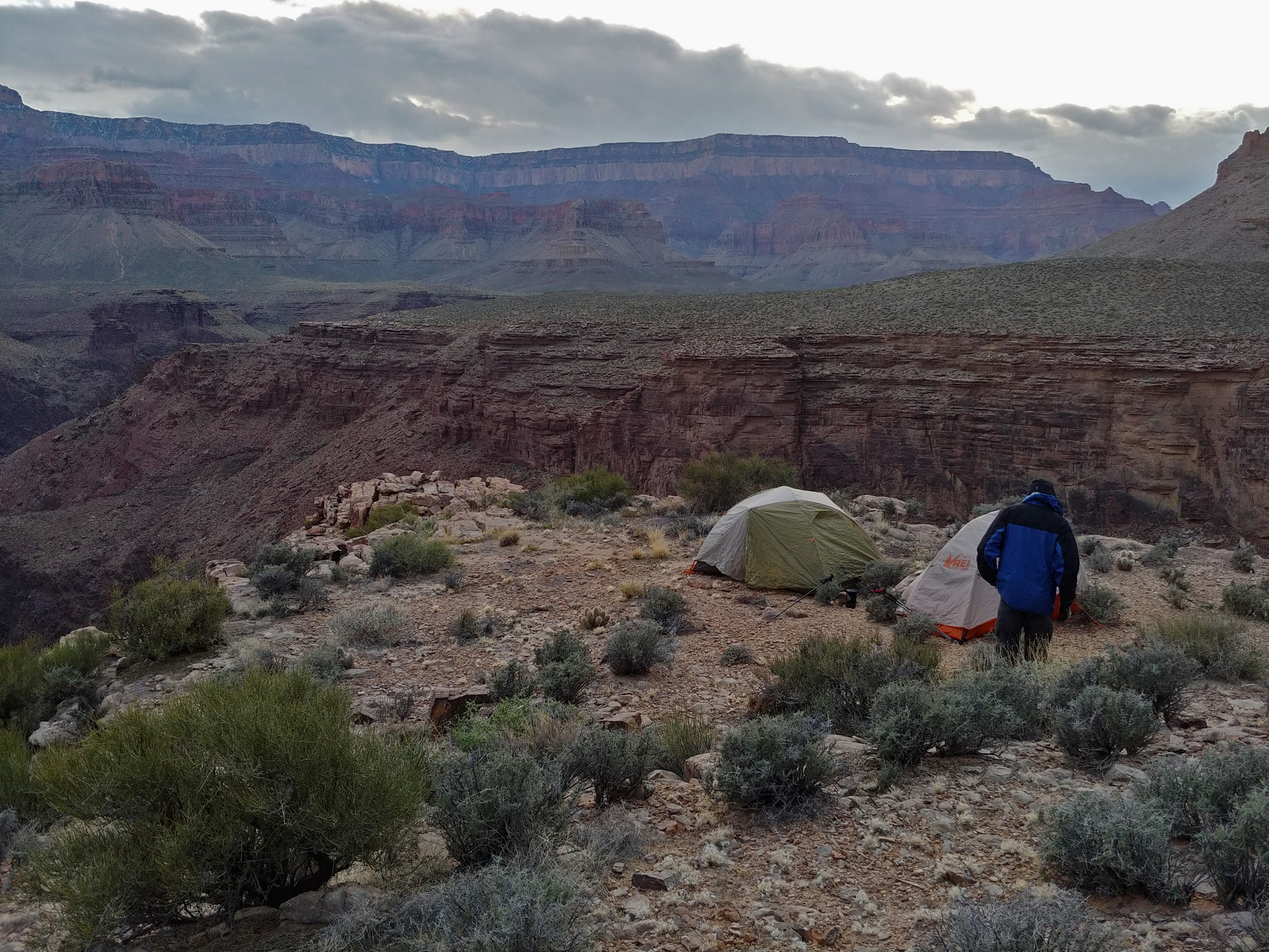
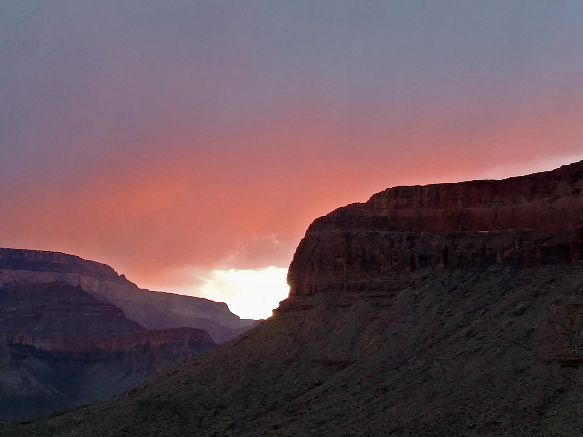
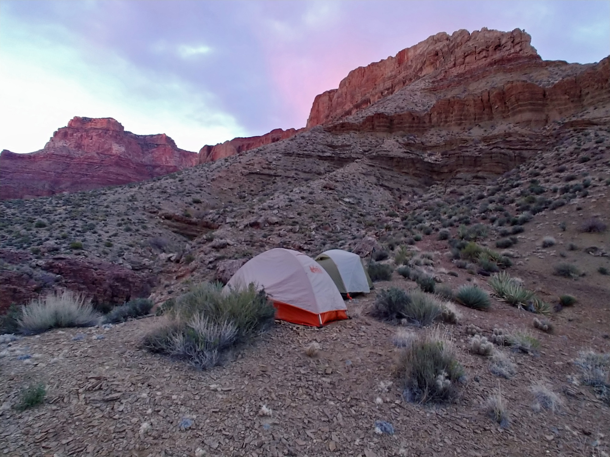
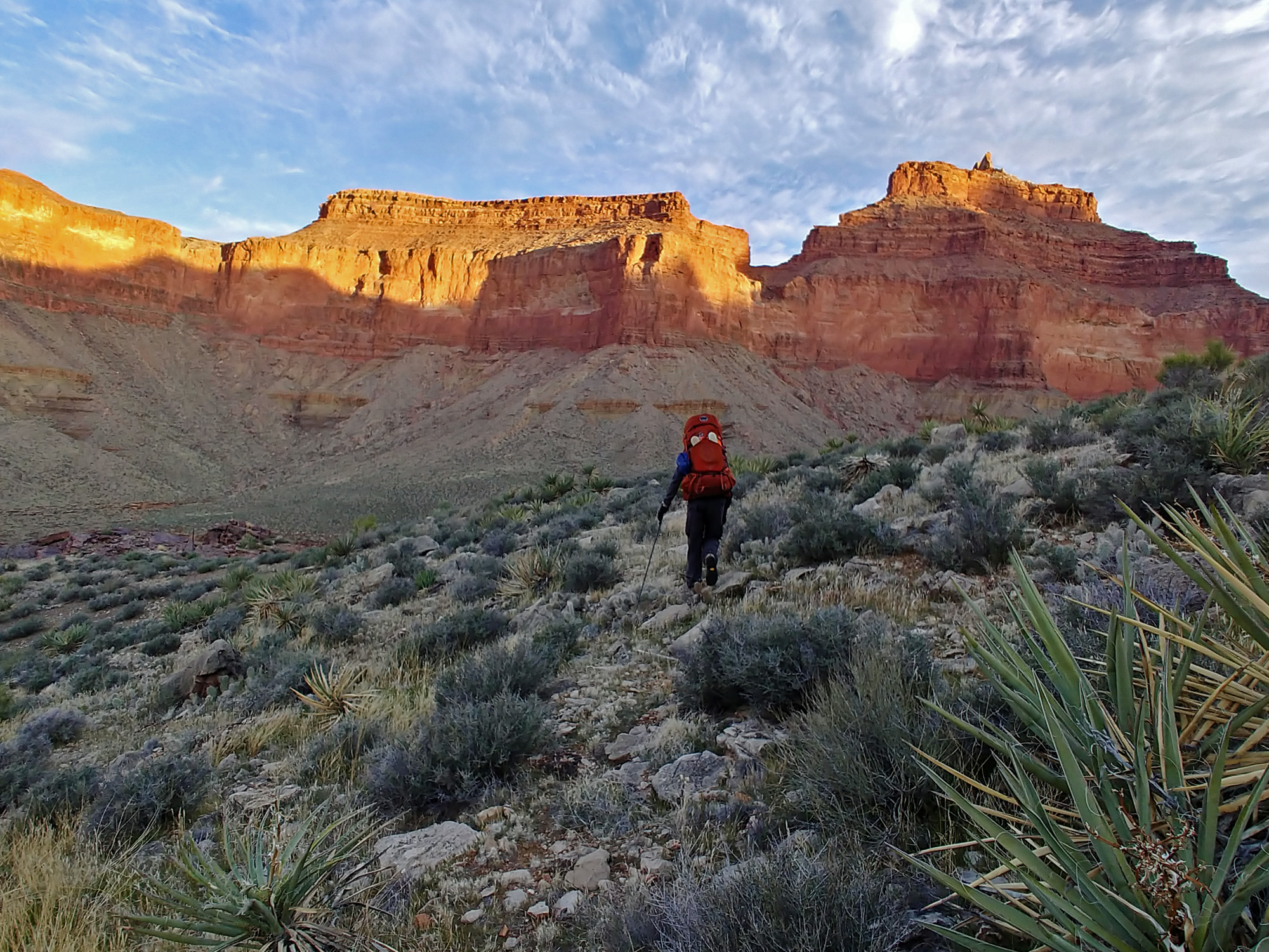
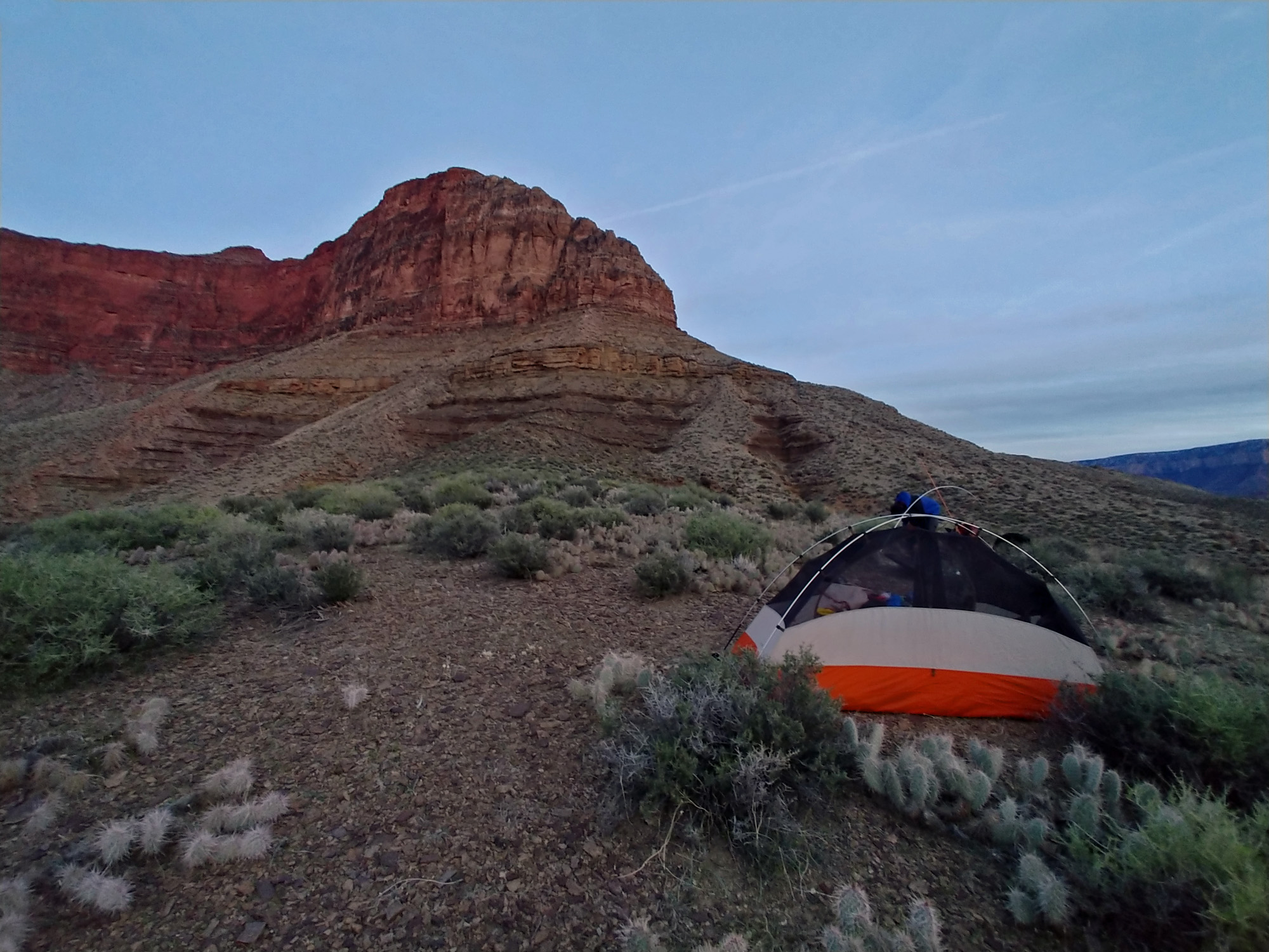
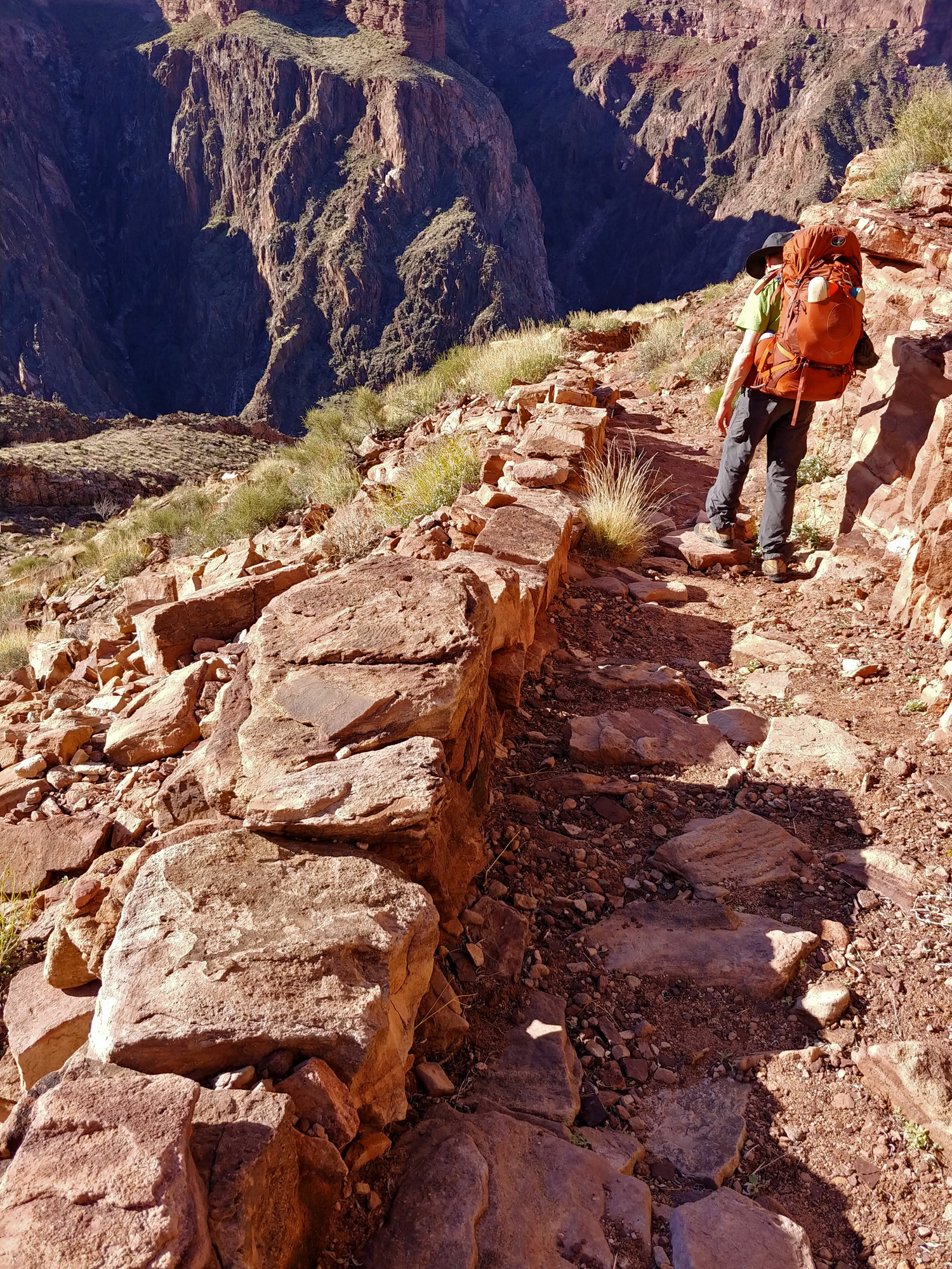
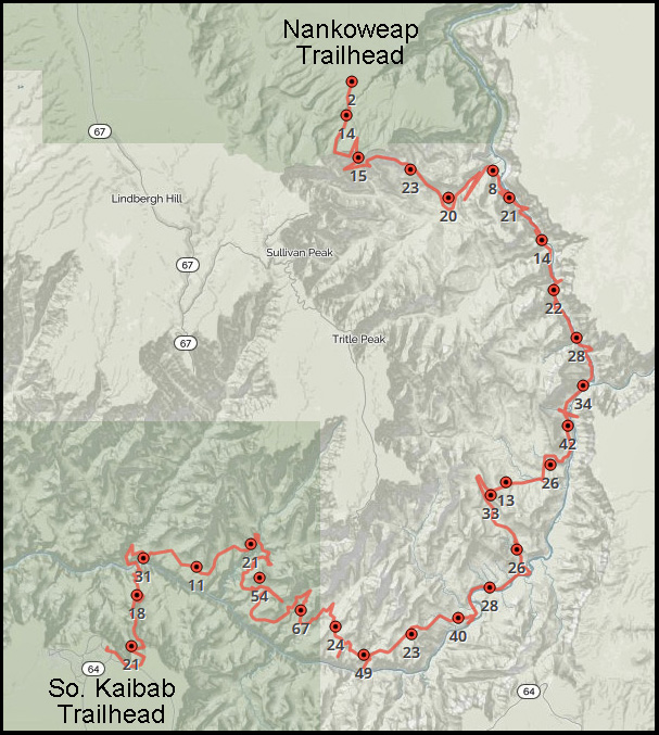
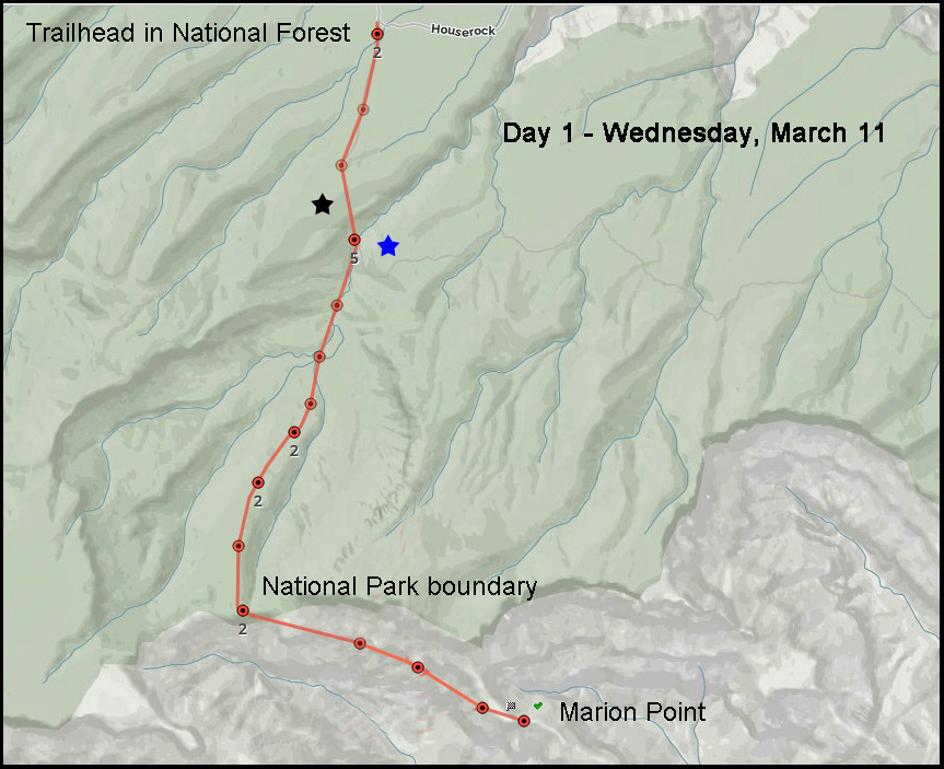
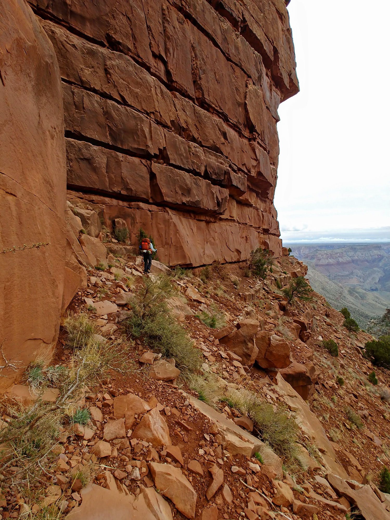
Day 1 - From the Nankoweap Trailhead to Marion Point (Wednesday, March 11): We left our homes in Flagstaff at about 9 a.m. in the driving rain and drove to the South Rim to drop a vehicle off at the Visitor’s Center. The rim was socked in with clouds here, but they started to dissipate a bit as we drove to Desert View. It was clear and dry the rest of the way to the trailhead – through Cameron and Marble Canyon and 20+ miles down the dirt road to the boundary of the Saddle Mountain Wilderness Area. We began hiking at 3:45 p.m. with the hope of reaching Tilted Mesa, on the Nankoweap Trail, for our first campsite. Our packs weigh in at about 45 pounds, which is low for this long of a hike, but we have a food cache waiting for us at the halfway point. About a half hour into our hike I dropped my phone, but didn’t realize it until about 15 minutes later. I retraced my steps and found it … with a crack in the screen. Lucky for me, that did not interfere with its function, which I used as my primary camera for the hike. [On the map, the black star shows where I dropped my phone and the blue star shows where I was when I realized it.] At 6:30 p.m. we reached the saddle that is at the boundary of the park and the real start, for us, of the Nankoweap. The hike up through the forested wilderness area went very well with only one short patch of snow to walk across, which is unusual for this time of year on this north-facing slope. We had thought about camping here, but at 7600 feet in elevation we were concerned that it would be too cold. So, despite the oncoming darkness we pushed on, intending to reach Marion Point (~7000 feet) before stopping for the night. It was a long slog to Marion Point, and much of it was done with our headlamps on. The ground was wet, but not especially muddy, which was especially nice at the first of the narrow, “scary,” spots of this trail where an inadvertent slip would send one down a steep slope and over high cliffs. When we reached our destination I was completely exhausted and feeling a bit nauseous. After setting up our tents, all I could muster for dinner was a cup of hot cocoa and then it was off to bed for the night. |
|
|
||
|
Click on any picture to see a larger image. |
||
|
|
||
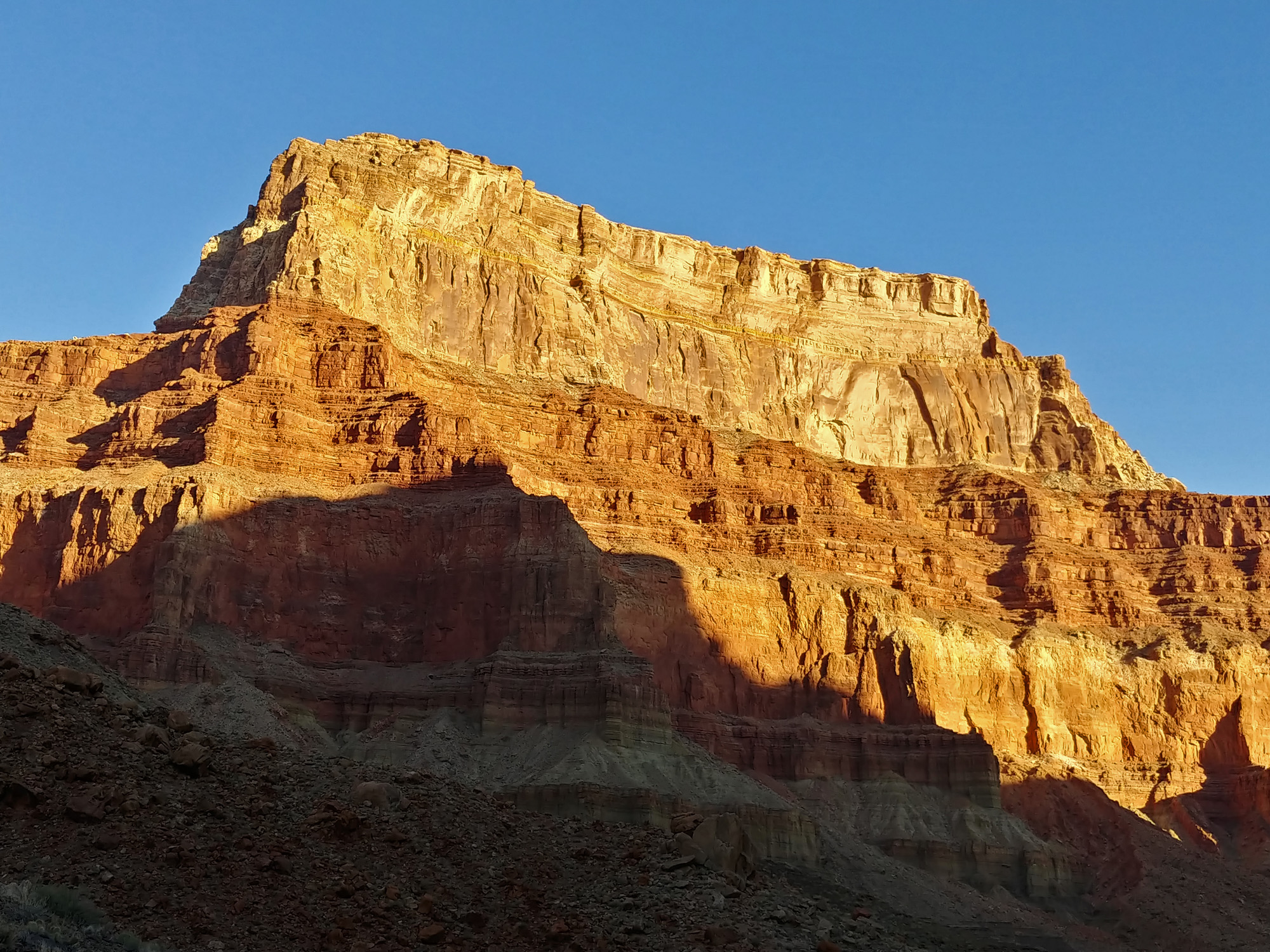
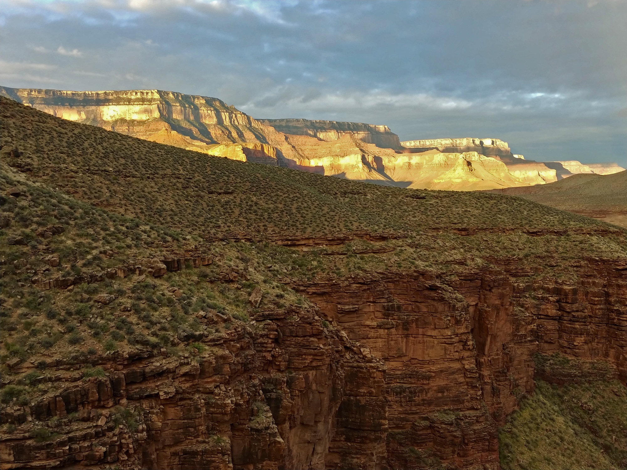
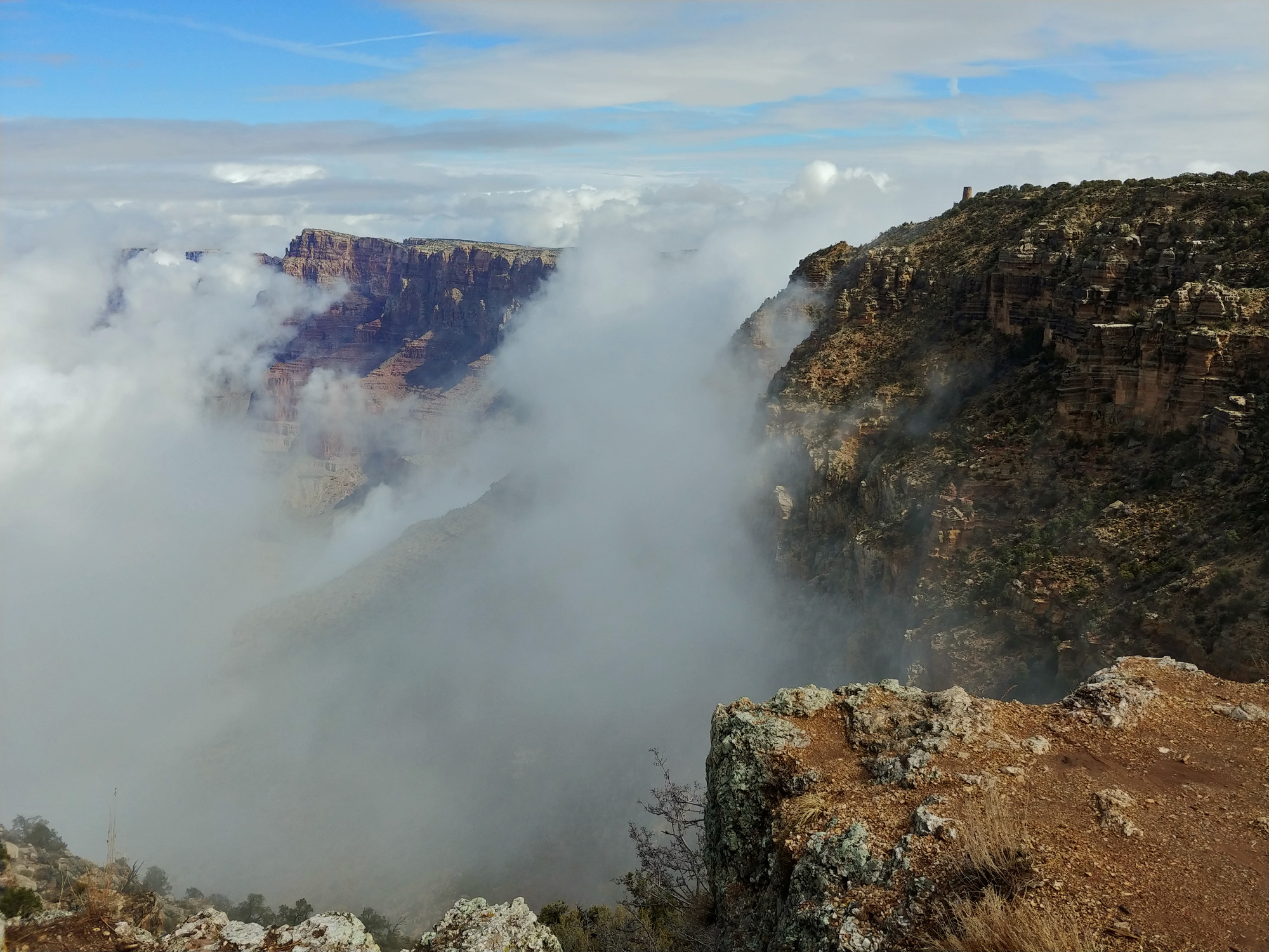 Clouds swirl around Desert View. |
 We were lucky that there was no snow on the north-facing ascent to the saddle. On a hike here more than 20 years ago we were post-holing our way to the saddle!! |
 At the low trailhead. |
 Good road to Saddle Mountain. |
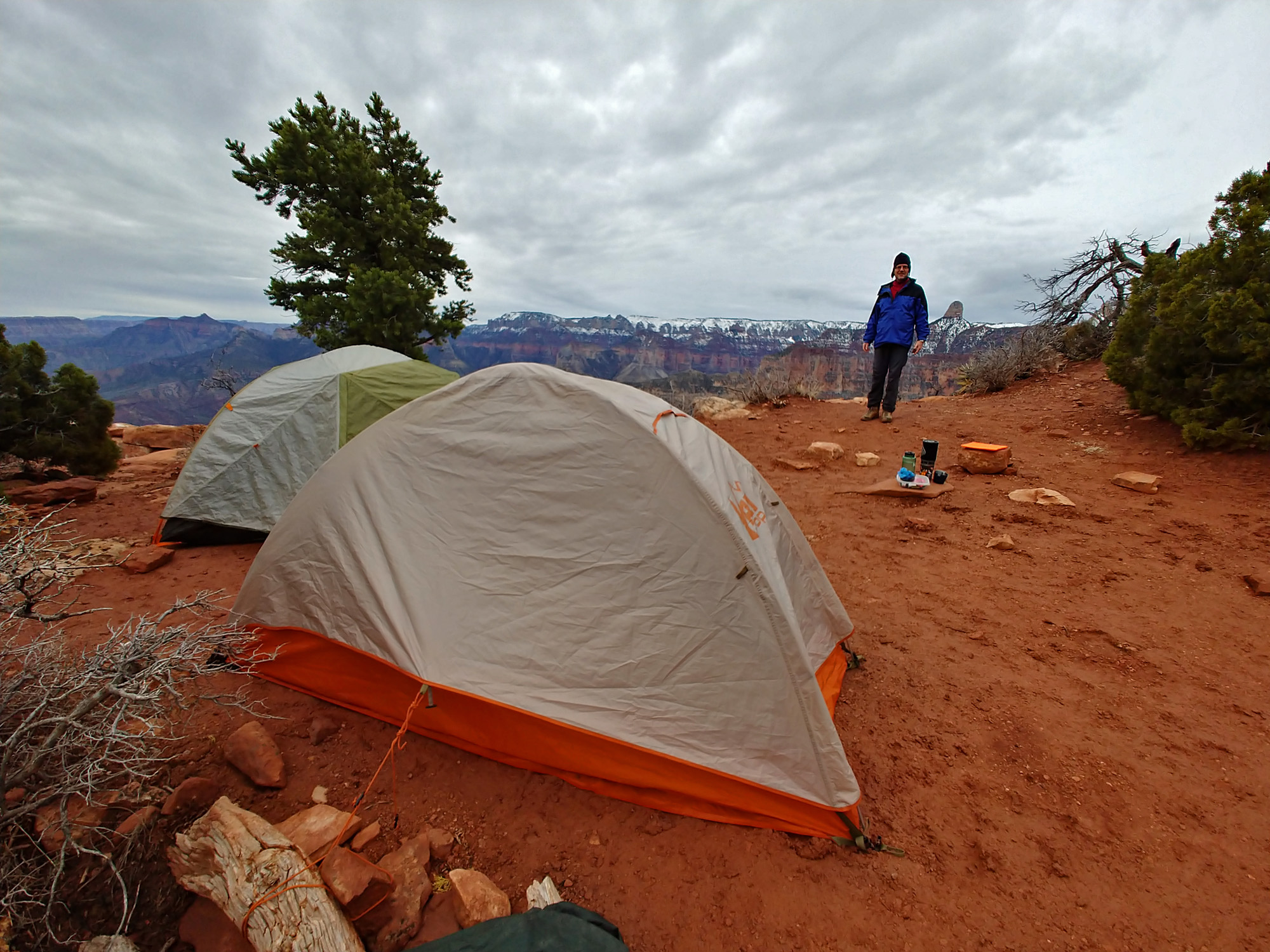 Camp at Marion Point. |
|
Day
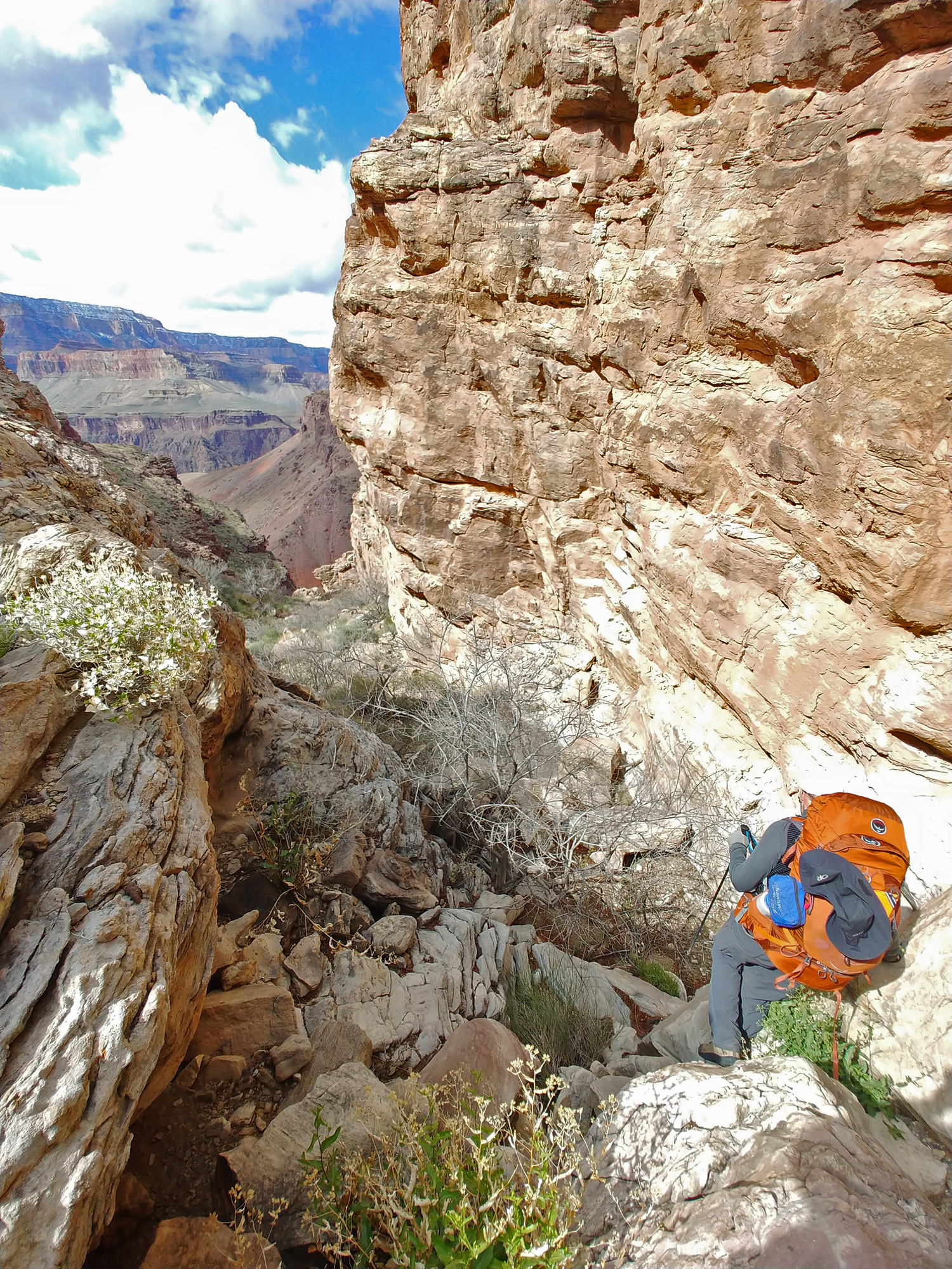
2 - From Marion Point to Nankoweap Creek (Thursday, March 12):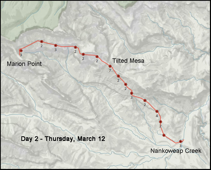 The past night was not as cold as we had feared. But I had a problem sleeping. I use a Big Agnes sleeping bag that includes an air mattress for insulation. That turns out to be crucial as the bottom of the sleeping bag is otherwise uninsulated. Well, my mattress went flat rather quickly after going to bed. So, many times during the night I would wake up on the cold ground and blow up the mattress enough to provide me with enough cushion to fall back asleep. A problem to be dealt with later. We got up late in the morning, at about a quarter to seven. I felt much better, despite the sleeping problem, and had a healthy appetite for breakfast – my standard fare of oatmeal, yogurt-covered raisins, pop tarts and cocoa (or apple cider, depending). We didn’t start hiking until 9:30 a.m. and we knew that reaching the Colorado River was unlikely this day, but we would get to the creek. Skies were overcast when we started and the trail was in fine shape. The section just past Marion Point is more north facing and if there has been some snow, that can be a challenge. But, no problem for us. It took us about three hours to reach the Tilted Mesa area. Along here is the second of the “scary” spots in this trail, where it gets very narrow and you are being gently crowded by the Supai cliffs in a most uncomfortable fashion. I waited for John to cross this spot before starting my own crossing – I definitely don’t want to catch up to anyone ahead of me and have to stop; I’d rather be sure that I can commit my full attention to just getting over to the safer ground. Just before starting our descent from Tilted Mesa we stopped for 45 minutes to have lunch. It was quite a grind for us, but the weather has been perfect – nice and cool. We made pretty good time descending through the Redwall and then down through the Tapeats and over to the creek, arriving at about 4:30 p.m. We probably had enough time to continue to the river but we were both quite tired and wanting to set up camp in the daylight. Once we had set up our camp three hikers passed by us heading to the river – the first ones we had seen. The next hikers we would encounter would be on day 13. I tried to figure out where my mattress was leaking by listening to it, feeling it and even dunking it in a nearby pool of water. No luck on that and for the entirety of the trip I had to cope with this problem. [I would spread out all the clothing/soft materials I had as padding under the mattress so that even when it went flat I was not totally uncomfortable.] |
|
Day
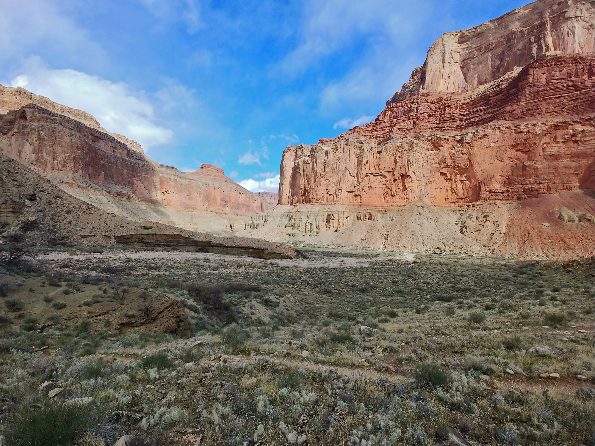
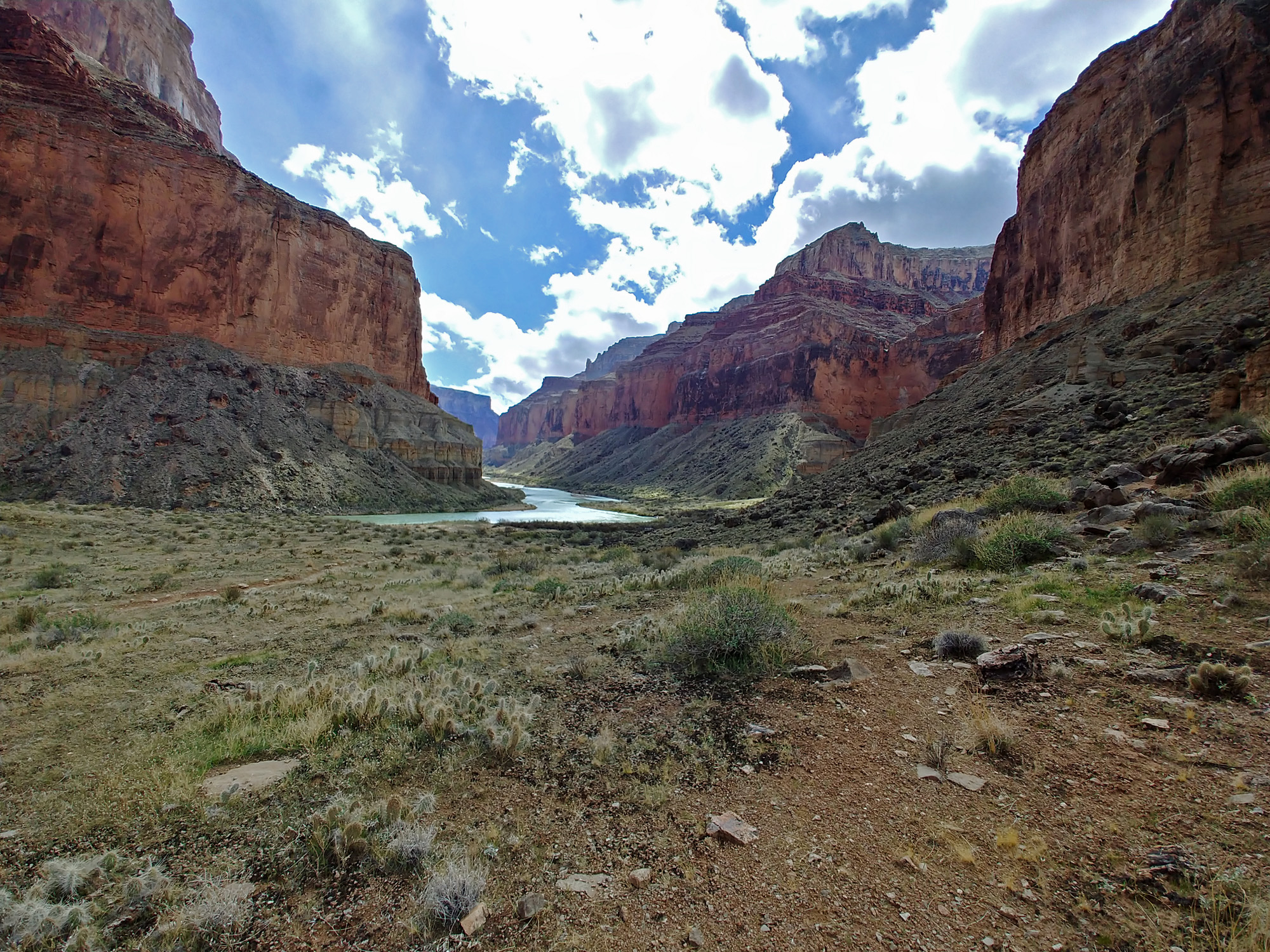
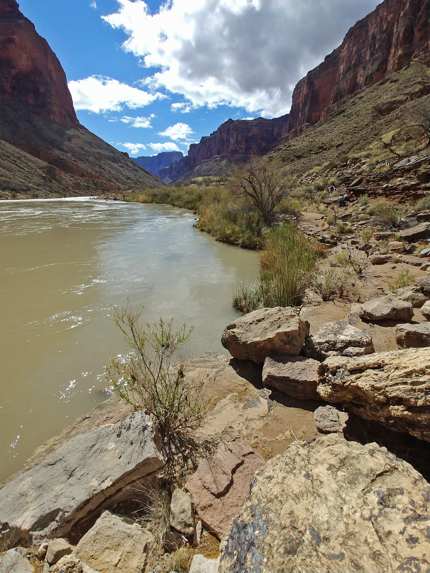
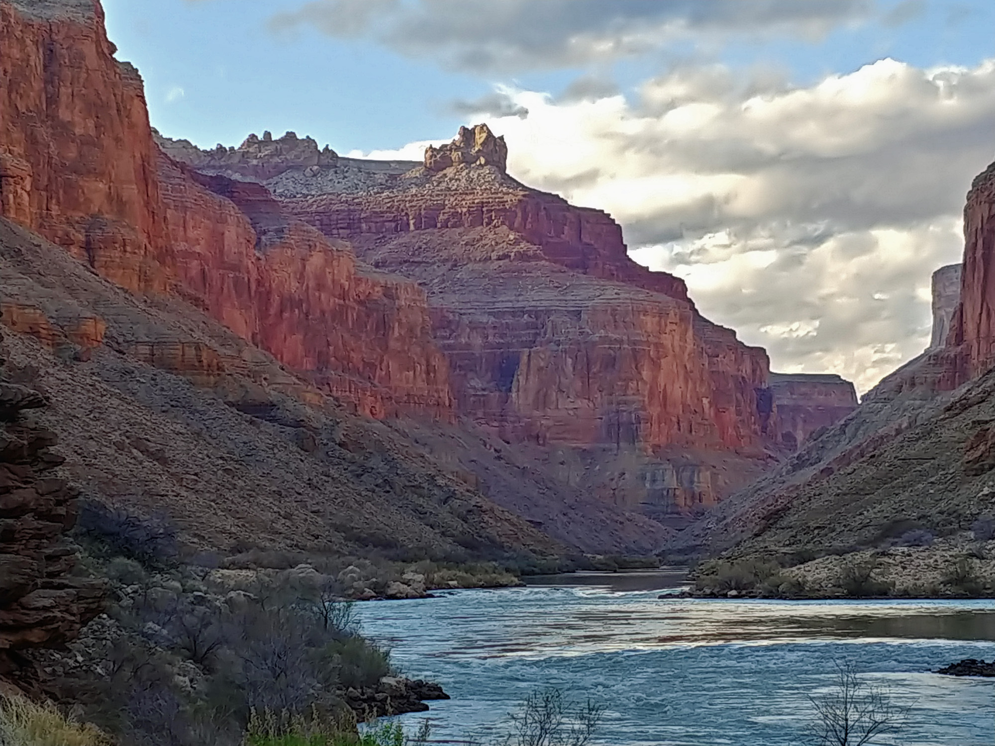
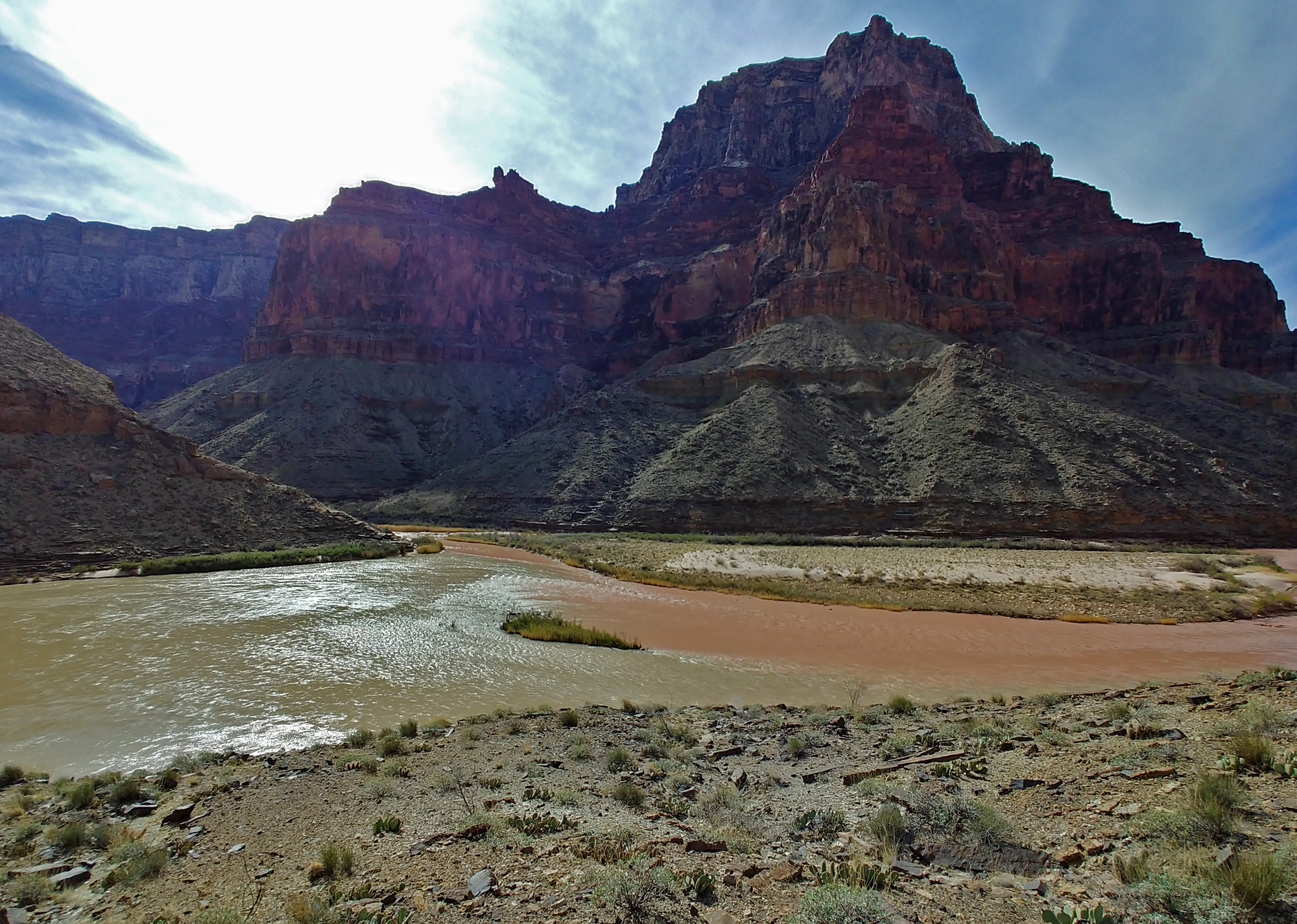
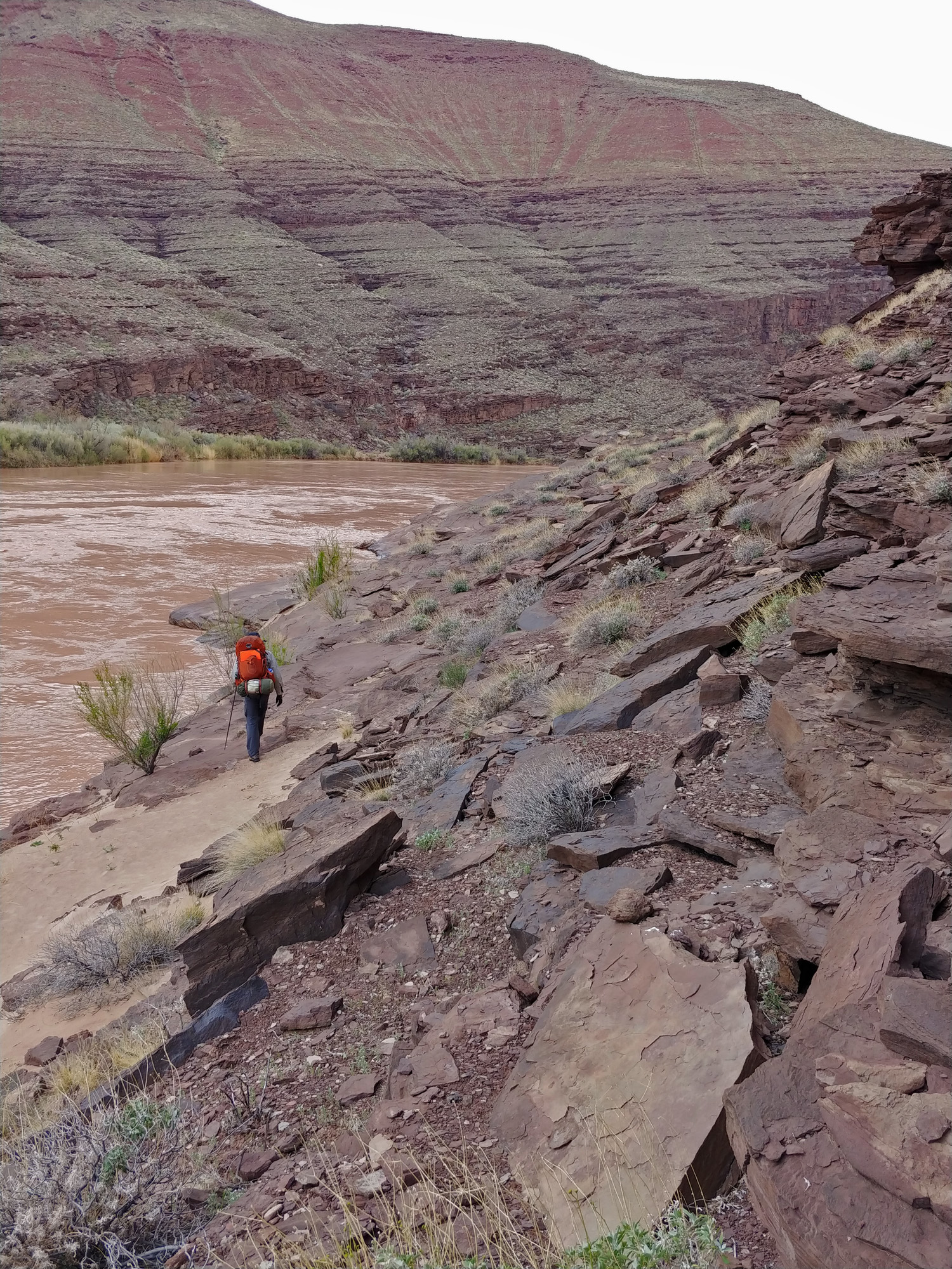
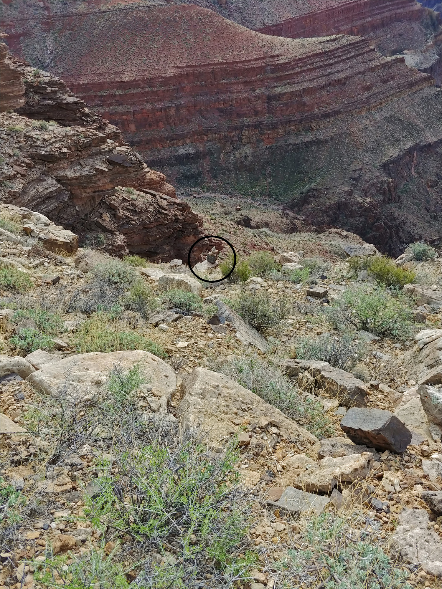
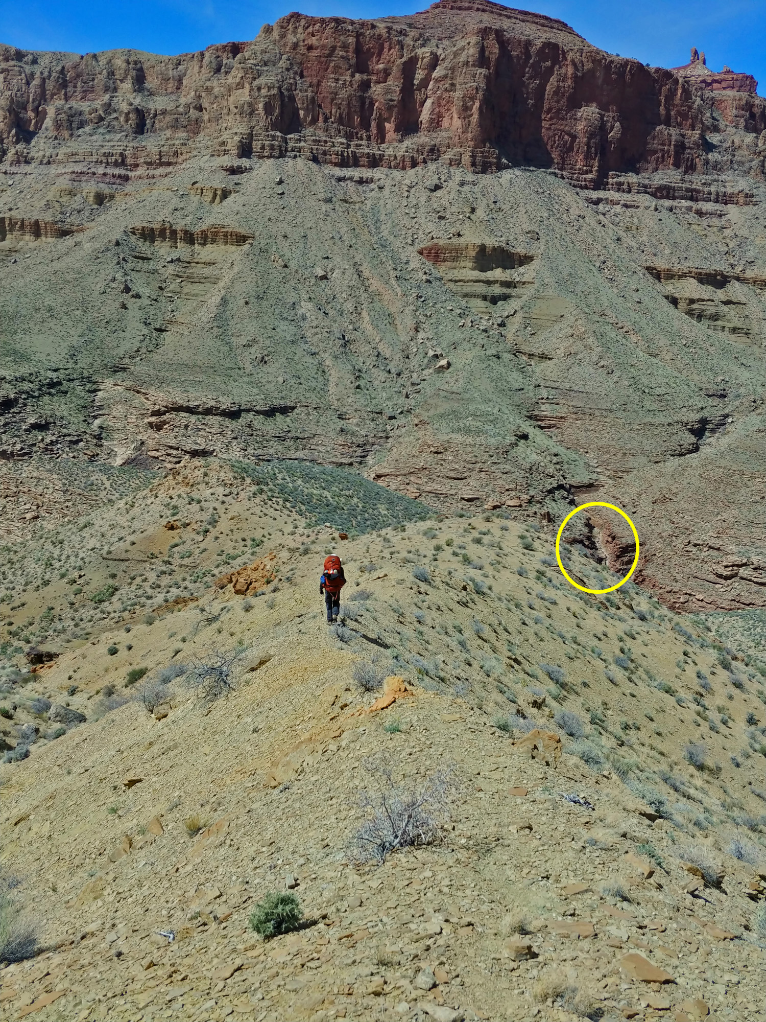
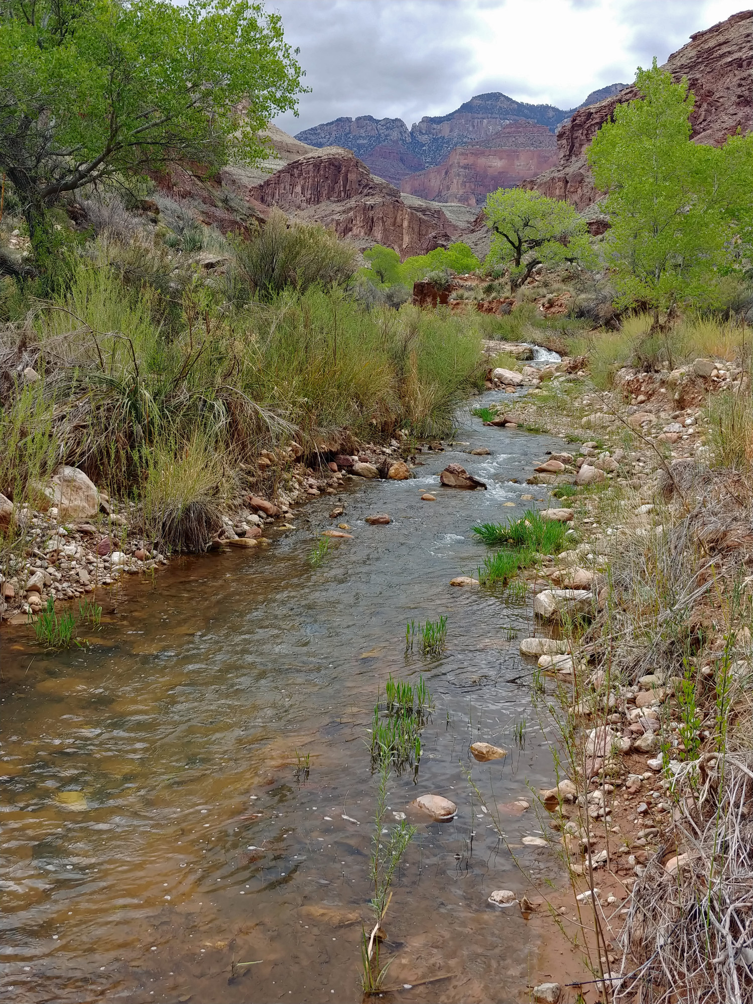
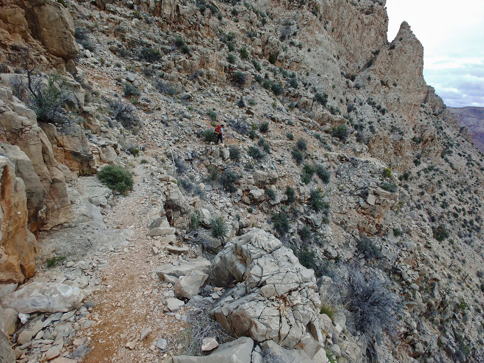
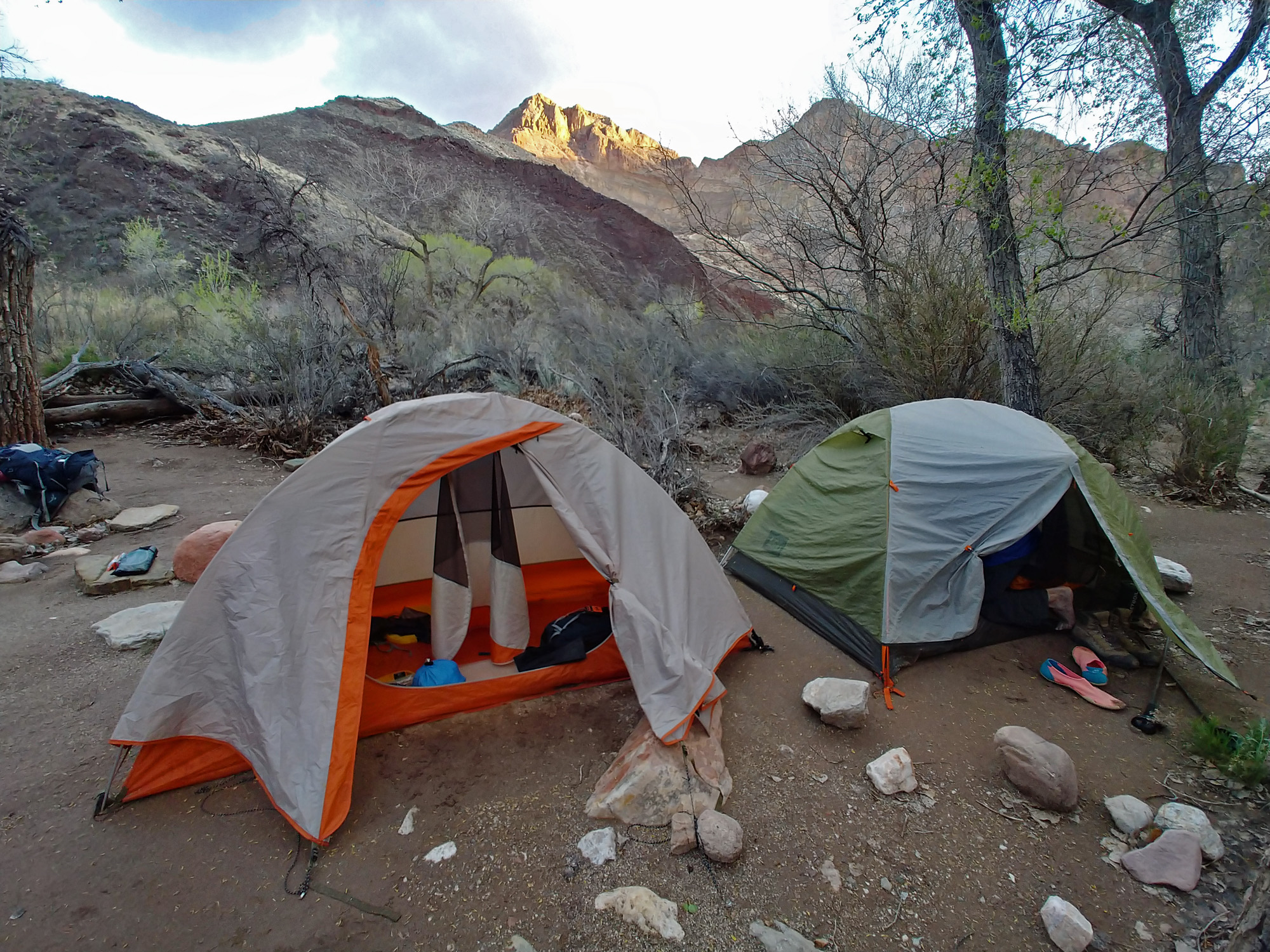
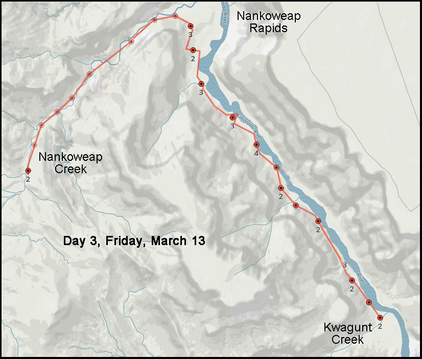
3 - From Nankoweap Creek to Kwagunt Rapids (Friday, March 13): We got a good amount of rain overnight, but it let up in the early morning and was followed by some wind so that when we got up and going, at about 6:30 a.m., many of the rock surfaces were dry. We started on our way at 9 a.m. so still not setting any records in this regard. The creek was not flowing especially heavily so all of our many creek crossings were easy. About halfway to the river we met and chatted with some river runners that were day hiking up the creek. They were staying above Nankoweap another night and we would see them again tomorrow when they floated by us on the river. It took over two hours to reach the delta at Nankoweap. We opted to stay on the use trail here and went over the hill to start heading downstream instead of going all the way out to the rapids. We rested briefly here and John visited some of the ruins on the hilltop. I have done this route, more or less exactly as we were planning, twice before – in 1984 and in 1993. I still remember that on both of those previous trips we stopped here on this hilltop and took in our new surroundings of the Colorado River and the sheer cliff walls to our east. The use trail led us down toward the camping areas that river runners use. We could have done the route up to the famous granaries here, but we have both been there before and that would have been quite a detour for us to make. Our trail took us to the lowest camping area where another river party was just about to get underway. We chatted briefly with them and then ducked into the brush until we were able to locate a lesser used trail that would parallel the river down to Kwagunt Rapids. Somewhere along this route we stopped for lunch. And, somewhere else along here I lost my ear band. Good thing I have a backup cap that covers my ears! There was a mistiness to the sky to our north and west and we wondered if we were going to be rained on. As we neared Kwagunt at 5 p.m., the off and on light sprinkles got heavier. Just before the creek bed we found a suitable place to camp in the tall grasses. Although rushed, we managed to get our tents up before getting too wet. When there was a lull in the rain, we were surprised to learn that there was no water flowing here in the bed of Kwagunt, so we were forced to get water from the river. |
|
|
||
|
Click on any picture to see a larger image. |
||
|
|
||
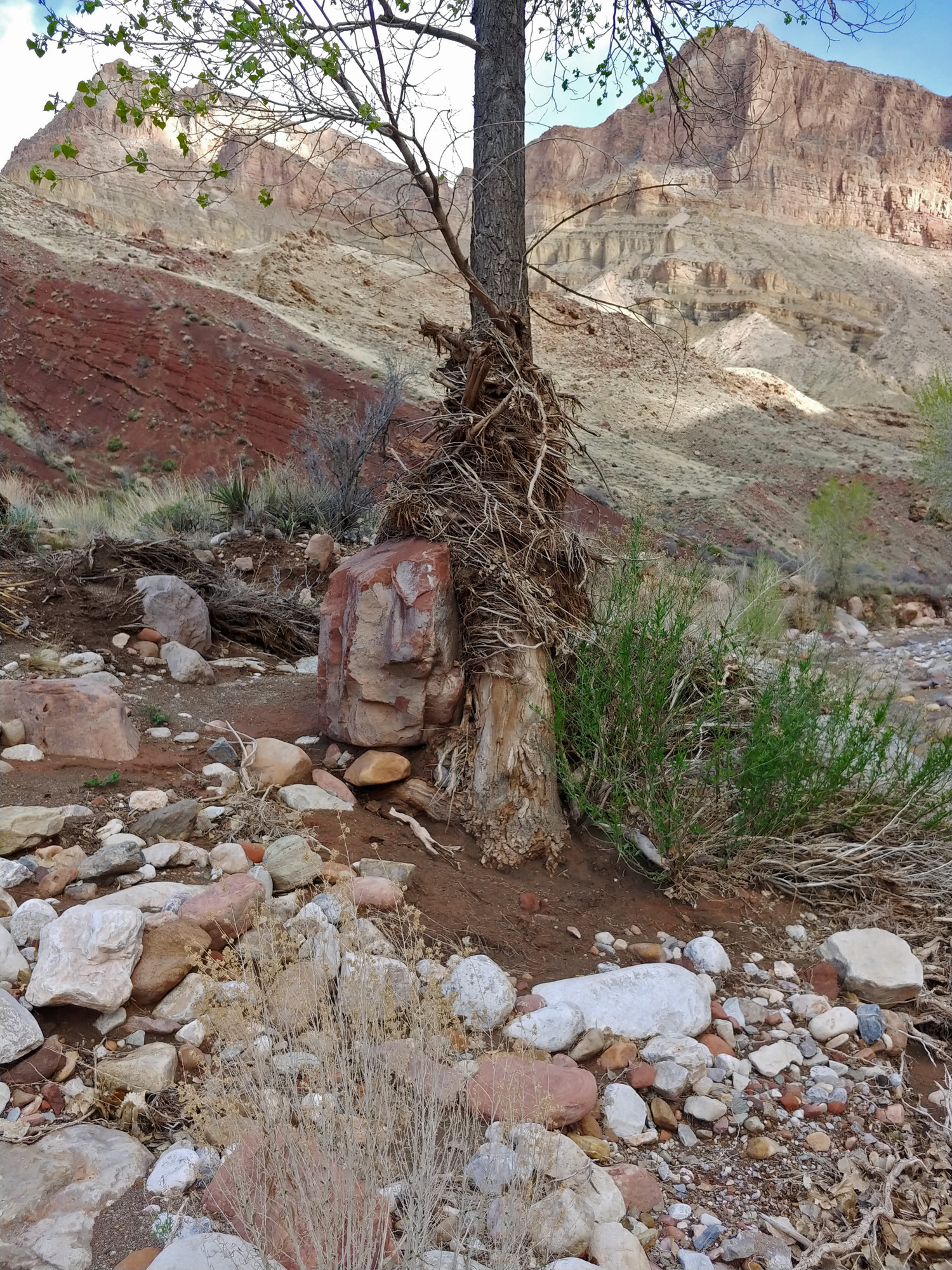 A tree in the Nankoweap drainage has snagged many branches and a large boulder, testifying to the power of flash flooding down this creek. |
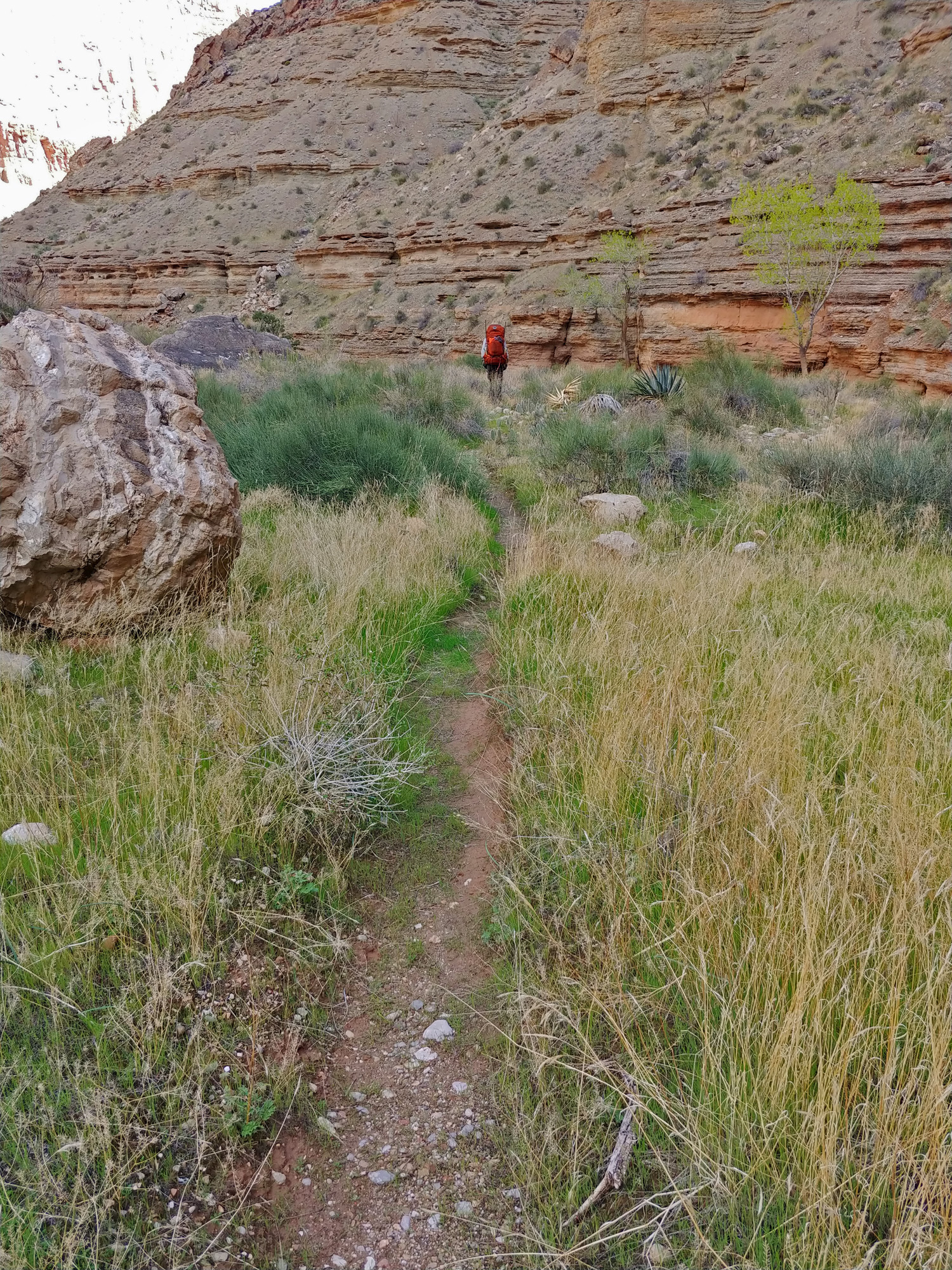 We followed a well-worn and very scenic trail down the creek to the river; along the way we chatted with some river runners on a day hike. |
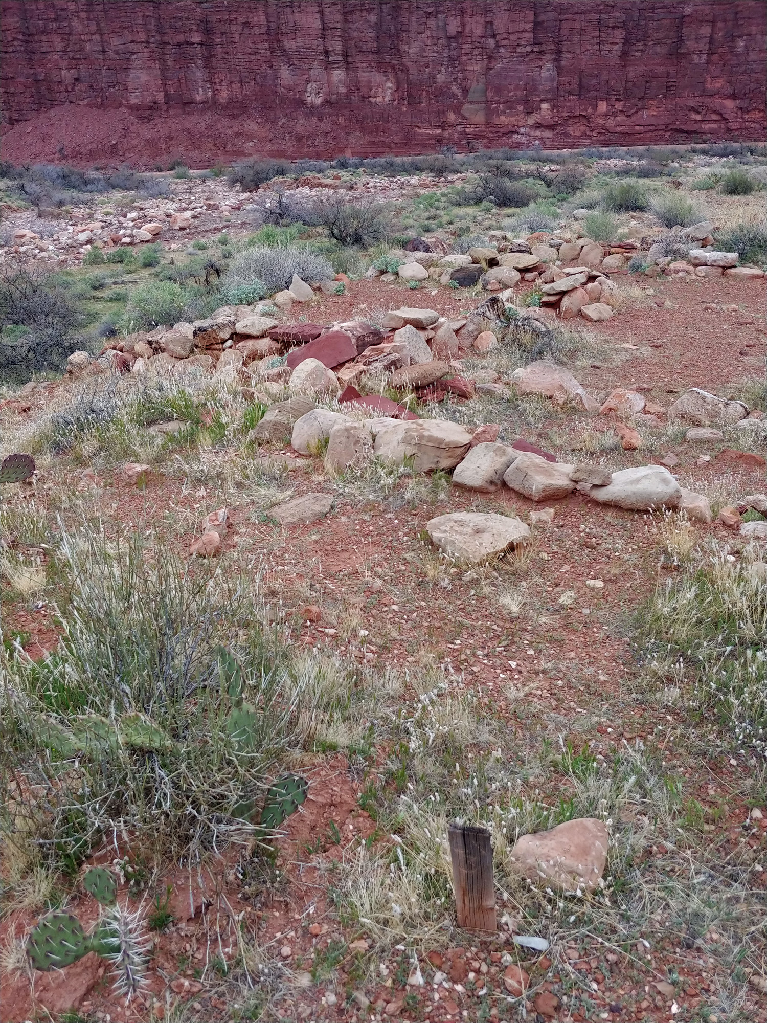
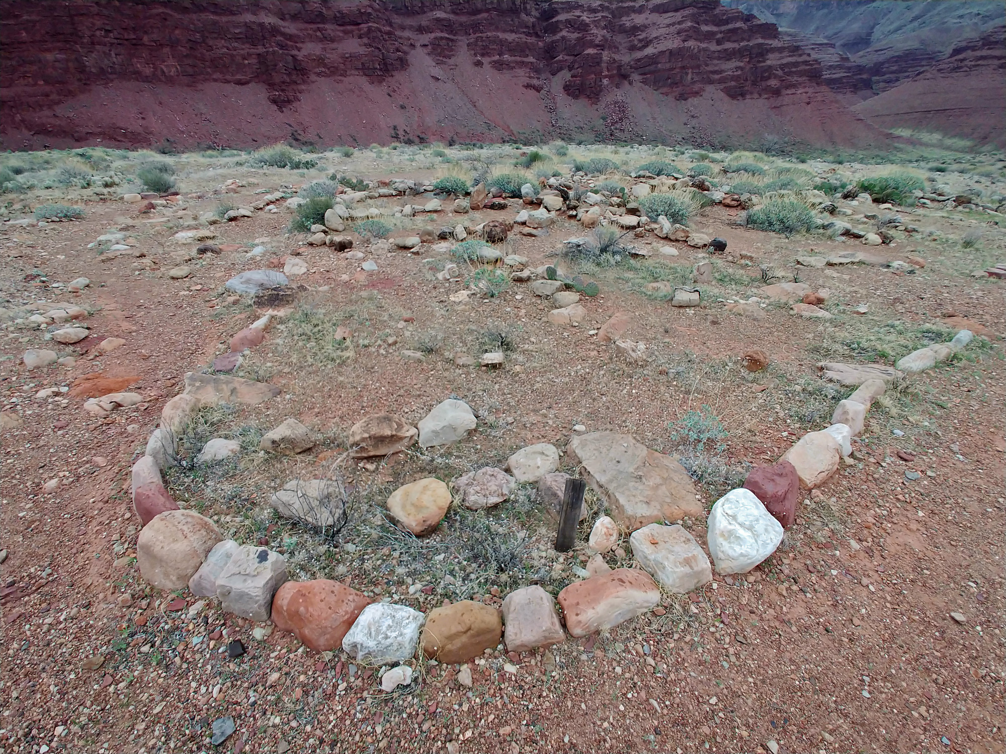
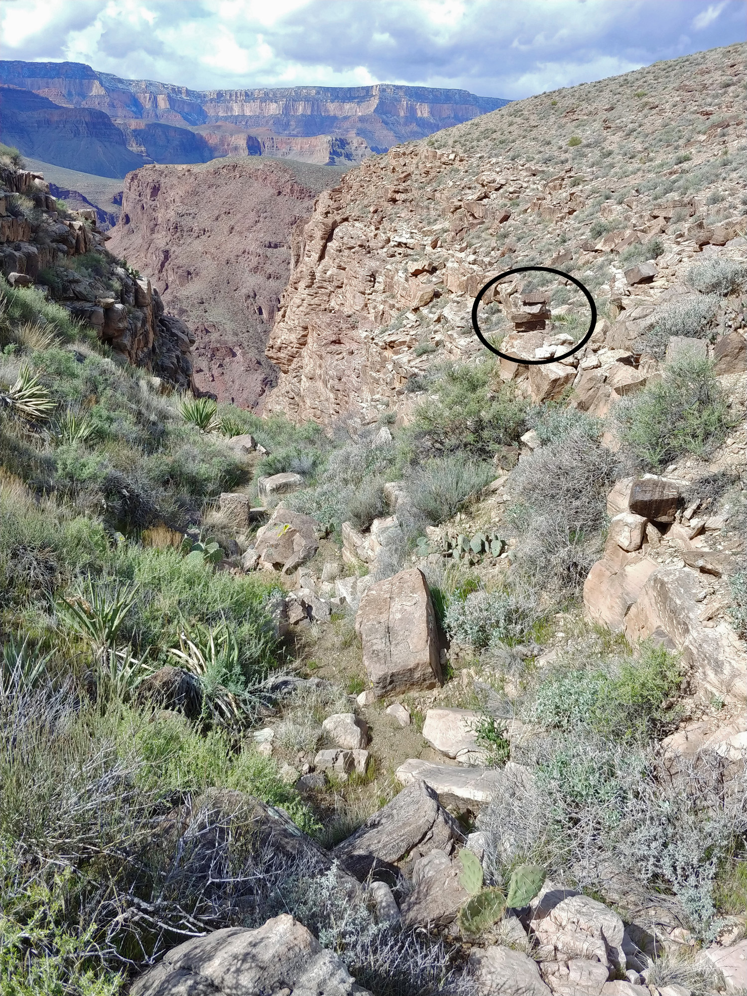
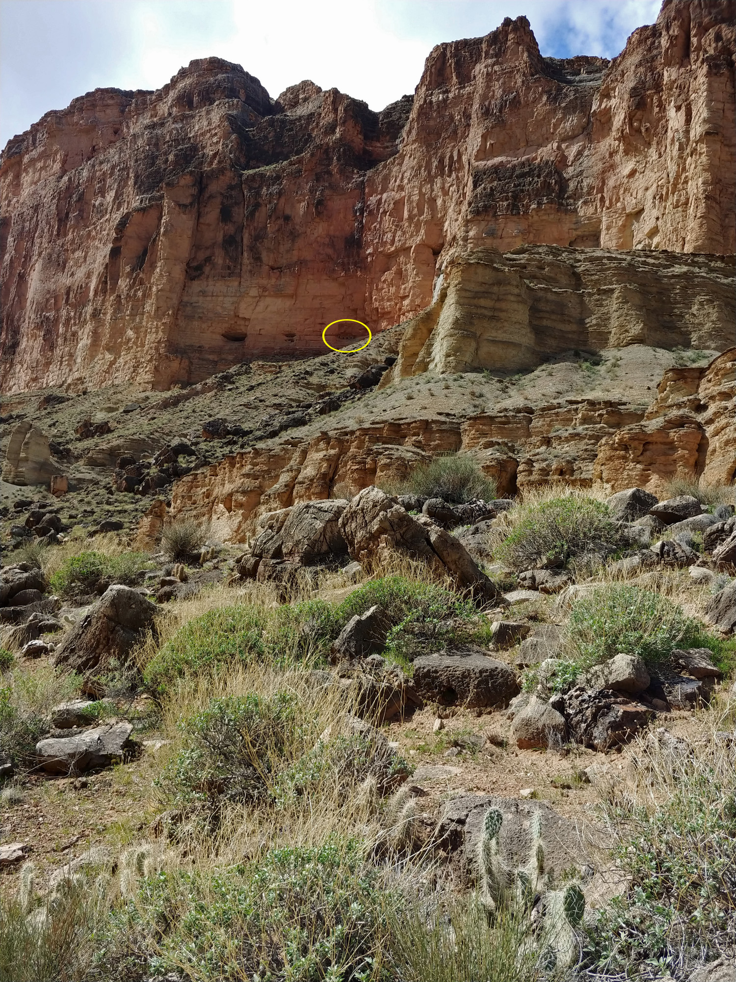 We had both previously been to the cliff granaries at Nankoweap (circled) and decided that a detour today would set us behind our schedule. |
 We rested on a hilltop near the river; here is the view upriver. |
 We rested on a hilltop near the river; here is the view downriver. |
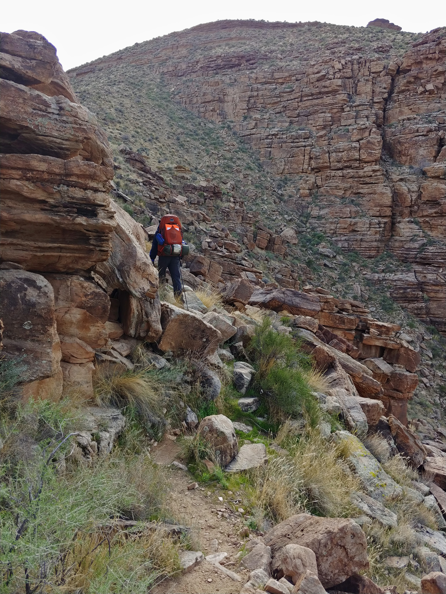
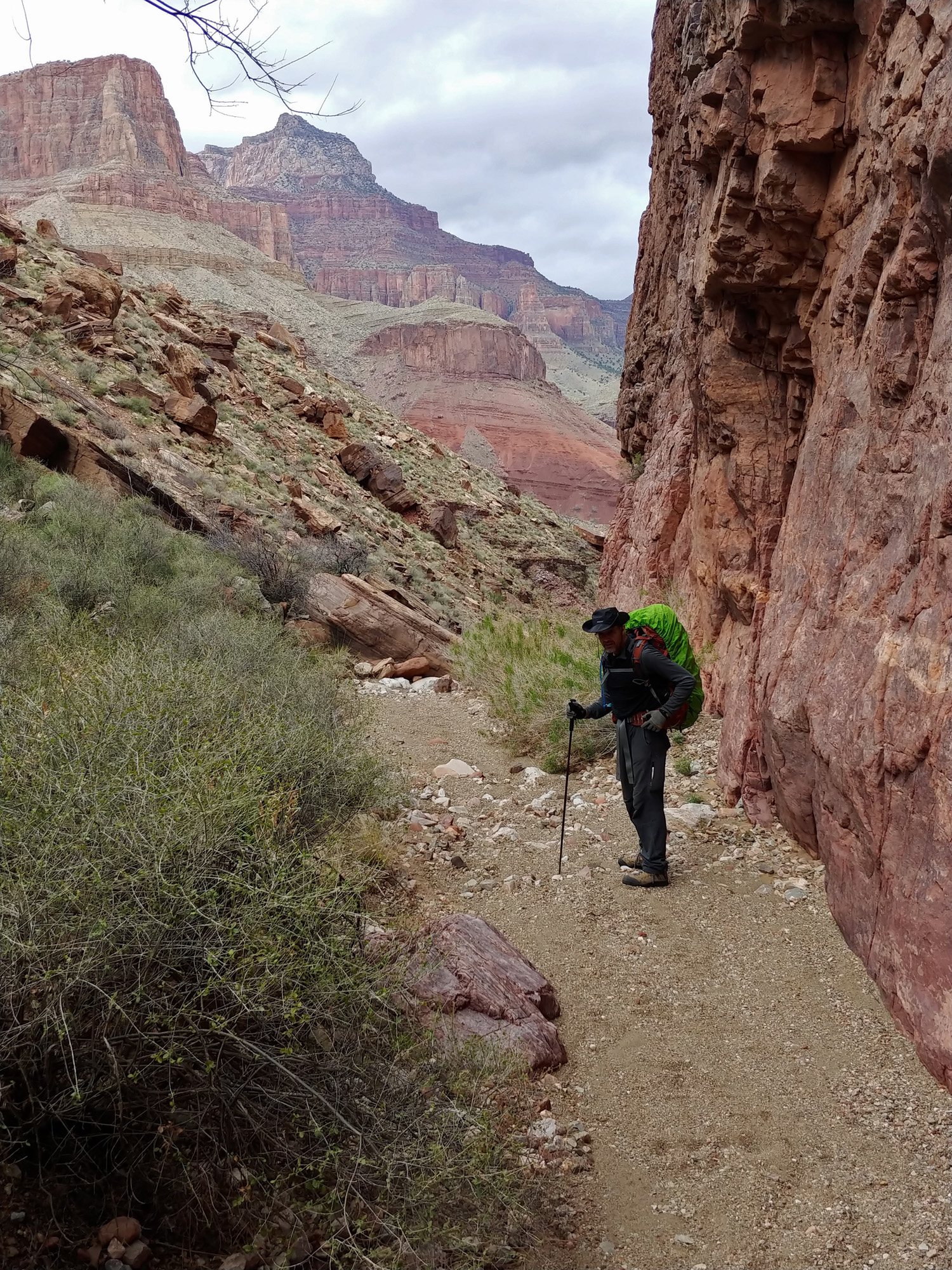
 John picks his way along the rocky slope as we near Kwagunt Rapids. |
|
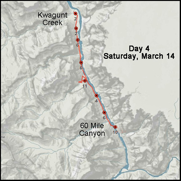
Day
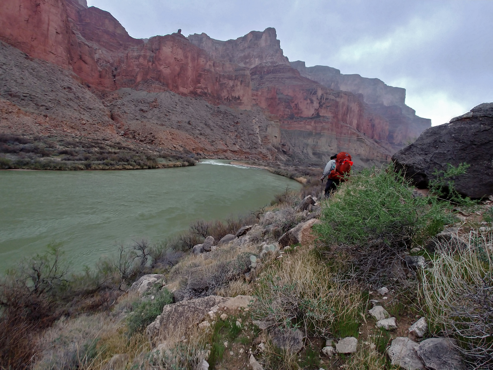
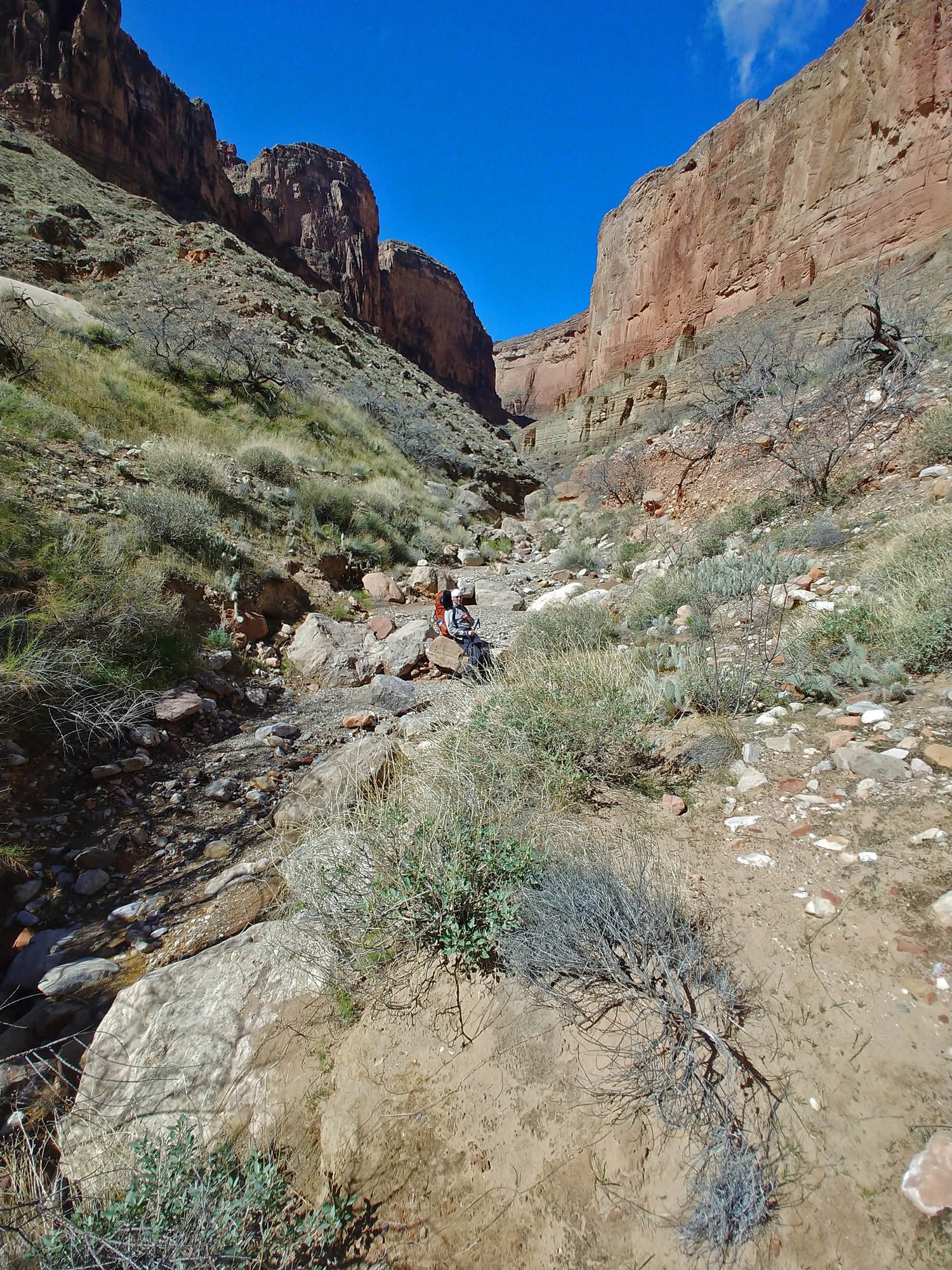
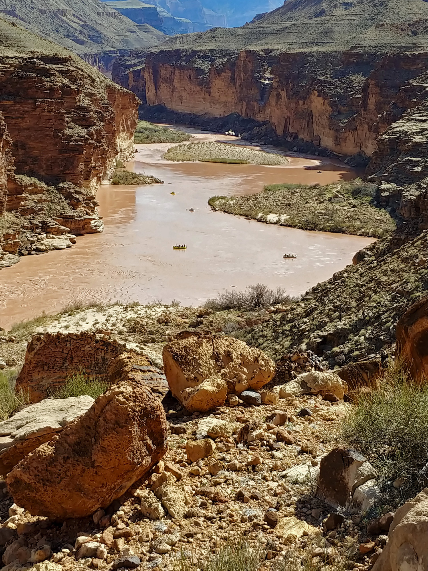
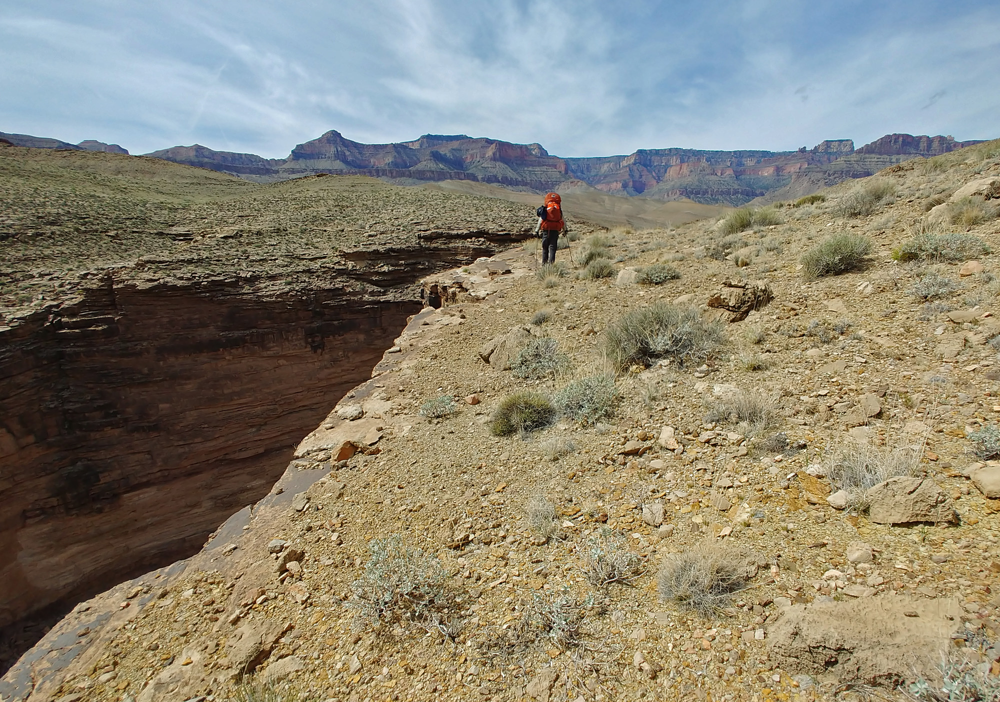
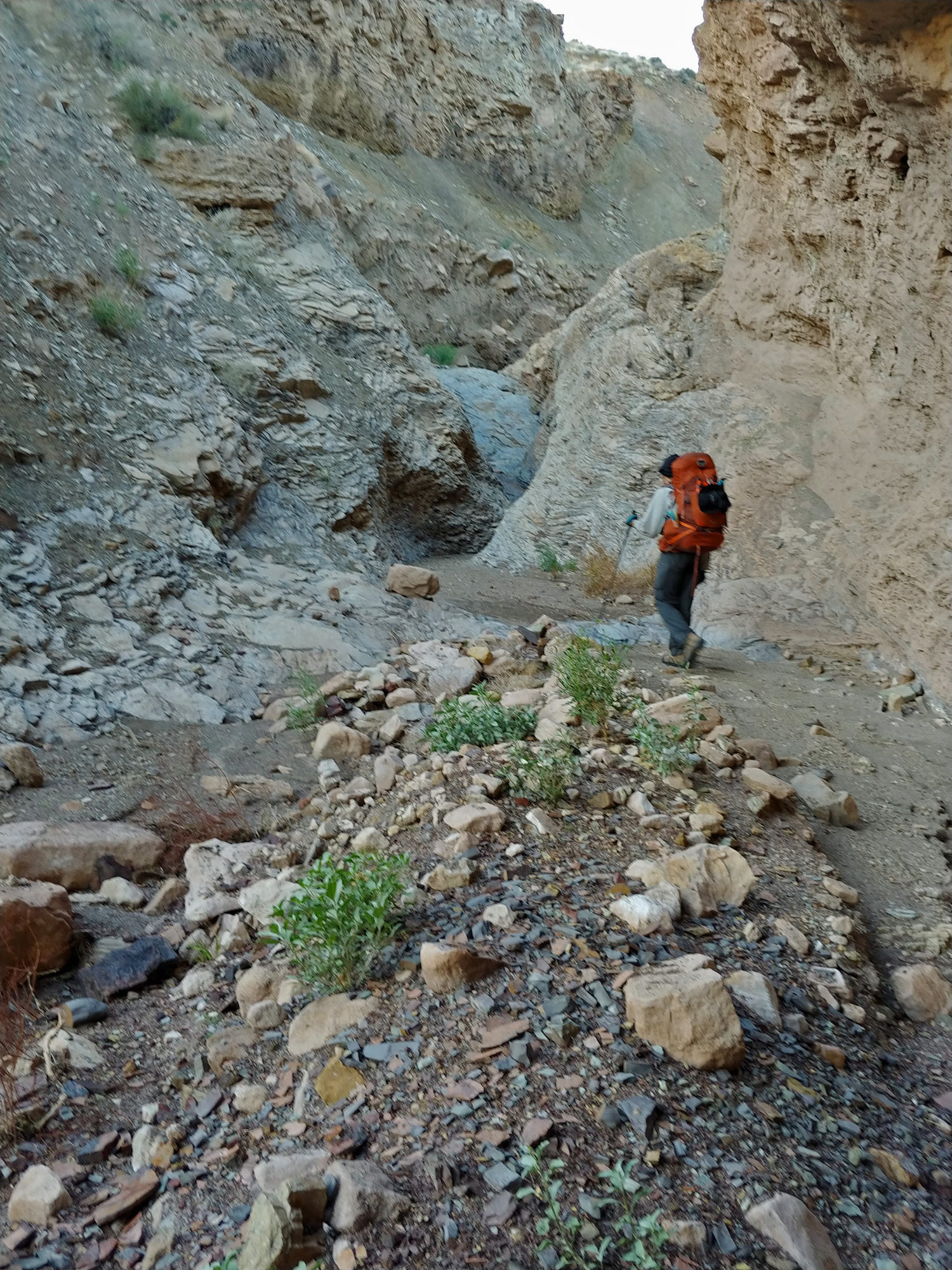
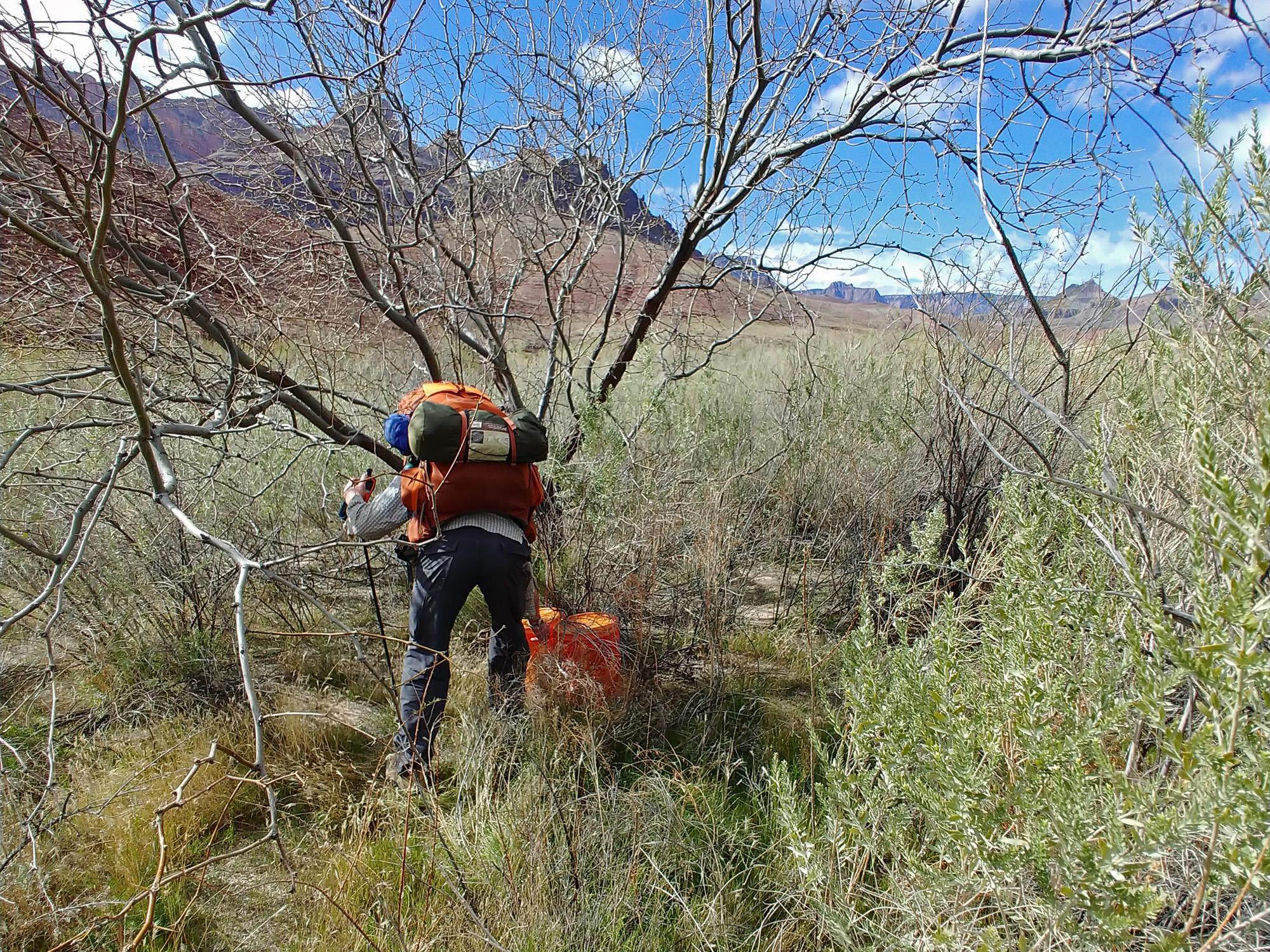
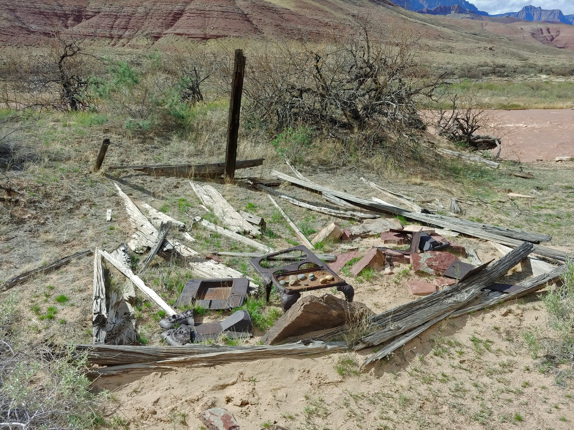
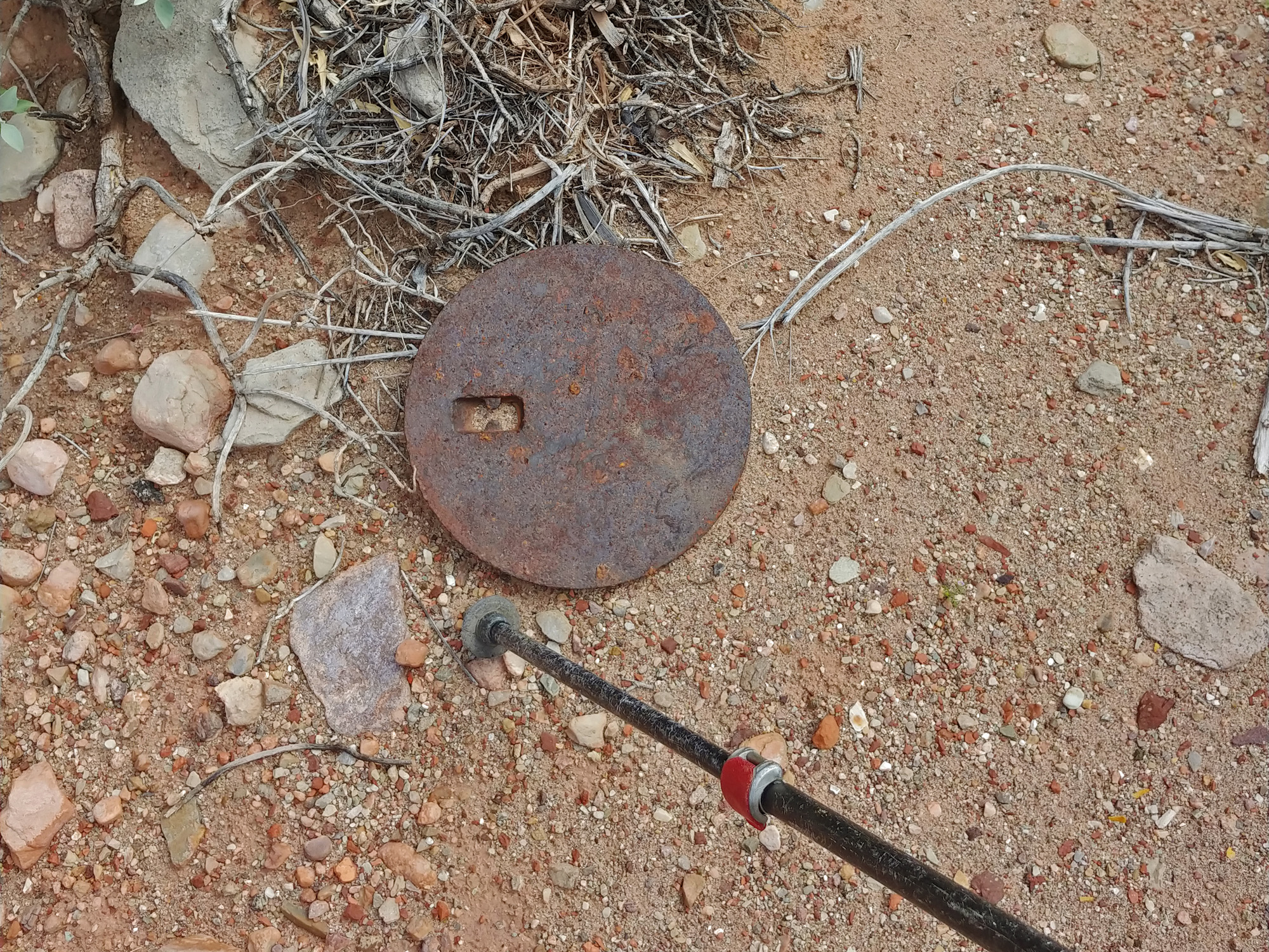
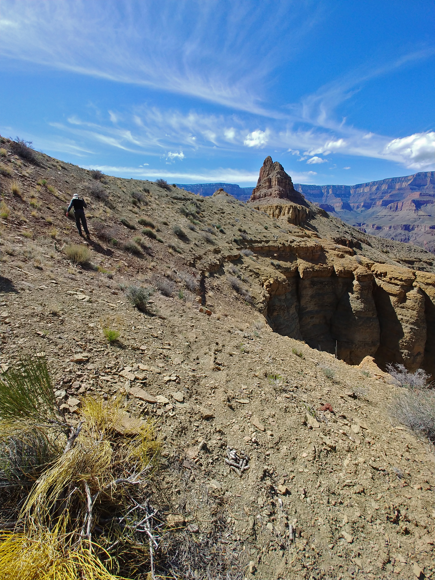
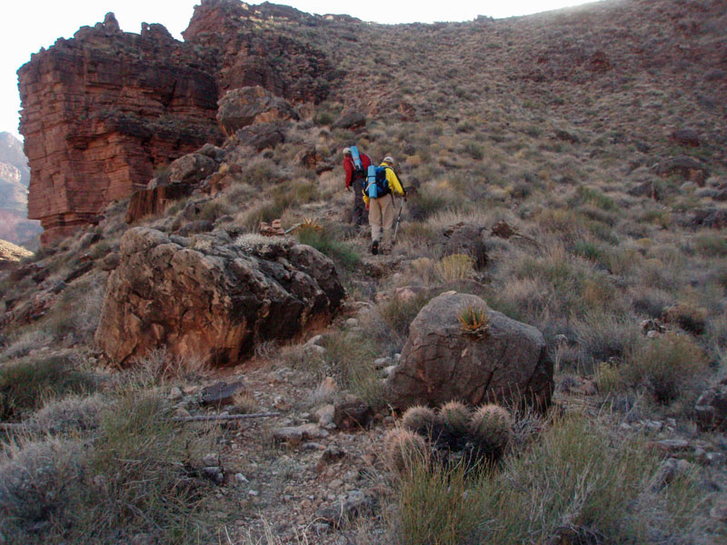
4 - From Kwagunt Rapids to Below 60 Mile Canyon (Saturday, March 14): The light rain came and went over the early part of the evening, but I don’t think it continued past midnight. I slept pretty well, despite my mattress problem, as the ground was soft. We were up at 6:15 a.m. and on our way at 9 a.m. Today we will not find as good a path to follow as the previous day. But, we kept our eyes peeled for any noticeable line to follow to make the hiking easier. I saw a solitary deer near our camp at Nankoweap Creek, but we did not see another one until we were almost to Phantom Ranch. Yet we saw faint deer trails and hoof prints quite often, which we followed with glee. In many places, when we seemed quite uncertain of our route, we relished hearing one of us call out, “Deer poop!” It took us a couple of hours to cross Malgosa Canyon and another hour and a half to cross Awatubi. As we continued downstream, ledges would form, taking us away from the water, but offering some occasional good hiking. But, it did get rougher after Awatubi. We were increasingly blazing our own path, and oftentimes with difficulty. At 3:30 p.m. we crossed 60 Mile Canyon and soon were fighting our way through thick brush. In one bad spot I tried to force my way through and ended up sprawled on the ground. The weather was rather perfect this day. We had some clouds, but also blue skies. It may have sometimes looked menacing, but we didn’t get any rain. At about 5:15 p.m. we came to a small beach area with some nice sand dunes and decided this would be our camp even though we still had a ways to go to get to the Little Colorado River. And while this was on our fourth day, we were now almost exactly one day behind our planned itinerary. But, we have a layover day coming up and we’ll catch back up to our schedule then. There was one interesting find here. Tucked in the sand under a huge boulder was an old rusting can. It looked to me like it was a gallon can of fuel for a camp stove. Probably forgotten by some river party long ago. Also, a new problem developed for me this day – my boots started to blow out on both sides at their widest spot. The seams were coming undone, making me extra careful about walking around and through cactus, and reluctant to casually walk through any water. They would continue to deteriorate over the rest of the hike, but otherwise held together. |
|
|
||
|
Click on any picture to see a larger image. |
||
|
|
||
 Typical hiking along the Colorado River below Kwagunt Rapids. |
 John takes a break in Malgosa Canyon. Yes, I would join him! |
 Ledges emerge as we neared the LCR; sometimes good hiking. |
 John studies a way off this ledge. |
 Old can (inset) near our camp. |
 Looking back at Malgosa Crest. |
|
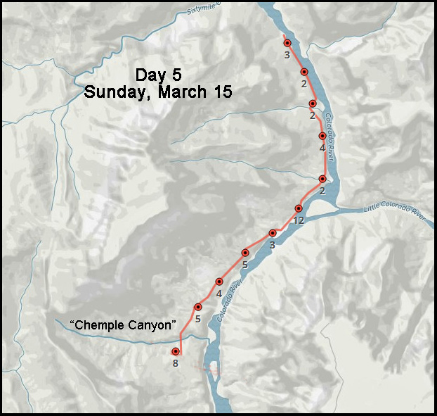
Day
5 - From Below 60 Mile Canyon to the Plateau Below Temple Butte (Sunday,
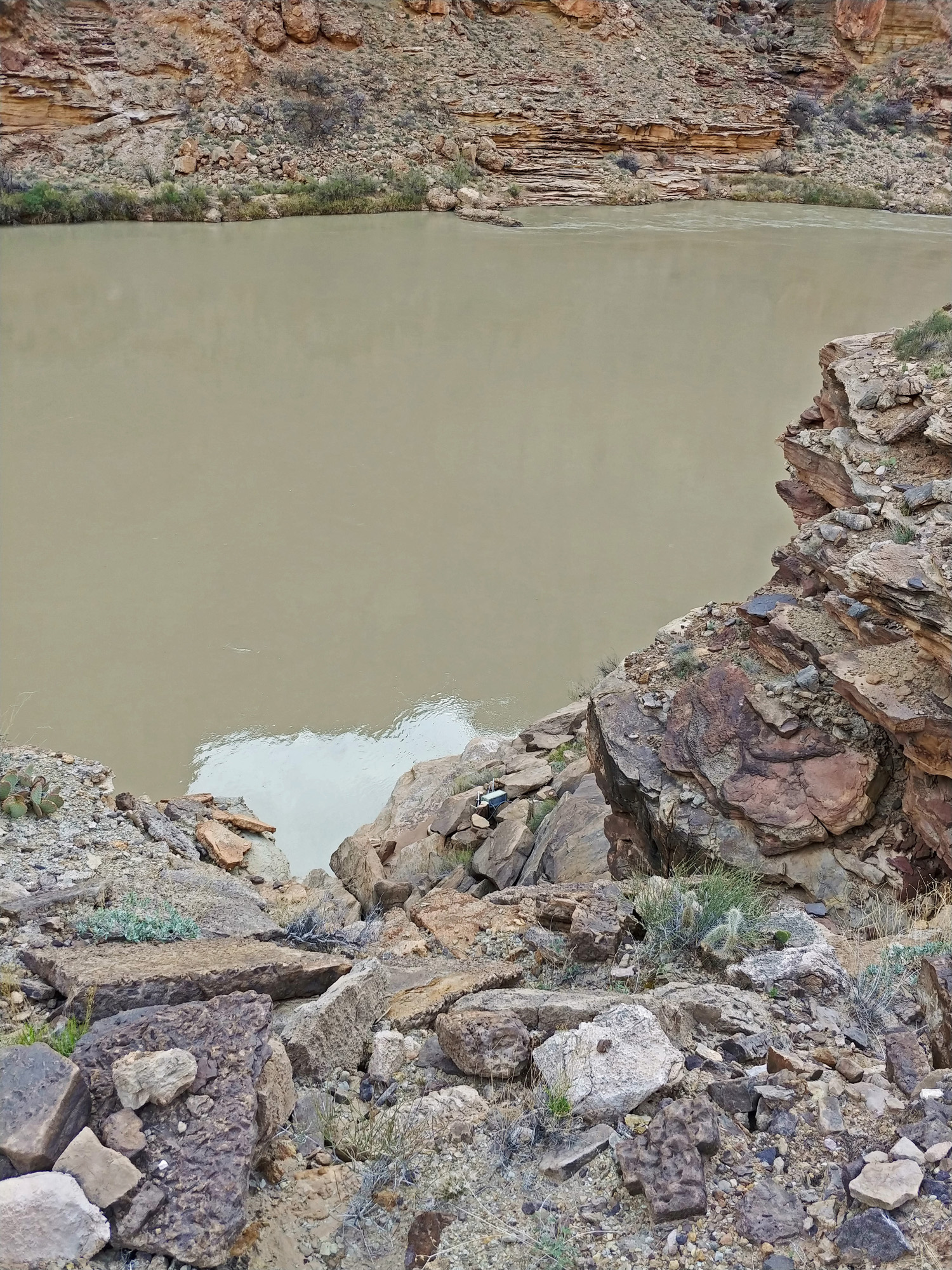
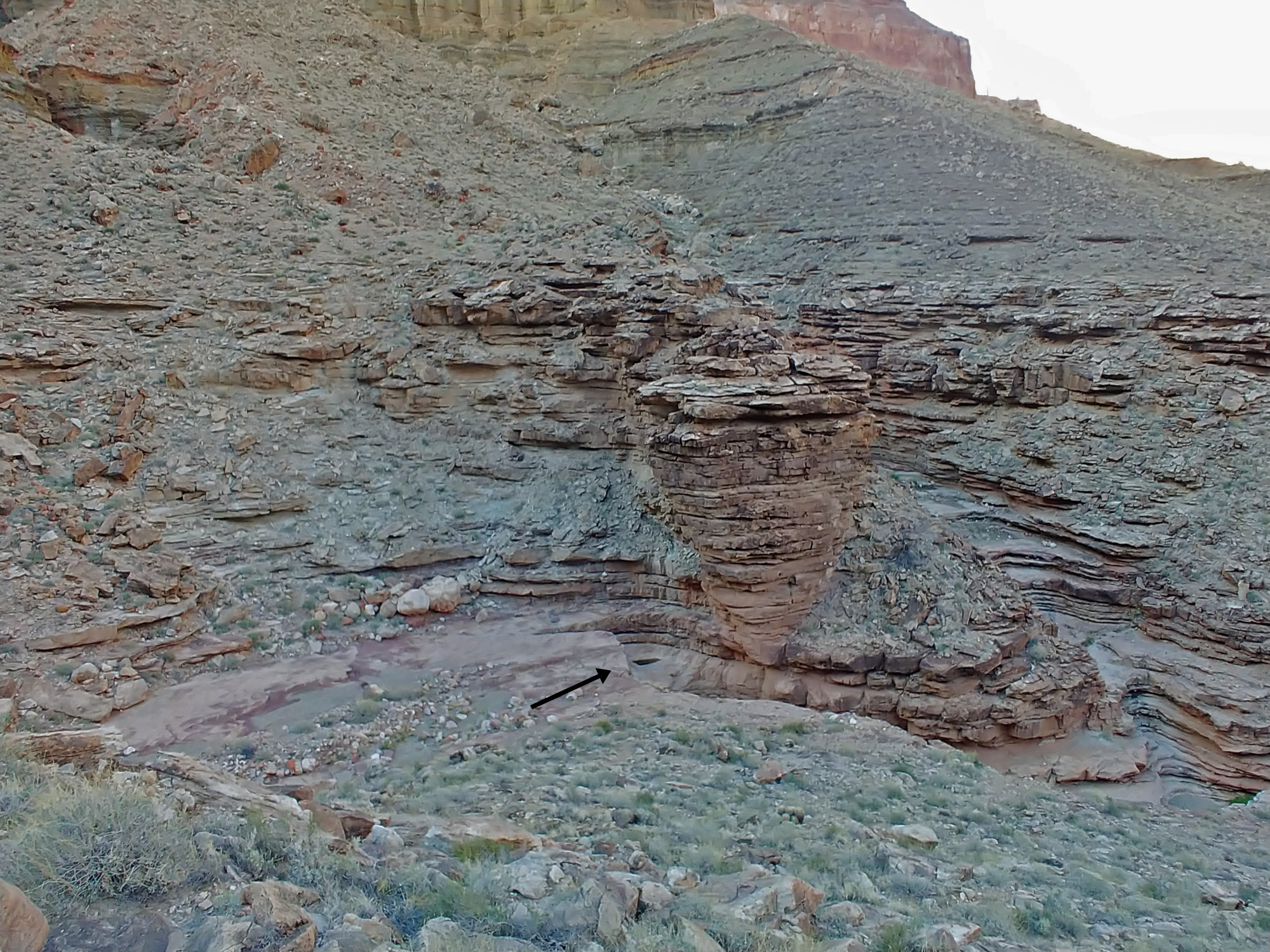
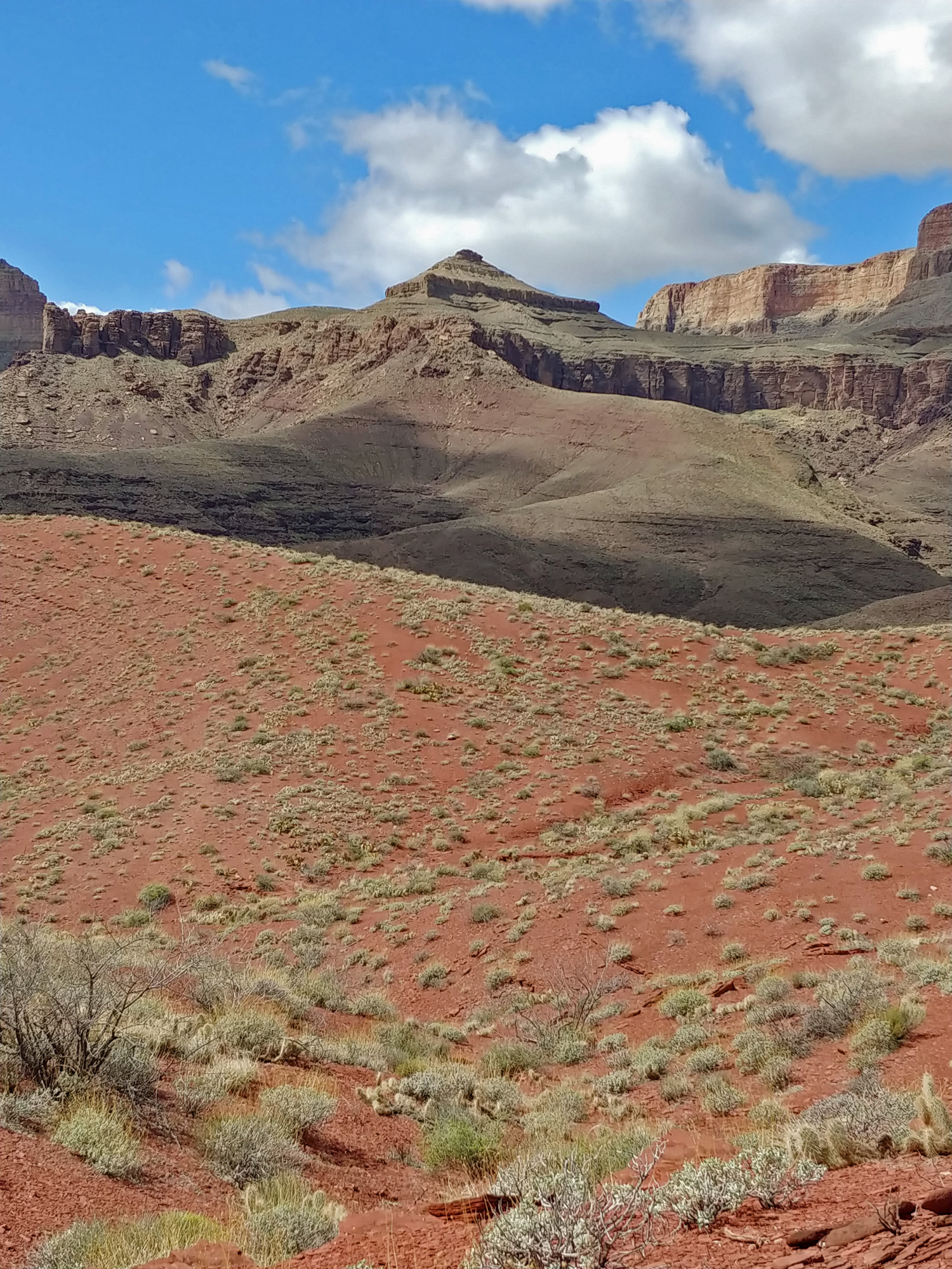
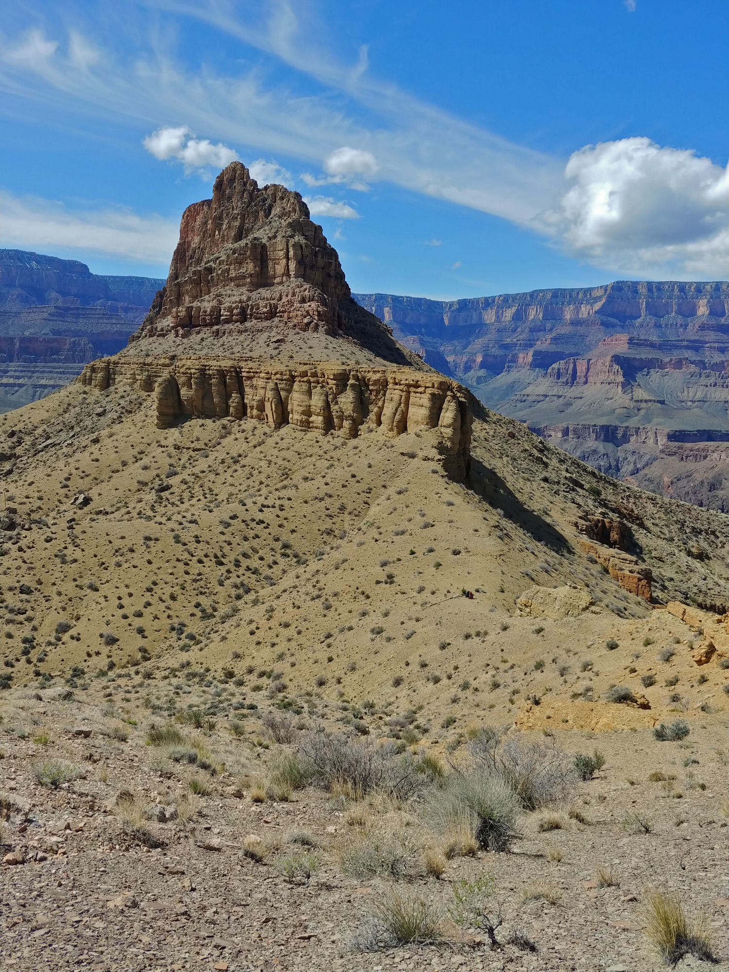
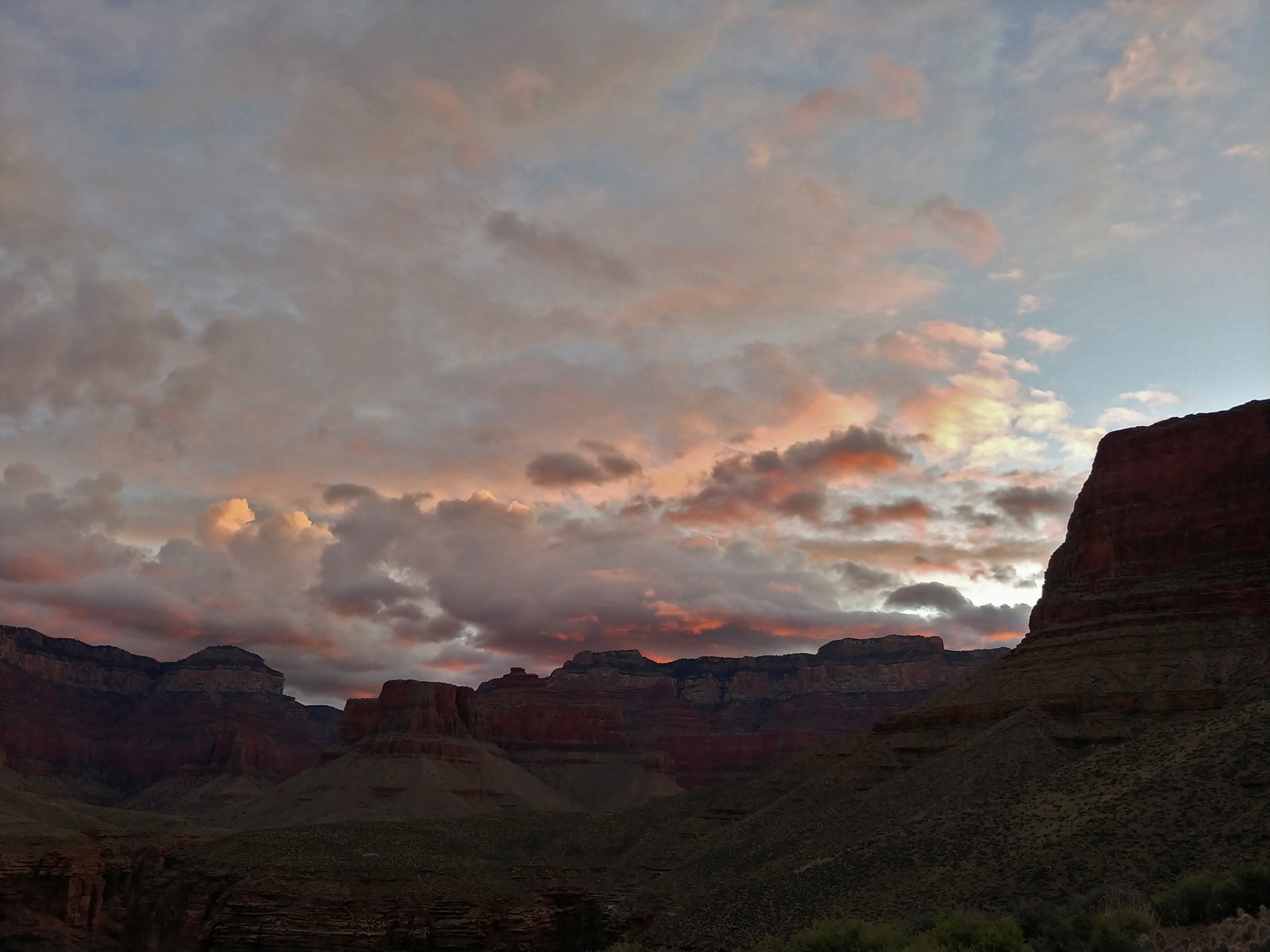
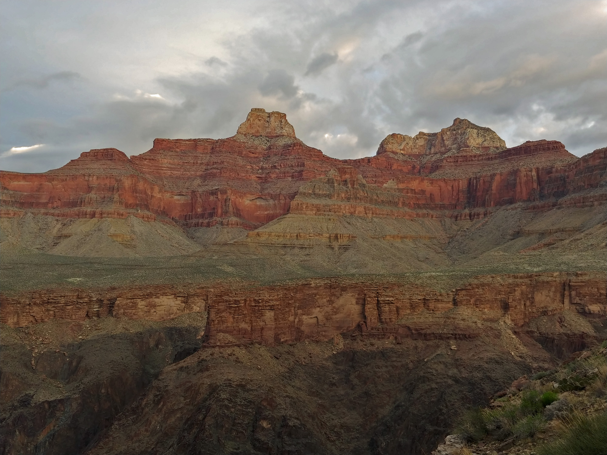
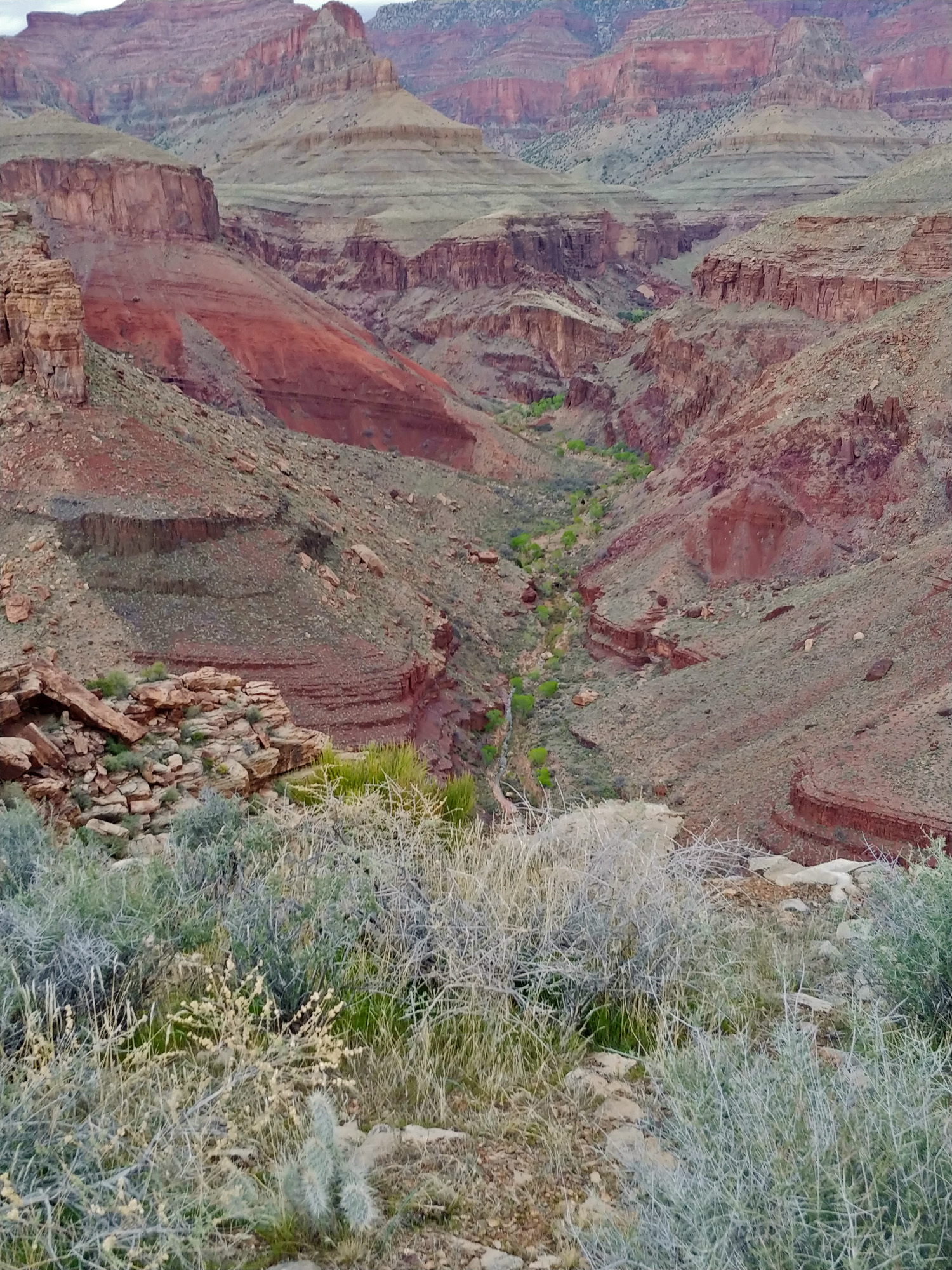
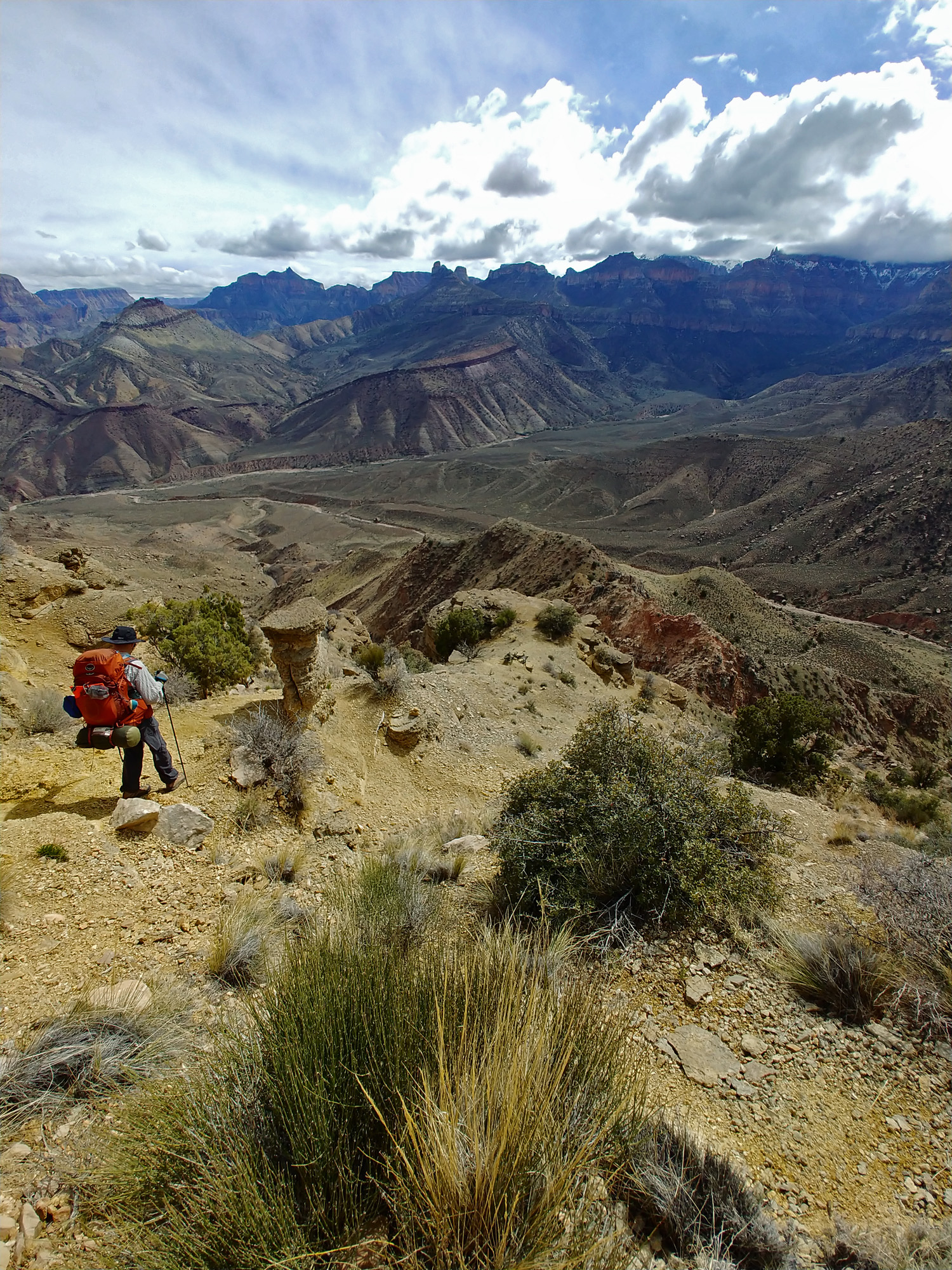
March 15): We decided that we needed to get earlier starts in the morning and so we were up at 5 a.m. this day. I guess that helped to some extent, but we weren’t ready to go until nearly 8 a.m. We did determine that at 6:30 a.m. there was good enough light to start hiking. By the end of the hike that would be pushed up by a half hour! We followed whatever path looked best. After an hour and a half we passed by a bent metal bar that I am thinking was part of the old tram that was strung up across the river and used many years ago to measure the river flow. When I came through here in 1984, the old tram was actually still here. Once we passed the pipe we had an excellent trail to follow. It took us to the confluence with the Little Colorado River and continued ascending the cliffs here above the river. We had a chance to go down to a beach just short of the LCR but it seemed too early to me. That might have been a mistake. Our fine trail pretty much dead ended us on some rather nasty looking slopes. We decided to continue a bit farther and found a gentle, but rocky, route that led us to the riverbank just before the deep red LCR got totally mixed in with the dull green CR and turned the river chocolaty brown. There we would spend almost two hours filtering water for a dry camp and having an early lunch. The filtering was slow and we ended up carrying some with us that was still untreated because we needed to be on our way. At a bit past noon we left our beach and started following a route that climbs up above the cliffs that form below the LCR. We will not have a sure source of water until late tomorrow when we reach Carbon Creek, although we will want to wait until a bit later when we reach Lava Creek. The hiking was tough along here as we contoured our way around part of Chuar Butte and made our way to the major side canyon that runs between Chuar and Temple Buttes. It doesn’t have a name, but we were calling it Chemple. We are at the newly emerging Tonto Plateau here, but still with steep and scoured out ravines that require careful attention. As we continued we were welcoming the widening of the plateau, which generally replaced side-hill hiking with cactus wading! Chemple is a very deep side canyon and we had to work our way back quite a ways before we could spot a route across. We did that at about 4:30 p.m. and a half hour later we were up on a flat high hill to the south where we decided to make camp for the night. After crossing Chemple we looked back and saw a fairly large water pocket in the bed. We thought about going back and getting some, but the weather had been cool and we were sure we had enough for the next day. It was mostly clear at sunset and it was a treat to leave the rainflys off our tents so we could enjoy the starry skies this night. |
|
|
||
|
Click on any picture to see a larger image. |
||
|
|
||
 John spotted this contraption. |
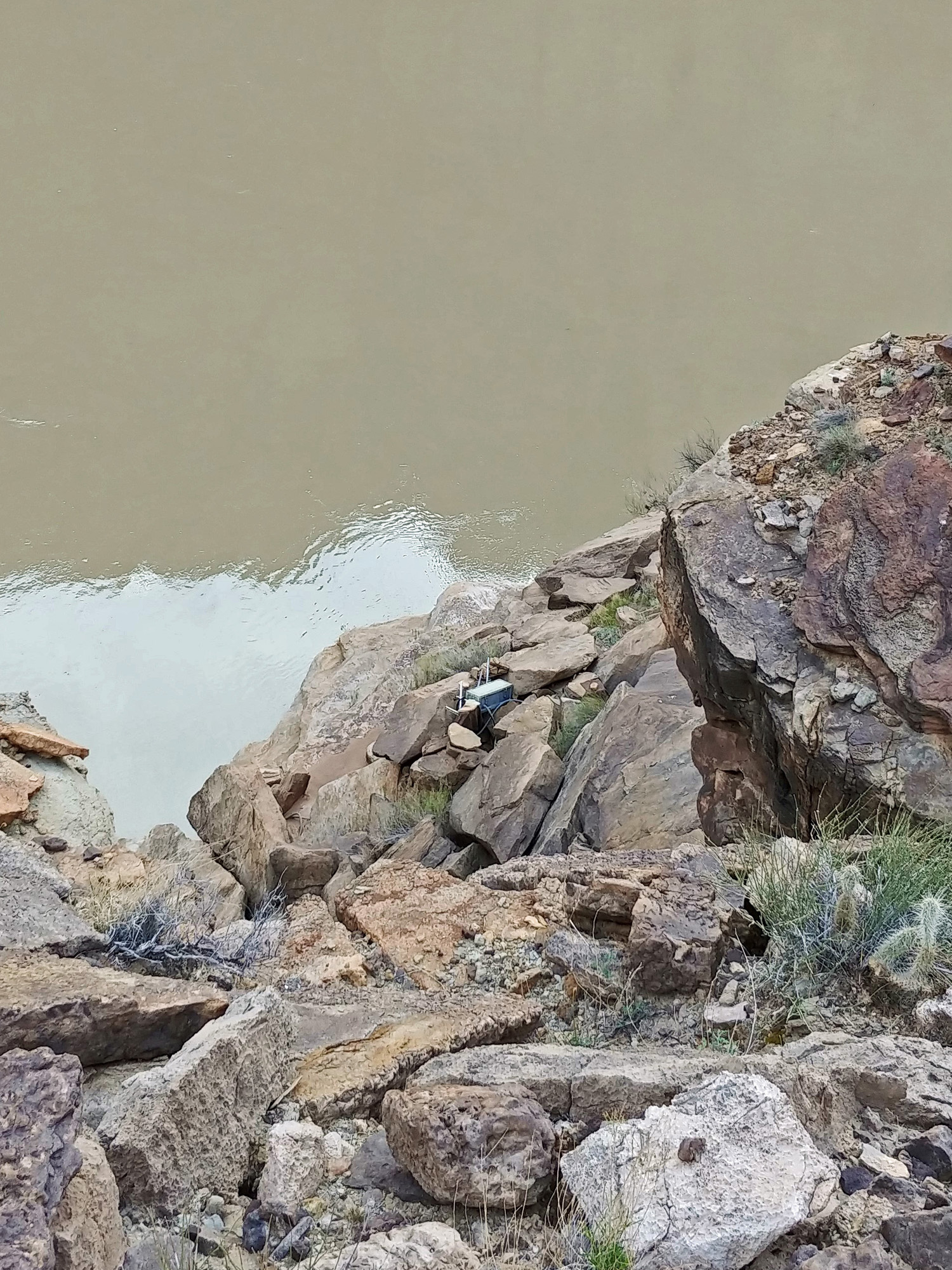 A close-up view; measuring the river? |
 Old site of the tram? |
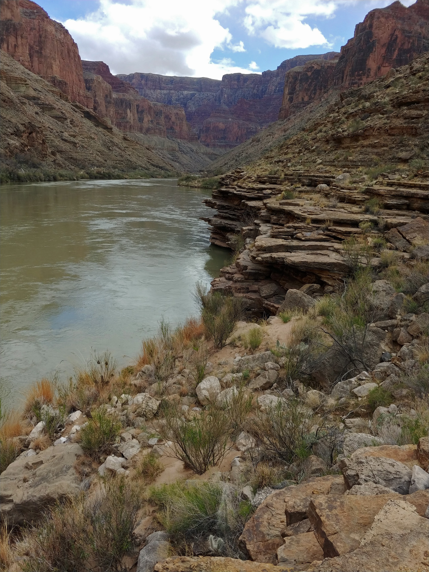
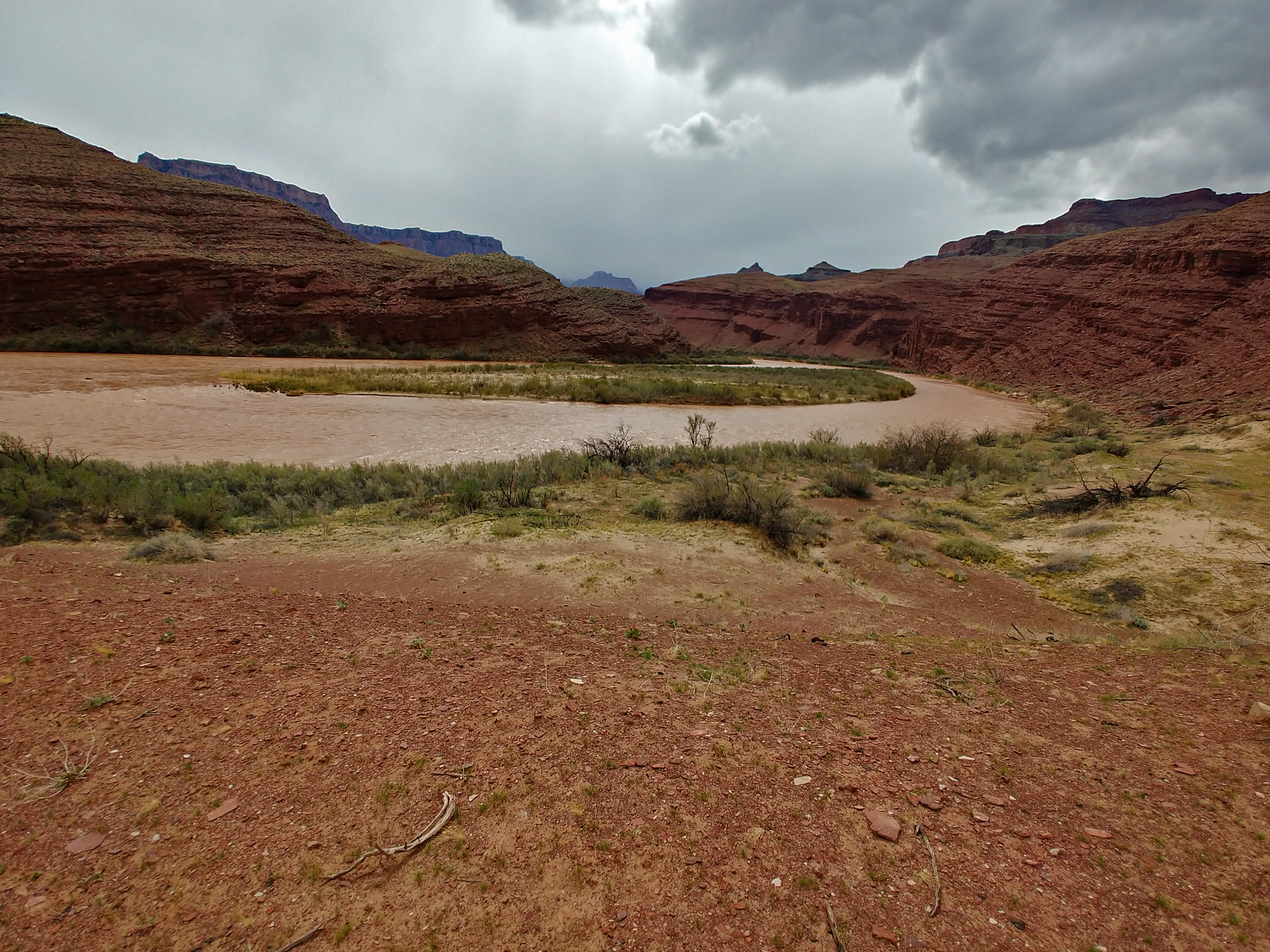
 Confluence with the muddy LCR. |
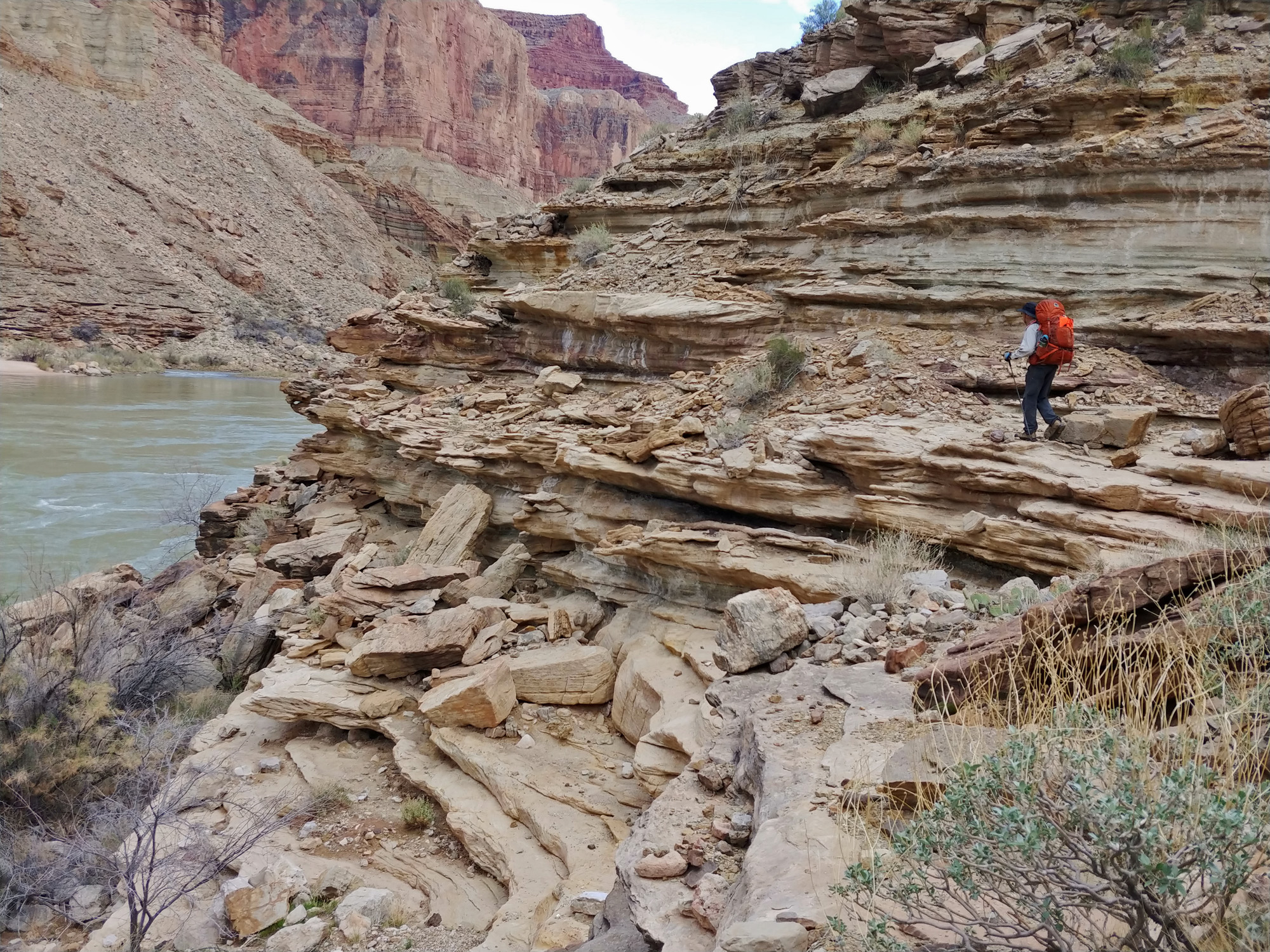
 As we left the confluence of the Little Colorado and the Colorado we had to start hiking and climbing along the emerging Tapeats cliffs. |
 Water pocket in Chuar-Temple ravine. |
 Cape Solitude & a boater. |
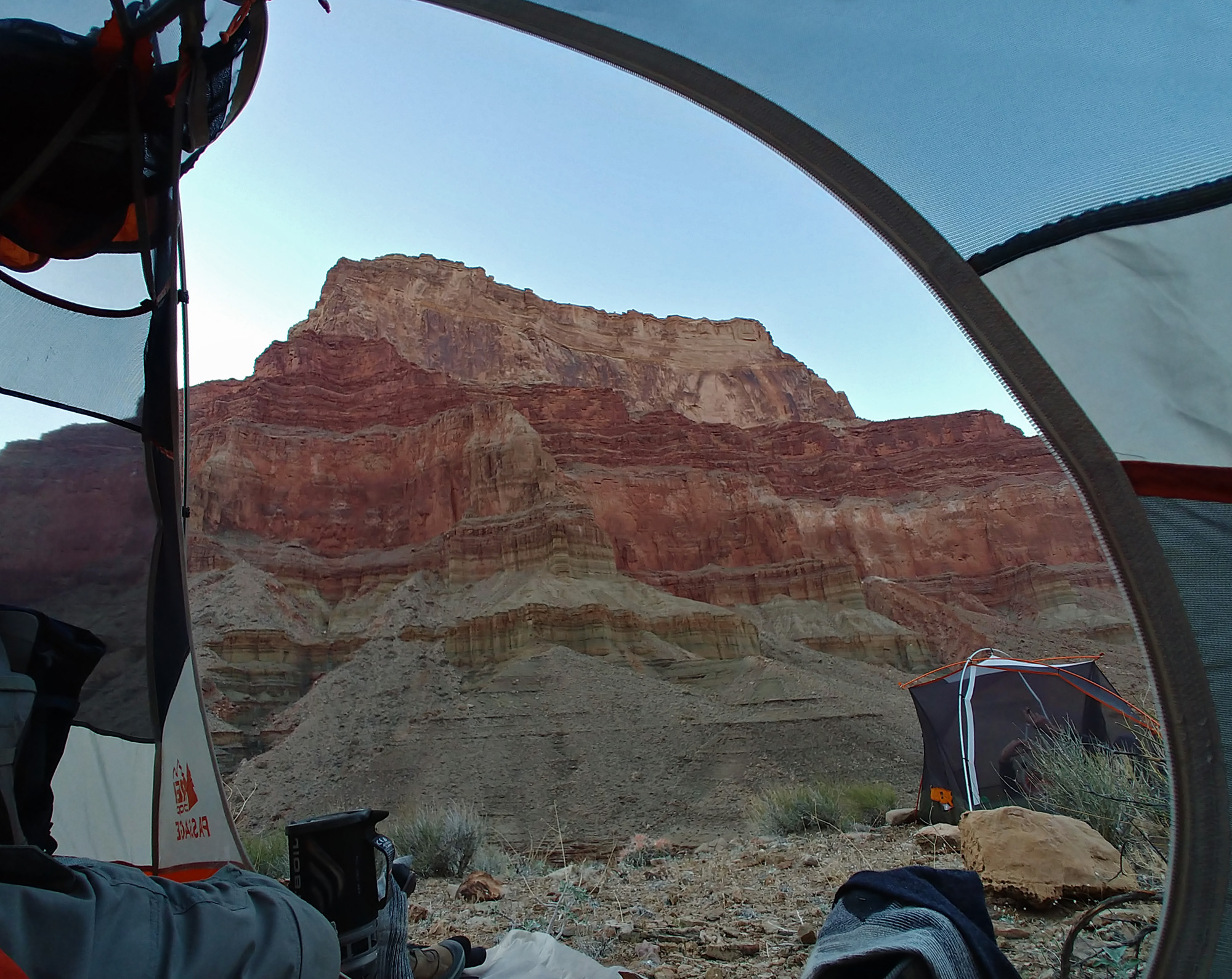 Chuar Butte from my tent. |
|
|
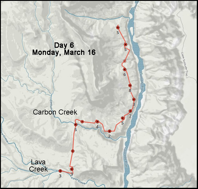
Day
6 - From the Plateau Below Temple Butte to Lava Creek (Monday, March 16): We must be getting more serious about this hike as we got up at 4 a.m. so that we could get started on our way by the first good light, which we did at 6:30 a.m. As we started angling down from our relatively flat hilltop we soon encountered somber ghosts from the past. We crossed a shallow ravine that was littered with some of the remains of a mid-air collision that occurred over the canyon in 1956. While most of the wreckage was cleared away at the time, there remain small pockets of debris strewn across a rather large area. After a few moments of reflection on this sad event we continued on our way around the aptly named Temple Butte. Most of our day would be spent in laborious crossings of innumerable side canyons, ravines and gullies as we circumambulated around Temple Butte. Some of these required careful study; others we would just head in and cross wherever it seemed best to do so. We were getting mostly clear skies this day, but temperatures are still quite reasonable so our water consumption is not too high. Along the way John had his first equipment failure – one of his hiking poles broke. It was actually still usable, but shorter than the other one (his are the collapsible kind while mine are the ones that telescope). After a while he gave up on trying to use it and tied it to his pack. We pretty much had to hike all the way to the rim of the next canyon – Carbon – and then make a westward turn and follow it back to where we could descend a few hundred feet to what is called the Butte Fault route, arriving at 2 p.m. The Butte Fault is a shorter, and probably easier, alternative way into this area from Nankoweap, just west of the major formations of Nankoweap Mesa, Malgosa Crest, Kwagunt Butte, Chuar Butte and Temple Butte. But using this route does require climbing many high saddles as you cross over these canyons and is waterless for a very long stretch. There was a trickle of water in Carbon, but we weren’t yet in need and the much better source – Lava Creek – was not too far away. We took a short break here and then headed on down the Butte Fault route toward Lava Creek in Chuar Canyon. Now we were on a very well-maintained trail – preserved by river runners doing a loop hike up Carbon, over to Lava and then back to the river. As we started along this trail I came to realize that this must be a remnant from Walcott’s survey here in 1881-1882. It took us less than an hour to reach Lava Creek. We would have liked to be well-upstream, near a site known as the “Still Spring” where there are remains from an old miner’s camp. But, we were quite tired and it is unnecessary for us to be that far upstream in order to continue tomorrow. So, at about 3:30 p.m., after about 20 minutes of hiking up the creek, we found a real nice spot to put down roots for the night. We had an extra day built into our schedule and are now back on our itinerary, although our rest day has dwindled down to a couple of hours! |
|
|
||
|
Click on any picture to see a larger image. |
||
|
|
||
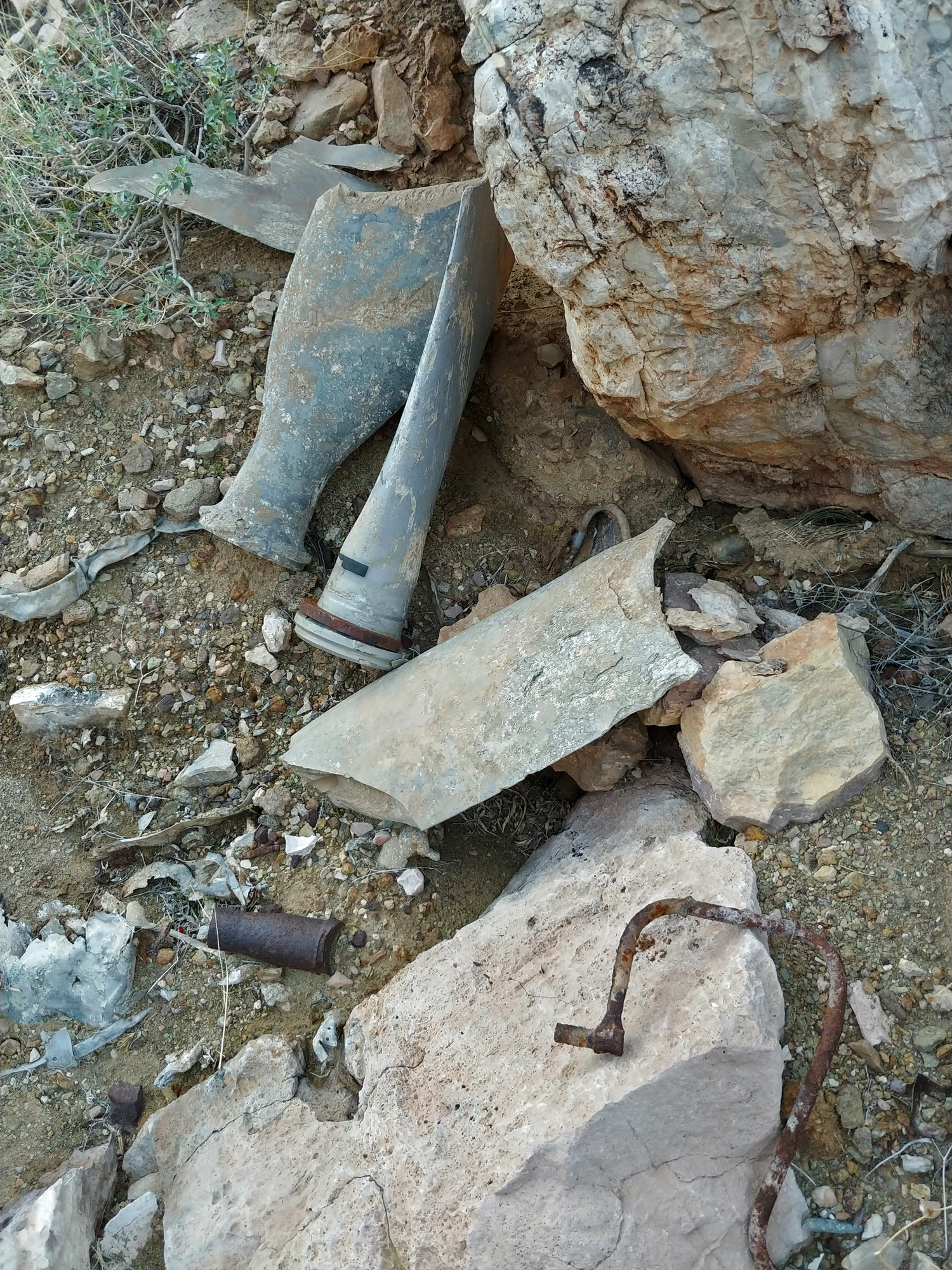 The debris we found was from the TWA Constellation. Lostflights identifies this as a propeller fragment. |
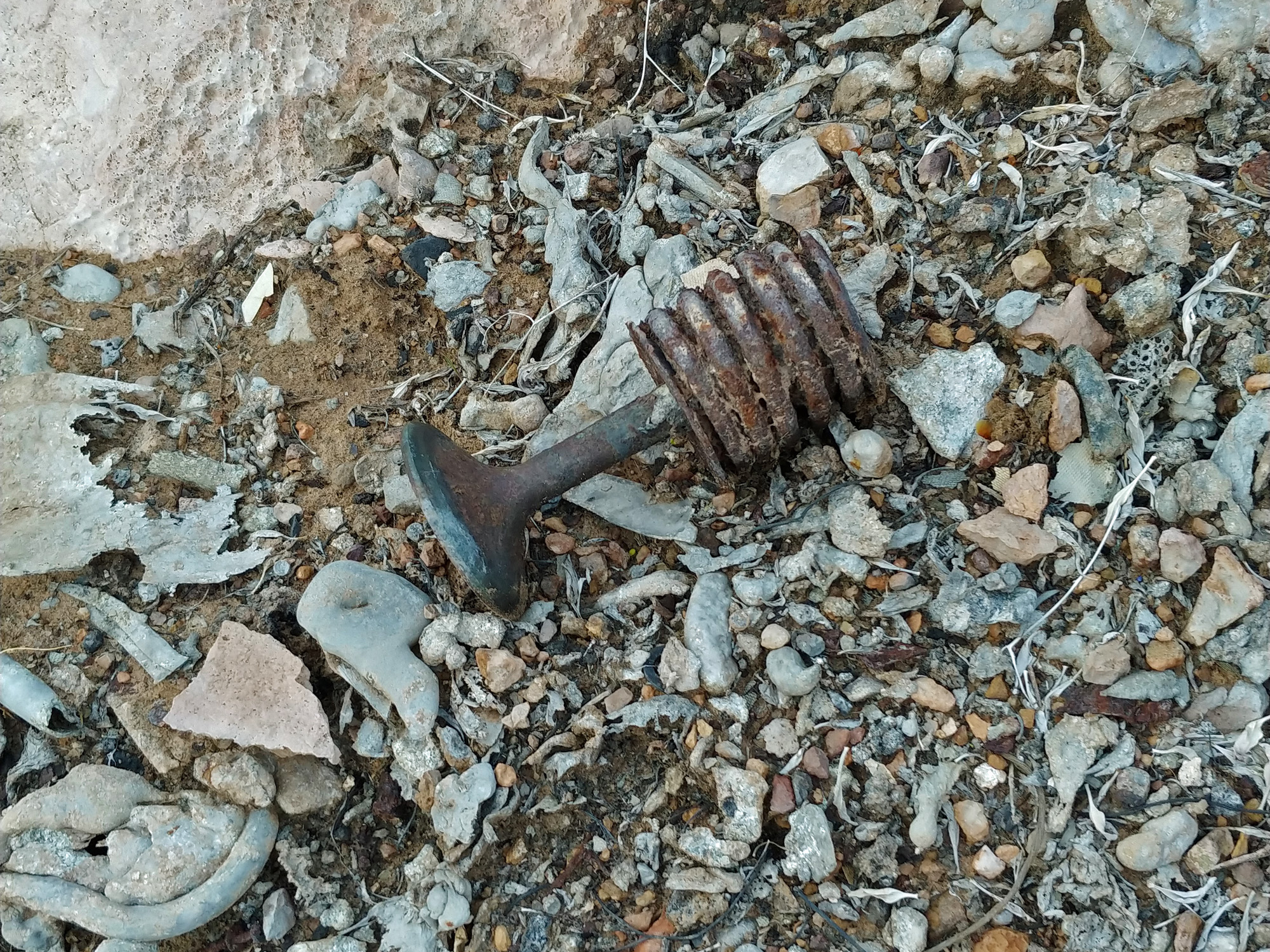 Piston and spring. |
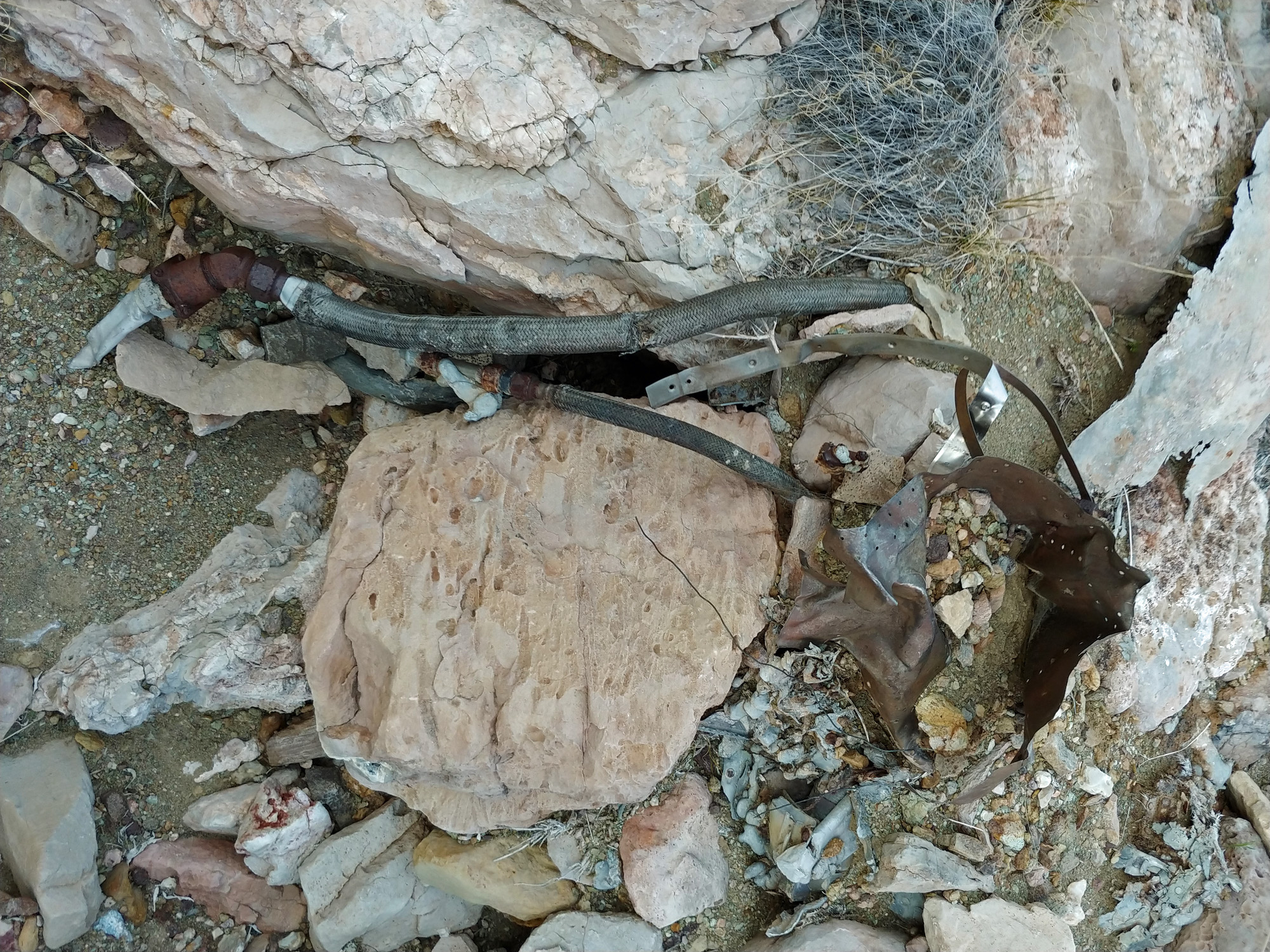 Debris. |
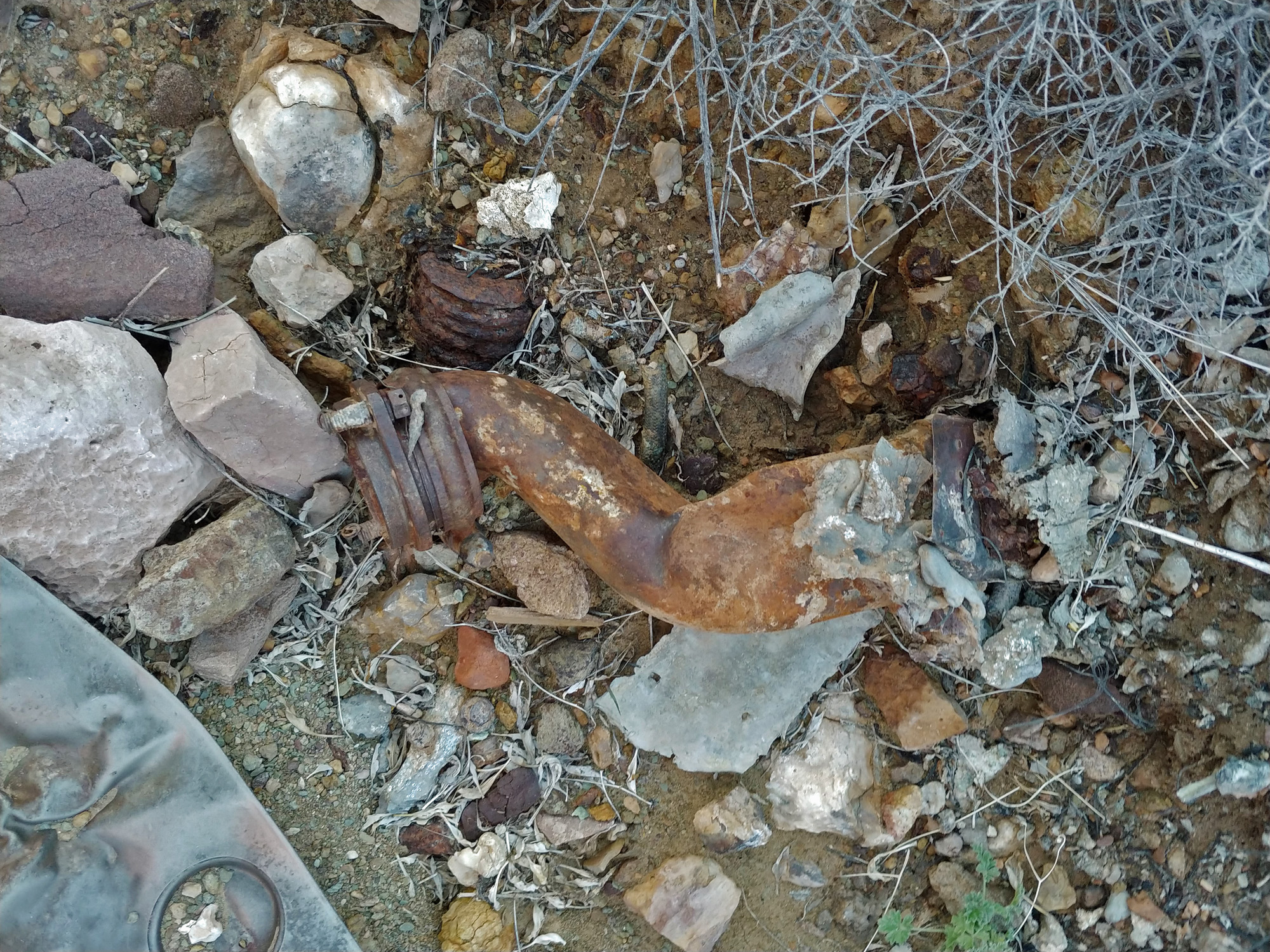 Debris. |
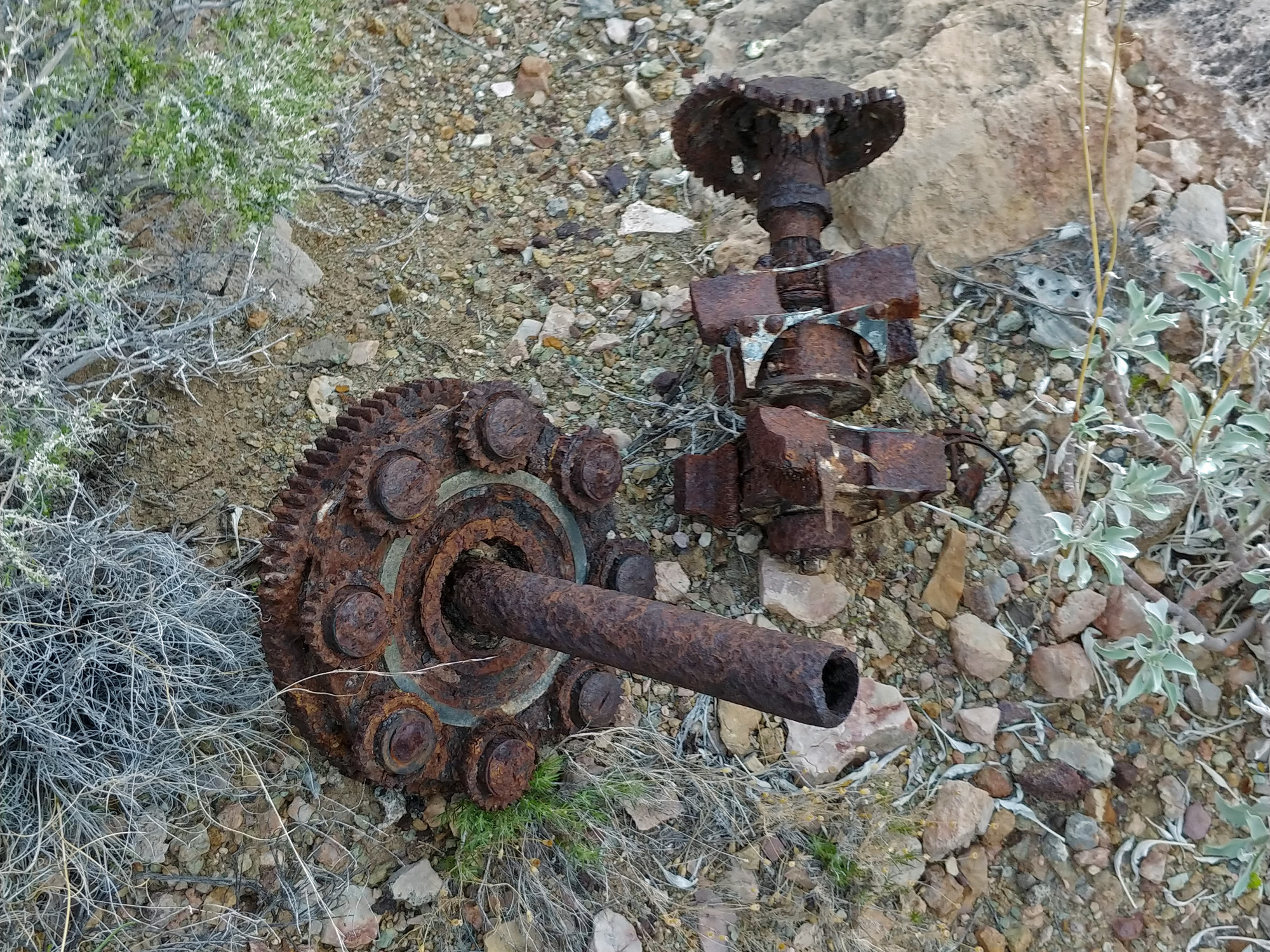 Planetary reduction gear. |
|
|
Read much more about this
accident and Michael McComb's extensive exploration of this area: |
||
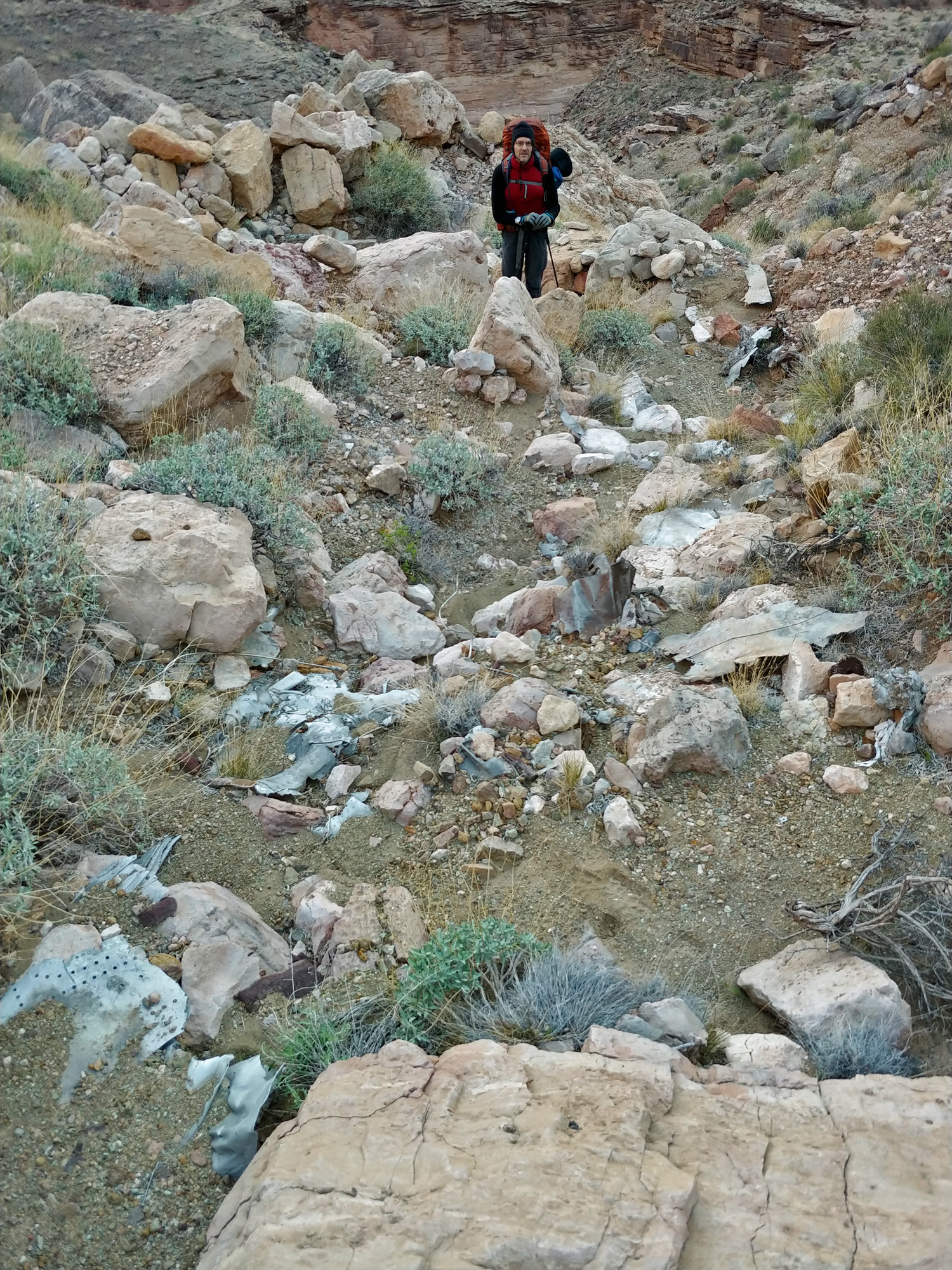 John pauses in the shallow ravine we crossed that contained debris from the 1956 mid-air collision between two commercial planes that killed all 128 passengers and crew aboard. |
 Chuar Butte gleams at sunrise. |
 Once on the Butte Fault route, there is a well-worn trail between Carbon and Lava creeks. This must be one of the few segments of Walcott’s old trail from 1882 which is still evident. |
 Heading west alongside Carbon. |
||
 The trail has a switchback! |
 Sometimes cactus is a problem. |
 Camp alongside Lava Creek. |
|
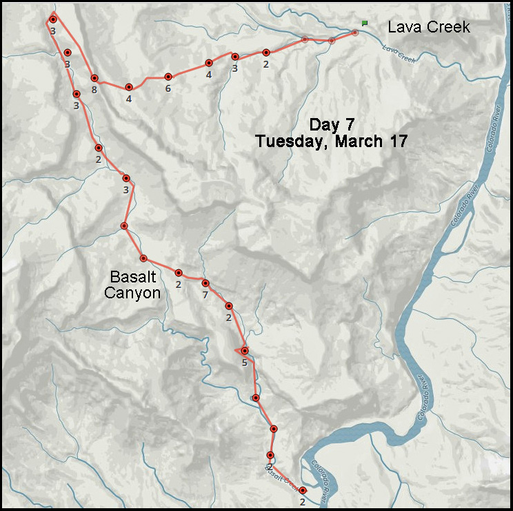
Day
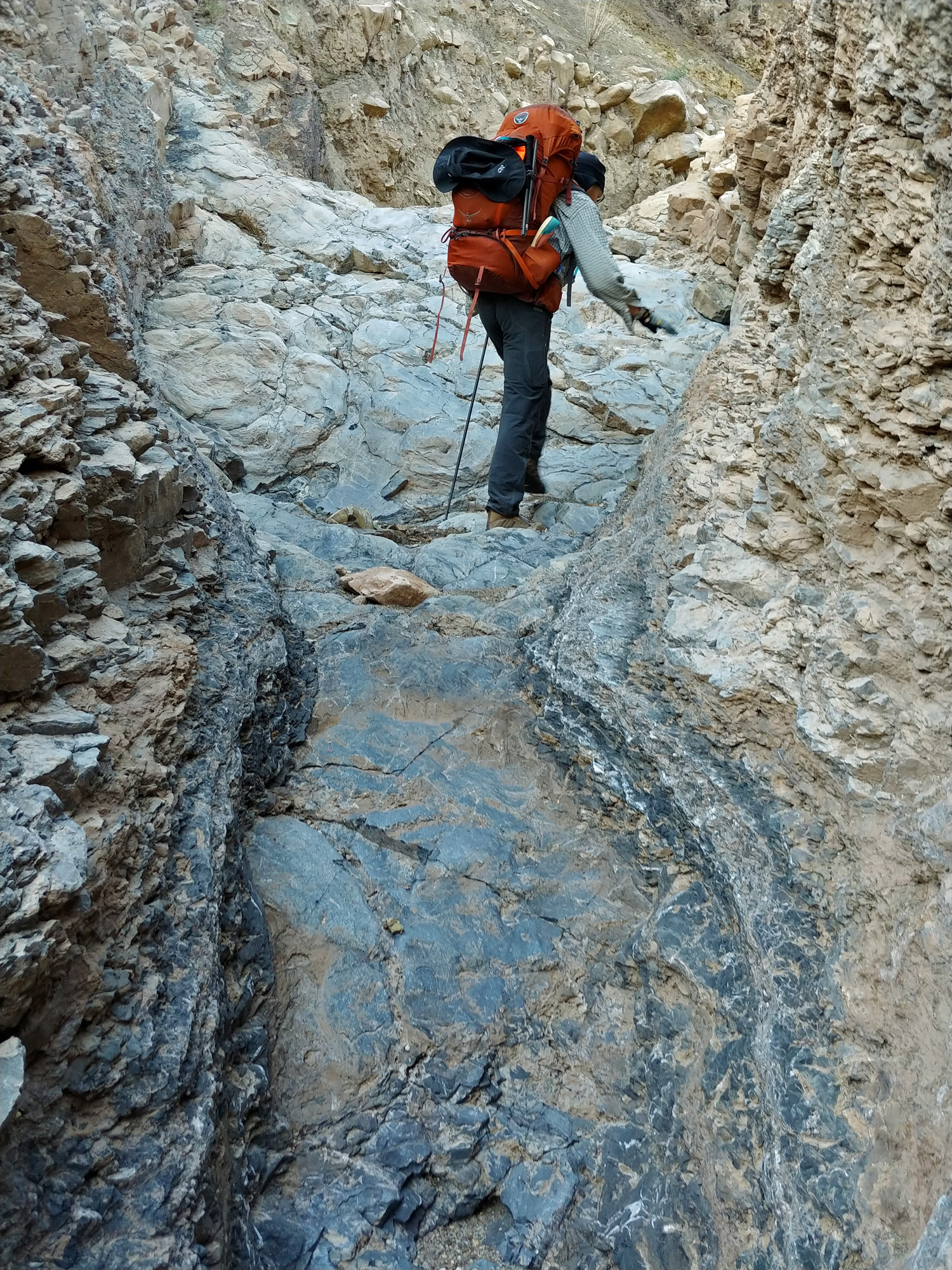
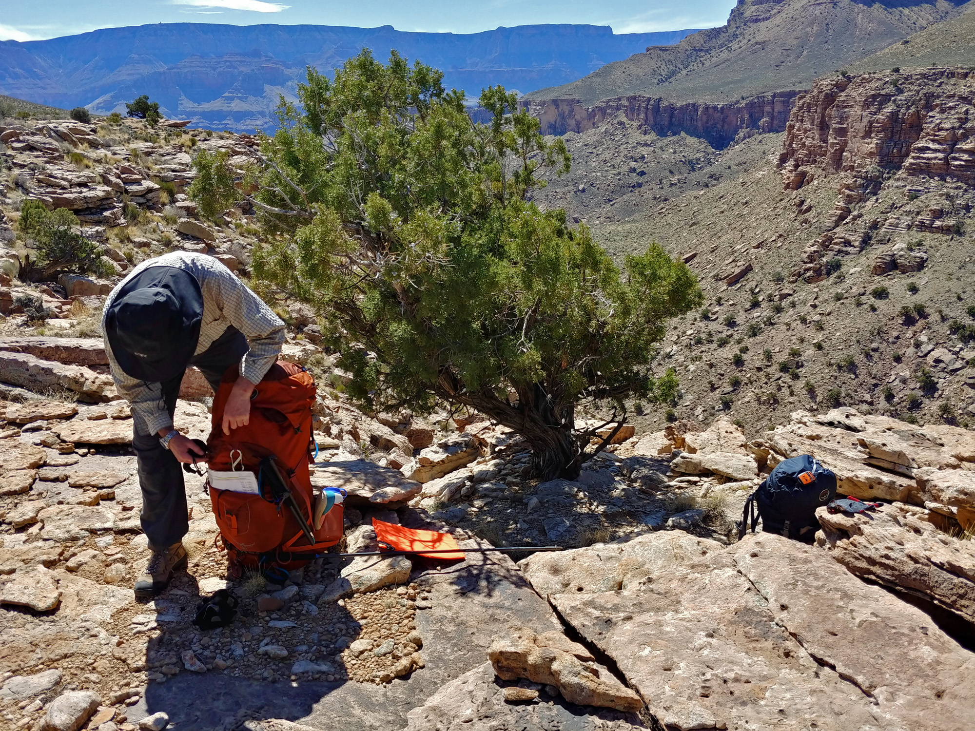
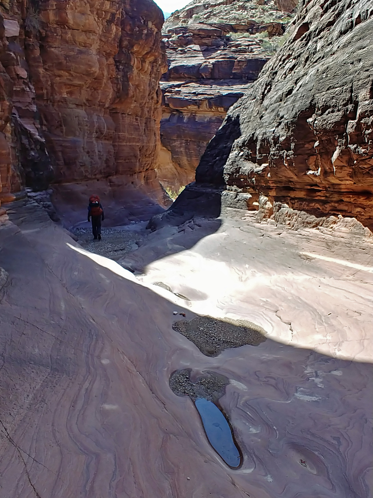
7 - From Lava Creek to Basalt Rapids (Tuesday, March 17): We are now mostly done with hiking along the river (except for day 8) and it is time to begin our canyon hopping as we proceed west towards Phantom Ranch. First up is to hike up to a high ridge and then down into Basalt Canyon, following it all the way to the river, which is going to be our next water source. It is also going to be where we had a river runner drop our food and supply cache a month earlier – two 5-gallon orange buckets from Home Depot. Once again we try for an early start, getting up at 4:20 a.m. and on our way at 7 a.m. We are headed up to a break in the cliffs to the west where I have been before. It has been suggested that this is also part of Walcott’s old route from 1882-1883 as he was able to lead his pack animals all the way to a steep chute that leads into Asbestos Canyon, which will take us a couple of days to get to. We started by walking up a nice, wide, sandy bed, with occasional climbs over small pour-offs. After about a half hour we began to climb up steep slopes, but ones that had good footing with lots of grasses growing around both the smaller rocks and the larger, gigantic, boulders. These slopes would lead to some flat area and then to another slope. This process went on and on and on, until we reached the steepest part of the climb at the break at 11 a.m. Once on top of the ridge we found shade under a tree – juniper I believe – where we decided to have an early lunch. At noon we left our shady spot and headed back up to the head of Basalt Canyon in order to find a way to the bed. That took us about twenty minutes. Almost right away we were met with challenges of big drops in the bed that required bypassing. That usually meant steep climbs and often heavy brush. We found that was the routine through what I call the upper valley of Basalt – easy walking down the bed and then a terrifying drop that must be bypassed. One spot in particular was so bad that we found a bit of a trail that bypassed two or three falls in a row. Where the canyon widens we are in the middle valley and need to find our way to the branch of Basalt on the east – the one on the west leads to a dead-end fall some distance down the bed. We first had to gingerly walk down a very steep slope made up of polished and fractured rock. Quite unnerving. We then had to cautiously descend the loose slope to the boulder-strewn bed. Thinking we had completed the worst of this we were disabused of that a few moments later when we came to a fall. We had to backtrack up the bed and climb out onto the other side from where we had entered. That leads to some gentle slopes. Gentle, but covered by long-thorned mesquite and the awful acacia, aka as catclaw for obvious reasons. We got only a few feet before we had to take off our packs and spend some time breaking mesquite branches to allow us passage to a slightly open area about twenty feet away. What a chore! But, when we got across this patch we could look down into the bed, below the fall, and see a cairn atop a boulder at the bottom of the ravine right in front of us. We made our way down this side ravine and found ourselves back in the bed. We still had some minor obstacles, but we were able to continue down this until you get to three major falls that finally dump you into the lower valley of Basalt. At two of these we lowered our packs. All three have obvious bypasses, but none of them look very safe. The first requires some steep steps down “lousy, crusty soil” as I wrote in my journal. The next involved a short slope of loose rocks and the last required inching our way down on a large boulder until the toes of our boots could just reach a spot where we could then scamper to the bed. Even past these obstacles it still took the better part of two hours to reach the river, which we did at 6 p.m. just before darkness fell. We found a great place to camp and John went in search of our caches while I headed to the river to fill up buckets of water. We definitely need to use the alum on this water. At 2 a.m. I was up and checked the water and the sediment had perfectly settled in both of our buckets. I gently scooped out water for my four liter gravity filter bag, hung it up and went back to bed. I think that we were both down to our last 16 ounces and it will be great to have something ready to go for breakfast. |
|
|
||
|
Click on any picture to see a larger image. |
||
|
|
||
 We headed up a drainage just a few yards from our camp. The walking was great and we were able to go quite far up here before climbing in earnest. |
 What pouroffs we did have to get by were not difficult. Often all we had to do is just walk right up them as in this case. |
 Many climbs ended in flat sections. |
 The break we are heading for. |
||
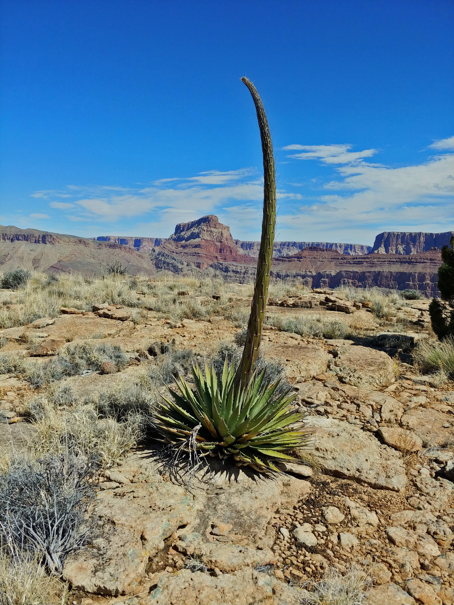 We saw a lot of young agave plants over the course of our hike. This one was on top of the ridge between Lava and Basalt and close to where we had lunch. You can see Chuar Butte dominating the background. |
 Looking south ... at the Watchtower! |
 The upper "valley" of Basalt mostly involves walking down a wide gravelly bed, punctuated by big drops that must be bypassed. Those can be quite a pain. Mostly I remember this part of the route. |
 Our lunch spot on the ridge. |
||
 Boulder filled main ravine. |
 A side ravine to the main bed. |
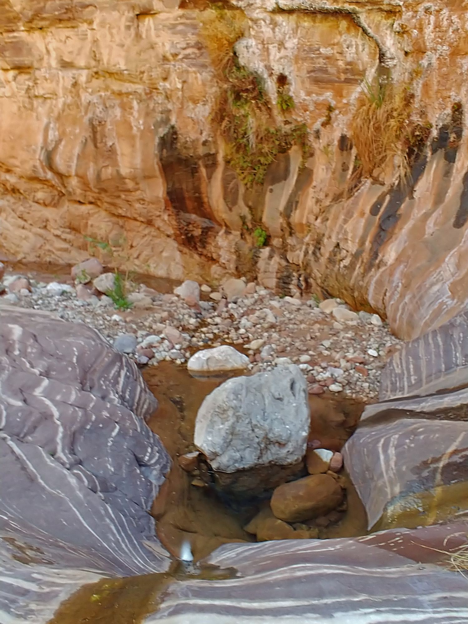
 Water ... briefly, then dry falls. |
|
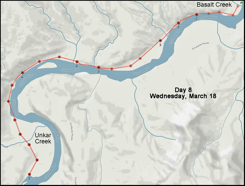
Day
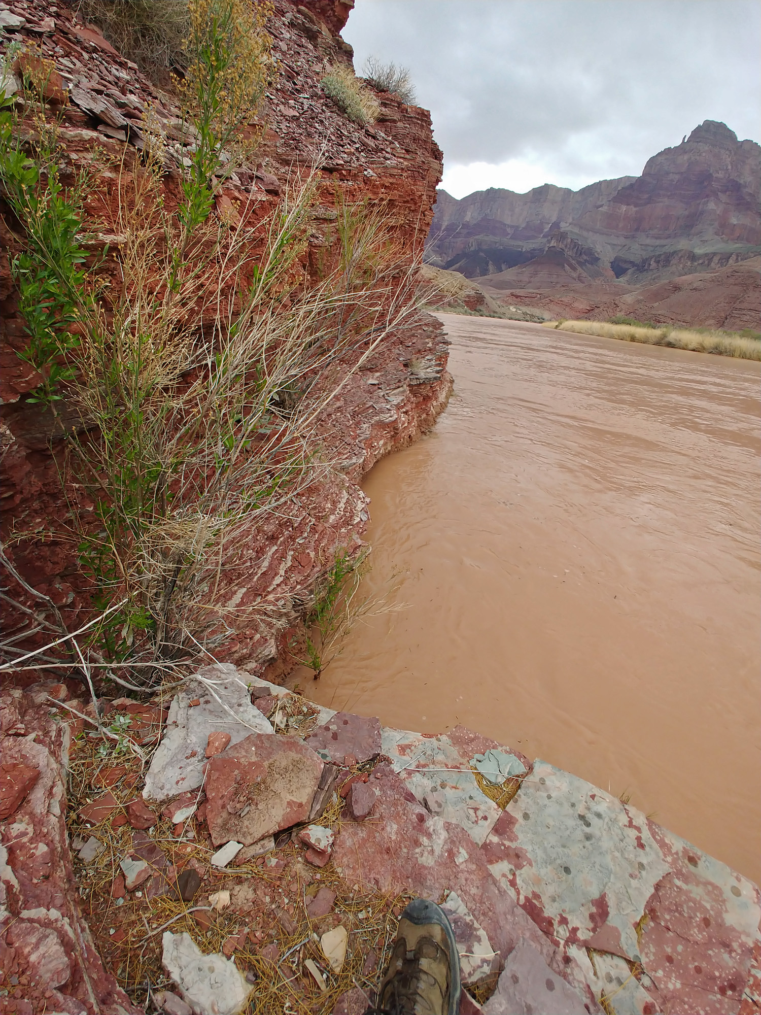
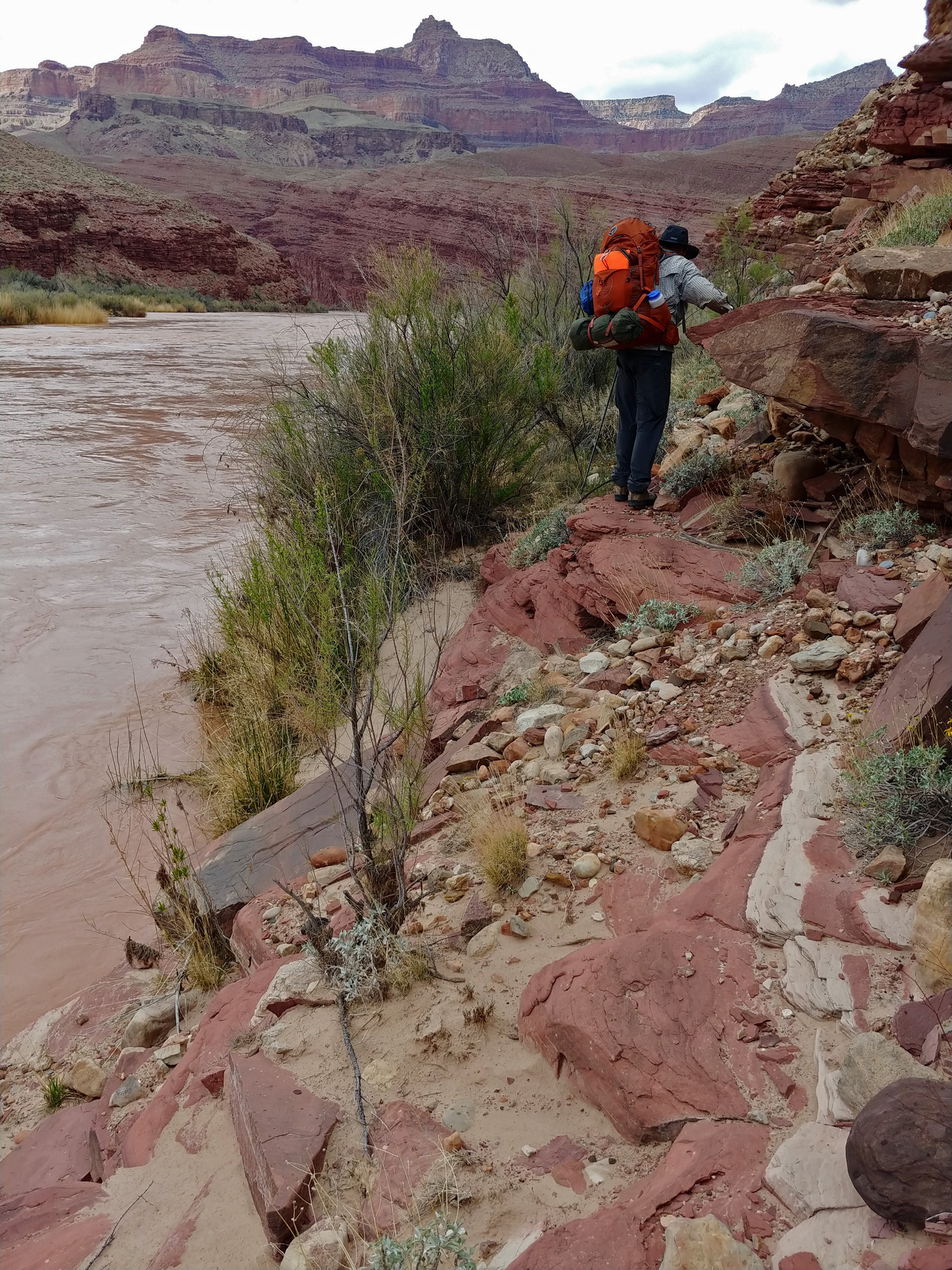
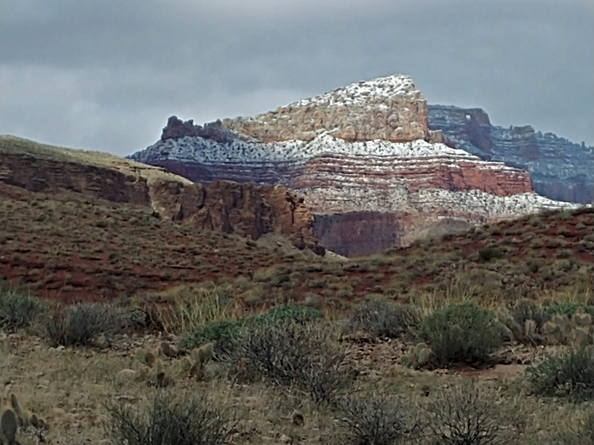
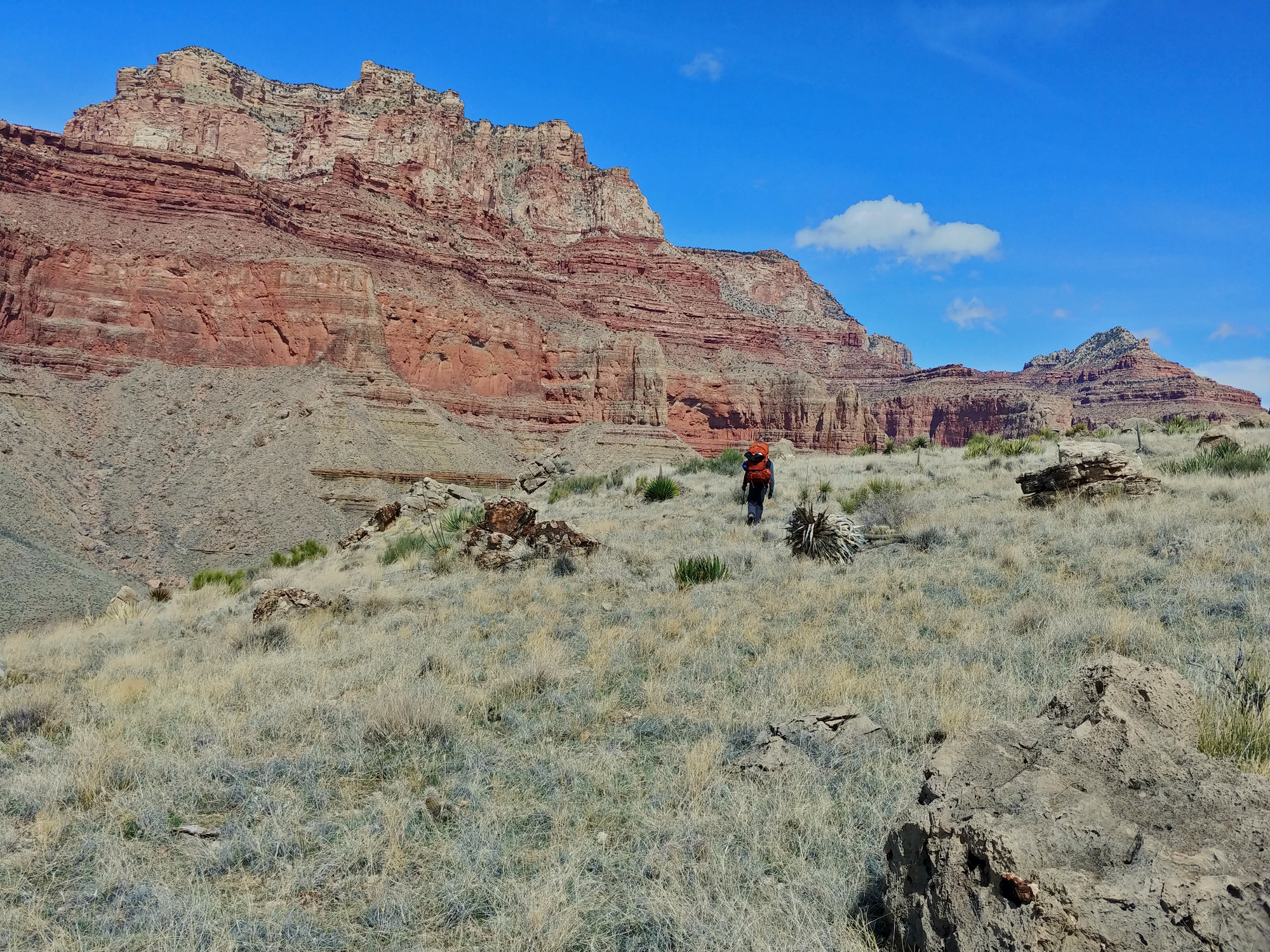
8 - From Basalt Rapids to Unkar Delta (Wednesday, March 18): It shouldn’t take us all day to reach our next objective – Unkar Delta. So, we slept in and we spent some time going through our caches and didn’t get on our way until 10 a.m. We had some special goodies that we ate right away and we both packed a couple of clothing items, although I never did feel compelled to change mine. [TMI?] We repacked our buckets with trash and anything we didn’t want to carry with us (including John’s busted pole) and left them at the same place, since we know what the GPS coordinates are. After we return we will seek out a river party that would be willing to pick them up for us. This day’s hike is straightforward, but not necessarily easy. We will follow alongside the river between Basalt and Unkar. Much of the time we will be fighting our way through thick brush while hemmed in by small cliffs on one side and the river on the other. We have two particularly bad spots along this route. The first, which will come within an hour of leaving is a narrow ledge above the water that gets more narrow as you reach the end and then puts a bush in your way. My thought was that if we decided to turn back, we would be able to return to Basalt and take a higher, although longer, route over to Unkar. When we got to the narrow ledge, which wraps around a bump out, I waited until John got through because the last thing I wanted to do was turn around while on the ledge. We had decided to unbuckle our packs just in case we fell into the river. After waiting a bit I headed around the bend and found that John was stymied by the bush. John likes rocks and I tend to like bushes. After looking it over a while he decided that the bush was okay to hang onto as he stepped onto a spot that was probably only a few inches wide and then over to safety. Then I did the same. One obstacle down. The route got better when we hiked across a long beachy area, and then we were by the cliffs again. As we got closer to Unkar we came to the second tricky spot. We followed a slight ramp in the rocks up above the river and then it dead-ended. After a moment’s reflection I realized that we were at the spot where you can wade through the water to the other side of this spot. Given that the water was very brown, you can’t see it, but I have been through here before and felt confident that we could do this. I took off my boots and unzipped the leggings of my pants, put on some aqua shoes and, with my pole constantly probing the water, waded through here. Woo hoo! Quite soon after passing the wading spot we came to a rather nice river camp. This turned out quite nice for us as from here we were able to follow a well-worn trail all the way to Unkar Creek and the many ruins that dot this site. But, as we arrived, the rain started to fall. By 4:15 p.m. we had found a good camping site at the lower end of the Unkar Delta and hurriedly set up camp. Some things got a bit wet, but I was finally able to try out the system of hooking my poles to my footprint and then covering it with the rainfly. Then I ducked inside with my pack and managed to set up the tent from the inside. After about an hour the rain stopped and we got some water from the river and doused it with alum and let it sit. After another hour, at about 6 p.m., the clouds lifted and we could see snow on the south rim, coming down to below the Coconino! Before turning in for the night I pulled out my sewing kit to repair my hiking pants, which are not only getting tattered daily but had just split down the backside. My crude mending held up for the rest of the trip! |
|
|
||
|
Click on any picture to see a larger image. |
||
|
|
||
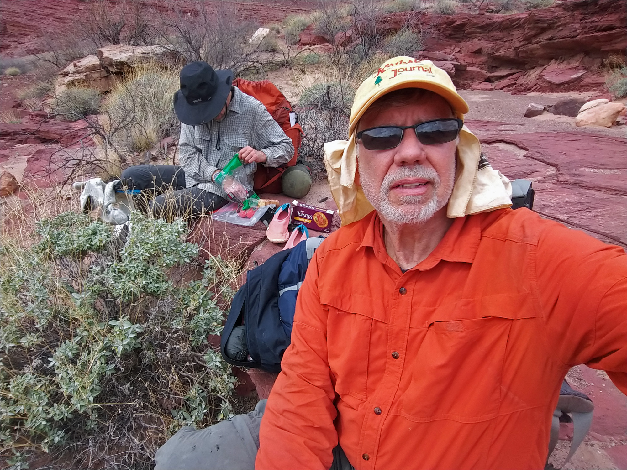
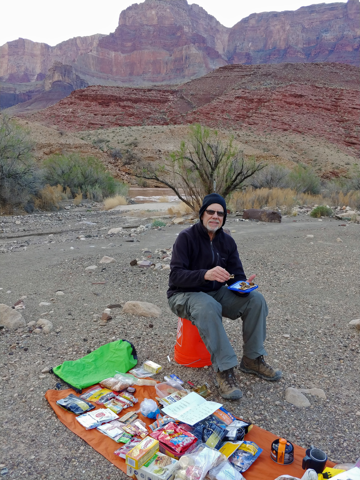 Basalt was critical to our hike because we had made arrangements for someone to drop off a food and supply cache for us. Here am I sitting on my bucket the next morning, snacking on some smoked oysters and triscuits. |
 John replaces buckets ... for later. |
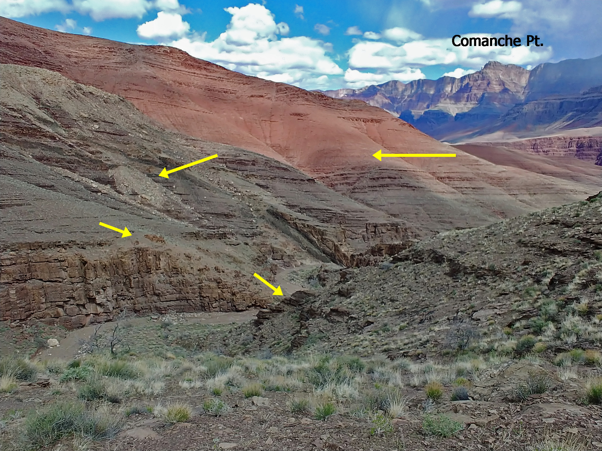
 Looking back at the narrow ledge, and the awkward bush that was sort of in our way and sort of helpful in getting us across to relative safety. That's Comanche Pt. dominating the view across the river. |
 Old miner's cabin at Basalt. |
||
 Typical hiking when along the river. This is actually a pretty nice spot as we aren't concerned about falling into the river nor are we fighting our way through the brush. |
.jpg) We reached a spot where a little sand bar allowed us to merrily ramble across this section. Too cool to pass up even without the brush. "The easiest steps of the whole hike." [JE] |
 Selfie at lunch time. |
 Wide-angle view of the last stretch. |
||
 There are lots of ruins at Unkar, but time and rain would not allow for us to do more that see the ones we passed by. Our trail came in above the delta and then down by these ruins. |
 Another set of ruins. |
 It doesn't seem like much, but whenever we set up camp it felt so good to lie down and stretch out. Really, who needs more? In fact, my pack is right behind me! |
 Our camp at the west end of Unkar. |
||
|
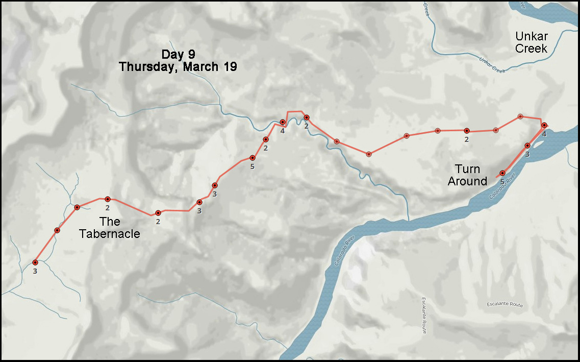
Day
9 - From the Unkar Delta to the Valley Below The Tabernacle (Thursday,
March 19): We had a light
rain pretty much all night long. When it stopped at about 6 a.m. we got
up and got started for the day. It shouldn’t be a long one – our plan
is to hike downstream to the next canyon (nameless) and then up a long
ridge to get onto the now materializing Tonto Plateau and back down into
Asbestos Canyon, where we’ll get our next water. Our plans went awry
rather quickly, but first it was time to eat, filter our water and pack
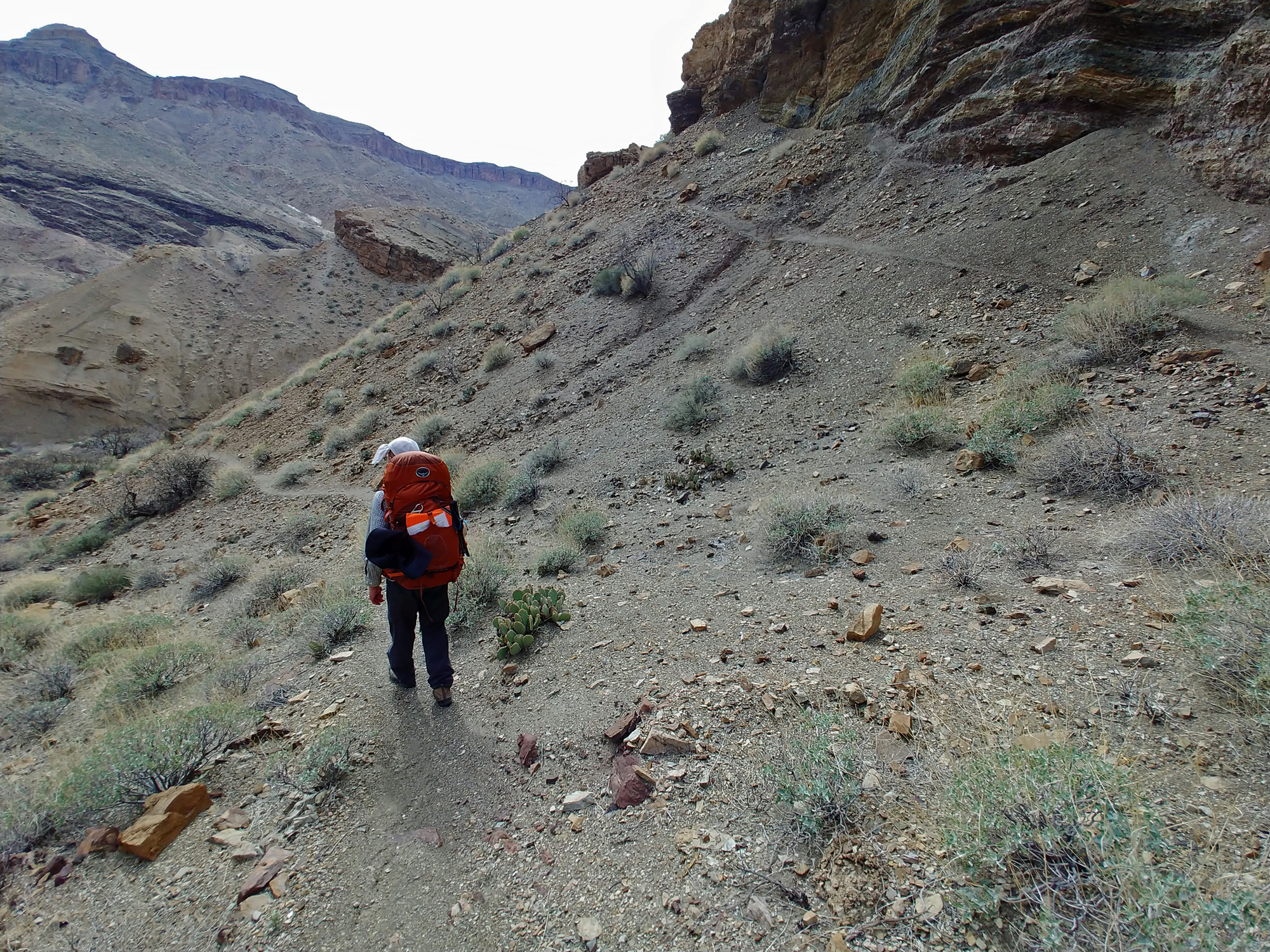
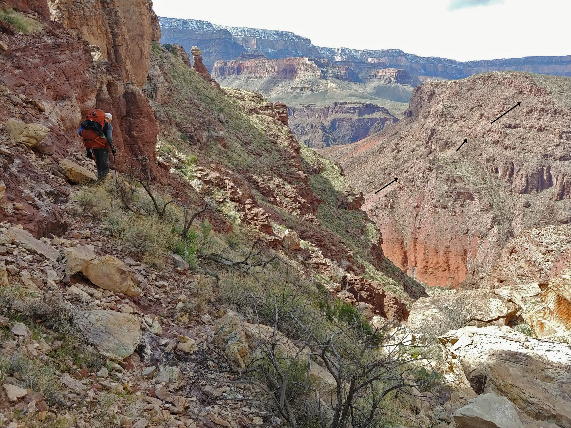
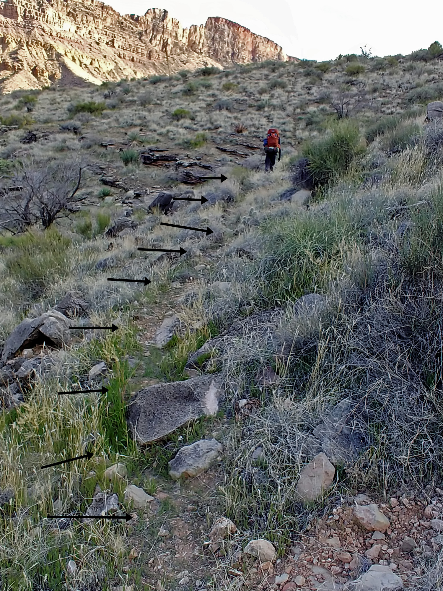
up our camp. By 9:30 a.m. we were on our way alongside he river. We faced the usual challenges of whether to stay right at the edge of the river or look for passage behind the trees and brush. After about 30 minutes we came to a spot where our route led up above some small cliffs over the water. The route worsened and dead-ended in a big drop. John suggested that we might use our 50 foot length of webbing to get down in a couple of places, but I was unconvinced. I had been through here twice before – years ago – without incident and there was nothing in my old notes about this being a problem. One thing we did have was a couple of photos on my phone of the old map Harvey Butchart made during his many years of exploring the canyon. I had downloaded some scans from key sections of our hike and this was one of them. While he did the river route, we saw that he had also once crossed over into this unnamed canyon from the gentle slopes west of Unkar. We decided that we would do the same. So we retraced our steps and returned to our campsite. At 11 a.m. we on our way for the second time today, now well behind schedule. [Later I would learn from two other hikers that I missed a bypass ravine on the river route. Doh!] Hiking over the hills wasn’t hard. It took us about forty-five minutes to reach a saddle where we could look over into this next canyon. Across the way we saw two routes that followed up ridges to the Tapeats – one that would go directly to a formation called The Tabernacle and one that topped out a little south of that. But the canyon in front of us was deep and the bed was flanked by sheer cliffs. Harvey’s old map showed that he went back into this canyon quite a ways before crossing and so did we. Eventually, after we saw a route exiting out the other side we found a way to get down on our side. We crossed the bed of this canyon at 1:10 p.m. and started climbing up to the ridge that we could see leading directly for The Tabernacle. We couldn’t quite see what was going on up in the Tapeats cliffs, but we were hopeful that a viable route would exist there. When we reached the ridge at 2 p.m. we stopped for a half hour to have a late lunch. Then the most amazing thing happened – we put on our packs and we were suddenly hiking on a real trail! It led us right up to, and through, the Tapeats with no problem. I had been through here twice before, many years ago, and I must have used the other break while coming up from the river and had no clue about this trail. This route is much better and, as we have experienced before, maintained by river runners – ones that are wanting to climb up to the top of The Tabernacle. And once again I am quite sure that this is also a vestige of Walcott’s trail/route from 1883 when he was able to take his pack animals as far as the Tonto Plateau above Asbestos Canyon, which is where we are headed. The trail took us up to the plateau and then started to wrap around to the west side of The Tabernacle and make its ascent to the top. Should we do that as a little detour? No. We had planned to get to Asbestos, and water, for this evening, but instead we’ll be dry camping somewhere along the plateau surrounded by The Tabernacle, Sheba Temple and Solomon Temple. So, at a convenient spot we left this fine trail and plunged down into the main ravine as we headed for Asbestos. The terrain here is pretty gentle and the hiking is not hard, except that you need to wend your way through rocks, bushes, cactus and small drainages. It did look like we might have trouble finding enough space to actually set up a camp that was out of the main bed. The threat of rain seemed real to us, so that impacts where you want to pitch your tent! A bit before 5 p.m. an opportunity presented itself for a campsite and we decided to take it. In retrospect maybe we should have climbed up to the top of The Tabernacle. So it goes. As it turned out, the night was mostly clear, but a bit colder. |
|
|
||
|
Click on any picture to see a larger image. |
||
|
|
||
 The initial section along the river was great for hiking – open space with sand and good rocks to walk on. That would change and we would be forced back to our campsite to start over. |
 Snow ... and Angel's Window! |
 Now we can see our route up to The Tabernacle on a long ridge. The jumble at the Tapeats cliffs looks doable and we would find an actual trail through here. In years past I have come up farther to the left. |
 Easy hiking ... look for John! |
||
 Annotated route through this canyon. |
 Here is John on the trail as we began to exit from the jumble of Tapeats. The trail is likely yet another vestige of Walcott's route from 1883. |
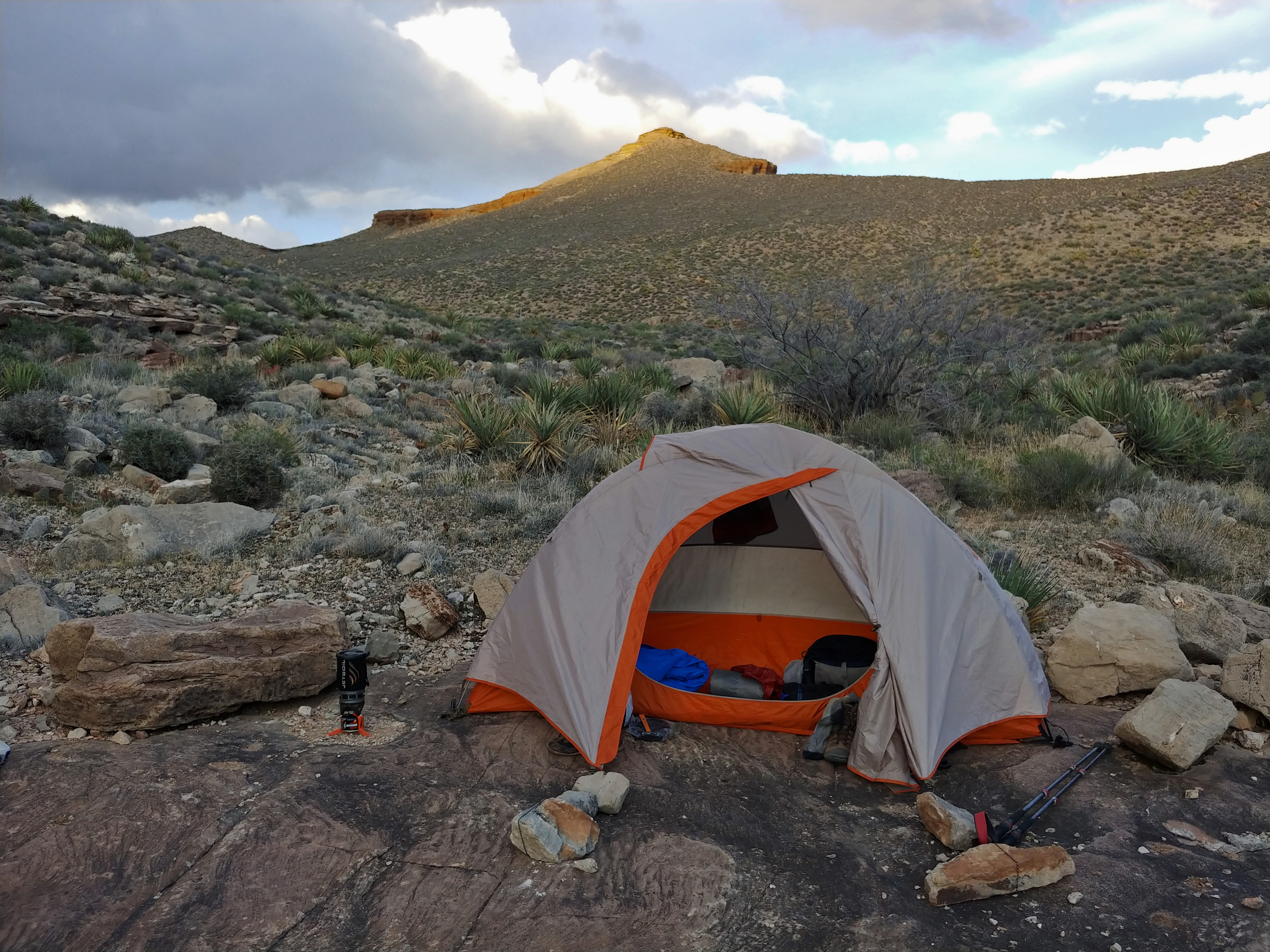 The sun sets on The Tabernacle behind my tent. The hiking here was good, but finding a decent camping spot was a challenge. It was OK, but cold when my mattress went flat. |
 Happy hikers on a trail through here. |
||
|
Day
10 - From the Valley Below The Tabernacle to the Tonto Plateau West of
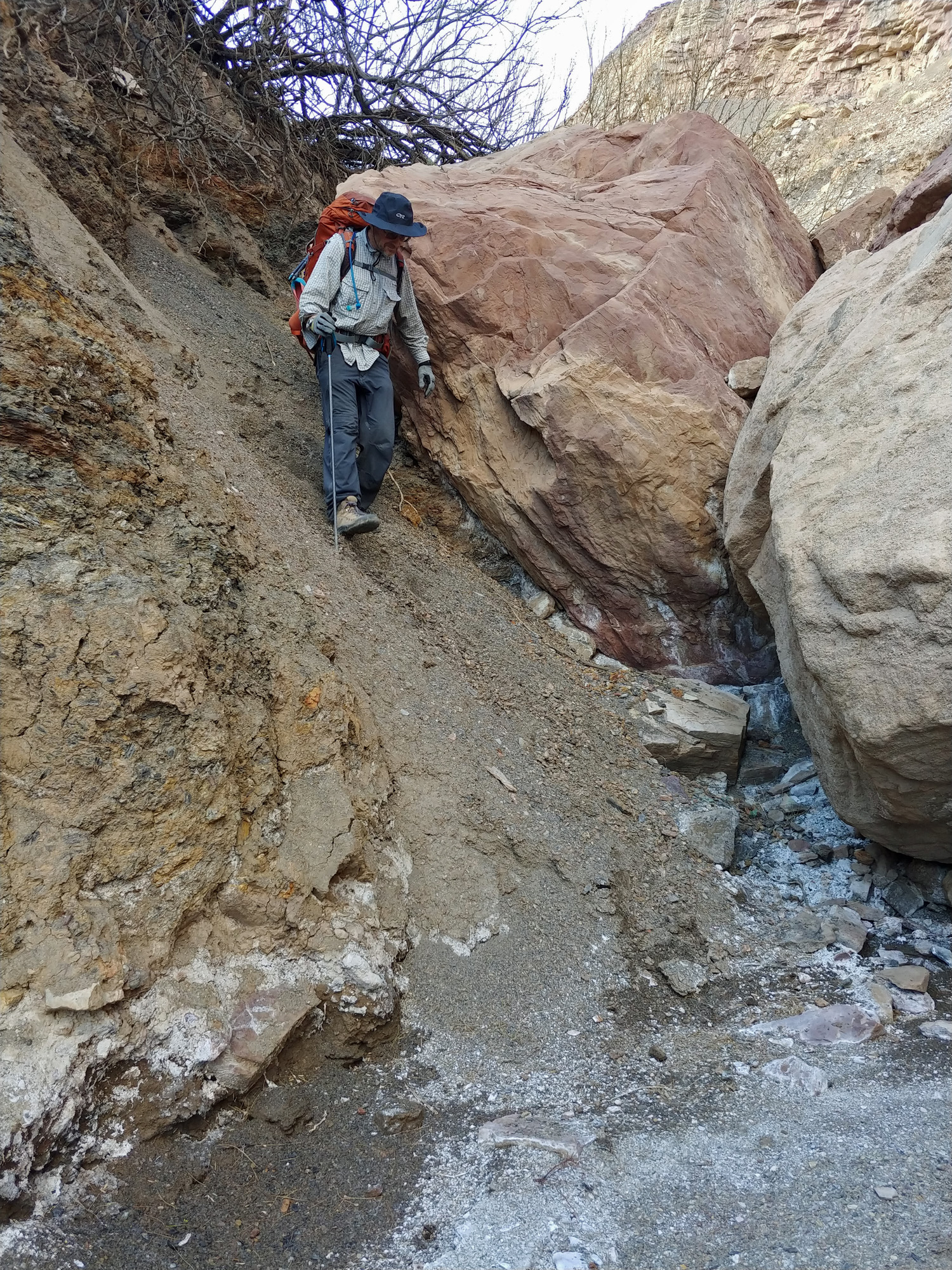
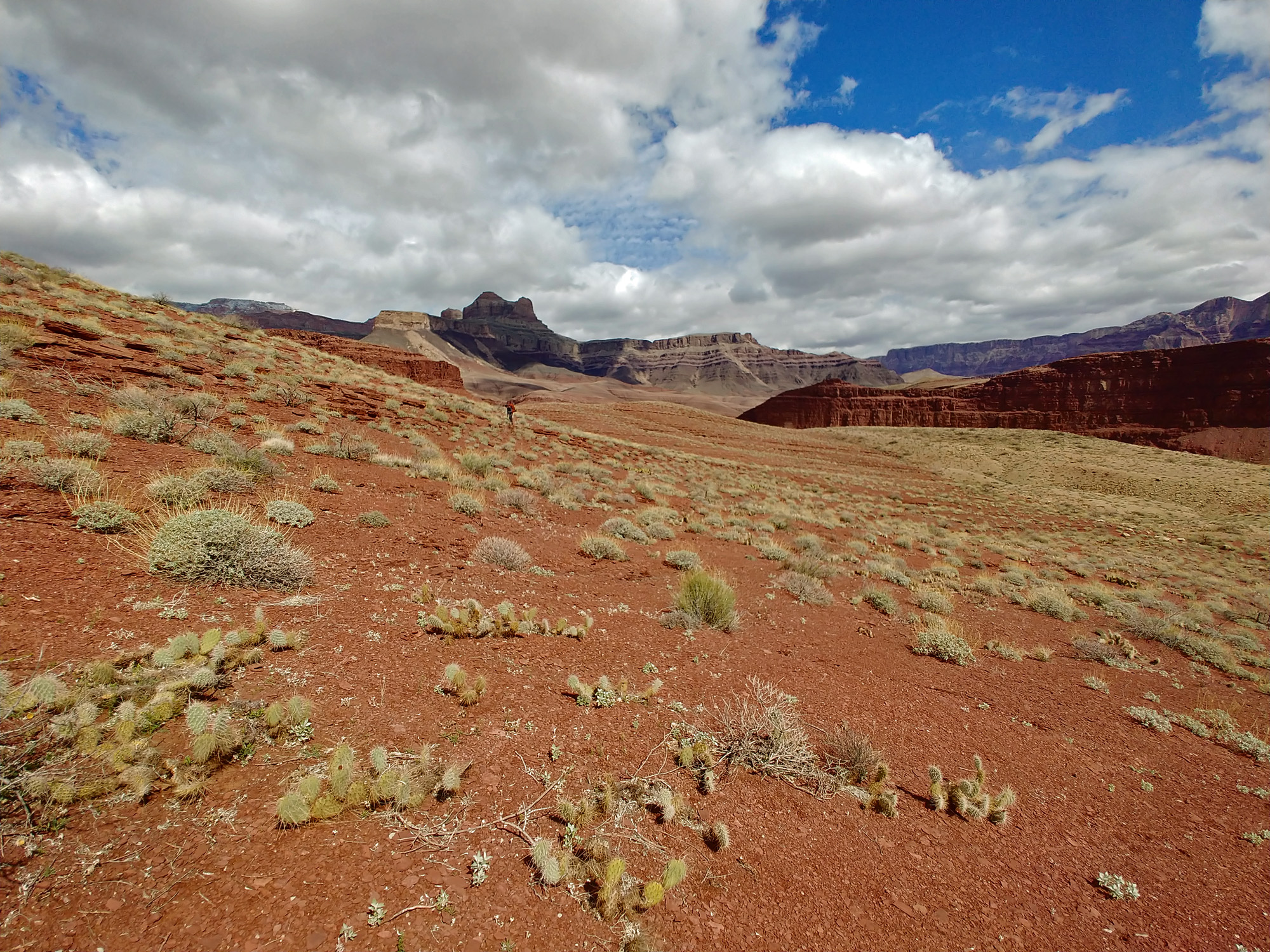
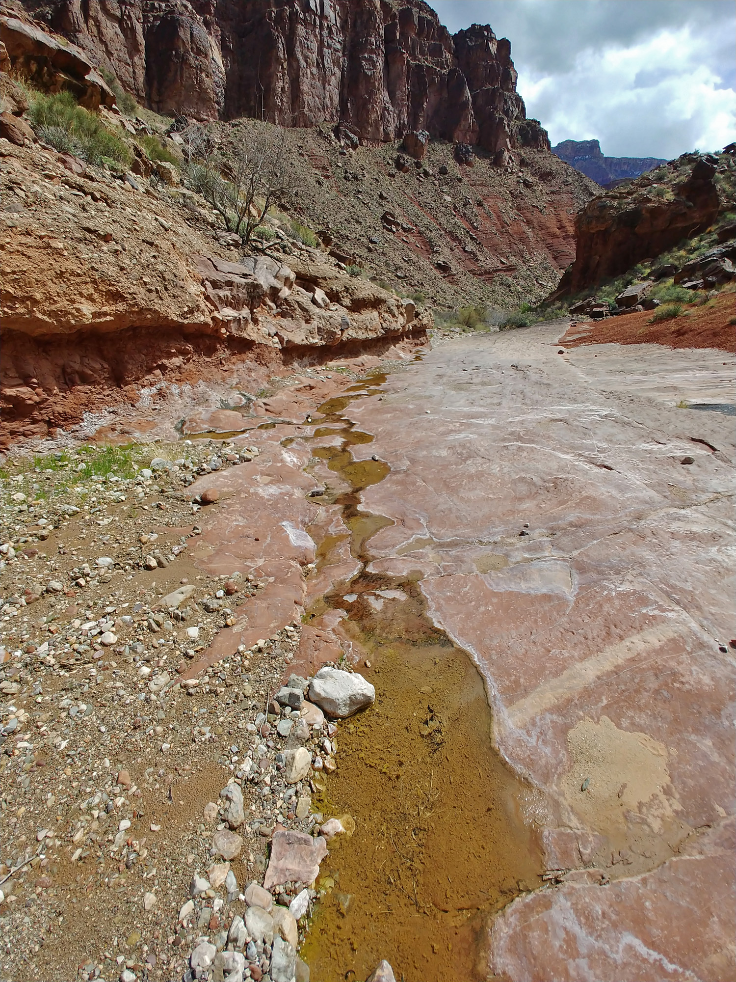
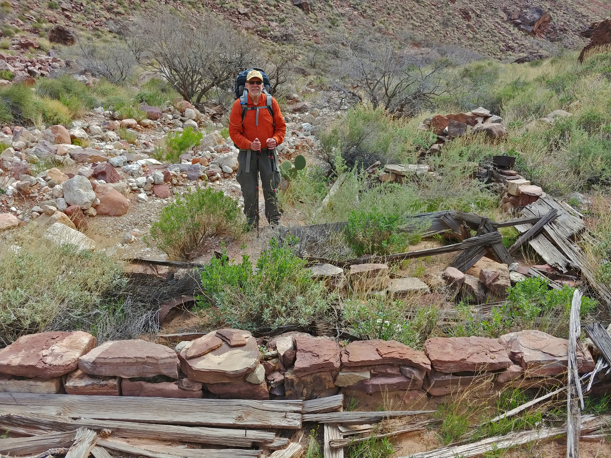
Asbestos (Friday, March 20): Because of our having to backtrack from the river route yesterday, we are now about a half day behind our schedule. There are no layover days left on our itinerary and we will not be able to make up this time. Also, instead of starting and ending each day at water we will be dry camping and passing a water source in the middle of each day. That means heavier packs in the afternoons. We were up at 6 a.m. with generally blue skies, but with much of the south rim shrouded by thin layers of transparent clouds. By 8:30 a.m. we were all packed up and on our way. In my journal I wrote that we were probably three hours away from Asbestos. That turned out to be too optimistic by about 50%! After an hour and a half of contouring around Sheba Temple we reached the head of a very steep ravine that plunges over a thousand feet down to the bed of Asbestos Canyon over a horizontal distance of less than a half mile. That would take us nearly three hours! Back in 1883, Charles Walcott was surveying the eastern part of the Grand Canyon for the U.S.G.S. He was able to get his pack animals as far as the plateau here above this ravine. He would scramble down to the bed of what to him was an unnamed canyon and that would be as far as he would go during the 82 days he spent below the rim. We reached the bed of Asbestos a bit before 1 p.m. and didn’t leave until 3:20 p.m. Part of that time was consumed with filtering the little trickle of water here for our dry camp this evening. Of course we also spent time having a late lunch. But, one of the highlights of this trip was poking around John Hance’s old mining camp here. The main camp structure outline is still here. So is an old stove, large pot and pan and a shovel head. We had hoped to get here for our camp the day before and have some more time to explore, but we will have to content ourselves with this short visit. One of the unusual facts about the Grand Canyon that most don’t know about is that this area is technically not part of the park. It is what is known as an “inholding” – privately held land surrounded by public lands. It doesn’t have any practical effect, but interesting none the less. Climbing out of Asbestos to the west was a real challenge, both physically and mentally. I have done this route out three times, but the last time was 27 years ago, in 1993. My memory of the exit is that it was no big deal, and actually rather enjoyable. I recorded in my notes from that last trip that, “[T]he climb out was fairly straightforward – didn’t really make any mistakes on the way up … It was a nice cool climb.” For this hike, I wrote in my journal, “Harrowing climb!” The footing was poor. The rocks were loose. I was constantly uttering under my breath, “Make good choices.” In places I was mentally mapping out my route only 2-3 steps at a time. It took us over two hours to exit Asbestos. We reached the Tonto level at about 5:30 p.m. After that, we only hiked for a half hour before finding a nice camping spot on a point overlooking a shallow canyon west of Asbestos where some of Hance’s old mines are located. As you would already have figured out, he mined asbestos here. |
|
|
||
|
Click on any picture to see a larger image. |
||
|
|
||
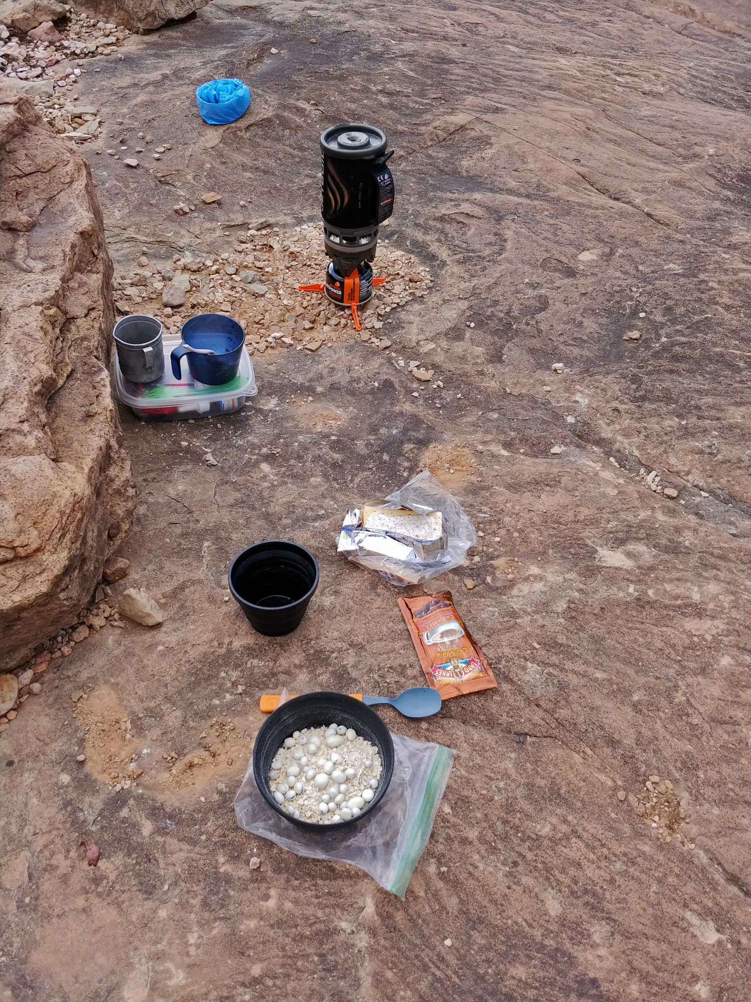 The kitchen is all set up for my usual breakfast of oatmeal with yogurt-covered raisins, pop tarts, and a package of hot cocoa. Well, it works for me. |
 Clouds shroud the south rim. |
 And, so it begins. This is the start of the very steep, and very long, ravine that will lead to the bed of Asbestos. Someone took the time to put up a cairn here. |
 The Valley of The Tabernacle. |
||
 John begins our initial descent through the top of the Tapeats. There wasn't a lot of decision-making for us to do and we did have the benefit of an occasional cairn to direct our efforts. |
 Our exit is marked on the other side. |
 The water in Asbestos. It comes from a spring near to where we reached the bed. On past hikes I have noted that it wasn't very tasty, but we found it to be quite good on this hike. |
 Near the bottom of this descent. |
||
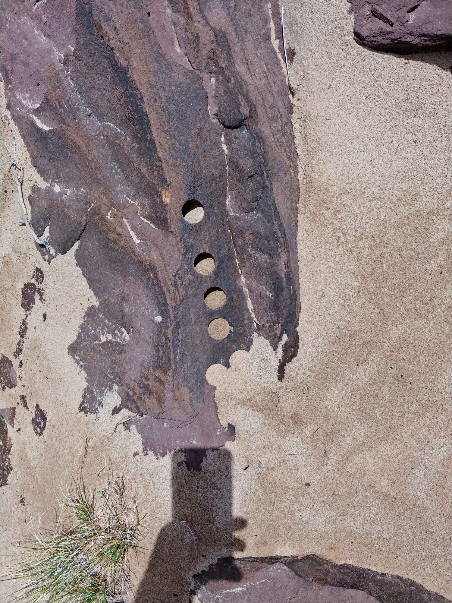
 At the remains of Hance's old camp. |
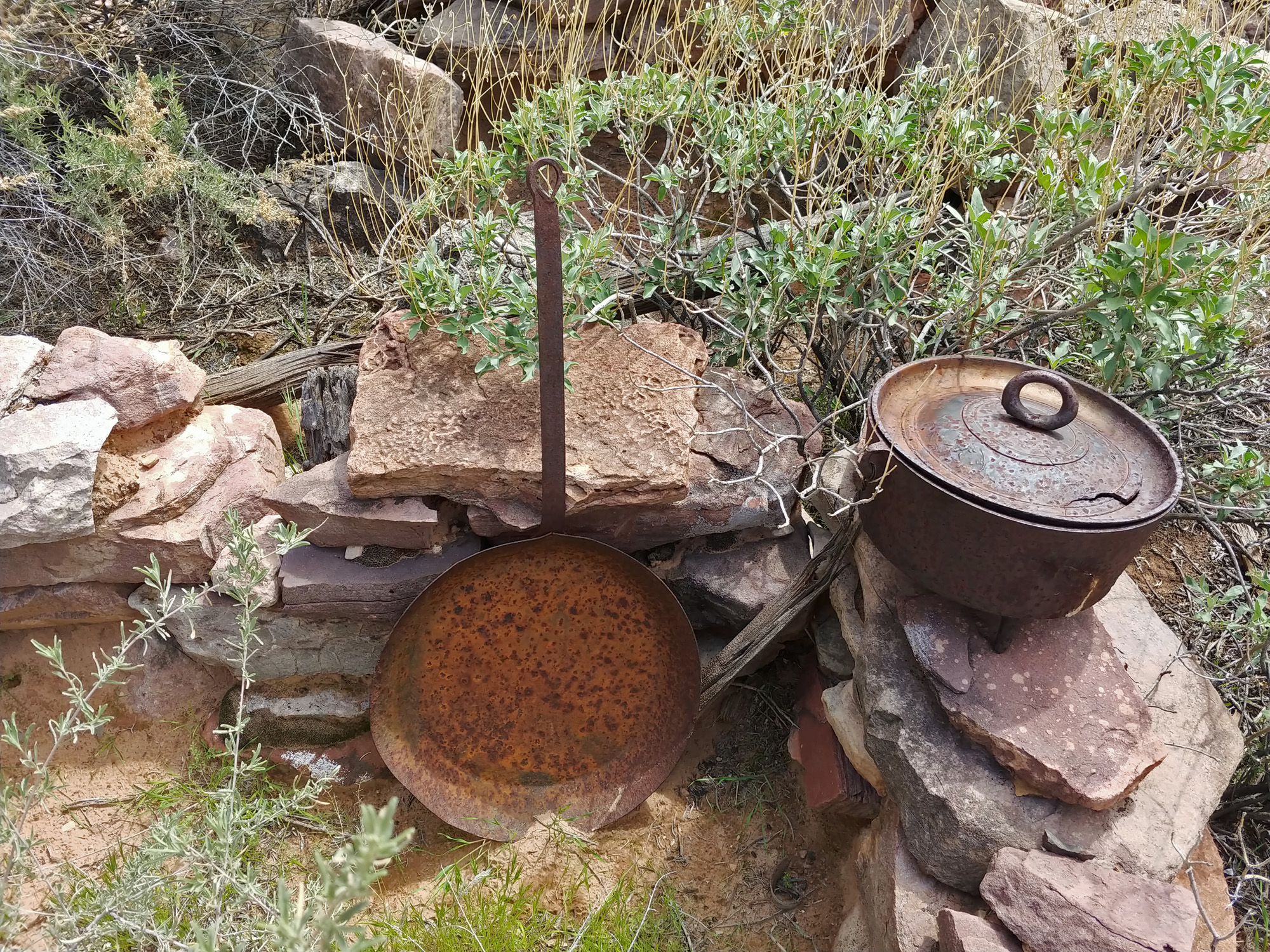 Giant pan and iron pot. |
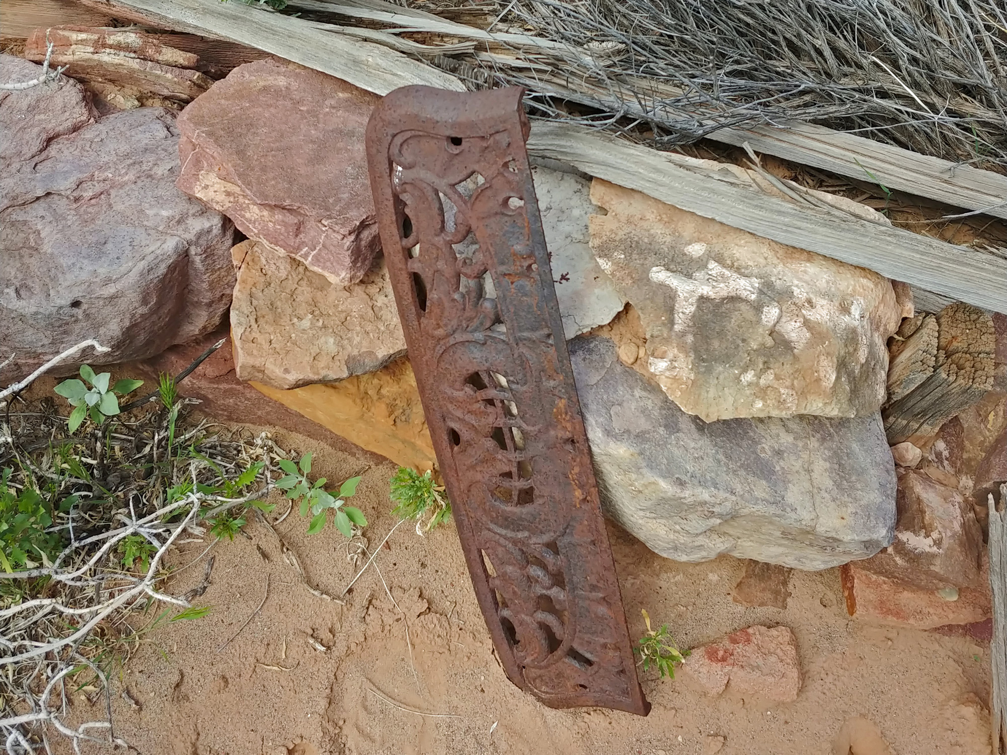 Part of the old stove. |
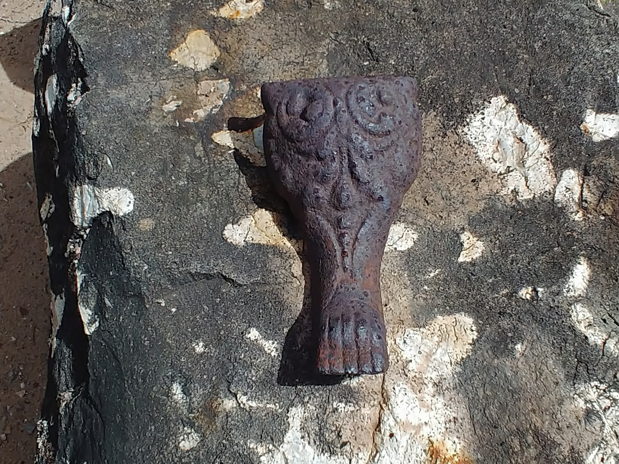 Part of the old stove. |
 Part of the old stove. |
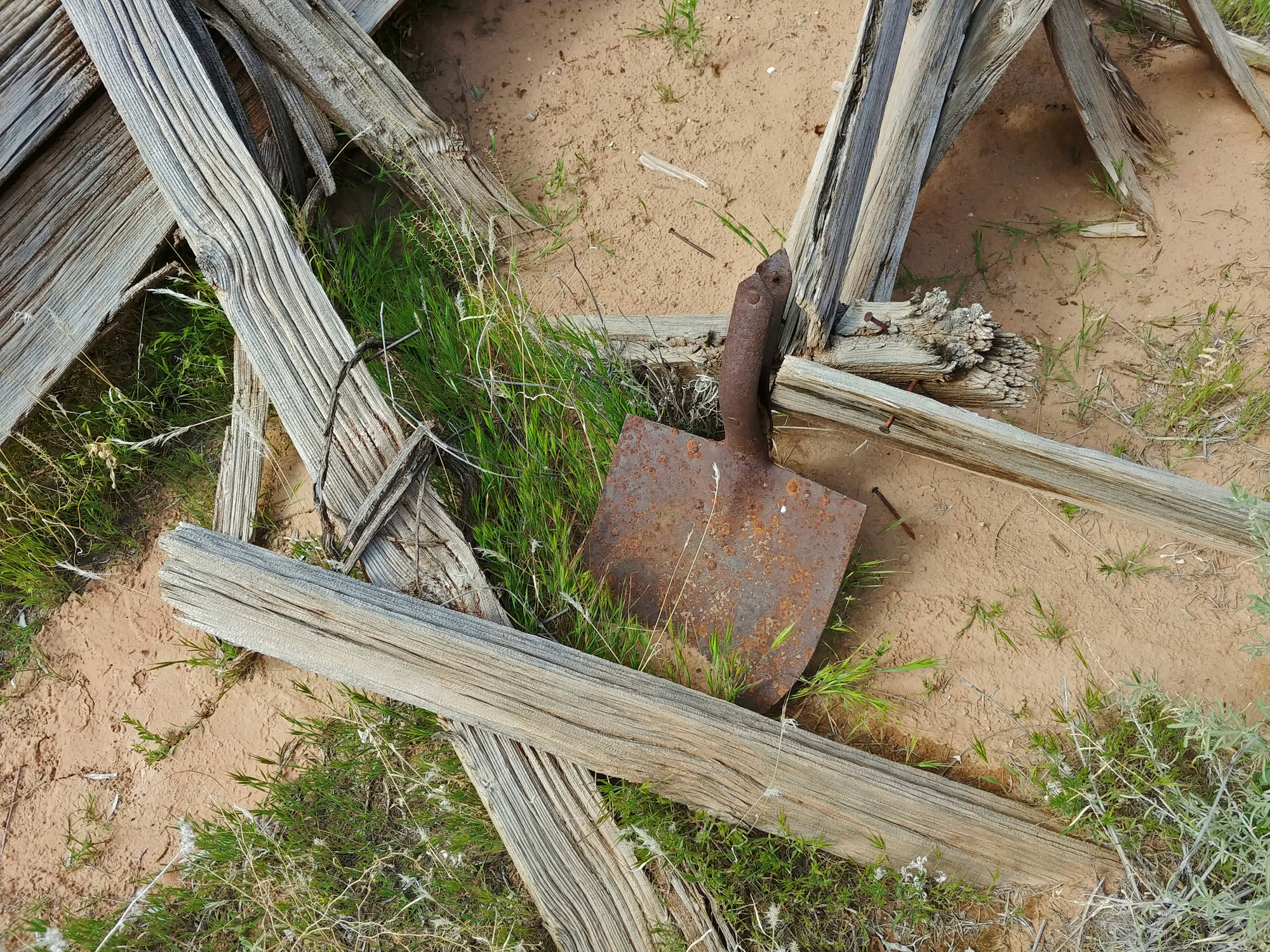 Shovel head. |
 Some kind of pole. We saw a few. |
 Hmm ... sheltered in a cubbyhole. |
 An agave point the way. |
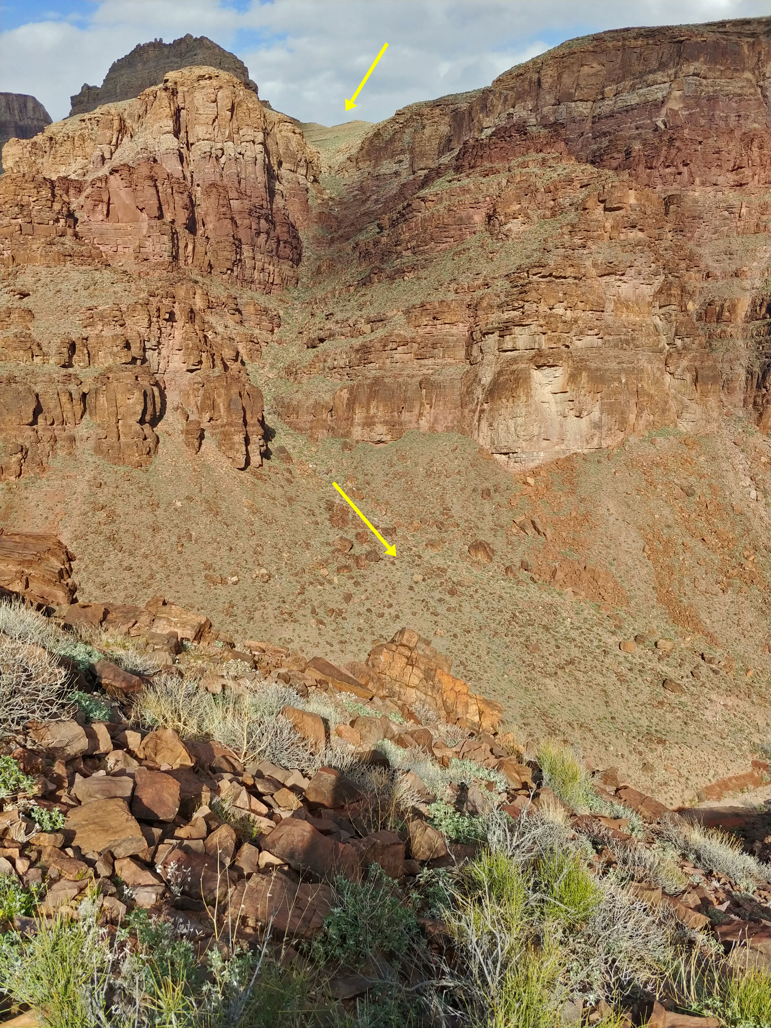 Here is a brief annotation of our route down the long and steep ravine from the east, as taken from our exit to the west. It looks much worse than it felt, although parts were sketchy. |
 Looking back down at the bed of Asbestos and a little bit at the route we had come up. Very loose rock throughout and made me quite uncomfortable. |
 Camp with a view of Angels Gate. |
 Our camp is near a scenic overlook! |
||
|
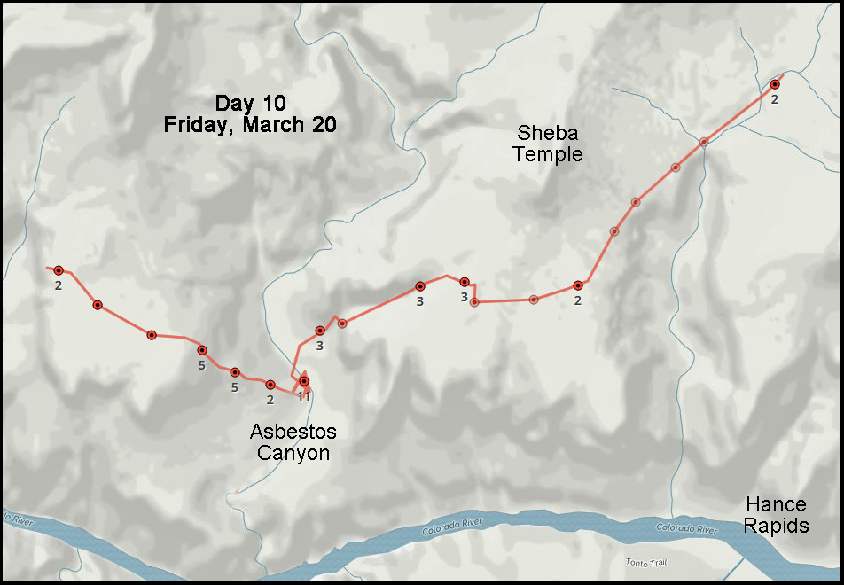
Day
11 -
From the Tonto plateau west of Asbestos to the Tonto plateau east of
“Double Disappointment” Canyon (Saturday,
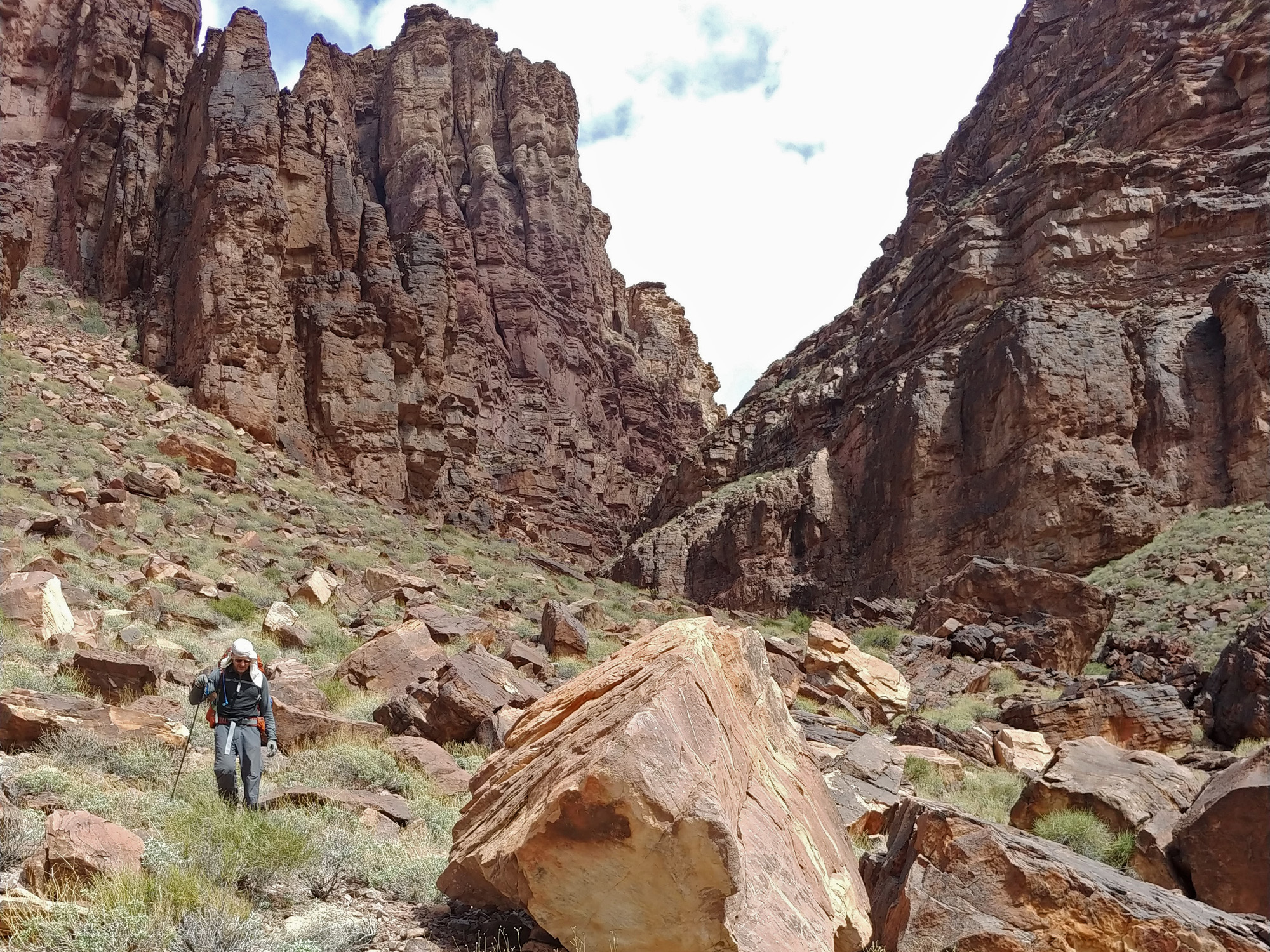
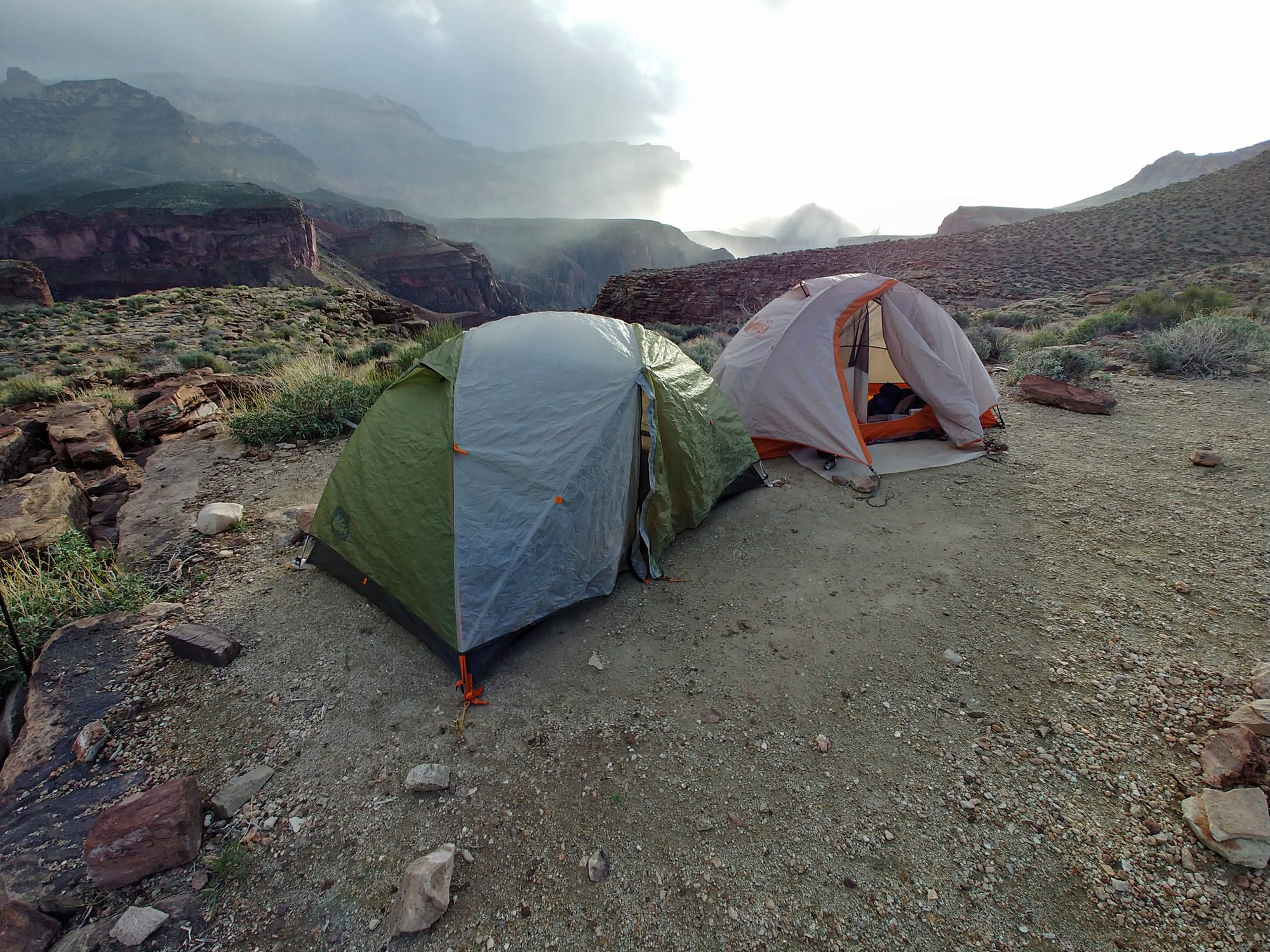
March 21): Temperatures overnight were in the low 40s, which has been usual for this trip. That’s fine with me. Any lower and it takes me a long time to get up and get going in the morning! We were up today at 5:30 a.m. and on our way at 7:40 a.m. One of the projects on my “to-do list” for years has been to check out reports of some well-constructed switchbacks coming out of the shallow canyon in front of us, up onto the plateau. This would be the way that Hance would have exited from Asbestos to the east. He had some plan to construct a trail all the way to Clear Creek, but seems to only have gotten as far as Vishnu, our next canyon to the west, where there is an old cabin that I think must have belonged to Hance. I wouldn’t say that this has become my white whale, but for ten years I have been stymied in my quest. A rock fall in 2010 cut short a trip with Bill Ferris. A shoulder injury cut short a trip in 2015 with John Eastwood and Bill Ferris. And, time ran out on me during a solo trip here in 2016. But now I would have the chance to check this out as we hiked along the plateau towards Vishnu. It only took us about forty minutes to reach a spot where we could drop our packs and head out toward the river and do our poking around. There are a couple of bays out here where the Tapeats are broken up enough so that it looks like one could get down below them. We found cairns in a couple of places but could not fathom any route down. We walked out quite a ways before giving up and turning around. Maybe next time. To get into Vishnu we need to climb up to a saddle between Newberry Butte, to the south and Krishna Shrine, to the north. Every time I have come through this saddle I have taken a route to the downstream side, warily crossing a steep shaley slope to a rocky ridge that gets steeper as you approach the bed of Vishnu. But, the last time I was here I looked carefully at an upstream route from the saddle and convinced myself that this would be better. We reached the saddle at 11:15 a.m. and set down our packs to look around. We found two faint paths leading to the north; one below the small cliffs that are here and one above. We decided that the higher path was better. We walked it pretty much all the way to where the steep shale gives way to more gentle grass covered slopes. At about ten minutes before noon we strapped on our packs and headed off the saddle. The hiking was good for a while, but we soon had to make some choices about getting through some scoured out ravines. We went down a long narrow ridge until we were atop the Tapeats and then contoured upstream until we could get down to the bed. Along the way we saw a small waterfall on the other side of Vishnu, which is where we will exit. It wasn’t until 1:30 p.m. that we reached the bed of Vishnu. There is a spring farther upstream from here, but no water running where we were. Going downstream we were immediately hiking in some narrows, with polished rock underfoot and flanked by cliffs just yards apart. There were small pools throughout this section, some of which required relying on the friction of our soles to get by. At 1:50 p.m. we reached the small waterfall and stopped to have lunch and resupply our water bladders. While here John spied a possible route directly out to the east that would have saved us quite a bit of time. We didn’t leave the waterfall area until 3:30 p.m. Getting back up to the plateau requires some tricky climbing and one spot where I passed my pack up to John. We then started to contour our way around Hall Butte and into a large nameless canyon to the west. Nameless, but it is generally referred to as “Disappointment Canyon,” or “Double Disappointment Canyon.” That’s because you are well-advised to forgo the first opportunity to descend into this canyon and, instead, climb up a bit higher and continue up to a better place to cross over to the other side. We had hopes of getting to, and crossing over, Double-D, but by 6 p.m. we decided to camp pretty much right where the ill-advised descent begins. We got some light rain just as we set up our tents, which lasted until about 7:30 p.m. We are splitting a dinner tonight – Pad Thai noodles – in John’s roomy tent; I brought the dark chocolate cheesecake dessert. |
|
|
||
|
Click on any picture to see a larger image. |
||
|
|
||
 Large cairn. |
 John ponders if there's an old route. |
 Another cairn. |
 We stopped at the saddle and then followed the slight path visible here. We were satisfied it would work and so had to come back to fetch our packs. |
 Looking back at Newberry Butte and the saddle. The route we took from the saddle led us up above some cliffs before contouring to safety. |
 Still following a visible path! |
 Nice walking through here. |
||
 Down a ridge; waterfall visible. |
 The narrows of Vishnu. |
 Our water resupply in Vishnu. |
 Coming out of Vishnu at the waterfall was quite the chore. But, once up to the Tonto level we once again found ourselves on a bit of a well-worn path. That lasted for a little while. |
 Panorama of Vishnu from Vishnu Temple (l) to Newberry Butte (r). |
|
 The sunset from Double-D. |
 Wotan's Throne, Hall Butte & camp. |
|
|
Day
12 -
From the Tonto plateau
east of “Double Disappointment” Canyon to the Tonto Plateau west of The
Howlands Butte (Sunday,
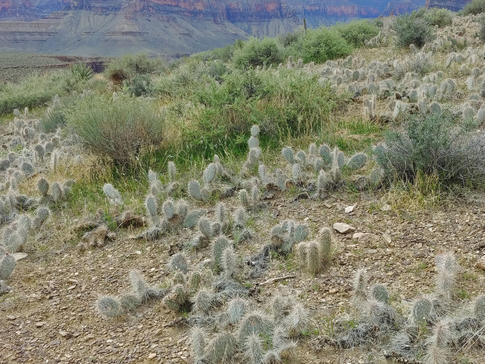
March 22): We know that our pace has been slow and that we need to start putting in longer days. So, we were up at 4 a.m. and taking down the camp by the light of our headlamps. While in midst of getting things organized in my tent I spilled my open water bottle. Lucky for me it was easy to toss everything out the door before getting wet and the bottle – a 16 ounce one – was less than half full. Still, I managed to get water all over the tent floor, but it mostly dried off before we left. At 6:45 a.m. we left our camp site and started back into Double-D. The route across, at least in my mind, involves starting down before you can see the full route and going around a knob before it fully opens up to you. You should be able to see a nice hill on the opposite side with a well-worn path leading up to the Tonto. Well, somehow I missed all this and we kept contouring back into this long canyon. It didn’t seem worth it to try and back up and look for the regular route, so we just kept going. Finally, at 8:45, after two hours of hiking back into this canyon, we crossed on a small Tonto ledge. After a fifteen minute break we were on our way, later to pass by the route we should have taken. I’m going to start calling this Triple-D Canyon! We had some hope that we could reach Clear Creek today, but that now seemed unrealistic. We were focused on getting to the head of 83 Mile Canyon, after we have contoured around Dunn and Hawkins Buttes. [Many of the buttes in this area are named for members of Major Powell’s crew that were the first through the Grand Canyon on the river in 1869.] Here we are quite hopeful of finding a water pocket that has served me well on three previous trips. If there isn’t any water there, we’ll likely be scrapping by on empties before we can get to Clear Creek. After many hours of hiking, at 3:20 p.m. we reached the head of 83 Mile and there were two water pockets. Hooray! In fact, later we would find another, smaller water pocket, in the next little ravine about ten minutes away. We found some shade and dropped our packs and began the process of scooping out water and running it through the filter. We were each down to our last liter of water, but when we left here, at 4:30 p.m., we each had a full gallon. More than enough to get us to Clear Creek. It had been a bit warmer this afternoon, especially when the slight breeze stopped blowing. We have been constantly pestered by small gnats and doing our best to keep them from flying into our ears, mouth, nose and eyes. As long as we kept moving we seemed to be able to hold our own against them. I felt especially rejuvenated after our stop at 83 Mile and enjoyed the two more hours of hiking that we put in contouring around The Howlands Butte. By 6:40 p.m. we had turned the corner and were paralleling Clear Creek back toward the break that would get us into this canyon. We set up camp on a hill that was not quite flat, so I did a bit of sliding around during the night. It was a good day; in fact, it was a twelve hour day! Tomorrow, we’ll try that again. |
|
|
||
|
Click on any picture to see a larger image. |
||
|
|
||
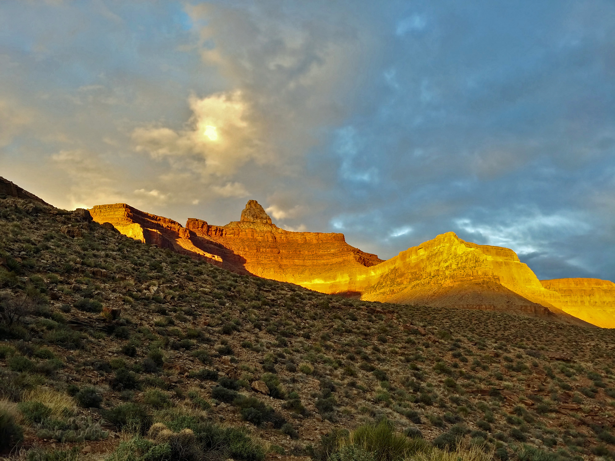
 Sunrise on Dunn Butte & Angels Gate |
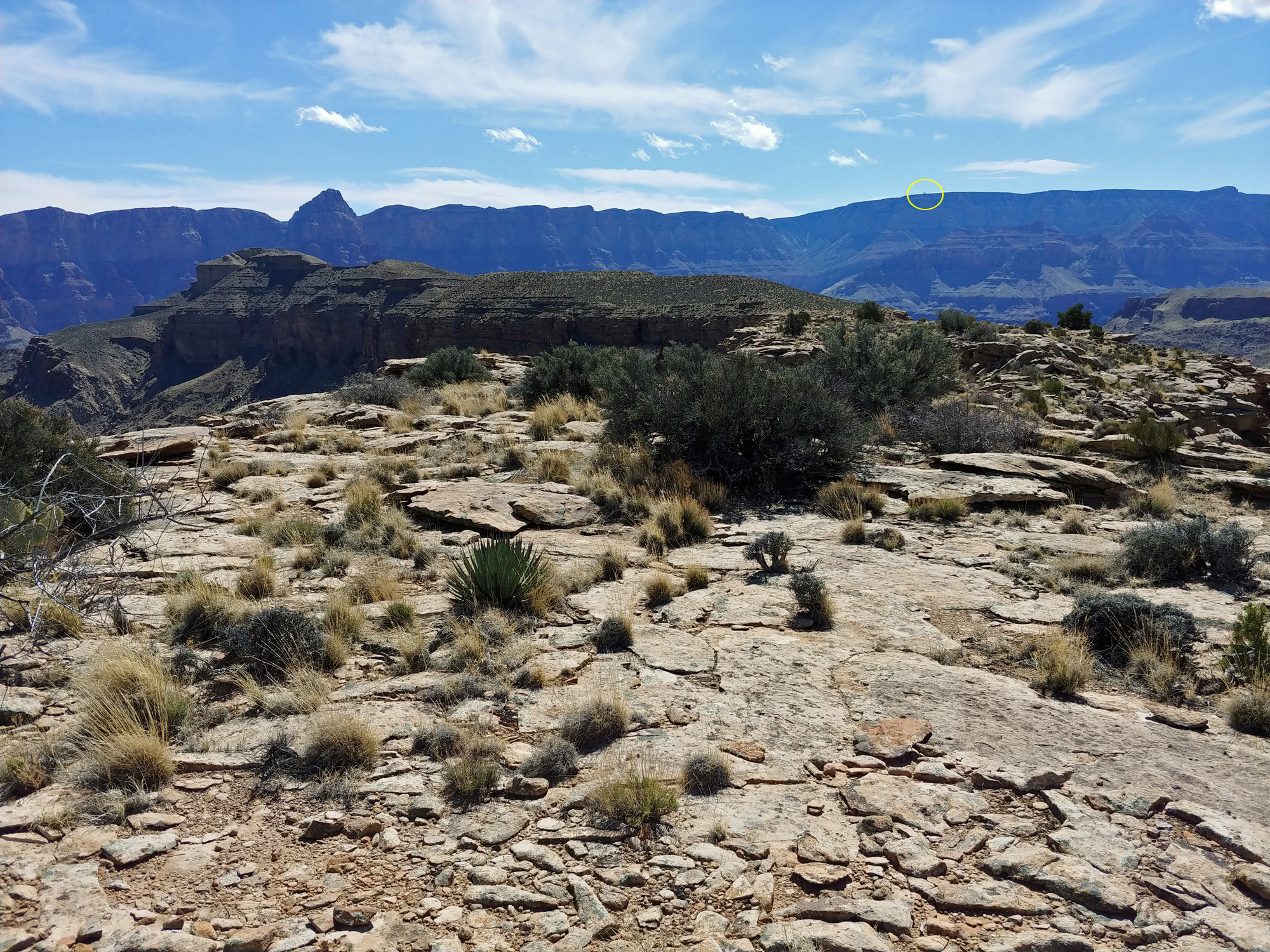
 Wotans Throne & two hikers. |
 Our crossing of Double-D canyon. |
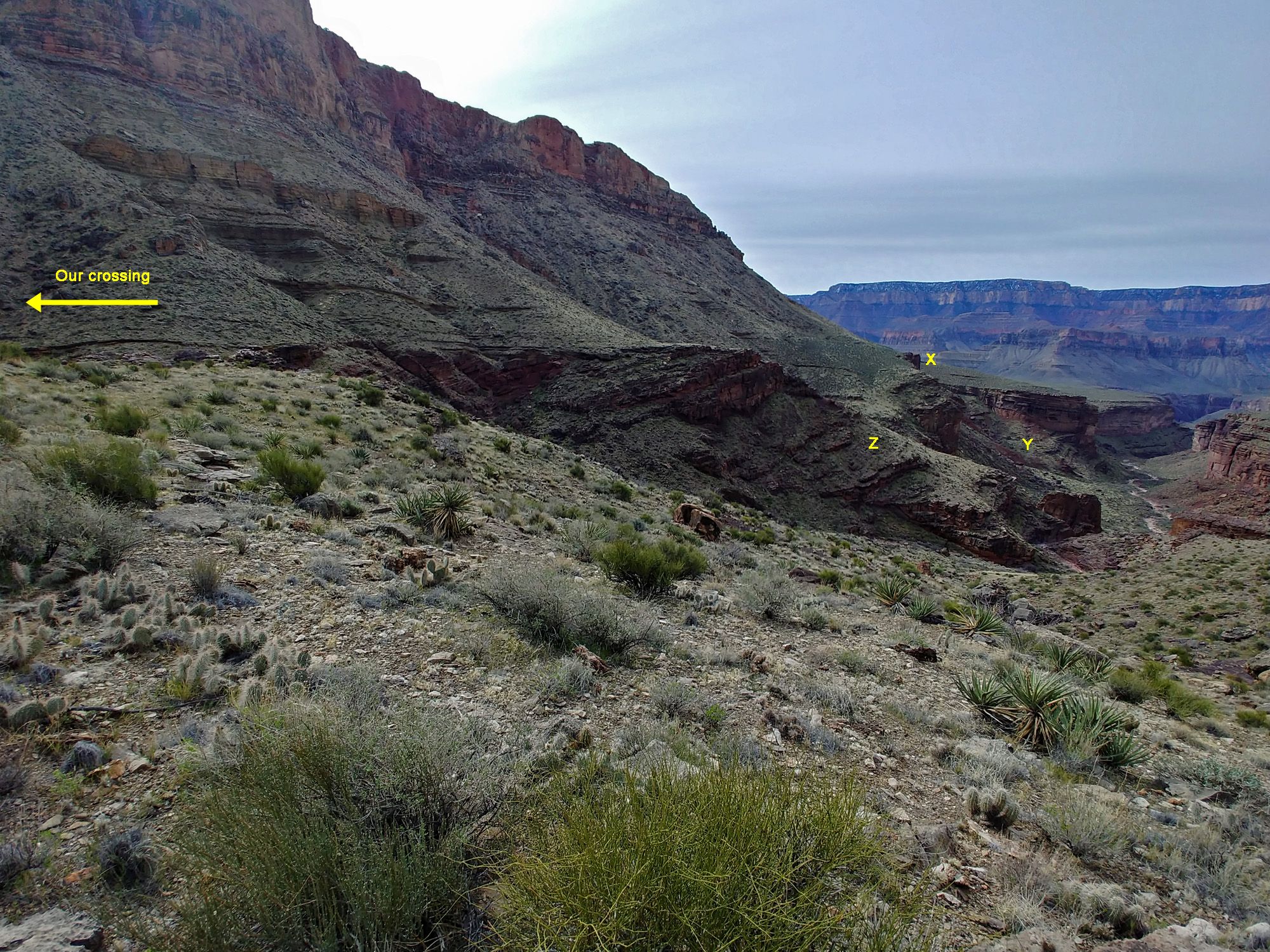 Our camp (X), route (Y), preferred (Z). |
 We started seeing more cactus. |
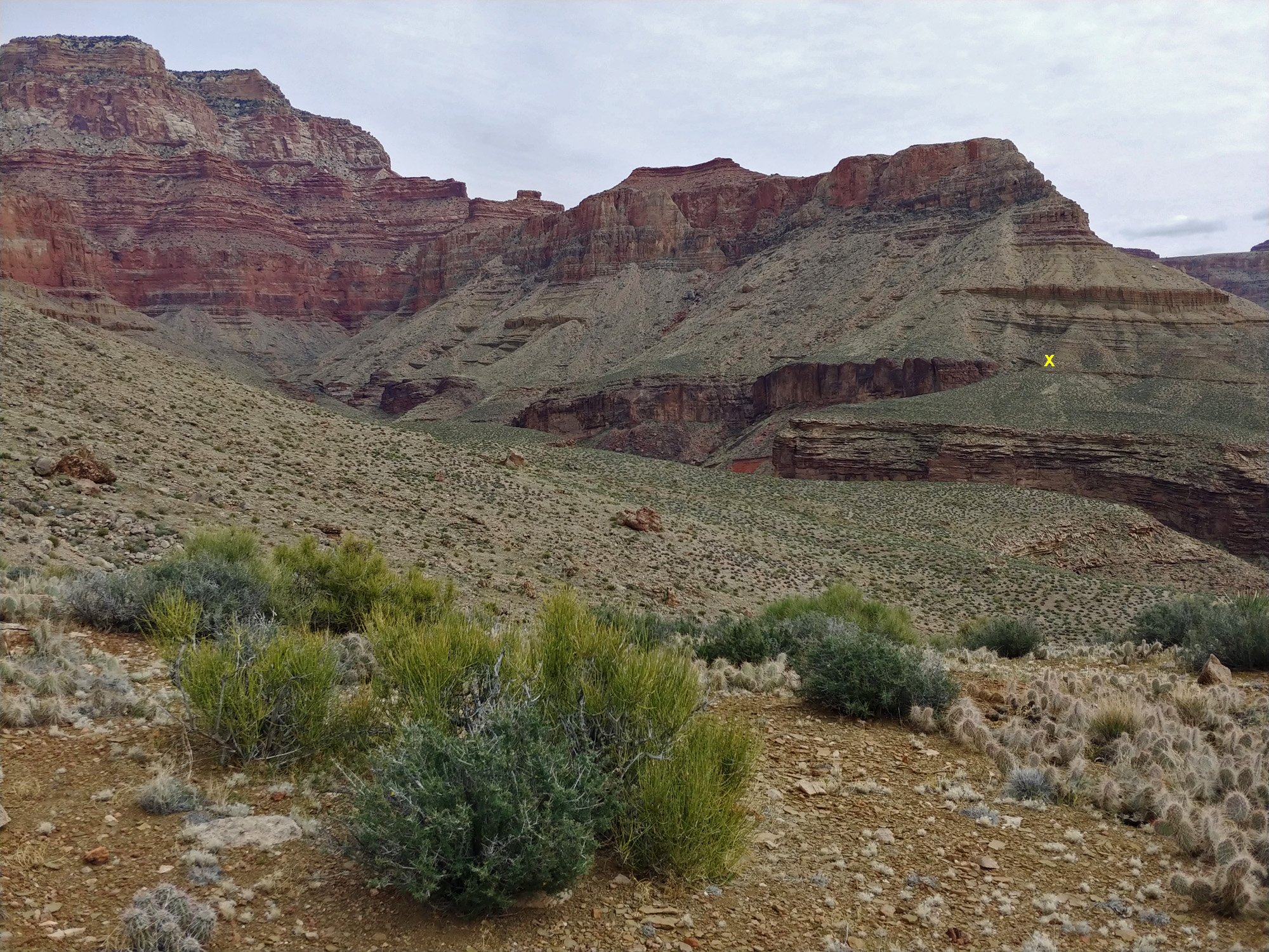 Looking back; our camp is "X." |
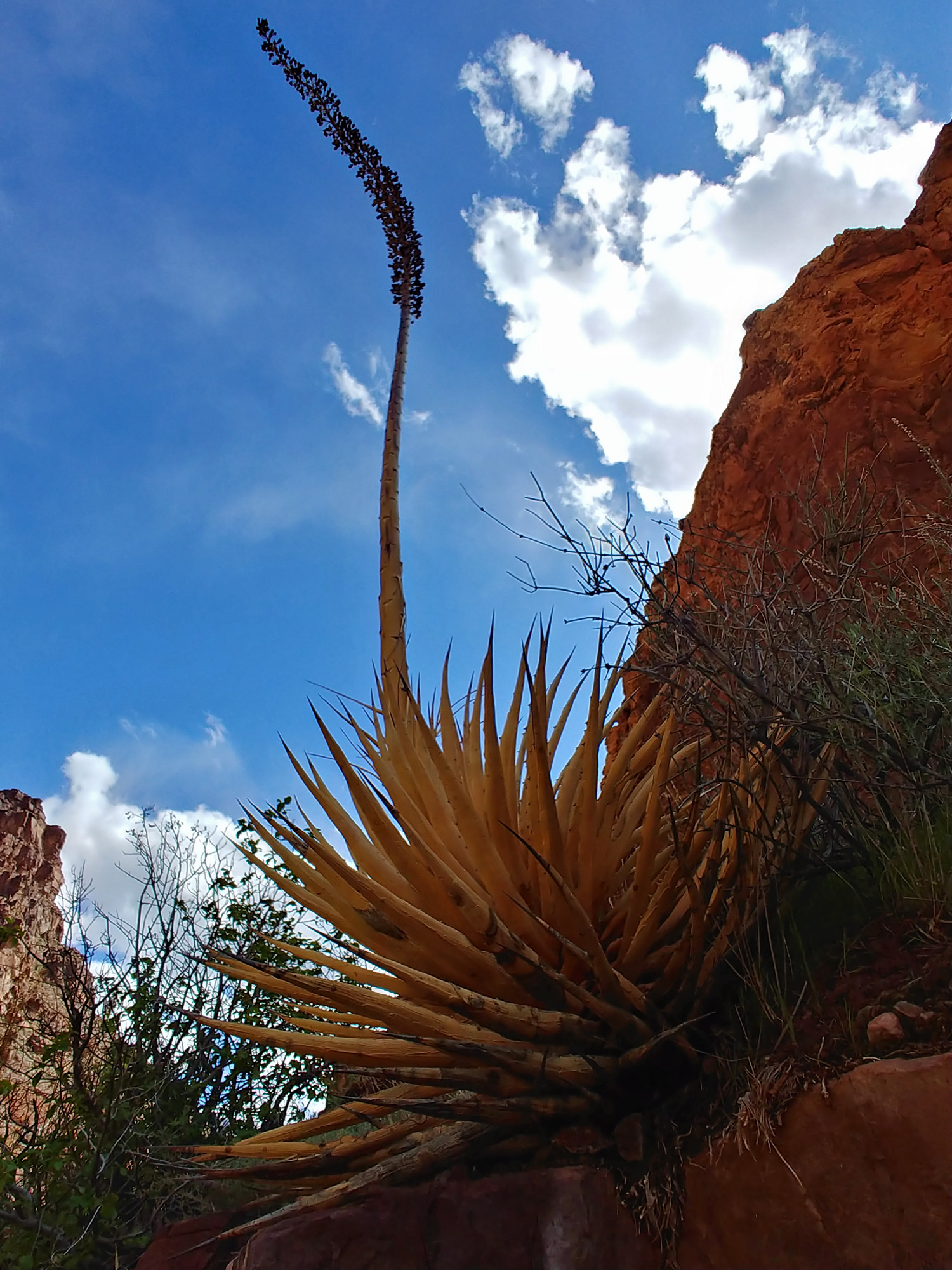
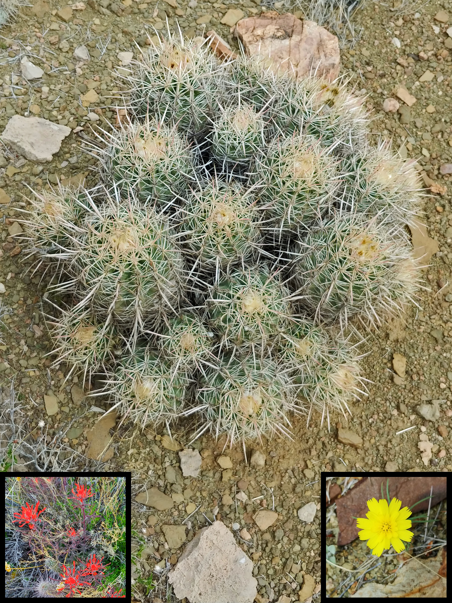 Among the numerous cactus (or, cacti) that we saw were the barrel cactus. This particular group caught my attention. Insets are blooming Indian Paintbrush (l) and Yellow Tackstem (r). |
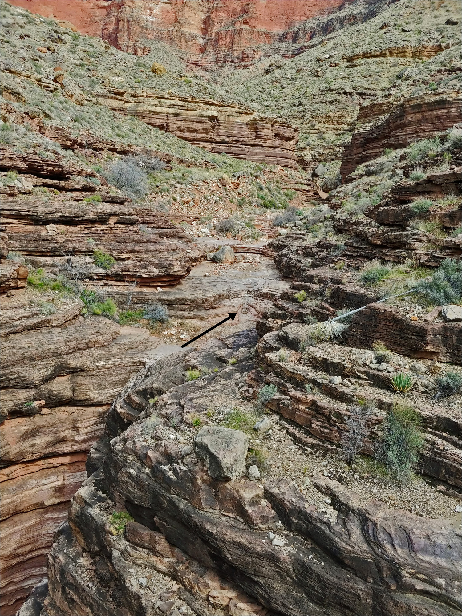 I have camped and passed through this spot - the head of 83 Mile Canyon - many times over the past ten years and have been fortunate to always find water in two pockets in the bed. |
 Unusual clouds. |
 Tilted camp below The Howlands. |
||
|
Day
13 -
From the Tonto Plateau
west of The Howlands Butte to the Clear Creek Trail east of Bright Angel
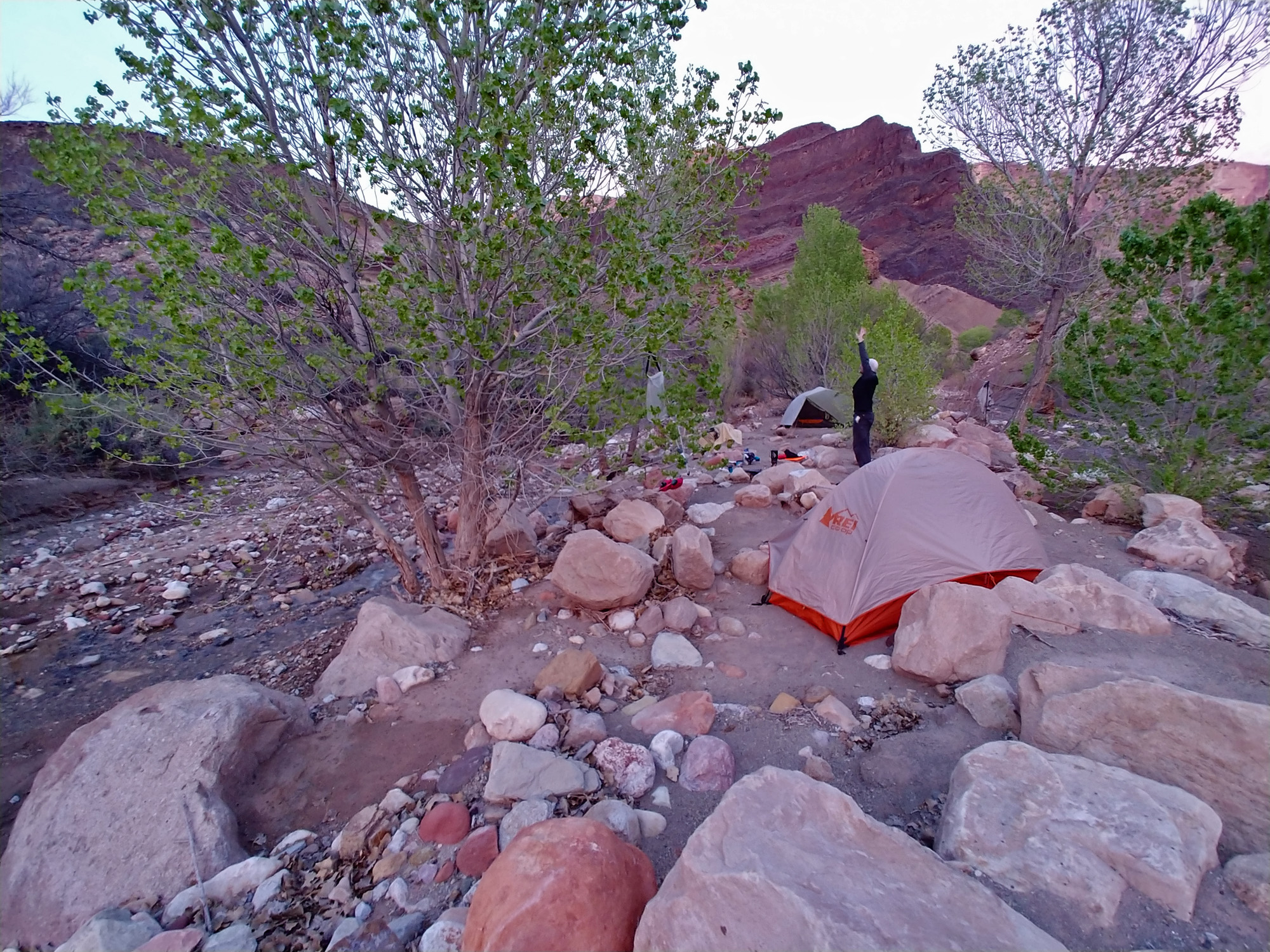
Canyon Despite sliding to the downhill side of my tent all night, I slept pretty well. We were up early again, today at 4:20 a.m., and got to work breaking down our camp and eating breakfast. At 6:30 we were on our way. The contouring went pretty well for us. Although it is quite cool this morning we are still fighting with the gnats. It took us two hours to reach the top of the descent into a dry arm of Clear Creek Canyon, arriving at 8:30. Although I have been through this descent many times, we still had to hunt around to find out where it starts. If you didn’t know it was here, you might easily decide that this wasn’t the right spot. And that wouldn’t be a terrible setback as it wasn’t clear to us how advantageous this steep descent really was. It takes about forty minutes of further contouring to get to a much easier descent into the wet east arm of Clear Creek. From there it is just a simple walk down the bed to Clear Creek itself. Conversely, after we get down to the dry bed at this break, we still have some major obstacles to bypass on our way to the creek. Our route is shorter, but it may not be faster. It took us an hour to reach the bed. The descent seemed rougher than when I was here just four years ago. In one spot we did lower packs, although we each took a different downclimb through this difficult spot. The clouds have been darkening to the west and just as we arrived at the bottom of the climb we got a few drops. More will come later. It took us another hour to get down this bed to its junction with the east arm of Clear Creek, maneuvering over, around and through many rocky obstacles. From this junction we are mere minutes away from the main bed where we hoped to find a good social trail up the canyon to the Clear Creek Trail. We found such a trail on the north side of the flow and were able to follow it quite a way before having to make our only creek crossing. That was a good thing because crossing required us to stop and change out of our boots and into our water shoes. We got hung up at a couple of other places but altogether it only took a bit more than an hour to reach the nice camp sites where the Clear Creek Trail technically ends. We spent from 11:40 a.m. until 12:20 p.m. here, getting some water and eating what we have left for lunch – that amounts to the rest of my cheese and crackers and most of my salami, which we split between us. We had planned to be hiking through Phantom Ranch right now and buying something to eat there, but the half day we lost at Unkar has set us permanently behind our schedule. Soon after leaving our lunch spot we were making the long, steep climb up to the Tonto Plateau. We did it in one long push, taking just thirty minutes. What a difference it makes to be on a real trail! Up until now we had only gotten occasional light sprinkles and we were enormously grateful that we didn’t have to do any of our off-trail hiking, and climbing, in the rain. But, once we got started hiking along the level Tonto Plateau, the rain started as well. Light at first, but then heavier and very windy. We had on our raincoats and we had ponchos on over our packs. But, that wasn’t enough and even though we were soaked we ducked out behind a rock and out of the rain and took the time to put on some rain pants. After another twenty or thirty minutes the rain stopped and the skies cleared up quite a bit and the sun started shining down on us again. Off came the rain pants. My hiking pants were still soaked, but they dried off as we hiked along mile after mile. The Clear Creek Trail is about nine miles long, from the creek to Phantom Ranch. We knew we couldn’t make it out of the canyon this night and we wondered whether we should check in with the ranger at Phantom and try and get a spot in the Bright Angel Campground. It might be possible, but this is the peak season for canyon backpackering and we feared that the answer would be, “No.” We would then likely have to try to start climbing up to the rim, but we both knew that we’d not make it and would end up finding a place to camp overnight. So, rather than risk being turned down, we decided that we would hike along this trail until it starts its two mile descent to Phantom Ranch, and find a place to camp there. We had been a bit surprised that we saw no hikers in Clear Creek, because that is a very popular place for backpackers. And we also wondered why we weren’t seeing anyone on the trail as well. At about 4 p.m. we finally passed two small groups of hikers. They told us Phantom was closed up, due to the spreading fear of the Coronavirus, which was just a nagging issue when we started our hike. When we got to our intended camping spot at 5 p.m. we had the nice six, or seven, places here all to ourselves. We did a food inventory to figure out how to best see our way through the next 24 hours. John had no dinners left. I had only one-half of a dinner and six slices of salami, so we split that for our meager dinner. I also had one pineapple fruit cup, so that became our dessert. For breakfast the next day, John was out of his usual fare (I guess he does a much better job of packing than I do!) but I still had two packets of oatmeal which we split up. I still had a couple of packs of hot apple cider and John still had some packs of coffee. We both still had a goodly amount of snacking food, which would easily last us another day (but, probably not two days). We only got a couple of light sprinkles of rain after setting up our tents, although the clouds to the south and west looked very threatening. It was colder than we had been used to for this trip, but still quite tolerable. We know that tomorrow will be a relatively easy day so there won’t be any rush to get up in the morning. I had been visualizing a hot shower and sleeping in my own bed at home for this evening. Ah, so it goes. One more night. Time to roll over and blow up the mattress again. |
|
|
|||
|
Click on any picture to see a larger image. |
|||
|
|
|||
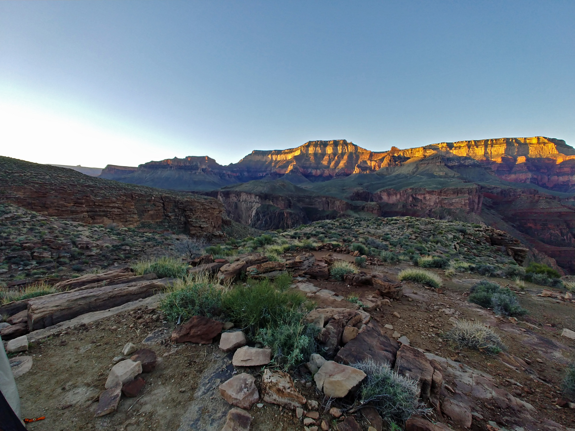
 Early morning looking to the north rim. |
 Zoroaster & Brahma Temples. |
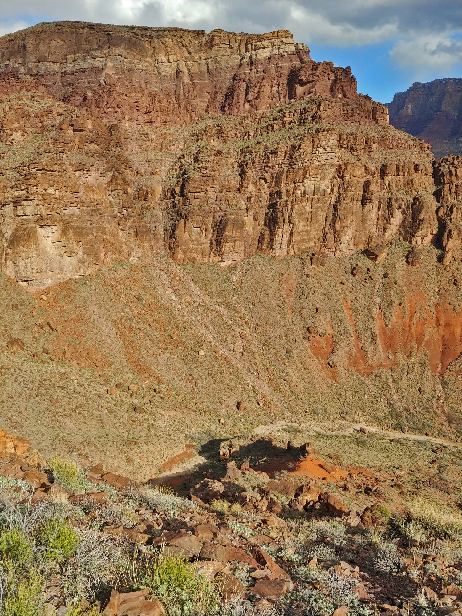
 A nice view of Clear Creek from near our descent. Part of the Clear Creek Trail is barely visible as it cuts across above the dark red slope on the left side of the creek. |
|
 A chilly early morning start. |
 Sunrise on the south rim. |
||
 One of the many rocky obstacles. |
 John pauses in the dry bed. |
 Looking up Clear Creek. |
|
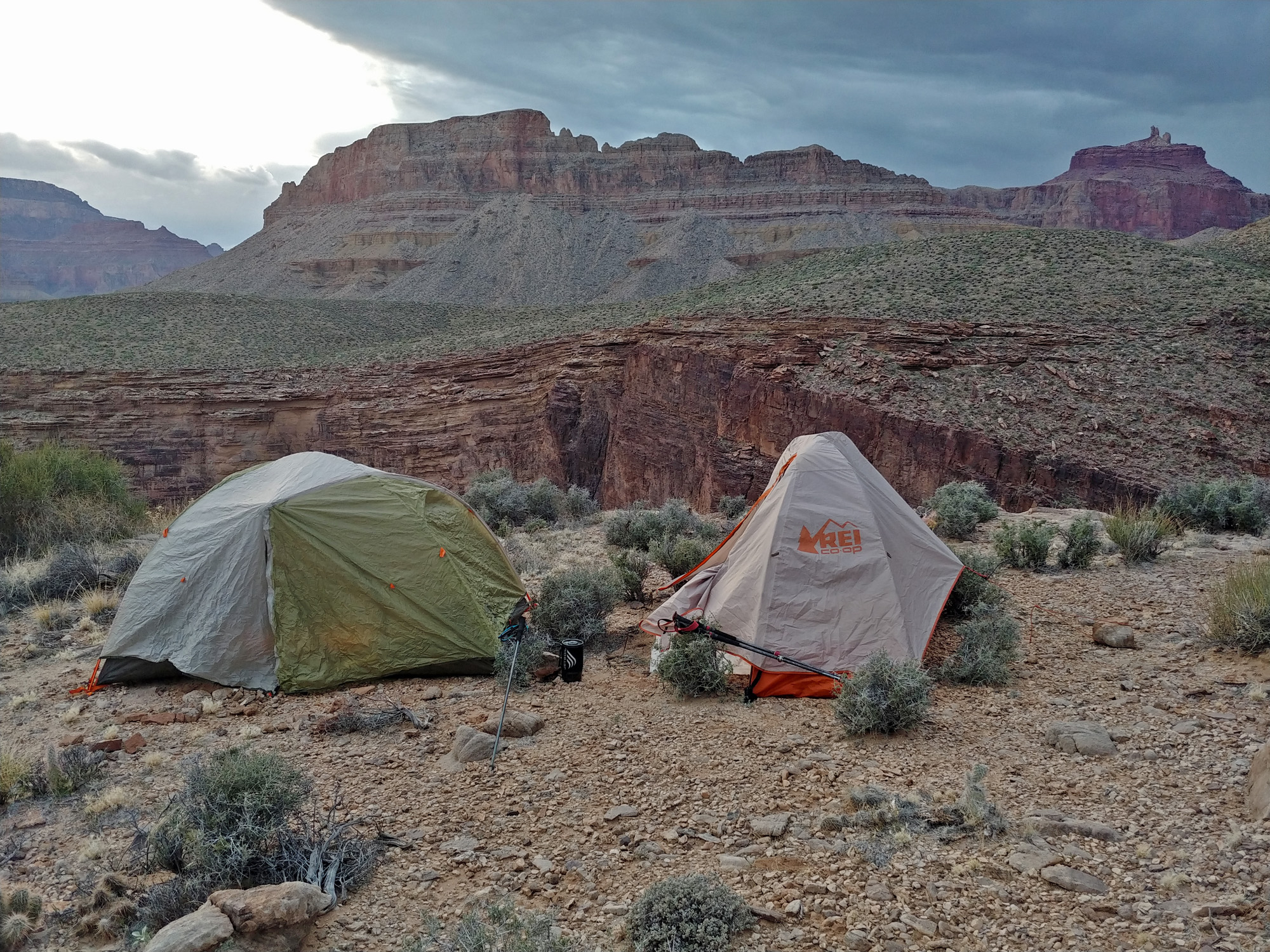
 Still some rain at our camp two miles from Phantom. |
 Picturesque sunset on Zoroaster Temple. |
||
|
Day
14 -
From the Clear Creek Trail east
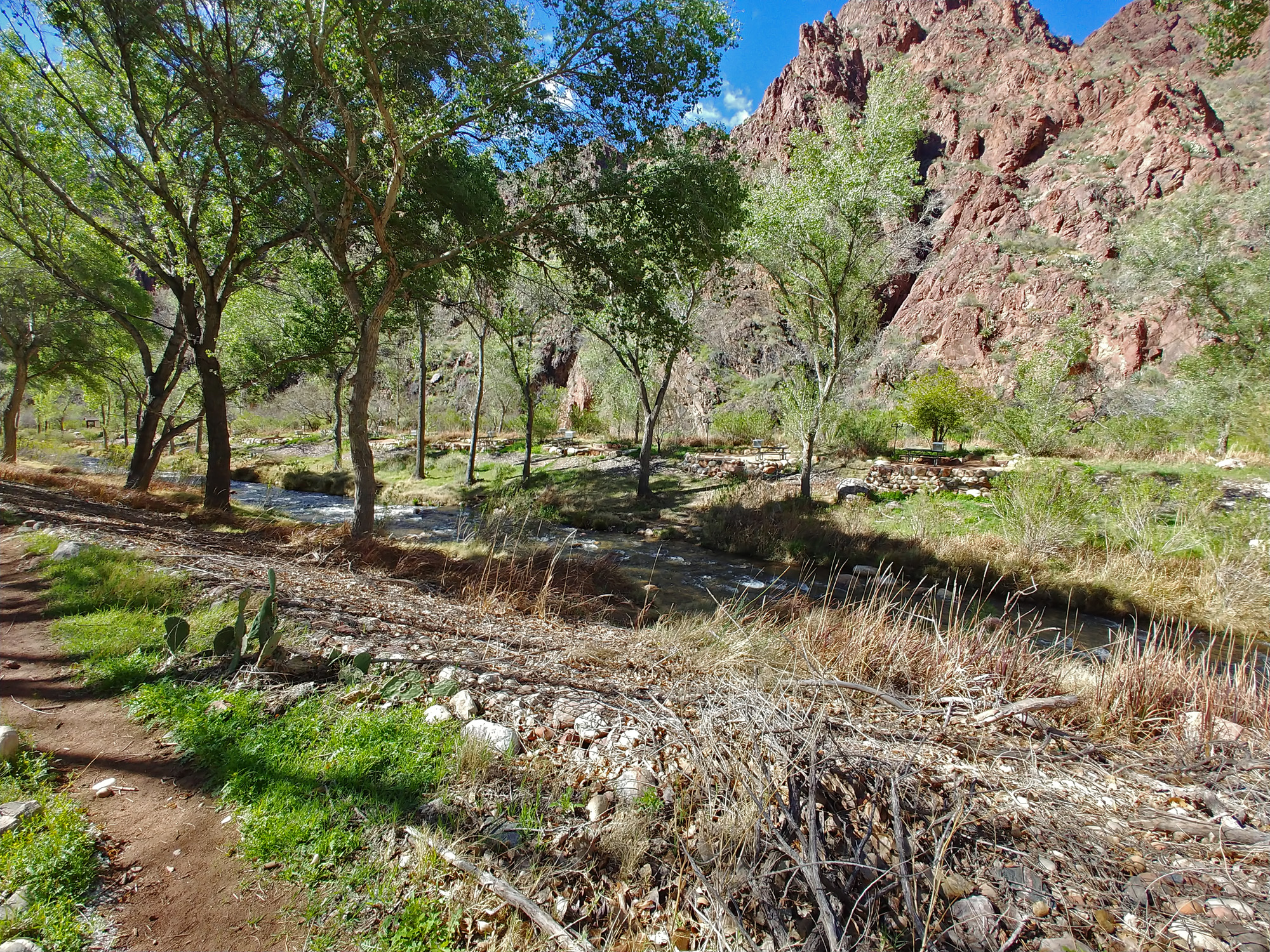
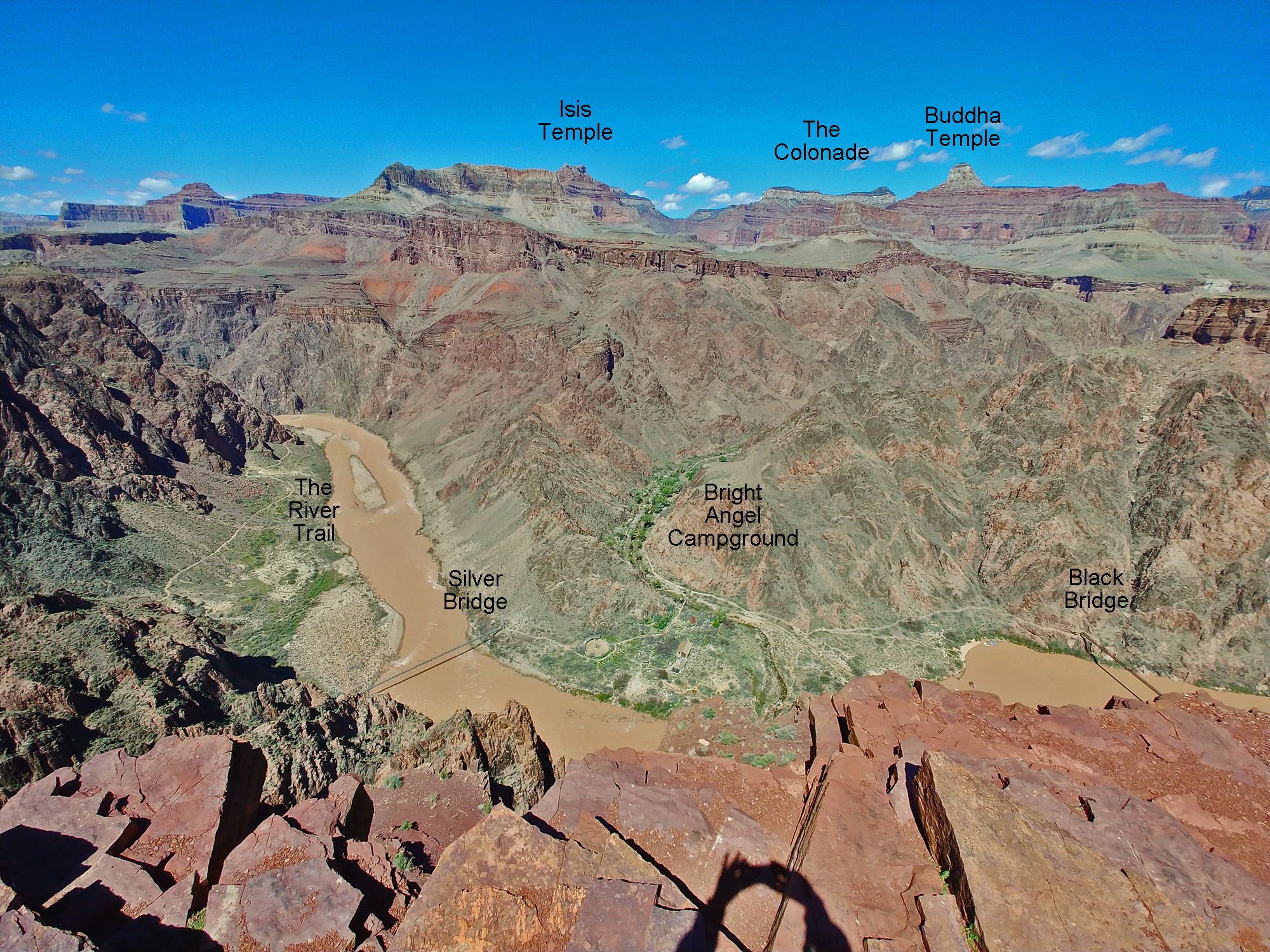
of Bright Angel Canyon to the rim via the South Kaibab Trail We were up at 5:30 a.m. It was a bit colder overnight and everything outside was still wet from yesterday’s rain. But, skies are blue and we are looking forward to the sunrise warming us up. We had our last breakfast and were on our way by 8:20. It took us less than an hour and a half to reach Phantom Ranch. As we neared the bottom of the Clear Creek Trail we met a day hiker coming up the trail. He told us that not only is Phantom closed but that services on the rim were also shut down, although the park service was still allowing hiking. Walking through a deserted Phantom Ranch made me think that we were living some old Twilight Zone episode. Eerie. We saw notices posted on the door of the canteen announcing the ranch’s closure and that they would reopen on May 21. [Three weeks have since passed, so I don’t know if that is still the case.] We stopped by the ranger station and talked with permanent volunteer Sjors. We wanted to make sure that someone at the park knew that we were finishing up this long hike, even though we are not required to check in with them. He filled us in on what was going on. There were only two groups in the campground last night, so we certainly could have come all the way here and gotten a spot. The water pipe is busted between the ranch and the river, but the water stations are still working for now. [I was surprised to hear about that pipe since it was just put in a few years ago!] We stopped to fill up with water at the junction where the Bright Angel Trail meets up with the Kaibab Trail. By 10:40 we were on our way up the South Kaibab. So far we had seen only a few day hikers during what would normally have been a very busy time in the canyon. At 12:30 p.m. we were on the Tonto Plateau and stopping at the new shade shelter here. It is a nice place to stop and take a load off your feet. But do watch after your stuff as I saw a squirrel lurking around and suspect he is getting well fed. I left John to look after my pack while I went and hiked out the Tonto West trail over the next hill to a spot where I had cached some instep crampons back in February. We were worried that we would need them for the top of the trail, which can be very icy, but we didn’t want to lug them around for two weeks. Instead, all we needed to do was carry them up from here. Of course, they were not needed. At 1 p.m. we were on our way, reaching the top of the Redwall an hour later and stopping here for a twenty minute break. There were a handful of day hikers here and I think that all of them were only going this far. Over the course of the day we saw maybe two dozen day hikers and only one couple that was heading down to the Bright Angel Campground. At least for the moment, the park service was still allowing camping, although you couldn’t get a permit on the rim. It took us another hour to hike up to Cedar Ridge, arriving at 3:25 and stopping here for a half hour. Along the way we had passed a couple of rangers heading down, including one I had recently met at the Grand Canyon Guide Training Seminar this past February, where I had given a presentation on “Old Maps and Forgotten Trails in Grand Canyon.” While we were resting here another ranger came down the trail and we chatted with her for a while. Not too many people to talk to on this trail today! It took us another hour to hike up to the rim from Cedar Ridge and at 5 p.m. we were out of the canyon. But, we were not done hiking. The shuttle buses are shut down and the visitors center is a couple of miles away and that’s where I parked my truck two weeks ago. We’re tired, but at least the path is paved. We reached my truck at 6:15 and the packs came permanently off our backs. We enjoyed some snacks and sodas at my truck and after some minor clothing changes we were off. We stopped at the Wendy’s drive-thru in Tusayan as the sit-down restaurants are mostly closed. That was a tasty meal! Then, on to Flagstaff, dropping off John at his home and me arriving at my home at about 10 p.m., ready for a hot shower and a soft bed. |
|
|
||
|
Click on any picture to see a larger image. |
||
|
|
||
 At sunrise, looking out across the plateau between us and the river. There are at least six well-maintained spots here for camping and we had our pick of the litter. |
 John heads down an especially well constructed part of the trail that passes through the Tapeats cliffs. We have about two miles to go to reach Phantom Ranch. |
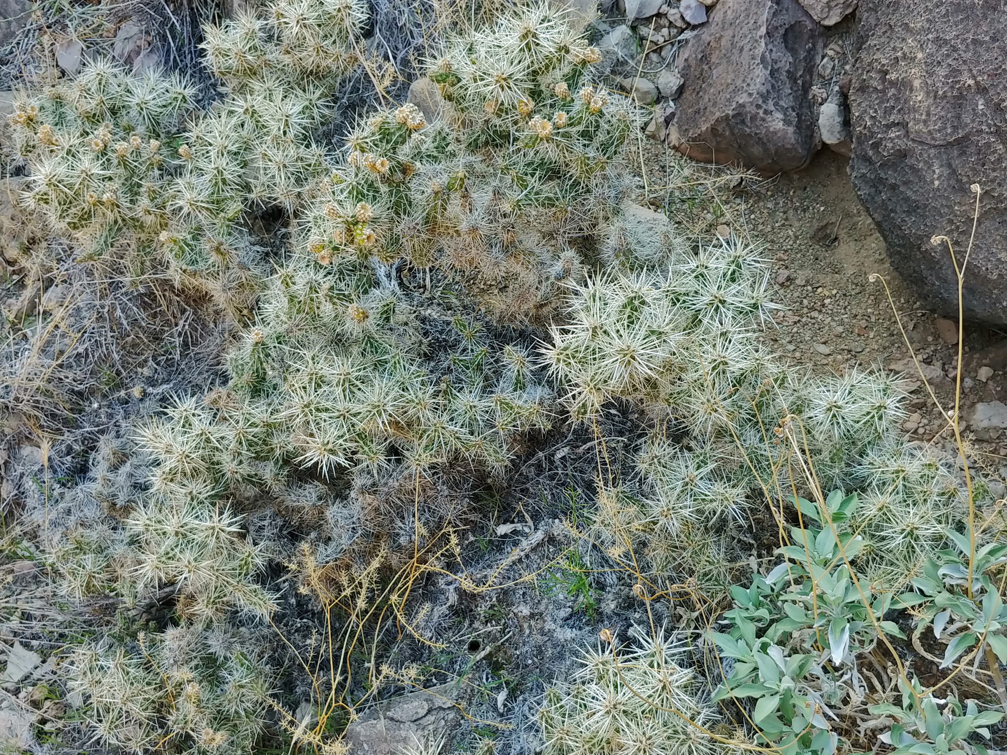
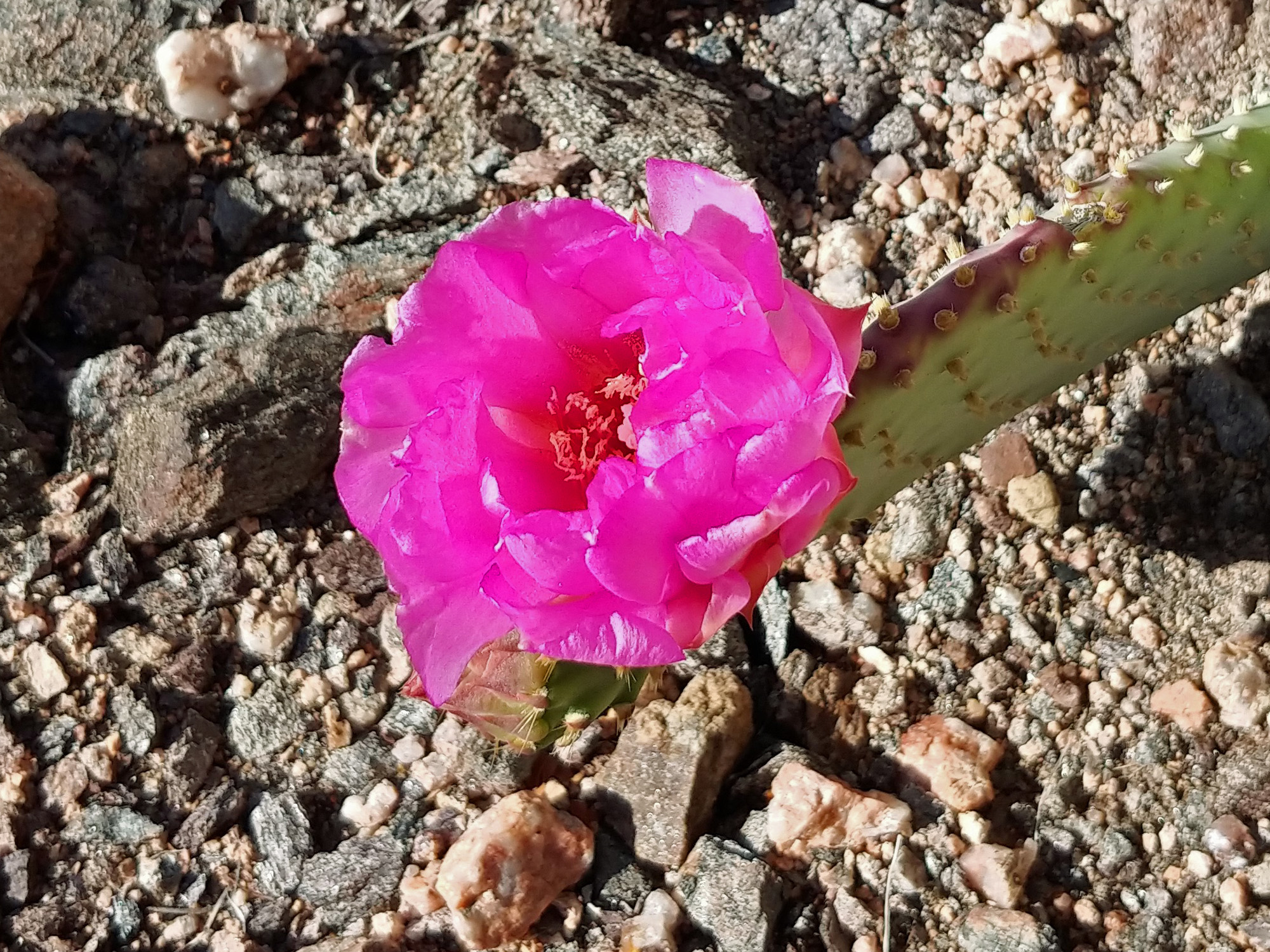 We saw our first cactus blooms. |
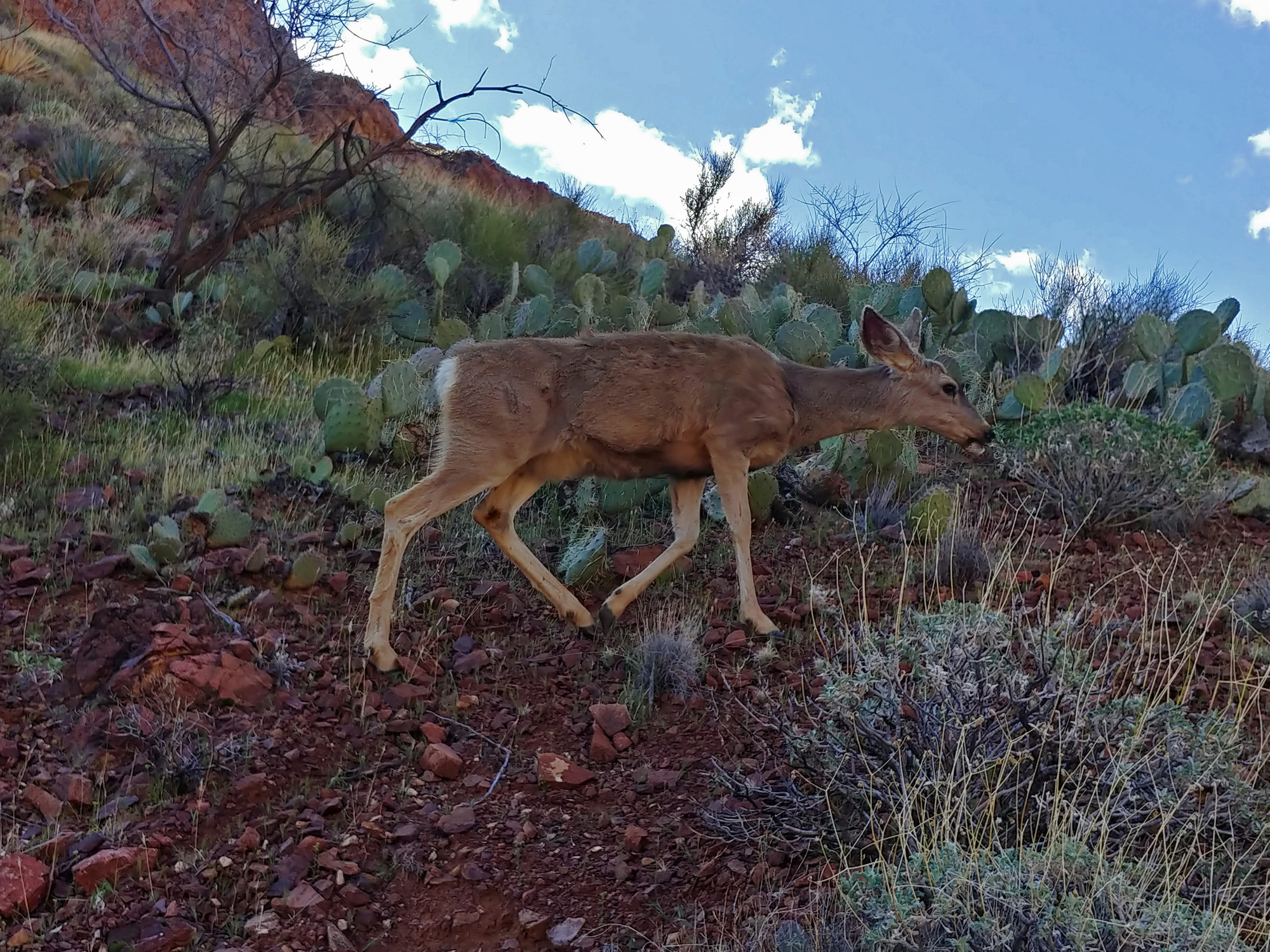 A deer moseys by us. |
||
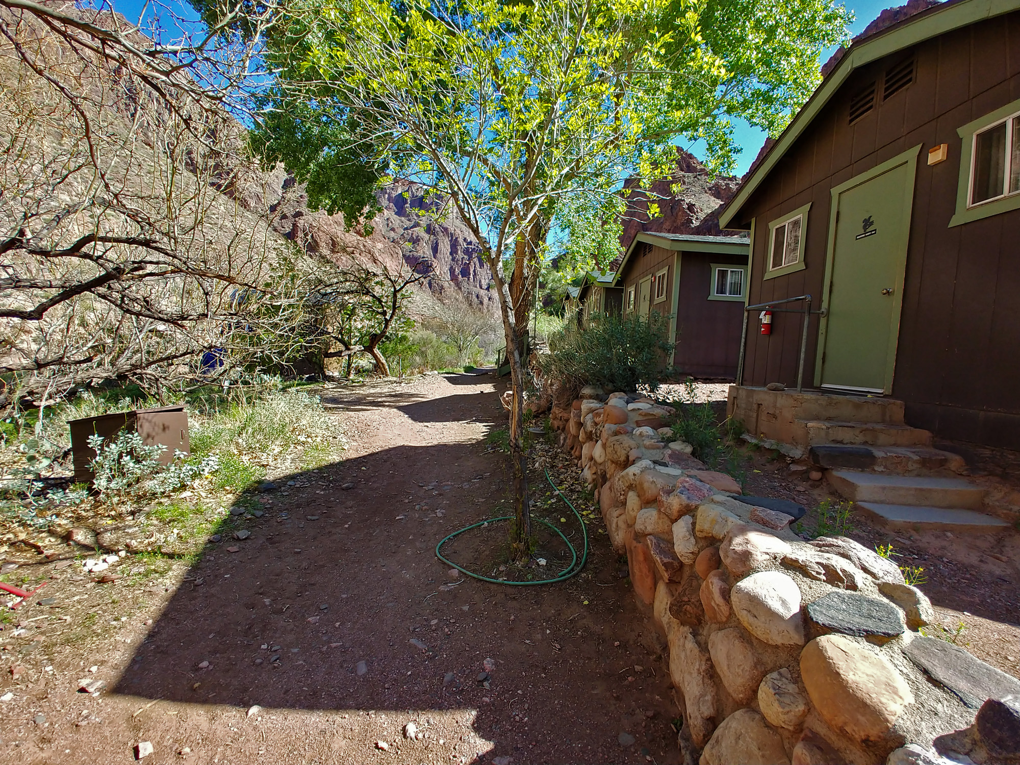 Nobody at the Phantom dorms. |
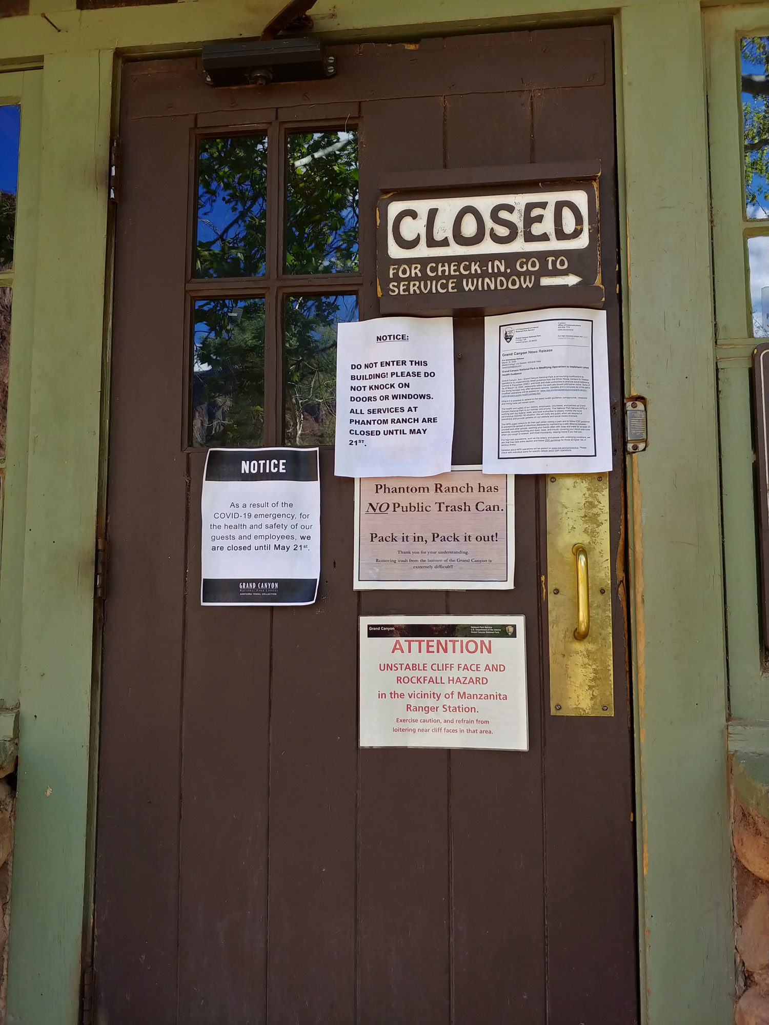 The door to the canteen had notices about the closure. They intend to open up in late May, but I wouldn't be sure. Nearby were two ammo cans for mail pickup. |
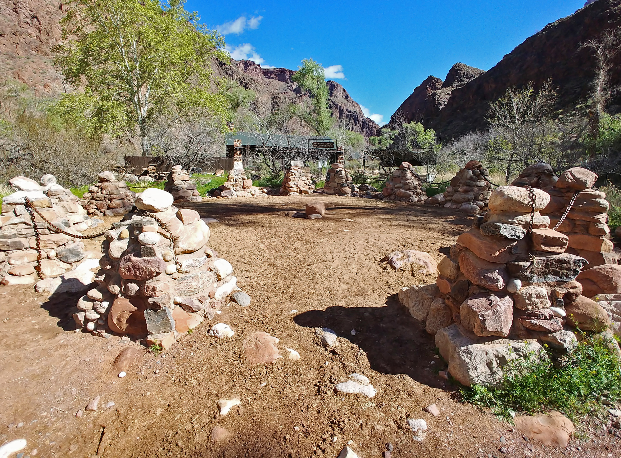 Empty mule corral. |
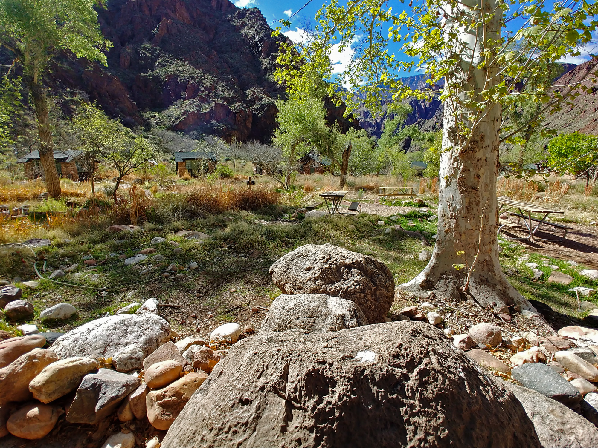 Nobody at the cabins. |
 Empty campground across the creek. |
|
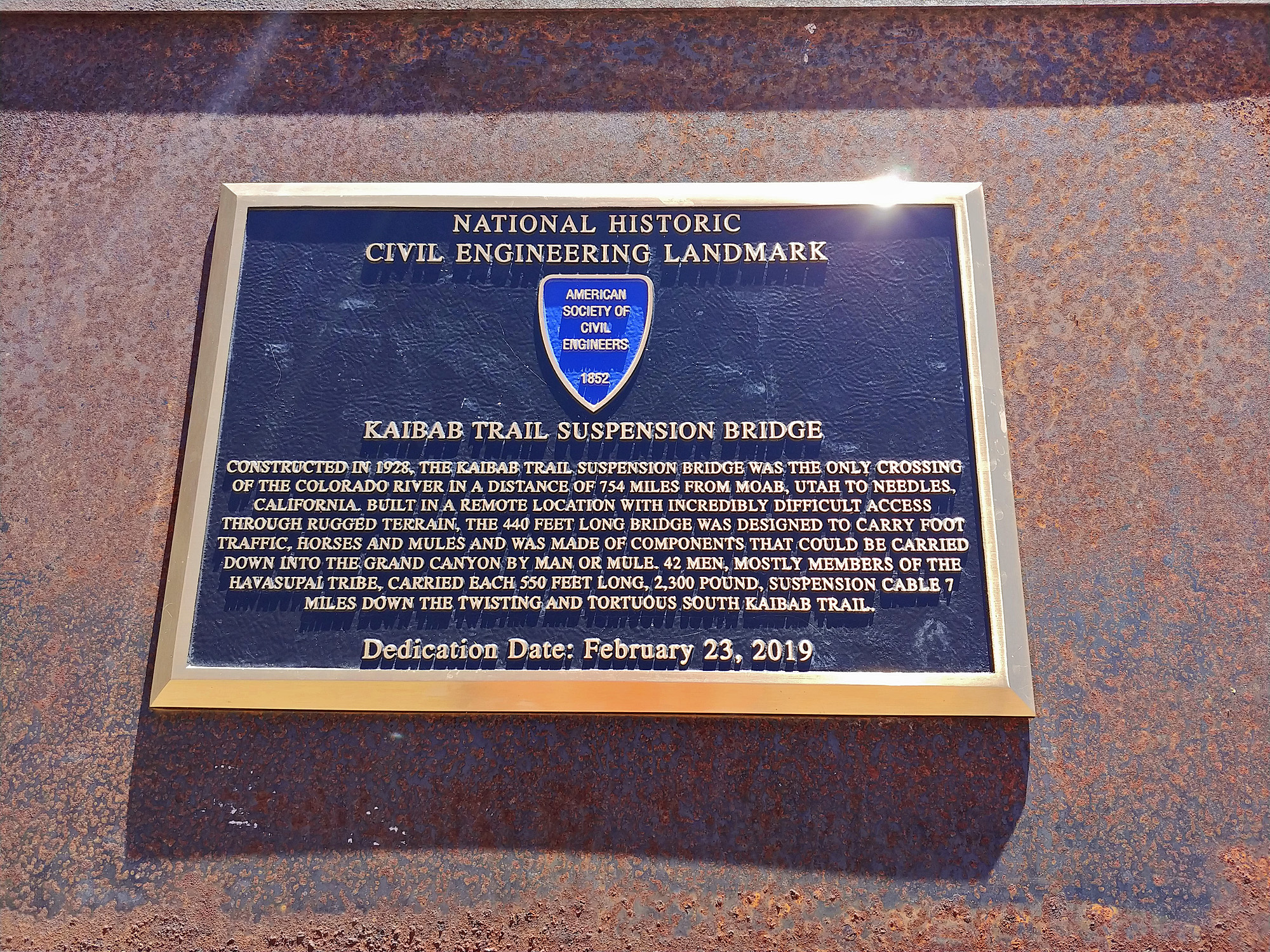 Plaque recently installed. |
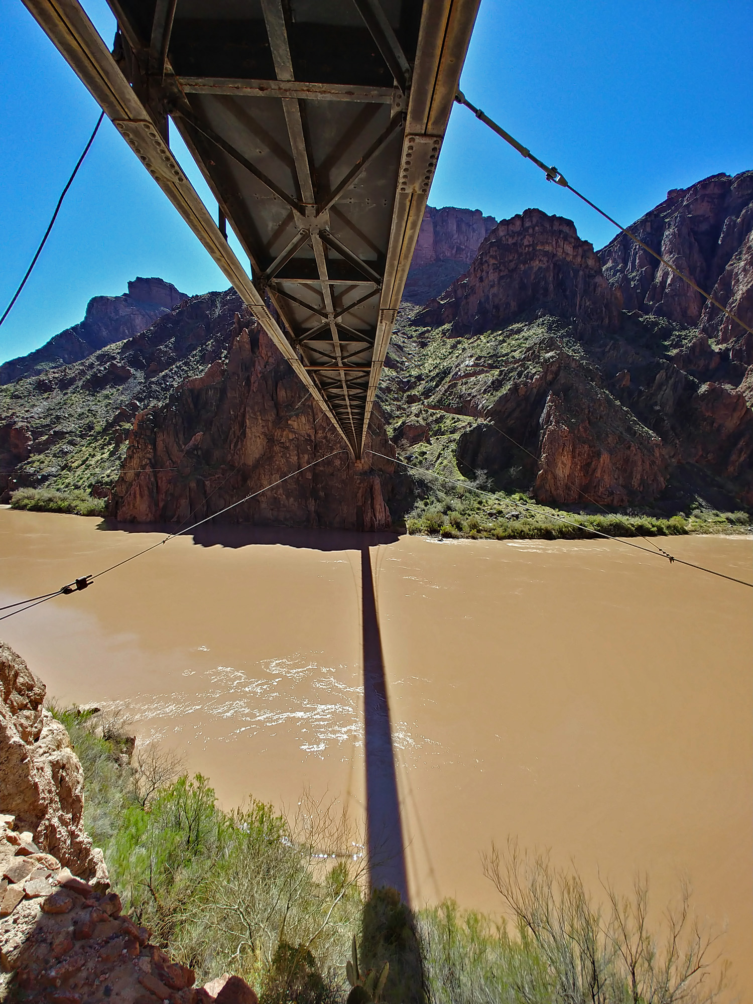 Looking across the river underneath the black bridge. There was another suspension bridge here before this one went up in 1928. It came across about my level. |
 What we see from the S. Kaibab trail. |
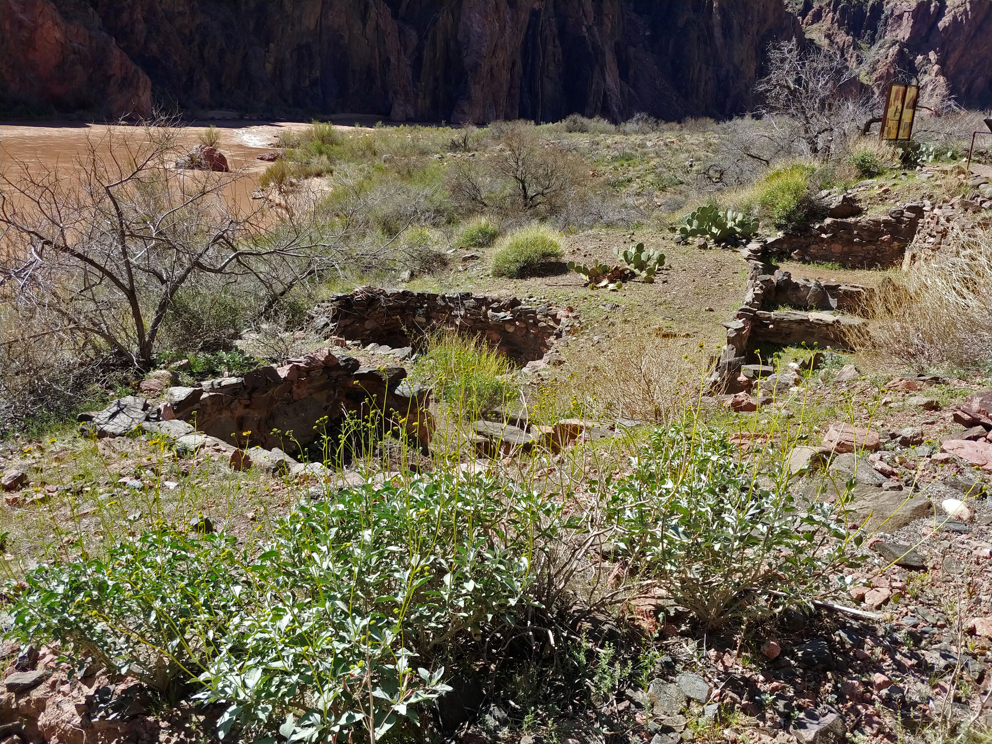 The Bright Angel ruins. |
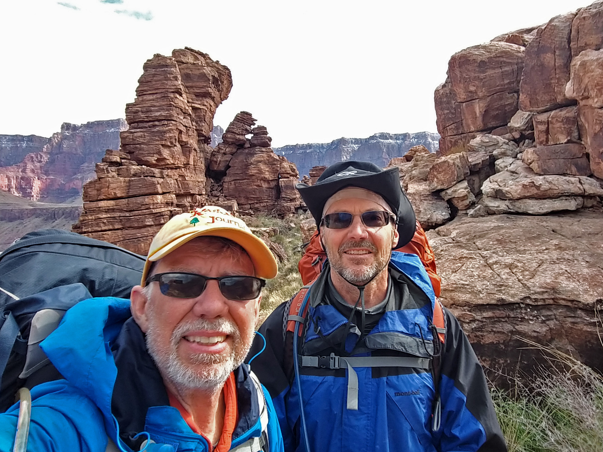
 Dennis & John at the top! |
|
|
|
||
|
|
Return to Hiking Grand Canyon home page |
|