 |
|
|
In &
Around Shinumo Amphitheater Thursday, Sept. 12 - Thursday, Sept. 19, 2013 by Dennis Foster |
|
|
|
|
|
|
|
In &
Around Shinumo Amphitheater Thursday, Sept. 12 - Thursday, Sept. 19, 2013 by Dennis Foster |
|
|
|
|
|
|
|
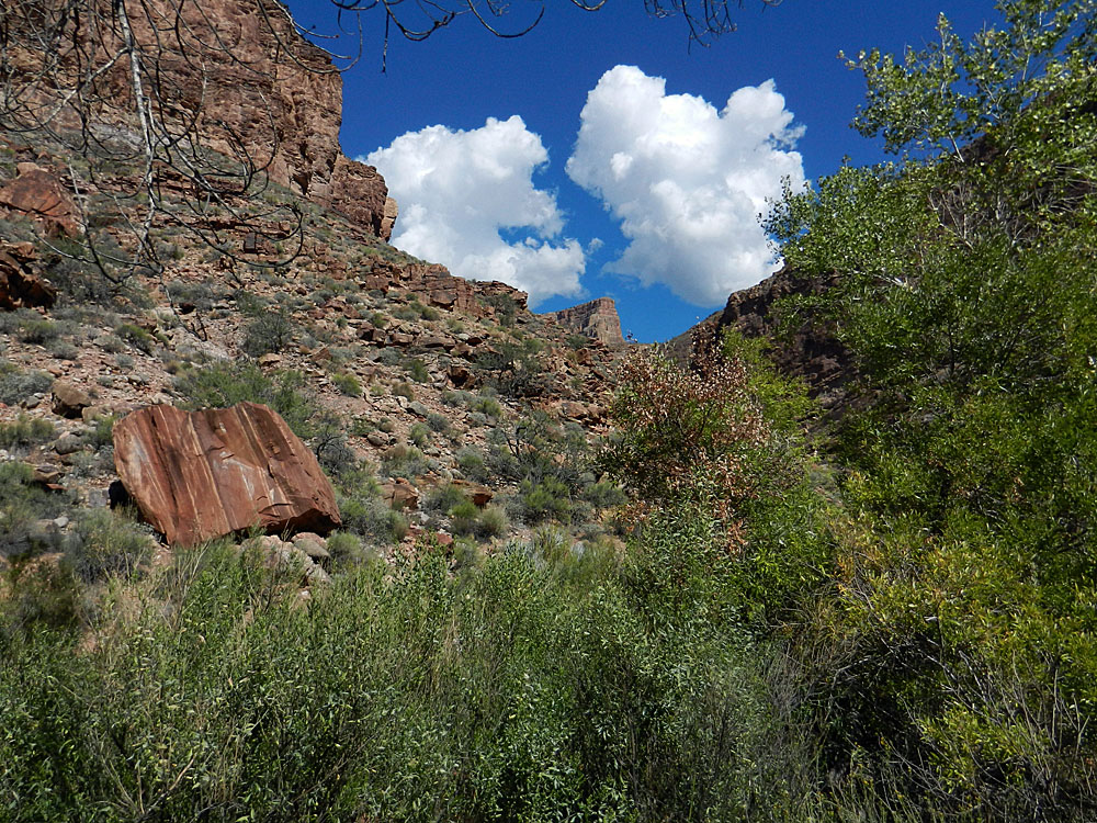
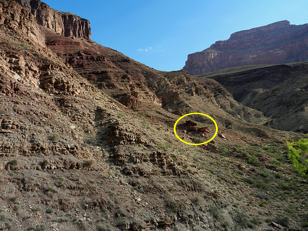
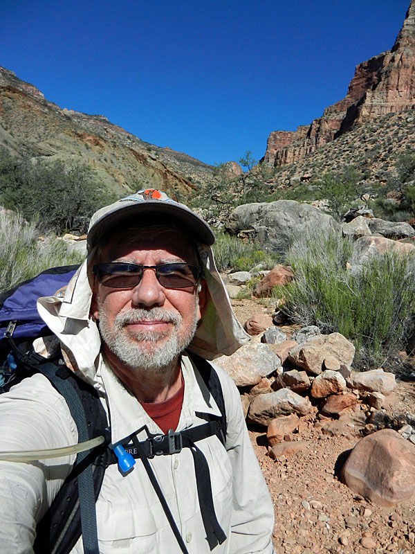
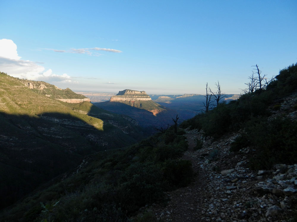
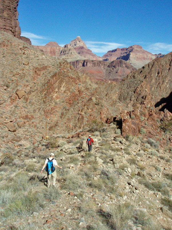
My 74th hike in Grand Canyon took me, finally, to the North Bass Trail. Yes, it is a hard one to get to. It was 1983 and I only hiked down to Queen Anne Spring, just a short distance below Muav Saddle. [NPS info calls this "Queen Anne Spring" while some trail guides I have refer to it by the more unimaginative name of "Muav Saddle Spring."] Still, it was only a taste. I would return a couple more times, but never get lower than the saddle, until 1993, when four of us hiked down to Shinumo Creek and got a chance to really see this area, or at least some of it. I returned, briefly, in 2009, when on a hike from the Crazy Jug area to Phantom Ranch. We overnighted in the cabin on Muav Saddle and then spent our next night just below Bass' old Shinumo camp. It was cool to hike through the area but I still wanted to get there and do more. But, this trail is hard to get to. During the winter and spring, snow keeps the road closed and hikers off the North Bass. The summer is possible, but the heat is likely to be quite overwhelming. This trip was in mid-late September and the heat was knocking me out, so I can't imagine trying this in June or July. So, the prime time to hike is the fall before it snows. Since I teach at the university in Flagstaff, that means I am pretty much out of luck on this score until a brief window opens at Thanksgiving and more time is available in mid-December. And, usually that's too late. But, this year I am on sabbatical. And, that means I can do some fall hiking that I wouldn't otherwise get to do. So, five months in advance (as per the current rules), I submitted my request for a permit. I wanted something later in the month, but what I got was something more in the middle. So it goes. All I could do is hope for decent weather (i.e., not hot). Indeed, in hindsight, I picked the right time. If I had gotten my first choice - early October - I would have been sorely disappointed as that's when the government "shut down" and hiking in the canyon was put on hold for a couple of weeks!
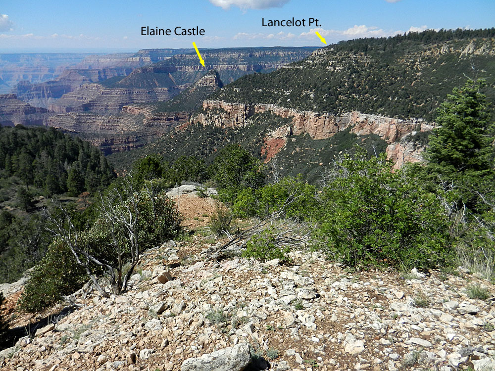
As I contemplated this hike I became increasingly interested in hiking
up Shinumo to Modred Abyss and on up to Elaine Castle and out on the rim
at Lancelot Point. There were supposed to be a couple of tricky
spots along this route - the top of the Supai and a spot in the
Coconino. After thinking on it for a while I realized that I might
day hike on the rim and down to these spots to see if I would feel
comfortable hiking up through them. So, that's what I planned -
two nights camped in the forest so I could day hike Lancelot Point and
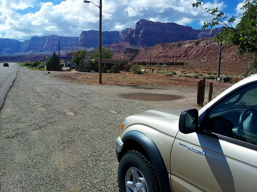
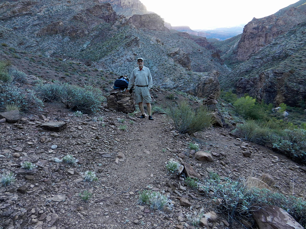
then spend 5 nights in Shinumo. On Thursday, Sept. 13, I drove up to the north rim from my home in Flagstaff. Along the way I stopped briefly at Marble Canyon, where the restaurant and store burned down some months ago. I hope they rebuild. At Jacob Lake I filled up with gas and checked in with the Forest Service Visitor's Center to see about road conditions. It had been a rainy September for us - quite unusual. Nothing was closed, but I was warned that some roads may be muddy. As it turned out, I only had to drive through a half dozen puddles on my way to the rim. No problems, but I did scare up some turkeys along the way.
Once past the park boundary, the nice road signs disappear. But,
the crucial junction was well-marked, if a bit out of kilter.
Swamp Point is the trailhead for the North Bass. My day hike, on
the other hand, would start from the road leading to Kanabownits Spring
(& cabin). I decided to check on the road to Swamp Pt. first and
that was worthwhile - about two miles short of the end I came to a large
tree that had fallen across the road that I could not budge. I Then I drove down the Kanabownits road to look for my jumping off spot for the next day's hike. There is a fire road on older maps but I couldn't find any sign of it. I decided that a meadow I had seen on Google Earth would be a good place to start. So, off I went into the forest to find a place to park and camp out for the night. The next day I headed through the woods for Lancelot Pt. The thorn bushes are bad in here and I was often hacking my way through. I was wearing my new Spot device for the first time and using its tracking feature. Friends and family were able to follow my progress and probably figured out well before me that I was going to miss Lancelot Point! I ended up getting to the rim east of the actual point. Since I didn't have the time to get to the point and to check out the cliffs below, I decided to scrub my initial plan of hiking out this way. Instead, I would hike back out the North Bass Trail. After returning home, I wrote an article for the local paper on this hike. |
|
|
||
|
Click on any picture to see a larger image. |
||
|
|
||
 Site of old Marble Canyon restaurant. |
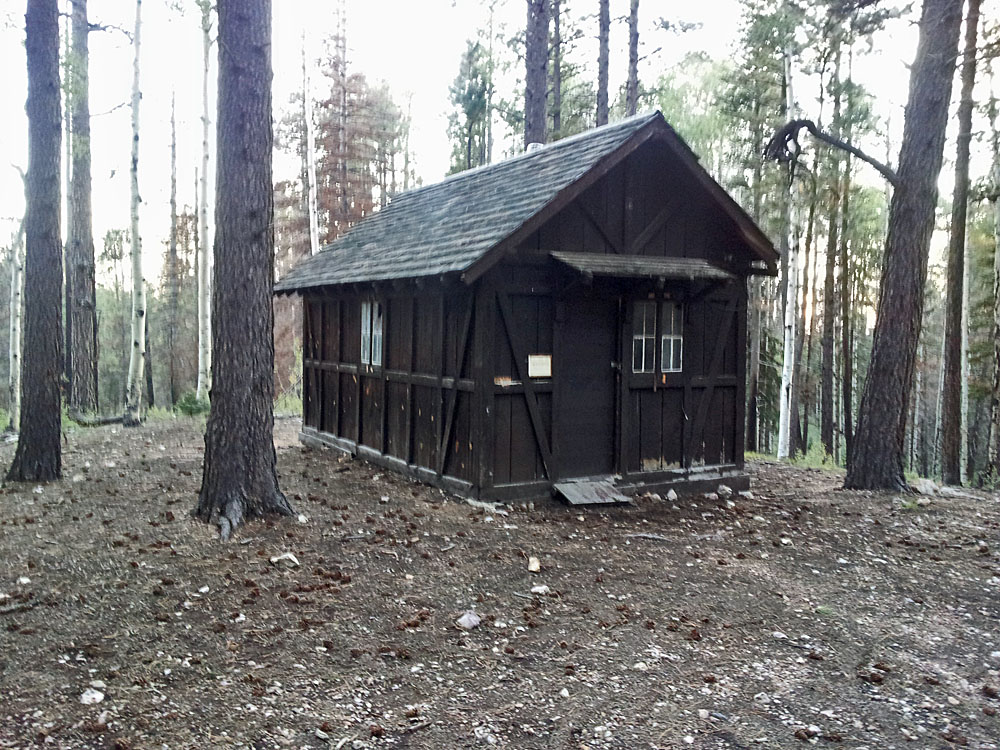 Kanabownits cabin. |
 Fallen tree on Swamp Pt. road. |
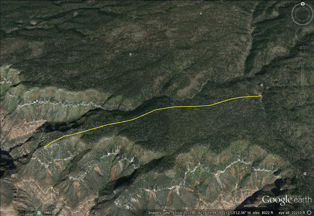 Hike to Lancelot Pt. route planned. |
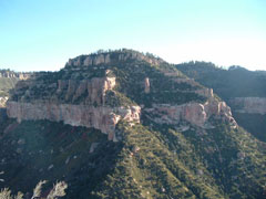 Doug Nering' photo of Lancelot Pt. |
 I didn't quite get there! |
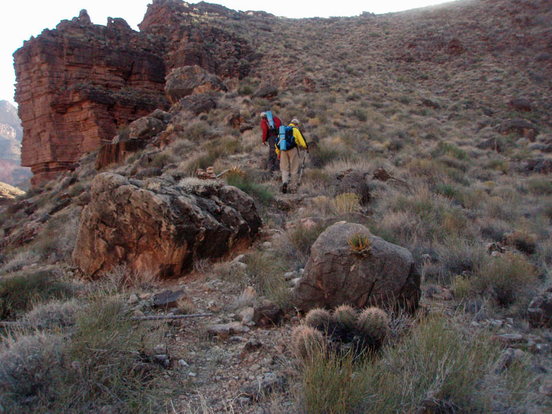
Day
1 - Down the North Bass Trail (Saturday, September 14):
I got up very early and got a nice start on the trail, heading down by
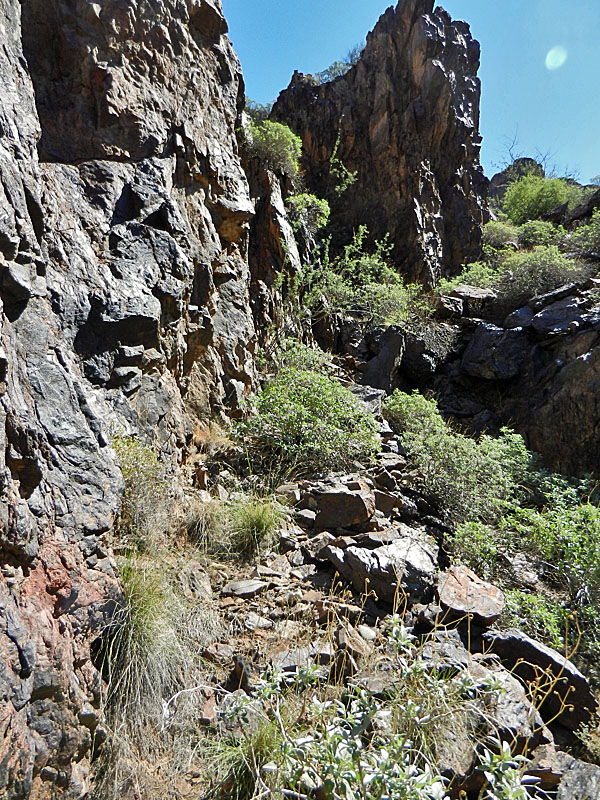
6:30 am. The trail is in great shape down to the saddle and I
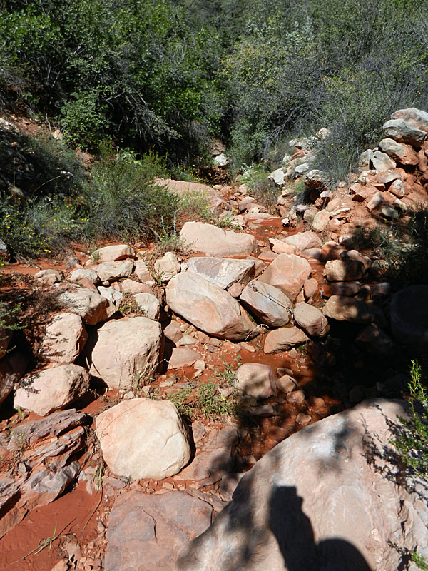
reached that in about a half hour. Then down through the upper
Supai and just as my trail was giving out, I heard thunder and saw the
sky darkening behind me. Soon it was raining and I had my poncho
on, which kept me from getting drenched, but not from getting wet.
Now I was hiking down the ravine of a trickling spring so everything was
wet. I looked
for any place to duck out for a while, but it is all open in this
section, and covered with lots of trees and bushes. So, on I went.
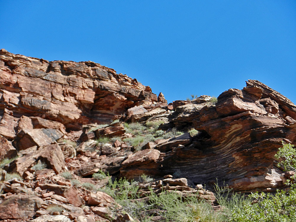
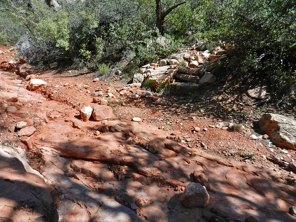
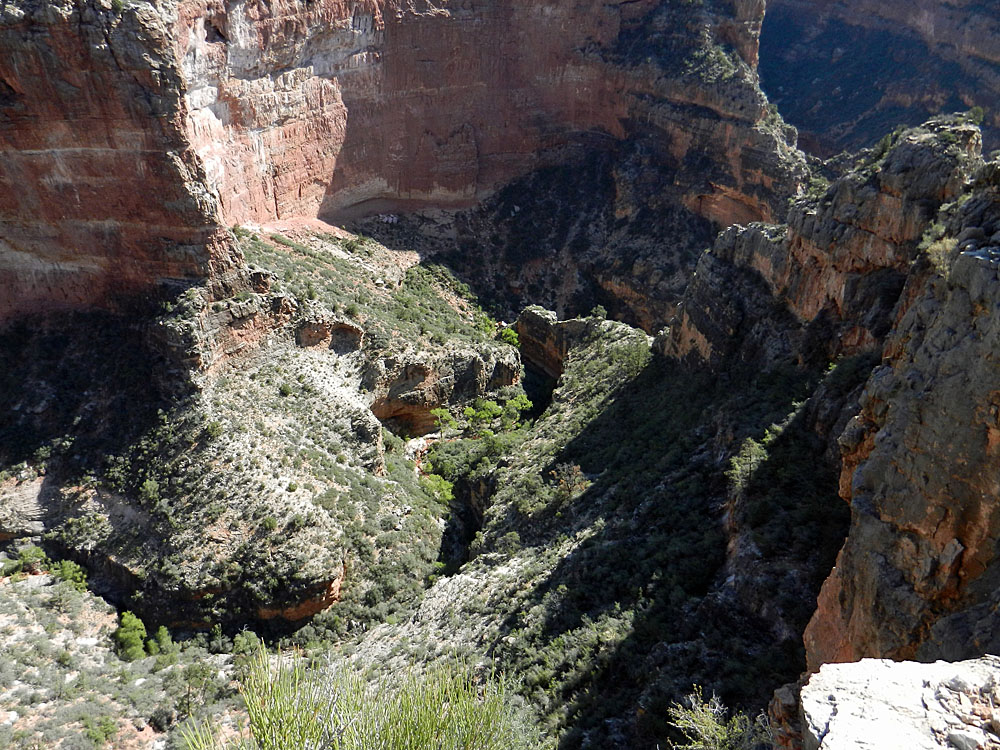
At 8:45 am I reached the bypass trail that goes along the top of the
Redwall, while a narrow canyon forms below. The sun was back out
and I took a long rest stop to dry out. Along here the trail is
again in
great shape and easy to follow. Years ago, the trail guides would
point out that you needed to keep an eye out for the proper descent. Now
it is quite obvious. [The ascent, however, is another story.] Back in 2005, the park service had
a volunteer crew out here rebuilding parts of Bass' old trail - where it exists -
and so these segments are in good condition and you just fly along them
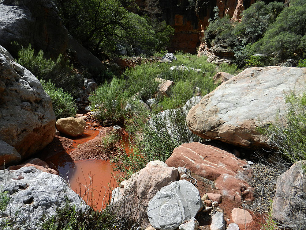
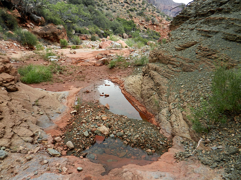
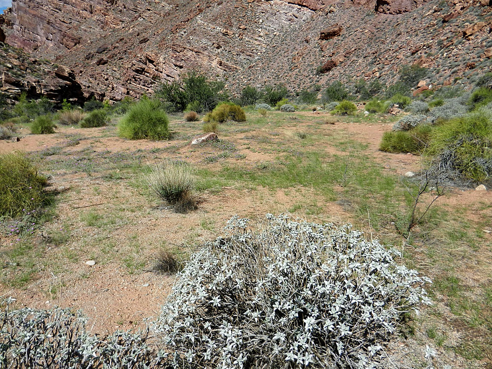
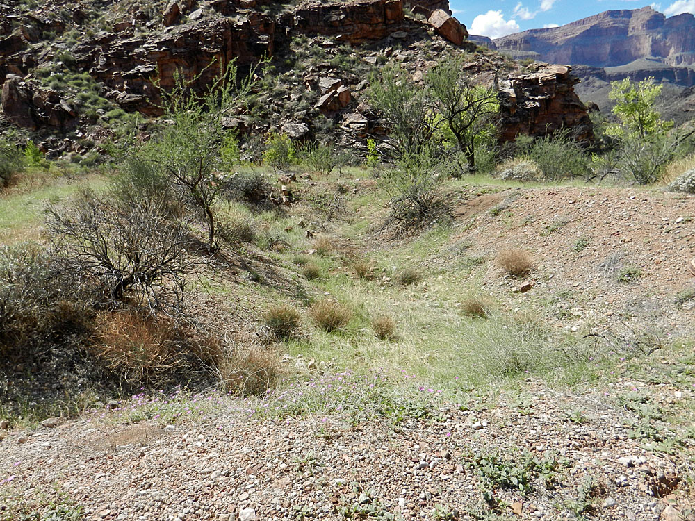
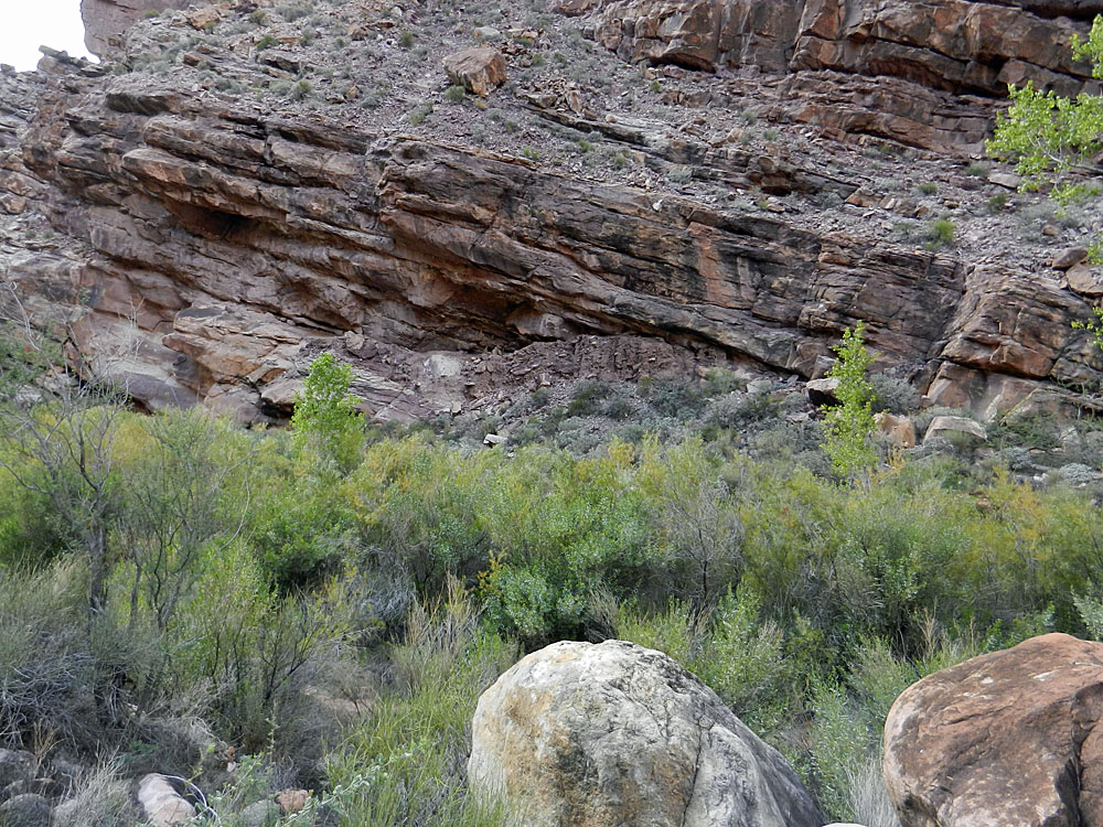
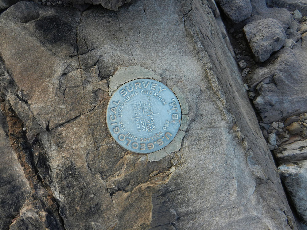
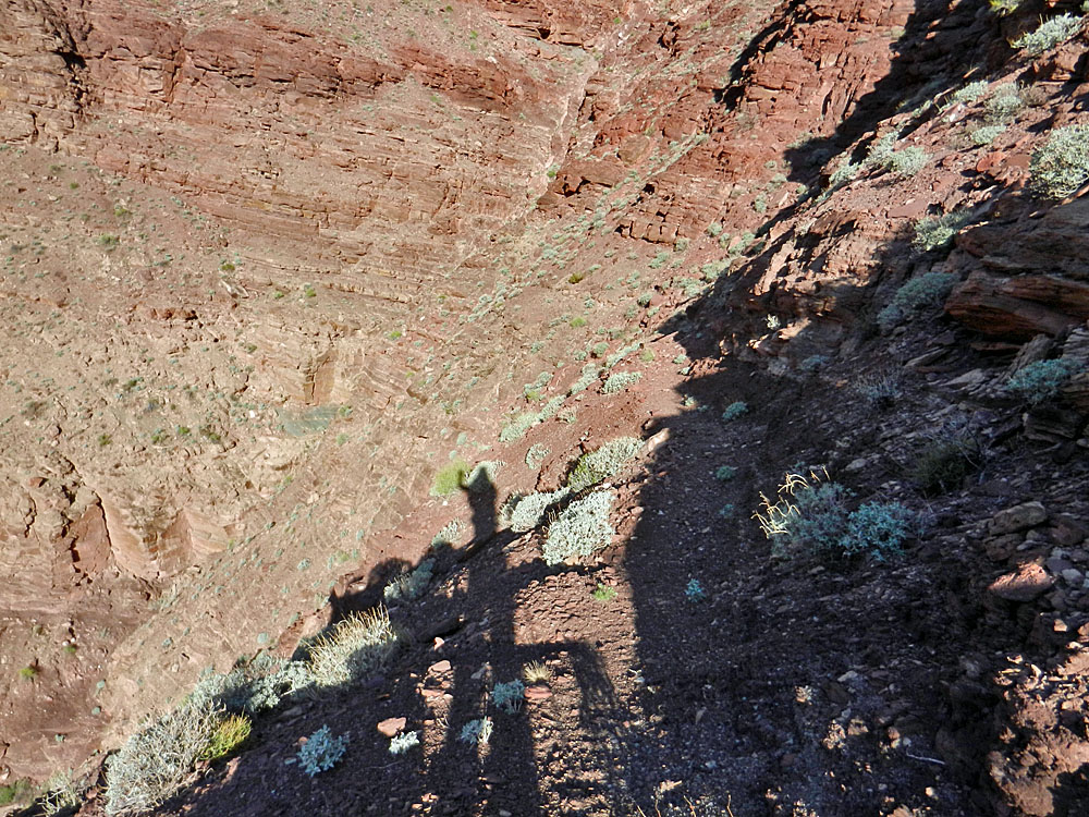
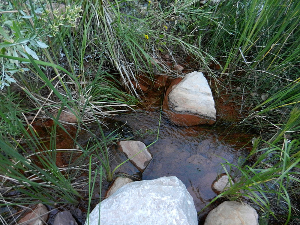
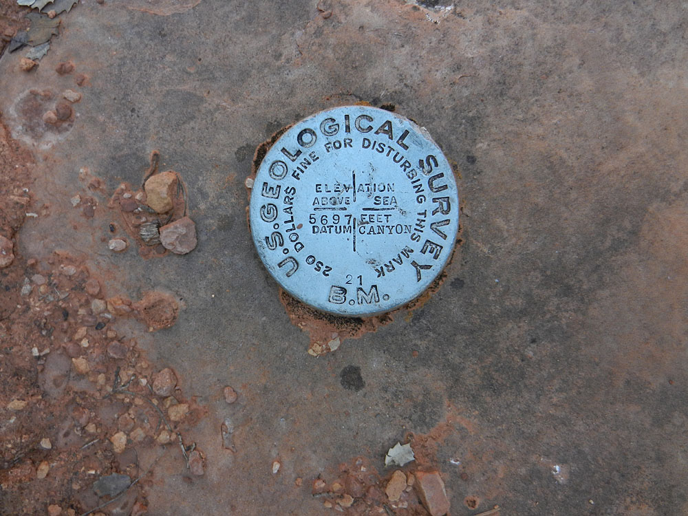
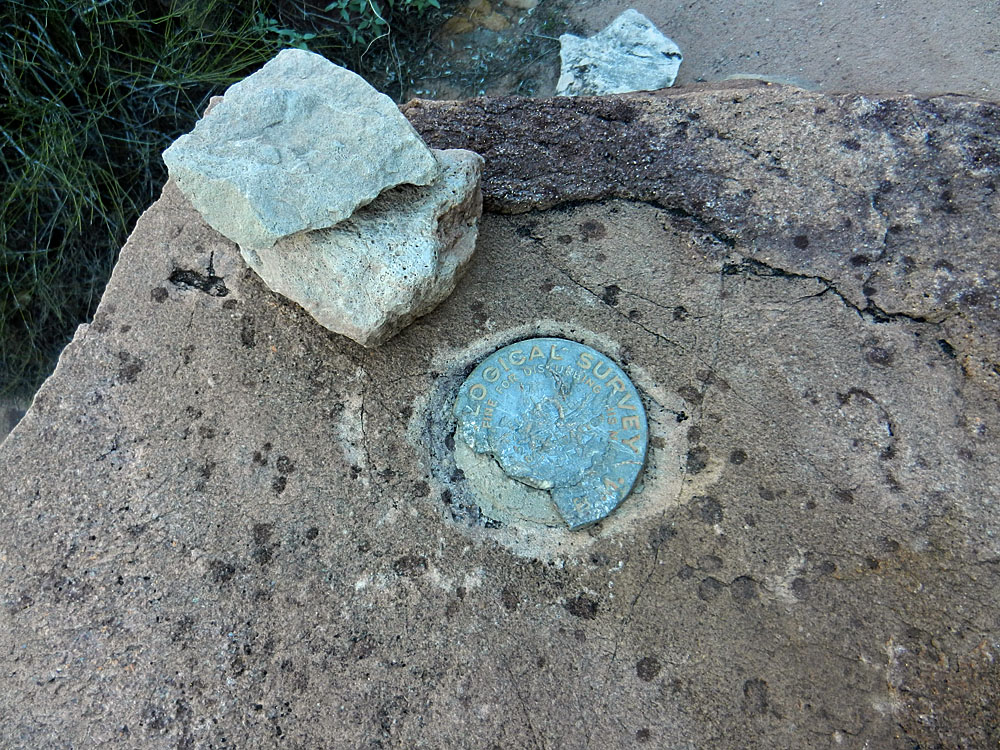
with ease.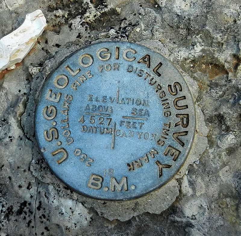 It took about a half hour to descend the Redwall. Along the way I saw the first of many benchmarks that I would encounter on this trip (shown to the right). Once back in the main bed I was again following flowing water - White Creek. The "trail" would hop back and forth, go down wet stretches and sometimes be hard to see. I was constantly looking for cairns to validate my choice of routes through here. By noon I was getting quite tired and wanting to take a break. I had slipped a few times on the muddy surfaces and the slow going was wearing me down. I still had a little flow of water beside me so I decided it would be a good time to fill up and insure that I had enough before it disappeared. I pumped two liters at this spot. I stayed here for an hour and then pushed on. The water did soon stop and I saw only a few potholes for a while and then they, too, disappeared. By now the canyon had widened out quite a bit. On occasion the trail would leave the bed and be easier to follow. At 3:30 pm I reached the place where the newly rebuilt Bass trail leaves the bed and follows along the Tonto level before descending to Shinumo Creek. I wanted to continue down White Creek to Shinumo. But, I knew that the going would be rougher from here and I was feeling the effects of a hot afternoon. I had just passed a brief section of narrows where some water had accumulated into pools, so I decided I would stop here for the night. I got a gallon of water, set up my tent and made dinner. I initially put up my rainfly, but that soon came off as it was just too hot and stuffy, even as it got dark. I decided that I would need to allocate two days to hiking out, since I still hadn't reached Shinumo and I was hiking downhill! I also decided that I would refrain from doing much, if any, hiking during the afternoon hours. It just was too hot for me. |
|
|
||
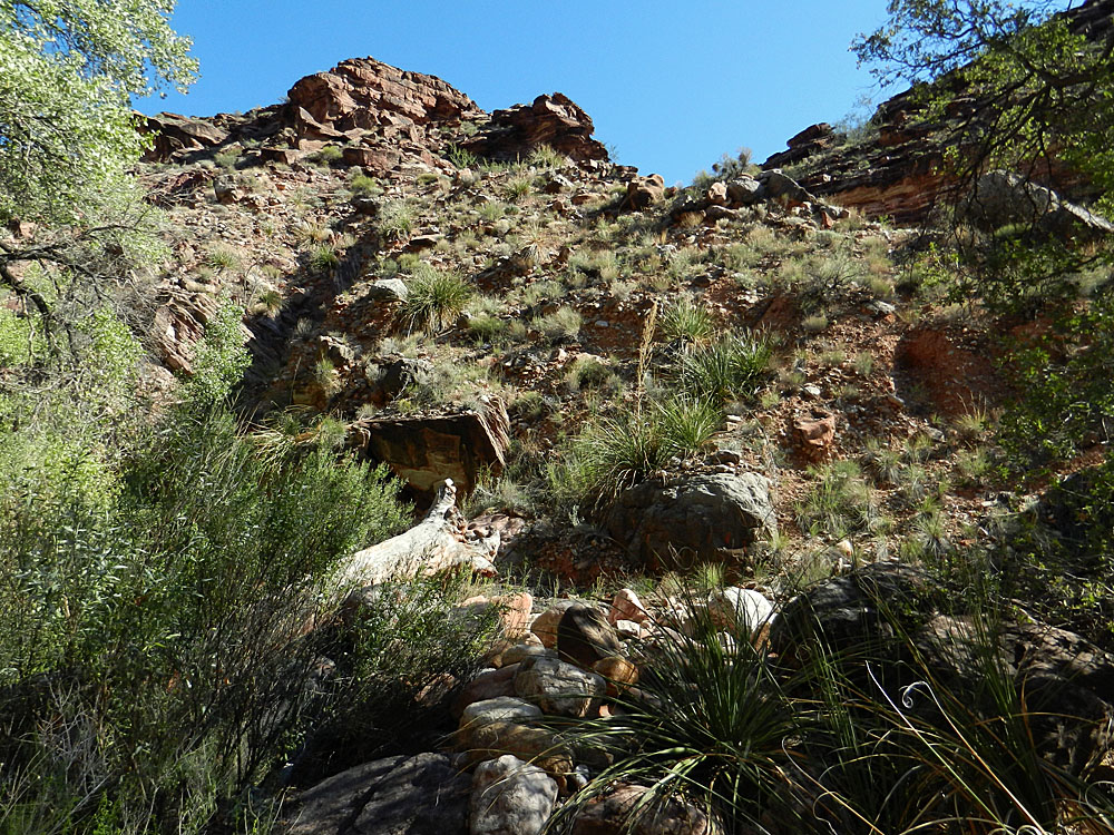
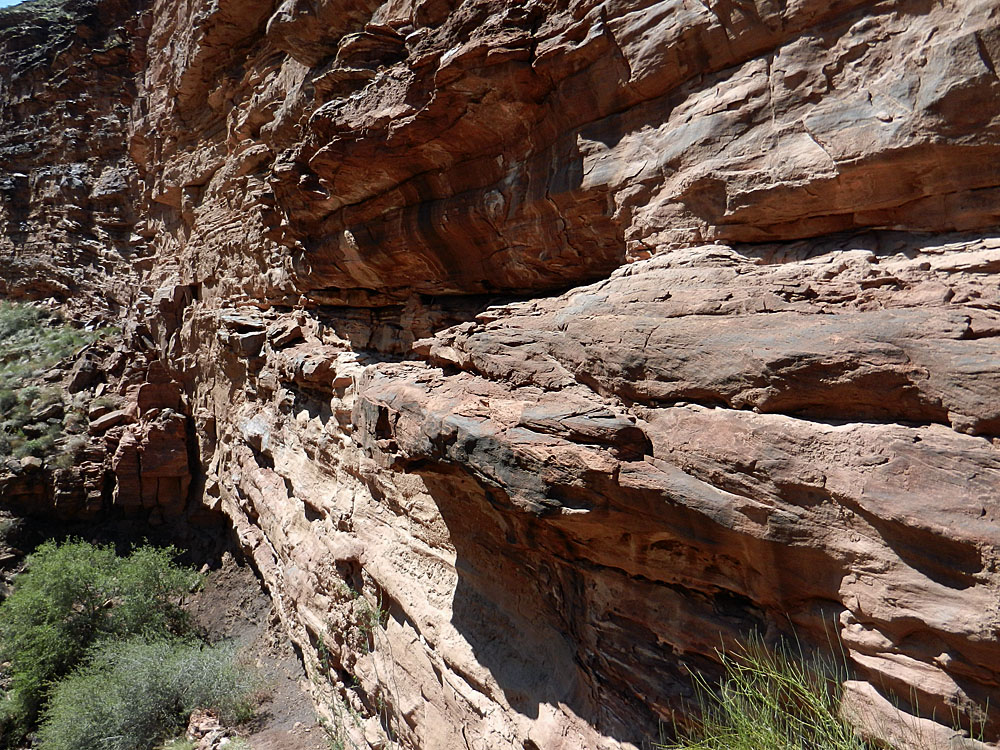
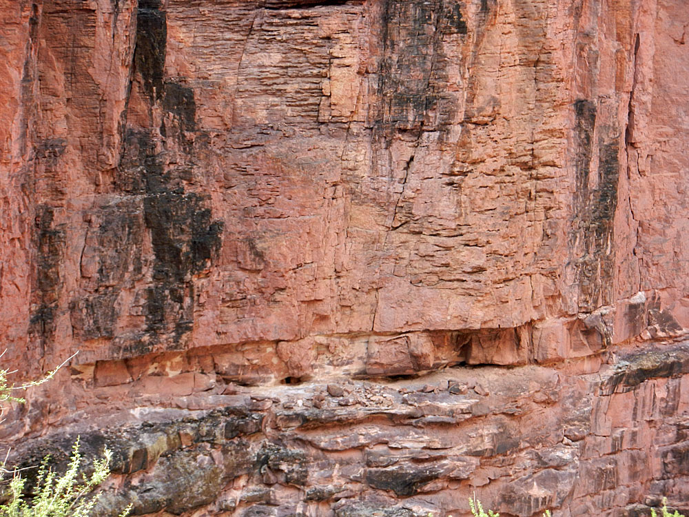
 The Redwall cliffs develop quickly and the trail stays atop this layer for a while before descending to the bed. Muav Saddle can be seen in the background. |
 At the bottom of the Redwall. |
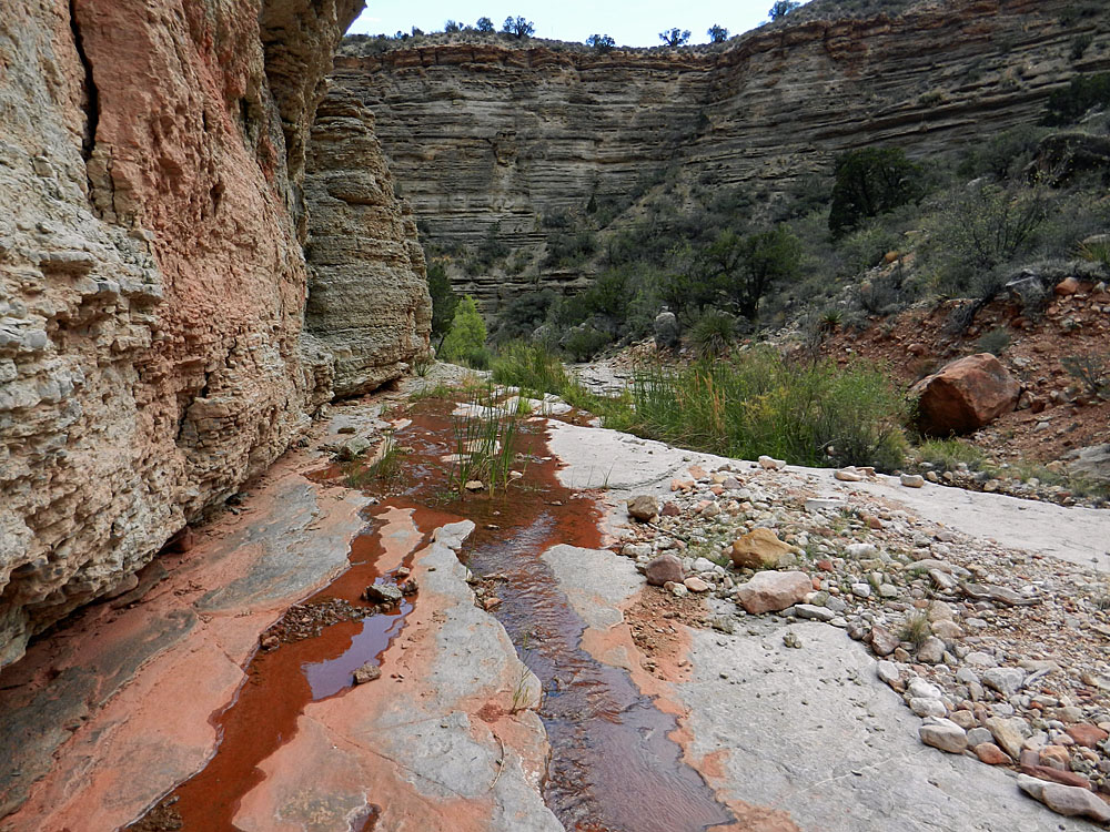 The trail and creek are the same. |
 Typical terrain in the bed. |
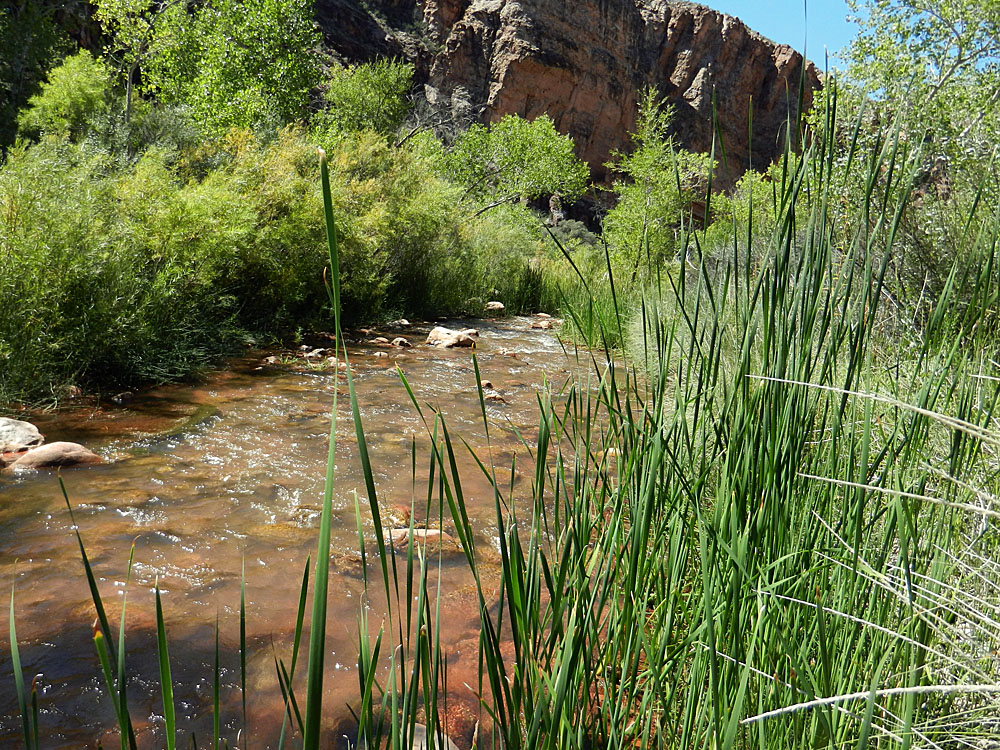
 Reeds growing in some pools. |
|
|
|
||
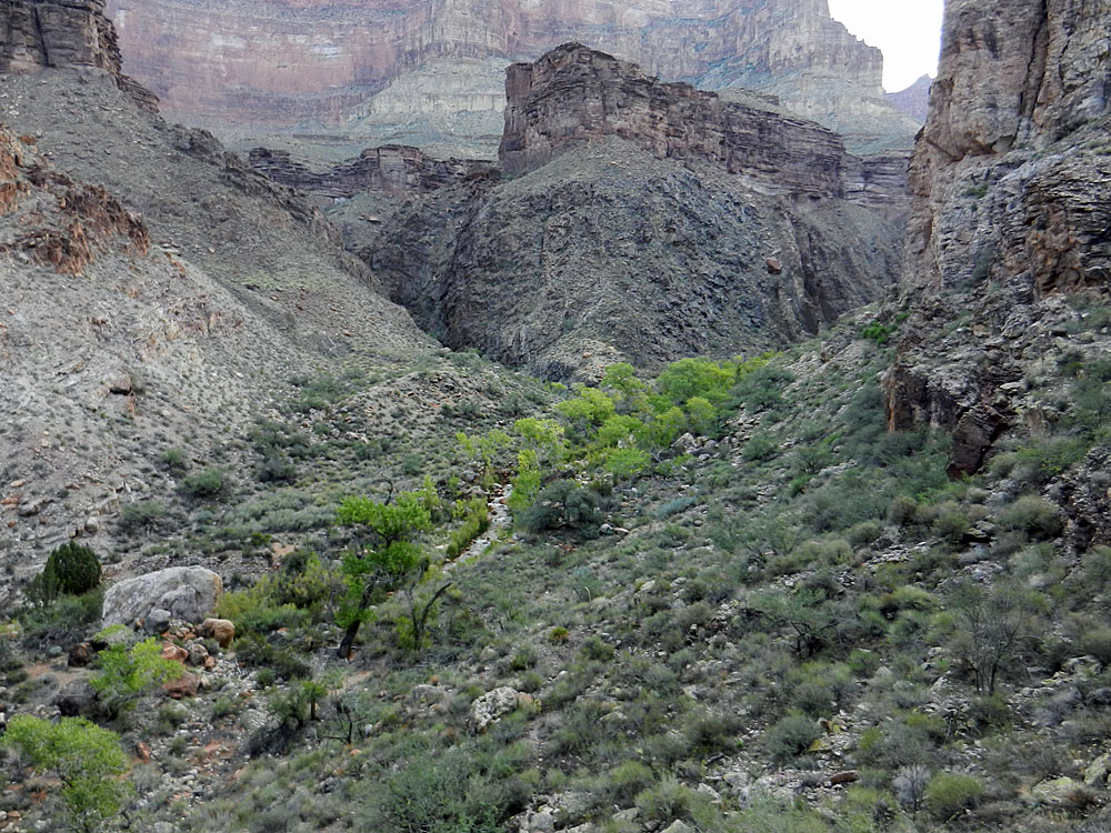
 At the Tonto level the canyon widens. |
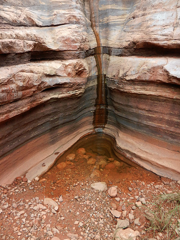 As the afternoon wore on I was looking for water before making a camp. There was a short section of Tapeats that formed a narrows and this pool provided for my needs. |
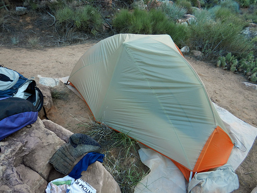 My camp; the rainfly soon came off! |
 Pothole water wasn't there 6 days later. |
 Holy Grail Temple, aka Bass' Tomb. |
|
| Day
2 - To Shinumo Creek - Finally! (Sunday, September 15):
I slept pretty well once it cooled down - probably at/after midnight.
I was up at 5:15 am and on my way at 7:45 am. I knew I would reach
Shinumo this day and was not in a super hurry since I was not going to do
anything else in the afternoon. In fifteen minutes I came to the
narrows that must be bypassed to the north, down a side ravine.
Down in here it was nice and cool and shady. Very narrow, and with
a spooky charm. Since this route hasn't gotten as much use since
2005, it seemed more like bushwhacking than I recalled from my 1993 trip.
Lots of bushes to push through and you are constantly going back and
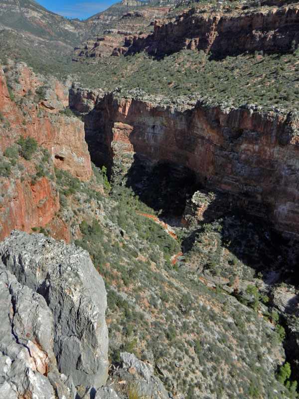
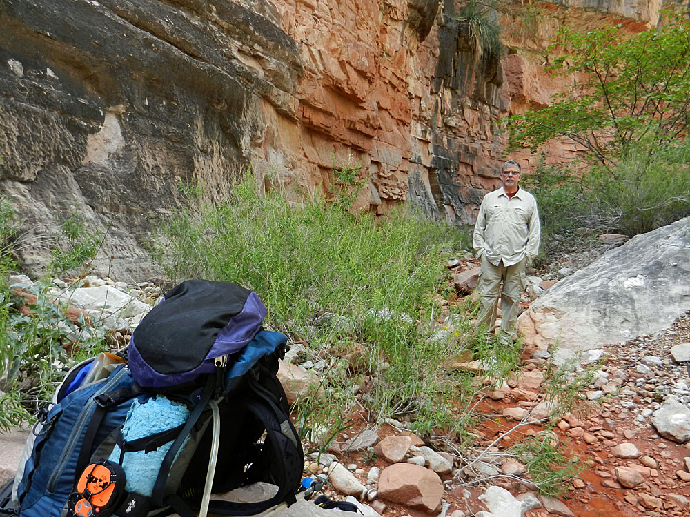
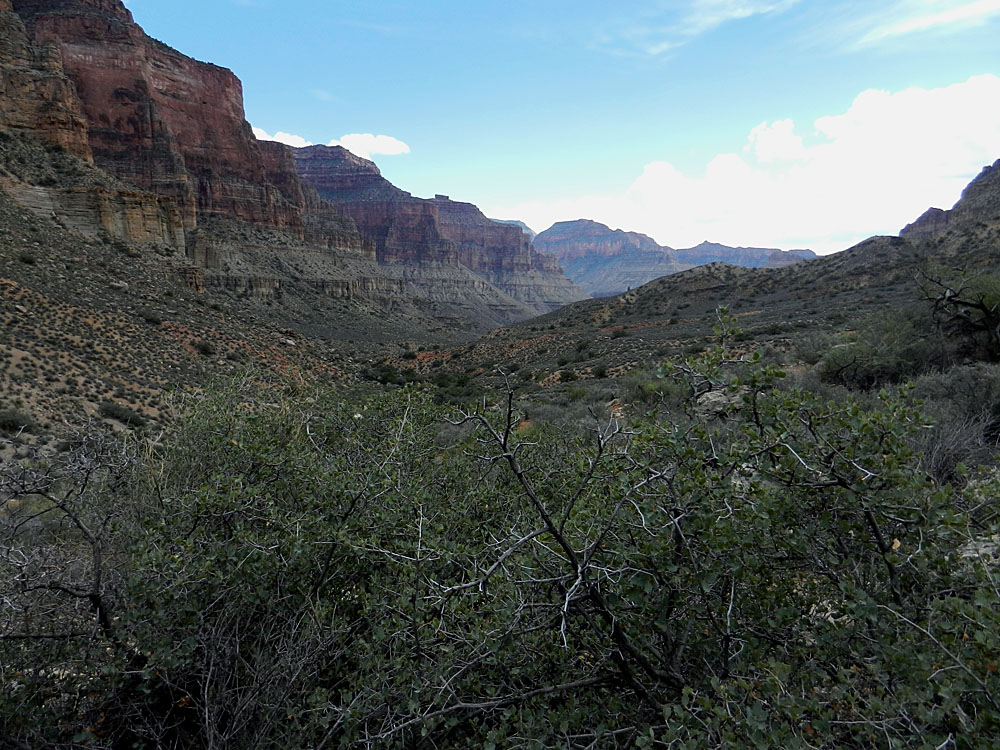
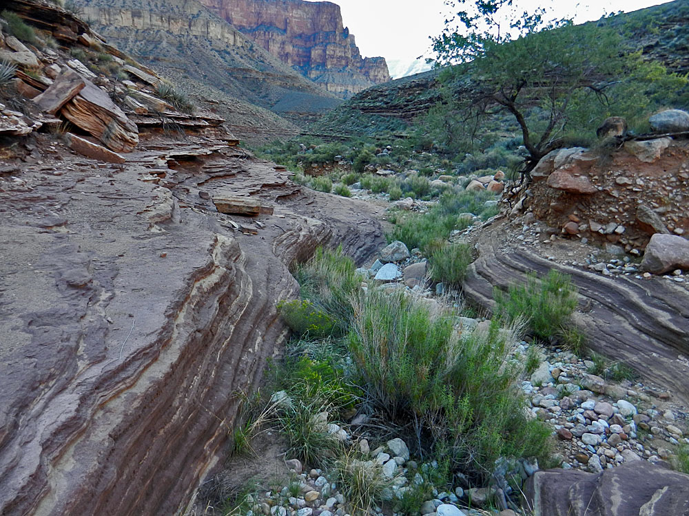
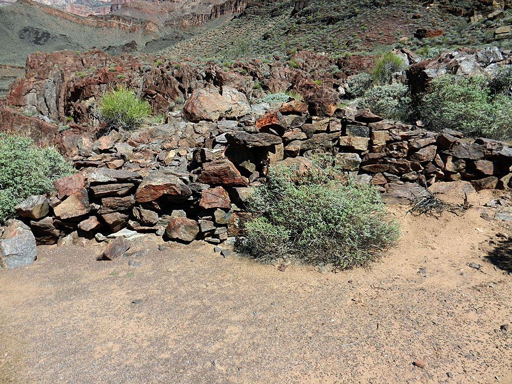
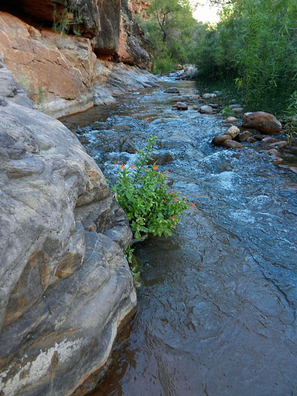
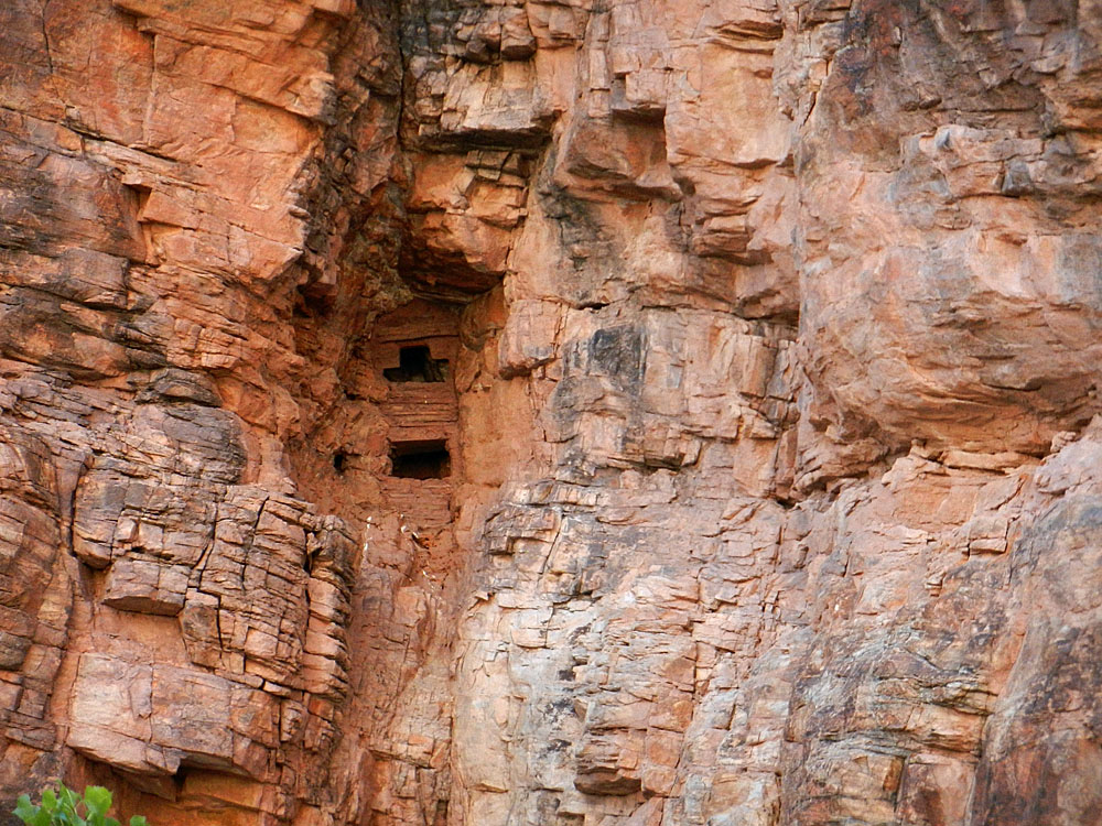
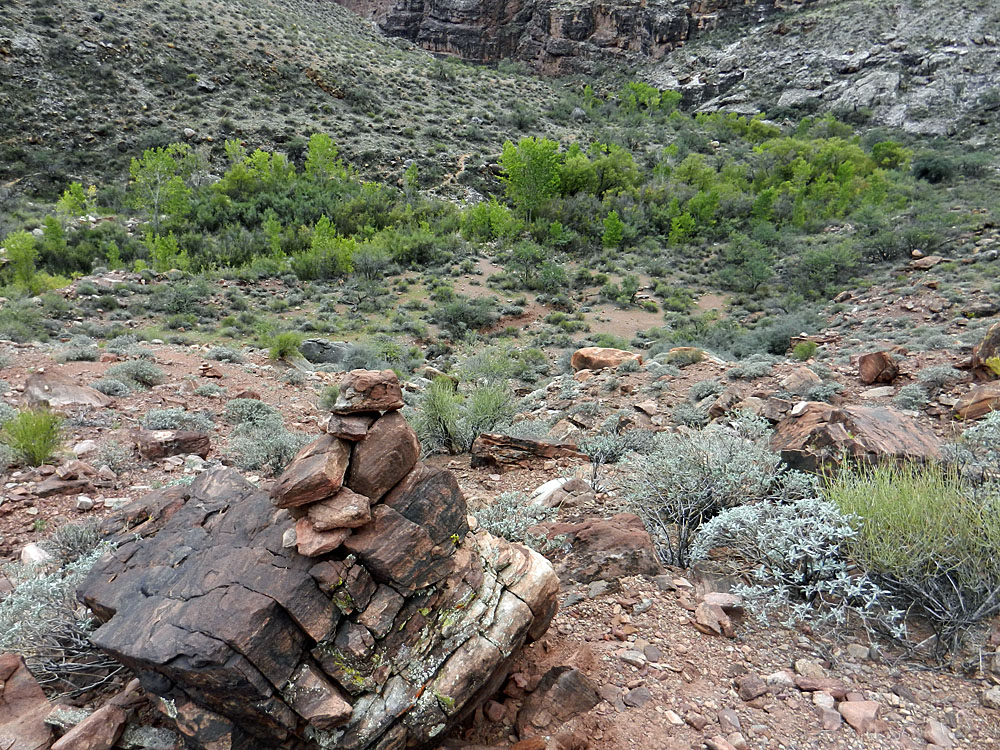
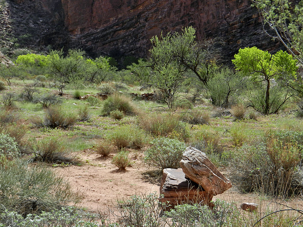
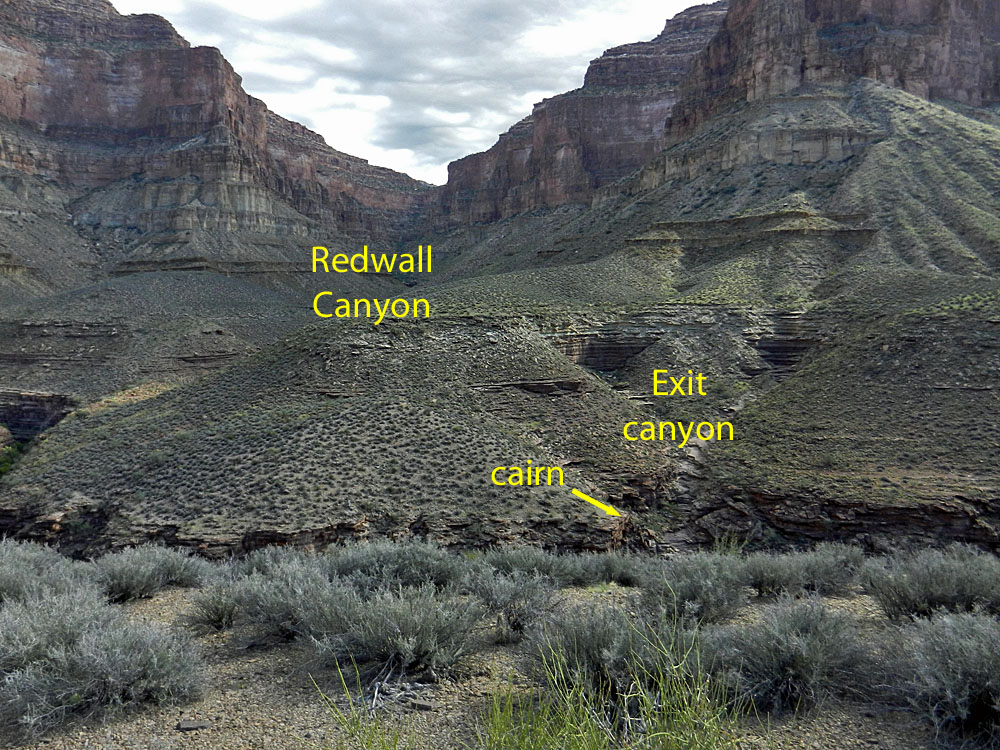
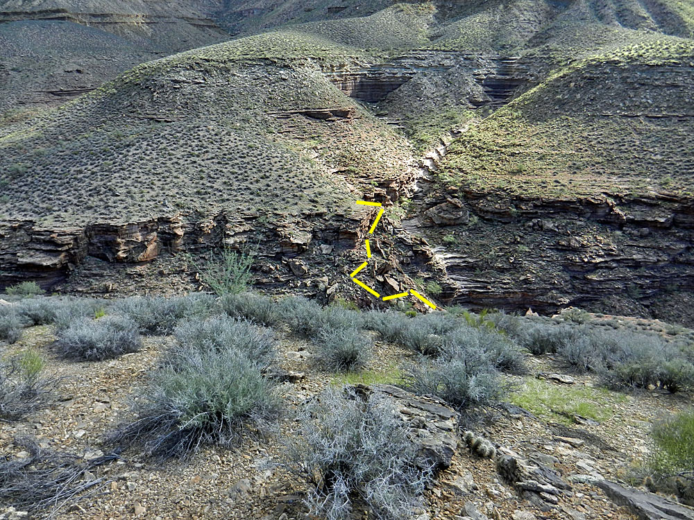
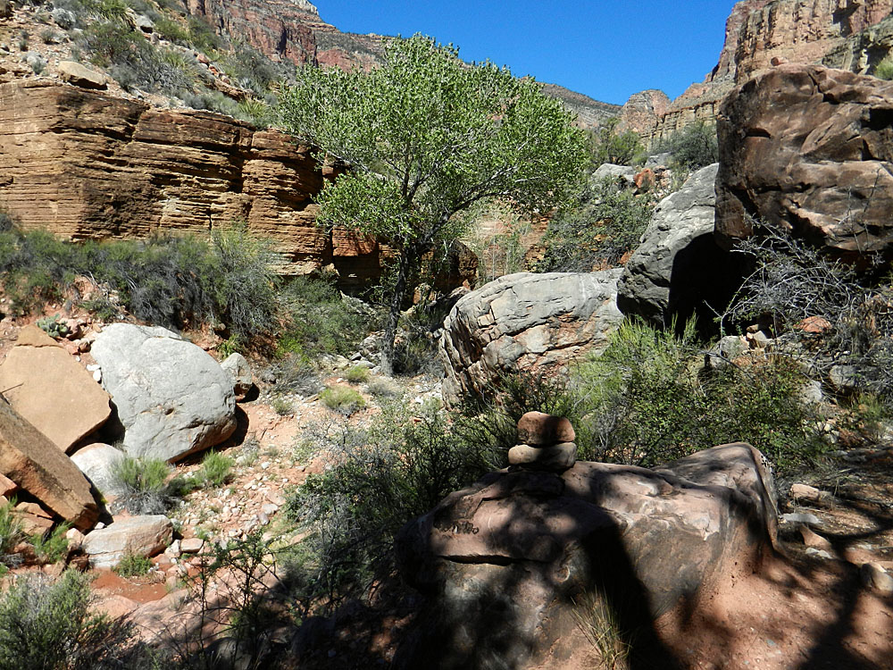
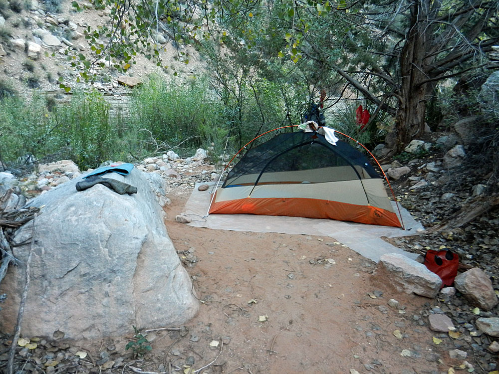
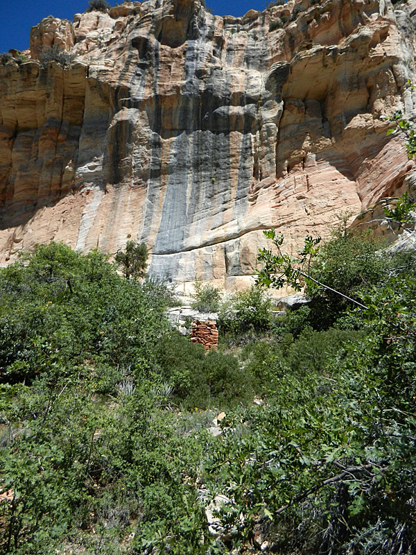
forth over the little creek. It took me about a half hour to reach Redwall Canyon, which comes in from the left. Looking up through here you can see the Holy Grail Temple, which is pretty cool. Only about 15 minutes further down, I came to a wider spot and was taking a break when I saw what looked like a route up to the top of the Tapeats, also on the left side. Harvey Butchart had written about finding some old trail construction in here and I think this was it. I headed up and found a few times I was on something faintly level like an old trail. At the top was a cairn, which I added to. From here one can followed the plateau around the Holy Grail and into Modred Abyss. Well, maybe on a later trip. After another 20 minutes downstream I came upon some giant blocks of Tapeats cliff that had broken off. I went over to them and found the remains of an old camp - used both by Indians and miners. Most certainly, Bass must have used this spot. Further up the slope I spied a granary in a ledge marking this as an ancient site. Just before reaching Shinumo, the bed plunges over a small fall and there is a bypass to the left. An old iron stake is still here, driven into the rock, indicating Bass' use of this route a hundred years ago. I reached the creek at 12:30 pm and was quite ready to call it a day. I started off hanging out in the shade of some trees on my side of the creek (west side), but I could see a tempting spot on the other side. After about an hour I checked it out and it was far superior. So, I hauled everything across the creek and set up my camp, where I would spend the next three nights. |
|
|
||
 Down the dry bed of White Creek. |
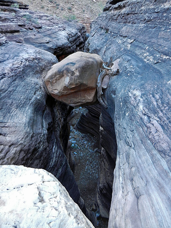 The canyon forms some narrows that have captured some boulders. I have a photo of me on this one from 1993. |
 Once below the top of the narrows you can walk back up the main bed and see some of the other boulders stuck in the narrow crevice. |
 Waterfall bars further progress up. |
||
|
|
||
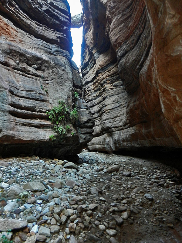
 Narrows of lower White Creek. |
 Seep springs feed the creek. |
 Low-hanging tree. |
 Bass' exit from canyon to the north. |
 Looking further down White Creek. |
 Cairn atop Bass' exit. |
|
|
||
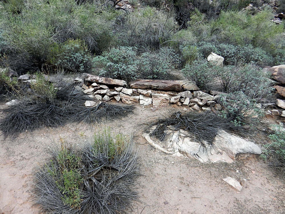
 Old camp under Tapeats blocks. |
 Pottery shards and old metal can. |
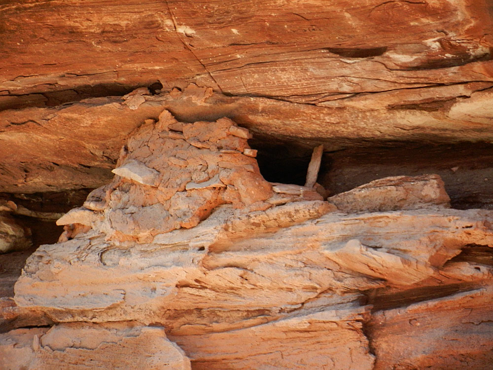 Nearby granary in the cliff. |
 Getting to granary is beyond me! |
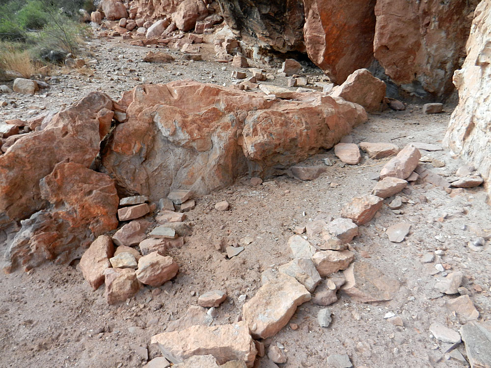
 Final bypass in White Creek. |
 Old trail construction at bypass. |
 Shinumo Creek. |
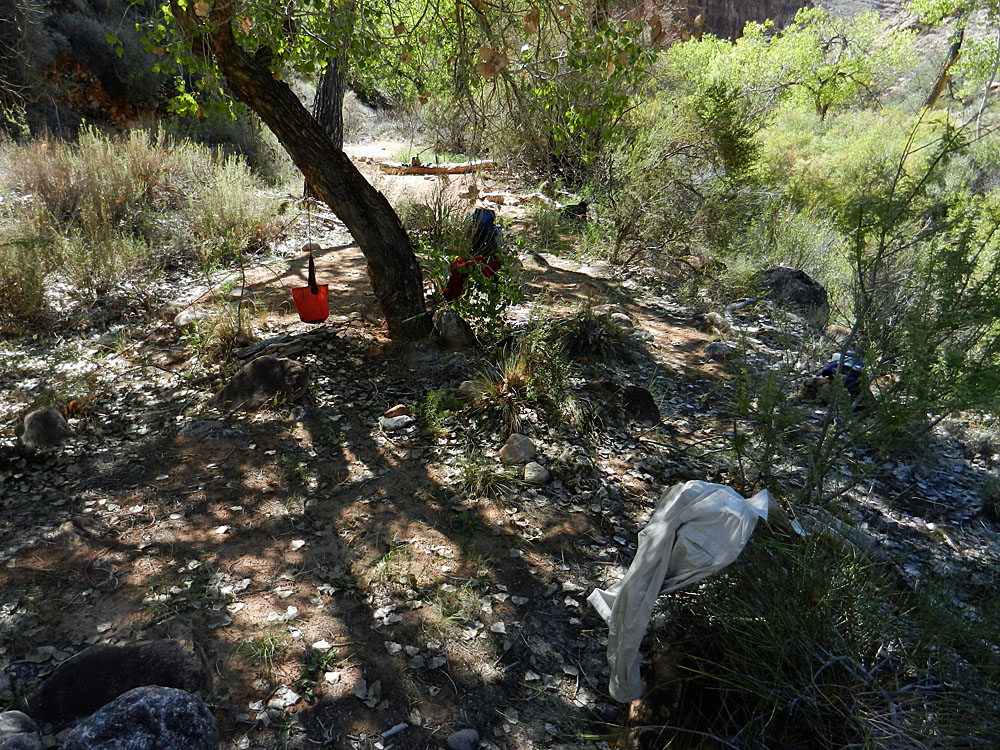 Campsite at Shinumo. |
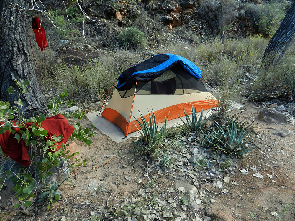 Tent's up. |
| Day
3 - To Bass' Shinumo Camp and Colorado River Tram Site (Monday,
September 16): It was a lot harder to sleep here
even with the creek nearby. It was quite warm until very late in
the night. Still, I was up early and on my way downstream for a
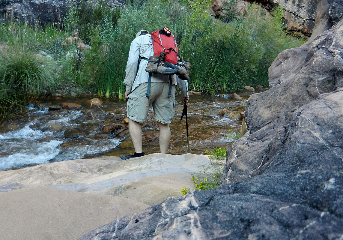
day hike at 6:30 am. I was easily able to follow a trail down the
creek, but it makes many crossings. I brought along some aqua
shoes and put them on at every crossing. Then, I would change back
into my boots. I made six crossings to reach Bass' Shinumo Camp,
and it took me a long time because of all the footwear changes. On
the rest of my forays up and down the creek, I decided to just leave my
aqua shoes on and only change into my boots when my crossings were done.
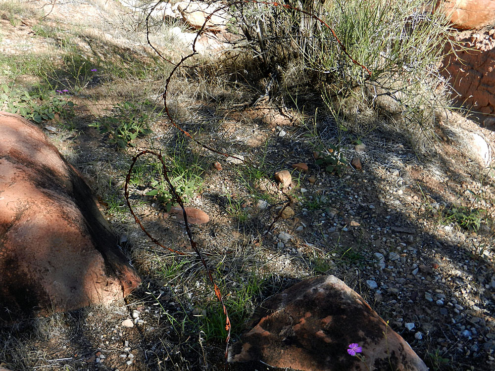
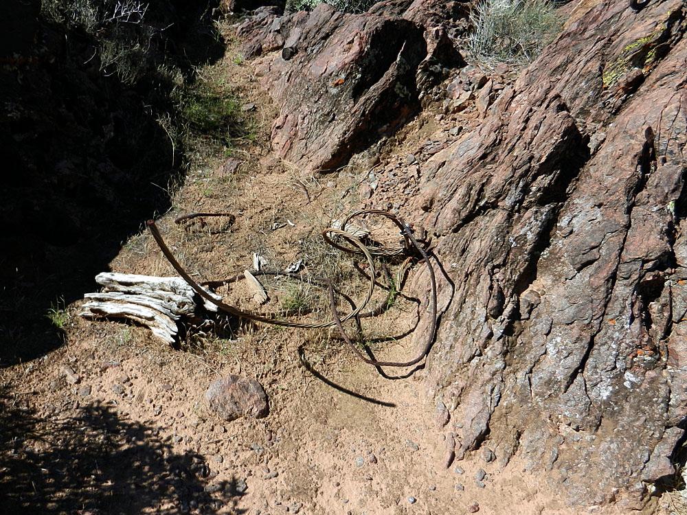
At 8:50 am I came upon some barbed wire. I was very excited about
this find because it seemed like this might be off the beaten path.
But, my elation was dashed when but five minutes later I crossed the
creek again right into Bass' old camp. So it goes.
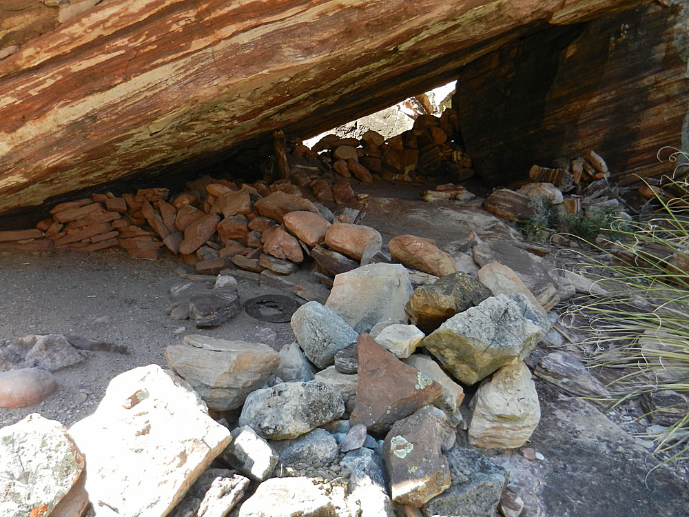
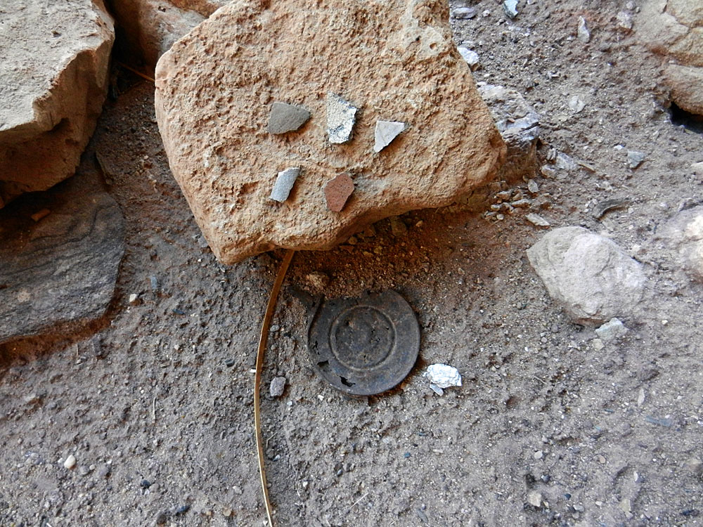
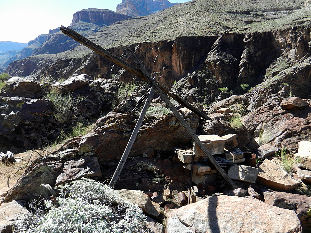
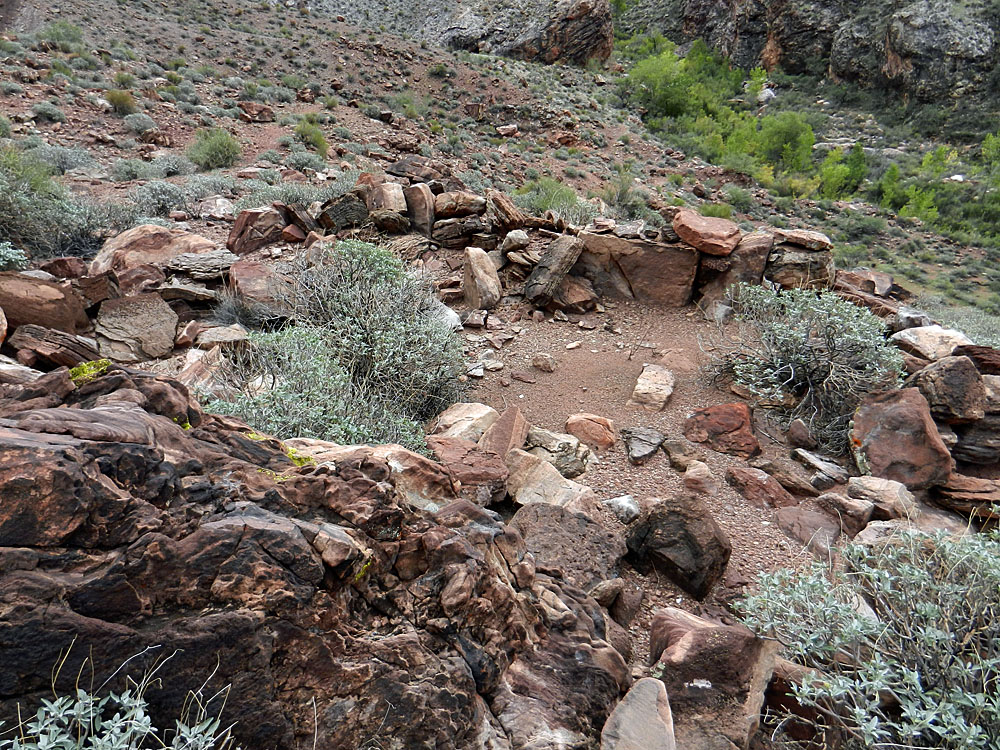
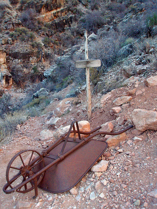
I spent quite a
while looking over the old camp remains. A lot is still here and
nicely displayed on a couple of planks. I noticed some white
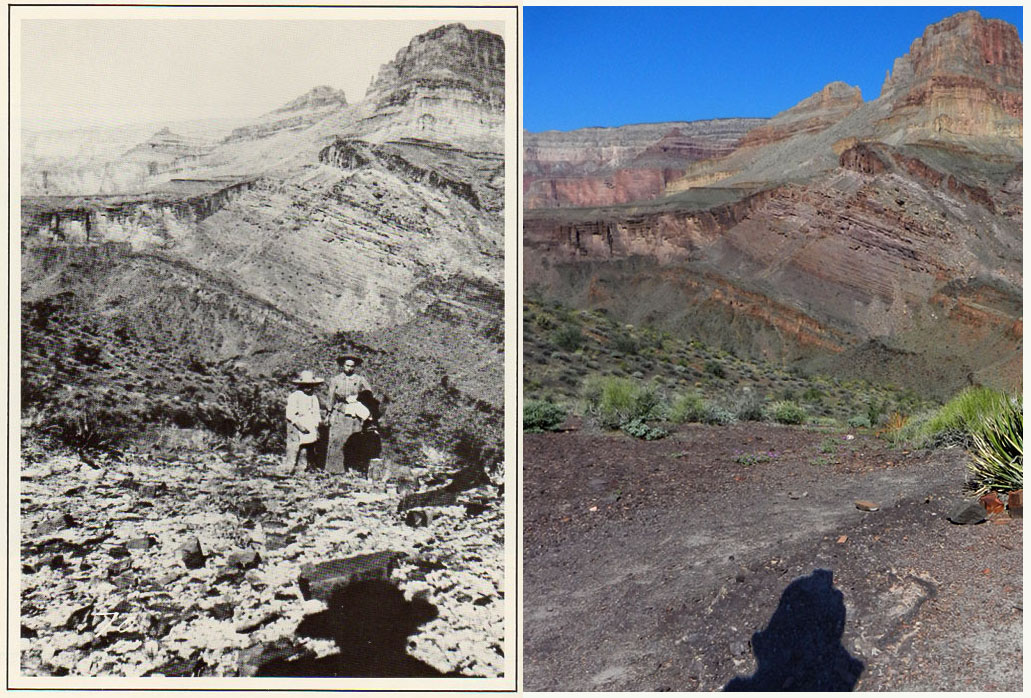
fibers on the ground and at first thought At 9:30 am I was on my way down the trail. Just a few minutes away is a great camping spot - we stayed here in 2009. There is a large blocky rock with one of the benchmarks in it, although part has been chipped away. Then it's up hundreds of feet to a saddle overlooking the Colorado River. This is the way to Bass' old ferry and tram site. I was at the saddle at 10 am and stopped for a bit. I had a photo that Bass had taken of his wife and son at this spot and I wanted to see if I could reproduce the image. Nailed it. See the two photos, below, separated by more than a hundred years! |
|
|
||
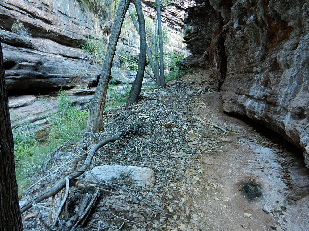
 Trail runs high above the creek. |
 One of many creek crossings. |
 Barbed wire near Bass' camp. |
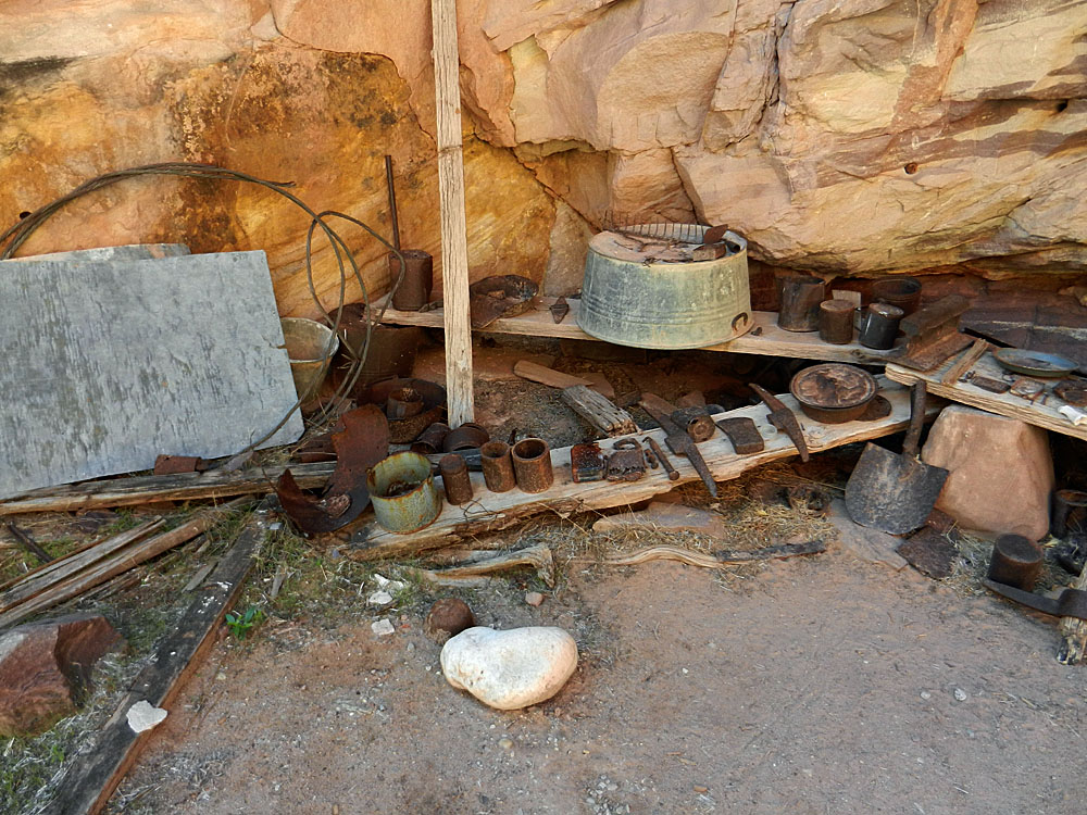 Odds and ends piled up along ... |
 ... some planks under an overhang. |
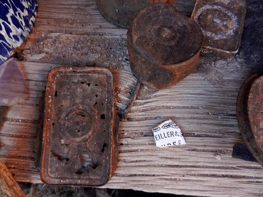 Old metal cans. |
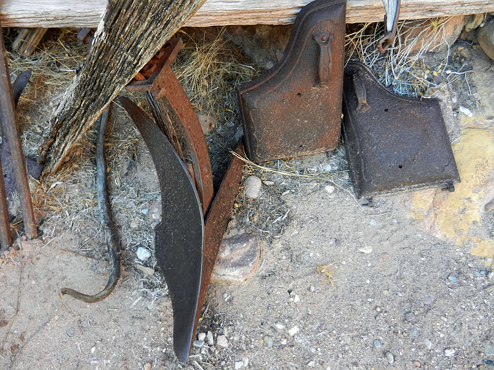 A plow blade and stove doors (?). |
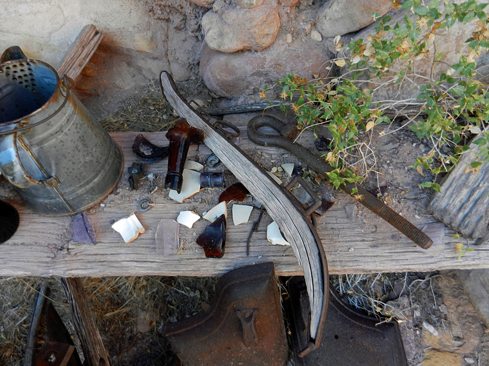 Coffee pot, glass, et al. |
 Fibers on the ground. Asbestos? |
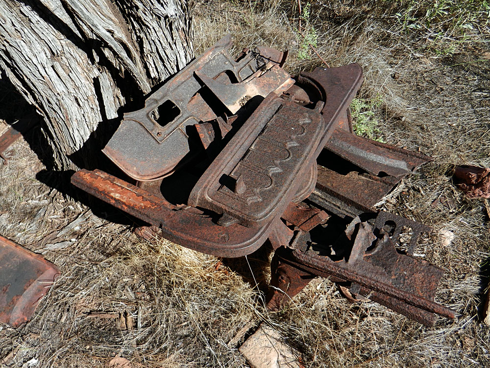 Cast iron stove. |
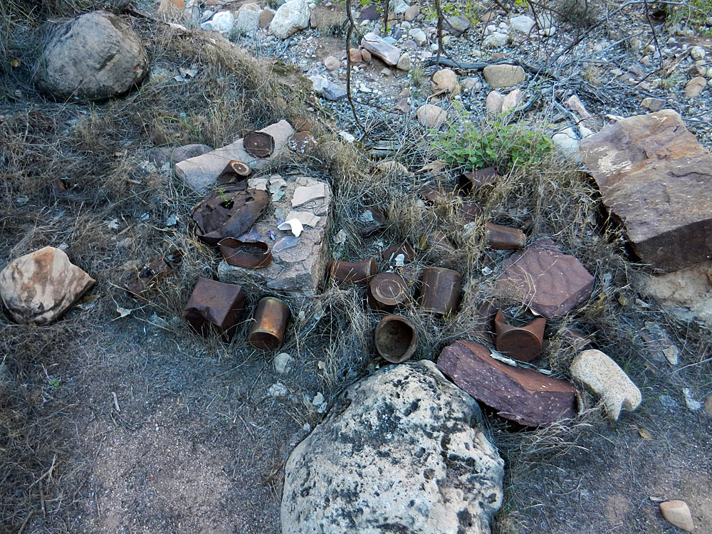 Trash dump nearby. |
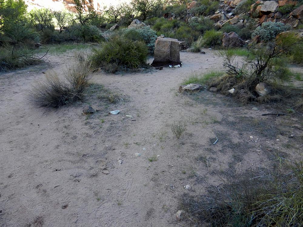 Benchmark site (atop rock). |
|
|
||
 The trail leads up to this high saddle between Shinumo Creek and the Colorado River. A cairn is visible as you near the top here. |
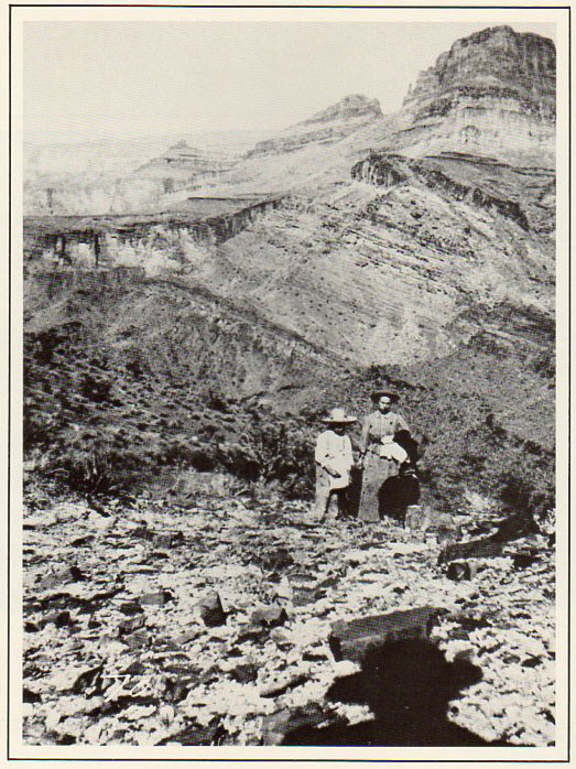 W. W. Bass' photo of wife & son. |
 My photo from the same spot. |
|
To see a larger side-by-side comparison of the historic photo and my photo click here. |
||
|
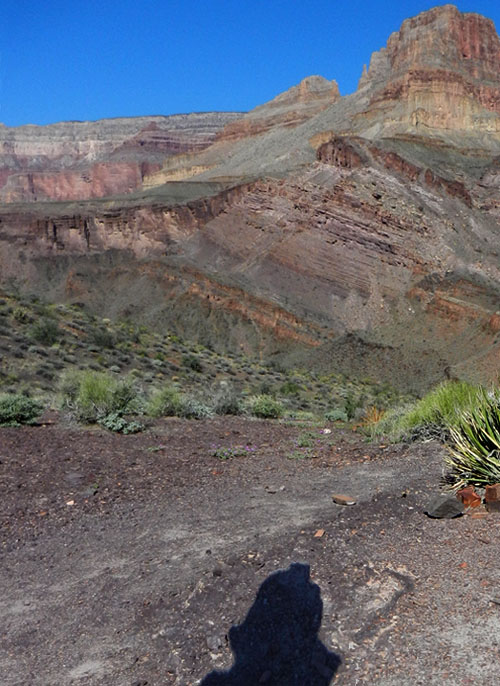
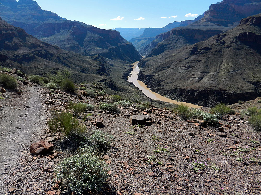
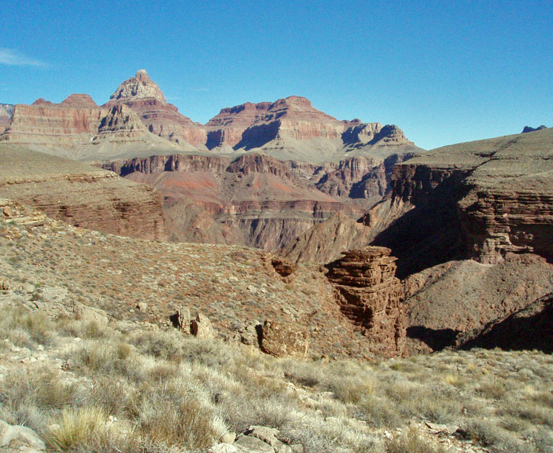
The saddle offers up a great view of the Colorado River. While
hiking I saw two river rafts run through Bass Rapids, which is at the
bottom of the South Bass Trail. To get across the river, Bass came
down a bit and descended to a beach where he could launch a boat.
Going back he could do the same. After some years, he added in a
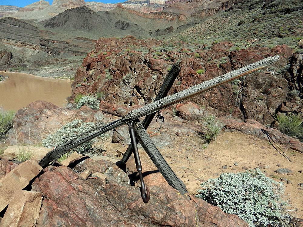
tram, suspended by cables above the river. I reached this site by
10:40 am and got a chance to look over the place quite closely. In
the ravine beside the tram was an old trail leading down to the boat
beach. I went down there and ducked out in the shade to rest and
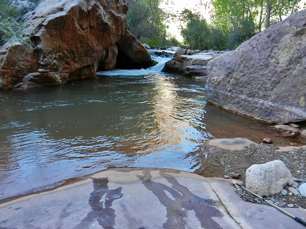
relax for a bit, dipping my kerchief into the river to help cool down. By 11:15 am I was on my way back and it was brutally hot and a tiring trek to the saddle, which I reached at about noon. I was drinking constantly but was still parched and the thought of finding a shady spot to spend the afternoon kept me going. I passed by the old camp about 25 minutes later and just a few minutes upstream from here I found my Shangri-la. A permanently shady spot on the slickrock next to a small waterfall. Idyllic. I only stayed
here for a couple of hours and then got going back to camp. I got
a chance to better figure out the creek crossings. And, I kept
looking for where the Tonto Bypass trail comes down into
As I was nearing my campsite I spied an interesting granary on the east side of the creek and took some photos. I decided to also check it out on the next day's hike. I reached my camp too early - at 3:30 pm - and wasn't able to do anything but move around in the shade until the sun set on me at 5 pm. I had started the day with 3 liters of water and ended up with barely one-half when I returned here. |
|
|
||
 The river, from the saddle. |
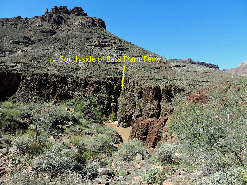 Bass' tram site on the south. |
 Cable is still anchored into the rock. |
 Two rafts about to hit Bass Rapids. |
 Part of the support system for tram. |
 Low wall may be "landing" site. |
|
|
||
 Just to the right of the tram site was a ravine with a trail that angled down directly to the beach below, where the boats would be ferried across. [Was this here before the tram was built?] |
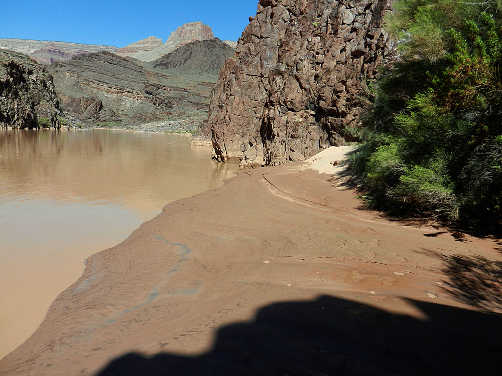 The beach was small and muddy. |
 Below Bass' Camp and a bit below the "benchmark" campsite is this rock with a name, date and place carved into it. It reads: W L Vaughan Claude, Tex 7-11-1912 |
 Two afternoons were spent here. |
||
|
|
||
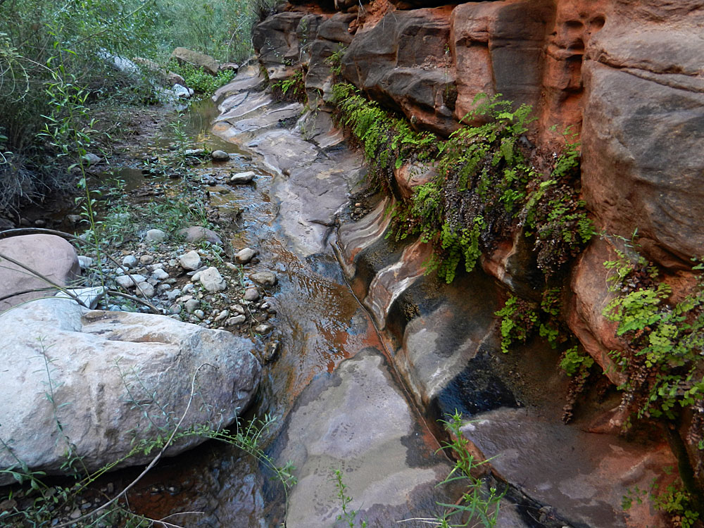
 An idyllic canyon backdrop. |
 I decided to see whether I could save some time by trying to walk up the creek at a crossing spot so I wouldn't have to wait to cross again. Deep places kept me from repeating this. |
 Granary spied from across the creek. |
 The "bypass" trail is behind this site. |
 Two more in the same area. |
|
| Day
4 - Day hike to ruins, Bass' garden and the Hakatai exit (Tuesday,
September 17): I thought I would get an
especially early start this day, but the appearance of clouds building
caused me to spend some time rain-proofing my camp. Also, my arms have
either developed a rash or I am being bitten by tiny insects. The
upshot is that they are very itchy and I've discovered that my supply of
hydrocortisone cream is low. But, even used sparingly it has
helped. By 6:45 am I was on my way with four objectives in mind -
the nearby ruins, the exit trail out (i.e., the Tonto bypass trail), Bass'
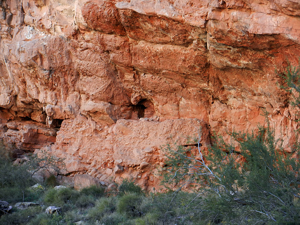
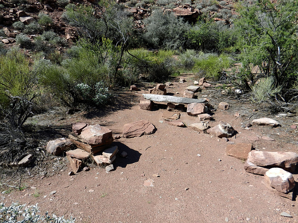
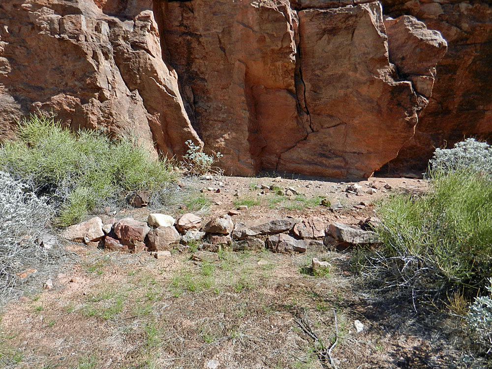
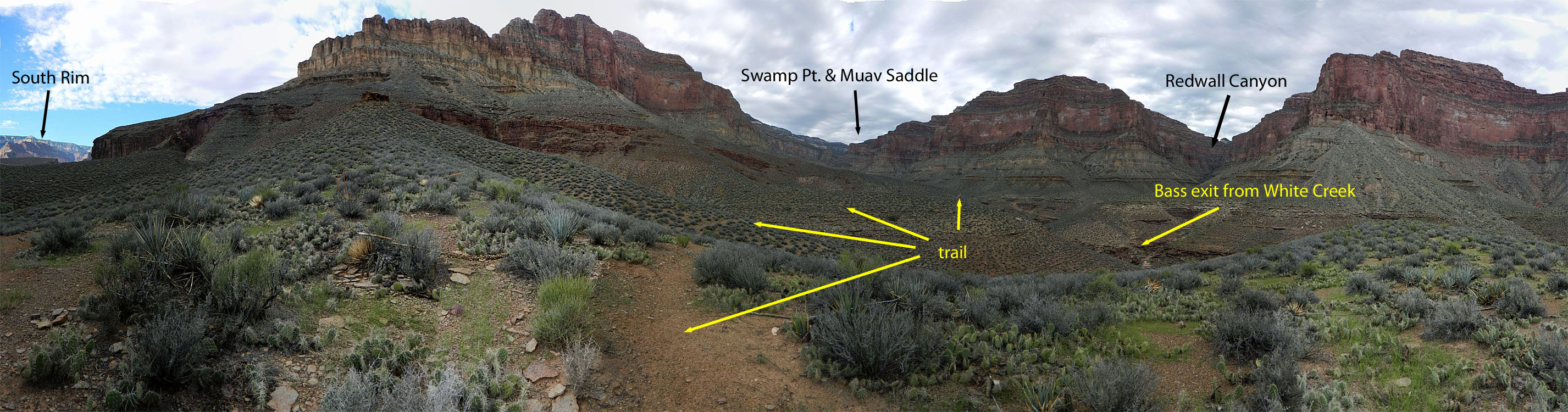
garden/orchard area, and the route to Hakatai Canyon. I was able to stay on my side of the creek all the way to the ruins I had seen. Since the well-worn trail is on the west side, I suppose that very few hikers see this spot, much less get a chance to visit. I was surprised to find that this must have been a big settlement. Many room outlines were visible at the base of the cliff, well below the granary I had seen before. I only saw one pot shard, but it seemed to me that Bass probably used this site for his purposes. One of the odd features I noted was an abundance of dried up burro droppings under the lowest overhangs. Certainly the burros didn't put it there! So, maybe it was a fire-starter supply? Well, odd nonetheless. I would say that there were six, or seven, big rooms here. Up against the cliff there were still pieces of the old masonry wall in place. The granary was especially surprising. After gazing up at if for a bit I realized that it was atop a 6 to 8 foot man-made wall. I wondered if there wasn't something behind the wall. Climbing up the wall didn't look easy and not anything I entertained. Later in the day I noticed two more of these walls in the canyon cliffs. My next
objective was to actually find where the real trail comes
down to the creek. This Tonto bypass is the other end of where I camped
the first night in White Creek. I was quite sure of the general
area where it reaches Shinumo - there is a wide sweeping curve here.
I had passed by here twice the previous day and saw no sign of where the
trail was located. This morning I resolved to nail this down,
since I would be using it tomorrow for my exit. I started at the
funky cairn. To the north it looked impossible because of the
cliffs. Behind this cairn, heading to the west, the going looked
easy but I could see the massive Tapeats cliffs up high and they looked
unyielding. And, I knew that the trail must top the Tapeats, so
that option was troubling. Still, I headed west and climbed up the slope for a
while. No signs of cairns. No signs of use. No signs
of a trail. Looking to
the north I spied a couple of faint lines angling down through some of
the cliffs and decided that these must be parts of the trail. Back down I climbed
and then headed over in that direction. On my way I startled a Grand Canyon
rattlesnake. It started slithering away instead of rattling.
Probably that was because it was somewhat entangled in the brush and
likely couldn't really get off a good strike if it had to. By 10:30 am I was on the terrace where Bass had his garden/orchard. I spent a while wandering over this terrace. It doesn't look like much at first glance, but there is quite a lot here - low walls in many places, a tank dug into the ground, a stone chimney and the odd tin can. I got to thinking about our notion of what is, and what isn't, important about history. That is, why do we strive to save only the physical remnants of history? This little terrace was used by Indians for hundreds of years, and by Bass for at least 20 years. Maybe it's just me, but I'd like to see someone still gardening this land, growing melons, bean, squash, peaches and the like. One of the famous historic photos shows Bass and friends eating watermelon here. Maybe it was just the heat, but I sure was wishing I had a piece! I got it into
my head that I might be able to follow along this garden area to the
route that leads to Hakatai, where Bass has some of his mining claims.
But, I found the brush to be quite thick and as best I could tell, I was
going to get cliffed out. So, I crossed the creek, put on my boots
and did a bit of exploring before working out the details of finding the
Hakatai route. The route is along a narrow ramp
that rises out of the creek between two cliffs. To get to it I
would have to cross the creek through a thicket of bushes. But, I
was able to cross without taking off my boots and was soon at the right
spot. Then I saw that my initial impression was correct - you can
just follow from the garden area to this route; there is room at creek
level to get by the upper cliff and onto the ramp. I suppose that
this might be a better way to describe how to find the route than to
look for the ramp from the east side of the creek. I got to my rest spot by 12:30 pm and spent the next two and a half hours there. I was back in my camp at 4:15 pm and didn't have to wait long for the sun to settle behind the cliffs. I only had about 8 ounces of water left, so I guess it was a good thing I didn't follow the Hakatai route up to the Tonto. |
|
|
||
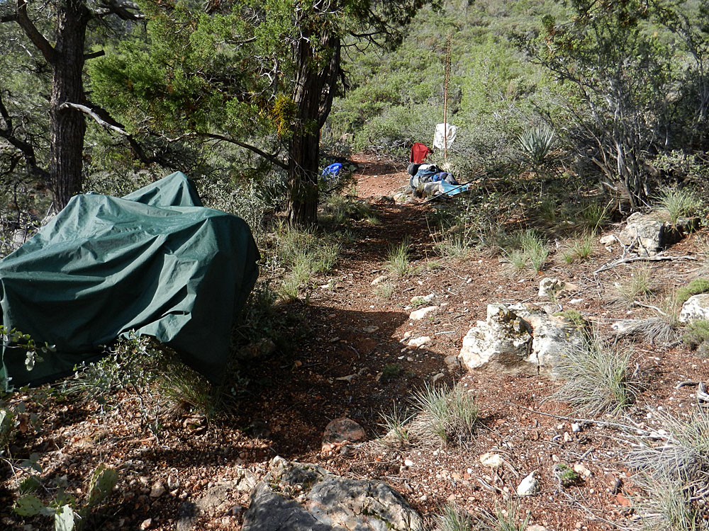
 Sunrise for my next day hike. |
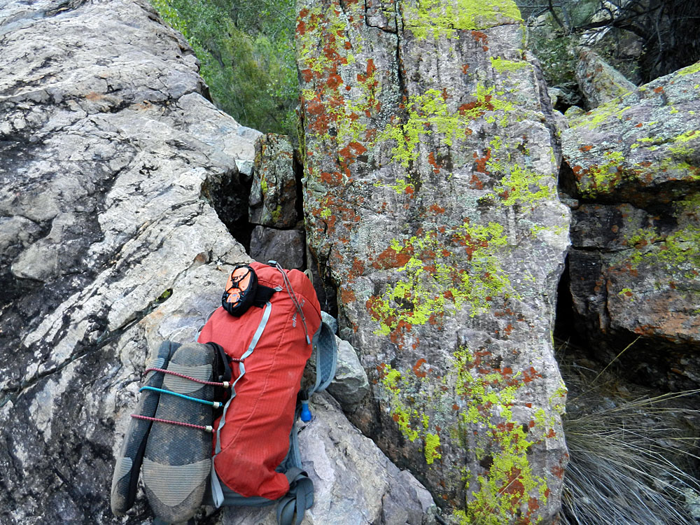 My day pack set-up w/aqua shoes. |
 Looking back to White/Shinumo jct. |
 Many rooms outlined at this ruin. |
 Signs of more recent use. |
 Granary sits atop a man-made wall! |
|
|
||
 Boulders mark bypass trail for exit. |
 One of the cairns I added. |
 Habitation remains around boulders. |
|
|
||
 Low wall marks north end of garden. |
 Expansive terrace for gardening. |
 A tank to hold water; now dry. |
 Stone chimney in garden area. |
 Looking up terrace from the south. |
 Another low wall remains here. |
|
|
||
 Close encounter with a GC rattler. |
 The "eye" granary near Bass' Camp. |
 I had hopes of following along the old route to Hakatai Canyon (or, at least, towards it). But after finding the right ascent, I decided it would be too hot to continue up and along the Tonto. |
 Dramatic vista. |
 Another man-made wall? |
|
Day
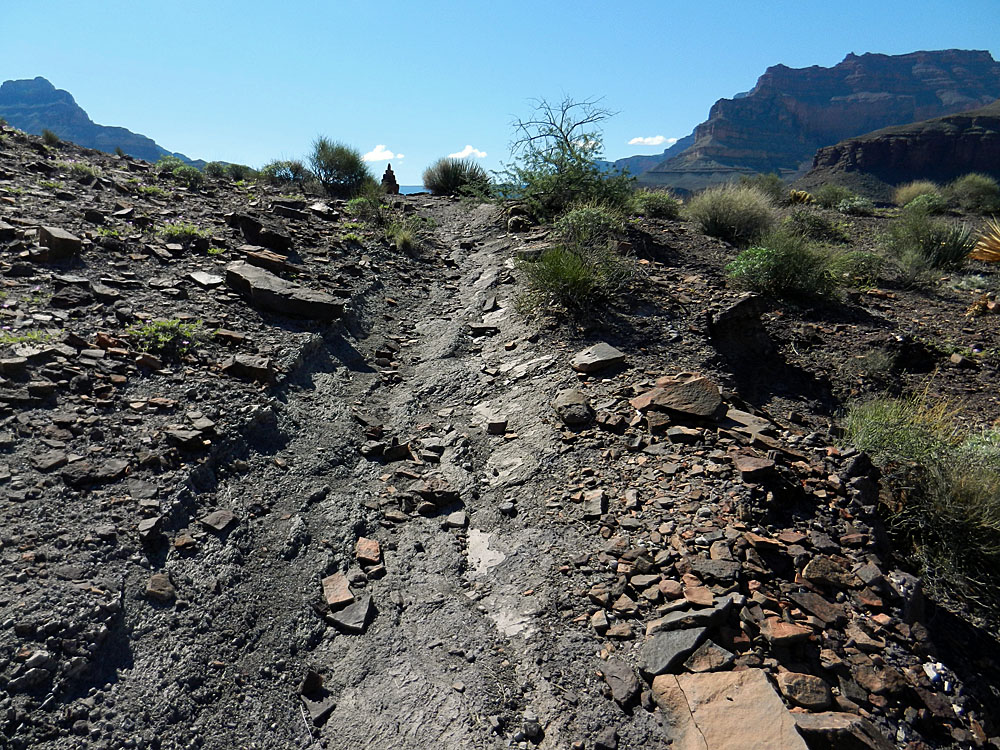
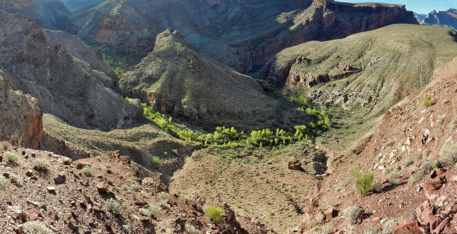
5 - Hiking out to below the Redwall (Wednesday, September 18):
I was up at 4:45 am, but still not on the trail until 6:40 am. I
wore my aqua shoes until I was up on the bypass trail, just below the
big boulders. It had taken me a bit
 less
than a half hour to reach this spot. I got a nice set of photos to
make a panorama of this little valley (below) as I neared the first big
saddle, where there is yet another benchmark. Because this trail
comes out at Shinumo relatively close to where White Creek enters, you'd
think that from this saddle it wouldn't take long to reach the bed of
White. At least, that's what I thought. It took an hour and
a half. It was another hour and a half hiking up the bed before I
reached some water in shallow places. A half hour later, at noon,
I found a pretty good place to camp next to the small trickling creek
not too far below the Redwall narrows. Although I was concerned
about the afternoon heat, I probably could have continued and topped out
late in the day. And, as long as I was up high enough, there
wouldn't be any problem following the trail by flashlight. But, I
was content to while away the afternoon in this shady spot and save the
climb out for Thursday morning. The sun set here an hour earlier
than at Shinumo. And, once again, that triggered all my activity
here - setting up camp, pumping water, and making dinner. And, at
some 1200-1300 feet higher than my Shinumo camp, the night was much more
pleasant! less
than a half hour to reach this spot. I got a nice set of photos to
make a panorama of this little valley (below) as I neared the first big
saddle, where there is yet another benchmark. Because this trail
comes out at Shinumo relatively close to where White Creek enters, you'd
think that from this saddle it wouldn't take long to reach the bed of
White. At least, that's what I thought. It took an hour and
a half. It was another hour and a half hiking up the bed before I
reached some water in shallow places. A half hour later, at noon,
I found a pretty good place to camp next to the small trickling creek
not too far below the Redwall narrows. Although I was concerned
about the afternoon heat, I probably could have continued and topped out
late in the day. And, as long as I was up high enough, there
wouldn't be any problem following the trail by flashlight. But, I
was content to while away the afternoon in this shady spot and save the
climb out for Thursday morning. The sun set here an hour earlier
than at Shinumo. And, once again, that triggered all my activity
here - setting up camp, pumping water, and making dinner. And, at
some 1200-1300 feet higher than my Shinumo camp, the night was much more
pleasant! |
|
|
||
 On the bypass trail. |
 The trail is easy to follow. |
 Long shadows in the early morning. |
 Looking back on the exit valley. It was only when I climbed the "false start" that I could see the proper route out. |
||
|
|
||
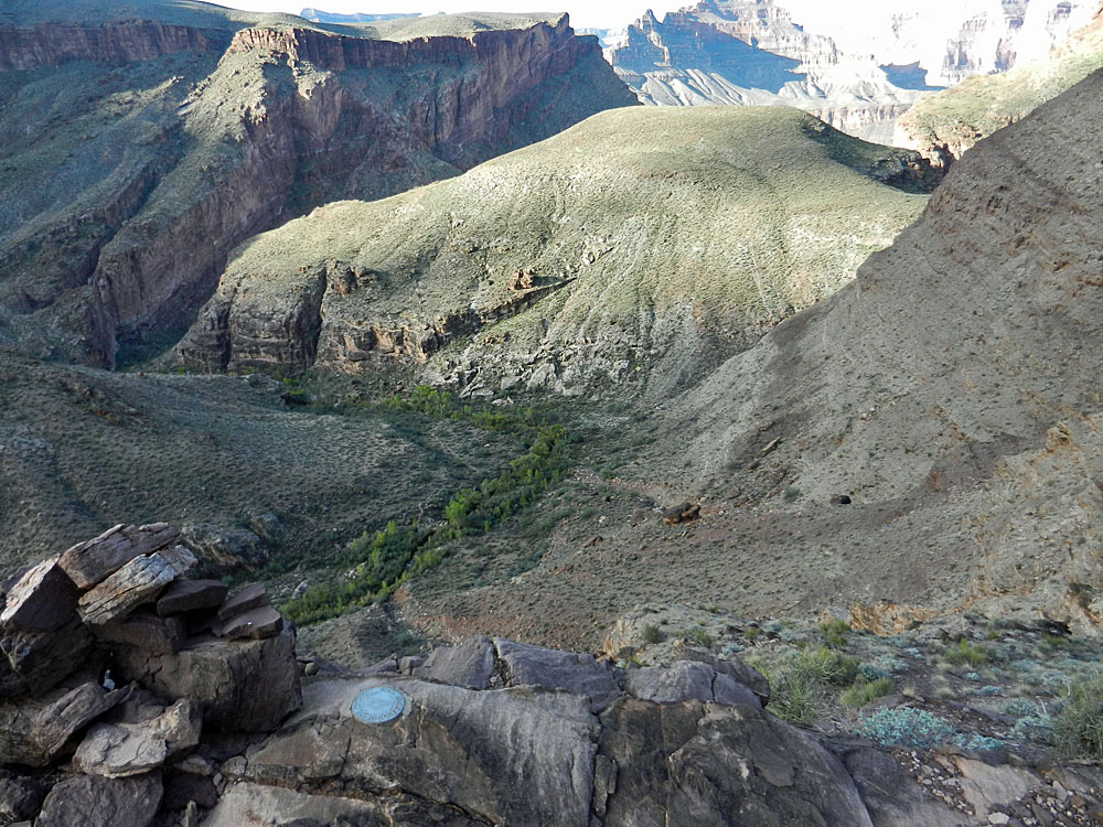 Benchmark over exit valley. |
 Trail crosses at Tonto level. |
 I reached the bed of White Creek with the sun starting to beat down and heat things up. This is where I camped on my first night, unable to reach Shinumo Creek. |
 Good view to exit from White Creek. |
 Close-up on White Creek exit. |
|
|
|
||
 A lonely cottonwood in some narrows. |
 My last campsite, once the sun set. |
 My nearby water source. |
|
Your moment of Zen. The breeze blows through the leaves of this lonely cottonwood tree, sheltered between some narrow cliffs. [You may have to turn up your volume.] |
||
| Day
6 - To the rim (Thursday, September 19): Up at
4:20 am and on my way at 6:10 am. I headed up the canyon, hopping
rocks, bulling my way through the brush and criss-crossing the creek.
And, at 7:15 reaching a small fall in the bed. It didn't look
familiar. That's because I missed the ascent in the Redwall!
Yikes! So, I turned around and headed back down. Looking up
all I could see was sheer cliff, so I should have been paying closer
attention in that direction. Ten minutes later I found a small
cairn that led up into the brush. Up above I could see a solitary
boulder that I recognized from the route down five days earlier.
So, while this didn't look right, I felt confident that I could end up
at the boulder and catch the real trail there. As it turned out, I
was on a piece of the original trail - there were numerous signs of
trail construction (see below). So, perhaps the park service
volunteers missed this section when they fixed up the trail in 2005.
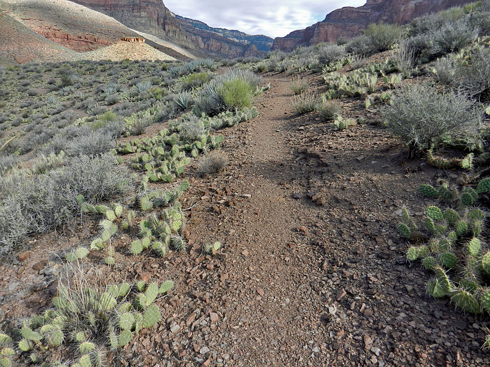
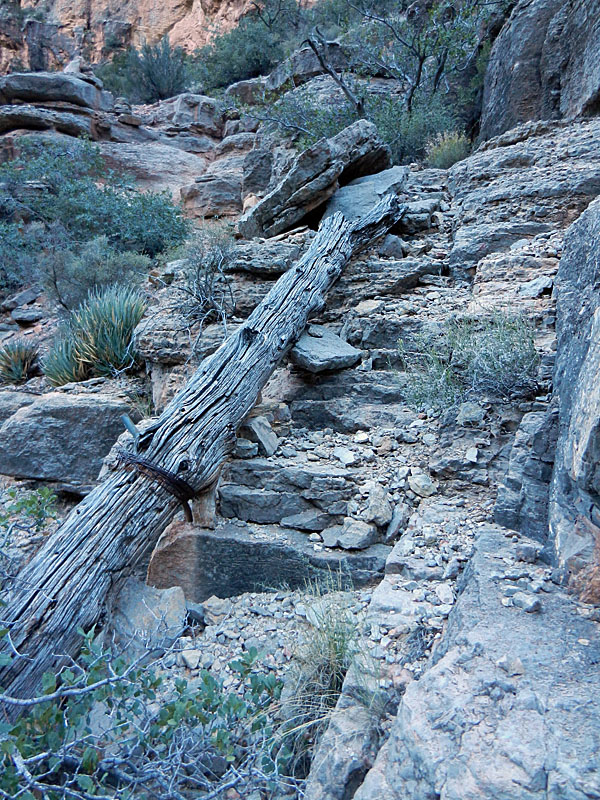
Or, maybe Bass rebuilt this spot, although it seemed quite usable to me. By 8 am I was atop the Redwall, now in the full sun. But the temperature was pleasant and a slight cool breeze blew throughout the morning. It took about 45 minutes to reach the bed where this bypass starts. It was another hour up the bed before getting back on a real trail. After a couple of switchback you cross a dry bed and here was another benchmark. And, that was it for all the rough part of this route. From here on out it was a nice trail and very easy to follow. At 12:15 pm, barely ten minutes below the rim, I met the first person I had seen since leaving the highway near the Kaibab Lodge. [I'm not counting the river runners, whom I only saw from afar.] Ian Hall, who hails from British Columbia, has been an avid Grand Canyon hiker for many years. He was doing a lot of day hiking in the area and on this day wanted to go down to Muav Saddle and check out the route to the west, down Saddle Canyon. After chatting up a storm for about 40 minutes, we went on our separate ways, and I reached the rim at 1 pm. |
|
|
||
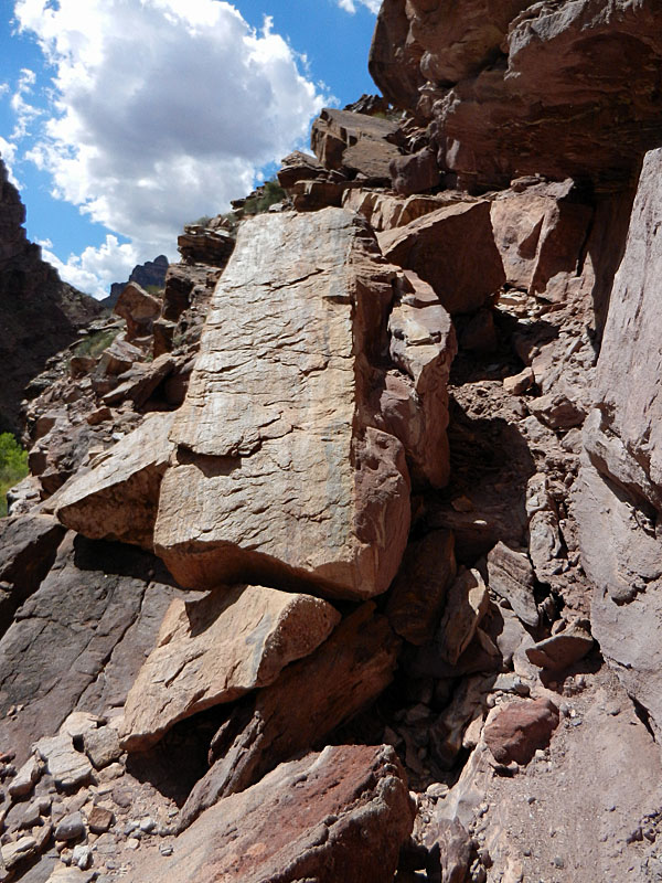
 I missed the Redwall ascent! |
 There is an older trail here! |
 More signs of the old trail. |
|
|
||
 The trail follows up a ravine, with trickling water, once you get off the Redwall. That doesn't end until this spot, where you make your last crossing and are on a trail the rest of the way to the saddle and the rim. |
 Last creek crossing. |
 Hoodoos below Coconino? |
 BM at last creek crossing. |
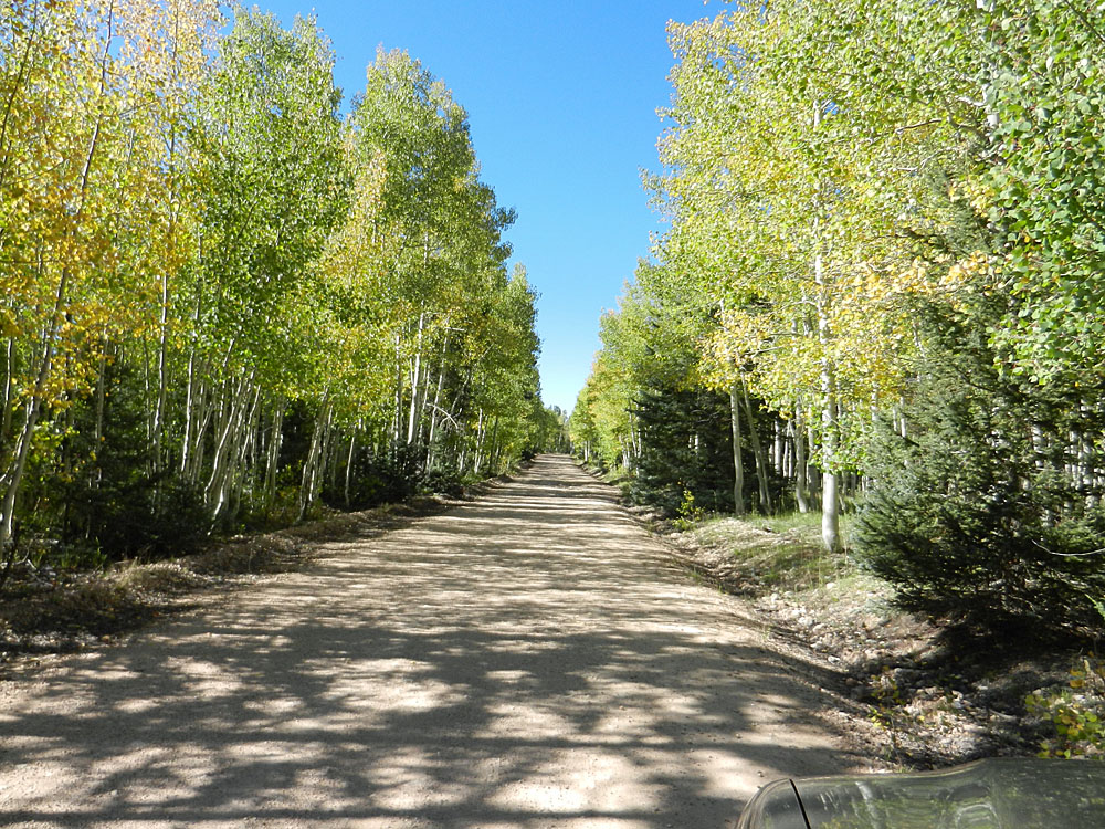 The aspens are a-changin'. |
|
|
After checking in on my Spot device and cleaning up, I was on my way
back home. I saw three other vehicles parked in the area and the
tree was still down across the road. After the brief morning rain
on my first day of hiking, it was dry for the rest of the trip and I noticed that many of the
potholes I saw on the way down were dry on the way up. The aspens
along the forest roads were starting to change and would be peaking in
another couple of weeks. Here are some of the hiking times I had
for this hike: From Swamp Pt. to Muav Saddle: 35 minutes (down and up) From Muav Saddle to the start of the Redwall bypass: 1:35 down and 2:15 up From the start of the Redwall bypass to the bottom of the Redwall: 1:25 (down and up) From the bottom of the Redwall to the last of the water flowing in the bed: 55 minutes (down and up) From the end of the water to the Tonto bypass trail: 2:25 (down and up) From the Tonto bypass to Shinumo via White Creek: 3:56 down From Shinumo Creek to White Creek via Tonto bypass: 2:15 up From White Creek/Shinumo jct. to Bass camp: 1:20 (down and up) Bass camp to Bass tram: 1:15 (down and up) |
|
|
|
|
|
In August, 1901, a party was arranged, consisting of Mrs. J. B. Gayler, … a learned doctor from St. Louis, Mr. Bass and myself. On Sunday, September 1st, after loading three pack animals with provisions and bedding needed for the trip, we set out down the trail, headed for Point Sublime. To the ferry nothing of particular interest occurred. From this point on I shall use the diary of Mrs. Gayler as the basis of my descriptions … The sight of the river rouses me to a considerable pitch of enthusiasm. How dirty and muddy a river it is, and how it roars and rages. There is a great rapid a quarter of a mile above where we cross. While we are to cross in still water, the current is strong and bears one on to the worst rapid in the whole river … We part with our animals near a little shelter at the top of the Archaean rocks and scramble down a slippery trail. With some trepidation I enter the boat; a few articles are thrown in, Dad takes the oars, some one pushes us off and we are fairly on the stream. The boat soon strikes the sandy landing on the other side, a considerable distance below, and Dad hands me out with care and courtesy. I occupy myself looking at the structure of the rocks. There are many curious faults and flexures. The river is very strange; walls black, gloomy and precipitous. The landing on the south side was solid rock, here a bit of sandy beach between bars of rock. The Doctor is already here. He makes a fire of driftwood near the wall of black rock under which is the stretch of sand. I pick out my sleeping place and begin the making of my bed. James, Bass and Dad go back and forth across the river many times to bring our stuff, and daylight is entirely gone long before the job is completed … Monday, Sept. 2, 1901. 3 a.m. Writing by moonlight. The roar of the rapids is constant. One hears it even in sleep. There are occasionally little swirling, flapping noises. What a wonderful place for me – a quiet, New Jersey woman – to be sleeping in. … After breakfast, the doctor and I scramble up the rocky trail to the plateau above, mount two of the burros and start for the Shinumo Camp. It is 6:30 when we start – quite early I should call it – and we reach camp at 8:00 a.m. A stiff climb nearly all the way. What a clear mountain torrent the Shinumo is. It is like our Eastern creeks. Its rocky sides are lined with willows or other green trees and it comes splashing and dashing down as pure and sweet as can be. The camp is a novelty to me. Part tent, part wood, part rock, -- part indoors, part outdoors. The fireplace is of stone and out of doors, and the table is a great slab of red sandstone resting on two heavy rock supports. It would hold a ton. There are two good beds. Across the stream a little way down is the Shinumo garden. It seems incredible that there can be a garden here with excellent melons, cantaloupes, radishes, onions, corn, squash, beans, and with fair-sized peach and other trees. They tell me it is a prehistoric garden and that it was discovered by following the ruins of ancient irrigating ditches down to the spot. In the wall beyond are several small cliff-dwellings and storage houses for corn and other vegetables. There are tremendous tilts and flexures in the rock walls on each side. Mr. Bass and Dad go off to hunt for the horses and mules we are to use on the trip … Tuesday, Sept. 3, 1901. At and preparing to leave Shinumo. The magnitude of the undertaking appals [sic] me. It is so much more tremendous than I anticipated. The saddling and packing of the animals occupies much time. We start about nine o’clock with nine animals, six burros, two horses and one mule … We go up a long trail over a ridge, with loose soil, quite barren. The ascent is not very steep but the hillside across which the trail passes slopes down to canyons and precipices which suggest unfathomable depths. At one place the trail, for about fifty feet, is over ashes or some exceedingly loose material that allows the animals to slide very quickly down towards the deep precipice on the right and the sight is most trying to my nerves … From this we pass into a canyon or series of canyons where one can plainly see that in the remote past a torrent has poured down, tearing away the soil and tossing huge boulders about. Many naked rocky ledges show, and my burro is occasionally required to carry me up stone steps. Presently we enter a narrow canyon through which flows a clear, cool stream. Walls of red rock on both sides with much gray stone. Many large sycamores, cottonwoods and alders, grass and flowers, with maidenhair ferns on the rocks. We stop for lunch under a big cottonwood tree. About four thousand five hundred feet elevation. We leave this lovely spot and go up the canyon which makes a sharp turn to the left. This is Muav Canyon. After a little distance we emerge from this canyon and leave the stream. Then begins a tremendous climb which I accomplish by clinging to the coat tails of the guide with one hand and sometimes with both hands, he holding tight to the burro’s tail ahead of him … Finishing this part of the ascent, we come to a fertile plateau with trees in great number and variety. At an angle of the canyon below, nearly opposite the steep trail up which we have just climbed, is the eroded terminus of a great promontory, carved into a high and slender pedestal upon which stands a rude figure not unlike one of the wooden statues seen in the old Franciscan missions of California. Below this the rock strata are curved and twisted into all kinds of shapes. In one place there is a fold where the strata seem to have been curved and forced almost into a circle. On this plateau we still see the canyon with its perpendicular gray stone walls. It falls below our trail and we ride along the brink of it and down in the bottom see the black entrance to a cave. Then we come to the dry bed of a stream which we follow until we come to water. The quantity is small but it is sweet and pure. We camp here; elevation six thousand one hundred feet. The canyon walls are steep and the bottom narrow. We are in a heap together, - rolls of bedding, camp-fire, burros, horses, mules, men, kyacks containing food, saddles and packs, myself, etc., all in the very small space … Wednesday, Sept. 4, 1901. We have had a very cold night and though my bed was most comfortable I awake feeling rather miserable. My courage almost fails and I talk of giving up, but after awhile [sic] feel better and decide to go on. A discussion goes on as to the time we shall spend on the trip and the determination is finally reached that, if possible, we shall return to this spot from Point Sublime in four days. The little stream, which failed in the night, now runs freely, the result of condensation of moisture in the atmosphere above. We start again and ascend a steep, loose trail in the manner of yesterday. The trail is very pleasant here, springs of excellent water coming out from under the cross-bedded sandstone and trees of considerable size shadowing the way. At the Saddle there is a long pause for repacking the burros. I am started up the next and last steep climb on my burro. After a little the trail becomes very steep and dangerous looking and I am ordered to dismount and finish the climb on my feet … We are now on the top of the north side, - really on the summit of the Kaibab Plateau. Dutton Point, the great salient promontory of Powell Plateau, seen so clearly from Bass Camp on the south rim, is close before me, and views and vistas in every direction are glorious and sublime. We ride on to Swamp Point. The views are magnificent, but who shall attempt to describe them? |
|
|
||
|
|
Return to Hiking Grand Canyon home page |
|


