 |
|
|
New Hance
Trail Day Hike Friday, April 5, 2013 by Dennis Foster |
|
|
|
|
|
|
|
New Hance
Trail Day Hike Friday, April 5, 2013 by Dennis Foster |
|
|
|
|
|
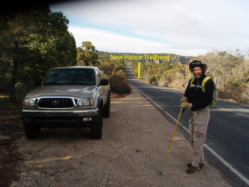
Last Saturday, John Eastwood and
I did a "geology" day hike down the New Hance, about which I have
already written. Since we
only made it to the creek bed, I was anxious to return and try to get
the whole hike done - to the river and back - in one day. The last
time I had done this was in 2004 - nine years ago. Based on the
experience John and I had, I knew that I would need a very early start.
Hiking up any of this trail in the dark, even if by the light of a
headlamp, would be slow going at best. At worst, it would be
impossible, requiring me to spend an unpleasant night awaiting the next
day's sunrise. I have hiked well-worn trails at night, but
something as rough as this one is pretty much a deal breaker for me.
So, I decided to camp in the forest near the trail in order to get an
early start. That worked out perfectly, although I wasn't sure it
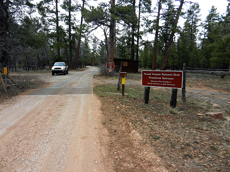
was going to at the time. Casual study of the map will show that
the National Park/National Forest boundary is less than a mile from the
highway in the Grandview to New Hance area. I had thought to park
at an off-the-road spot and hike through the woods with a backpack and
cot to accomplish this. But, just a couple of miles east of the
Grandview overlook there is a dirt road. On it is a marker
indicating that it is part of the
Arizona Trail. While I was
still about 2.5 miles from the New Hance trailhead, I decided to check
this out. In just a
|
|
|
||
 |
 |
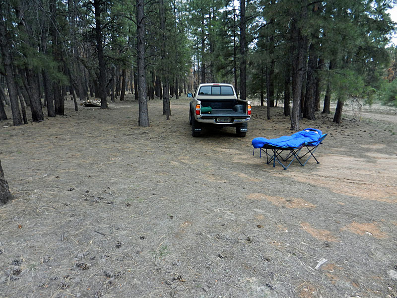 |
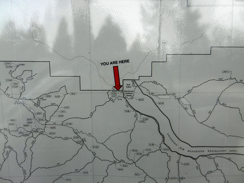
| The Grandview Entrance to the park. | Map on kiosk on National Forest side. | My cot ended up on the pickup bed. |
|
My alarm went off at 4 a.m. and I was soon up and getting dressed and
packing up my gear. It was probably in the mid 40s and no wind.
I could spy a thin crescent moon just rising in the east through the
trees. I had brought some coffee in a thermos that stayed pretty
warm. After a couple of cups, I was heading out at 4:45
a.m. My plan was to drive to the Buggeln Picnic Area, where there
is decent toilet facility. I ate my breakfast sandwich in
the truck, finished my coffee and used the facility before heading on
down the road by 5:15 a.m. It is less than 1.5 miles from Buggeln
to the spur road
that is right opposite the Old Hance route. I have often parked
here and walked the remaining half mile to the New Hance trailhead.
I didn't see anyone parked here so I figured I wouldn't have
any trouble getting an even
better spot further up the road that John I had
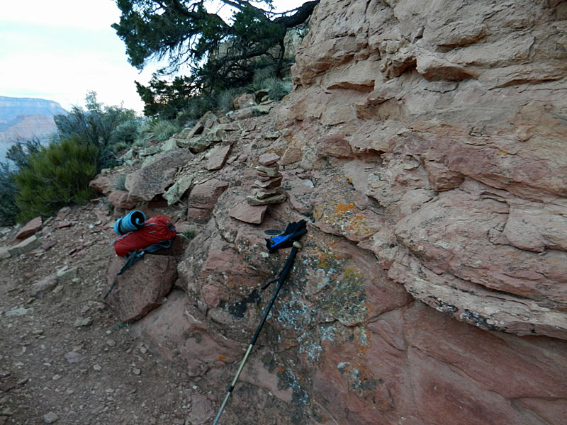
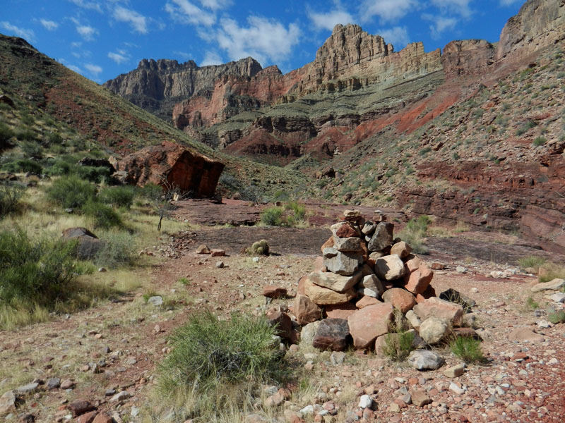
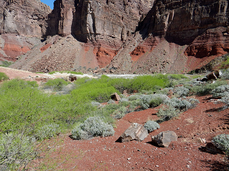
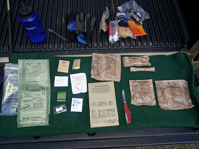
used the previous week. That turned out to be an error in reasoning on my part. As I got to the New Hance trailhead, I saw vehicles parked up ahead of me (to the east). There were five in total at three different spots here. I guess that hikers are now eschewing the spur road (to the west) and Moran Point (to the east) for parking. Well, I can't blame them. Walking down this road is just awful, with about a three inch shoulder on the payment and a steep embankment that dumps you into the brush. So, I turned around and found a good off-the-road spot about 0.15 miles east of the trailhead. By 5:30 a.m. I was walking down the road with my headlamp on - no cars came by in the time it took me to reach the trailhead in the woods. I reached the rim by 5:42, having turned off my headlamp a few minutes earlier. This is exactly what I was hoping for - a hike to start at the crack of dawn. My pack was a bit lighter than last week, ringing in at 14 pounds, which included one gallon of water (weighing 8 pounds). My plan was to cached two liters in two spots on my way to the creek bed and get more there if needed. Before I even got through the upper Kaibab limestone I had taken off my light coat. The temperature was on the cool side, but with no breeze it felt great while hiking. It took me only 20 minutes to reach the benchmark that is right at the top of the Coconino sandstone and another 20 minutes to reach the Ponderosa tree that is below the Coronado/South Rim saddle. From here you follow a ravine down through the Supai to the rim of the Redwall. After about ten minutes of hiking down the Supai I found a good spot for my first water cache. |
|
|
||
 |
 |
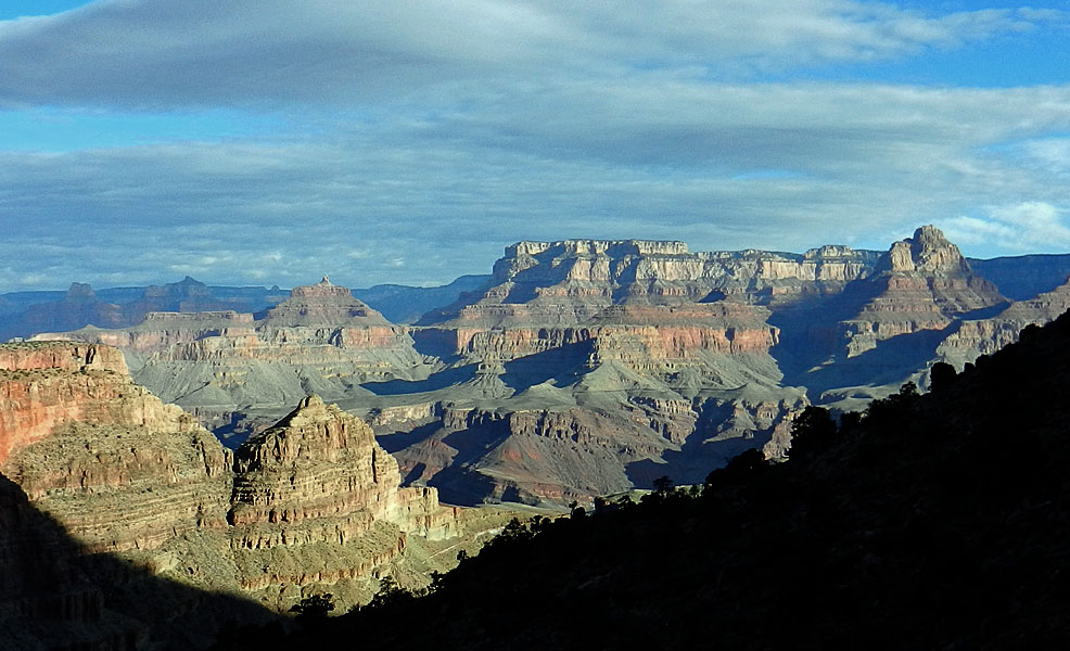 |
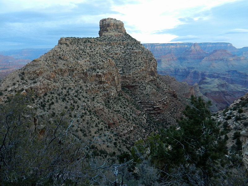
| Coronado Butte in first light. | The benchmark atop the Coconino. | Sunrise on Grand Canyon. |
 |
 |
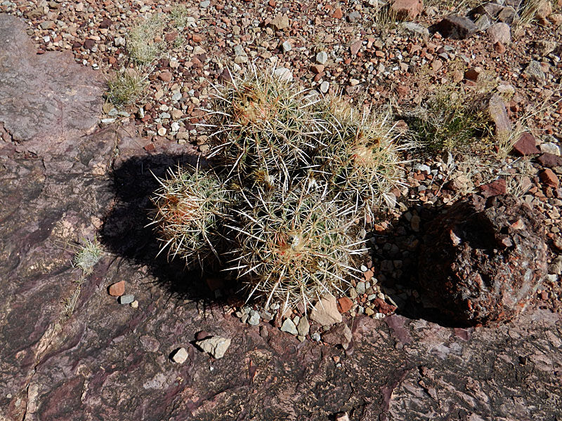 |
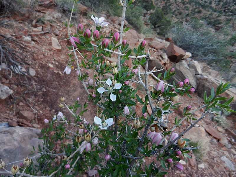
| Many of these bushes were in bloom. | The first cactus bloom. | Barrel cactus. |
|
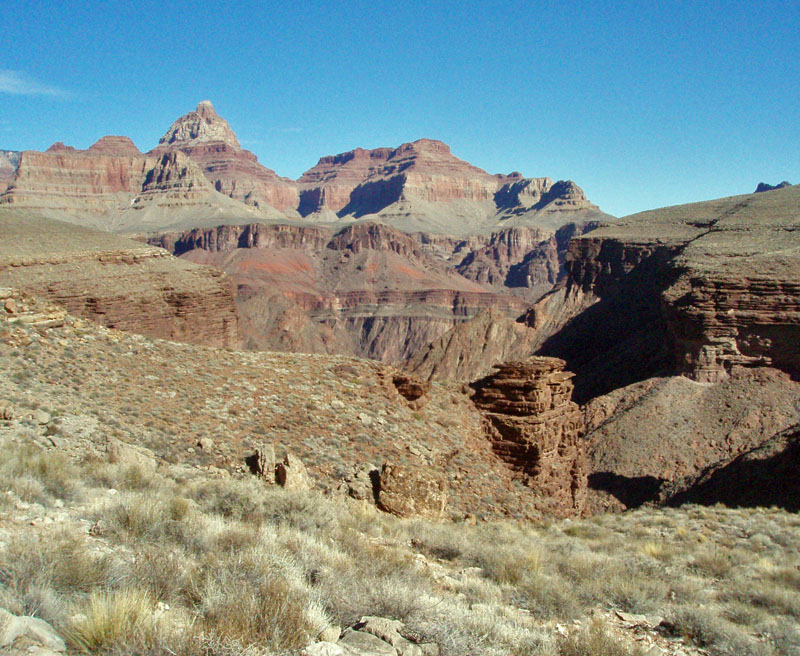
I reached the Redwall rim at 7:08 a.m. and began the mile long traverse
over to the descent. The places where you have to climb over rock
slides didn't seem as challenging to me this week. I guess I am
getting used to them. Still there are a few thin spots along here
and the footing can be precarious. By 7:50 a.m. I was starting down
the Redwall. Twenty-five minutes later I was at a couple of big
camping spots where I cached my second liter of water. I figured
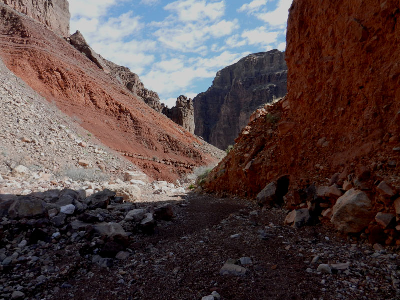
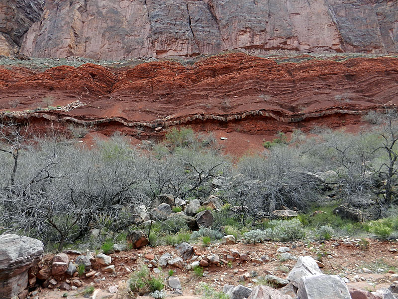
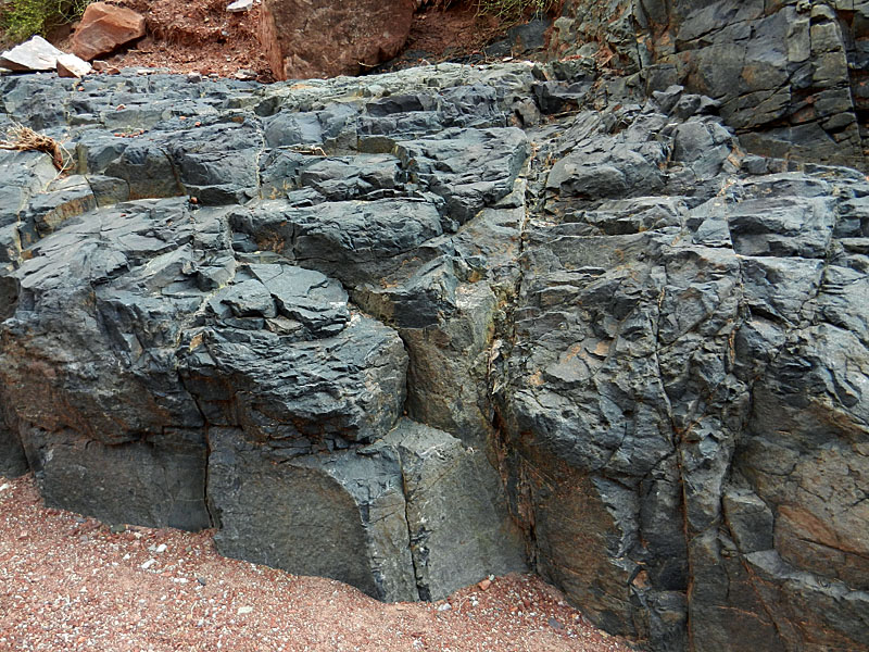
that this would be good place to find shade on the way up and to rest before climbing the Redwall. By 8:45 a.m. I was finally in the sun, although the temperature was still quite pleasant. I had passed a few new blooms along the way that I didn't see the week before, or didn't notice. I saw one cactus bloom (shown above). I do remember that John and I looked at it last week and wondered when it would start blooming, because it looked close. Now I know - one week! At 9:10 a.m. I reached the creek bed, where we had rested in the shade of a huge boulder last week, and where a very large cairn marks the route. I rested here for thirty minutes, putting on sunscreen, prepping 0.5 liter of water from the trickling creek and doing some light snacking. This is about 6 miles from the rim, and there are about 2 miles to go to reach the river. I left this spot at 9:40 a.m. and reached the river less than an hour later. The route mostly stays in the creek bed, and so consists of slogging work through the gravel and sometimes climbing over rocks. There is a stretch where giant house-sized boulders fill the canyon and a rough bypass trail appears on the east side. Parts of this trail are in good shape, but other parts are rather narrow. I wonder what it looked like when John Hance was traveling up and down this canyon a hundred years ago, either with valuable asbestos or valuable tourists? But, I wanted to pay closer attention the the geology in here, as John and I weren't able to cover this ground last week. There is a great example of a diabase sill exposed on both sides of the canyon through here. What especially fascinates me is how this baked the surrounding rock (Hakatai shale), turning it a darker color. There is also an exposed section here that has a distinctive green hue. The authors of Hiking the Grand Canyon's Geology wrote that, "Water coursing down Red Canyon has polished the greenish intrusion. The edges of the sill are especially green and are composed of smaller crystals than those in the center. This is an example of a chilled margin; where the magma met the cold wall rocks, it cooled quickly, resulting in smaller crystals." [105] |
|
|
||
 |
 |
 |
| The trail leaves the creek at this cairn. | Hiking down the creek bed. | A piece of the bypass trail. |
 |
 |
 |
| Exposed diabase sill and dark Hakatai. | "Chilled margin" of magma is green. | Basalt rides over this older rock. |
|
As I got close to the river, I headed up to the terrace that forms to
the east. Harvey Butchart had
written that, "Hidden in the
mesquite east of the wash and about 75 yards from the river is an old
camp. The clutter of trash shows that it must have been used for
some time." I have some photos I took 30 years ago of parts
of a stove and a corral that are labeled as this camp. But, I
wanted to see if it was still here. Unfortunately, I didn't have a
lot of time to look. I made a pass through this area as I headed
down to the river and again as I headed back up, but saw nothing.
I was looking for any well-worn trails here, thinking that certainly
river runners that stop here probably would take the time to visit such
a site. So, a closer inspection on my part is going to have to
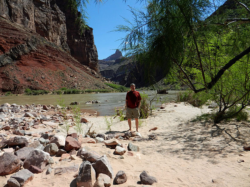
wait. There was a hiking group here and I talked with one guy who appeared to be the trip leader. They had all come out to the rapids to watch a river party go through - mostly two person rafts, but with one wooden dory in the lead. I only caught the tail end of their running of Hance Rapids, one of the most violent in the Grand Canyon. I sat in the shade of some trees, ate my lunch and relaxed a bit. I did soak my feet in the river briefly, and douse my head with the icy cold water. It was starting to get hot and that felt quite nice. |
|
|
||
 |
 |
 |
| Terrace where Hance had his camp. | Relaxing a bit before heading back. | Diabase dike across the river. |
|
At 11:25 a.m. I was all set to go. Another river party arrived
then and stopped to get out and look at the rapids before running through
them. I wandered back over the dunes and terrace looking for signs
of Hance's old camp before coming down into the wash above the spot
where you can first see the river. It took me an hour to hike up
the creek bed to the big shelter rock and the small trickle of water
(which only flowed down the bed about thirty yards below here). I
prepped another 0.5 liter of water. I could feel the effects of
the heat, as my mouth was drying out and I was losing my appetite.
But, I felt strong enough to hike and knew that in just another couple
of hours I would be high enough to get the benefits of much cooler
temperatures. At 12:45 p.m. I started up the trail, leaving behind the little creek. I dunked my shirt into one of the small pools here and that felt quite nice while it lasted. It took me an hour of hiking up through the Hakatai shale, Shinumo quartzite, Bright Angel shale and Muav limestone to reach my water cache spot at the bottom of the Redwall. I took a 40 minute break here and actually fell asleep for a short while. I made some Gatorade with my treated water and had half (10 oz.) right away. I couldn't eat anything, but once I started hiking again, at 2:20 p.m., I felt noticeably better. It took me 25 minutes to reach the top of the Redwall and another 50 minutes to follow the traverse over to the bottom of the Supai ravine. My condition improved all along the way here, especially when I was back in the permanent shade of the ravine. I rested here for only fifteen minutes, but was able to eat a whole granola bar (the most I'd had since lunch) and drink more water. I left here at 3:50 p.m., picked up my water at the upper cache at 4:30 p.m. and carried it up to the Ponderosa tree, which I reached ten minutes later. After another fifteen minute rest break I was on my way and soon back into the sun. But, the temperatures were probably twenty degrees lower up here than deep down in the canyon, and I felt a lot better than earlier in the afternoon. I left the Ponderosa at 4:55 p.m., reached the benchmark atop the Coconino at 5:20 p.m. and the rim of the canyon at 5:50 p.m. Six minutes later I was at the highway and it was only another five minutes until I was at my truck, looking forward to a change of clothes for the drive back home. Once home, I weighed my pack and it was a mere 8 pounds, which still included a liter of water! Since I started with 4 liters and treated another liter, I guess I had enough. Well, at least overall I had enough. I noticed that I had only about 10 ounces left in my bladder when I was ready to leave the creek heading uphill. So, I added the 0.5 liter I treated into the bladder and treated another 0.5 liter as a backup before I reached my lowest water cache. From then, all the rest of the way up, I had plenty of water available. |
|
|
||
 |
 |
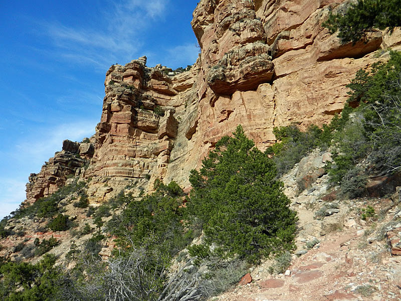 |
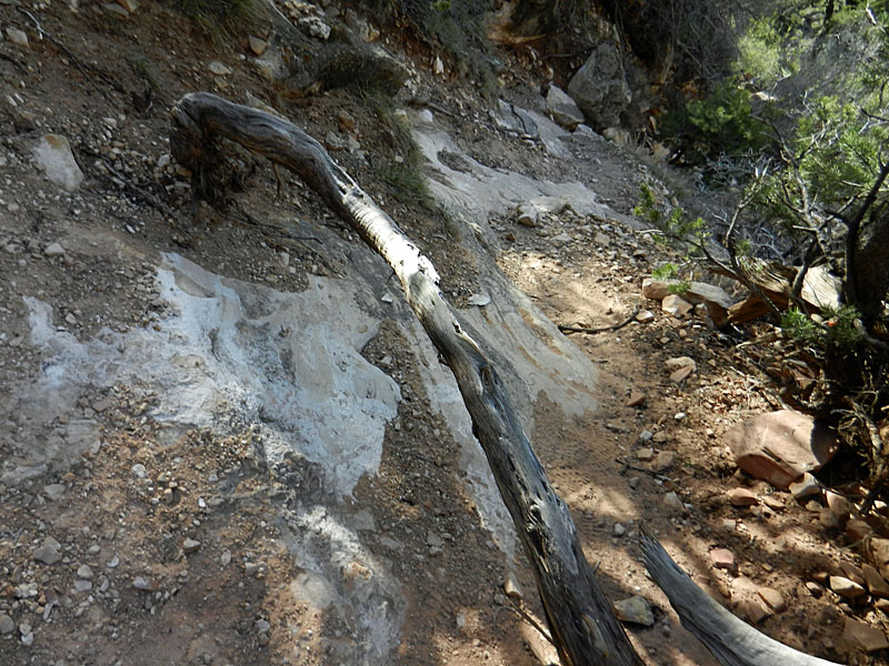
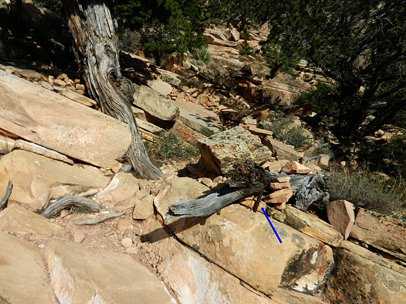
| Trail washed out in the Coconino. | Trail hardware from Hance's day. | The Kaibab cliffs at the rim. |
|
|
||
|
|
Return to Hiking Grand Canyon home page |
|