 |
|
|
Marion
Point: Friday-Saturday, April 15-16, 2011 by Dennis Foster |
|
|
|
|
|
|
|
Marion
Point: Friday-Saturday, April 15-16, 2011 by Dennis Foster |
|
|
|
|
|
|
Although it is tax day, and although the Feds gave us until Monday to do
them, I had them done early (for once!) in order to drive out to the
Nankoweap trail. My hiking buddy Bill Ferris was setting out on an
8-9 day solo excursion through the Grand Canyon, starting at Nankoweap
and ending up atop the South Kaibab trail, a few miles from the Grand
Canyon Village. I have done this hike three times, and know that
it is not only a great trip, but also a grueling one. Bill had
gathered lots of information, and had hiked at both ends of this trek,
and was excited about the challenge that awaited him. Since I had
no classes on Friday, I offered to drive him out to the trailhead (so we
could leave his car on the South Rim where he would exit) and accompany
him for a short 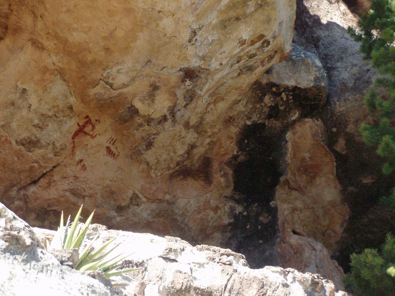 distance.
We camped along the National Park boundary Friday night, and started
down the Nankoweap together. I only went as far as the nice rest
area where the trail crosses a long arm that reaches out to Marion
Point. I decided to see if I couldn't hike out to the end as a day
hike, before heading back to my truck at the trailhead, while Bill
continued with his trip in earnest, descending to Nankoweap Creek.
You can read all about Bill's trip on his web site, Grand
Canyon Adventure. distance.
We camped along the National Park boundary Friday night, and started
down the Nankoweap together. I only went as far as the nice rest
area where the trail crosses a long arm that reaches out to Marion
Point. I decided to see if I couldn't hike out to the end as a day
hike, before heading back to my truck at the trailhead, while Bill
continued with his trip in earnest, descending to Nankoweap Creek.
You can read all about Bill's trip on his web site, Grand
Canyon Adventure.
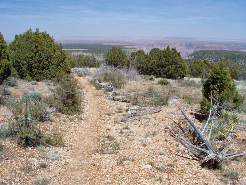
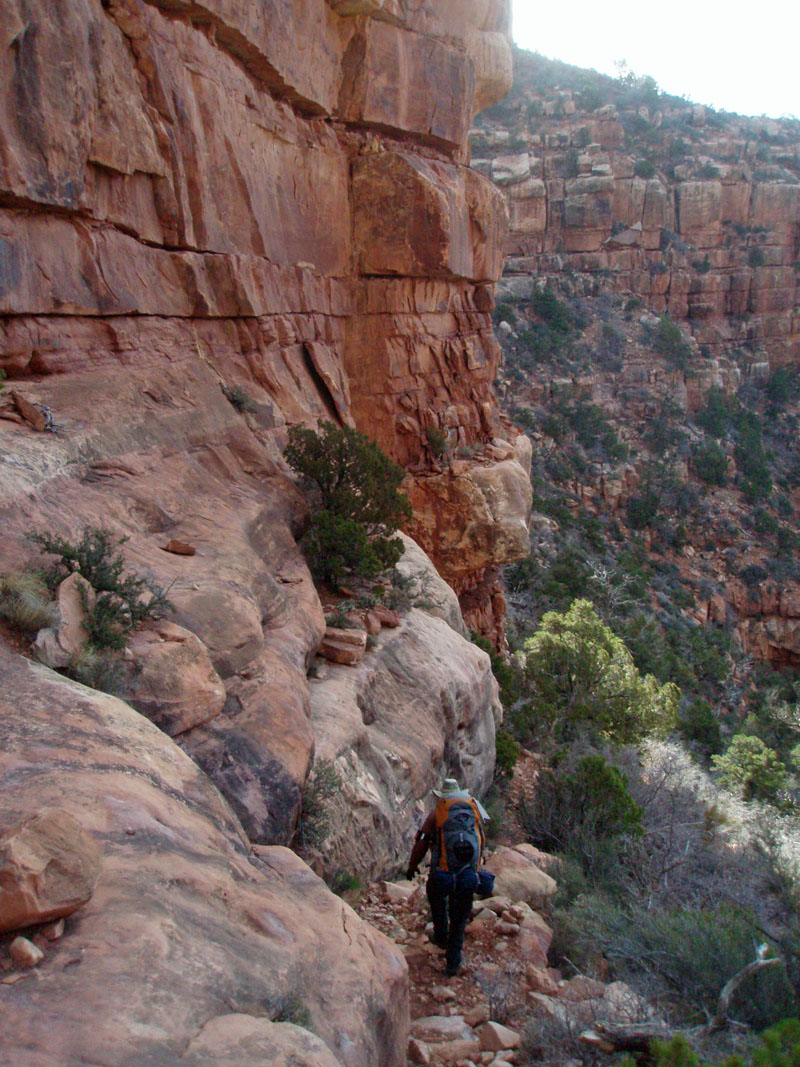
Day 1 - To Saddle Mountain (Friday, April 15): It was a long day, but not particularly harried. At 6:40 a.m. I was on my way up to the South Rim, where I would meet up with Bill as he dropped off his car at the Backcountry Office parking lot. We made a quick stop at the McDonald's in Tusayan, and were able to get to the parking lot by 8:20 - good time by my reckoning. We shifted his gear over and were all set to go fifteen minutes later. We drove out via the East Rim Drive, exiting the park at Desert View. We reached Marble Canyon at 10:55, where I gassed up and we were on our way. At 11:26 we reached the turn off for the dirt road that goes for some 25 miles to the trailhead. It was a nice day and it was clear sailing for us. We reached the parking area at 12:20 p.m. There were five other vehicles here, although a group was just getting back from a hike and they were using three of these cars. We had some lunch and got ready for the hike. By 1:05 p.m. we were on our way. Even though I am only going for about 24 hours, my pack seemed heavy - 37 pounds. Some of that is the water I must carry, but that was a bit less than 5 liters, accounting for some 9 pounds of the total! The route follows up an old road that the Forest Service closed off years ago. On my very first trip here, back in the 1980s, this road was open. This route, all the way to the creek at Nankoweap, is so long, that this additional stretch really makes the hike a killer. We aren't going all the way, so it isn't that big a deal for us. Near the end of the old road (where there used to be a hunting camp), the trail takes off along a terrace that has great views looking north across the Marble Platform. It soon reaches a deep little canyon and descends into it, passing a nearby ledge where there is an ancient pictograph, shown in the photo above. At the bottom of the canyon, there is usually water, and there was this time. But, it is so close to the trailhead as to be relatively unimportant for trip planning purposes. We were here at 1:50 p.m., having taken about 45 minutes to get this far (about half on the old road and half on the trail). From here, there are two trails heading away - ours going uphill, and another one that stays low and swings along the north side of Saddle Mountain, coming out along the park rim a few miles away. In 1983, my dad and I came out here and hiked this other trail - the only time I have ever been on it. It was a nice hike through the woods and we trekked through a number of old Indian sites with lots of pot sherds laying about. |
|
|
||
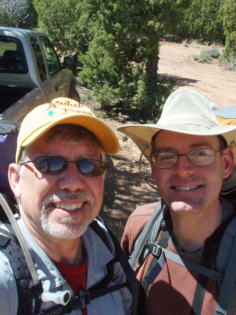 Bill Ferris (r) and I are all packed up and ready to leave the parking area to ascend the old road and forest trail to reach the park boundary.. |
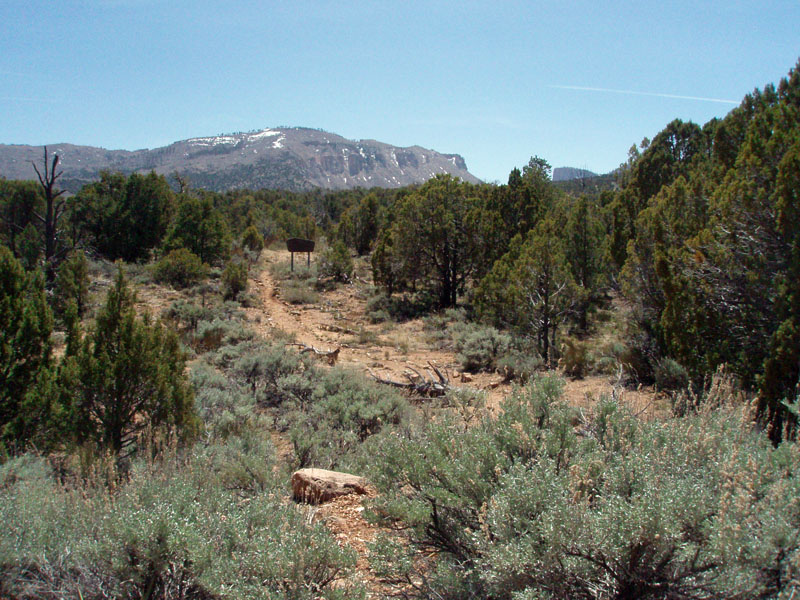 Saddle Mountain from trailhead start. |
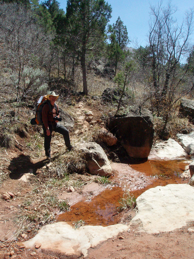 Leaving the road, you follow a trail across a terrace. It descends into a ravine that often has water. From here it's all uphill. |
 Looking back down the old road. |
||
The climb up to the saddle (between Saddle Mountain and the North Rim)
is not insignificant - 1000 feet, give or take a few feet. The
trail crosses back and forth across the bed, usually where the water is
in standing pools, as opposed to flowing. Then, you start to climb
out, already amongst the pine trees. The terrain is fairly rocky, with
not 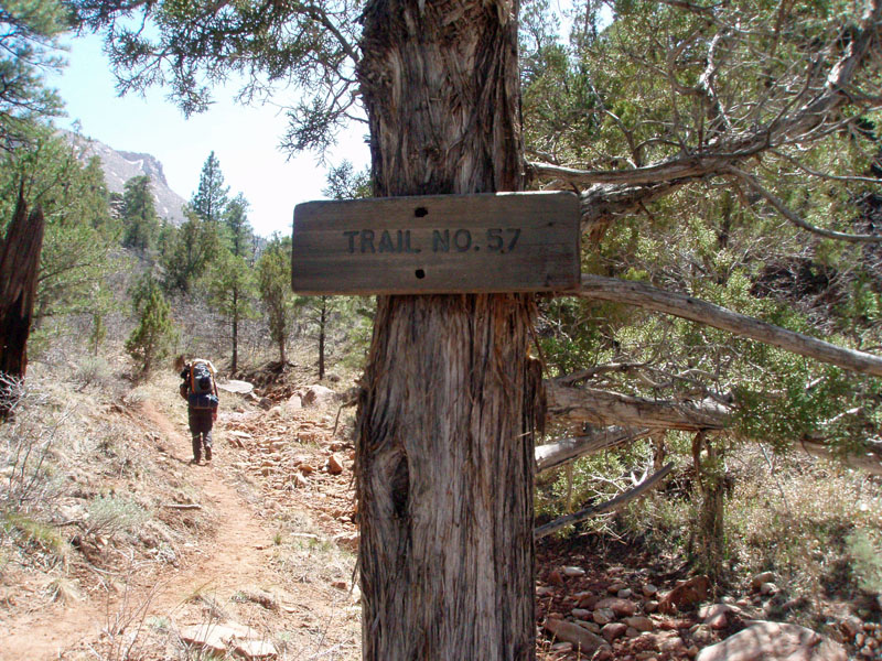 much
in the way of soil cover, and there are places where the manzanita is
quite thick, discouraging one
from wandering away from the trail. Technically, this is
"Trail 57" and it climbs all the way to the North Rim.
The Nankoweap trail starts at the saddle, but you have to hike in on
Trail 57 to get there. So, most people probably just think of this
as part of the Nankoweap trail. The upper trailhead is only
accessible during the summertime, when the North Rim is open. Even
then, it may be impassable in the early summer if there was a lot of
snow over the winter. The lower trailhead is accessible all year,
although being north facing, it can be deep with snow in the
springtime. We saw only a small patch on our way up, but once we
reached the saddle, we saw lots of snow higher up on the North Rim. much
in the way of soil cover, and there are places where the manzanita is
quite thick, discouraging one
from wandering away from the trail. Technically, this is
"Trail 57" and it climbs all the way to the North Rim.
The Nankoweap trail starts at the saddle, but you have to hike in on
Trail 57 to get there. So, most people probably just think of this
as part of the Nankoweap trail. The upper trailhead is only
accessible during the summertime, when the North Rim is open. Even
then, it may be impassable in the early summer if there was a lot of
snow over the winter. The lower trailhead is accessible all year,
although being north facing, it can be deep with snow in the
springtime. We saw only a small patch on our way up, but once we
reached the saddle, we saw lots of snow higher up on the North Rim.
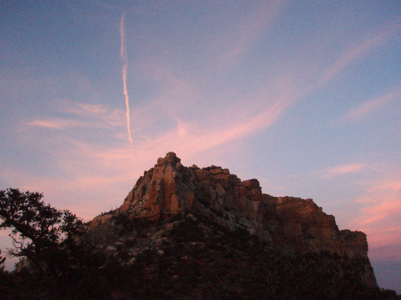
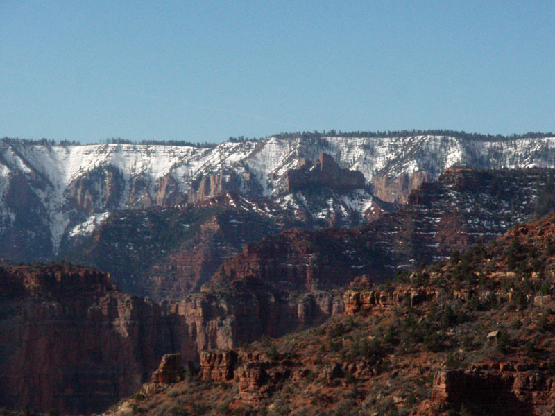
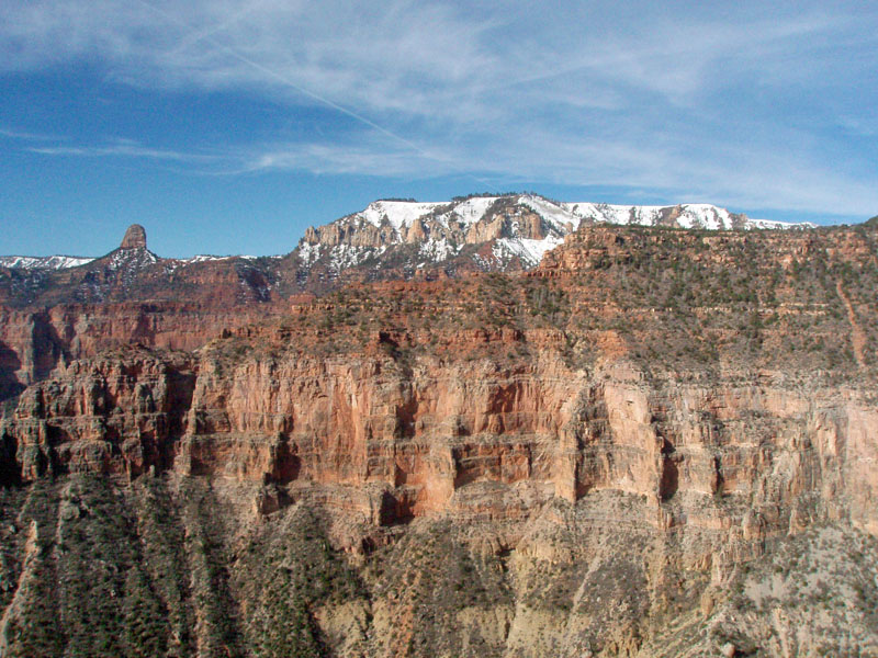
We covered this ground quickly, reaching the saddle at 3:05 p.m. with plenty of time to set up camp, relax and have dinner. We had given some consideration to pushing on and camping at Marion Point. That would have put us off of Bill's permit, but sometimes you have to make a judgment call on these matters. Given that he ended up suffering from some heat exhaustion the next day, that might have made the difference! But, we were aided in this decision by seeing a group of six hikers just a short distance down the trail, starting to contour over towards Marion Point. It only takes about an hour, and they may have decided to go further, but we didn't want to have to crash their party, if that's where they decided to stop. Temperatures here were on the cool side. Once our packs were off, we were both wearing jackets, even in the sun, to keep the chill at bay. And, we had lots of bugs flying about, until things really cooled off at sunset. So, I hopped into my tent to rest a bit without the bother of bugs checking out my ears, eyes and nose! I had a sudden flash of insight and called out to Bill, "Hey, I've got a definition of 'home.' Home is where you can lay down." It seemed to me that the idea that you can totally relax defines home. There is something about laying down on my sleeping bag in my tent that makes me totally relaxed in a way that is just like home. [By way of contrast, staying at a hotel does not make me feel at home. Maybe it's just me.] We had fantastic views from here. We could see much of the Nankoweap area, lots of the North Rim, the Little Colorado River canyon and even the Desert View Watchtower (with a pair of binoculars). The setting sun lit up the sky and we both enjoyed this fabulous light show. To top it off, a big, nearly full, moon hung in the sky as if to put an exclamation mark on the day. We had our dinner at about 6 p.m. and I brought along a couple of special treats - two small plastic bottles of wine to celebrate the start of Bill's trip and some brownies for dessert, which were so good that I may just do that again some day! By 7:30 p.m. it was dark and cold and we both turned in for the night. |
|
|
||
 |
 |
 |
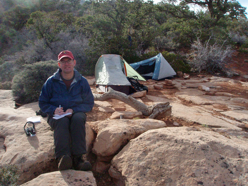
| Trail shoring I worked on in 1997. | Bill jots down some notes at camp. | Sunset on Saddle Mountain. |
| Day
2 - Checking out Marion Point (Saturday, April 16):
It was a pretty comfortable night for me. Although we were at 7500
feet in elevation, and it had been cool during the day, it wasn't cold
for me at night and I slept soundly. Maybe knowing that I wasn't
going to have to lug my pack around for most of the next day
helped! We were up at 5:30 a.m. as the sky was beginning to
lighten up. I didn't eat much for breakfast as I am not doing too
much today and will be snacking quite a bit. At 7:30 a.m., with my
pack hanging from a tree, we were all set to go.
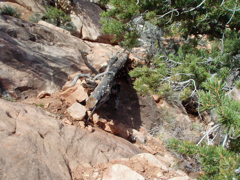
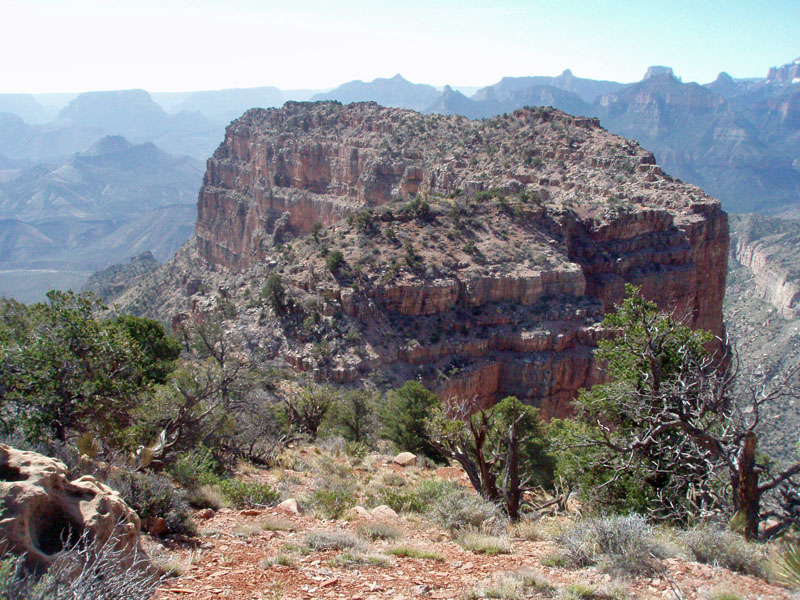
We had to climb up a bit to catch the route that descends through the upper cliff layer in the Supai, which is where the Nankoweap trail properly starts. Just below here is a spot where the supporting materials had been eroding away for years, requiring hikers to precariously cross over about 6-7 feet of sloping rock. Back in 1997, I camped on the saddle at the end of a long trip in Nankoweap and took the time to repair this as best I could. I dragged up branches and trees and big rocks to shore up this spot, and, quite frankly, today it looks pretty much as I left it back then. More dirt now than when I made some improvements. But, I have a photo from the 1997 trip and it looks quite close to what it looks like now! It only took us one hour to reach the rest spot at Marion Point. Of course, the actual point is way out at the end of the arm, but where the trail crosses the arm, most people refer to it as Marion Point. There used to be a seep here, but I haven't seen water there since the early 1980s, although it can still be a bit damp. The real bad spot in the trail, where it is quite narrow and the side plunges away precipitously, has been widened! You don't even notice it now. Or, at least, I didn't notice it. So, that is a nice change. There is another narrow spot further along, but it wasn't as bad, in my opinion. We had a short break and quick snack here, and by 9:00 a.m. we had said our goodbyes. Although Bill would be in the canyon, probably alone, for some eight more days, he would still have folks looking over his shoulders. He brought along his new Spot device and planned to wear it on the outside of his pack and leave it on all day, sending out a "bread crumb" every 15 minutes. These markers showed up on a map that anyone could access from the web. What a great idea! So, for the next week, I was constantly checking in on his progress. The signals sometimes got mangled up, but it otherwise worked very well. A lot of the folks at the Yahoo group were following him and having lively discussions each day about his progress and route. |
|
|
||
|
|
||
|
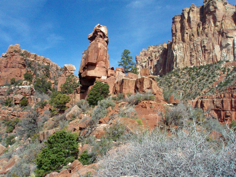
So, off I went in search of Marion Point. I have camped here
before, but never had the time to do any exploring. I got around
the big blocky formations that I call the "battleships" and
from the back side they don't look the same! Indeed, except when
you are right there, it is very difficult to even pick out these big
towers from further away, as they blend in so well with their
surroundings.
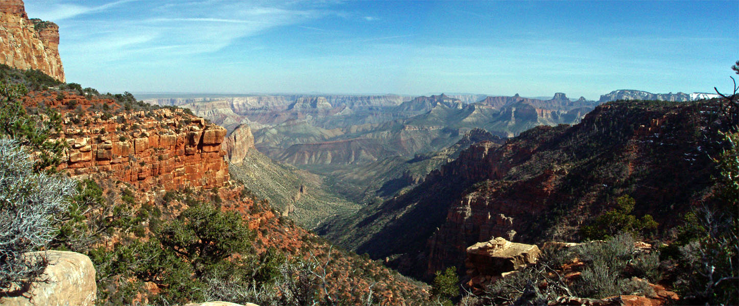
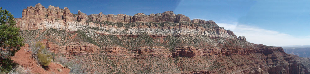
The walk out here was easy. I stayed mostly on the top part of the ridge, although sometimes you get forced off to one side or the other. I had some game trails to follow as well. It only took a half hour to reach a spot where you have to descend to a saddle and then climb back out in order to walk the final distance to the point. And, that's where I ended my trek. I gave it some thought, but the climb out the opposite side looked a little too thrilling for me. I am still in the recovery phase of my ACL surgery, and am not as nimble as I'd like to be under these circumstances. So, I looked it over for some time and decided to reject going further. I did scout around a bit and found a chute that descended to the saddle. I thought to go down and take a closer look at the route up and out, but at the bottom of the chute, there were spots that made me feel uncomfortable, so I didn't go any further. I sat around in the shade of a tree for a while and snacked. I was looking over at the long contour of the Nankoweap trail that leads to Tilted Mesa, but saw no sign of Bill. I think that his progress through there was so good that he had already passed beyond where I was looking. I did snap some photos that are stitched together, below, showing this part of the trail and Saddle Mountain towering above it, as a panorama. |
|
|
||
 |
 |
 |
| Nearing the end of Marion Pt. | A final saddle to reach the end. | Chute leading down to saddle. |
|
|
|
By 10:15 a.m., having only spent about forty-five minutes out at the end
of my hike, I was ready to head back. I reached the trail by 10:50
often times following my own tracks back. I had left camp with 2
liters of water and only had 1/2 liter by the time I was back at the
trail. That means I chose poorly on this score - if I had made it
all the way out to Marion Point, I most certainly would have run out
before getting back to my pack, where I had left more water!
I reached my
pack at noon, with about 8 ounces of Gatorade left. Whew! No
wonder Bill was suffering from heat exhaustion this day! There was
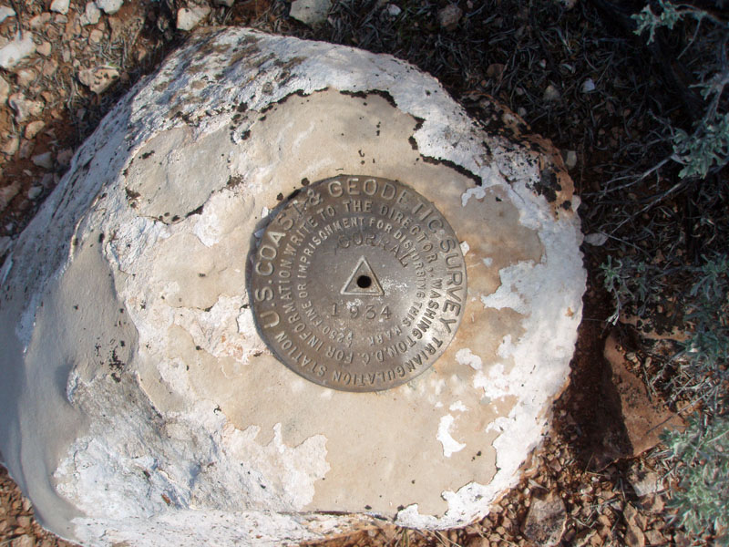
a guy and his dog I was ready to go at 3:40 p.m. and noted down that the odometer read 260.8 miles, which covered the distance traveled since I had left my house the previous day. On my way to the highway, I had seen a benchmark identified on the map, so I looked for it. It was about 10 yards or so off the road. There was a small cairn to help mark the spot. It was stamped with the word, "Corral" on it. I stopped at Marble Canyon for dinner a bit past 5 p.m. and was back on the road at 5:45. At 7:45 p.m. I was back home, with the total distance for this trip ringing in at 425.2 miles. Once home, I checked out my pack and found that it weighed in at 23 pounds and that I had only some 10 ounces of water remaining! Postscript: It was cool following Bill's progress all week. He hadn't decided how long his trip would really last and was thinking about coming out a day earlier than his permit allowed for. So, when I saw that he was coming out early, on Friday, April 22, I decided to cruise up to the canyon to give him a ride from the trailhead to his car (versus riding the shuttle and taking an hour). I tried to check his progress on my cell phone, but service was spotty and it wasn't clear when his bread crumbs got uploaded. As it turned out, I arrived at the parking lot for the South Kaibab trail literally as the bus was pulling away, which he was on! So, I drove over to the visitor center, where he would have to transfer, and waited. When his bus arrived (it was dark, so maybe 7:30 p.m., or so), he was one of about ten riders. As he got off, I called out, "Hey, is that Bill Ferris over there?" He looked around, rather puzzled and then broke into a big grin. We drove over to his car and he did a quick change so we could have dinner at the AZ Room in the Bright Angel Lodge, where he would tell me all about his trip. |
|
|
||
|
|
Return to Hiking Grand Canyon home page |
|
