 |
|
|
Day Hike
to Phantom Ranch Friday, July 13, 2007
by Dennis Foster |
|
|
|
|
|
|
|
Day Hike
to Phantom Ranch Friday, July 13, 2007
by Dennis Foster |
|
|
|
|
|
It's summer, and I have managed to keep free of work. Teaching is
a great profession that way, especially if you like to hike the Grand
Canyon. Well, optimal hiking is in the fall and spring, so there
is a bit of a mismatch here. Still, once the monsoon season starts
to kick in, here in northern Arizona, day hiking the canyon can be quite
enjoyable. As the heat builds up during the day, the clouds roll
in, mitigating temperatures, and, if all goes well, they will dump a bit
of rain on you, to really cool things off. May and June are not
like that - those are our driest months. But, July and August can
be great hiking times, if the weather is cooperating.
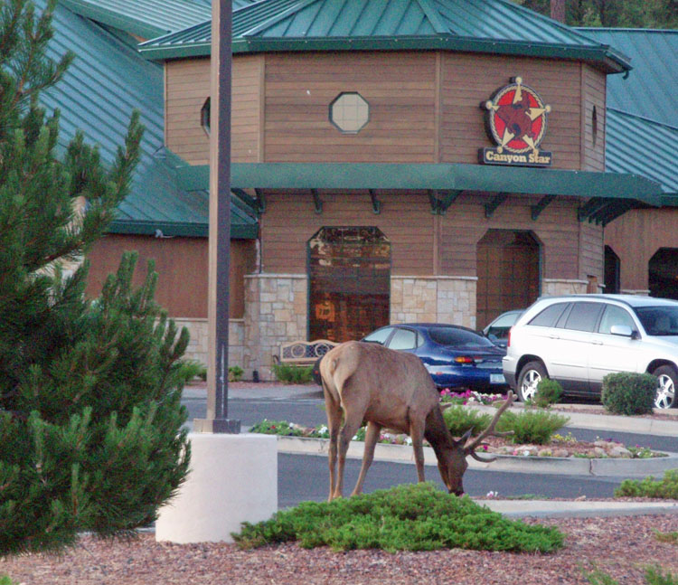
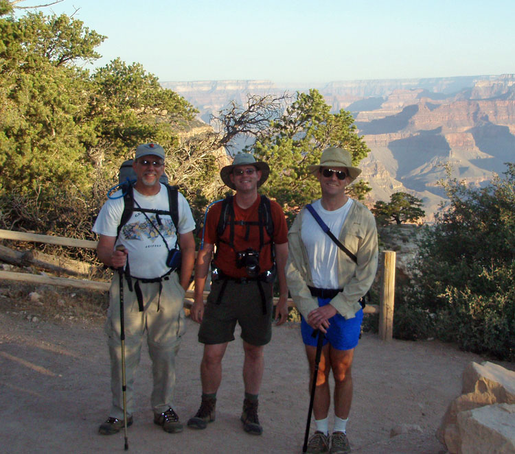
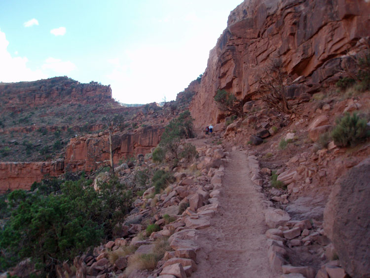
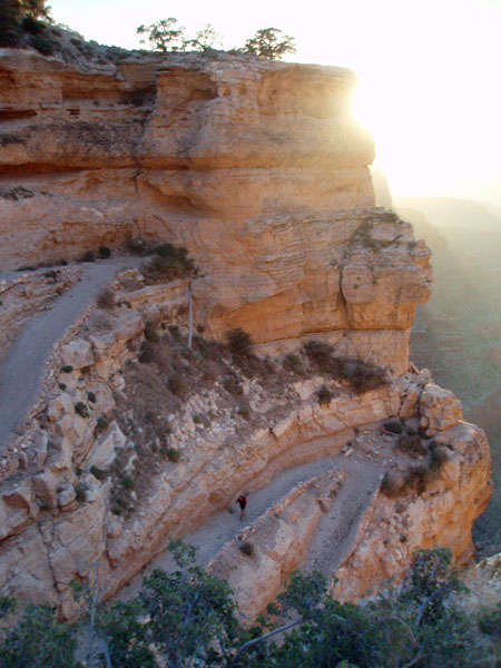
It looked like this would be a good day for a hike, despite it being Friday the thirteenth! The forecast was for highs in the low 80s at the rim, and about 110 degrees at the river. But, we also had afternoon clouds in the forecast, with a 20%-30% chance of a thunderstorm. Hiking buddies John Eastwood and Bill Ferris were up to the challenge of a midsummer's day nightmare down into the canyon. To make it even more challenging, we were going to take the South Kaibab in, and out, of the canyon. There is a perception of dread about this trail, at least for the hike out, because there is no water along the route, and there is not nearly as much shade as along the Bright Angel trail. But, perception is not necessarily reality. The key advantage to the Kaibab trail is that it is about two miles shorter than the Bright Angel. Also, on the return hike, you start climbing right away along the Kaibab, mitigating the heat at the time you are hiking at your strongest. Along the Bright Angel, you have to hike above the river to Pipe Creek, broiling all the way. And, the shade issue is overplayed. There are many great shady spots along the Kaibab, from near the river to the switchbacks at the very top. Bill volunteered to provide the wheels for this hike, and we got an early start. I was up before 3 a.m., and we were at the trailhead by 6:20 a.m., even with a brief pit stop in Tusayan. We saw many elk this day, both in the morning and on the trip back in the evening. Two, or three, were even wandering around in Tusayan. The sky was clear and blue at the start of our hike. The temps were comfortable, and we cruised through the opening legs of this hike. It took us 30 minutes to get to Cedar Ridge (1.5 miles down) and another 30 minutes to get the top of the Redwall, where I had planned for our first water cache. While the trail is waterless, it is an easy task to bring along enough for the trip back up. If you tank up at the top, you don't really need more than a couple of liters to get you to the bottom, as long as you hike early. That allows for room to carry a couple more liters to cache along the way. Then, if you tank up at the bottom, you start the return trip fully hydrated, with two liters on your back, and two more to pick up along the way. An extra added benefit to this plan is that you can freeze your water for the cache. That way, on the return, you not only have water, you have cold, or even icy, water, which goes down like sweet nectar on a hot day! We only spent
about fifteen minutes at the Redwall cache and were on our way. An
ascending mule train slowed us down a bit, although we still reached our
next cache spot - a permanently shady ledge at the base of the Tapeats -
by 8:20 a.m., two hours after the start of our hike. We spent some
25 minutes there, resting and snacking. We had four mule trains
come up and pass us by, so we were at this spot longer that usual.
One of the wranglers was a Native American
and he was telling his group that this kind of spot is referred to as
"big shade" because it is always cool, even
during the hottest part of the day. So, while I have always called
this spot "the shady spot
below the Tapeats" we
decided to start calling it "Big Shady." We had to look
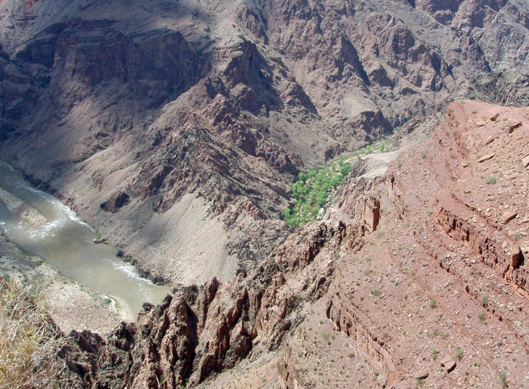
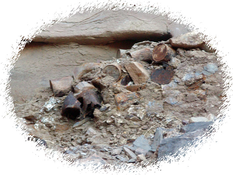
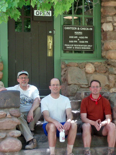
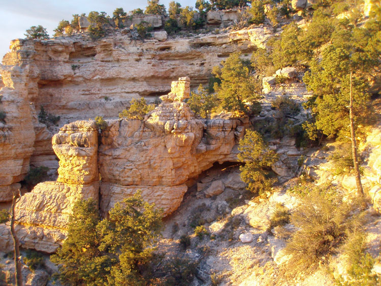
around for a good spot to cache our water, and the small My usual cache spot was too small for the cooler, so we followed the ledge uphill a bit and realized that we were on some kind of old trail. The clincher was the fact that we passed a small trash dump (pictured the left). This route came to a dead end about 10-12 feet below the top of the Tapeats. We didn't investigate further, but it was easy to imagine that some cribbing could be fashioned here to carry the trail up to the Tonto level. You learn something new every day! One more interesting note here - down the trail, a short distance, is a saddle where you can see the phone line coming down from the Tonto. I have followed that down through the Tapeats before. So, there are three different routes right in here. [And, one more sidebar - on the old M-E map, the trail is shown as going over this saddle.] By 9:40 a.m., some three hours after our start, we reached Phantom Ranch. The last bit through the schist was hot, and the stretch from the bridge to the creek was hotter still (as it usually is), but most of our trek down was pleasant. At the canteen, we drank lemonade, wrote postcards and ate our lunches. We bought a bag of ice and filled up our water bottles and water bladders. [That was an excellent idea - I was sucking cold water out of my pack all the way back up to the top of the Redwall.] We headed down to the campground spent the rest of our time soaking in the creek. |
|
|
||
 |
 |
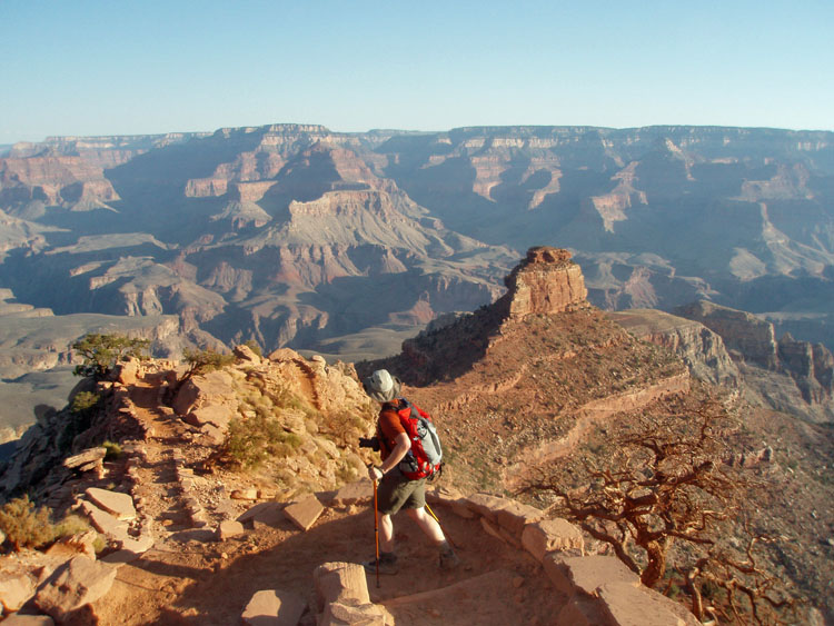 |
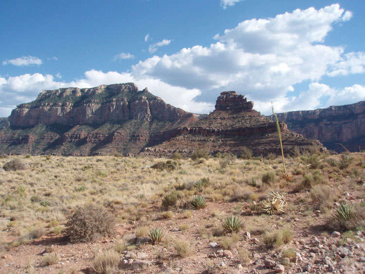
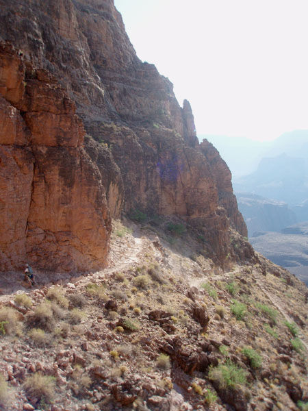
| Is Tusayan elk habitat? I guess so! | At the rim, conditions are ideal. | Bill peers down at O'Neill Butte. |
|
|
||
|
|
||
|
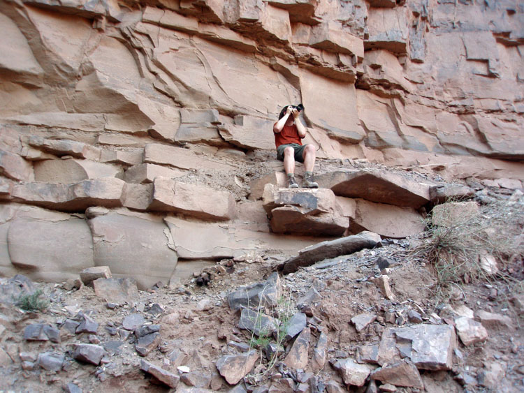
Bill sits atop a rocky outcropping to get some photos of the mule trains passing us by (there were 4!). Upon inspection, the slope below him looks like an old trail. The compacted trash dump, below him and to the left, was a point in favor of this notion. |
||
At 11:35 a.m., about two hours after arriving at the canteen, we were
heading back up, from the campground area.
Although it was hot, it wasn't going to cool off for many, many
hours. So, one has the choice
of sticking around until 3 or
4 p.m., or tightening down the pack straps and pressing through the heat
as quickly as possible, which is
what we were doing. It took us 1.25 hours to reach Big Shady,
where we took a long, well-deserved, break. Two 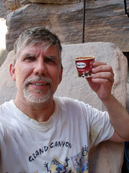 hours
long. We enjoyed the ice cream and cold sodas, and napped for
quite a while. One guy came down past us shortly after we
stopped. After him, we didn't see anyone else on the trail until
we reached Cedar Ridge late in the day! The trail was all ours. hours
long. We enjoyed the ice cream and cold sodas, and napped for
quite a while. One guy came down past us shortly after we
stopped. After him, we didn't see anyone else on the trail until
we reached Cedar Ridge late in the day! The trail was all ours.
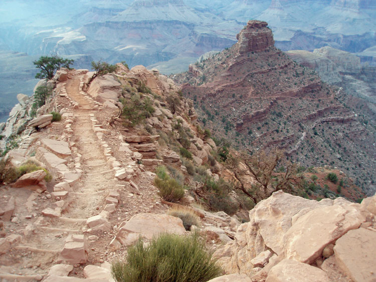
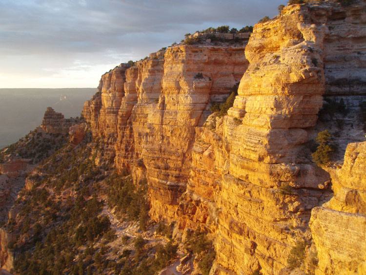
From Big Shady it took us nearly 1.5 hours to reach our cache atop the Redwall. We did take small breaks along the way. From a shady spot in the Bright Angel shale, we sent John ahead to signal back the conditions we'd face on the switchbacks. Both arms upraised meant shady trail. One arm upraised and one horizontal meant some shade. Both arms horizontal meant we were going to bake. He signaled back - arms horizontal. It was sometime after 3:30 p.m. and, in another hour, the trail would probably have been shaded through here. Despite the signal, Bill and I started up the trail and soon caught up with John. We spent a half hour (4:15 to 4:45) at the top of the Redwall, in the shade of the upper ten feet of cliff here. Our water cached here was not so cold. The spot I picked must have gotten some sun and, even though we piled up rocks to obscure our bottles, they were fully thawed. Still, the water wasn't hot, so it served us well. Even though we had only covered a bit more than half the distance from river to rim, topping out over the Redwall is a huge psychological boost for me. From now on we can see the top. We can clearly see the outhouse on Cedar Ridge. The trail doesn't look as menacing. Indeed, the traverse up through the Supai is mostly in shade. And, the temperatures are much more pleasant up here. Although the forecast called for clouds, we weren't getting any respite on our trek uphill. There looked to be good cloud cover regularly shading the canyon north of the river, but nothing to the south. From our Redwall rest stop, it took us - well, it took me - a solid hour to reach Cedar Ridge. Bill was a few minutes ahead of me, and John was probably ten minutes ahead of him. We saw hikers here, some just down to this spot, and others on their way to camp at the river. We spent fifty minutes at Cedar Ridge before hunkering down for our final leg of this trip. Finally, the cloud cover kicked in for us, and we enjoyed regular shade up through the Hermit, Coconino and Toroweap layers. From Cedar Ridge it took us an hour to reach the top, arriving right at sunset (7:40 p.m.) and some 13 hours and 20 minutes after starting down. Of course, this wasn't really the end, since we parked at the picnic area about a quarter mile away. By the time we were back to the car and ready to go, it was dark - no wasted opportunities on this day hike! |
|
|
||
 |
 |
 |
| The south rim from Mormon Flats. | Shaded route through the Supai. | Clouds kick in for the last leg. |
|
|
||
|
Bill
takes photos of the sunset from |
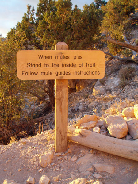
Whoa! Is that really what the sign says? Well, ok, Photoshop is just too cool. Still, it is prudent to take even this, altered, advice. |
|
|
|
||
|
|
Return to Hiking Grand Canyon home page |
|