|
|
|
An Old
Mining Camp in Cottonwood May 18-19, 2000 by Dennis Foster |
|
|
|
|
|
|
|
An Old
Mining Camp in Cottonwood May 18-19, 2000 by Dennis Foster |
|
|
|
|
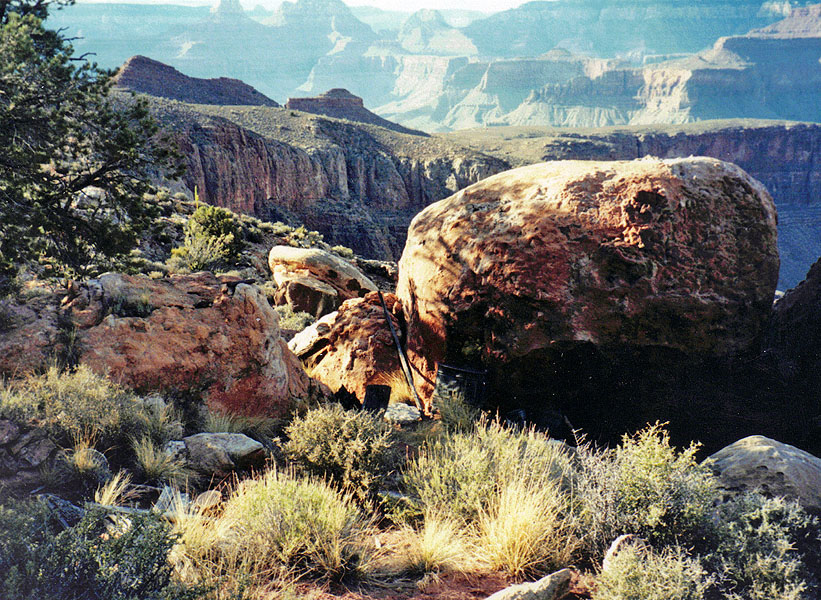
| "Looking
down Grapevine Canyon to the northwest, one might think it would be
simple to walk right through the Redwall... Some care is ...
needed to find the route through the Coconino directly below the
trail. Indians and prospectors must have known abut this
route. An unbroken prehistoric pot was found in a shallow cave
below the Redwall rim to the northeast and there is a miner's [sic] camp
still farther east." --Harvey Butchart, Grand Canyon Treks (p. 49) "There is also an easy route through the Redwall to the top of the promontory dividing Grapevine from Cottonwood. The miner's [sic] camp is about halfway between the heads of these two routes at the top of the Redwall." --Harvey Butchart, Grand Canyon Treks (p. 55) The brief reference in Harvey Butchart's book interested me for a long time. As do about a million other such passing comments. But, I also have a copy of his actual trail logs - over a thousand single-spaced typewritten pages. So, I was able to read his fuller account of this route before trying to find these sites - the cave, called Olla Cave in his journals, and the miners' camp, which must be one of the last places in the canyon to have so much original material still laying around. Although May can be a very hot month to hike in, this hike was practically perfect insofar as the weather goes - recent rains and nearly constant overcast skies made for very nice temperatures. Along with hiking buddy John Eastwood, I headed up to the canyon early on this Thursday morning for a day hike. That part didn't go according to plan, as I'll comment on later. I left my home (in Flagstaff) at nearly 6:00 a.m., which is late for this time of year, and we were starting down the Grandview trail at about 8:00 a.m. Our plan was to hike down the trail to a place where it wraps around a sky island of sorts. At the furthest point we can leave the trail and pick out a route heading down into Grapevine Canyon. Then we would contour atop the Redwall into Cottonwood Canyon, and drop down to catch the Tonto trail. We would follow it up to Horseshoe Mesa, back on top of the Redwall, and continue on the Grandview trail back up to the trailhead. Although the place where we left the trail is not too far from the rim, we decided to cache some water there for our return, just in case we needed some. This was one of the last hikes that I "took" notes on a microcassette recorder. The transcript is included, below, as an appendix. |
|
|
||
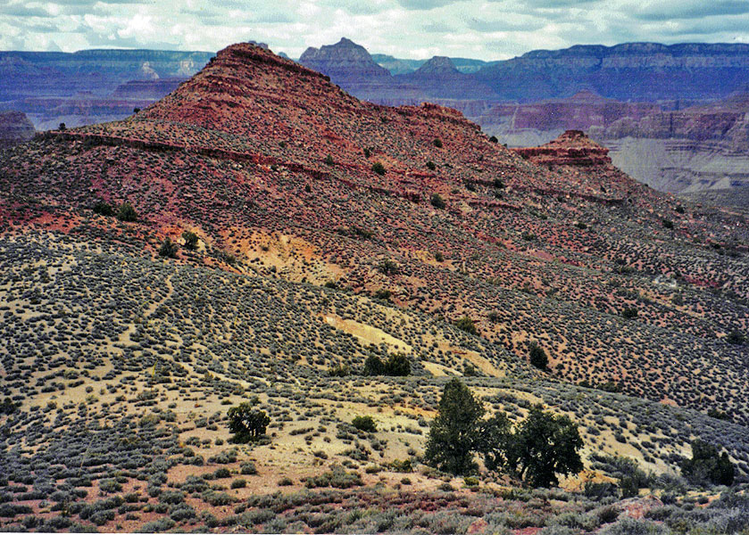
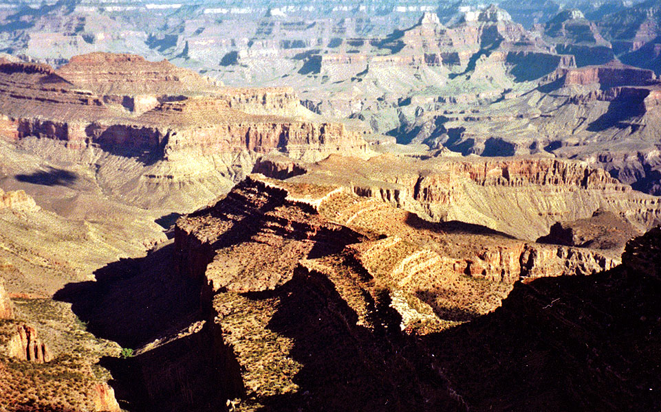 Terrace along east side of Grapevine. |
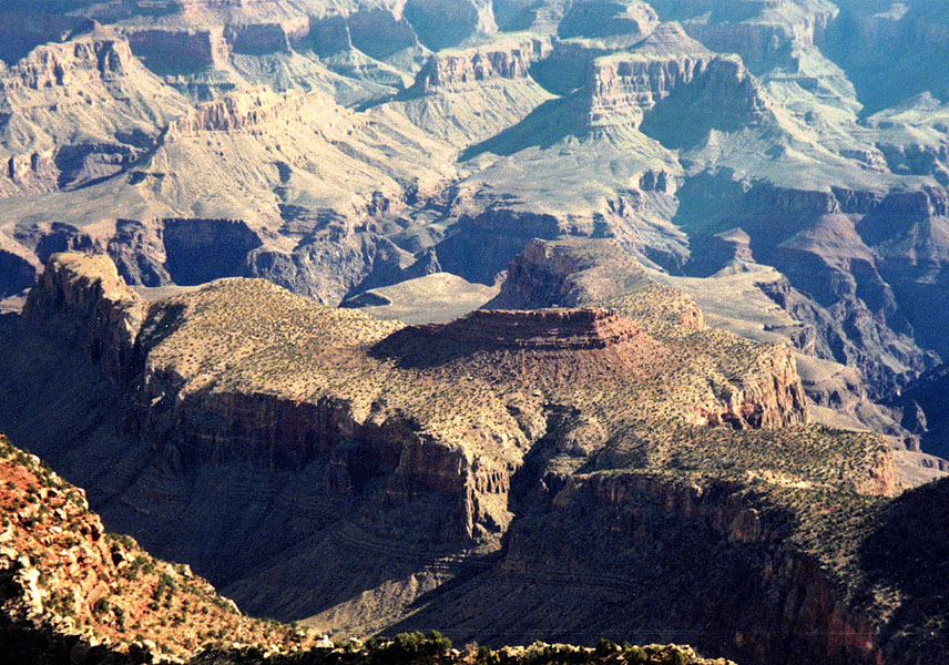 Horseshoe Mesa. |
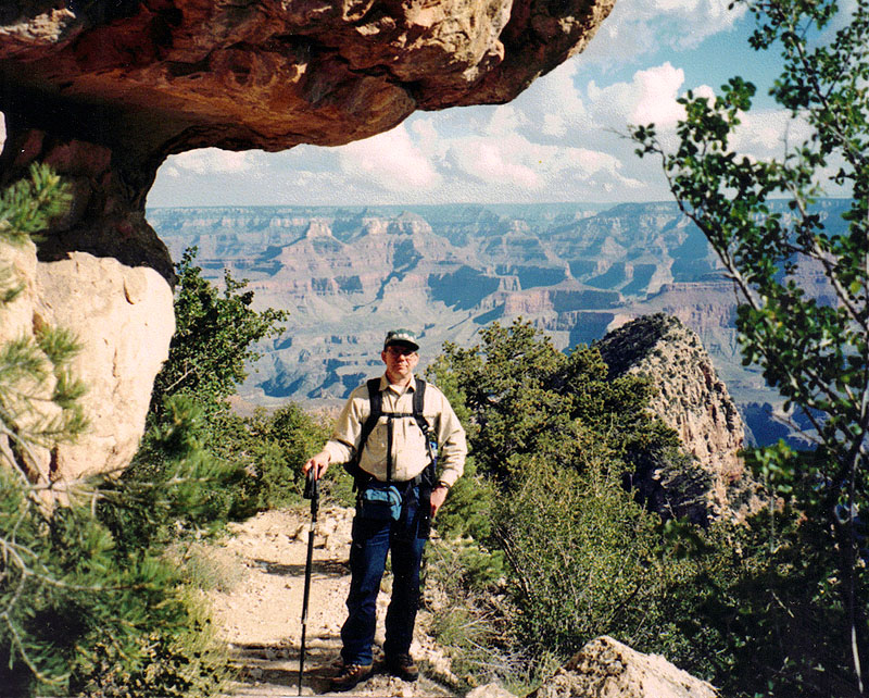 Dennis on the Grandview trail. |
|
It took barely a half hour to reach the spot where we left the
trail. Another half hour brought us to the bottom of the Coconino
cliff, having picked our way through a boulder-strewn ravine. It
took another hour to descend through the Supai layer and reach the top
of the Redwall, which we would follow along for the many hours.
The descent was straight-forward. We came across occasional cairns to help guide us along. In the Supai, we had to deviate from the main ravine quite a bit to get through a few small cliffs. We were pretty generous with our rest breaks and not overly concerned about making good time. While it had taken us two hiking hours to reach the bottom of the Supai, we had left the trailhead three hours earlier. |
|
|
||
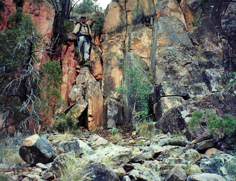 John climbs down a Supai crack. |
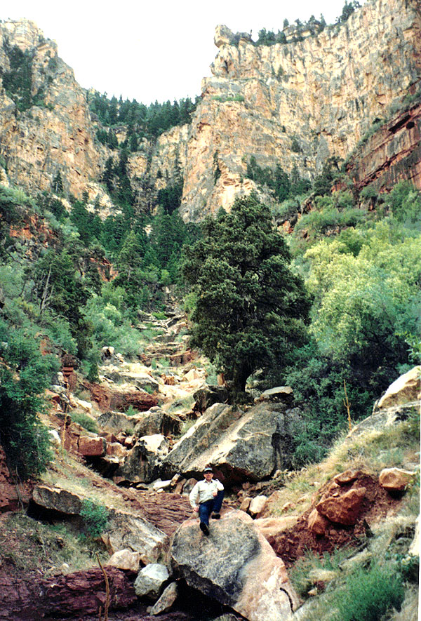 Dennis posing on a big boulder in the ravine we hiked down from the Grandview trail. |
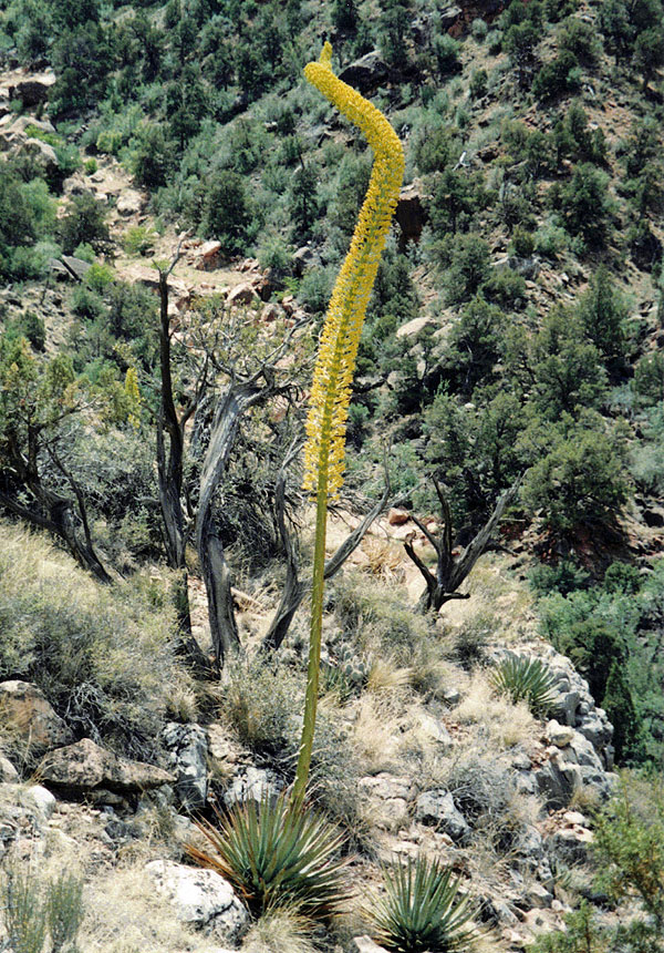 A young agave stalk is nearing bloom. From here we contoured atop the Redwall. |
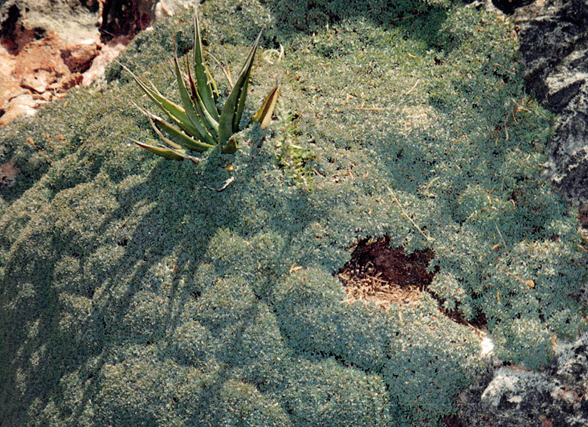 Yucca immersed in ferns. |
||
|
Once we reached the top of the Redwall, the going got better. It
was pretty easy hiking along here. We saw an interesting looking
cave, although my notes assured me that it wasn't the Olla Cave that
Harvey writes about. We checked out an interesting overhang, but
found nothing of particular interest. When we reached Olla, we had
to go past it before we were able to climb down through the top of the
Redwall, then making our way back to it. It was shallower than I
expected and hardly flat and level. This is where an unbroken pot
was found years earlier.
We took a very long lunch break at the cave - nearly an hour and a half. Then, we continued on at this level. A terrace forms in the Supai, up above us, and we must still contour quite a ways before this gives way to a full-fledged terrace that runs atop the Redwall, which continues almost to the river. I bet the views from the end of the terrace are fantastic, but that will have to wait for another trip. At 3:30 p.m. we were poking around in an area where some mining had been done. Once again, our hiking time since reaching the top of the Redwall (2 hrs. 10 min.) was quite a bit shorter than the total time including breaks (4 hrs. 30 min.). We were very excited by finding this mining site - I can't imagine that very many hikers even know about it, much less see it. We peered into a shaft that was about 30 feet deep and found bits of copper in the mine tailings here. |
|
|
||
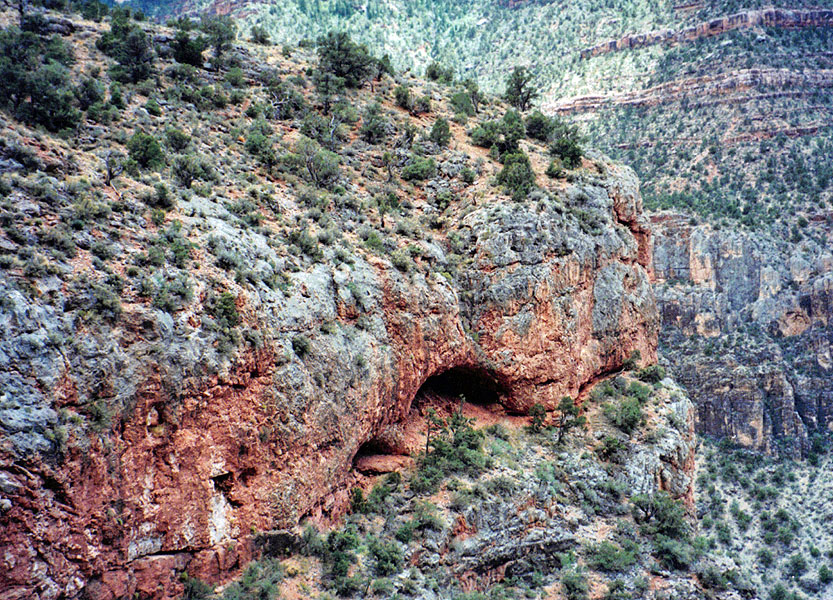 Olla Cave. |
 The terrace has a faint trail on it!! |
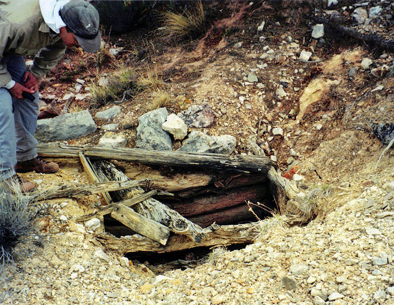 An old mine shaft on the terrace. |
|
We spent the better part of an hour looking around the old mining site
before we headed back south, to continue our contour atop the Redwall
until we could descend into Cottonwood Canyon, to the east. We
were now on the look out for the old miners' camp and we kept a close
eye out as we hiked through here. As it turned out, that wasn't
necessary. You almost certainly would have to walk right through
the middle of the camp as you hiked through here. It is close
enough to the edge so that you couldn't miss it on that side, and it
just isn't flat enough here to make hiking up along the slope practical.
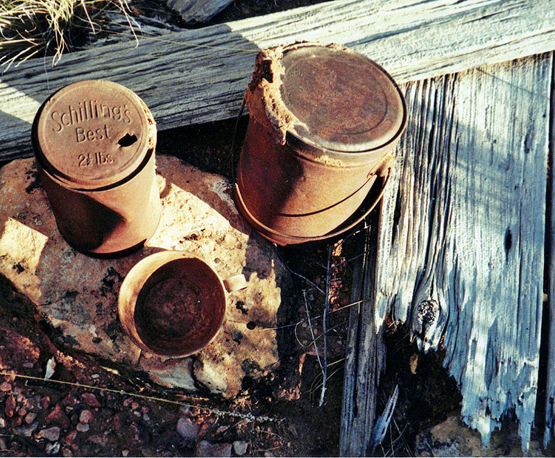
But, an interesting thing happened along the way, about which I may be the only person "in the know." Before reaching the camp, I had to answer the call of nature. John continued on (finding the camp) while I headed up the slope a ways to make sure I wasn't too close to the main walking area. Well, after I was done, as I was angling to meet up with John's path, I stumbled on an unusual pattern of rocks (pictured below). I thought they might be a house outline, but as I looked more closely I came to think that it might have been a grave! There was dirt piled up in the center, and bushes growing there, and the rock outline looked about right. Well, someday, maybe someone will check it out. The miners' camp was absolutely amazing. I couldn't believe all the stuff that was here. We decided that this was probably part of Pete Berry's Grandview operation - maybe an exploratory camp. Maybe not - I'll have to look into whether there were mining claims filed for this area. But, there was an anvil, a big cast iron stove and lots of pots, pans, and picks here. Some barrels, tucked away under an overhanging boulder, were still red after all these years! Some of the things Harvey reported were not here - the canvas tenting, for instance. So, it is deteriorating. But, still a lot of cool old stuff which is likely to stay a long time. |
|
|
||
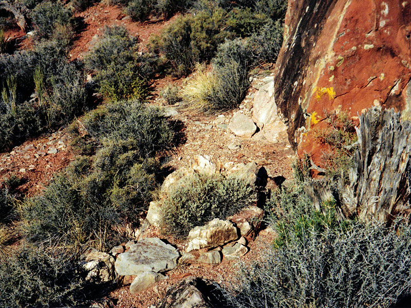 I had the feeling it was a grave. |
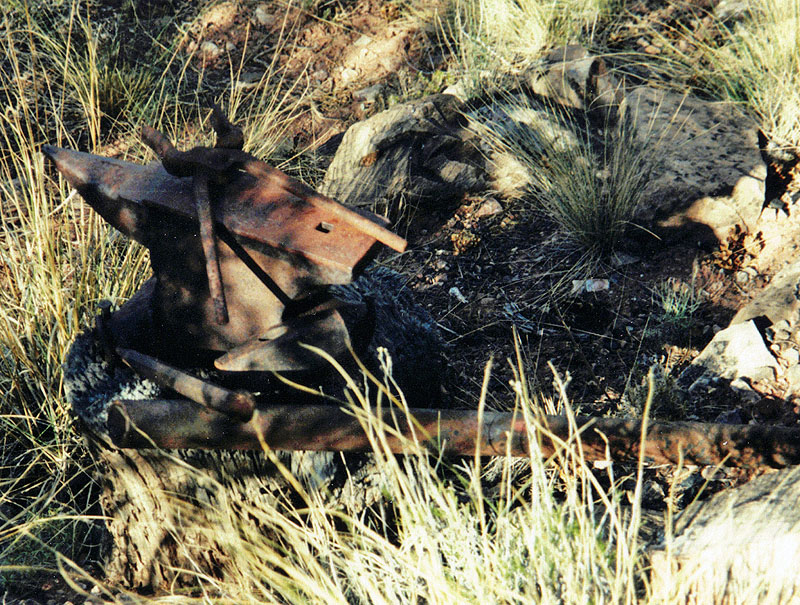 Heavy work with an anvil! |
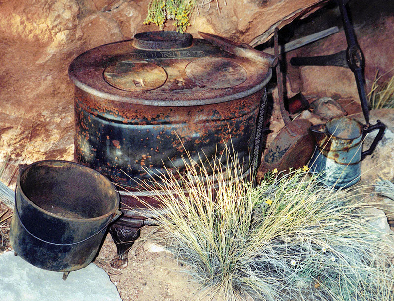 Stove and pots. |
|
|
||
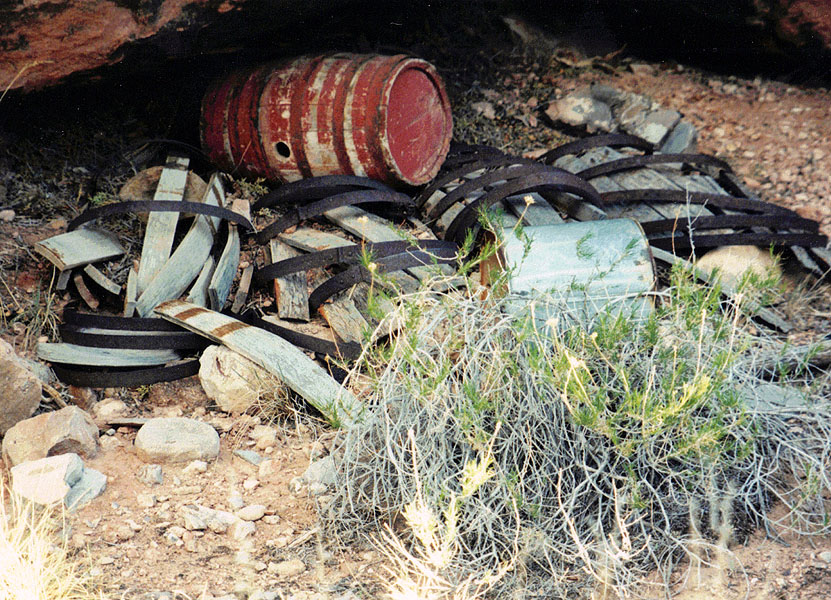 Under a rock, the barrel is still red! |
 Camp debris. |
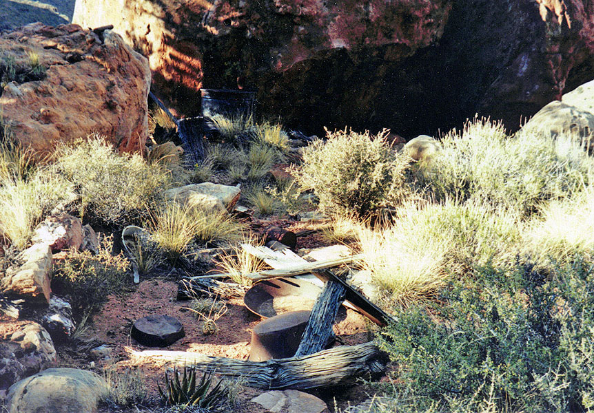
 Looking northwest at the camp site. |
|
At about 5:30 p.m. we left the camp site, now more focused on finishing
our trip. However, we still needed to hike down to the Tonto
plateau before we would catch the trail and start hiking back up to the
rim. It took us about a half hour to reach the Redwall descent,
which is just a walk down. I had been here years earlier and came
up this canyon a bit to see how easy it was to get up through the
Redwall. It took us some 45 minutes to reach the Tonto trail and
another 45 minutes to reach the water in Cottonwood, where we filled up
with what we would need for the hike out.
At 7:50 p.m. we left the gurgling Cottonwood creek, as it got darker all around us. A half hour later we were starting the ascent to Horseshoe Mesa, and still holding off on using our flashlights even though we could now see stars in the sky. We reached the mesa, and a blast of light from a full moon, just past 9 p.m. We were starting to wear out from the long day. Although we were only 3 miles from the trailhead, it would take us a total of eight more hours to reach it! We stopped here for two hours, partly napping before continuing on our way. At 12:20 a.m. we reached the Coconino Saddle and stopped there for three hours, getting some fitful sleep. Finally, at just before 5 a.m., we reached the rim and my parked truck at the trailhead. To this day, John is suspicious when I mention going on a "day hike," thinking it may take 24 hours! Still, we got to see some very interesting places and hike through a real neat route in the canyon. |
|
|
|
Appendix:
Microcassette Transcript It is Thursday, May
18th, 5:55. I’m just about to leave my home, head over to pick
up John and go on to the Grandview trail, check out the route down
towards Grapevine and the area on top of the Redwall. The miles
read 66,987.9. It is overcast and it has been sprinkling here
early in the morning. It’s not raining right now, but things are
damp and wet and hopefully that means a nice cool day down in the
canyon. It is 7:55 and we are
just about to leave the truck and head on down to the trail. The miles
read 67,081.5. We have mostly clear skies above us, although it is
reasonably cool here and it also had rained here a little bit earlier as
well. A few big banks of clouds surrounding us although nothing
looks threatening right away and we can see a little bit of the smoky
obscurity of the north rim. It is now 8:36 and we
are leaving the trail at the ridge where the trail loops around a point.
We haven’t been too concerned about our progress thus far; taking it
easy; meeting a couple of guys heading on the way up. And it feels
very pleasant right now. It’s now 8:51 and
we’re actually on our way. We spent a little time at this spot
taking pictures for a couple of girls and caching a couple of liters of
water after somebody had knocked it down – knocked one of them for a
ways. It’s really nicer down here. It’s not as cool as
it was at the top. Warming up in terms of the day and also in
terms of the elevation, I guess. There is a definite haze to the
north looking up the canyon that must be the residual from the fire, but
we don’t see any plumes of smoke coming out of the north rim at all. It is 9:20. We
are near, or at, the bottom of the Coconino and that turned out to be a
pretty decent route. We followed along the ridge there and we did
pick up bits of kind of a trail looking spots and also a few rock cairns
here and there. It actually went straight out and we hit a point
where if you look to your right you can see the cliffs of the Coconino
in a little bay and then we cut – then we kind of headed a little bit
off to our left and are now on a slope right at the very bottom.
It wasn’t this cold at home. We can look up the main bed and we
can see that there are some cliff spots in there that look like they’d
be tough to get through. So, the key is to stay out of the main
bed in getting through here. There’s a couple of Supai cliffs
below us that look the troublemakers that Harvey talks about. But,
actually, looks like we’re on a route that could go all the way to the
bed and then from there it looks like an easy walk over to the top of
the Redwall. It is 9:53 and I am in
the bed of the ravine. John’s just a couple of minutes behind
me. Careful picking our way through that two or three cliffs of
the Supai. But, we seemed to do OK. There’s a couple of
spots there where it’s climbing down face out. So, through some
steep steps to get through these spots. And, stop here, put on
sunscreen, take a little snack break before pushing on.
We’re really very close to the top of the Redwall, so I don’t
suspect it’s going to take more than a few minutes to get down there
and then start contouring. Actually, not even contouring; just
heading straight away for our destination today. It is 10:24 and we’re
pushing off from our spot here, heading down to the top of the Redwall
and then out to Olla Cave. It is 10:54 and we’ve
reached the top of the Redwall where we’re going to begin contouring
to the north really, towards the cave and then the miners’ site.
The temperature’s went up a bit here as the sky cleared for the sun
and it was very still. But, lots of clouds around us, especially
big banks of them up ahead of us to the north and the west. So,
onward towards the cave. It is 11:24 and we’ve
stopped opposite a cave that we can see in the upper portions of the
Redwall, across the … across Grapevine from us. And, we’re
going to hike up the hill here and check out an impressive looking
overhang. At least, it looks impressive from here. We
haven’t yet reached the indentation where we expect to find the cave. It is 11:50 and we’re
back to our packs. The overhang turned out not to pan out.
Still, it was a fairly impressive spot, but not very deep and no signs
of any human habitation. And, so now on to the cave. It is 12:28 and we are
in the Olla Cave. In order to get here, you really have to come
all the way back to almost the head of this indentation to work your way
down below the cliff and then come back a piece to get to the cave.
The debris here slopes right up into the back of the cave, so not much
in the way of places to sit or even lay out a sleeping bag, Harvey’s
comments notwithstanding. There are some kind of fern-like flora
here on the floor and we saw some ferns up above as we were climbing
down through the Redwall and before we contoured over. So, there
must be some water that does get in here, dripping through occasionally,
or whatever. So, we’ll stop here and have lunch before moving
on. It is 1:56 and we are
all set to leave our lunch spot and rest area at the base of Olla Cave.
It was a pleasant time. The wind blew a little cool, but we were
in the shade. In the sunshine I’m sure things will be different.
We have some high clouds passed over, but still mostly blue, and it
looks like it’ll be a fine rest of the afternoon. So, we’re on
to look for the miners’ camp. It is 3:28. We
have not yet seen the miners’ camp, but we have come far enough north
where we are definitely in the area where they were digging, as Harvey
references in his journal. So, the camp must be back further,
closer to the large promontory that we had come around and we’ll be
checking that out as we go back. But, for now, a rest break. It is 4:21 and we are
getting ready and on our way out of here. There was one mine shaft
real close to where we stopped. It was at least 30 feet deep.
It had some cut wood at the top, forming some support. And, we
walked around a bit and we’ve seen some piles of look like mine
tailings, but really didn’t see another mine shaft the way this one
appeared. There was one area where the side of the hill had been
dug away and there were some bits of copper in the tailings there.
So, now we’re on our way back and hopefully we’ll pass the miners’
camp on the way. It is now almost totally overcast.
There’s very little blue sky up there. Most of the big kind of
clouds – it’s not continuous – but, a great deal of threatening
something, but maybe just keeping things cool. It is 5:28 and we have
spent some time at the miners’ camp, as John found it. Lots of
interesting things around here. The pole and canvas tent that,
remnants of, that Harvey mentioned, aren’t here, although there are
some pieces of wood here that probably were the pole. Frying pans,
coffee pots, one big cast iron pot. And, we’re looking at
this stove here, and it looks like quite a significant piece of
furniture to lug around. And, it’s stamped, “Miner No. 6.”
Which is the brand name, I guess. Some barrels, barrel hoops, a
stovepipe, some stakes, some metal stakes driven into the rock here, and
the house outline that Harvey mentions along with some pieces of wood
that are still around with some nails in them. Just all kinds of
things. Very hard to miss – it’s right along the way. As
we’re walking back, we were kind of scouring the area looking high and
low for this, but didn’t seem you could miss it at all. And,
just a little bit further back to the north, passed a spot that looked
like it might have been a grave. A little bit off the trail
itself. But, it had that kind of shape to it – built a little
bit above ground. It is 6:05 and we’ve
reached the top of the Redwall descent and we should be on a trail soon.
We did seem to follow a bit of a path coming over here. Presumably
part of the miners’ camp path/trail, and haven’t seen it for a bit,
but we might pick it up a little bit here as we go down through the
Redwall. It is 6:49 and we have reached the Tonto trail. Once you get down through the Redwall it is still quite a long hike down the bed to get to the trail. In fact, we’re practically at the point here that we have to go around. So, that’s kind of nice. It is 7:15 and we are
just about out of here, on our way to find water. We still have
some light, although I do believe the sun may have set. It is 7:36 and we’re at the water in Cottonwood and I guess we’ll stop and fill up. A couple of liters, maybe, each. Or, one liter each. We’ll figure that out. It is 7:48 and this is
the sound of Cottonwood Creek (gurgling) . . . which we are about to
leave. We each have a couple of liters of water from here and that
should be plenty to see us all the way up. It is twilight, I
guess, here. The sun has set for some time. Things are kind
of a darkening up, but haven’t got too dark yet, although we both have
our flashlights ready to use whenever we need them. The moon is
full tonight, but probably won’t be of much help for a little while. It is 8:20 and we are
just crossing the streambed and ready to start heading up to Horseshoe
Mesa. We treated one of the liter bottles with the antidote, since
it had been well-mixed by now. As we were coming up the creek bed
we got lost from the trail and ended up walking up and ended up in the
creek bed for a while until found the trail, just before it crosses
here, so it wasn’t really that big a deal. But, we should be on
the trail from here on out. It is definitely dark. I see
some stars and still can see pretty well what’s going on and I think
we’ll probably still be able to avoid the lights for a bit. It is 9:09 and we’re
at the top of the Redwall and in the moonlight suddenly. In fact
we’re walking into the moonlight and it’s a little bit blinding.
But, we’ll be stopping soon. It is 11:10 and after a
bit of rest and maybe some sleep, but probably not, we’re ready to go.
Things are made a little bit more pleasant because it’s not windy at
all. And, it’s really not that cold. But, still a little
cool. So, moon is up, shining on us and we’re going to head up
the trail. It’s 12:20. We’re
at the base of the Coconino, top of the Supai in the cut to stop for
some time. It is 3:30 and we’re
pushing off from this spot and heading on up. It is 4:55 and we are
on the rim, walking to the truck. Oh, man it feels good to be out.
That bit went pretty well for me, although I am mighty tired and pretty
damp too. So, we had twilight here the last half hour or so,
adding to the light. We didn’t use our flashlights coming all
the way up. The only time we used them was when we were checking
the little sites, our little rest areas, to make sure we picked up
everything. So, that’s kind of neat. |
|
|
||
|
|
Return to Hiking Grand Canyon home page |
|