 |
|
|
Day Hike off Great Thumb Mesa Saturday, August 30, 1997 by Dennis Foster |
|
|
|
|
|
|
|
Day Hike off Great Thumb Mesa Saturday, August 30, 1997 by Dennis Foster |
|
|
|
|
|
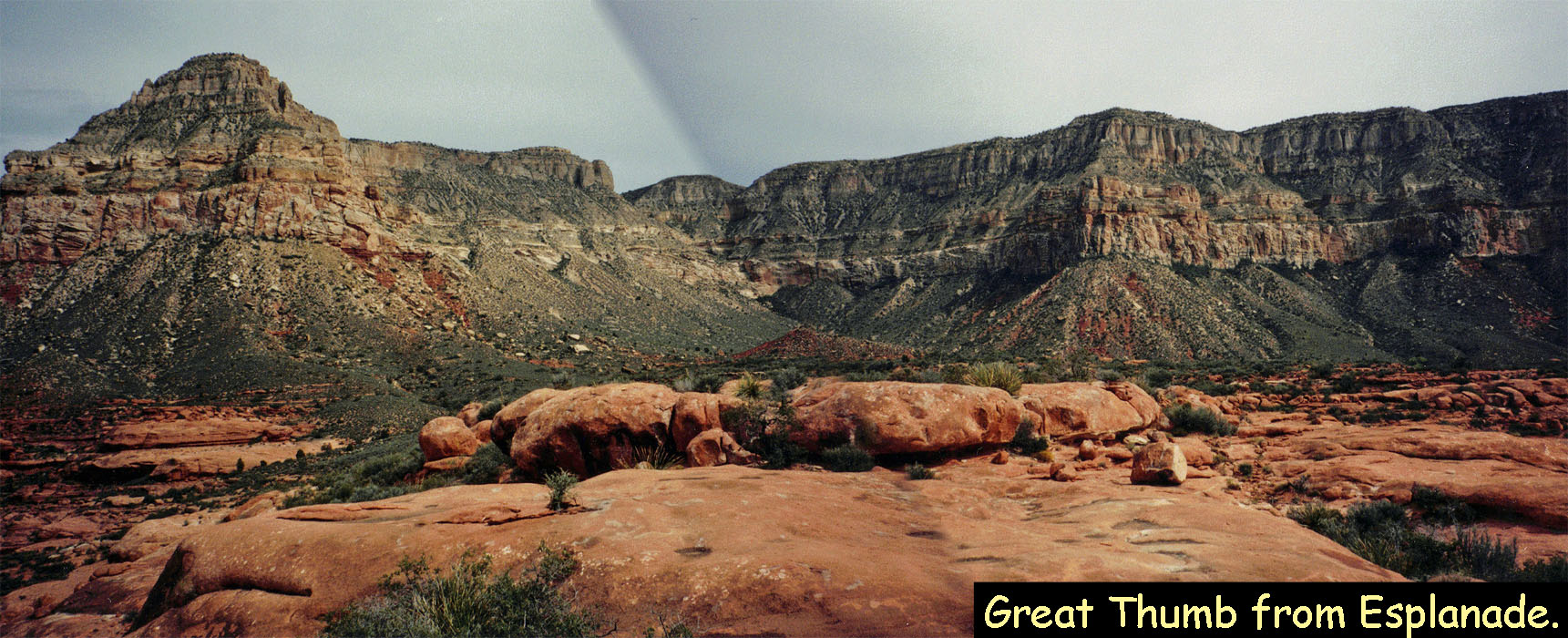
As one hikes more and more of the Grand Canyon, certain areas start to stand out. Mostly, they do this because they are totally devoid of lines drawn in showing your hiking progress!! One such spot for me was the Great Thumb Mesa, well to the west of the South Bass area. In May of 1983 my father and I drove out on the Great Thumb road (with a detour to the Topocoba Trailhead, which leads to Supai). We were stymied by a huge hole in the road that looked to be impassible by any vehicle, four wheel drive or not. We were just past Enfilade Point, and driving alongside the rim. We walked down the road a half mile or so just do to that, but otherwise had to turn around and leave Great Thumb to another day.
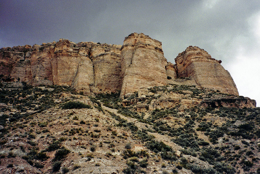
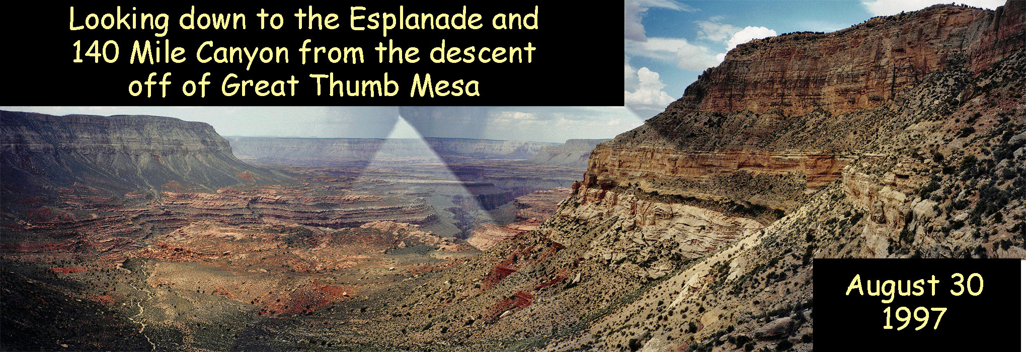
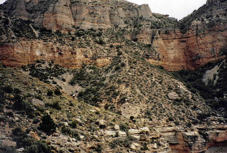
Fast forward to 1997 and it is finally time for another try at this. Colleagues Doug Brown and John Eastwood agreed to join me as did Doug's son (and my student), Mathieu. We decided to make it a day hike as best we could, and it would be a long day. My notes are scanty for this trip but I know we left early in the morning. We didn't have to stop and pay at the Havasupai gate during this trip, although this might have been before that operation started in earnest. And, hiking the canyon in August is not that popular. We didn't have any trouble on the Great Thumb road - that hole must have been filled in. The road does get very rough and slow going. Mathieu wanted to run part of the road and I believe that John joined him. Doug brought along his mountain bike and rode it over the last few miles. I can't say that they weren't traveling about as fast as I was driving! [Doug was probably faster!] It was just about noon when we reached a dead end in the road. You could see signs of a huge fire that had swept through here with lots of burnt trees, but fairly lush grasses growing. We headed north from the truck at 12:10 p.m. and found a ravine that we followed to the rim. We didn't seem to be on the real trail, but were able to make our way down through the Kaibab. At the top of the Coconino, the trail, which we did find, contoured to the right to a talus slope and then plunged down to the Esplanade. We walked across the Esplanade to an overview of the upper reaches of 140 Mile Canyon, and Fishtail Mesa across the Colorado River. All in all it took us 2 hours and 15 minutes to get here from the truck. |
|
|
||
|
|
||
|
|
||
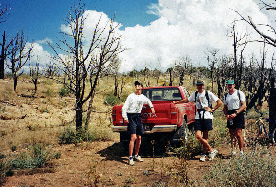 Mathieu, Doug & John at "trailhead." |
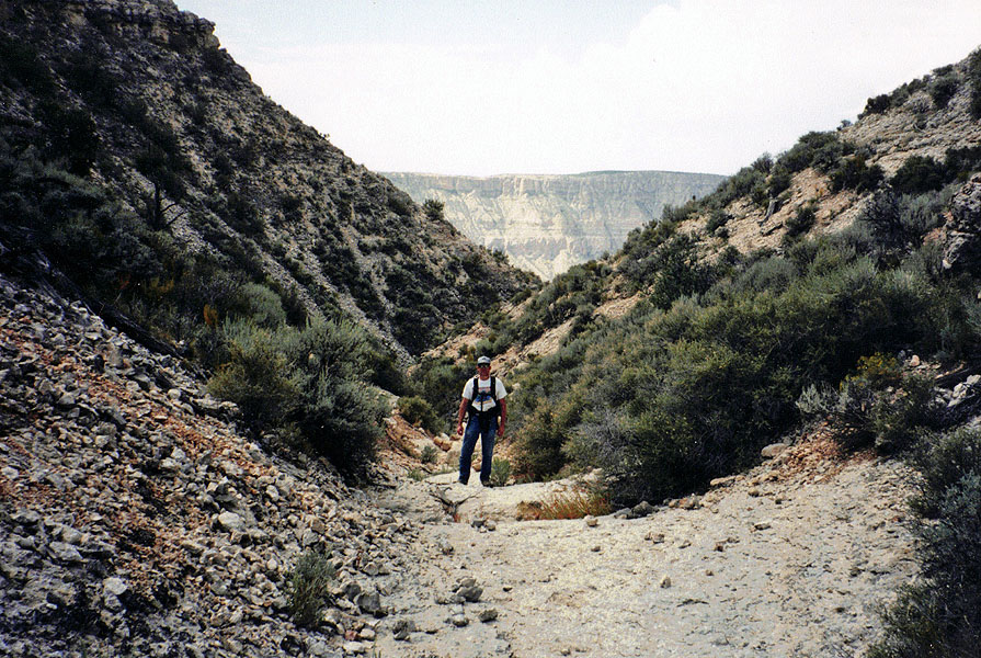 Dennis in descent ravine. |
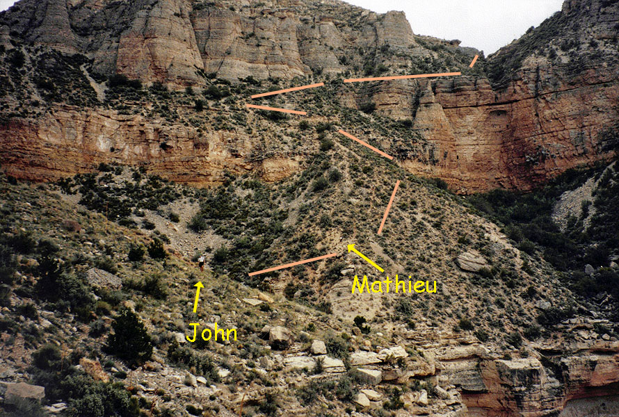 Our route, annotated (or not). |
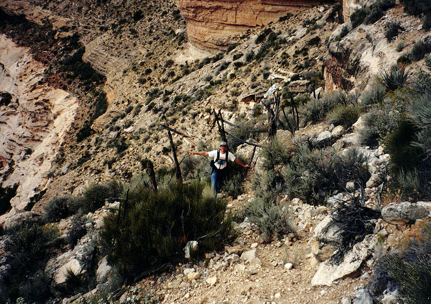 Dennis at old fencing. |
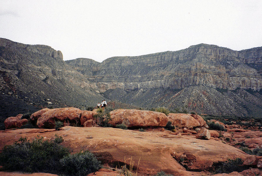 The group nears the end. |
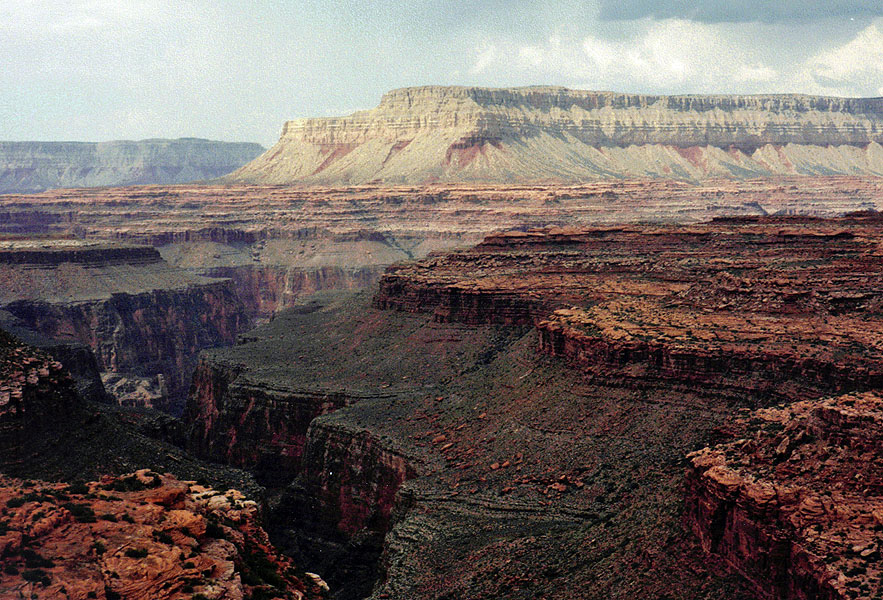 Our view into 140 Mile Canyon. |
|
There is supposed to be a spring in the next bay, but we just didn't
have enough time to check it out on this trip. It probably took us
2.5 to 3 hours to get back to the truck and start heading back, sometime
after 5 p.m. We passed the "Cave" triangulation area (we
didn't find it) at 5:45 p.m. From here it was 15.1 miles and 2
hours and 35 minutes to get to the gate that is at the start of the
Great Thumb road (where it turns off from Topocoba). Yes, the
going is very slow!!!
From here it was 11.2 miles, and another 35 minutes to reach the "No Hunting" sign, which I believe is the boundary where the Havasupais now charge to pass through. But, our speed was increasing, which felt good. Less than an hour later, at 9:44 p.m. we had covered the remaining 23 miles to the highway at the Moqui Lodge (back when it was still standing!). We stopped in Tusayan and had dinner at the Red Feather and didn't leave until 11 p.m. Consequently, we got back to Flagstaff pretty late, with me reaching home at 12:30 p.m. having covered 271 miles on the road over this very long day. |
|
|
||
|
|
Return to Hiking Grand Canyon home page |
|