 |
|
|
Nankoweap
to Phantom Ranch Friday, March 8 to Saturday, March 16, 1996 by Dennis Foster |
|
|
|
|
|
|
|
Nankoweap
to Phantom Ranch Friday, March 8 to Saturday, March 16, 1996 by Dennis Foster |
|
|
|
|
|
I had twice done the long hike from the
Nankoweap Trail to Phantom Ranch and then out to the South Rim - back in
1984 and in 1993. Both times we hiked along the river from Nankoweap
to opposite the Little Colorado before ascending to higher terrain.
This time I would not only be following the Butte Fault from Nankoweap
to Chuar, but I would be doing this as a solo trip. I had been
over the Butte Fault route two years earlier and camped at Lava Creek
for a day of exploration before returning. For this hike I would
be covering new ground from upper Lava to Vishnu canyon by taking the
high saddles - first into Unkar and then into Vishnu. Once in
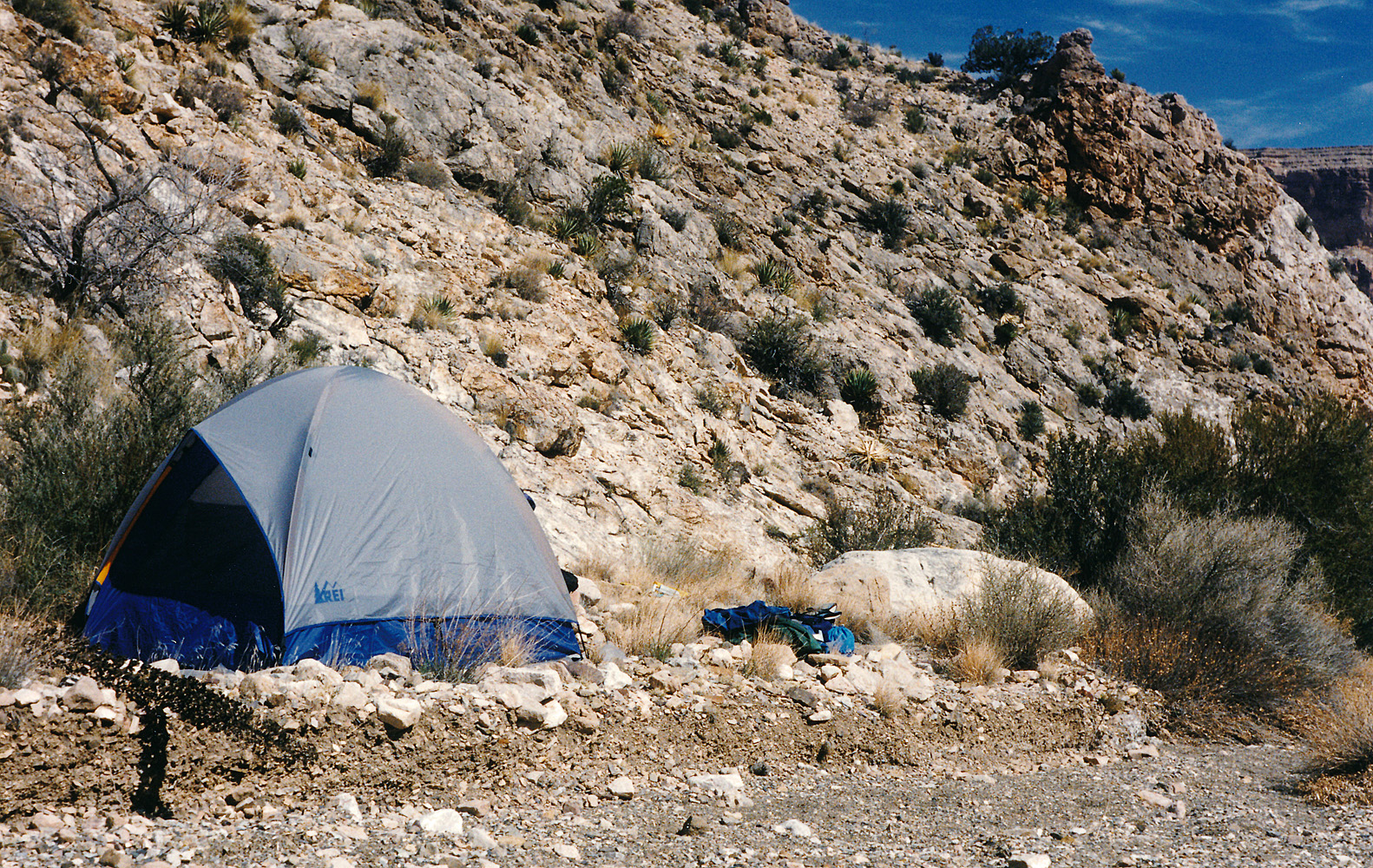
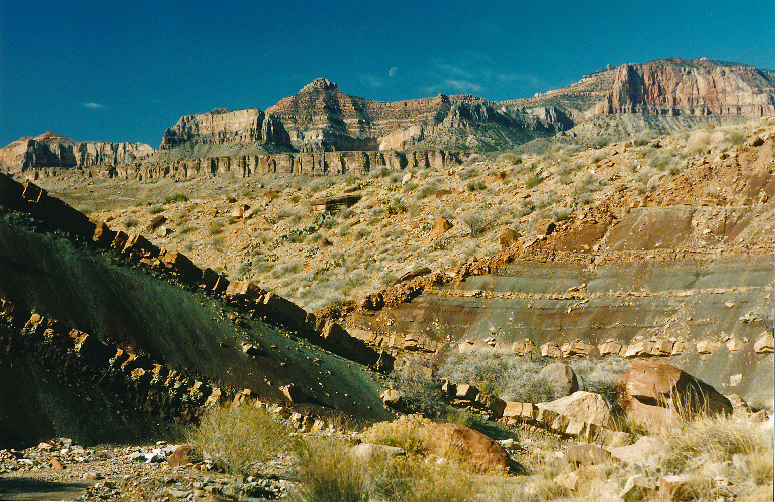
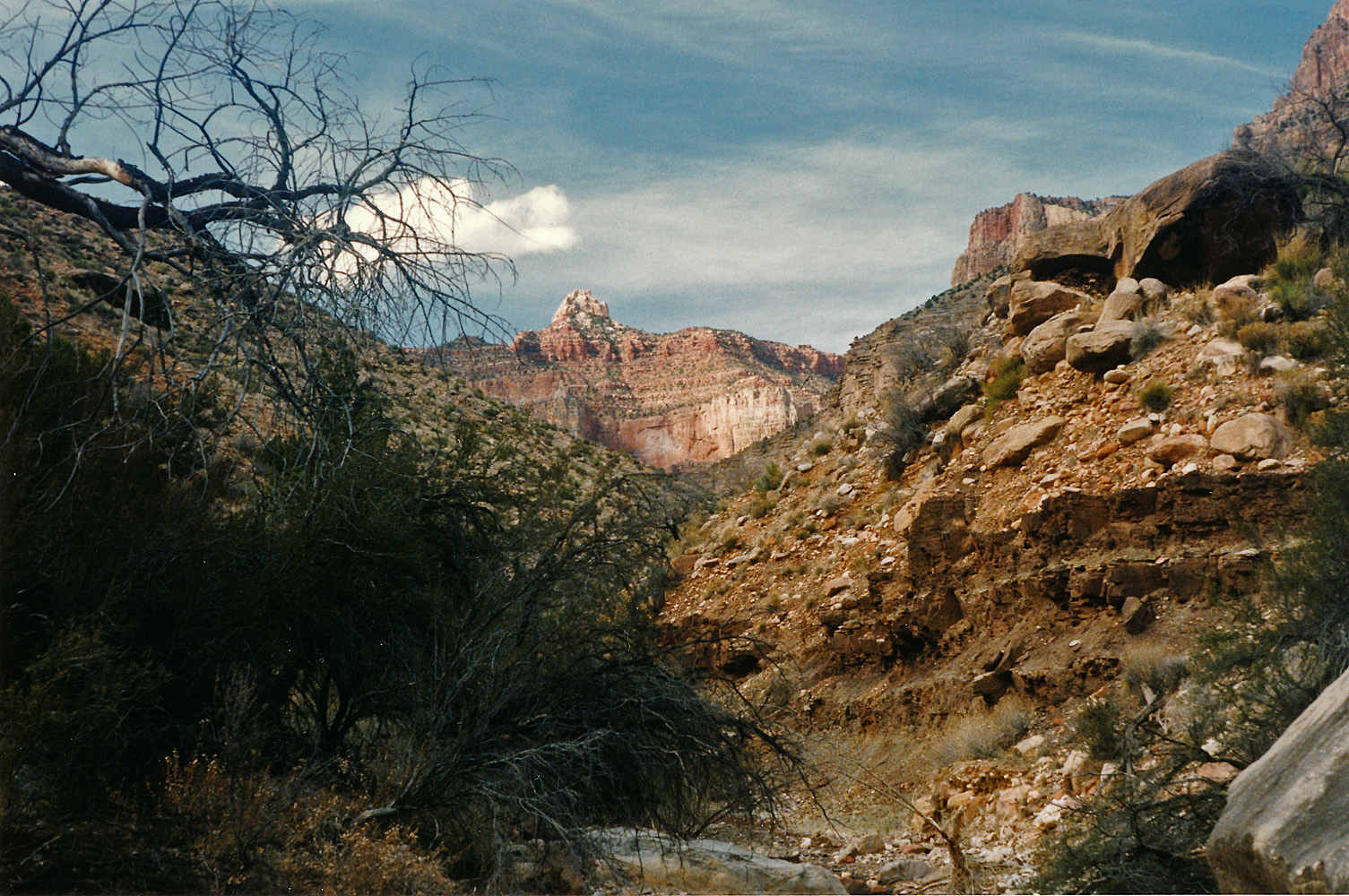
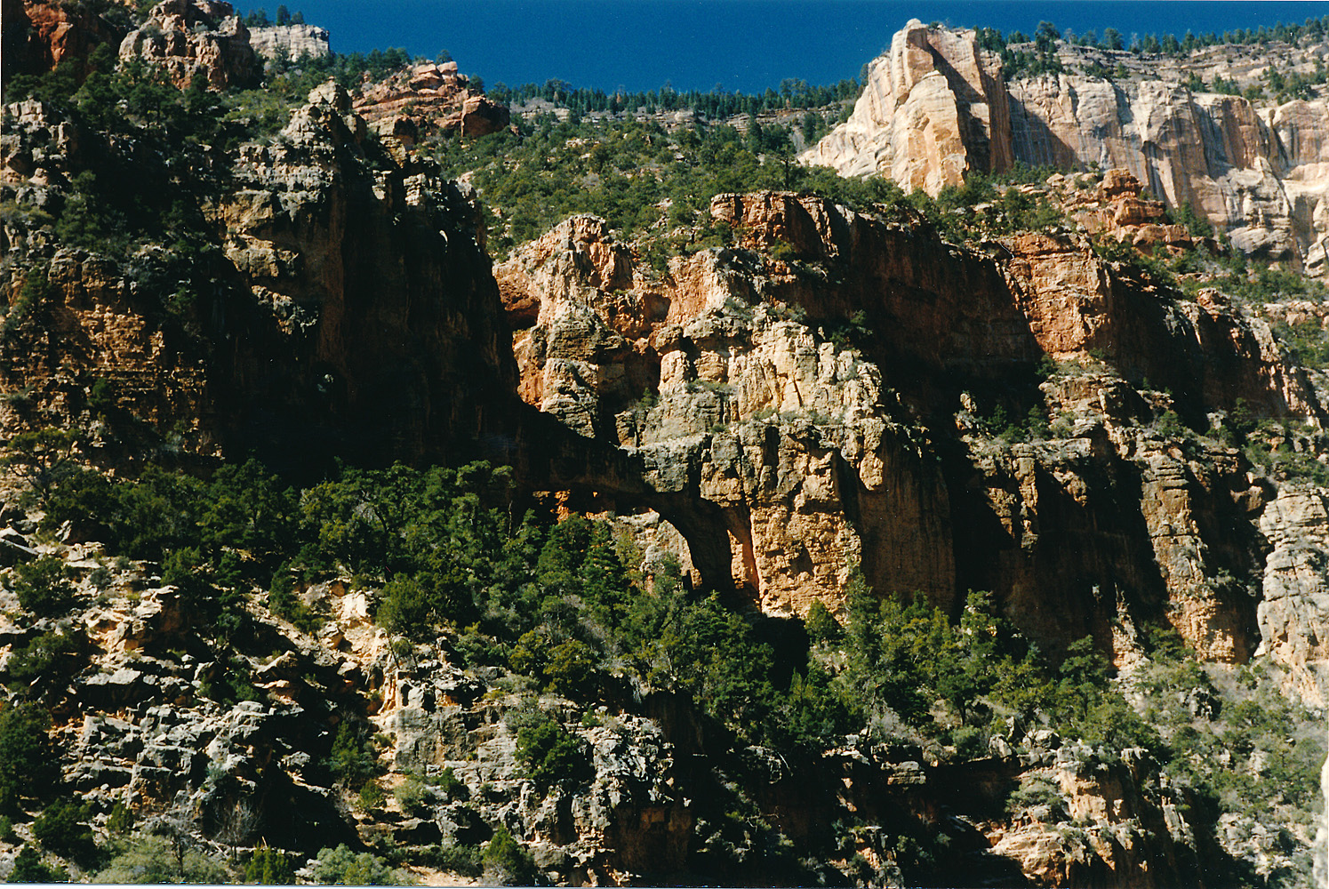
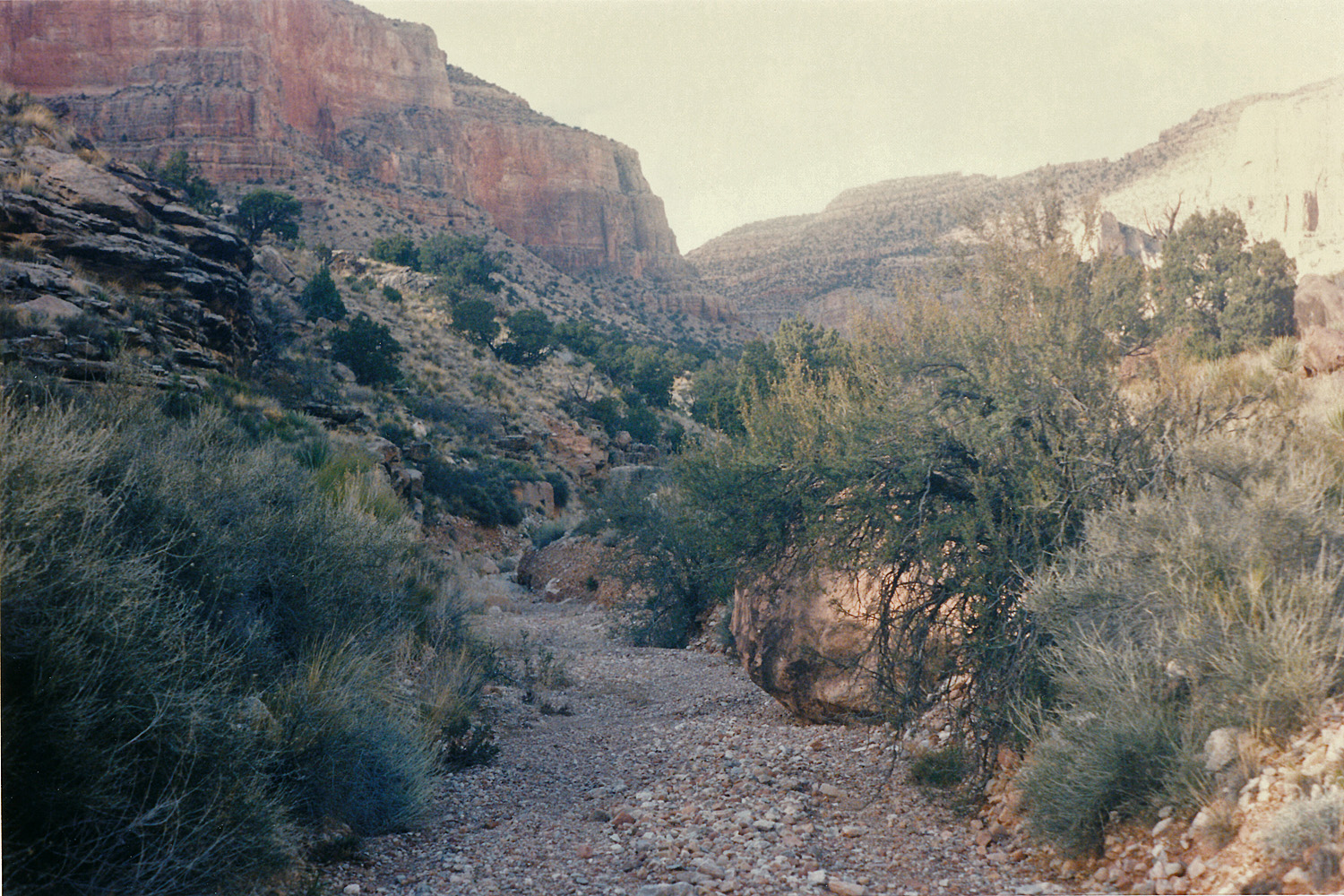
Vishnu I would again be on familiar ground. Day 1 - Friday, March 8, 1996 - My pack was on the heavy side, weighing in at 63 pounds. Partly that is due to the uncertainty of the weather - it turned out to be rather warm, but I had to pack for cold weather. Also, I brought my two-man tent, which has the advantage of being nice and roomy but weighs more than a solo shelter. I didn't record how much water I started out with, but I imagine it was 3 or 4 liters. It was a beautiful day - clear skies, calm and nice temperatures. There was another vehicle at the trailhead and I was able to follow in that person's footsteps through the snow, which was a couple of feet deep in some places, up to the saddle and the start of the trail in the park proper. I left my truck at 6:30 a.m. and reached the saddle at 9 a.m. It took me 1 hour and 15 minutes to reach Marion Pt. and another 2 hours to reach the camping spots above Tilted Mesa. With rest breaks, it wasn't until just past 3 p.m. that I was heading down through the Redwall. I reached the creek three hours later, shocked to find that flooding had wiped out some nice camping spots since I was last here. I found a spot a bit upstream and set up camp. It had been a long day, but I had been hoping that with the early start I would be able to get all the way to Kwagunt. So it goes. |
|
|
||
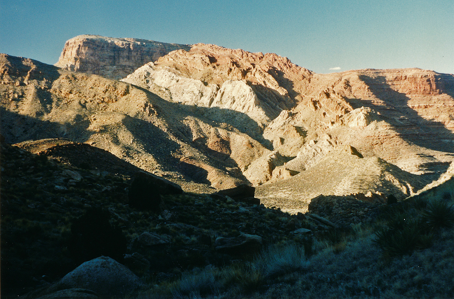
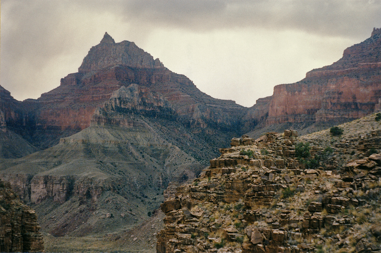
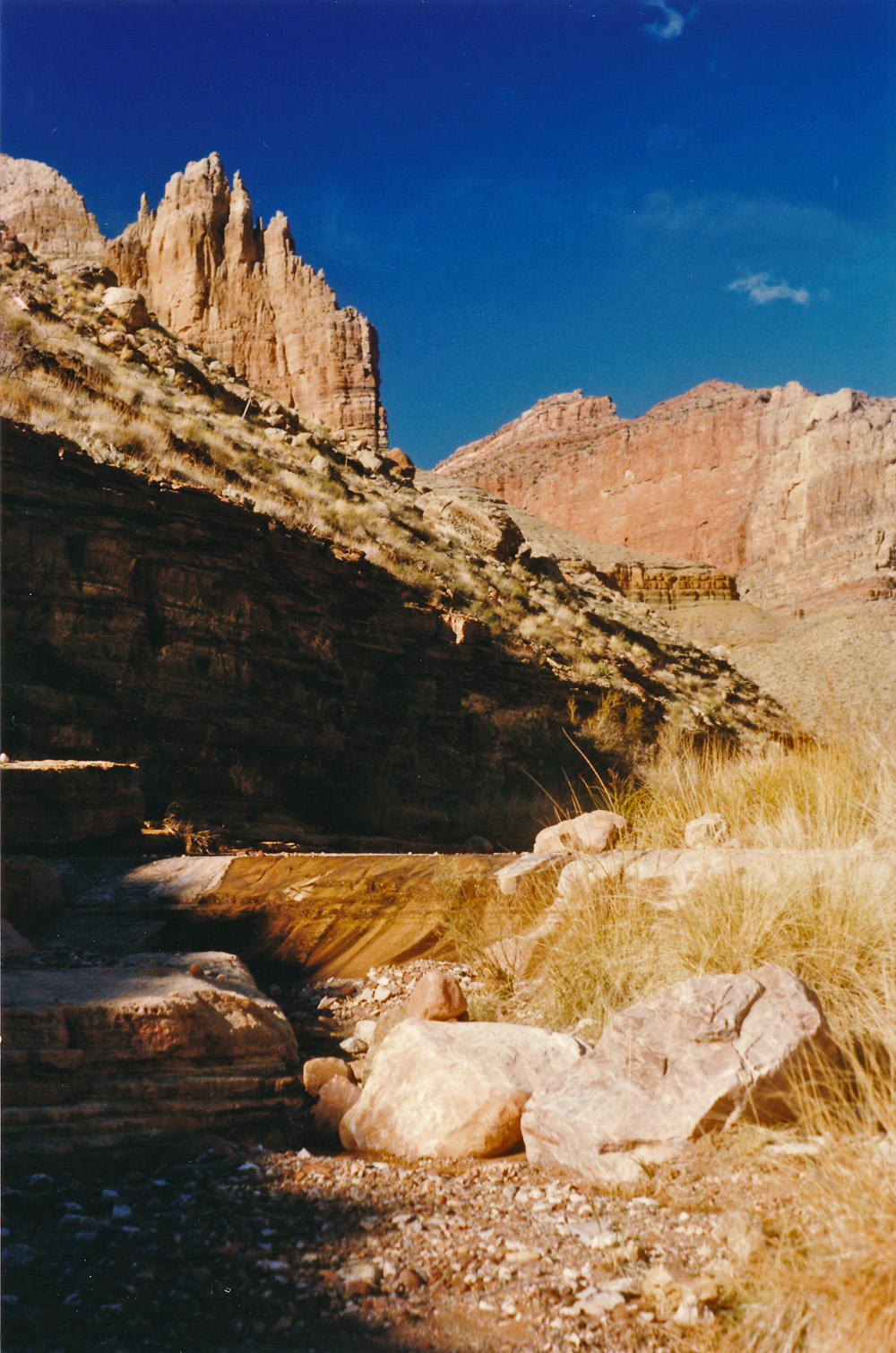
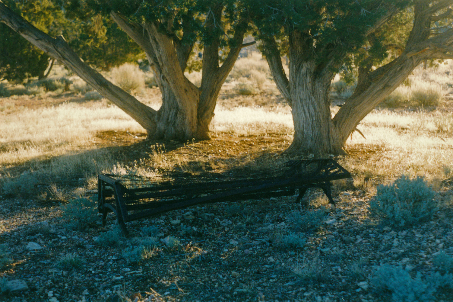 Remnants of old hunting camp. |
 Marble platform. |
 On the saddle. |
 Marion Point. |
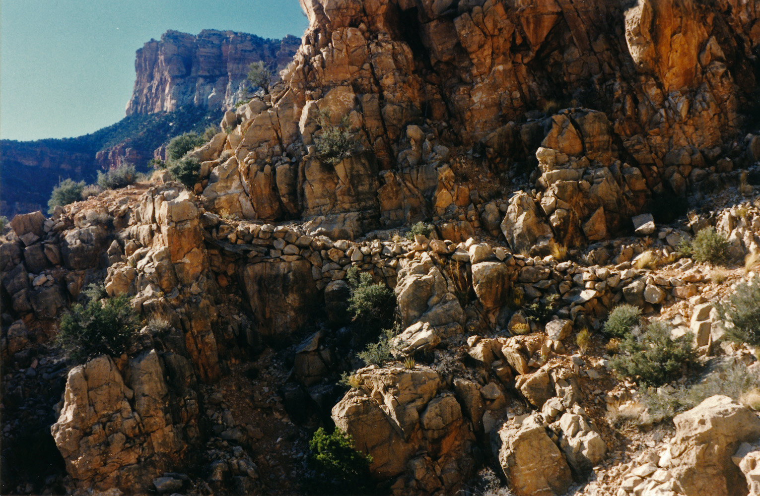 Old trail construction in the Redwall. |
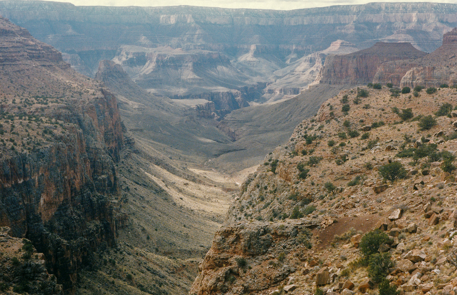
 View of route to Kwagunt. |
|
Day 2 - Saturday, March 9, 1996
- I got up reasonably early - between 5 and 6 o'clock. It was well
before sunrise, but the light of the moon was pretty strong.
Still, I didn't manage to actually leave until 9 a.m. I headed up
a ravine and dropped my pack at the base of some small cliffs. I
had read in Steck's book about some petroglyphs in the area, so I
scouted around to see if I could find them. Nope. With the
pack back on I made
pretty good progress up toward the saddle with Kwagunt, although what
seems like a perfectly clear-cut route from across the canyon suddenly
becomes confusing when you are right there. I reached the saddle
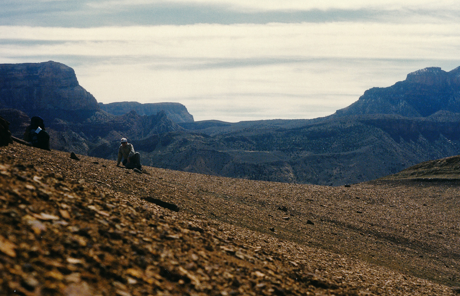
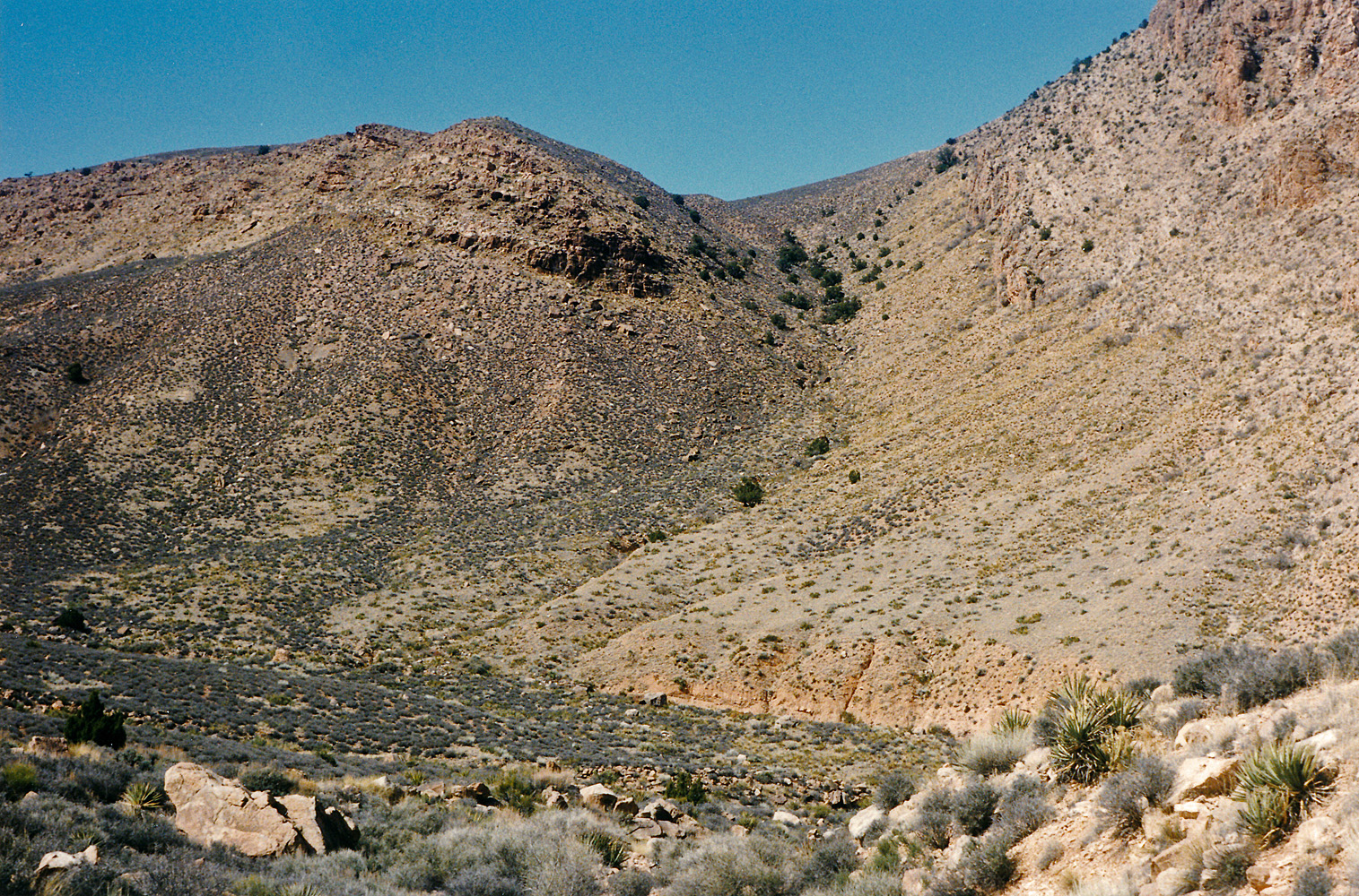
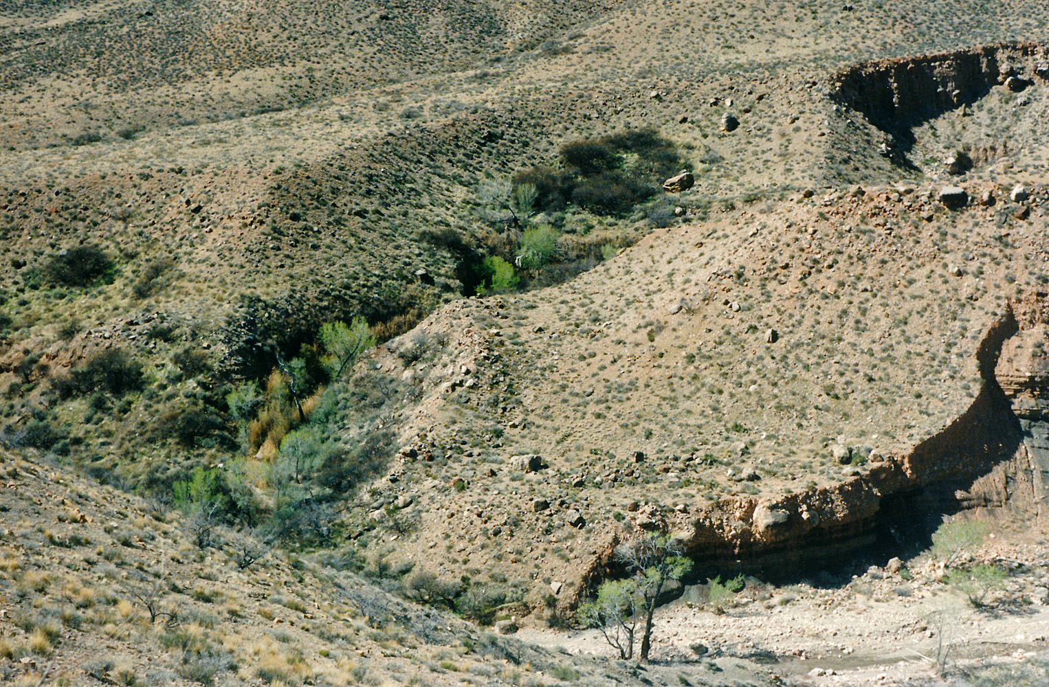
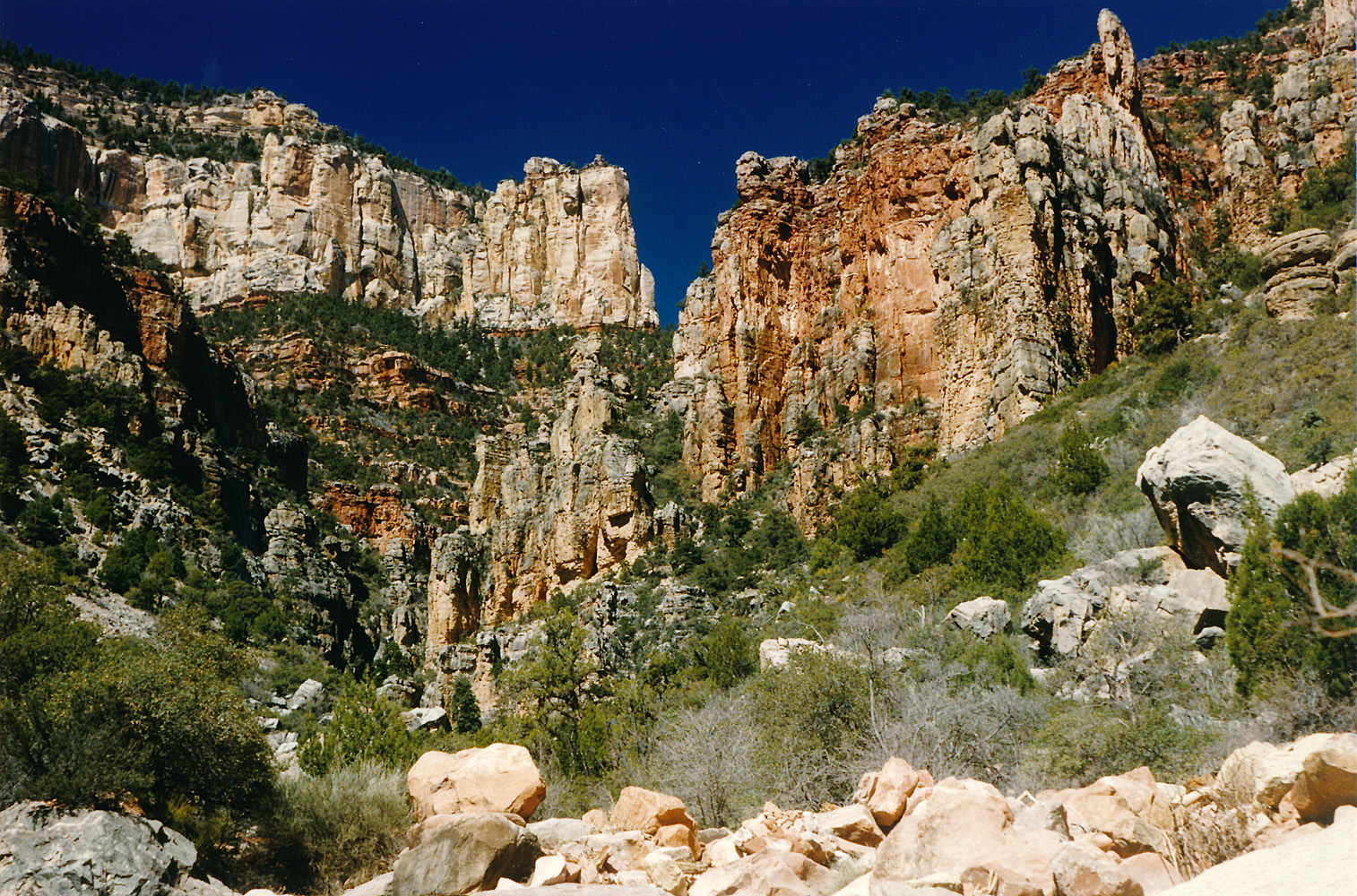
at 11:30 a.m. and hung around for about 20 minutes. The route down into Kwagunt is straight-forward. One cool section is when you're in the bed walking alongside a shelf of rock tilted up at about an 80 degree angle. I reached the creek at 1 p.m. and took a long two hour break. I carried four liters of water from here, hoping to get water at Awatubi but thinking I could make it stretch, if need be, all the way to Lava. Coming out of Kwagunt was hard. It took me two hours to reach the saddle, which I did at about 5 p.m. I had hoped to get to at least 60 Mile Canyon, but now I was in a race to even reach Awatubi. And, that race went poorly. Coming down into Malgosa looks easy, but I got into a ravine that started taking me way downstream of where I really wanted to be. I decided that it would be a minor annoyance, and once in the bed I would just hoof it back up to the exit ravine. But, I got cliffed out above the bed and although I made some attempts to find a bypass I ended up having to retrace my steps back up this ravine. In my tape recorded journal (posted below) I noted, "It's 5:56 and I am really screwed here in Malgosa." I was tired and getting quite cranky. I finally got to a grassy slope that led to the dry creek bed and on my way down I took a head over heels tumble. The ground was soft so no damage done, except to my ego. I reached the bed at 6:30 p.m. I still had to walk up the bed to the exit ravine and I finally reached it at 7 p.m. now with my headlamp lighting the way. An hour and a half later I recorded, "It is 8:26 and I don't know where I am." It turned out that I was on the descent into Awatubi and an hour later I would reach the bed where the little seep often trickles atop the gravel. I was just spent and anxious to get to bed. |
|
|
||
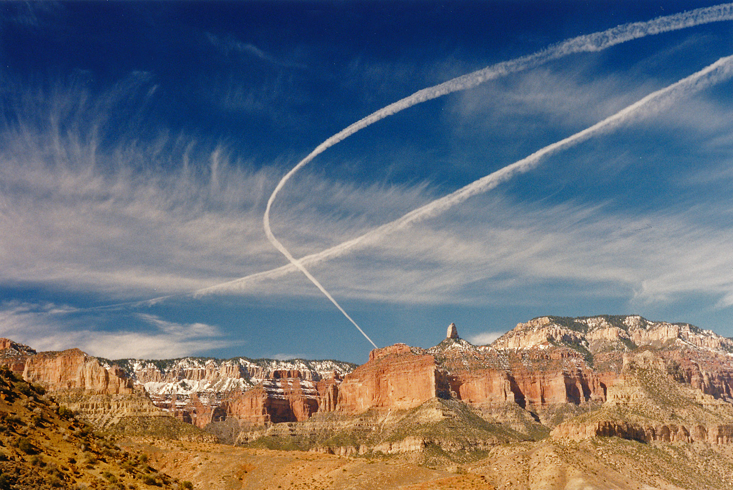 Contrails over Mt. Hayden. |
 The Nankoweap-Kwagunt saddle |
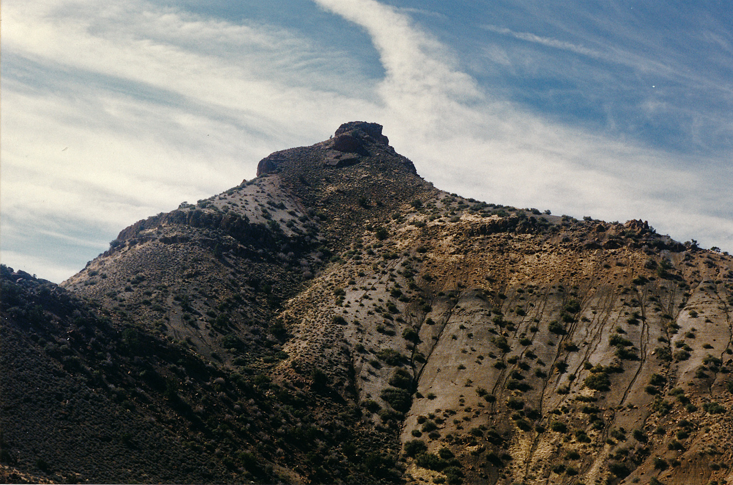 Nankoweap Butte. |
 Selfie in the days of film - lol. |
 Kwagunt Creek. |
 Looking back from Kwagunt exit. |
|
Day 3 - Sunday, March 10, 1996
- The past night did not go well for me. At 2:30 in the morning I
rocketed out of my tent, knocking over an uncapped water bottle, and
threw up. Was it just the exertion from the previous day? I
don't know, but it would worsen. I delayed my departure by many
hours as I was fighting to rehydrate and build up my strength.
But, the water in Awatubi was having ill effects on me, as it had two
years earlier. I had the "Awatubi runs" strike every couple of
hours for the rest of the day and whose effects would linger until late
on Monday. I left my camp at 1 p.m. feeling quite weak and lethargic. I still had one liter of water from Kwagunt that I tried to rely on for drinking. By 2 p.m. I was on the saddle leading down into 60 Mile Canyon. With a half hour break, I reached the bed at 3:30 p.m. After another hour-long break I started up for the saddle leading to Carbon. I reached the top of the saddle at 6:00 p.m. and decided to call it a day. I thought that boiling what water I had from Awatubi would help and I think that worked. Overnight the water cooled off and so was palatable. It was quite windy here and I had to put rocks on the corners of my tent and ground cloth. Although I thought I was doing better, at 8:30 p.m. I once again threw up my dinner. |
|
|
||
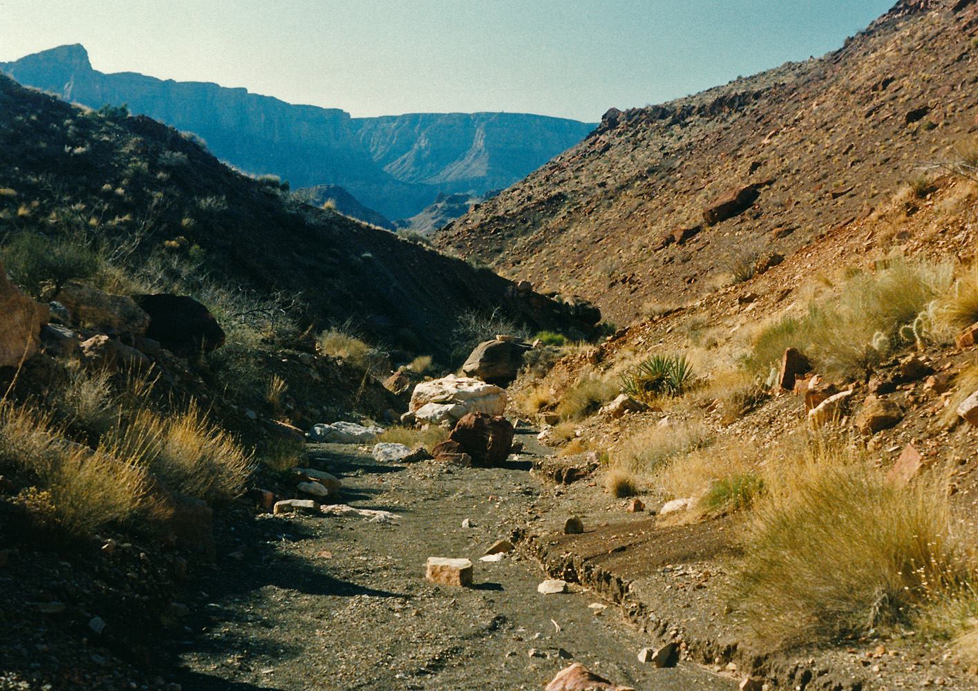
 Awatubi camp. |
 Route into Awatubi from Malgosa. |
 Route from Awatubi to 60 Mile. |
 Heading to the 60 Mile-Carbon saddle. |
 Looking back at 60 Mile Canyon. |
|
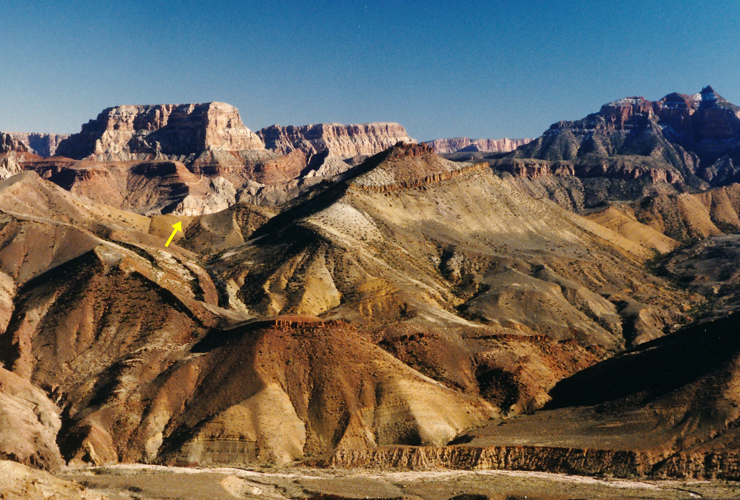
Day 4 - Monday, March 11, 1996
- I was up at 5 a.m. and feeling much better. My oatmeal went down
well enough but I knew I was still fighting a calorie deficit. I
had planned on getting to Lava yesterday and then spending a layover day
there today. I had another layover day scheduled for Vishnu canyon
and decided that I would use that one up in Lava. So, all I need
to do was get to my jumping off spot way up Lava, near the Juno ruins and
then I could camp there for two nights and try to recoup over the extra
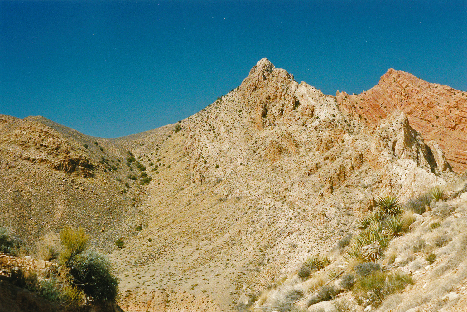
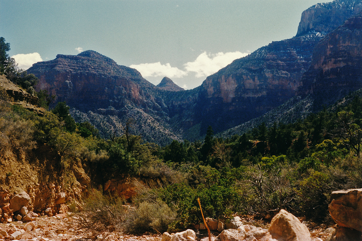
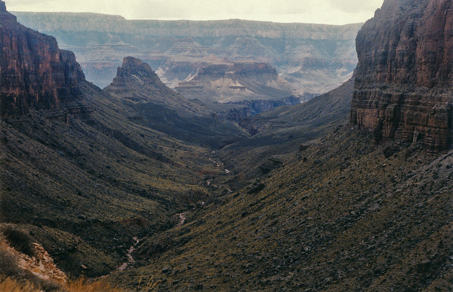
day. I was on my way by 8 o'clock. There are some bypasses on the way down to Carbon, but also more signs of informal trails that one can occasionally pick up. I hiked down the bed for a couple of hours and then took a 45 minute break. I had reached a spot where I would leave the bed and cut cross-country to the west, coming to Lava Creek well up from where the Carbon route takes you. That worked like a charm. I reached a tall ridge overlooking Lava at about 11:15 a.m. and worked my way down to the bed, just above the "still" spring. Two years earlier I had done the same thing and surprisingly came to Lava at the same spot! I reached the creek at 11:30 a.m. and stopped for a bit over two hours. Then I started up the creek bed. At 4:30 p.m. I passed the main spring feeding Lava and found a campsite just a few minutes beyond that. I set up camp in a nice spot at the base of a huge obelisk-like boulder. I felt better and had a good dinner and, of course, better water before settling in for the night. |
|
|
||
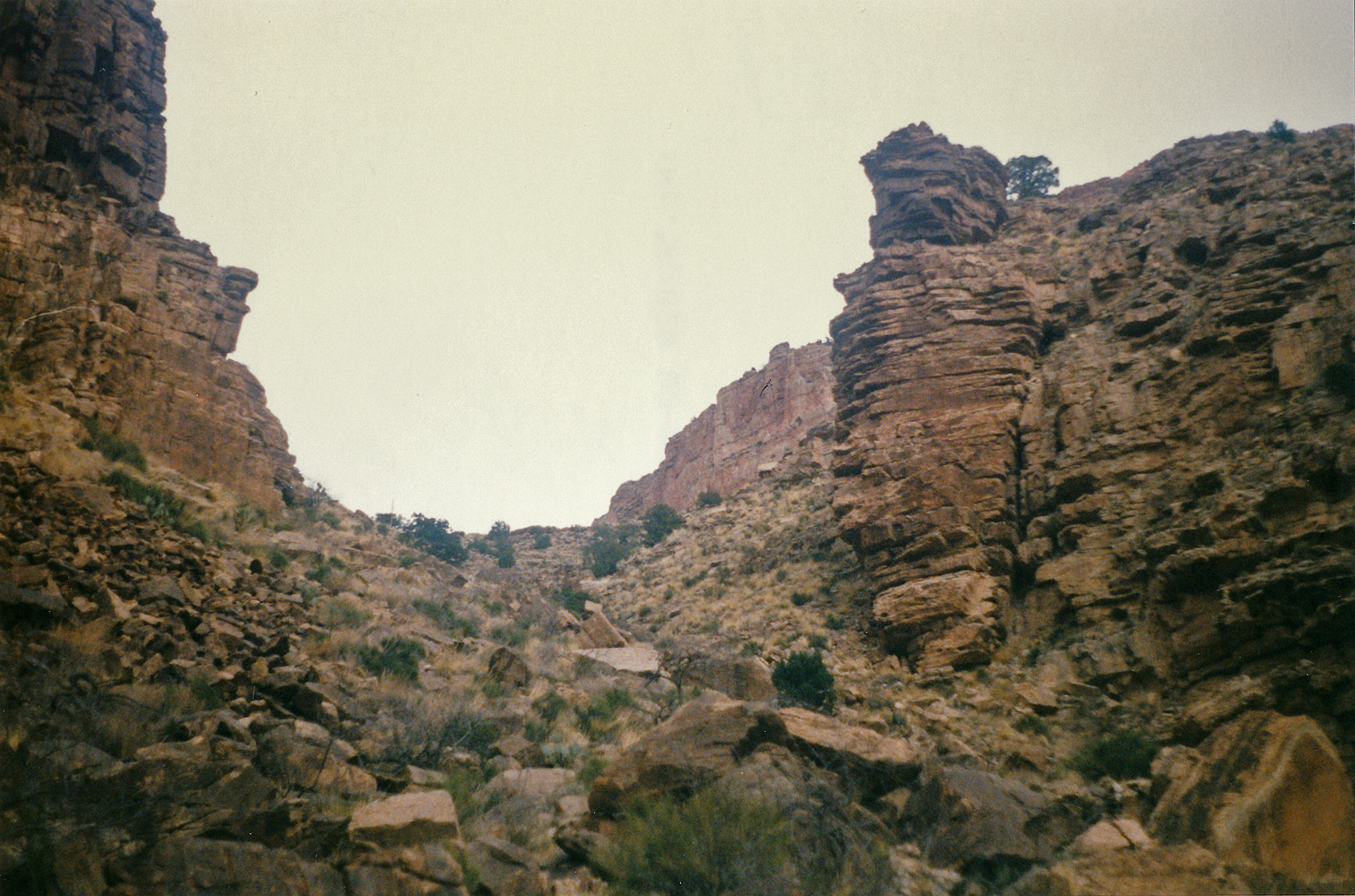
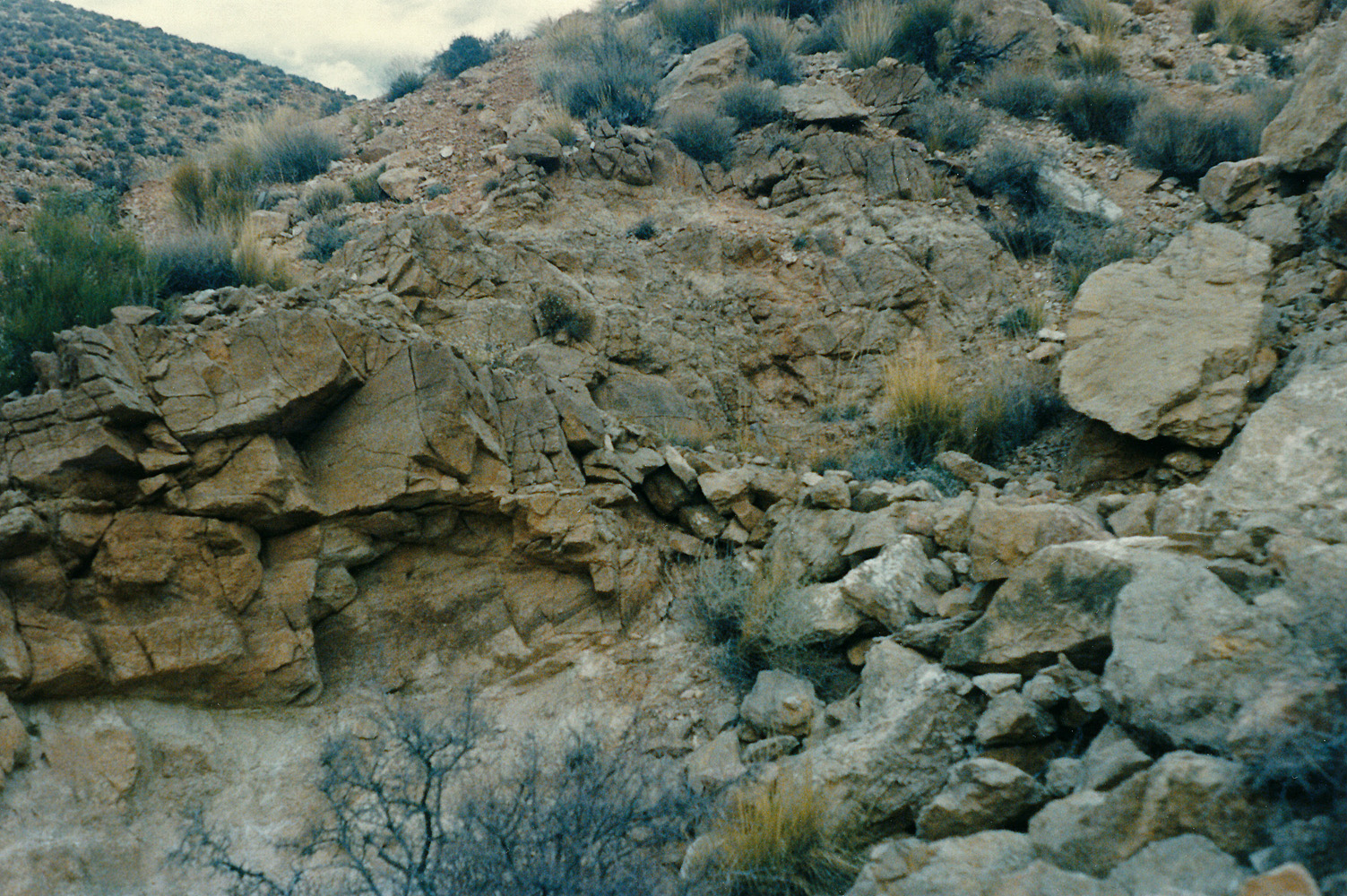 Old trail in Carbon. |
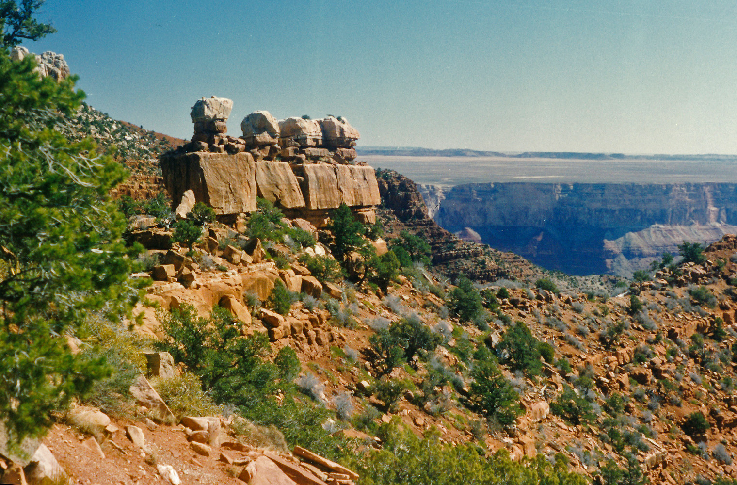
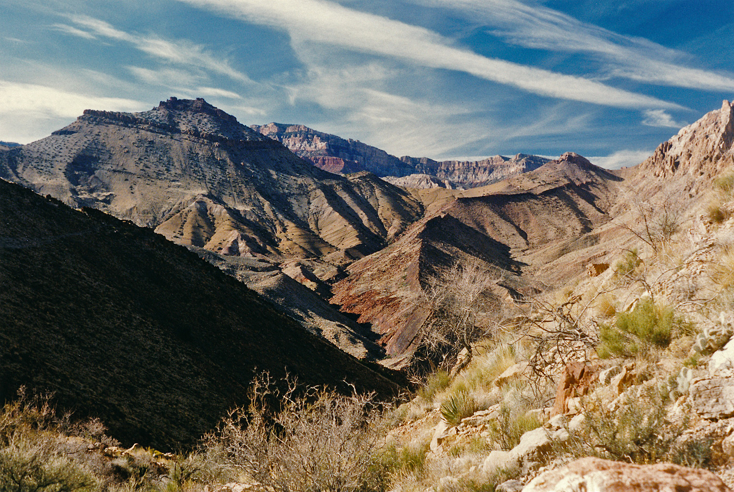
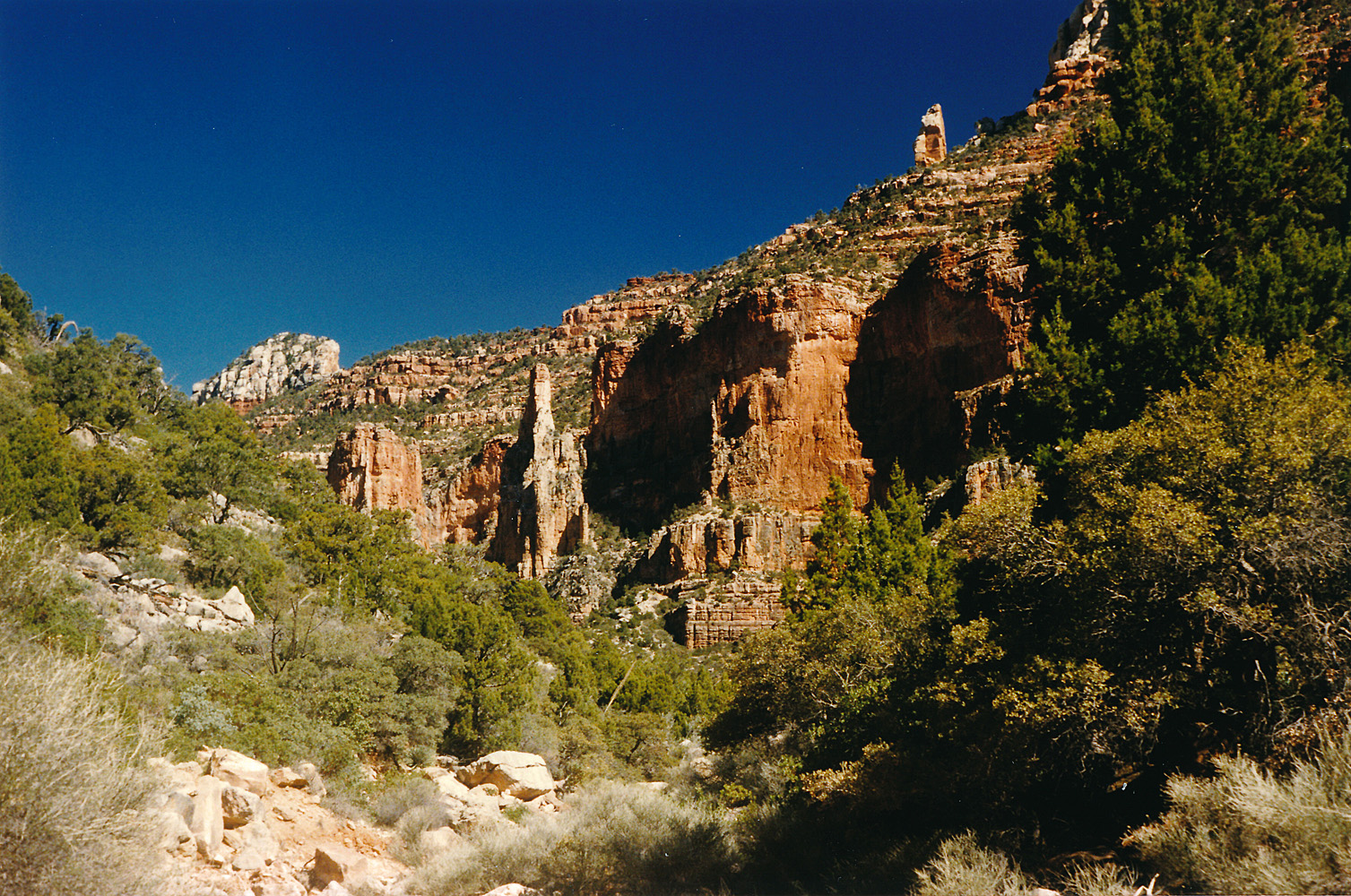
 Looking into Chuar Valley. |
 Nice hiking toward Chuar. |
 Tilted strata in Chuar. |
 Looking down on Lava Creek. |
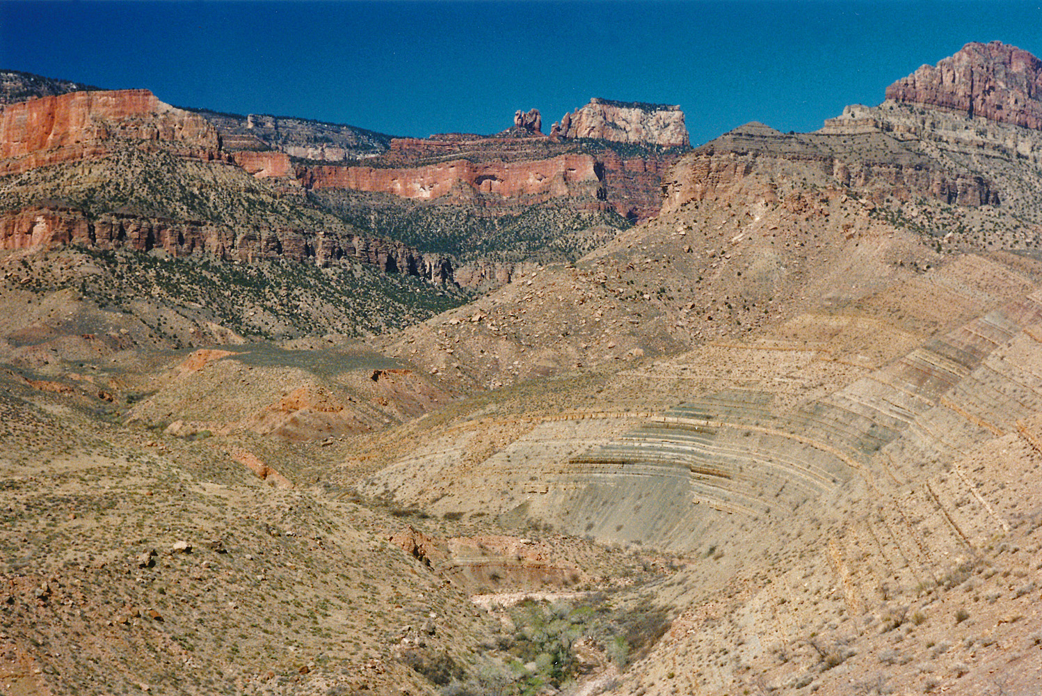 The view up Chuar/Lava. |
 Lava Creek. |
 Looking up Lava (at Siegfried?) |
 Near the Lava spring. |
|
Day 5 - Tuesday, March 12, 1996
- I had a good night's sleep and got up at 7 a.m. I decided to
pack a day bag and head up to the Juno ruins (which I'd seen before)
and then on up the canyon to Hartman Natural Bridge. So much for
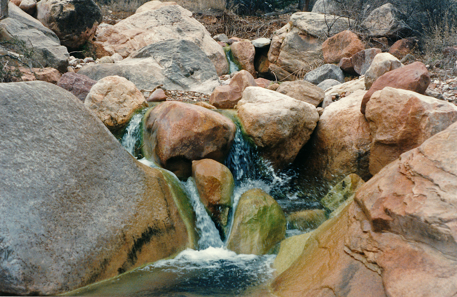
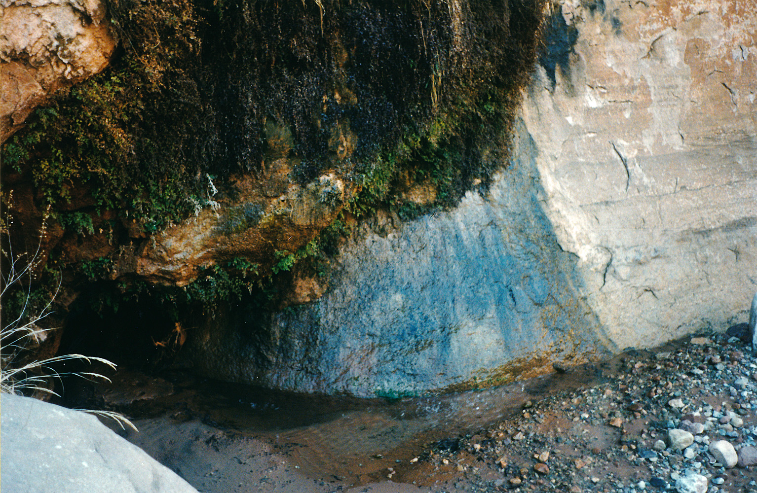
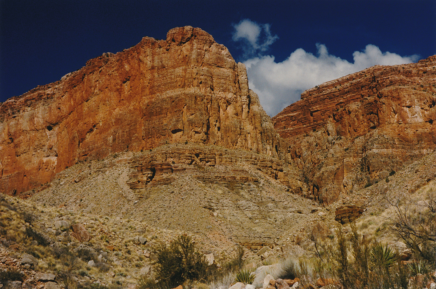
just laying around all day! I started off at about 9 a.m. and spent 20 minutes at the ruins before continuing on up Lava Canyon. I encountered some flowing water up the bed a ways. At 10 a.m. I passed by the major ravine that heads to the north with Hubbell and Poston Buttes on the east and Siegfried Pyre on the west. The main bed angles a bit to the northwest from here. I found the source of the water and then higher up there was another little flow of water in the bed. A bit past 11 a.m. I was at a place where I thought I could see the bridge, but no luck. I climbed up on the east side of the ravine here, and just before I was ready to give up, at 12 noon, I saw it. Coming up the bed, I most likely would have missed it - the bridge spans a ravine that runs to the west and not the main bed. I took a few photos and rested for a few minutes before turning around and heading back. I was still seeing recent footprints even here that I presume belonged to the hiker whose vehicle was parked at the trailhead. I got back to camp before 2 p.m., had a leisurely lunch, cleaned up in the creek and generally organized my camp. I had a very nice dinner and felt fully recuperated from my Awatubi experience. A bit before 8 o'clock I was ready to turn in for a good night's sleep. |
 Spring in upper canyon. |
 The route up to Hartman. |
 Hartman Natural Bridge. |
 View to the rim from near Hartman. |
 Looking to exit canyon from Lava. |
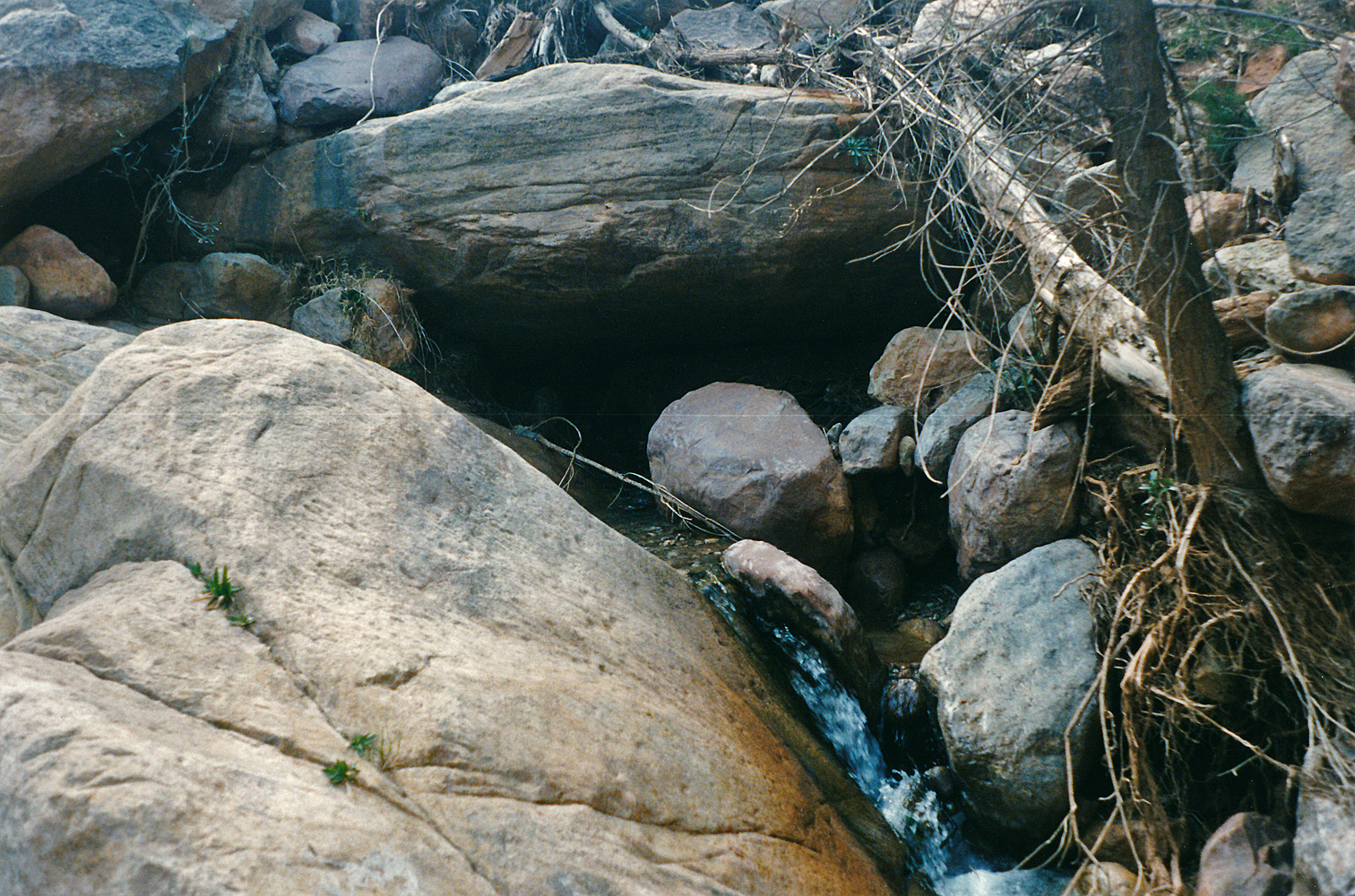 Spring above camp. |
|
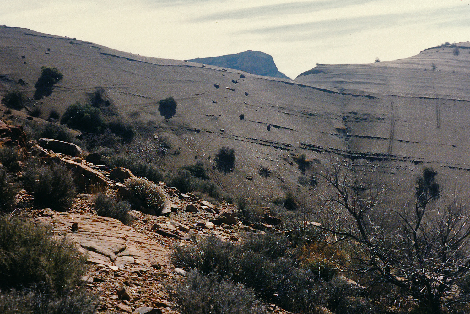
Day 6 - Wednesday, March 13, 1996
- Rain in the early morning, and snow higher up (!), kept me in bed
until close to 7 a.m. It let up and I was able to pack up with
only the tent a bit wet, but the ground cloth was rather much a mess.
But those items fit into a bag lashed to the outside of my pack, so I could
deal with them later. It was 9:15 a.m. when I was ready to head up
the canyon leading to the saddle that would take me to Unkar. By 10 o'clock I had gotten above the Tapeats through a well-traveled break with a rather distinct trail helping me along. I just assumed that one heads straight up this canyon to top out above the Redwall, but near the top it looked quite impossible. I slowly ground my way up the main ravine and twenty minutes after noon I reached an impassible cliff. I had seen an alternate route further to my right although where it tops out requires some contouring to get to the actual saddle. By 1 p.m. I was in the proper ravine and a half hour later I was on the saddle. Quite a lot of work to make it so short a distance! I stopped for an hour and a half and was mostly able to dry out my tent while having my lunch. At 3:30 p.m. I was hiking down the main bed and the light rain was turning to snow and I donned my poncho. At 5 p.m. I reached the edge of the Tapeats and had no clue how to bypass this cliff. There was no mention in either Harvey's or Steck's books. But I had seen a reference in Harvey's journals that he had come up through a break to his right. So, I headed to my left and found this break in 20 minutes. I returned to my pack and headed down into Unkar valley. By a bit past 6 p.m. I had settled on a camp site and set up my tent during a lull in the rain. |
|
|
||
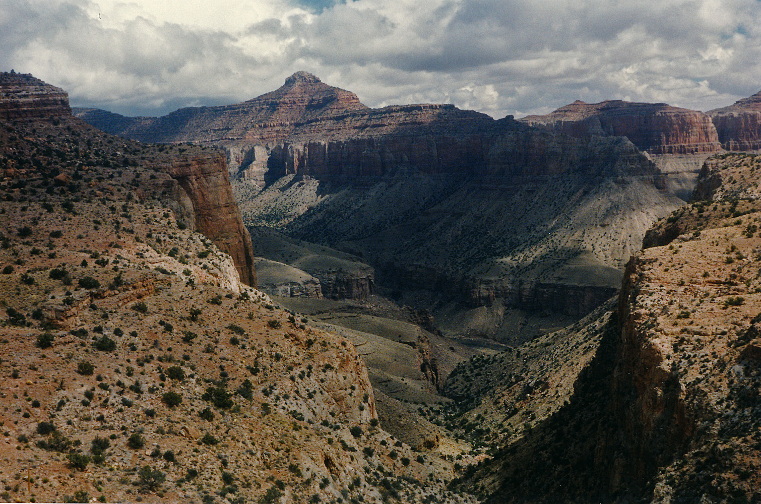
 Cloudy morning. |
 Looking back to Juno ruins. |
 Siegfried from Lava/Unkar saddle. |
 Heading down towards Unkar. |
 Vishnu from atop Tapeats. |
 Tapeats route into Unkar. |
|
Day 7 - Thursday, March 14, 1996
- Lucky for me it didn't rain all night long. But, the tent was
still damp and I would dry it out later. I left a bit after 8 a.m.
and in 45 minutes I was heading up a ravine to the top of the Tapeats. I
made a couple of false starts going up this route. The Tapeats
have to be bypassed away from the main ravine and then you can work your
way back into the main ravine.
At the top of the Redwall there were a couple of choices - I stuck close
to the wall on the right-hand side. In one spot I had to take my
pack off and shove it up above me and climb up after it. But, it
seemed to me that there was a better route on the left side. And,
once you get up to the right elevation, you're not quite at the saddle
but I found a bit of a beaten path that led me to the saddle, which I
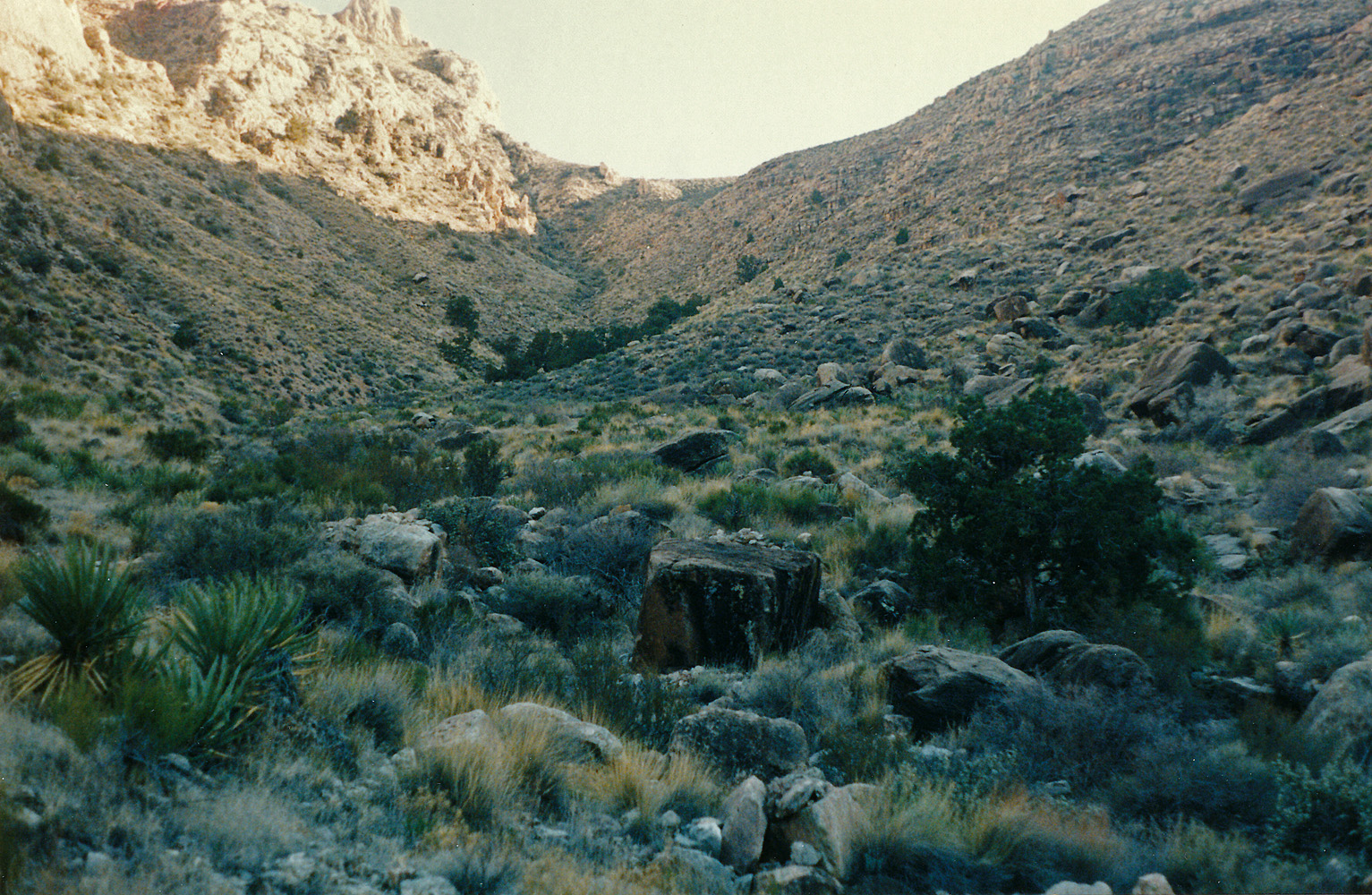
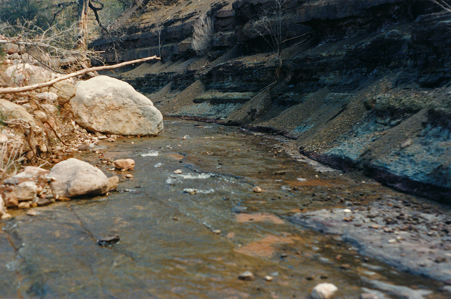
reached at about 11:30 p.m. I had lunch on this saddle and got going again at 1:15 p.m. I descended the main ravine from here and followed the notes I brought along from both Butchart and Steck. The main ravine doesn't go all the way down. Below the Redwall you have to start contouring to the right, heading up Vishnu canyon. Steck is clearer on this point to go north until you reach a talus slope that will take you down to the bed. I found some of the contouring fraught with danger - the slope was steep and the footing poor. In my recorded journal I described the descent down the final talus slope as "treacherous." It was a bit past 2:30 p.m. when I reached the bed of Vishnu. Although I passed by a couple places with water it took me about an hour to reach the spring that produces enough to fill up some little pools. I was here for about an hour and picked up five liters before continuing on my way. I wanted to try and get out on the Tonto in front of Hall Butte, but I didn't get very far before stopping at 6 p.m. at a nice place to camp. Overnight I got a nice night shot of Vishnu Temple with star trails behind it. |
|
|
||
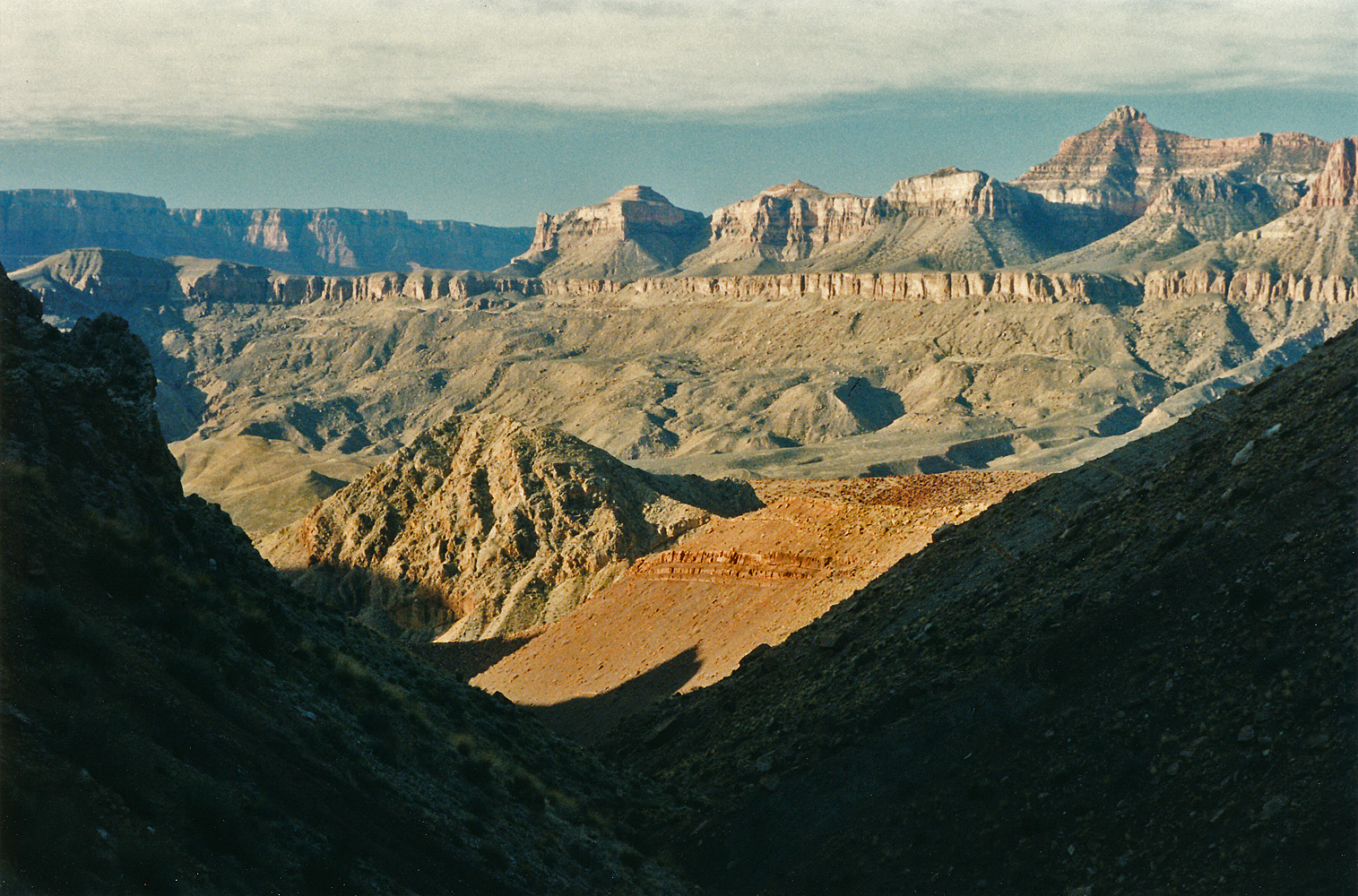
 Looking back up Unkar. |
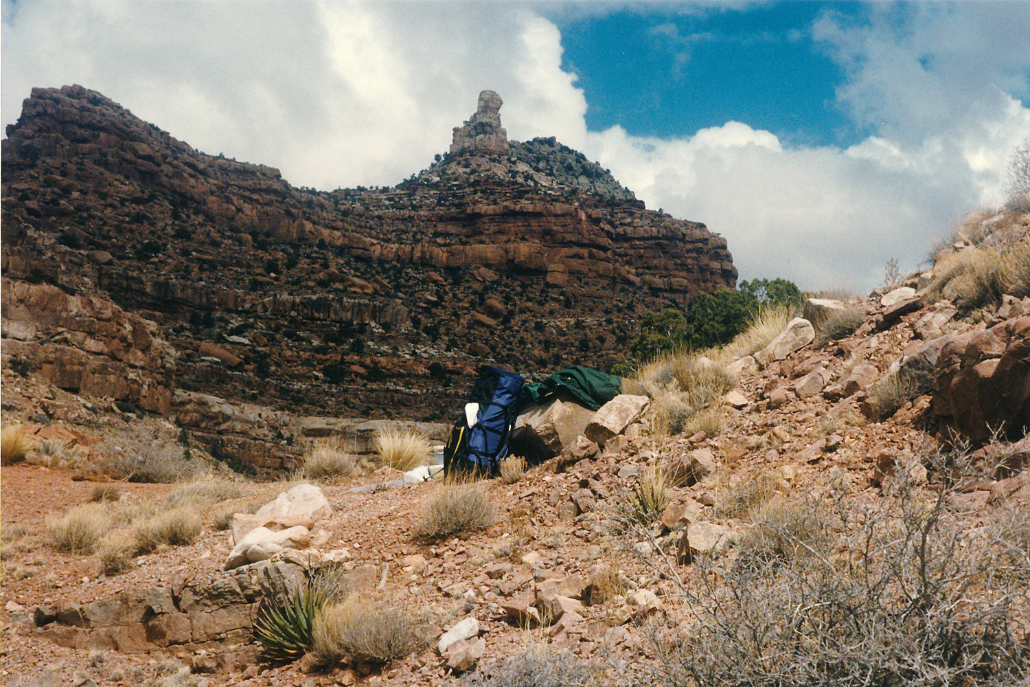 Freya from Unkar/Vishnu saddle. |
 Vishnu canyon. |
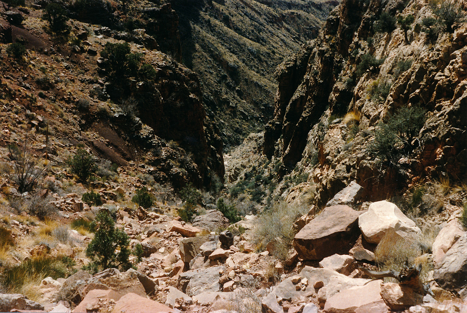 Initial descent into Vishnu. |
 Vishnu canyon along descent. |
 The contour in Vishnu canyon. |
 Spring in Vishnu. |
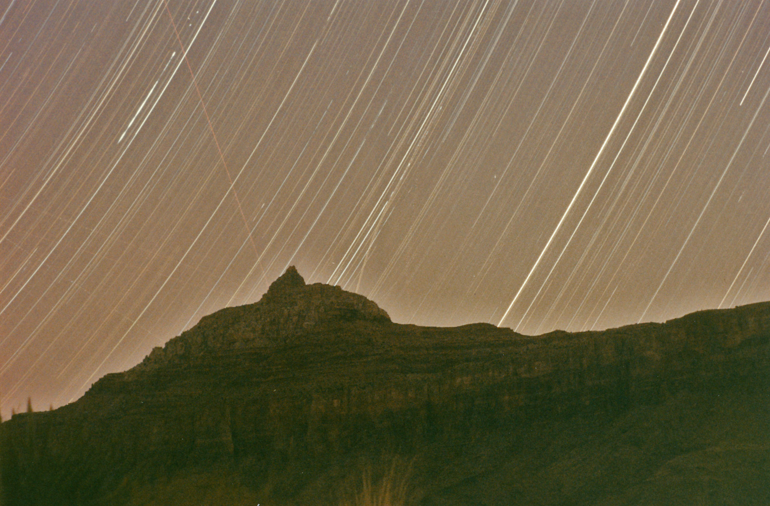 Star trails over Vishnu Temple. |
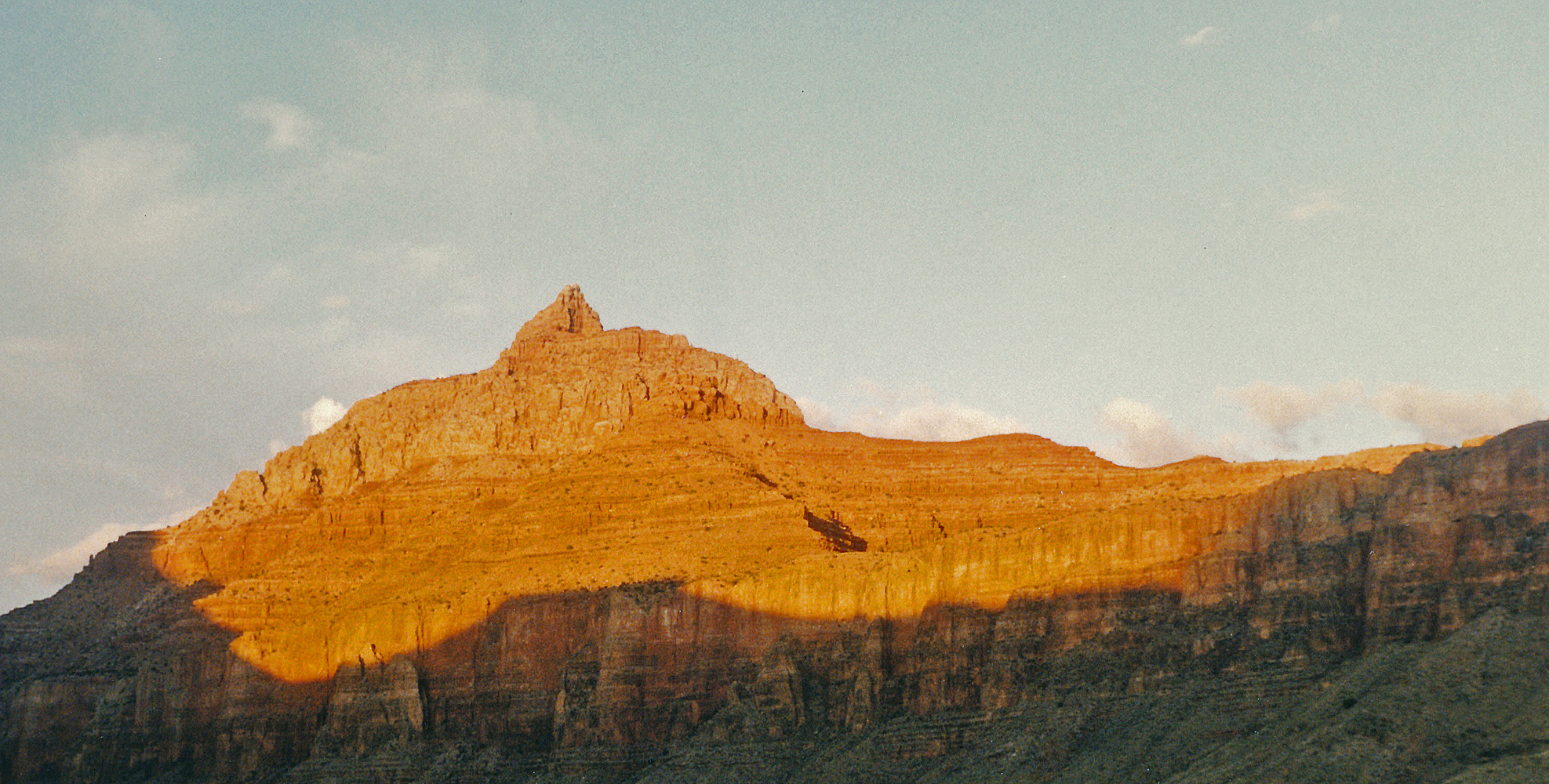 Sunset on Vishnu Temple. |
|
|
Day 8 - Friday, March 15, 1996
- I was up at 6:30 a.m. and on my way two hours later, as usual!
Some overcast, but the day was pleasant and even on the warm side.
At 10 o'clock I was in the bed of the nameless canyon that is between
Hall and Hawkins Buttes, referred to by some as "Disappointment Canyon"
or "Double Disappointment Canyon." Those names certainly must come
from the fact that as you contour into this canyon you are best served
by climbing a bit higher and coming down to the bed way upstream of
where you can first go down. That gets you by a fall in the bed
that is problematic at best. I have seen water here, but not this
time. After a twenty minute break in the main bed I was slogging my way back up to
the Tonto level to continue my contouring. It was 1:30 p.m. when I reached the head of 83 Mile Canyon and I stopped for a bit over an hour here for lunch. At 5 p.m. I reached the top of the descent ravine into Clear Creek. An hour later I was finishing up getting my water bottles filled up at the area of the main camping spots. I met a group here and chatted for a few minutes. At 6:09 p.m. I was on my way up the trail and I stopped on the Tonto level at 6:43 p.m. to camp for the night. |
Day 9 - Saturday, March 16, 1996
- I got up a bit after 5 a.m. to check on a passing comet, but early
morning cloudiness once again foiled that plan. As, it has for
this whole trip!
 By
7:15 a.m. I was on the trail. I passed by nine deer in a big
ravine along the Tonto, which is probably the most I've ever seen
together in the canyon. At 10 a.m. I started my descent and an
hour later reached the North Kaibab Trail. I decided to bypass
Phantom Ranch (despite the title of my blog) and rest at the campground.
I got there at a quarter past eleven and stayed for a half hour. By
7:15 a.m. I was on the trail. I passed by nine deer in a big
ravine along the Tonto, which is probably the most I've ever seen
together in the canyon. At 10 a.m. I started my descent and an
hour later reached the North Kaibab Trail. I decided to bypass
Phantom Ranch (despite the title of my blog) and rest at the campground.
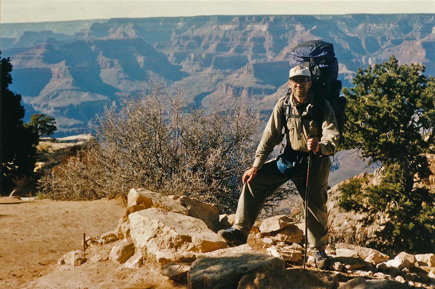
I got there at a quarter past eleven and stayed for a half hour.Climbing up the South Kaibab Trail was pretty easy. I started across the black bridge at noon, reached the top of the Tapeats an hour later and the top of the Redwall another hour later, where I took a break of almost a half hour. It only took me 45 minutes to reach Cedar Ridge from here and I continued without a break on up to the rim, topping out at ... 4 p.m. as best I can tell - my recording is garbled on this score. But, I was all ready to drive away from the parking lot at the trailhead by 4:30 p.m. [Yes, back in the day you could park here!!] I had a friend of mine come to the Nankoweap trailhead and retrieve my truck a few days after I started and park it here at the South Kaibab for me to pick up - great logistics if you can get 'em! Once home, my pack weighed in at 44 pounds which included only about a half a liter of water. Oh, yes, I only took one picture the whole day. And, in fact, I didn't even take it. I got someone at the rim to snap the photo to the right as I topped out of the South Kaibab Trail. |
|
|
|
Appendix - Micro-cassette Transcript [Tape 9a/9b] Thursday, March 7, it is 8:43 (pm), and I am just leaving the gasoline station on my way out to the Nankoweap trail head for a hike from Nankoweap to Phantom Ranch and out. The mileage reads 29,478.3; the weight of my pack is 63 pounds. It is now 11:12 (pm), and I’m just turning off the highway on my way to Saddle Mountain. The mileage is 29,621.4. The trail or rather the road out here has been renumbered as 8910, I guess that replaces the 445 designation. It is 12:18 (pm), the mileage reads 29,649.5 and I’m at the trail head. I was following a car for awhile and I think it must have turned off at the Buffalo Ranch Road, there was some cairns along the junction and here at the trail head there is another vehicle with a little camper shell. I don’t know if there’s somebody there now or maybe if they’re in the canyon. So now off to get some sleep before hiking out tomorrow, or later today. * * * * * * * * It is Friday, March 8, 1996, and it is 6:38 in the morning, and I’m all packed up and ready to go. It’s a very clear morning, the moon is just a little past full, and the sun hasn’t come up yet, but the sunrise has started. I can see that there’s some snow on the saddle, but doesn’t look like very much. So it’s on to the saddle. At 6:56, I have left the road and I’m on the trail. I stopped for about 25 minutes along the upper part of the trail here before it hits the switchbacks. I took some pictures and took off my coats . It is pleasant enough so I don’t need those. There’s no wind, it’s very calm. Again very clear, a beautiful looking start to the day. May actually get a little bit warm here. The horizon has some wispy high clouds, but I can see Navajo Mountain, Marble Canyon, Vermilion Cliffs, very pretty here standing out against the background. Although there is a bit of a brown haze up there in the Lee’s Ferry area. Shinumo Altar is also very prominent and distinctive from here. So on my way. It is 7:44, and I’m at the crossing of the little creek bed. There’s a couple of little icy ponds of water here, but it isn’t really flowing more than just a tiny, tiny trickle in this particular spot. [As many] times that I’ve been here, I still ended up following Trail 31 up a bunch of switchbacks when I should have been following along at the creek; so easy to sort of miss that junction. The Nankoweap part is just not very distinct right there or at least doesn’t dominate so much. So I had to turn around a bit, turn around and come back a bit. The water is flowing a bit more up here. Still just a tiny trickle kind of like a Boucher [Creek] or something right now. It is quite cold here in this whole ravine. This creek, except for right here where it’s flowing, was frozen over with some water underneath, but very chilly down here. It is 9:06, and I am at the Nankoweap trail head having just taken off my pack and rest here for a few minutes. Take a little water and snack a bit. It is just really pleasant. Very still and calm, blue skies, hear the birds chirping in the background. There’s still a trace of snow over this side. On the way up there was some spots where it was up to my knees, but I was able to follow in the footsteps of that other hiker that is here. And it appears that he is probably a day ahead of me, based on how much the snow would have melted in the spots where he trekked through. So it may be that I actually run into him, unless, of course, he went to the river. But that made coming up through the snow very easy, I could follow in his footsteps and not expend a lot of energy and effort climbing up here to the saddle. So I’ll just be here for a few minutes before pushing on. [A weird beeping noise] It’s 9:43, and I’m all set and ready to go. Next stop Marion Point. It is 11:03, and I’m at Marion Point. I’m going to stop here for a little bit. Take a picture of the seep, have a maybe little bit of snacks before pushing on. It is 11:34, and I’m on my way from Marion Point. It is now 1:30, and I have reached the ridge that leads to Tilted Mesa, down which I can see Little Nankoweap as well as looking off into Nankoweap itself. I am running a bit behind here if I really want to get to Kwagunt. There’s no problem getting down to Nankoweap with lots of time to spare and time to cook and set up camp and all that kind of stuff, but it’s a really big question mark whether I can push on to Kwagunt without then sacrificing quite a bit for tomorrows hike. So I probably will be here for a while having lunch and resting, and relaxing. I’m fast running out of steam here on this downward hike. This little spot is very pleasant. It still very calm, temperatures are real nice, the sun is out and warm in the sunshine. A little cool perhaps in the shade. And from here you can actually see a little chunk of the river so that makes it nice as well. And it’s a very deep green color today. So now to have some lunch and relax. It is 3:04, and I’m all ready to go. I took a nap right away here and that sure felt very good. It is just, there’s just a light breeze here off and on, and laying out in the sun felt quite nice. So I did that and then I had lunch and am all ready to go. I am resigned to staying in Nankoweap tonight and hoping that I can go very far tomorrow across these saddles. So probably I’ll only be a couple hours down to the bottom. I have high hopes of getting down there around 5 o’clock. So on I go. It is 4:10, and I’m just passing Camp-on-a-ledge. It’s 4:44, and I’m in the Tapeats through the old trail part here that goes through the cliffs. Stop and take a water and rest break here. It’s 5:11, and I’m on my way. It’s 6:02, and I have come down to Nankoweap and all the nice camp spots right there at the bottom of the trail are all gone. It appears that there has been some flooding in here and has torn up those at least first couple of nice spots heading downstream. So I’ve come upstream a bit. I have come to the first ravine heading out. The one that I took out of here last time and it’s possible, I may just look a little bit further up and if I find something better I’ll come back and get my pack. Otherwise this is where I’ll be. It is 6:11, and I found a pretty nice little sandy beach just a little bit up the creek. And closer to where I really want to leave from tomorrow and so I just moved all my stuff here and now I’ve got twelve hours off before I got to put the pack back on. The sun has set here at the creek level quite a while ago when I was still coming down off of the basalt. And it got just a little chilly, but it’s very calm, very still so it actually feels quite pleasant right now and hopefully will over the night. It’s 8:39, and time to hit the sack. The way in which I planned today didn’t quite go as hoped. I really thought I had a shot at getting over to Kwagunt and later in the day I really thought at the minimum I would have a couple hours here at Nankoweap in the light instead of the less than one hour that I really had. Still I had dinner, got everything straightened away in that regard. Inside the tent here, it’s kind of a mess which means that I will be spending a bit of time tomorrow morning packing up which is kind of an old story. But hopefully things will go well for tomorrow. It’s a beautifully clear night. Lots and lots of stars out. I also can see the Milky Way. It’s still very still. It has been rather cool but not unpleasantly so. * * * * * * * * Saturday, March 9. It is 8:50, and I am just a couple minutes away from heading on. All I have to do is put the top bag on my pack and load up and head on out. I’m going to head for a ravine just a little bit up above me which would catch a nice ridge leading up to the cliffs and see if I can’t scout out Steck’s petroglyphs, although I have this sneaky suspicion that they’re still quite a bit to the north and west from where I’ll top out here. I have a shot at having picked the right area. I got up pretty much on time - somewhere between 5:30 and 6. It was still dark, but the moon was out and lots of light to do things. It was quite a cool, but not all that cold. I felt comfortable enough walking around, getting the fire started and so on. Still it takes awhile to get all packed up. I repacked the bag in a different way to, I think, better accommodate my ability to get in and out of it, especially at lunch time. And, so I’ll see how that works. So that took a little bit of time to organize and get straight. I am less concerned now about how far I’m going to get each day. I would like to get all the way to Lava today, but I don’t know that that’s really possible. I might be able to get into 60 Mile Canyon though and that would make the next day I think a reasonably short day. So on up here to check out these petroglyphs. The skies are mostly clear. There’s some high wispy light cloudiness sort of covering the sky here from horizon to horizon. So I don’t know what that means but it’s supposedly going to be a warm one. I put on some sunscreen today after having started to get a little bit of a sunburn yesterday on my hands so that’s now the new order of the day. It’s 9:35, and I’ve reached the base of the little cliffs that ring around this hill up here at some 4300 feet. And I’m going to take a rest here and scout out along the base of these cliffs, see if I can’t find the petroglyphs that Steck writes about. It is 10:02, and I have returned to my pack and as soon as I put it on I’m ready to head on up. I didn’t find any of the petroglyphs that Steck wrote about. I wandered along the base of this cliff, actually there’s a couple little cliff areas here. And checked out overhangs and rock faces, almost all the way to the end of the ravine that I followed down once before, but no sign of anything so I don’t know if it was further away or it still might be yet to come on the way between here and the break that I’ll climb up through. It is 10:39, and I am taking a break in the shade of a juniper tree or, yeah a juniper, up here on a little flat area that has lots of grass and also quite a few cactus as well. But it would be a suitable spot to, I think, find a place to camp if one wanted to come up pretty far towards the saddle. The saddle isn’t too far away. There’s a hill in front of me that I either have to go up and over or contour around to catch the last bay I believe before getting over to the saddle, but that hopefully will go pretty well. It’s been a nice comfortable walk up here. It is still very calm, still quite clear as well and a pretty nice day. The sun is a bit warm but not unbearable, although I have picked a shady spot to stop. It is 11:12, and I’m all set to go. I’ve decided to climb up and over this hill as I think that I’ll be able to maintain my altitude all the way to the saddle. Well climbing up this hill turned out to be a little bit of a mistake. As I topped off it’s actually a ridge, although it is a little bit of a hill. As I topped off, I can see that I was right at the same altitude as the saddle and I could see the little faint trail heading off to the left-hand side here, heading towards me so I was thinking everything was going great, but then I rounded the edge here and I noticed that I got to go back down in order to go back up - so contouring at or about the level that I had been on would have been the ticket and not wasted any climbing. So anyway on to the saddle. It’s 11:32, and I’m at the saddle. I’m going to stop for just a couple minutes and get a picture. It’s 11:47, and I’m through playing around with taking pictures up here on the saddle and I am ready to head on down into Kwagunt. The route out looks pretty good, especially considering how I went out last time I was here so I think that might go a little bit better for me as a consequence. There is some high still wispy cloudiness. Not as wispy as this morning, but still looks very calm since the jet contrails are hanging around and persisting for awhile. So on to Kwagunt Creek. It is 12:53, and I am at Kwagunt Creek. I am going to have lunch in a little campsite here. There isn’t a whole lot of shade as these trees have no leaves, but there is a bit of shade and it is still a pretty nice day. Seemed like a long ways down that creek bed leading to here. There was water running up high out of the ravine to the right, from where I came in. And then later on there was water running down through most of the lower part of this ravine which made it a little bit muddy, a little bit messy to get through some spots. I’m sure during the summer that’s not going to be the case. So I’m going to have lunch here for a bit before heading on. It’s 3:12, and I’m all set to go. I was actually ready to go about ten minutes ago, but my cassette had apparently got turned on and the tape went to the end and then when I was trying to find the right spot to pick up again the tape didn’t work so well and I had to change the batteries. I hope the new ones will last here for the rest of the trip. It has been a real nice lunch break here by the creek. I ended up moving over by the creek instead of staying in that campsite so that I could dunk my feet, get water rather easily without a lot of trouble. So now on up to the saddle and over into Malgosa and hopefully pretty far here from where I have to call it quits for tonight. [Tape goes from 1.2 to 2.4 speed here!!] I am carrying four liters and I drank probably about two liters before, just before finishing up here. So I feel pretty good although the pack feels mighty heavy. [And now the tape goes back to 2.4 from 1.2!!] It is 4:53, and I’m at the top of the saddle here from Kwagunt to Malgosa. Quite a climb and I’m really quite parched. So I’m going to take a break here. I don’t know for how long, maybe half an hour and in one hour I might be able to get into Awatubi. It’s 5:13, and as soon as I put on my pack I’m ready to go make a good effort to getting to Awatubi here. I hate to think that all my planning was so bad that I can’t even replicate what I did a couple years ago here and so it may be getting late in the day when I get there. On my way up this ravine to this saddle there was a couple of spots where there was some water flowing, not very much just a trickle, but that speaks pretty well and I’m expecting then to find some water once again in Awatubi. It is 5:56, and I am really screwed here in Malgosa. I came down the ravine that lead off to the right[1] from the saddle thinking that was exactly what I wanted to do and it came down and came down and came down and it just looked like I was going to far so finally I started contouring around into the creek, thinking that maybe I’d catch a ridge down to the creek bed and I have come around for quite a ways and gotten cliffed out here in the lower Supai/upper Redwall and I’m not even near the ravine that I have to take to get out of here. It has just been extraordinarily bad what I’ve ended up in here. It’s almost worthwhile going back up and then going back to where I should come down, but I think since I have to go way back to get up anyway, I might as well go down to the creek bed and come up from there. I think the creek bed goes all the way. I didn’t see anything that looked like an impassible fall although it seems like this is kind of the route on how to get to the river so there I have it. It is now 6:36, and I’m in the creek bed here at Malgosa. From where I had been I decided to try to backtrack uphill, maybe catch a nice ledge back to where I wanted to be, but that just didn’t pan out. I was contouring back into the ravine I had been coming down into and judging from where I was it looked like I was going to end up having to go back down quite a bit before I could come back up into the area where I had been near the saddle. So instead I took a ridge that was leading down into the ravine and decided to follow it all the way to the creek bed and there were a number of small little drops off in there that I had to get my way through. It wasn’t a very pleasant experience, a lot of brush there and of course I’m tired and thirsty and it’s getting dark and there’s no water here in Malgosa so I really do want to get to Awatubi. I’m going to have to pull out my flashlight in case I have to use it to get over there. It looks like it’s going to be a ways up here before I can reach the right ravine heading out. It wasn’t from my vantage point up above, it wasn’t a little short hop, so I expect to be here on the creek bed for awhile. It is now 7:04, I have just reached the junction with the bed that heads up over to Awatubi. I have only seen one little slimy puddle on the way up here so I’m going to keep on and try to get into Awatubi here. Should be alright except for the fact it’s getting dark and it’s getting cold. I can still see enough to walk. The only problem of course is that I’m getting very tired. Hopefully Awatubi soon and some water down in there. It is 8:26, and I don’t know where I am. I was climbing up the ravine, plugging right along and as I was nearing what looked like the top I left off to my left and was going to just follow the more even kind of terrain up to the saddle. Well I noticed that I was not headed for a saddle and the ground sloped away to my left and so I sort of angled off that way and I have been walking for quite a while. I appeared to be now on the downward portion of the ridge heading into Awatubi, but I can’t really make anything out with my light. I’m going to sit here for a couple minutes with the light off, see if I can’t be a little more confident that I should just head straight down this slope that I’m on. It is 9:30, and I am at the little seep in Awatubi. It doesn’t look like it’s very much but I should be able to pull something out of it. Maybe not tonight but certainly tomorrow. I just spent a long time coming down this route. I couldn’t figure out when I should leave the ravine and really, really getting tired. So now to stop, set up camp and munch on a couple things and go to sleep. * * * * * * * * Sunday, March 10th, it is 7:49, and I’m just getting up. I slept in because I did not feel very good. Last night at about 2 o’clock in morning I tried to eat something, but got sick instead. And in my rush to jump out of the tent I was holding a water bottle and set it down and knocked it over getting the lower end of my tent all wet. So from bad to worse in that respect. It is cloudy, overcast. I don’t know what that means here, but I’m going to get up and have something to eat, see what happens here about getting out of here and on to Lava. It is 1:09, as soon as I put the pack on my back I’m ready to go. It has been a real, just a grueling morning. Very pleasant temperature-wise, the clouds rolled out, it got to be blue sky, warm in the sun, cool in the shade, a little breeze blowing to keep it cool too. But I was just having problem after problem after problem with cooking stuff, getting stuff packed. I must have packed my tent five times. Or at least rolled it up five times before I got it finally packed. So I’m all packed up, hopefully in five hours I can be in Carbon somewhere where I can camp and if I don’t have enough water that’s okay because I can get to Lava easily the next day. But it looks like my layover day in Lava has gone by the boards. So a couple minutes here, I’ll be heading out. Alright it’s 1:16, and I’m on my way. It is 2:07, and I’m on the saddle, about to head down into 60 Mile. It is 2:15, and I’m going to stop here in the ravine and take a little break for a bit. 2:41, and I’m ready to leave this spot which wasn’t a whole lot of fun. It is shady and cool, but I got hit with a case of the Awatubi Runs. That’s twice now that that’s happened when I’ve come through here, also hitting me on the way to Lava. Well on down to 60 Mile and see what kind of effort I can put on the other side. It’s 3:19, and I’m at the creek bed of 60 Mile Canyon. I’m going to take a little break here before heading on. It is 4:21, and as soon as I put my pack I’m ready to go and head on up to the next saddle. I laid down for a bit here, did some light snacking, had a little bit more water. I still have about a half a liter of some Kwagunt water that I have been drinking on the way up and I feel pretty good. So, my plan is to get as far as I can in the next hour or so. I have this feeling that I will end up camping on the saddle although I certainly wouldn’t mind getting down into Carbon a piece, but that may be something for tomorrow. I’m also pretty convinced that I should change my plan and tomorrow head to Lava where I should be and then take a lay over day anyway and use up my Vishnu Creek layover day there just to be in better shape for my exit out of there. So that seems to be the operating plan as of now. It’s 5:58 and I’m on the saddle. It’s 6:35, and I have got my campsite all set up. It is windy up here as I was beginning to suspect it would be. So I have rocks holding down the corners of the tent and pad and it was a little bit of a chore getting it set up. As soon as I got those poles out [?], the wind really wanted to carry it away. I had all my pack stuff close at hand to throw in the tent as soon as I got it open so I got squared a way pretty well. But if this keeps up all night it could be kind of annoying. Well now I’m going to try to relax a bit, fix dinner. I was planning on boiling the water from Awatubi, in hopes that that could make it more digestible. Tomorrow shouldn’t be to long to get down to Carbon and then hopefully over into Lava. On the way down into 60 Mile Canyon, I did pass a pool, a murky pool of water in the Redwall, but otherwise haven’t seen anything since then. So it’s still a perfect clear night. There are some a couple of little clouds may on the horizon. They don’t seem to be moving very much so maybe this wind will die down as it gets dark. It’s 8:20, and I just thrown up my dinner again, just like last night although that was at 2 o’clock in the morning. So I don’t know what that means. Certainly I’m not getting enough food if I’m going to just keep on throwing it up. So I’m going to relax, try to get some sleep, see what I do in the morning. * * * * * * * * Monday, March 11, it is 7:48, and I am all set to leave this campsite - got everything all packed up. I got up about 5 o’clock this morning and even with the problems I had with dinner last night, I still felt pretty good and still feel pretty good. The biggest question will be how long I can persist. I did try to have some something in the late night hours; about 12:30 I got up and had some pudding. That went down all right and this morning I had my pretty regular breakfast - oatmeal and some hot cocoa. And I have had about a liter of water that I boiled so that seems to be palatable and should work okay. I got only about a liter left so maybe the pack will feel just a little bit lighter here on the way down into Carbon. Quite windy here. When I set down for camp and the wind blew off and on during the night, not always blowing and reasonably still in the morning. But it’s picked up again. There is a little faint light cloudiness around most of the sky here. The moon is about a little more than half full – I checked for the comet this morning except that the moon was probably right about where it is. Which means maybe in a couple days I might be able to see that. Well the plan is to get down to Lava where I had hoped to be yesterday and then go ahead and make a layover day there instead of at Vishnu and hopefully I will be recuperated and in good shape to hike out from there. It is 8:40, and I am back in the bed where the continuing descent should be gradual, very pleasant. The upper end here there’s some trails to follow that sometimes are kind of hard to find, but from up above I was able to do that alright. The first one leads as soon as you come down off the saddle, it leads off to the left a bit as you approach the first drop-off and it continues over and down to bypass some steep areas. It continues to stay on that side, I think, through another little cliff there. Then you are in the creek bed for a bit and looking ahead it looks like things must be dropping off pretty sharply and on the right is a black sand hill that (is) stands out although I couldn’t really detect much of a trail across it. I decided to contour around at that level and as I came out across the ridge I could see that’s exactly what I wanted to do. Stay up very high on the right-hand side contouring into a rocky area, still fairly decent traveling. Hard to follow the trail through there. And on the other side you pop out on a grass covered slope that is also made up of this black sand and can catch a deer trail that I could see from across the way on down to the creek bed past all the drops-off and jumbles of rocks and so on. So that’s a nice thing to find. It seems like this is a route that you don’t really want to stay in the ravine, in the upper sections. Well the sun hasn’t yet started to shine in here so that’s good news. I think I’m going to try to get down to the junction with the west arm before stopping and putting on some sunscreen and then heading off across country to try to hook up with Lava a little bit higher than I would otherwise run into it. The fun was heading up Carbon over towards 60 Mile Canyon[2]. The jump off is pretty well defined for when you want to ascend and you might even see that deer trail, but certainly as you come around the bend there’s a section that is made of that mint chocolate chip kind of rock that would be that signal for when to leave and it certain looks like it wasn’t going to get any better trying to stay in that creek bed. It is 8:52, and I got to stop and do some business. It’s 9:06, and I’m on my way. This is more cases of the Awatubi Runs here. Twice yesterday and twice today so far. So I got to get to Lava Creek I think, get some good water. It is 10 o’clock and I am at the junction of the west arm here. And am going to stop, put on some sunscreen, have some water, munch a little bit, rest a little bit. So things are looking alright so far. The sun is up, clear skies so time to put on some sunscreen too. It is 10:46, and I’m all set to go. I’m hoping to get to Lava fairly soon here up this west arm, and then it may a little bit of a hike up to where I want to be for my camp, but I’m sure looking forward to it. A clear day, little light breezes which are keeping things cool for me and I’m down to my last quarter liter. It’s 11:16, and I’ve reached the top of a pass and I can’t see Lava yet, but it is time to head down. I followed up the ravine as far as it seemed like a good idea. Took a kind of obvious side ravine off and have been following deer tracks all the way here. Well this gives a way to a little flat depression and then in the next ridge should show me Lava Creek. It’s 11:20, I’m looking down into Lava Creek and guess what? I’m looking down right at the spot I had been once before when I came this way, except that this time it seemed like things were going a little easier for me. The … So I’m going to go down to the creek bed and head up. Looks like I can see some water up a ways but right here in this big bend, man I don’t know, it looks like maybe it’s just wet. Which would be quite a shocker all things considered. The still site is off to my left just a little bit, but I’m going to opt for following up the creek rather than cut across the terrace here. It’s 11:33, and I’m at the creek and there is water flowing through here. It just didn’t look quite so obvious from up above, but now to take a big long break. It is 1:41. My what a long break this was. But I had lunch and got some new water and had some water so I feel pretty good. It’s still very clear. Quite warm when the wind isn’t blowing, although the wind has been blowing quite a bit here and now as soon as I put on my pack it’s time to head up Lava Creek and I hope I can get all the way as far as I want to go today. It’s 2:12, and I’m right at the junction with Chuar. There’s nothing flowing out of Chuar. The water in Lava though seems to have picked up a little volume as I came up the bed. Well it’s been pretty good going so far. It is quite warm still but I’m looking good for getting up there near the ruins for my campsite. On the way up from where I had started to Chuar I saw a minnow in the creek flopping around, working its way down the creek. It is 2:55, and I’m just now crossing at the junction with the ravine that comes out the east side of Chiavria Point, and there is a bit of water coming out of this one adding into Lava Creek, but most of the flow is still in Lava and still quite a good amount of water up here. Some clouds have rolled in a bit, more to the west than I see to the east, but shading things off a bit and who knows what they foretell. Hopefully just some partly cloudy days. It’s now 3:57, and I’m getting close, but haven’t quite made it yet. Ever since about 3:35 I’ve been thinking it’s only about five more minutes, but that keeps playing out into another five minutes. I am getting very close now, but I got to stop and just drink. It’s 4:09, and I’m on my way. On my way up here I had noticed some foot tracks all the way from where I started a set coming up and apparently going back. It looks like maybe somebody was up here just in the last couple of days. It’s 4:34, and I’ve just passed the head waters here in Lava flying out from underneath a rock. Quite a bit of water too. So now it’s time to hunt for a campsite. It’s 4:48, and I found a good spot and went back and got my pack and I’m now sitting in it. A lot of little bugs [hiccup] flying around and I got the hiccups again and I’m not too far away from the water; I’m behind the big block where the water starts. It’s still [Hiccup] reasonably quiet. So, looks like a pretty good spot here for a couple of nights. In Awatubi there was mosquitos, I hope there aren’t any here. It has stayed cloudy, it doesn’t look like it’s threatening anything yet, but who knows. It’s 7:36, and I’m just about to hit the sack. I feel pretty good, things are going pretty well. The threat of rain subsided and the sun was shining on the south rim or I guess perhaps the east rim cliffs and I could see that. It looked pretty nice through the trees here. There are still some clouds rolling by, but not overcast like it was earlier today, so I guess the threat of rain has disappeared. I feel pretty good, had dinner, had some pudding for dessert, been organizing the tent – going through the regular kinds of problems. A big attack of the hiccups again for reasons I don’t understand, but it looks like it should be a nice easy going day tomorrow when I’m just going to be sticking around here, maybe doing a little light walking up to see the natural bridge if I can, but otherwise preparing for the trip out towards Vishnu. * * * * * * * * Tuesday, March 12th. It is 8:49, and I am just a minute or so away from heading out for a day hike up to Hartman Bridge this morning. It is a beautiful morning, crystal clear, blue skies. The sun came up about 7 o’clock, a little bit after 7 started shining in this general area. I am camped in amongst a bunch of trees - looks like juniper - and so I got quite a bit of shade here. But still the fact that the sun is up and shining in the area means that I can always move into a sunny spot and stay warm. It was pretty pleasant this morning when I got up at about 7 o’clock and I have had breakfast and (token) taken everything out of my tent and shake it out since I had some dirt in there and re-stacked it in there and am all set to go for the day. It should be a real nice day without the pack on my back. I feel good, I feel strong and I think I’ll be able to walk all right without any problem even though today is supposed to be a recuperative day. I am planning on not having to take more than a couple of hours to get up to the bridge although you never can tell how far this is going to be and should then be back for lunchtime and a chance in the afternoon to do some things, hang around, and just relax and prepare for my hike out tomorrow. One of the things I have to do here as well is check out where the route is that I leave for tomorrow. So on up to Hartman Bridge. Well it’s about 9:18, and I’ve spent about twenty minutes up at the Indian ruin changing film and taking pictures so I have some more shots from at least this particular trip of these ruins and now on my way towards Hartman. Just a few more minutes up the creek bed, I encountered lots of trees and was thinking that there must be some kind of water source that comes through here even though it was dry, but not too many more minutes and I came upon some running water. Looks pretty decent, not very far up here at all and so we’ll see how far that continues, but that’s an interesting thing to note as well. It is 9:55, and I am just at the junction with the ravine that heads up to between Hubbell and Siegfried, Hubbell and Poston both being on the right-hand side as you go up this ravine. Judging by the map, then, I have still much further to go to get to Hartman Bridge so I’m a little concerned about having the time to be able to do that. I had a chance to look back at the route out to the Juno saddle and quite frankly the upper stretch through the Redwall looks just horrible. I can’t imagine what’s going to happen up there, but it looks very, very steep. I don’t recall anything mentioned in Harvey’s notes, or Steck’s, about it being anything more than just troublesome with the bushes and trees and things, but it looks like it may be a lot longer haul than I had planned. Well continuing on up this creek here, I did pass the head of the flow of water not too long ago. There was kind of a shower spring dripping down and that’s where the water was starting and I have continued to see that set of footprints that I followed yesterday, even up as far as I am here, heading up and heading back. So onwards. It’s 10:02, and I’ve just finished climbing up through the Tapeats and there’s more water now once again in this creek bed and that water was coming out of a draw from the west. On my left a big amphitheater here so perhaps a permanent spring up there wouldn’t be unexpected. The creek bed once again is dry. It’s 10:25, and I’m going to take a short break. It’s 10:44, and I’m set to go. I took advantage of this little break to do some shovel duty as well. And so I pronounce myself fairly recuperated from the Awatubi problem. It is 11:11, and I’m just now passing the drainage that flows sort of northeasterly that runs into this canyon and so it shouldn’t be very far at all further up here to get to the bridge. It is still nice and clear, the sun is out, a little breezy here during the morning that keeps things a little cool, but that’s quite pleasant for me right now. A bit of water here in the ravine that is coming off of a amphitheater here off to my right, not a very big one right at the creek level, but it looks like it opens up bigger area up above. It’s 11:28. I’ve come up through one cliff level and have hit another one that I almost could get up but I needed a tree to finish it off and I just didn’t feel very comfortable about it. There’s still no sign of the bridge so I’m going to reread the notes and rethink out how I’m going to try to do this. It’s 11:38, and I don’t think I’m going to be able to find a way up to Hartman Bridge. It looks like it’s going to take some route finding and that’s going to use up… It is 12:09, and I can see Hartman Natural Bridge. I was checking my map out and I came to the conclusion that I must have been practically in it and in fact I believe I was. The picture I took looking up the canyon would have been directly down below the bridge because it bridges a ravine that’s off to the (right or to the) left which is the west and as I looked at the map and I tried to make sense of the movement of the changes here in the cliffs I decided that there was a chance that it was up above me so I was looking for a way to either climb up there and look up the canyon, or climb up on the right-hand side which is what I did. I spotted what looked like perhaps a piece of it and I started coming up the slope here and I think I was sort of headed for that draw that Harvey talks about being where they found the pots and I thought well I should get a good view from there if that’s the case and so it is. It looks like it would be a pretty easy thing to get up to. Right at this junction with this major arm comes in from the southwest running to the northeast right here at this junction, you just head right up the slope and as you get up in the Redwall there’s kind of a cliff - just continue on around to the right and pretty soon there you are. A note about the other hiker. I saw his footprints up in the area where I was climbing up through a couple of cliff levels that I just did not like very much and hard to say where he went to, or whether he actually saw the bridge cause again going up the ravine here is kind of a mistake. I suppose if you go up a ways and you look back you might be able to see it and from the ravine I gather you could work your way up to the bridge without too much trouble. I don’t know if there’s another cliff level in there or not, but the thing is about halfway through the Redwall and pretty big arch and a pretty big opening. It’s 1:47, and I’m back at the campsite. Feeling pretty good, I’m a little bit tired but still it’s there’s plenty of hours here to relax and to take it easy and prepare myself for tomorrow’s hike. It was a nice hike coming down and am looking forward to dipping myself in the water. The campsite is in the shade of the big rock and it looks like that is going to persist for a lot of the afternoon and perhaps briefly back in the sun before the sun gets behind the rim, although if it stays a little bit further to the north it could be sunny here all afternoon. In fact that might well be the case, although still lots of tress to keep is shady. It’s 7:45, and I’m all set for bed. It’s been a very pleasant afternoon, had a big lunch and went down to the creek and jumped in and I’ve had a very nice dinner - my clams and angel-hair pasta just tasted fabulous and so I am set for tomorrow. I have all my things sort of repacked and ordered and ready to go in the morning. I’ll try to get an early start and go as far as I can, hopefully all the way to Vishnu, but that may well be unlikely and I be planning to carry six liters of water so the pack should be a bit heavy. Journal continued on next side. * * * * * * * * Wednesday, March 13th. It is 6:08, and although the alarm went off at 5 and I heard it, I have not gotten up because it’s been raining. It started raining about midnight with a few little sprinkles that woke me up and got me going outside to pick everything up and bring it inside and probably about three or four o’clock it seemed to be coming down a little bit heavily and the wind was blowing quite a bit and since then it’s been more of a drizzling rain not to heavy thankfully but enough to keep me in the tent for a while thinking about how I’m going to get out of here. It would be nice if it does let up here in the morning. I’m planning on it taking a day and a half to get to Vishnu so I don’t really want to spend only just a half day today hiking but that is an option. Well it’s 6:56, and I’ve just gotten finished boiling my water for breakfast. I went out and was looking around. The clouds to the east look very ominous, very dark, very threatening, but I don’t think their heading this way. To the west the clouds fill up the canyon, sometimes breaking away and showing me the Redwall, sometimes even the Coconino, but other times seeming to blow in quite low, just a little bit above my level, above the Tapeats I would say. And the snow comes down at least to the bottom of the Redwall. It doesn’t look like very much, but there is some fresh snow up that way. Right to the south of me, the sky’s opened up and I saw some blue sky, saw the moon in fact, so that is a good sign. I hope that continues. Anyway I’m back inside my tent going to have breakfast and then go to work packing up my pack and then packing up the tent last and stuffing it in the bag on the outside. Oh, yes it had stopped raining just a few minutes after my entry at 6 o’clock. It is 9:15, and I’m all set to go. The sun has broken through a couple of times and it has been rather still and cold, cool, but not too cold. Not too unpleasant just for being around the camp. The clouds however here at the rim still hanging down into the Redwall up in the canyon that I’m headed and up Naji way their hanging around the Coconino and around the rim. But I see some more blue sky so maybe that’s just going to keep breaking up and clear off for this afternoon. I have been pretty good at packing up today, almost everything is inside the bag. On the outside I’ve got my tent in a little bag which is only a little damp on the bottom. The fly which is a little damp as well and the ground cloth which is pretty much a mess, but those should ride alright outside as well as my cushion and my poncho should I need to stop and put it on. I’m wearing my overcoat so I’ll be somewhat protected against off and on drizzle, but if it should pick up I will be able to get to that pretty easily. Well it’s been a really nice camp site here, really nice spot with the water nearby and trees and so on. Actually it would be pretty nice here in the summer except that it would be rather difficult to get to. So on to the saddle between Juno and Cape Final. See how that goes. It’s 10:03, and I just crossed over a ridge here at the top of the Tapeats and am now heading into this upper valley. The climb up through the break was pretty decent. I was following a trail almost all the way that was on the right-hand side of the ravine. It looked like the deer use it a lot. The ravine is overgrown with a lot of moss and grasses so the trail was pretty distinct to follow at least until I got near the top of the ridge. Once I crossed over the wind picked up quite a bit and it looks like I can stay in the level I’m at, just sort of gently contour down into the bed and then follow that on up. It still doesn’t look any good from here, but Harvey says it goes so let’s take a crack at it. There is a little bit of snow on the saddle, it doesn’t look like very much though. And, it is still partly cloudy, a little bit of blue sky here and there. The clouds still hanging around the rim off to the west so a little bit low. Anyway onwards. It is 10:43, and I’m going to take a break here in the ravine. My progress has been slow, but steady. I’m not especially concerned about making good time as long as I can accomplish a few things. So things are going alright in that regard. The ravine is full of trees and shrubs and bushes and I imagine that during the summer when their all leafed out and full it would be much more difficult than it is now and it is already pretty difficult. As I look up the ravine I am still quite puzzled by the route. At the very head of the ravine there is a tree line chute up through the Redwall, but it looks rather steep and it looks like it might not go, although you can’t tell til you get there. There is on the other hand a talus slope leading up to a .. up quite a ways through the Redwall to a tree-covered slope that looks like it continues and tops out on the Redwall, but you would then have to contour over to get to the saddle. Which sounds kind of like what Harvey wrote about, but it wasn’t quite that clear and Steck didn’t say anything about going right up the middle of the ravine, although I don’t have Steck’s map with me. So I’m a little concerned about exactly where the route is. I figure that if I go up a little bit further I can get to a spot where I might just drop my pack, go up the head of the ravine see what I can find, if it goes through come back and get my pack and if it doesn’t come back pick up my pack and contour over to the talus slope. So those are some options. Hopefully as I get closer, I might actually see something - signs of a trail, a rock cairn or something that would help me decide which is the better. For now my best shot, I think, is still to go with the ravine that is right at the very end, here the route that goes route up to the very end of this ravine. It’s 11 o’clock and I’m on my way. It is 12:11, and I am near the top, but not quite yet there. My path has been blocked up a cliff. It looks like I might be able to bypass it on the left. I can’t tell if it goes straight in here to the left because the sun is shining right in my eyes. So that’s kind of a pain in the eyes. I’m going to check out what I can do here. Leave my pack, sit for a minute get some water, if I can’t get up right here looks like there is a bench that leads around to the right into the next kind of little ravine so maybe that goes through. But as I recall the slope from up above came down on the left hand side here quite a ways so maybe all I have to do is pop around the corner here and find myself on a talus slope. It is 12:20, and this is definitely not the right ravine to come up to do this saddle. I can’t believe that it wasn’t written up that way, but either Steck or really by Butchart as a explicit note for where the ravine wasn’t. So I have a shot at it. There’s a bit of a climb I’d have to do that can take me to a ledge which then I may be able to use to get up through the last little section. I can’t believe how close I am to the top. It’s really very frustrating, all things considered. But, I might be able to work something out for that. Alternatively what? I got to go back down … well I would have to go back down not too far and then contour over to the west a bit. Looks like I could catch some stuff pretty easily over there and then come back up so that might not be such a bad idea. Fighting the brush coming up was hell, but going back down it might not be so bad. The alternative was to get a rope and maybe raise some stuff up here at this spot, but the more I look at it the less I like it. So time to go down. It is 1:02, and I’ve contoured over into the correct ravine, I believe this is the correct ravine. It is the only one that remains and should be able to get out fairly quickly, but I got to stop and have some water. It didn’t take too long to come down far enough, where I could start contouring over but man the contouring was slow and arduous. Then I ended up in a little ravine that was apparently being used by the deer. It was pretty clear going but pretty steep and rough as a consequence. Hard to get my footing in a lot of places. Anyway I just topped over a little ridge and I’m looking into this ravine and I’m hoping as soon as I contour over in there I’ll be on a real trail. It probably won’t take but ten or fifteen minutes to get on up and out of here, but first some water. It’s 1:05, and I’m back on the way. It’s 1:32, and I’m on the saddle. A little bit breezy up here, but that’s good. Get a chance to have lunch and maybe dry out some of my things. I caught the trail up through most of that ravine pretty well. Then suddenly when it looked like I was near the top I’d seem to lose it and I contoured over and found I was still below the saddle and had to climb up to it but not too bad. Anyway just looking for a little spot out of the wind here and have some lunch. It’s 3:02, and I’m all ready to head out of here. All I have to do is put on my pack. The lunch break’s been pretty productive. I got most everything dried off that came out of camp a little bit damp. The rain fly … or, the rain fly’s fine, the ground cloth is still a little bit moist but still it is in much better shape than it was when I left. The sun kept popping out from behind the clouds here and kept me warm even though the breeze blows a bit cold. Now there is much more dark clouds that I can see to the south that are blowing across the canyon some of which are dropping some rain so who knows what the afternoon will foretell. Looking to the north the cloud level is still wisping down to the Coconino level, but most of the clouds are fairly big and up high and I can see some partly blue skies. So actually it looks very nice with the clouds and the buttes and the rim and everything there. But to the south is where I’m headed. South and then west a long ways down Unkar here and it may be that I have to pull out my poncho somewhere along the way. It’s 3:29. Man that bad weather is blowing in now. A little bit of snow blowing with this rain. I’m going to keep going down as much as I can, before I have to stop and put on the poncho or duck out of here. I don’t really have to worry about flooding for a while because the bad weather is moving up this canyon instead of down. It is 3:50, and the snow picked up a bit so that I thought I better get on my poncho. So I found a spot that was pretty much sheltered and wrestled with that for a little bit and as soon as I got it on it all cleared away and now there’s blue sky over me. So I guess that’s kind of the way it works. Of course another little somewhat of a storm, or some rain, or whatever, could blow back in here I guess so I’ll leave it on for a bit but I was anxious to get down through the steepest parts of this ravine so that I wouldn’t have to worry about slipping on some of those rocks that you’ve got to get some good traction on to go down through some of those drops-off and I am down in the shale well below the Redwall so it should be fairly easy going from here until the spot where I would take off for the Vishnu Saddle. It is 5:04, and my ravine has started to drop into the Tapeats and right here the thing drops a couple hundred feet or more in about two or three different drops and I didn’t see a bypass and I don’t remember reading anything about not being able to follow this thing down. So I guess I’m going to have to backtrack and contour around, stay on the western side here and before I do that I’m going to take a drink and read up. It’s 5:23, and I have, again, I am quite aghast that in Harvey’s book and in Steck’s book there is no mention of getting by the Tapeats here in this ravine. There isn’t an obvious way to get around it. There is a reference in one of Harvey’s old trail journals that he had bypassed the Tapeats fall on the right coming up so I stuck on that side - that would be on my left side going down - and I climbed up and went around and I saw a spot where it looks like you can get through, but I really couldn’t find a trail or anything, but that seems to be the best I can do for now. From over there I could see all the way across the valley here to the route going up to Vishnu. But still the big question mark now is whether or not I can get down in that break. So I have returned to my pack and load up and head out. It is 6:03, and I’m right at the junction with the westerly arm and the creek bed is a mess. It is just rock and big rocks, little rocks, not really big rocks but this looks like it get a lot of flooding and the water really courses out groves here. Well I’m going to cut across the terrace here and head towards the other ravine and take whatever campsite I desire. It is 7:01, and I am sitting in the tent finishing up dinner. I’m actually having a cup of hot cocoa which seemed to hit the spot right here. I have already eaten my noodles and it’s still a little bit uncertain whether I’ll eat the pineapples but I will probably eat those too. As you might hear it is still raining. Actually kind of a drizzling raining kind of thing and off and on ever since I got to the bottom of that descent ravine where I pulled out my poncho and put it on. And set up the tent when it was kind of in a lull. I’m on this terrace about halfway between the west fork and the southern one and a spot where the deer apparently like to lay down a lot since it’s quite matted down. A lot of grasses, a lot of growth in here and I got dinner started before it started coming down a little bit again and I moved the stove as gingerly as possible to the doorway and was able to continue cooking since it had a little bit of a shelter there - what rain there is sort of trending a little bit downstream. Well I don’t know if this is going to continue all night. It sure has that look of it though and actually it might get quiet cold. I could see my breath here just a little bit ago and as I mentioned when I was in the decent ravine it was actually snowing on me. So it may be kind of a noisy night and it may be that tomorrow I get a little bit of a late start again, but I have seen the ascent out of here to the saddle between Unkar and Vishnu. I don’t know what it’s like going down into Vishnu but it looks like getting up to that saddle is going to be a pretty straightforward climb. Not too … not anything that’s like the Lava where it was full of trees and brush and shrubs and everything. This one looked a lot more like some of the butte fault ravines. So we’ll see how that goes tomorrow. Anyway I will be up doing some things, trying to make some order before tomorrow and before hitting the sack. * * * * * * * * Thursday, March 14, it is 8:08, and I am all set to head on out of here. Everything is all packed up. All I have to do is hoist on the pack and head on out of here. The rain stopped last night between 9 and 10 and didn’t rain any more the rest of the night, although it was cloudy and damp all night long. Nothing really dried out that I had, so this morning things were muggy and wet, but at least it wasn’t raining. I got up about 5:40, a quarter to six something like that and things have gone pretty well so far today. Like I say everything is still wet and damp, so the pack may feel a little bit heavy even though I’m only carrying about two, a little bit over two liters of water. The clouds towards the rim still down towards the Redwall that’s obscuring a lot of the rim area, although I can see some blue sky up above me and a little bit more to the west perhaps so it’s hard to say exactly what’s going to happen here. It does seem to have clouded up a bit more than it was when I woke up. But, I did see a couple of stars out but we will see. So now it’s on to Vishnu Creek. I’ve reread some of the trail description. The way up looks to be pretty straightforward, the way down may be a little bit more of a challenge so we’ll see how that goes. It’s 8:48, and in the ravine heading up at the top of the Tapeats you can’t get through, also there is a big cliff there that prevents you, but I have seen a way to climb out a little bit to my left as I come up and I hadn’t really wasted much time at all since I can contour around this hill here into that other bay and then out. So unlike coming down it’s much more of a question mark which way do you go but coming up I could see that’s the way to go. It is 9:15, and I reached the top of this bypass. This ridge here is well above the top of the Tapeats so you really do climb quite a bit here to get by this cliff, but it looks like you can keep this altitude and contour on down into the creek bed. And it looks like pretty smooth sailing right up the main bed, all the way to the saddle. The saddle is in the Supai so a bit high in that regard. I’m going to stop here for a few minutes, take a break, have something to drink and munch for some. The sky is still partly cloudy, some blue and some clouds still down a little bit low. I can see Comanche Point on the south rim and a little bit of snow over on that rim. It’s 9:32, and I’m on my way. 10:44, and I’m in the bed. My idea of contouring didn’t really hold up very well. There was a lot of trees in the way and a ravine that appeared that causes problems so basically I turned it downwards and caught a little deer trail at the top of the Tapeats, and followed it down in the bed and there was a rock cairn marking the way out. Well the sun has been out here for a bit and the skies are opening up somewhat. So I’m going to take off my coat here and hopefully enjoy myself climbing up this creek bed. It is 11:40, and I’m on the saddle, looking down in Vishnu Canyon and across the way to whatever canyon that is on the other side. Maybe Red Canyon or something? I don’t think so. Anyway quite a climb coming up here. At the top of the Redwall the canyon divided into two little forks and they were both rather steep, necessitating some climbing, I chose to go to the right and stayed on the wall a bit to bypass one fall, but then I hit two more in a row that I had to struggle through including one where I had to take off my pack and shove it up and then climb up after it. I just couldn’t get enough leverage to get up with the pack on. But as I was climbing up that side I noticed on the opposite side if I had backed up a little bit there was yet another route up and it looked like just a continuous slope. Not very wide, but it looked like it would run right through all of that stuff on the left. Once I got to the top I came up and I found that I was actually off the main ravine a bit, climbing up through the slope and there was bit of a trail to follow all the way up to the saddle. So if you’re on the saddle heading down I don’t know if you can straight down the ravine. You may have to go down the way that I came up which would have been to angle over past that first point into the next ravine and then down and then if you stayed on the right-hand side I suppose you can catch that slope I was missing on the way up. Anyway here I am on the saddle. Off to my left there is a couple of rock cairns marking as if a route down although it looks like you can start off right down here. Looks like the upper part of the Redwall is kind of a, or actually the bottom part of the Supai here is where I’m at. Looks like there’s some challenges to it and then your in the Redwall pretty soon. But there’s only one place to start heading down in the Redwall and I guess then the bypass at the bottom should be obvious. Well I’m going to have lunch. It’s still very cloudy, but some blue sky too, get a chance to dry out my tent. It is 1:16, and I’m all set to go. Worked out pretty well, drying out my tent and things. I would have liked to spend some time drying out the sleeping bag a bit, but that would have just been a lot more work trying to get it out of the pack and then packing everything back up. So anyway, I have changed out of my pollies and wool and back into my cotton and cotton as it seemed to be getting quite a bit warm when the sun is out. Still some big clouds floating around, but lots of blue sky in-between them, relatively speaking, which makes me think that it’s going to be an okay day in terms of the weather. Well I reread the description of the route through the Redwall and also where the water should be down here and things look like their going to work out pretty well. My plan is to go down and stop at the water source and load up with water and carry about six quarts with me and then keep on going as long as it’s not too late and get over into the next ravine perhaps and camp there for tonight. As I recall a couple of years ago when Neil and I went through there, there was water in that ravine so that might be just a little added bonus if that’s true today. Well I’m as close as I’ll probably ever get to the top of Vishnu Temple. It’s not very far away from me, except that it’s up a number of cliffs so it’s (ah) rather impressive standing right beside it here. And Freya seemed like an easy climb and even still looks pretty easy through the Coconino but to get through the Supai I guess is kind of a struggle. There’s a couple of rings of Supai cliffs that would have to be circumnavigated here to try to find a route up through them. Anyway on down through this part of the Supai and into the Redwall. It is 2:11, and I am just now at the top of the talus slope ready to head down to the creek bed. The key here is pay attention to Steck’s comment to go north as opposed to Harvey’s comment which is just to go around to the right. As you go around to the right there is a spot that looks like you can starts working your way down and I gave it some serious consideration, but I hadn’t yet started to go all the way around and head north. So I kept going and I really was uncertain how much of a trail this was here. I thought this would be much more well traveled and worn out considering that the deer and everybody that comes here would have walk the same way, but I didn’t really see much of that. And as I came further north I saw a slope heading up close to where I was and it looked like perhaps the next couple of knobs might show a way through, but if you just keep coming finally hop over one of those knobs and the slope comes right up to this level. In fact you’re going to … I’m going to end up probably in the ravine here that’s coming off from the north rim and Freya as opposed to the ravine that I’ve been coming down so that’s how far off you go to catch this talus slope. Down in Vishnu Creek I can see reflected water so that’s a good sign and everything is going well. It’s 2:38, and I’m in the creek bed. That talus slope was sure murderous or at least very, very treacherous. I had more than a couple of times where rocks were sliding away all which way and I was having a heck of a time hanging on and standing. I didn’t actually fall at all but I did have my right leg start sliding down past my left one before I could finally pull it free. Felt like I was doing splits. So that was quite a chore. Climbing up I suppose wouldn’t be so bad, but it would still take you a long time. It was quite steep and would have been quite tiring to go up. So now all I have to do is go down the creek bed which looked very … like very easy walking from up above. So I’m looking forward to that. It’s 3:06, and on my right there’s a seep spring dripping away like mad so it must be producing a pretty decent amount of water right out of the cliff here, a little bitty cliff that is exposed and not coming from anywhere except just seeping out of the rock. I wonder if that means it’s actually dripping a bit in the summer time. It’s not too far below the junction with the saddle - the ravine to the saddle, and the ravine up towards Cape Royal so kind of interesting. It’s 3:23, and I’ve reached a stretch here where the water seems to be starting. The creek bed comes to a bit of a drop off here, probably about eight or nine feet easy enough to get around, but that’s where the water seems to start. It’s 3:27, and I’ve passed Steck’s little reeds and bushes that start a little bitty spring and that’s adding to what I saw in here and it’s rushing down and forming a couple of little pools in here so I’m going to stop and maybe just reconnoiter a bit and otherwise fill up with water here. The afternoon it’s been quite sunny, quite warm, relative to the last couple of days so I’ve been a lot more comfortable here with my cotton shirts on and it looks like things are getting even a little bit more clear than they were before. It’s 4:26, and I’m a couple minutes away from heading out. I got everything all packed up. I decided to get five liters of water; I figure that should be plenty to get me to Clear Creek. And I’m going to take about an hour here, see how far I can go, hopefully get around the front of Halls [sic] Butte and maybe even into that next ravine. We see how that goes. I’m going to go down the creek bed here for a while and then I’m going to look for an early exit, see if I can’t get out early and start contouring sooner than normally would be the case. While scouting out the water source I had gone down to a cottonwood tree and that’s as far as I went and I turned around and went back. However, right now as I’ve been hiking down the ravine, I didn’t pass the cottonwood tree for very long before the water gave out - just disappeared under the bed. So it doesn’t, at least up here doesn’t persist for too long above the bed from that little cliff area and I guess I got water in just about the right spot. It’s 4:42, and I’ve just left the creek bed just where the narrows begins here. In fact there’s a lot of this sloping shale rock here that might actually make for some nice camping as well. So I hope this contouring early on helps save all the time, energy and effort that the big climb out of Vishnu usually takes. We’ll see. It is 5:40, and I’m just about where I would normally be if I had stayed in the ravine and then climbed up that steep slope to the Tonto level. So perhaps later I can judge the time a little bit better. I did have to go down and up two ravines here as I contoured around. One was not too bad, one was a little bit more deeper, but still I felt pretty good and I seem to pick up a trail quite often. This ravine that leads down is I guess fairly well noticeable because of the route on the other side, but also the next part where the cliff bulges out there’s a hill so you would want to go down before reaching that part where the hill is. Well it’s getting late, but I might put in another ten or fifteen minutes and grab a spot to camp. It 5:55, and I got a spot to camp at. I’m not as far as I’d like to be out here but still as good as I can do tonight. I seem to be a little bit high. Tomorrow I might drop down right away or I might go in and out this first ravine and then drop down. Anyway it’s a blue sky, a few clouds on … in the sky, scattered about, but it looks like it could a real nice night. It’s 7:46, and I am all set to go to bed. I have … was able to get dinner and get the tent set up, get dinner, get pretty well organized before it got dark and I’ve only used the flashlight just a couple of times to check some things on my camera. Try a night shot here tonight. It seems pretty pleasant. A little bit of a breeze kicking up now and than but it feels real comfortable out here. So it looks like a nice night and hopefully a good night sleep and then onto Clear Creek tomorrow. * * * * * * * * Friday morning, March 15. It is 8:32. I’m a few minutes away from heading out of here. All I’m doing now is waiting for my ground cloth to dry off a little bit so that I can pack it up. I slept in a little bit today - didn’t get up until about 6:30. Felt fairly comfortable. It wasn’t too cool, too cold last night. It was actually cool but pleasant when I got up, I didn’t have any problem getting up and around and doing things. I don’t know how my night shot worked out of Vishnu Temple. I had set the camera up at about 8 o’clock with the shutter open and I woke up at about 2 and turned it off. I had actually set my watch alarm for three to make sure that I would get up and there were some clouds out, a bit of clouds on the horizon so, have to wait and see how that turns out. Hope it turns out alright over the early part of the evening. The sun is out, the skies are blue. There are still some clouds a little bit to the east and northeast and a little bit to the southeast, but otherwise looks like it’s going to be a warm day. I have opted out of my pollies today and just wearing my cotton stuff and that should be plenty comfortable and it should be a pretty good day over to Clear Creek. I’m not anticipating any problems getting over there although I do have to climb in and out of ravines and gullies and all kinds of things on the way over. So, just a regular hard day on the trail I guess and should be well set for catching water and moving up to the Tonto for my camp. So just a few more minutes and then I’ll be heading out of here. It’s 8:49, and I’m on my way. It is 9:24, and I’ve just come around towards the corner here of Hall Butte, the southwest corner and have reached that spot where you have to make a decision about whether to go down this ravine, which is just like about all the other ravines I’ve been going down, or continue out along the ledge. Seems to me that advantage of staying along the ledge is that it’s going to head down anyway and when you get down to the bottom on the ravine you still have to go up the creek quite a ways to find a route out. So I’m going to stay up high and do it that way. When you cross, I mean, right here what you got underneath the Tapeats is all kinds of rocks shoving up at angles - that red dox and other stuff - pushing things around and at the head of that Tapeats area, it’s really quite a jumble. Looks like quite a bit of climbing to go up and above some knoll before you can come down and then continue at that level. One other note here. This spot is actually relatively high up off the Tonto so if one is coming around Hall and stays at the Tonto level you’re going to have to climb back out of there to reach this. Now if you just decide to go in the ravine, I suppose you could stay at the Tonto level and wrap around into this ravine. That wouldn’t work out too bad, but otherwise it seems like you got to work your way all the way back up if you’ve gone down that way. It’s 10:03, and I’m in the bottom of this nameless canyon. The final break here was still a little bit of a challenge, but the spot to pick is pretty obvious. One can come down quite a ways and it’s just up from a bit of a fall in the bed and it’s where the canyon here is about as narrow as it gets. And the ascent is just right across from me so that, I think, works out a lot better than going down soon and hassling with either finding an alternative way out, of which there can only be a couple, or coming all the way up here to climb out. So I’m going to stop and have a little break before pushing on. Another note. There is no water trickling down this bed, unlike the last time I was here. It’s 10:23, and I’m all set to leave this little spot. It is 11:31, and I’m just passing below a hill where there is a bit of a saddle that looks like the spot where Neil and I had camped. I was thinking of heading up to the saddle on my way through here, but it looks like a bit of a climb that I just didn’t want to make. So I’ve stayed lower and kept contouring, but when Neil and I came through we were looking for a spot to camp and that certainly does look like one of the few around. So on my way. It’s 11:49, and I just stopped for a second to drink some water. I have come around the bend out in the front here of whichever one this one’s called - Howlands or something. And I’ve left Vishnu and that area behind me. I’m not going to be seeing that until perhaps up on the Kaibab. The skies are getting a little bit fuller in terms of clouds. Some look kind of dark and ominous rolling in from the north a bit. So the afternoon may not bode so well for staying dry and cool. It is 1:31, and I am deep in the head … at the head of the 83 Mile Canyon, just having passed the very head of that and I’ve stopped in a ravine here to finally have some lunch. Pretty late in the day, but I wanted to make some progress. Still got a ways to go to get to Clear Creek, but this is where I’m having lunch. The clouds haven’t threatened really since earlier this morning. Still a little overcast, with some clouds which are keeping things pretty pleasant here. It’s 2:41, and I’m all set to go. Time to contour around The Howlands and down into Clear Creek. Hopefully that will be my next stop. Still partly cloudy. Out in the sun it’s pretty decent, actually almost too hot except for the fact that wind blows … the breeze blows a little bit cool. So on my way. It’s 3:47, I’ve had my first sight and sound of Clear Creek, way down below me. So things are going well. Onward. It is 4:59. I’m at the top of the descent ravine. I’m going to take a swig of water and then head on down, but timing doesn’t look very good for getting up and out the other side cause it’s going to take a while to get down and then it’s going to take a while to go up Clear Creek all the way to the spot where the trail is. So anyway quick drink of water and then on my way down. 5:15, and to the creek bed. Now down this dry ravine bed to Clear Creek. [LP to SP switch on tape speed.] It’s 5:31, and I’m at the junction of this ravine with the one heading up to Cape Royal Area. This bed is full of obstacles that seem to go unnoticed by me; giant rockslides and the like, which have to be negotiated to come on down. So it’s a very impressive ravine from that point of view. Well the water at Clear Creek doesn’t look to be too far away. We’ll see how far we get. It is 6:09, and I’m nearing the trail to head out of here. I came out from behind a rock and right into a camping party of three; three guys from Austin. A couple of them teach at a community college down there and we chatted for awhile. They have been down in the canyon a couple of times and had tried … decided to strike out for some lesser known regions were here in Clear Creek and so I took advantage of that time to fill up my four water bottles and just drop a tablet in each one and then continue on my way. There was another group of at least two people up right where the trail heads away from the creek. I just said hi to them as I passed so I’m going to go up to the plateau somewhere here and get a place to camp. It’s 6:43, and I got a spot to camp and am now in a race against time to try to get everything done. * * * * * * * * [Back to LP from SP on tape speed.] It is Saturday, March 16th, and the time is 7:11. I am all set to go. All I have to do is hoist my pack on my back and I’m ready to head out. It is a very cloudy overcast morning. Little patches of blue can be seen faintly through some of the clouds. I got up this morning at about five fifteen to check the comet and also because I was awake. And there was some cloudiness on the horizon so just wasn’t able to ever check for that on this trip with that morning cloudiness. It was perfectly clear when I went to bed last night. The stars were quite brilliant and very enjoyable. The evening was pretty pleasant as well, not too cool. Last night I felt very comfortable. At about 10:30 I woke up and munched for awhile. I guess I was especially hungry and I have … as I say I’ve been up since about 5:15 this morning. I am just a little ways off of the trail on about the only flat spot available once you top out, or one of the first ones available without being able to go another 15 or 20 minutes, so that turned out alright. A little bit of a downward trend at the campsite which probably kept me up a bit last night as well as I kept sliding a little bit towards the end of the tent. Well otherwise I’m looking to get to Phantom in a few hours, hopefully these clouds won’t turn into rain necessarily, that would be just a little bit of a hassle although I guess I could accommodate it, and then on to the top. It’s a little cold this morning, I’m wearing my wool shirt and poly top as well as my overcoat here, at least for awhile. Once I get to Phantom things may have warmed up a bit and I may change. It is 8:35. I have just been taking a little bit of a sit down break, looking at and listening to the river. This is the first time I’ve seen it since up on Tilted Mesa on my first day coming in. So that’s kind of an interesting thing to note. It is 8:58, and I’m beginning the descent into this ravine that will take me down below the Tapeats. That was not the ravine that lead below the Tapeats. It was just a descent into a ravine to cross it. So the actual descent ravine is still very, very far away. It’s 9:36, now I’m taking a little sit down break and what should I see, but the very first deer on the whole trip. Although I’ve seen innumerable signs of them. Finally I see one in this little wash here that may be what they refer to as Sumner Wash so maybe getting pretty close here to the descent. Change that to about eight deer. One, two, three, four, five, six, seven, eight nine that I can see. They all had crossed to my side of the ravine and once I got across I was going to look for that one deer again and there’s a whole bunch of them. It’s 10:03, and now I begin the descent in the ravine that goes down below the Tapeats. It’s 10:54, and I’m just reaching the Kaibab Trail. So that probably took about four hours altogether, counting last night. Well now on to Phantom Ranch and to the Bright Angel campground for a place to sit. It’s now 11:11 and I’m in the campground. The sun has been out for quite awhile. The skies are blue so warm up a bit and I’ll change here. Campground’s pretty much deserted, hardly anybody here. A couple of groups look like they may still be heading out; a couple more hanging around overnight. But, now all the sites have these big ammo containers for food to keep the critters away. It is now 11:43 and I’m off from the Bright Angel campground. Pretty nice little spot, real quiet actually; hardly anybody’s here. So still a beautiful day. Blue sky everywhere. I don’t know why it wasn’t like this in the morning. Anyway on up the South Kaibab trail head … Trail to the trail head. It is 11:59, and I’m just now setting foot on the Black Bridge. It’s 1:01, and I am stopped for a little break right near the very top of the Tapeats. 1:07 and time to be on my way. It’s 2:02, and I’m taking a break right at the top of the Redwall, right next to the corral. It is 2:27, and I’m on my way. The breeze has picked up a little bit and it’s cool. But the sun is still out, blue sky and if you’re in a still spot it feels kind of nice and warm. It’s 3:13, and I’m crossing Cedar Ridge, continuing on up. […] o’clock and I’m out on top having had somebody take a picture of me at the trail head although the sign has changed. Parking lot looks crowded and that looks like my truck right there. Well it’s about 4:30, and I’m all set and in fact I’ve just turned off of the Yaki Point road and onto the south … the East Rim Drive. So things look pretty good. Feels good to be sitting down and driving instead of walking and no weight on my back. The mileage reads 29,830.2. So I can use that to judge what was going on and a full tank of gas. The mileage at home is 29,915.4. The post-hike weight of my pack is about 44 pounds and that includes only about half a liter of water. |
|
|
||
|
|
Return to Hiking Grand Canyon home page |
|
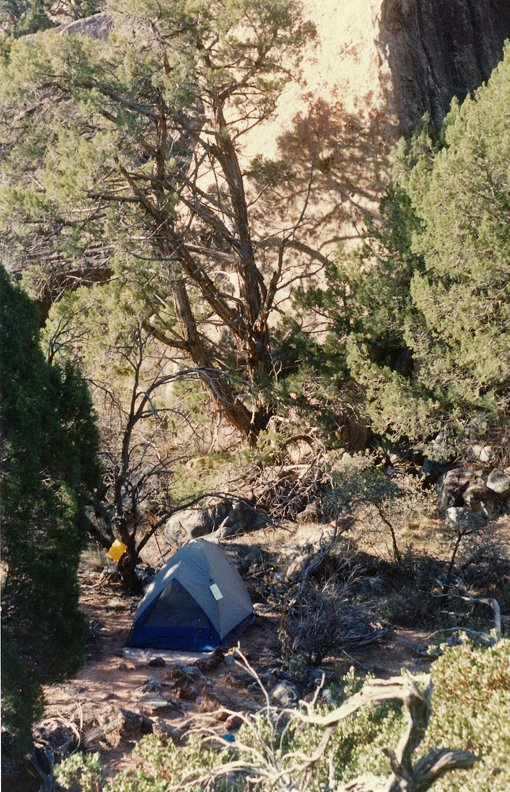
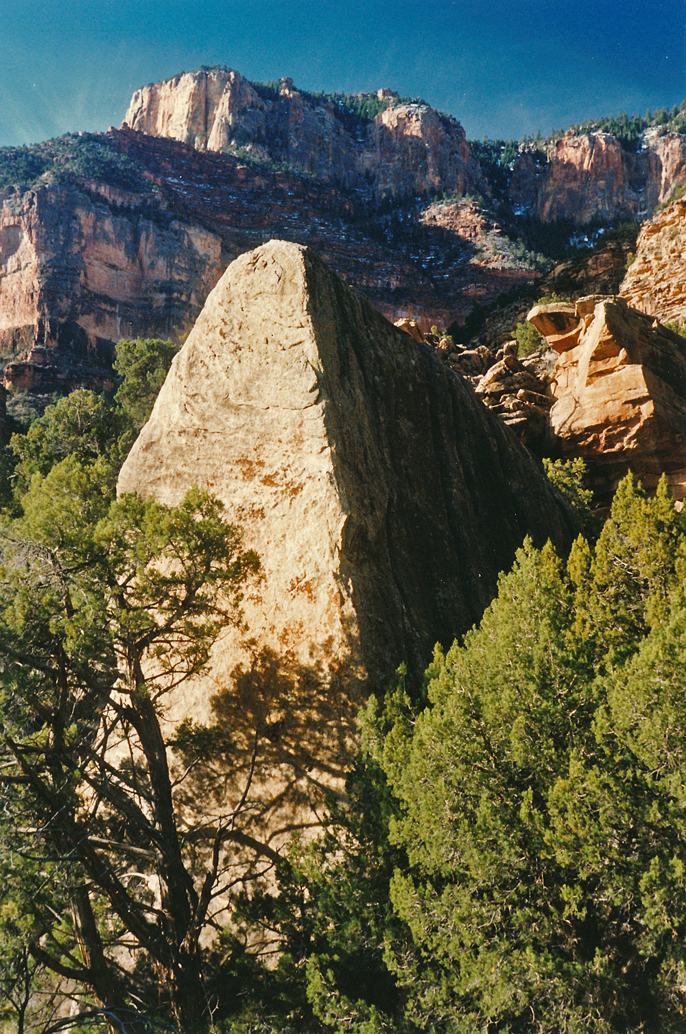
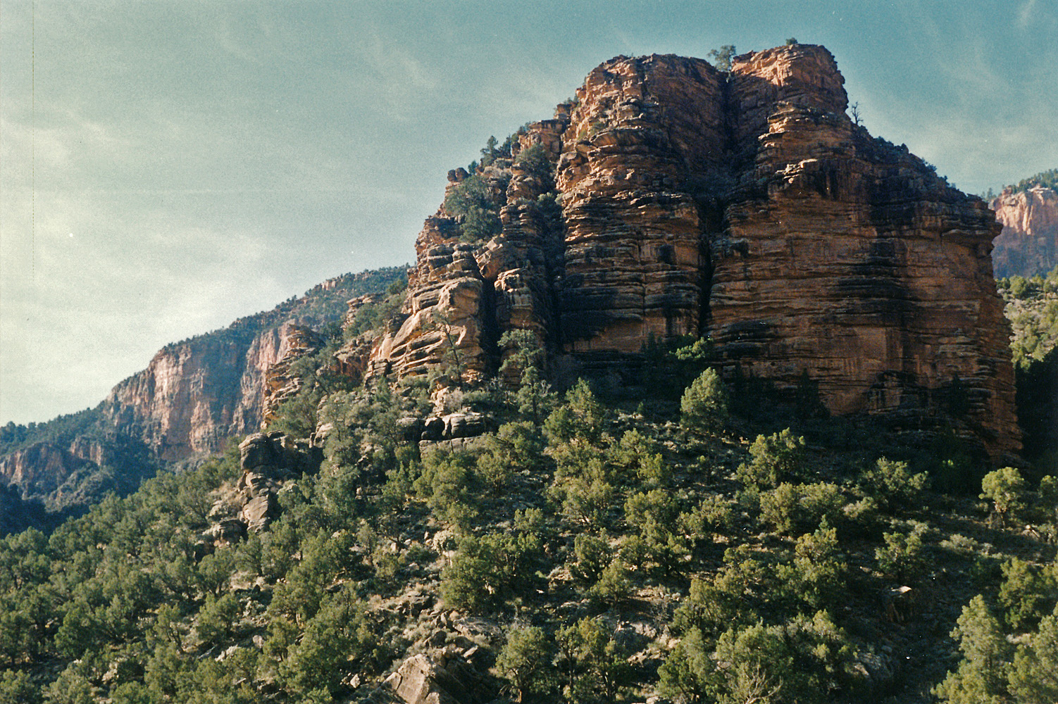
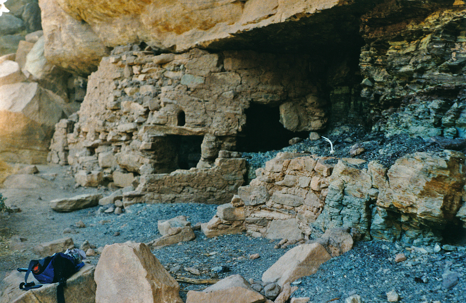
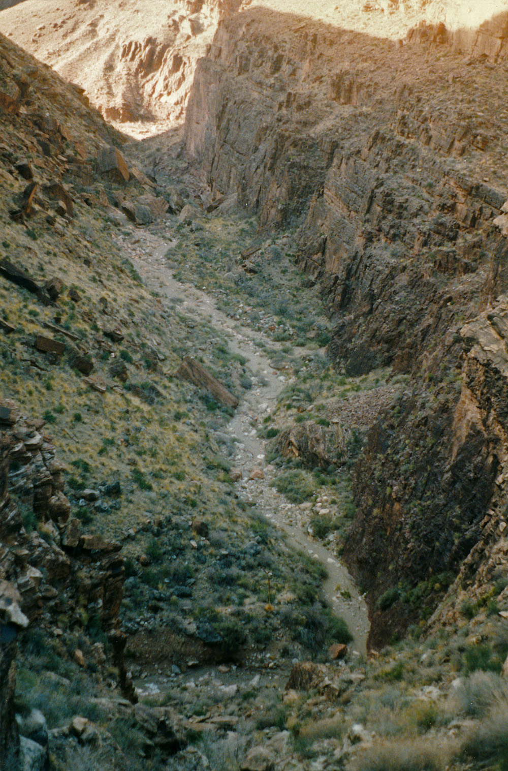
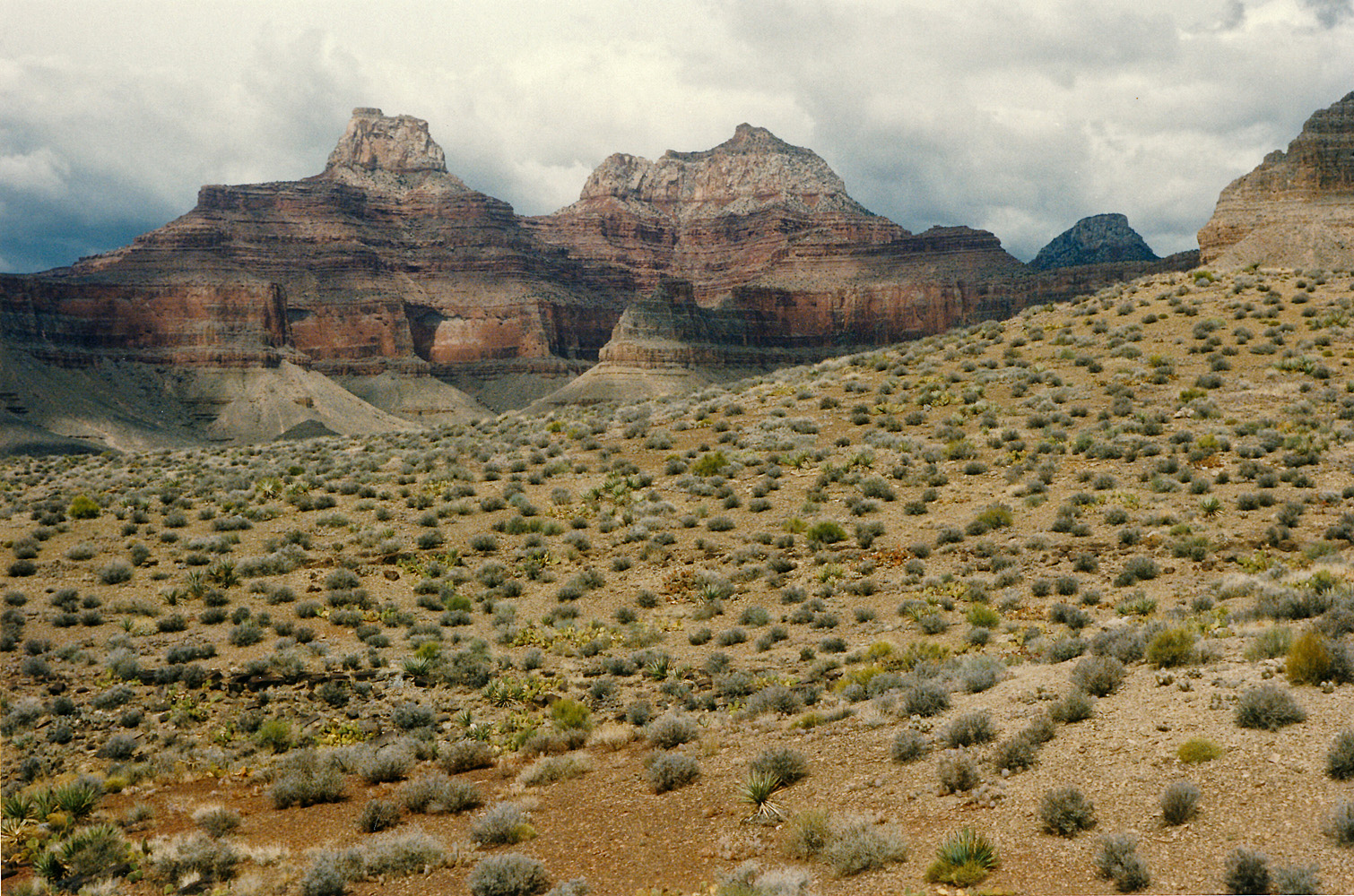
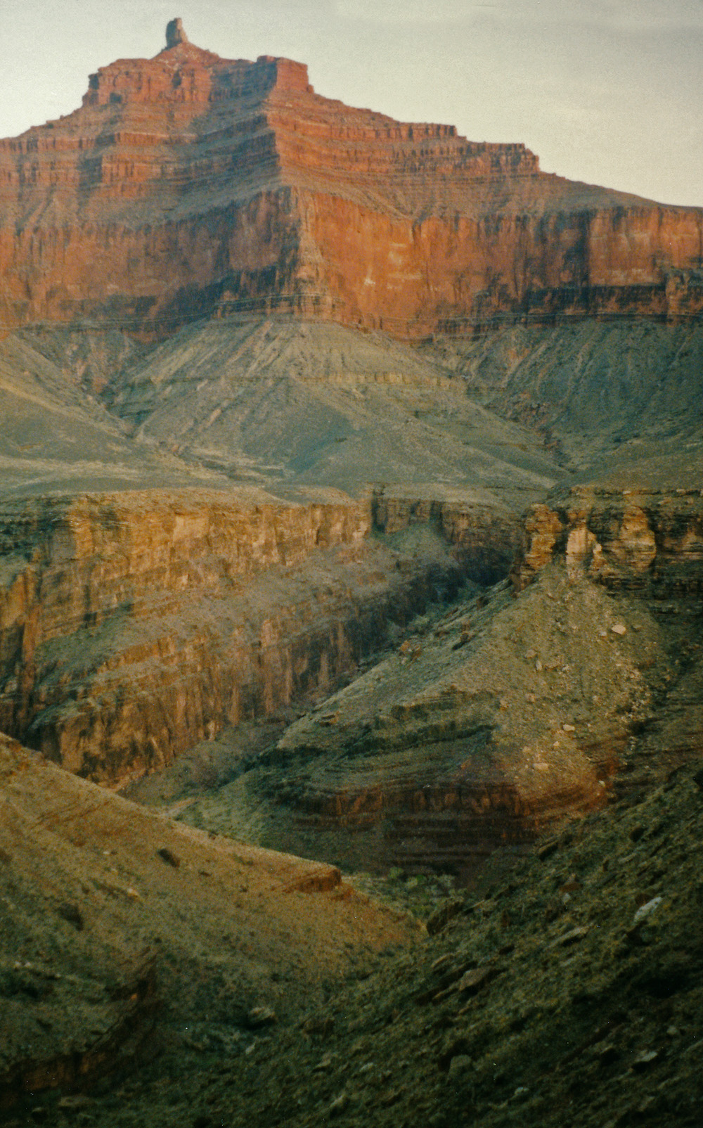
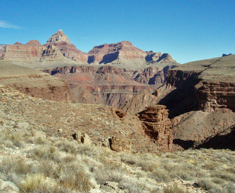
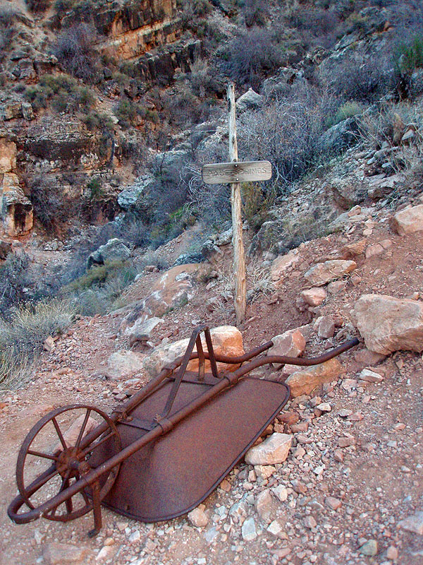
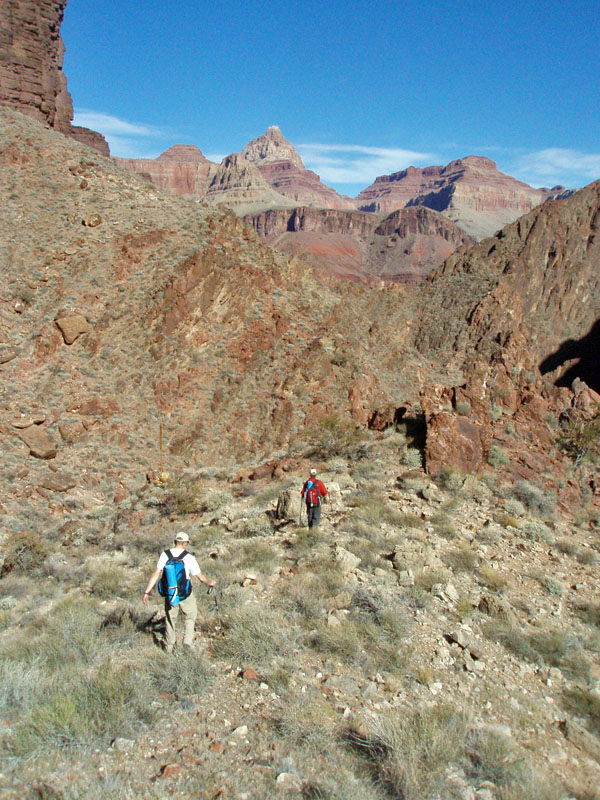