|

Appendix
- Micro-cassette Transcript
Text in brackets [ ] were added to the transcription.
Kanab Creek Hike - Indian Hollow to Cranberry Canyon Loop
Monday, September 12 to Sunday, September 18, 1994
[Tape 4a/4b]
Planned Kanab Creek hike – it is
September 12th, 4:45 a.m. I’m about to leave the house. The weight
of my pack with water is about 60 pounds.
It’s 11:06, and I am at the trail head at the end of Indian Hollow. A
couple of other cars are here, parked. So now to get my pack out, have
something to eat before I leave.
It is 11:52, and I am just about to head down the trail. It looks like
I could follow the trail a bit of the ways down this ravine before
dropping off and just following the ravine down through this route. It
is partly cloudy or maybe even mostly cloudy out here, so temperatures
are very nice.
At 12:58, I passed a ravine that went off a little bit to the north,
northeast, that shows up on the map and it seems that progress down this
ravine is really not as quick as one might expect. The ravine itself is
pretty decent going. People have probably been through here and
certainly the animals have. [Wind noise] Deer and even the cows, I
guess, wander down this way, or used to … [noise] but the ravine is easy
to walk down. There are places where it’s pretty wide and there’s a lot
of grass and sage and it’s matted down and easy to get through and the
creek bed occasionally is quite gravelly so things are going pretty
well. There are some places where the stickers bushes get in the way,
but so far that hasn’t really been a problem. So, onwards.
It’s 1:17, and I’m taking a break.
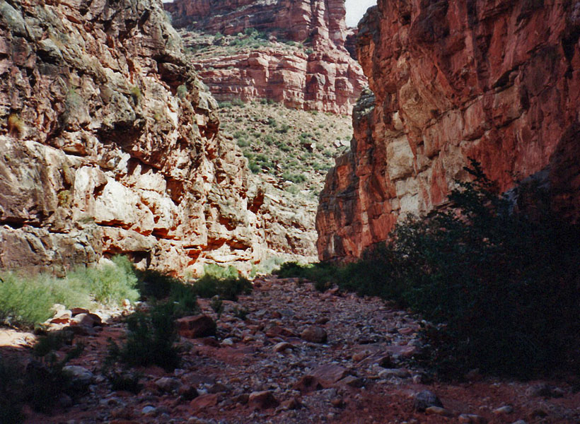
It’s 2:02, and I’m on my way down Indian Hollow here.
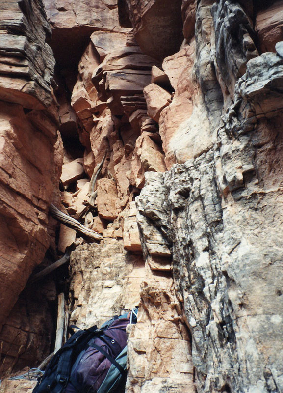
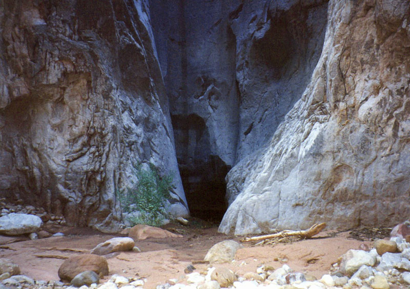
At 2:12, I reached the upper chockstone fall in the Coconino. So now to
start doing this. I can’t see out into the canyon at all. Still very
closed here in this ravine, but this is the upper barrier.
At 2:30, I’m ready to go again after a passing this little fall.
Getting my pack down on the rope was just a mess. The rope getting
tangled up, the pack not going where I wanted it to go. Really quite a
chore here, but hopefully that teaches me something for these later
falls and then for the obstacle pool tomorrow.
It’s 2:48 and I’ve reached the bottom of the second little fall in the,
big fall in the ravine. The bypass was off a little bit to my right and
I saw the rock quite, right away. It’s a steep little chute. I lowered
my pack and worked my way down with the rope tied to me, in case I
change my mind and decide to stay up high. On my way down I did knock
over a few rocks and stumbled for a foot or so, but things seemed
alright otherwise. Well, if that’s the case I should be reaching the
last barrier here real soon.
At 3:13, I’m down below the last of these bypasses and things went
pretty well. The chute was off to the side a bit and I was able to
lower my pack through it without any trouble. There’s a few drips
coming off the rock in the ravine here. Not enough to really gather any
water, but it makes the rock wet. Hopefully we’ll be seeing more of
this further down the ravine here. So on I go.
3:25, I’m taking a break on a rock. In the middle of the ravine I got
some shade from the clouds. Also I think, though, the sun is behind the
Coconino here which causes it to be very pleasant. The temperatures are
just great. A lot of clouds keeping it very cool. This last little
stretch down below the last fall was just awful. Forcing my way through
these holly bushes has just been tough work. It’s looks like I’m soon
to pop out of this. I can see Fishtail, part of Fishtail mesa or at
least the ridge leading over to it from where I sit and I can I’m well
below the Coconino now so I should be hitting that rock field in the
Hermit and then work my way down to the Supai. Anyway I’m going to be
here for a few minutes and rest and recuperate.
It’s 3:43, and I’m on way on down this ravine. Headed for the
Esplanade.
It’s 4:15, and I’m taking a little sit down break here. The bed of the
Indian Hollow here has, must have, some water come down it fairly often
because it’s pretty free of bushes. Not too long after my last rest
stop it got a lot easier working my way down through it, and we are, I
am, pretty close to being able to see around the corner here to the
north and seeing the Esplanade, which is essentially where I am now. I
can see Fishtail Mesa and the saddle between the two and as I look at it
seems that there would have been no problem at all hiking down the
Thunder River trail, across the Esplanade, up and over that saddle to
get down into Indian Hollow so that would have been an alternative
route. I don’t know if it would have been faster or not. Depends on
one’s progress across the Esplanade there, but certainly doable. The
route to the top of Fishtail is clear to me from this position and it
seems that getting to the top from the other side, the south side of
Fishtail, would be a real chore. One has to come up to the saddle and
then contour around and hope that you don’t have to go down too far to
continue that, to find that slide in the Coconino, which I can see quite
clearly from here. So it looks like the kind of thing that would be
easily accessible from Kwagunt Hollow or Indian Hollow here on this
side.
It’s 5:13, and I'm taking a short break. Have some water and dry off a
little bit here. My back has been quite wet and irritated by rubbing
against the pack on the way down here this last hour or so. The bed
drops down into the Esplanade before you really get a nice view of that
level so my views continue to be a little bit restricted. There are a
lot of trees growing in here. A lot of big ones, a lot of cottonwoods,
but I haven’t yet seen any water. I am hopeful though that I will be
coming to some soon, but it does look a little bit damp and occasionally
it looks like some little bits of water trying to force it’s way out
underneath the rocky ledges, but I’m going to shoot for a spot like that
before I set up camp.
It’s 5:29, and I’m off to continue on down this ravine.
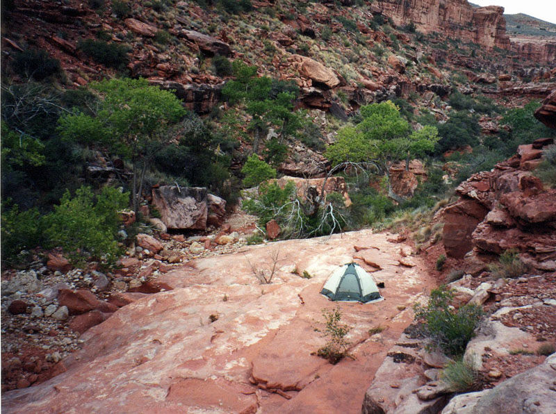
It’s 6:11, and I have stopped at a spot that I will camp at for the
evening. I have passed a couple sets of pools on the way down. They
didn’t look that enticing and I kept thinking that there certainly must
be something better further down the creek and I have come quite a ways
and it is just dry. There’s a lot of ground that is moist, but all
these places where you would expect to find pools, or even running
water, are just, hasn’t been any. Anyway I’ve reached the spot where
there is a pool and so I’m going to take advantage of that and stop by
it for the evening.
A note on this campsite. I have recently passed a major drainage coming
out of the right-hand side and on the map it appears to be the drainage
that leads to the water source that Harvey has noted near the “I” in the
word Indian Hollow and I have come a ways down from that but have not
reached the major drainage coming off from the left-hand side that’s
marked on the map.
It’s now 10 p.m. and I’ve been wiped out this evening. I’m very tired.
Just dragging myself around, fix dinner and eat dinner. I ate between
7:30 and 8 and have been napping since then and have gotten up to take
an aspirin. The wind kicks up periodically. Causes a lot of noise and
keeps me from really getting any restful sleep. Actually (I’m beginning
?) to wonder about bringing some earplugs. Well, I will, hopefully, get
some sleep before tomorrow morning.
* * * * * * * * * * * * * * * * * * *
Tuesday, September 13th. It is 9:25 in the morning
and I am all ready to go. My pack is all done. All I have to do is put
it on and start going. It was a windy night off and on and it kept me
restless throughout the evening. But I feel pretty decent this
morning. I was awakened by my alarm at 5:15, but didn’t really get out
of bed until about six and proceeded to make some breakfast and do my
chores, clean up the dishes from last night, and get some water out of
the pool. I had thought to use my collapsible plastic bucket to
retrieve some water and then use the pump. However, I decided to pump
the water directly out of the pool. It was pretty deep in one spot. I
think that the logistics are a little bit such that it is probably going
to be easier to put it into a bucket and then find a decent spot to then
go and pump it out. Since the intake hose is not very long. I packed
up everything inside the tent and rearranged my pack so that now the
tent and the ground cloth are in the fanny bag attached to the bottom of
the pack and I have put some of the heavier things towards the bottom of
the pack as well. Yesterday the pack was riding very uncomfortably,
very top heavy and I’m hoping that this will make things a little easier
for today. Well, the destination today is at least the obstacle pool
down here in lower Indian Hollow. Depending on how long it take to get
down there I may continue on with hopes of reaching water in Kanab
before stopping for the evening.
It has been windy this morning and, it for a while, it looked like it
might be going to rain, with fairly heavy cloud cover, but a lot of that
has dissipated by now. There are still a few clouds around, but the
threat of rain is certainly not imminent as of right now.
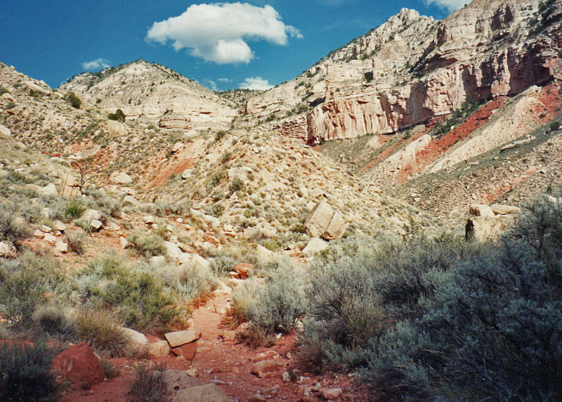
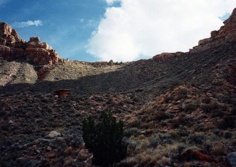
It’s 10:55, and I’m stopped at a junction between Indian Hollow and some
unnamed ravine that is clearly marked on the map. It is coming off of
the Kwagunt Hollow area and runs in from due east, traveling west into
Indian Hollow and things are going pretty well. I’m going to take a
little break here, have some water, try to fix my pack to ride a little
bit better. It seems to be riding a little too low. A postscript on
this morning’s log. First there was a quite a bit of a suspended sand
particles in the water pools so that was one of the outcomes of the
constant wind that I had last night. Secondly, I did pull out three
liters of water so I want to keep track of how much water I get with the
filter and that’s the first water that I’ve filtered and then lastly,
something else that eludes me at the moment. On the way down I have
passed the numerous pools ever since I left my campsite so I haven’t
been very far from water all the way down. In a couple places it was
actually running a little bit from pool to pool to pool. I had some
little detours to maneuver, but otherwise things went pretty well. I
did have one spot where I got half way down a little narrow spot, found
I couldn’t go any further and had to climb back out, and had to take my
pack off and push it up to get it back on the higher ledge there and
then scramble back up without the pack.
It’s 11:30, and my break is over. I heard something on the slopes up
this other ravine here, knocking some rocks around, but I couldn’t spy
what it was. Likely it was some deer unless it was just rocks rolling
around on their own. I must be getting close to doing some obstacles
here because I can see across Jumpup to the other side – the cliffs up
in the Coconino and Kanab – so clearly we must be coming near some spots
here to start descending.
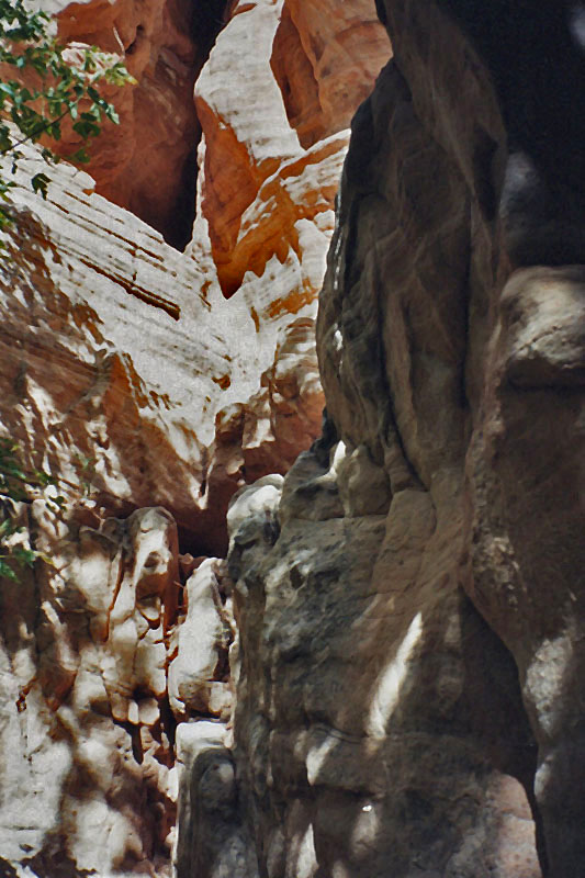
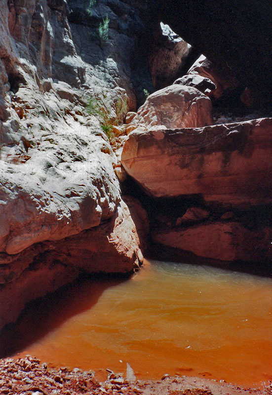
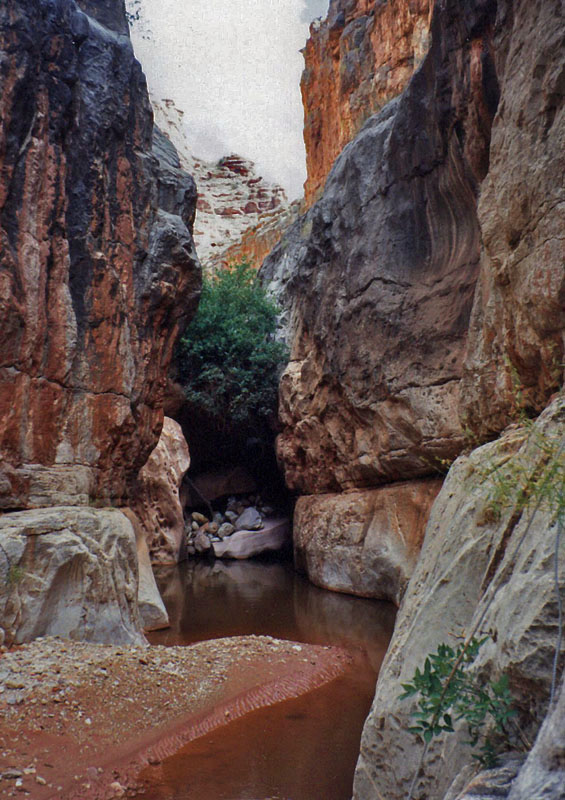
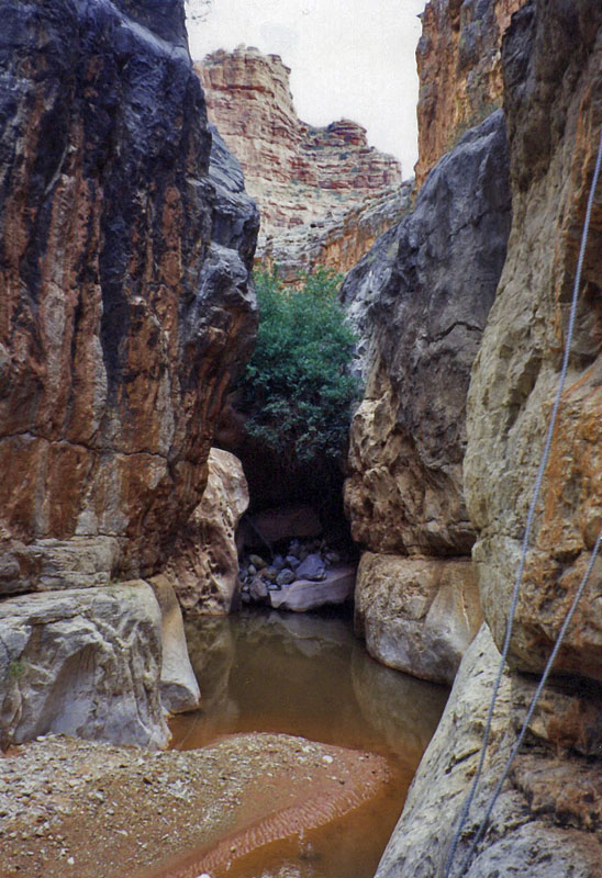
It’s 12:32, and I am down below what appears to be the big pool that
Steck mentions with the bypass, but it there doesn’t seem to be as much
water as normal and I managed to work my way down through the pool area
though not without incident. I got down past the first barrier falls
pretty easily, coming in underneath that really huge chockstone on my
left-hand side, and then I encountered two relatively small pools that
had to be passed or one on either side of a rock here and both of them
were just a little bit too much to get through. On the right-hand side
I eventually decided that I could try that pool. It looked like I might
be able to walk around this pool on the left and wade through the
water. It didn’t look too deep close to the edge and so I took off my
boots and rolled up my pants and got down there and I found that I would
have to step too far away and into a big hole in order to get around the
rock on that side of the pool. So I went back and dried off my feet and
put on my boots and came back to the other side – the right hand side of
this pool – and had been thinking about jumping it – probably about
four, five feet here to jump – but it’s at a bad angle and I tried to
lower my pack and see if I could swing it out beyond the pool and I was
not successful. The pack started to dip down into the pool and then I
had a heck of a time trying to pull it back up, and without gloves and
with this rope, was just searing my hands. Not to mention the sixty
pounds of pack at a precarious angle trying to pull it over the edge of
a rock, and I spent quite a few minutes fooling with that until finally
with one all out lunge I managed to pull it up on top of the ledge I was
sitting on, tearing off some skin on one of my fingers in the process.
I then decided to just toss the pack and then jump without the pack. I
didn’t feel like jumping with the pack on. It just seemed like too much
and the pack landed alright but then fell into the pool of water. So
the best laid plans certainly have gone astray here. So I jumped easily
this little distance and dragged the pack out of the mud, really, and
set it down and took a brief perusal around the area here. So anyway
I’ve been here for a little while messing with this dang bypass and I’m
going to try to continue on and see if I can’t reach that plunge pool
and have lunch down there.
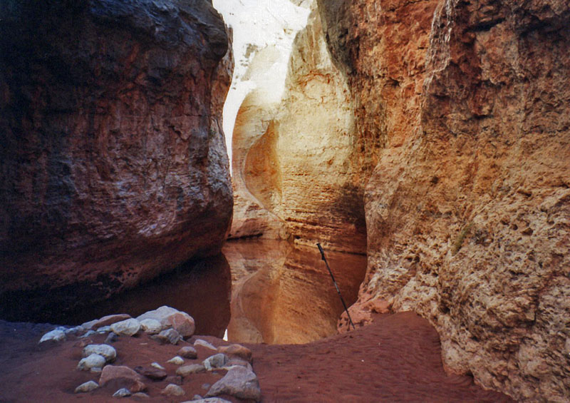
It’s 12:52, and I’ve reached the obstacle pool, and so I’m going to put
down my pack and scout out what’s going on here.
It’s now 1:15. I am ready to lower my pack and change into my aqua
shoes and swimming suit for the climb down by the chockstone. The drop
here is not as far as it otherwise would seem. There’s a big ledge
about half way down that one can get to pretty easily, so all I really
need to do is get the pack dropped down to there. Anyway so hopefully
this won’t take but just a few minutes.
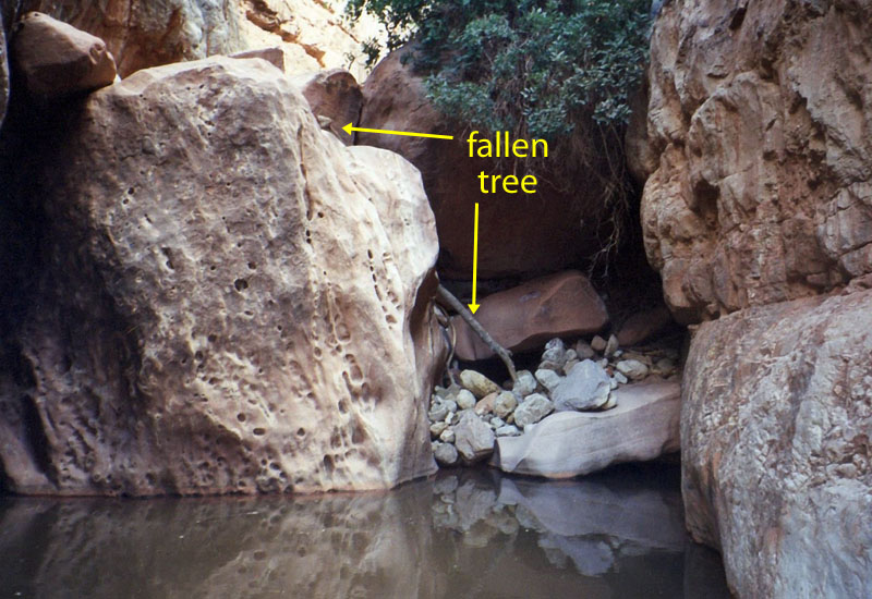
At 1:52, I’m down below the obstacle pool and I have fetched my pack off
the ledge. In fact, I ended up lowering the pack down the rest of the
way from where it landed on the ledge since the route down was not as
easy as I had thought. There is about a six foot steep part right at
the very bottom. I made it through the obstacle pool okay. I sat for
quite a while trying to think of how to get down. There’s a very steep
slick rock that’s probably about ten feet long there that drops into a
rock pile and I had thought to try slide down it and use my pole to
break myself, but I just had visions of all kinds of problems as a
consequence. So I rolled a few big rocks down it and they didn’t do
anything. They bounced out of the way and didn’t help form the little
pile at all. So I went back up the ravine and I found a real nice
twelve foot pole, tree trunk. Probably four inches, three or four
inches in diameter at one end and four inches at the other end and I
dragged it down the creek bed and jabbed it into that spot and came down
in nothing flat. I was able to stand up in the water at this spot. It
was about four feet deep, something like that, four and a half? And
then swam across the pool until I could walk out. Well this is going to
be a long break. I’m going to have lunch and try to dry some things
out, see what damage I’ve done to my pack. Before heading down I had
thought about using this spot as a camping site, but it really is quite
narrow. Not right here at the obstacle pool it’s a good thirty yards
across or so. Fifty yards maybe, but it’s all rocky and a little bit of
a slope and certainly is narrow and would catch a lot of water should it
rain. I figure it probably, I guess it’s about an hour and a half down
to Kanab and Harvey talks about some water about half an hour beyond
that so I think that’s probably what I’ll shoot for, for a campsite
tonight.
It’s now 3:01, and I have hung things up to dry. I’ve washed out my
pack, my fanny bag. I’ve got the ground cloth and the tent sitting out
although they’re already dry by now. I washed my shirt. Got some water
in the bucket that I will get a little bit later and I’m just now
sitting down to have lunch. It appears that, although a few things were
wet, not too much was wet inside the pack. The mud on the outside was
enough to make me wash it and the only real damage that I have seen so
far is the plastic shoe box has cracked and apparently poked a hole in a
bag of sugar or cream or something and it has spilled out. Although not
much of it spilled out, but enough to make it kind of a mess inside. I
have yet to take that apart and see what’s going on and my bag of nuts
popped open, or tore open, in the upper compartment spilling a few of
those. And my apples, I think one of them must have gotten mushed,
although I got them sitting on the side and we’ll take a look at them in
a few minutes. But now I’m going to finally have some lunch.
It’s 5:23, and I am all set to leave this obstacle pool in Indian
Hollow. I have been here a very long time and part of that is just the
time it took to repack everything after cleaning it up and letting it
dry and all that. So my decision making at the previous big pool cost
me in terms of the time I spent here fooling around with getting my pack
back in order, but everything is cleaned up, dried out. I had lunch and
I have filled up with four liters of water and expect that I shall gat
least go to the Kanab-Jumpup junction and camp there or perhaps continue
on. I might hike here until it gets dark and make alternative
arrangements about dinner. Although I can’t see the whole sky, I can
see a pretty wide band from east to west above me and there are no
clouds at all. So it may be that it’s going to be another clear evening
with no threat of rain at all.
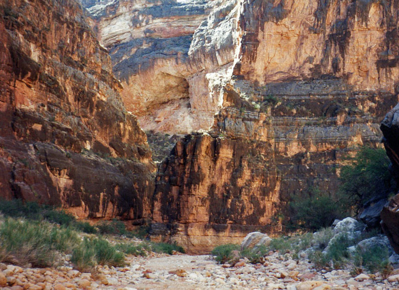
It’s 5:39, and I’ve reached the Indian Hollow-Jumpup junction and now
heading down Jumpup Canyon. Indian Hollow was kind of an interesting
route. I was surprised that there wasn’t more water than there was. I
somehow thought that there was more water, comparable to Kwagunt Hollow,
but really the water at Kwagunt Hollow is much more substantial than I
found here in Indian Hollow. There was a spot to camp perhaps a little
below the obstacle pool where a ledge that was covered in sand under a
very large overhang stood a good five or six feet above the floor of the
canyon. It’s a very narrow canyon, but still that would be a place
where one could pitch a tent and perhaps ride out any inclement
weather. There are bushes and things growing up just a couple feet off
the bed so flooding seems to be an irregular, usually sort of thing.
Although cliffs do look pretty well washed, about, up to about 6 feet, 8
feet off the ground so there’s something to be said for that. Well I’m
going to continue on down the Jumpup.
At 5:46, I spotted a little rock cairn off to the side under a largish
sort of overhang and there was a little seep spring there. it wasn’t
seeping out very much. I think one would be hard-pressed to try to
accumulate any water there, but it was wet and there were a few little
ferns growing at the base of the wall.
It’s 6:11, and I’m at “Frog Holler”
water and there’s quite a bit of water in here. Very damp leading into
it, muddy, and there’s frogs here. A lot of debris on the water, leaves
and things, but still here. I will continue on down Jumpup.
It’s 6:24, and I’ve reached another seep here on the, this time, the
left-hand side as I’m walking down and it seems suspiciously like the
spot where Neil and I had camped, although that doesn’t seem to be a
nice big spot to put out a tent. But I don’t remember camping near a
seep either. Well, continuing on down.
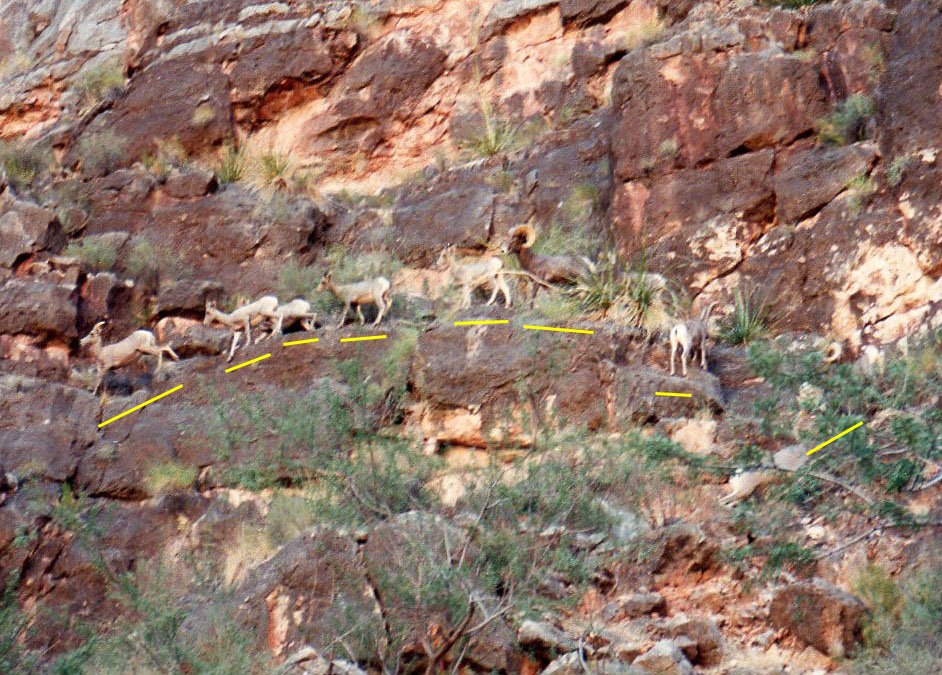
It’s 6:46. I’ve reached the big curving overhang here where there’s a
little bit of a seep here and I have stumbled upon a whole family of
bighorn sheep I would guess. Based on the antlers, there’s a couple of
adults, a younger one and then three smaller ones. I thought that there
might be some deer out ahead of me based on some dropping I saw on the
creek bed and also the reasonably fresh tracks and it seems that I’ve
run into them right here. I don’t know what they plan to do but I’m
thinking of reconnoitering on the high bank here. Probably about eight
or nine feet above the creek bed. And looking for a spot to camp.
Well they definitely are bighorns. There’s eight. Two with real big
horns curving all around and it looks like a couple three maybe that
have a good set of horns starting, making their first sort of bend. And
then another three that seem a little younger with just very small horns
starting. They’re all here on the rocks up above me. Sort of waiting
for me to do something I guess. Clearly they can’t go too much further
up before having to come back down here so I suspect that I will hear
them tonight.
Well it seems that the sheep have decided, some of them anyway, to come
back and down and bypass me. And now I’m thinking maybe there’s eleven
out here. And making a little noise as they come down. One of them
though is still cliffed up? A young one. All the adults and other ones
are now a lot closer to me. Wish it was light enough to take a picture.
* * * * * * * * * * * * * * * * * * *
It’s Wednesday, September 14, and it’s about 7:25. I’ve been up
for about an hour and am eating breakfast. The night was nice. It fact
it got a little cool towards the earlier hours of the morning and I
threw my poncho on over my sheet. I slept a lot better than the night
before. Although when I got up there was a ton of mosquitoes hanging
around. So I have been forced to eat my breakfast in the tent.
Yesterday at the obstacle pool I should have noted that I filtered
three and a half liters of water.
Last night I pretty much went to bed after getting all set up. I did
walk back up the creek a little bit and make some noise to try to
encourage the sheep to come back down and exit off of their precarious
cliff. As I had seen at least a couple of them stumble and knock others
over I didn’t want to be responsible for any accidents that way. And so
it seems that some or all actually did come back down and leave out the
other side. And that was between 7:30 and 8 o’clock and I was so tired
that I just pretty much laid down and was resting for the next couple of
hours. And, about 9:30, I pulled out the Irish soda bread and had a
bunch of that.
It’s 9:11, and I’m all set to go. All I have to do is put on my pack
and then head on down. The sun comes up here pretty late and in fact
just catches a corner of this little area that sticks out. Looks like a
nice day. Probably be a little bit warmer. Last night was very still
which was nice. When I got here there was still a little bit of wind
occasionally that blew a little bit on sand in the tent, but that
stopped pretty much after I got here. I’m going to wear my Croakies
again today. Yesterday it made for a much more comfortable fit for my
glasses and so I will continue doing that. So, on down to Kanab and
eventually Scotty’s Hollow today.
A note on my water situation as I’m leaving the camp. I had four liters
as I left the obstacle pool and didn’t have any until I got down here,
although I was getting a little bit thirsty. But I knew I wasn’t going
to be hiking for too long before I was going to have to stop. But I
wasn’t too concerned about the water. I thought I had plenty and didn’t
hesitate to drink whatever I wanted to once I got here. I did use a
little for kind of a sponge bath last night. Had a little extra this
morning to wash dishes and I have about a liter left that should be easy
enough to see me through till I get to some water down in Kanab.
It’s 9:27. I’ve reached the junction of Jumpup with Kanab. I thought I
was pretty close based on my hiking time yesterday. Although I couldn’t
quite tell because on the map it was unclear exactly where I might have
been. Although the bend seemed to be rather dramatic, on the map – it
was – I was less certain. So the sun is shining in here. It’s a
beautiful day. Blue sky, deep blue sky. Lots of camping spots here
that are high off the bed. And so I’ll head on down and take a look for
that plunge pool that Harvey mentions is maybe about a half an hour down
below here as I travel down Kanab.
Since reaching Kanab, I have been continuously buzzed by some
mosquitoes. I had not really seen much of them at camp after I was up
for a while as I mentioned many were waiting for me when I got out. But
they seem to disappear. Since I’ve come to Kanab they have been buzzing
around me and landing on me left and right. That could be because it’s
cool – it hasn’t yet warmed up at all, so it’s really pleasant in that
way and very still.
It’s 9:53, and I’ve reached the little tributary that comes in off of
the east side. Coming down it’s really easy to spot because the creek
makes a big bend here and this tributary continues on in a straight
line. Coming back however, I think it might be kind of easy for someone
to miss it. Although there is a little rocky debris that has washed out
from that ravine into Kanab. Anyway I'm going to take off my pack and
explore up this little ravine and see if I can't find Harvey's pool.
It’s 10:09, and I’m back ready to continue on down Kanab. Pack’s on my
back all ready to go. I got back a couple minutes ago from
investigating this little ravine and there were pools all up and down
it. The closest one even in site of the junction here with Kanab when
the ravine makes a bend and turns out of view. The plunge pool at the
end was very large. I wouldn’t be surprised if there’s as much water as
in the obstacle pool or maybe two–thirds of it. It was murky, but
certainly there was quite a bit of water in there. And it doesn’t
appear that the sun shines on it very long if at all during the day.
Well, continuing on down the creek.
Mosquitoes are still voracious.
By the little ravine I saw quite a few animal tracks and some droppings
which seem to me to be the same as the sheep – perhaps the little herd I
saw yesterday. And they didn’t look that old. I had noticed some
droppings on the way down to Kanab and then down Kanab this morning so
it may well be that this herd is still out in front of me somewhere.
And I may yet get to see them and maybe get a picture of them.
It’s 10:35, and I have caught up with the sheep. So I’m going to try to
see if I can’t get a good picture of them before I continue on.
It’s 10:52, and I’m back at my pack. I gave them a good chase and got
one decent shot I think of them before they climbed up higher than I
could go and rounded a corner. On the way back I got a picture of them
all just standing there. I don’t know how well it will turn out with
them against the cliffs high above me. But they’re all just sitting
there looking at me. So I think I’ll have a little bit of water and
then push on.
11:01, I’m continuing on down the creek.
11:04, I passed the first pool here in Kanab. It’s really not very
big. Maybe kind of a task to get some water – you can get a cup in
there and pull out some water, but very muddy. And it looks like it
could be a lot fuller than what it is right now. So that may be a good
sign anyway that I’m going to be encountering some water here.
It’s 11:23, and I’ve just come around the big 360 degree bend in the
creek that is marked on the map. It’s between the M in Mojave and the C
in Coconino dividing the two counties. And I have got some water here.
And, it looks this may be the beginning of the springs that flow on down
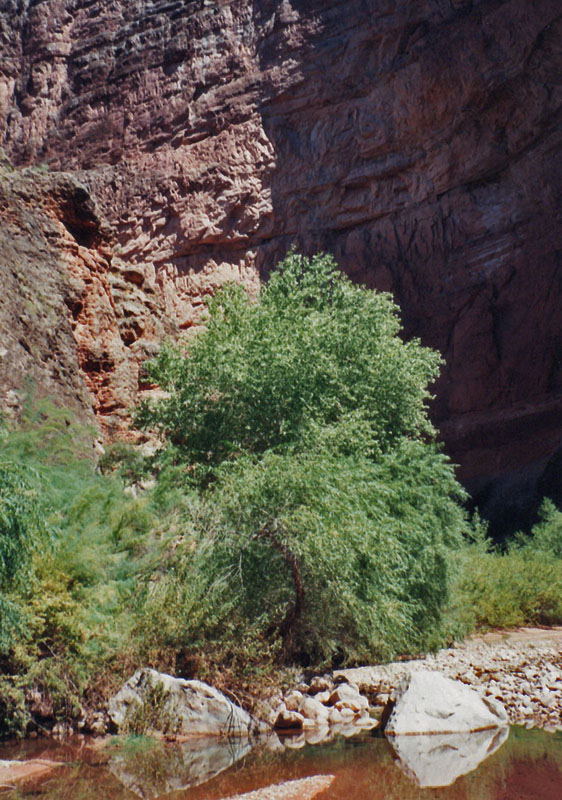
here. I can see it stretching on ahead of me. And a lot of trees here
along the banks. So, that’s a pretty good sign. I think I’ll go down
just a little while and find a nice spot and rest for a bit.
It’s 11:44, and I’m going to break for lunch. Also get some water. I’m
in a nice shady spot here. Pretty close to the next major ravine that
comes in off of the left, or the east, that’s marked on the map. It’s
probably only just a matter of a couple of minutes to walk down that
far. And the area I’m in is still in the morning shade. So it should
last for at least lunch. I scared up a few more mountain sheep just a
couple minutes ago and they went heading up the slope. And one ran
across the thin ledge at breakneck speed. It was just amazing to see.
It’s 1:16, and I am just about to leave. All I have to do is pick up my
walking stick. The sun has just reached my little spot about five or
six minutes ago while I was packing up to leave, so that was very
accommodating. It is quite warm in the sun so if a breeze blows that
feels pretty nice. Well, I think things are going along pretty well.
This little stream has been full of little minnows, little fingerlings,
and before I leave I think I’ll just let the stream make a few noises.
[Stream noise]
[Water noises] It’s 2:10, and I’ve just crossed a couple springs that
come in from my left side. I was forced to cross the creek here stay on
that side and fight my way through the real dense brush. And they must
be just about where the Shower Springs should be – just about where the
K is in Kanab. I’ve just come around this big long point and so I would
expect then pretty soon here to run into that.
It’s 2:13, and there’s the Shower Spring right in front of me so I was
really close.
It’s 2:27, and I’m going to take a little break here by the creek. I
have busted one of the straps that was holding on, or holding on the
fanny bag when I hopped over the big rocks below the Shower Spring.
There’s some deep pools there. In order to bypass them I had to sit on
the edge of this rock and then try to lower myself down and the fanny
bag just got caught and hung up there and when I was able to pull it
free I must have torn loose one of the pack straps. So I’m going to fix
that and have a little water before leaving.
It’s 2:47, and so I continue on down the creek.
It’s 3:16, and I’ve reached the campsite here at Scotty’s Hollow and
Kanab – the same one used by Neil and me some years ago. There’s an
awful lot of some kind of a vine growing in some of these areas. This
one ledge that we had cached all our stuff in preparation of a little
morning trip up Scotty’s Hollow has vines running all over the sandy
area there. I don’t know what kind it is but they seem quite prolific.
Anyway I’m right opposite of Scotty’s Hollow and this spot looks like it
catches the shade almost all day if not entirely all day. Near the
beginning of an “S” turn leading to the straightway that heads down here
to Scotty’s Castle there is a bypass that I’ve forgotten about that goes
well above some cliffs around that first bend. So that was a bit of an
unexpected or forgotten detour. And along much of the last
fifty/seventy-five yards here I walked close to the edge of the cliff
and not close to the creek. Well, now to unpack, set up the tent, and
think about how to lounge around this afternoon.
It’s now 7:09 and twilight is beginning; it has set in. I can still see
where I’m going and so on, but I couldn’t read anything. After arriving
and setting up camp I took a trip down the creek to see if I could find
the ruins that Harvey mentions. I was doing that from about from 4
o’clock till about 4:45, when I returned. I didn’t find any. I got
almost all around Scotty’s Castle and checked two real obvious
overhangs, but didn’t see anything and didn’t see anything further down
the creek. So when I go down in a couple of days I may try to keep my
eyes peeled, see if there’s something further than where I went. And
then I, when I returned to camp I took a shower and washed my clothes
and hung them up to dry and fixed myself some dinner and have just been
lounging around since then. I have my tent full of stuff. I was
thinking about inventorying it, trying to see what’s going on here with
future meals and then tomorrow I will take a day trip up Scotty’s
Hollow. So I’ll probably be up for a little while and then hit the
sack. It’s been a real nice night. It’s real still. It’s not windy at
all. The skies are still very clear, no clouds at all. And I haven’t
been bothered with the bugs and the mosquitoes here even though it has
been still this evening. So that’s been real nice as well.
This evening for dinner I used the TVP
for the first time. And that worked out pretty well. It absorbed some
of the water so I got to be careful to add some more, but it may be just
the thing to go with for dinners anyway.
* * * * * * * * * * * * * * * * * * *
It is Thursday, September 15th, and 6:45, right now.
I’ve been up since right around 6 o’clock and filtered out four liters
of water, plus a little bit more to drink. And if I hadn’t noticed it
yesterday at lunch I filtered three liters of water. And I am all set
to start eating some breakfast and start thinking about how I’m going to
start pack up things for a day trip up Scotty’s Hollow. It is a clear
day; very still again which has been very nice. It was a little cool
last night, and I once again threw my poncho over my sheet to stay
comfortable. That should be a good sign at least for temperatures
during the day. They hopefully won’t be too scorching. Things will be
well.
It is now 8:30, and I am all set to go. I got my stuff all packed up
in hopefully good order here at the camp. Everything’s all cleaned up.
I’m taking two liters of water. Hopefully that will see me through my
little adventure up here although I brought along my tablets to use if I
need to do that. I had thought about bringing just one liter and my
water pump, but I’m able to fit my lunch things into my front pouch so I
decided that the space wasn’t as critical as I had thought and so I’m
going to leave that behind. Anyway everything is going along pretty
well. The sun is creeping down to the bottom of this canyon here right
next to Scotty’s Castle and it’s still a very clear beautiful looking
day.
Well before leaving I downed a liter of water and I’ll will take the
other liter and set it in the stream so it stays cool.
It’s 8:46, and I’m up past the falls. Which take a listen to for a
moment. [Falls noise]
It’s 9:09, and a couple of reflections on Scotty’s Hollow. The water
certainly looks great and there’s quite a bit of it considering. I have
come through some areas that are just amazing. Some narrow stretches
where the creek sort of spreads out over most of the entire width of the
canyon. In fact I took a picture at one such place. And there was a
180 degree turn and some other sharp turns but none of them are marked
on the map which is kind of ironic when you think of the map as being an
accurate representation of these canyons and yet certainly the surveyors
had to make some guesstimates on some places and Scotty’s Hollow is
probably one of those. There’s a neat stretch where I’m at right now
with kind of a conglomerate sort of rock is. There’s some kind of
limestone I believe imbedded in some kind of slushy material that
solidified so it looks almost like cobble stones. And in this particular
section the creek has worn away some channels, a channel in this
cobblestone-like block layer, very fascinating, very interesting looking
kind of canyon.
It’s 9:22, and I’ve hit some sunshine here for the first time. And the
creek is cutting out really smooth beautiful channels in this gray mauve
limestone. Just looks fabulous. There’s some narrow stretches here of
the creek bed. In fact one spot where I was without a place to walk and
so I straddled the creek, a foot on each side and was able to sort of
baby step my way through a stretch of about ten feet twelve feet
something like that. It wasn’t very deep there. It was maybe a couple
of feet but I was able to stay dry through that.
There is some kind of a plant here that is most interesting. It has
real fuzzy leaves that are just like Velcro and stick to one pretty
easily sticking to my boots and the bottom of my pants. And the stems
are fuzzy as well but they are more spiny and little bit tough to grab a
hold of. But I noticed them all the way up this little creek and they
have continued to stick to my pants and my shoes.
It’s 9:27, I’m at the end of this stretch. I took a picture of the
smooth mauve walls. I’ve got a pool I’ve got to cross and I am going to
have to take off some clothes in order to do that. There’s no way to
walk around it and it looks pretty deep. Probably about four feet.
It’s 9:53, and passing that pool was an adventure and a half. It was
probably about five feet deep at the deepest, maybe a little less. And
the up creek side, it was really hard to get up. There wasn’t really
any place to climb out easily and so I had to come up right where the
water flows and the rock was very slippery. And I slipped back down
into the pool a couple of times and had to use my hands to grab where I
could until I got out. Which means hauling my stuff through was going
to be something of a problem. I decided I could get close enough in the
pool where I could toss things up past the little fall here, although I
had visions of them rolling right down into the stream or maybe back
into the pool. But I thought I could prevent that with my stick if I
was able to keep aware of it. So it took me three trips, four including
the practice trip to get all my things across. I did slip and got the
bottom of my fanny bag wet and also my camera a little damp. Luckily I
didn’t get too much water on them. And I also slipped when I was
bringing my clothes across. Although they didn’t get wet. And the
third trip I brought across my boots and that worked out fine. Going
back it shouldn’t be any problem at all. I can just slide right down
the water and hold onto things walking out the other side. Well there’s
a waterfall up ahead of me. I haven’t gone all the way to it, but looks
like I should be able to cross through that. We’re getting pretty close
to the top of (the) Muav.
Part of the crossing was really my feet stepping across the rocky bottom
to fetch my clothes was not very comforting. The bottom of the pool was
covered in a nice small gravel so that felt fine, but on both sides,
well actually on the downstream side the rocks certainly were a pain.
10:02, I’ve climbed up past that waterfall, though I wasn’t really too
thrilled about the prospect of climbing back down there. A little bit
steep there. But there are some foot holds that I should be able to
work my way back down.
In fact it was almost a bypass a little bit before that. It looked like
the lowest five or six feet was the worst, but I may come back that way
and lower my stuff and then climb back down the waterfall. Well, as I
continue on up here looks like I might have to take advantage of another
kind of bypass here. There’s another pool that looks to be something
that I can’t climb around so I’m going to climb up here. There’s some
steps that lead up to about twelve-fifteen feet above me and follow
along with the almost the top of the Muav.
It’s 10:20, and I’ve reached a stopper. It’s not, well, it’s a couple
of waterfalls that are choked off by the sides of the canyon here. I
had taken off my boots to wade up through one spot and then this
waterfall was right around the corner. And it looks like its next to an
impossible to get through without getting wet, without getting my stuff
all wet or it might actually be impossible to get through. There’s a it
seems that I could probably climb up the lower one and if I could throw
up stuff up on a big boulder, that might work. Although that’s a little
bit questionable. And from there on the left side it looks like I could
perhaps throw things up to a couple of rocks that are jammed in between
the big boulder in the side. But that climbing out of here means it
looks like you have to climb up where the water is flowing down on the
right. And it certainly doesn’t look all that easy. Especially with
just bare feet. If I had my aqua shoes then it might be a little bit
easier to get some purchase on the rocks there, but still looks like
there’s about a four or five foot jump there that, or gap that is going
to be kind of tough to get by. So this is it. I will turn around and
walk down a bit here and dry off my feet and put my boots back on and
just lounge around a little bit I guess.
10:40, and I’m just now ready to go. I had decided to strip down and
try to see if I could actually get up through this spot without my pack
and without trying to carry it around. And I just couldn’t even get up
the first little fall. The water is about waist deep and there just
isn’t really anything to grab a hold of and use as a foothold or
handhold or anything. The rocks that form the water fall there might,
maybe some people could use to hoist themselves up but I just couldn’t
figure it out at all. I could grab the top of the big boulder …
Well the tape stops and I don’t really notice it. It is now 3:10, and I
am down Kanab Creek a bit. I would say on my map I made that slow long
westward bend after Scotty’s Castle. And I am coming up on the sharp
rightward bend which will lead me in a long route over to the false
Scotty’s Castle. My thoughts when I was recording before seem to be
that two people with a rope might be able to get up if one boosted the
other up over the first fall and then up to the rocks in the crack in
the second fall. And if then one person could pull up the packs with a
rope. No small feat trying to keep them dry. On the way back down I
stopped at just past the pool, the wading pool, to have lunch. I
managed everything into one bundle in that wading pool and slid down and
crossed without incident. The bottom of my boots got a little wet and
so did the seat of my pants, bundled up with my pack. But that worked
out pretty well. I stopped for lunch from around 11 til 12, something
like that. Somewhere after twelve I left and continued on down the
creek. I stopped at a spot to take a look at a cave. And it was full
of the sheep droppings so sheep go up there a lot. But nothing else
going on there. That was high above the real sharp 180 degree turn in
Scotty’s Hollow Creek. I got back to the campsite at just about 1
o’clock and decided to pack up and head down Kanab. I was mostly packed
up by 1:50, but my foot was hurting and I took my boot off a couple of
times to investigate. And I noticed that I had a little bleediness torn
skin there underneath the my foot near my little toe. Then I think I
might have hit a cactus whip. When I was in that pool, the last pool up
Scotty’s Hollow I was searching for a place to put my feet and I hit
something sharp under the water there. And I thought it might be cactus
but I didn’t feel anything after that. It didn’t irritate me until I
was getting ready to go. But I had my pack all packed up and I had to
half unpack it to get the first aid kit. I didn’t really find anything
in there. I dug at it for a while, put some ointment on, bandage and
moleskin. And it has been riding all right – a little sore but seems
fine. And I had to pack my bag up a couple of times there because I
kept forgetting to put things in, but I finally got away at 2:15. This
stretch from Scotty’s Hollow down to where I am now has just been really
slow going. A lot of climbing over big rocks; looking for routes to
avoid the water and the waterfalls and the deep pools. And it’s not an
easy thing at all. I’ve crossed the creek a number of times, but this
stretch has been very slow going. And the rocks continue as I can see
here around the corner but hopefully that will be it for this part of
the trail. Anyway I’m going to stop here for a couple minutes, take
some, have some water and then go.
3:18, and I’m on my way.
3:32, I rounded the bend and have finished with these big boulders.
Things look a lot more decent from here on down as far as I can see. So
that was really quite a mess getting through that stretch of the creek.
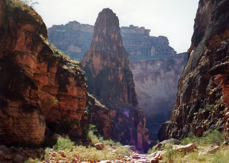
It’s 3:41, and I got to a spot where I can see this false Scotty Castle,
as it were. Pretty impressive tower nonetheless. And I can see right
through the neck here. The ridge that leads from the tower over to the
Esplanade area. I can see right through it to the other side. And I
can see the wall on the other side and I can see some further walls that
are down a canyon that are in a straight line with me here that take off
on that side. So, a few big boulders right in here. One that is huge,
as big as a house, a small house. And on top of it is a huge tree.
Perched there many, many years ago I would suspect in a big flood,
probably thirty feet off the ground. Anyway continuing on.
It’s 4:10, and I am right opposite that canyon I mentioned that I could
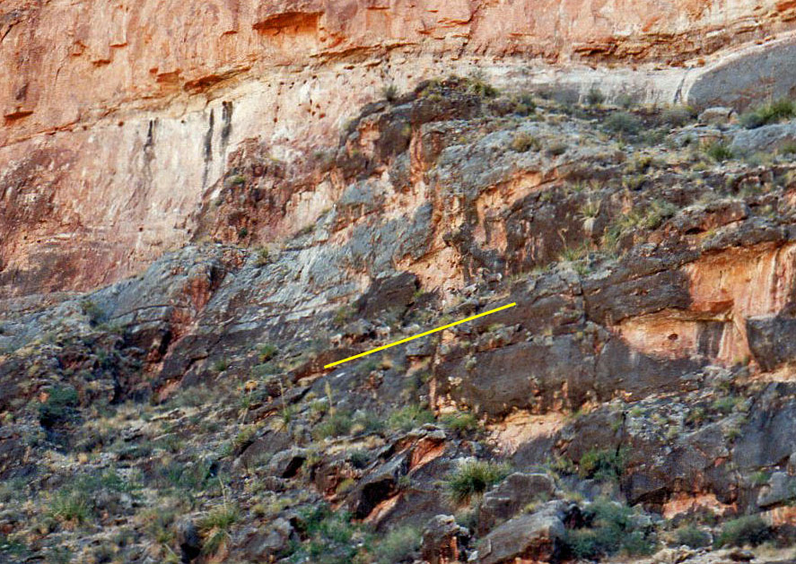
see from the other side of this false Scotty’s Castle. On the map it’s
got the 3200 foot contour mark for it. And you certainly couldn’t go up
the last little bit here. It’s a quite a dramatic dry fall right now.
Although it looks like a little bit up the creek here you could follow a
ramp that would contour you into the valley up above this fall. I’m
going to take a little water break here before continuing.
It’s 4:18, and I’m back on my way.
It’s 4:59, and I’ve reached the end of what I call, “stage three” of
little zigzags and am sitting opposite a well-defined canyon that
continues on the same line as I’ve been traveling and then you can walk
up from here at least a little ways. That runs off of an area that is
marked a boundary between the monument and the national forest on the
old quad map. And it’s the beginning of kind of a long straightaway. I
think I will keep pushing on; at this rate I’m thinking it’s possible I
could make the “Slide of Susurrus” area for a campsite tonight. So I’ll
go on for another hour anyway and see how I feel then.
On the bend between stages two and three at this little zigzag, I was
able to follow a game trail up high that cut across the little peninsula
there. Although it lead through a field of beaver tails that I ran into
a couple them, and I ran into a couple of them. The latter time which
was a little more painful – one needle got stuck to my pants before I
was able to get at it.
It’s 5:20, and I’ve just passed the canyon at the end of this
straightaway that heads off to my right. And you couldn’t get up there
I don’t think. It might barely be possible to go in a little slope
here down creek of it and contour in. But pretty wild going. Anyway
I’ve made the bend and I’m looking pretty good for catching the Susurrus
area for a campsite.
It’s 5:49, and I’ve reached Susurrus. I crossed the creek to be on the
Susurrus side thinking there might be more opportunities for campsites,
but there are none. But it looks like I might be able to catch
something right across the creek here. So now it’s just the matter of
finding a campsite.
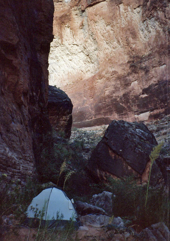
Well I took a couple seconds to get over on top of a little hill here
and get a spot. A really nice spot. And I have seen my first
footprints right over on this area. So, somebody’s been up. I suppose
one could come up from the river. Anyway time to pitch tent, make
dinner, clean up, get something to drink.
It’s 6:58, and things are going really well. It’s getting dark. It’s
getting to dusk right now. I cannot read my watch very well without
turning on the light. But I can still see well enough to do anything
around here. And I’ve been very efficient since I’ve arrived here. I
jumped in the water to cool off and wash off. That felt great. And
cooked dinner, just about to start eating it. I even made some pudding
which I’ve just finished mixing up and let sit for a minute. I have
pumped four, filtered four liters of water since I was down to
absolutely nothing when I had poured out some to cook with. And the
tent is just full of stuff but at least I’m here and tomorrow should be
a real good day. I found that I was able to keep track of where I was
in the canyon through all these twists and turns from Scotty’s Hollow
was very easy. After looking at the map and studying what was going on
so that was kind of nice. The boots have worked out well. Especially
the waterproofing part, since I was ankle deep in water a few times. It
was nice that my feet and socks stayed dry.
* * * * * * * * * * * * * * * * * * *
It’s 7:42 in the morning, Friday, September 16th, and
I am on my way up the “Slide of Susurrus” Canyon. I have packed up my
bag and it is sitting in my tent. All I’ve got to do it put some things
out of my fanny pack back in my bag and pack up the tent and I’ll be
ready to leave from here. So, that may be just a couple hours.
It’s 8 o’clock and I’ve reached the slide area at least as far as I can
go up this canyon. I can see the water trickling and cascading down
over these numerous little Muav-type ledges until it reaches this final
pool. There was another little slide area, had a pool that was only
about 8 minutes up the canyon which confused me for a bit, but this is
certainly the area he’s [Steck] talking about. So, I think I probably
will take a dip, see if I can’t go up here a bit and catch a picture.
It’s 8:23, and I’m back from the “cruise slide” of Susurrus. This pool
leads to some ledges that you can climb up and then there’s a couple
little pools and a few more ledges until you reach another big pool and
the true slide. I can see it from here. It’s coming down at sort of a
right angle to where the flow is coming into this pool. And then from
that pool you can see that it’s really a long slide as the water
cascades down the rock and then the last foot, foot and a half,
splashing into the water. And then there’s some seep springs up above
an overhanging ledge that drip water down into the pool. The pool is in
a really dark recessed area. It’s very interesting. In fact a bat just
flew over me even at this time of day. And so I went up there and
thought that I couldn’t get a picture because I swam across the lower
pool, but on the way back I found that I could walk across this pool -
the water was up to about my neck. So, I grabbed my camera and went
back up and took a couple pictures. I hope they turn out. I have been
a little bit concerned about this roll of film, but I’m back and this
trip turned out to be a lot shorter than I had thought it was going to
be. And I’ll just dry off and head on back down to the campsite.
8:36. I’m on my way back down this little Susurrus Canyon.
At 8:53 I’m back at my campsite.
It’s 9:29 and all I have to do is put on my pack and start heading on
down Kanab.
It’s 10:15, and I’m just opposite the lower canyon here where the Kanab
sort of bumps out a bit and continues on for another straightaway and
it’s right opposite the “ek” in creek on the map. And there’s a little
spring sliding out of that. It’s probably about forty feet tall and,
fifty feet tall maybe, and water dribbling out of that and covered with
ferns.
It’s 10:39, and I’ve reached the end of the S sort of route here that
comes out near a canyon that runs off of almost directly off of Fishtail
Point and the 3600 contour is marked to the south of the canyon. I
haven’t quite reached that spot as of yet, but I’m pretty close.
Through the end of sort of stage two all the way around the bend and
through most of stage three, I was on these Muav ledges. So, this may
be where Steck was talking about. And it looks like we’re just about to
end and the sun is just about to begin as well, so an ideal time to
stop.
I’ve been following footprints ever since Susurrus. It seems that maybe
three or four people had to come up here, I presume, for the day and
back. And so there’s a well-worn trail here to follow which is kind of
nice and I still see some occasional sheep tracks as well.
11 o’clock and I’m back on my way.
From 11:35 to 11:38, I’ve been sitting here in a nice shady spot at the
end of what I would call stage two of this S loop that I have been going
through. I am at the end of the southern sort of flow and ready to turn
a little bit to the west. Just below the 2400 contour line that’s
marked on the map. At the end of the first stage I found a(n) old tire
mangled up, buried in the sand and debris, pretty high off the creek bed
so carried down during some much large flood. There’s Bright Angel
shale ledges here that have made for nice walking. And I’ve also been
on a trail up above the creek bed in many spots here so the going has
been very nice and very pleasant.
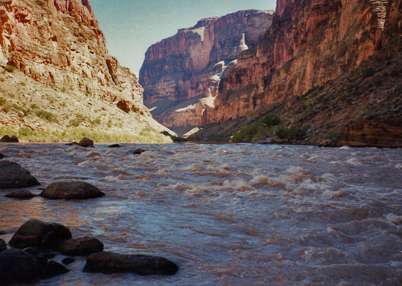
It’s 12:21, and I’m on a bluff overlooking Kanab Rapids. River is very
muddy today. I found a trail around the hump or bump as it were and
back tracked a little bit on Kanab to find, to hook up, with another
trail I saw on the right hand side that lead to the top of this big
dune. Now it’s just a matter of finding a really decent place to camp.
This is all very sandy and hot right here.
4 o’clock [No, this must be 1 o’clock.] and I located a suitable site
pretty soon and have set up my camp. I took a stroll down to the
rapids. It is very cool down there. The river looks like it gets a lot
of shade all day long as it’s in shade right now. But it’s very hot
right here at this campsite so I’ve loaded up some things and I’m going
to head back up Kanab here and find a nice shady spot and crash out for
a couple hours before coming back.
It’s 4:07, and I’m going to leave my little afternoon break spot here by
Kanab Creek. I took a dip, cleaned up my boots, had a leisurely lunch,
and just generally lounged around. It may still be sunny down at the
campsite but I got to go down and check out the crossing of this creek.
I also filtered out three liters of water.
It’s 7:06, and I am in the tent and packing things up for tomorrow. My
walk down the creek bed was rather interesting as I startled a number of
fish. I guess trout, seem pretty big. Wish I had a fishing rod. And
then I saw them just a short while ago when I went back over to the
water near the Colorado. I guess that’s a favorite area for them. I
saw, I counted at least eight that I could see swimming there recently.
And I walked down the beach, the rocky shore to a small little beach
towards the end of Kanab Rapid. Later on, the clouds starting to roll
in around sunset and got me worried a bit and I made a dash back down
the creek and filtered four liters of water. Two that I had already
filtered I put into my water bag for emergency use. And am trying to
pack up and hope that we don’t get any rain. It’s too hard to tell
what’s going on now since it’s that time of night when you can’t see
anything anyway, but hopefully later on I’ll be seeing stars.
* * * * * * * * * * * * * * * * * * *
Saturday, September 17th, 6:27 a.m., and I’m leaving later than I
wanted to by about half an hour. Things were going pretty well by about
quarter to five but somehow things just take longer than it seems like
they should. But I’m all ready to go. I got my swimming suit on – I
got to wade through water and change into my pants on the other side so
there’s going to be a little more delay there, but hopefully I’ll be
getting on my way here before it gets warm.
285 [I have no idea what that should be – maybe 6:45?], and I’m through
wading across the creek and cleaning up and all ready to go. There’s a
little bit of a trail here at that the start. That will be nice if that
continues.
Its 8:15 and I’m stopping at the mouth of a canyon that looks to be half
way to Fishtail. I think I gotten the right one here. So, things going
pretty well. Along this route sometimes I’ve been close to the river,
sometimes up above a little cliff, sometimes on a trail, sometimes
hopping rocks. It has it all. The sun has just hit me about fifteen
minutes ago, but there’s some scattered cloudiness which is keeping
things nice and cool. And a boat party just went by me – at least one
boat. So, I’m going to stop here and rest for a while.
8:38, I’m on my way. More boats heading my way too.
It’s 8:56, and I’ve passed the real canyon I was thinking of here that
would be about halfway. On the map, the canyon that I stopped at was
just to the right of the 2000 foot contour that’s marked. And this
canyon it just to the, excuse me, that was just to the left and this
right is just to the right of it. So, I’m just passing that now.
From 9:45 to 9:57, a little water break. Take off my pack, but I’m back
on the trail.
It’s 10:12, and I’m right opposite 140 Mile Rapids. The canyon itself
opens up a little further up the river. Not too far, maybe ten minutes,
but I’m getting close.
It’s 10:56, and I’ve reached Fishtail. Now I’m wondering if this is
really where I cached my food those many years ago
or instead I had cached it in Cranberry Canyon. Well it’s certainly
been a long morning. The clouds are still out which is keeping things
really decent here. So, I may go on or I may stay here for a bit.
It’s 11:19, and I’m at Cranberry Canyon. And now I think maybe I was
right about caching stuff at Fishtail. It’s just that it seemed that
the area didn’t look quite so familiar. [I think that means I decided
that my cache had been at Cranberry.] I’m going to wander around look
for a spot to sit down and relax a while.
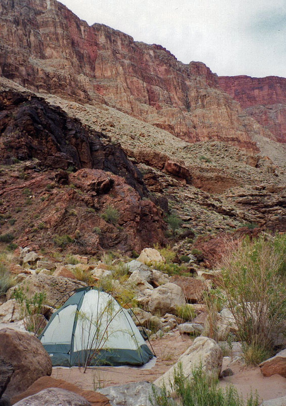
It’s 12:30, and I have decided to stay here at Cranberry Canyon for the
evening. Which is pretty much what I was planning to do anyway, but now
I’m thinking about trying to get out tomorrow. It looks like the route
up the break is pretty treacherous from down on this side. It’s
possible, I guess, but it sure looks pretty loose, pretty steep.
Steeper than the rest of the climb. I have a very good view of that
hill leading down towards the dry lake bed. I remember how steep that
was. It appears that some of this is steeper. So, to get to that break
with some degree of certainty, it seems that you have to go through Deer
Creek. And so I figure if I’m going to go through Deer Creek I’m going
to go ahead and hike out the trail from there. I thought about trying
to do that this afternoon but the heat is just too much and I was really
quite exhausted when I arrived here. And felt that I might get to Deer
Creek okay, but I would have some serious problems trying to get out the
end of the day, especially if I wasn’t drinking as much as I should,
eating as much as I should. So I’ve found a nice little tamarisk here
that’s providing some shade as well as the partly cloudy conditions
which are aiding in that. And I’ve pulled some water out of the river
and filtered about four liters and it tastes great. The fact that it’s
cold it just means all the difference in the world. So I’m just going
to lounge around for the afternoon. Not do much of anything. Probably
won’t set up my tent until very late in the day, if at all. There’s not
a whole lot of spots around here where you can do that. I might end up
just sleeping out tonight so anyway that’s what’s going on right now.
It’s 7:30, and I am all set to go to sleep. I did reconnoiter a bit and
found a semi decent spot to camp at. At least big enough for the tent
and level enough for me to sleep on, but a second person would be
sliding off the side, so there weren’t very many choices here at this
little delta. I did find a big overhanging ledge that somehow escaped
my attention on the way in. It was, it’s just massive. That is
indicated by Steck as a shelter. Indeed you could camp a whole bunch of
people out in that ledge and keep away from the elements as long as you
didn’t need a tent. I filtered another two and a half liters this
evening, and am going to try to repeat yesterday’s early morning
performance, or today’s early morning activities and try to get out
a.s.a.p. I have scouted out the beginning of the trail. That was
pretty easy to find. At least to the top of the cliffs and heads over
to Deer Creek and hopefully only a little bit there towards Deer Creek
itself will be the only hard part tomorrow morning.
It’s a pretty much full moon and that is likely to shine on me all night
long. The sun was on this place until very late in the day. It’s a
tremendous amount of the sunshine. Thank Goodness for the clouds out
mitigating that, but it is a nice and cool spot. As you can probably
hear the rapids in the background are barely noticeable. I’m pretty
close to the river. And a slight breeze that blows this way just cools
things down tremendously.
* * * * * * * * * * * * * * * * * * *
It’s Sunday, September 18th, 6:17 in the morning, and
I’m all set to leave camp. Got my pack on my back. All I got to do is
start on the trail. The evening was a little cool. I ended up using my
poncho again and that was okay. The, I woke up at 4:45 this morning and
was surprised to see some flashes of lightning, which made me more
focused on packing up. But nothing came of it. I saw some stars and
then it cleared off a little bit. And this morning there’s still some
clouds and some clouds in the east which looks nice, but also a lot of
blue sky right above me. So things are looking pretty good. On to Deer
Creek.
It’s 6:51, and I’ve just crossed over the Siesta Spring, which is
flowing pretty heavily here, considering. The trail passes through a
real thick layer of brush. I got cut up on my finger on one of these
sharp sided leaves or blades or whatever. And wanted to get through
it. I couldn’t tell where the ledge was. I climbed up and crossed at
an easier spot and now I got to climb down. But it’s an interesting
spot nonetheless.
It’s 7:07, and I’ve changed my mind about the Cranberry Canyon route. I
got to a big bay just east of the Siesta Spring and I had a pretty good
view up towards the sloping part that leads into the break and it seemed
very possible to climb up the ravine I was in and get up there without
any undue trouble. The idea that it would take another couple of hours
to get to Deer Creek also prompted me to go ahead and make this dash.
I’ve just climbed up above the first little cliff. There’s a lot of
brush, probably some water down in there. It sure looked like it. It
was damp anyway. I came up around it, sort of contoured behind it, but
I’ve just started not more than five or six minutes ago. So onwards and
upwards to the top of this break here at Cranberry. It looks pretty
good.
It is 7:35, and I’m just about even with the big rock I could see from
down below that I was using as a target. And I’m going to stop and have
a little water.
7:42, and I’m pushing on.
It’s 8:49, and I’m above the Redwall. I was going to take a break
before making the last climb but I figured I was going to take a long
break anyway might as well go ahead and do that. So it worked out
okay. And now I’m at the top of the Redwall. Sun is behind the rocks a
little bit but still some clouds in the sky. And now I’m going to have
mucho water and take a little rest break here.
It’s 9:30, and I’m all set to go. A nice little break here. The sun
came out briefly but the clouds have since hidden it. And most of my
things got a little dryer so I feel a little more comfortable that way.
I can see a boat party camped at a beach across from Deer Creek, in the
Deer Creek area. Very tiny little boats and actually just a little
further downstream, at another real marginal looking beach there’s
another couple of boats and it looks like maybe something smaller like
kayaks or something. So on to the spring, Ghost Rock and out the top.
It’s 9:54, and I’m passing our old campsite.
Pretty hard to miss. It’s the first one from the bridge and aren’t
really too many choices. It looks like after this either unless you go
out further out towards the point.
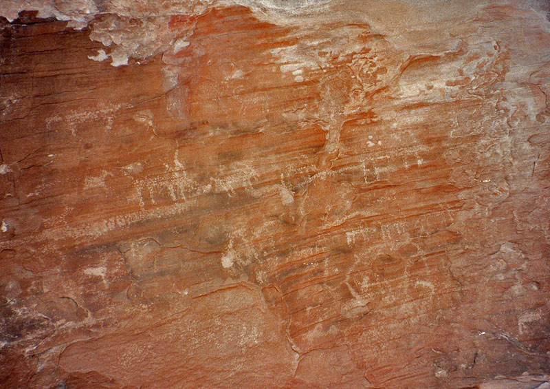
It’s 10:32, and I’m at the petroglyph rock. It is a big almost round,
roundish Supai rock, like the top layer of these Esplanade, these round
smooth rocks. And there’s a couple others nearby that look like they
crash-landed into the ground. In fact, like they rolled here. Anyway
this one has got a somewhat smooth east-facing side and then a, sort of
a hollowed out flat side facing north, where the petroglyphs are. If
the eagle rock can be described as the third big ravine coming off of
the east, then from the spring I would say this is between the first and
second ravines as you look at the Supai level and determine the ravines
from that. Well onto the spring.
10:55, and I’m at the seep spring. There were a few pools about, oh
twenty, thirty yards down the bed here. It’s still pretty nice. Quite
cloudy. Kind of a light high cloudiness. I’ve been following a set of
tracks coming back from towards the point there overlooking the river.
So, I’m going to take a break here.
It’s 11:22, and I’m on my way. All I did here really was have some
water, rest a bit and fill up an emergency liter with the spring water.
I have about a liter and a quarter left of filter water and if need be I
can use this either with a tablet or it’s a seep spring, maybe I can
even trust it. So, hopefully it won’t even come to that. Now I’ve
decided to go up the easterly ravine here on my way to the Esplanade.
It’s 11:55, and I’ve reached the top of the ravine. The very top which
is a little saddle which empties out to the Deer Creek area. Now I have
to find a break here somewhere to the west and scamper on up to the real
top here of the Supai. Although it may be that I should go down and
contour around, whose name I’m afraid I just don’t remember. Anyway so
here I am.
12:52, and I’m finally to the top of the Esplanade. It was one hell of
a trip. I started coming down off the saddle, rounded a corner, had to
come down further and I just didn’t like it. So, I backtracked, tried
to climb up through the cliffs, got cliffed out, decided to go back the
way I was going, re-read Harvey’s description which was accurate. And
so back down and across and up the draw here that leads to Ghost Rock.
I can see Ghost Rock, but I don’t think I’m going to head for it. I
don’t know how to, I’m still got some levels here to maneuver through
but I’m going to angle more towards the trail.
It’s 1:06 and I’m taking a little break under a shady ledge, and I can
see the route pretty straightforwardly here. See where the trail comes
up to the top, the rim, the long contour over to the break in the
Coconino and down the hill, down the slope, past a couple of, at this
point, prominent little hills. And so that’s my target. Looks like I’m
going to have to climb back down a little bit and cross over and then
climb back out to get to the red hill that I’m looking at. But this
should be alright. It has been hot and sunny, although there’s clouds
all around and I hear thunder so a storm is, I guess, rolling in which
wouldn’t be too bad.
1:44, and I’m all set to leave. The clouds have rolled in a little bit
here, although I still see some blue sky. Mostly to the east although
it is still kind of bright out this way. I can see the sun shining on
the tops of some clouds. But it is cool anyway. And now off to the
trail and up to the top.
It’s 2:14, and I’ve reached the trail. And I’ve actually reached it
where this two and a half foot tall sign says “Trail 23”. So on up.
It’s been raining a little bit here. It lasted a while. It was coming
down pretty good for briefly. Now it’s just sporadic.
It’s 2:44, and I’m going to stop for a little water break. I am just at
the beginning of the switchbacks through the cliffs here in the upper
Coconino, so things are going well.
2:51, and I’m pushing on.
3:23, and I’ve reached the top. Now down to the trail head.
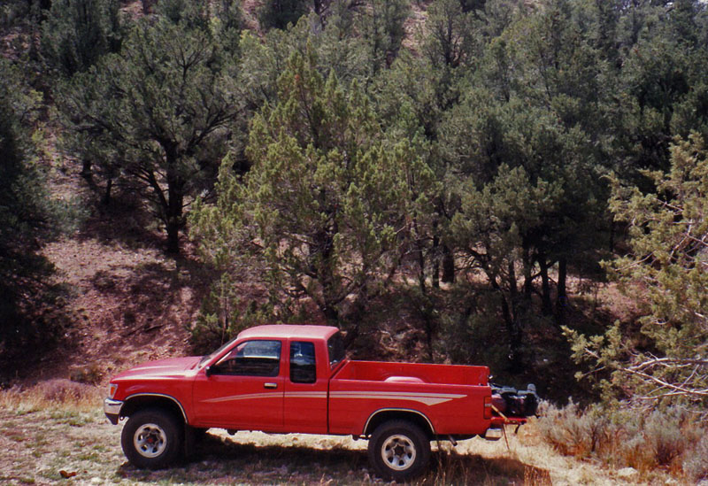
3:28, and I’m back at the truck. Man am I tired. There’s three other
vehicles here. Someone else from Arizona, someone from Colorado and
someone from New Mexico. On the way up after my rest break, I ran into
a guy coming back down the trail. He had been ahead of me and
apparently he’s headed over to Bill Hall or Thunder River and dropped
his tripod off at a spot or forgot to take it with him and hiked back to
pick it up and had retrieved it and was heading back. Pretty late in
the day for doing all that kind of stuff. I didn’t think about till
later, but I could’ve offered him a liter of water. Anyway, it’s good
to be back.
It’s 4:21 and I’m on my way. I’ve just left the trail head. I made a
little mistake with the water. It was deliciously cool and great for
drinking, but I thought I had two and a half gallons, that I took my two
gallon jugs and although I drank a bunch right away I wasn’t paying
close attention to it and used it all up and found out that in my little
canteen there was no water so what I have drunken there is all I got. I
have written down Steck’s instructions backwards for getting to Jacob
Lake and we’ll see how it works.
It’s 5:23, I’ve been at the Jacob Lake Visitor Center for about a minute
or two and the mileage reads 34.9 from Indian Hollow.
Post hike weight of pack forty pounds which includes one liter of water.
* * * * * * * * * * * * * * * * * * *
|
